

Weather webcast with Chief Meteorologist Rob Haswell
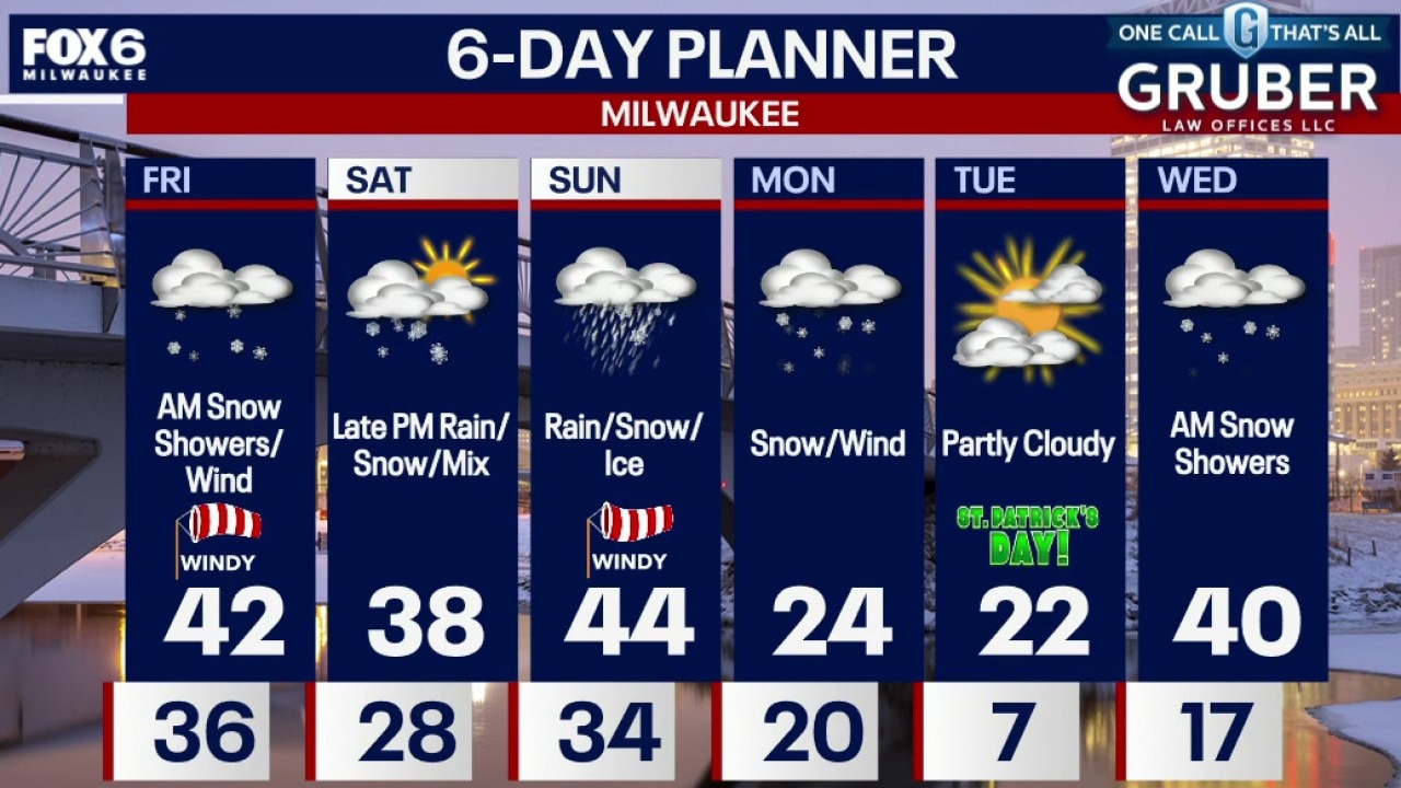
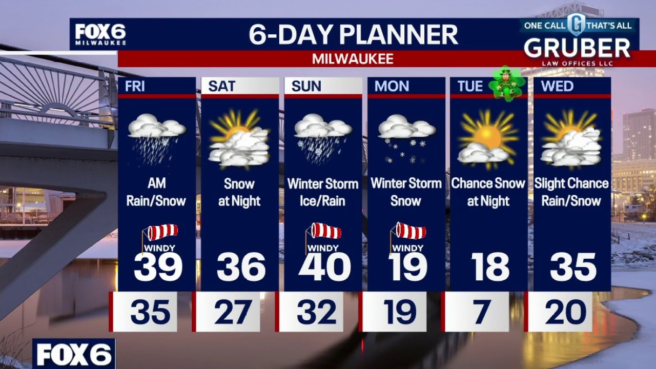
Attention quickly turns to a potentially more impactful storm arriving Saturday night into Sunday. Confidence is growing that parts of Wisconsin could see significant snow, blowing snow, and even some ice.
Attention quickly turns to a potentially more impactful storm arriving Saturday night into Sunday. Confidence is growing that parts of Wisconsin could see significant snow, blowing snow, and even some ice.
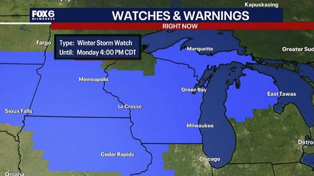

Southeast Wisconsin winter storm watch; snow, ice, dangerous wind gusts
A winter storm watch has been issued for southern Wisconsin as a weekend storm could bring snow, ice, strong winds and dangerous travel from Saturday night through Monday.
A winter storm watch has been issued for southern Wisconsin as a weekend storm could bring snow, ice, strong winds and dangerous travel from Saturday night through Monday.
Weather webcast with Rob Haswell
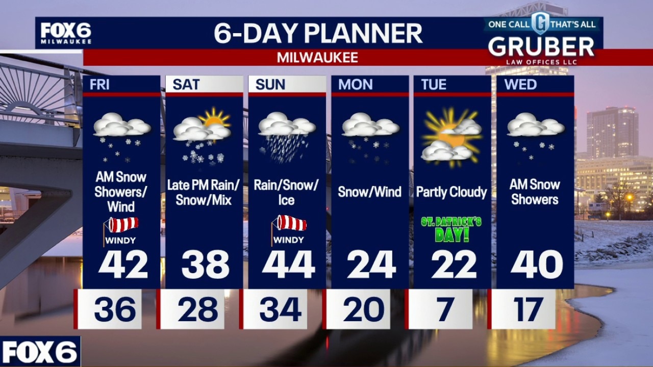
Rain with a brief mix of snow possible north of I-94 Friday morning, followed by a blast of powerful winds that could gust close to 60 mph behind the cold front Friday.
Rain with a brief mix of snow possible north of I-94 Friday morning, followed by a blast of powerful winds that could gust close to 60 mph behind the cold front Friday.
Weather Webcast with Chief Meteorologist Tom Wachs
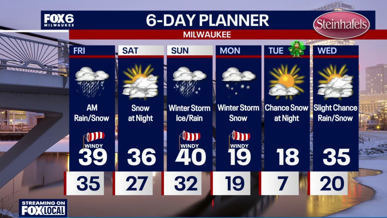
High Wind Warning until 4pm Friday for ALL of SE WI. Winter Storm Watch from 7pm Sat. to 4pm on Monday
High Wind Warning until 4pm Friday for ALL of SE WI. Winter Storm Watch from 7pm Sat. to 4pm on Monday


Milwaukee Weather: High Wind Warning Friday, Winter Storm this weekend
High Wind Warning from 4am to 4pm Friday for ALL of SE WI. Winter Storm Watch from 7pm Sat. to 4pm on Monday
High Wind Warning from 4am to 4pm Friday for ALL of SE WI. Winter Storm Watch from 7pm Sat. to 4pm on Monday
Weather Webcast with Chief Meteorologist Tom Wachs
High Wind Warning from 4am to 4pm Friday for ALL of SE WI. Winter Storm Watch from 7pm Sat. to 4pm on Monday
High Wind Warning from 4am to 4pm Friday for ALL of SE WI. Winter Storm Watch from 7pm Sat. to 4pm on Monday

Weather webcast with meteorologist Holly Baker
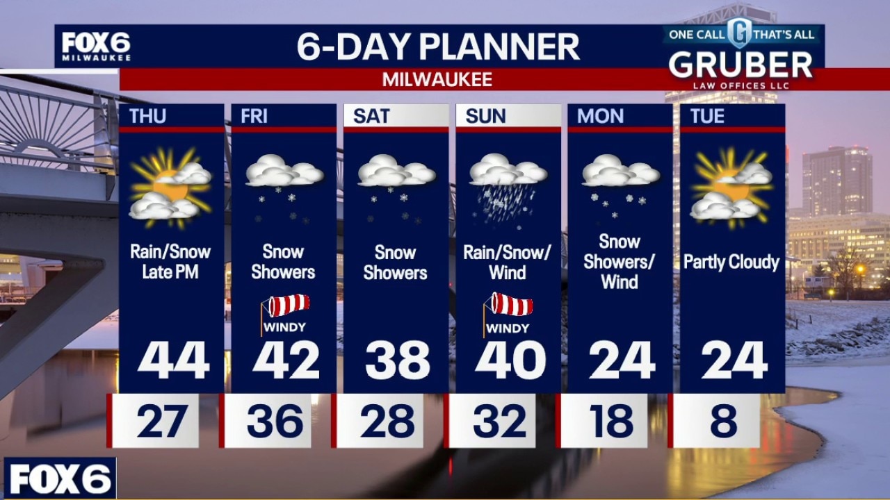
Partly to mostly cloudy Thursday before rain moves in Thursday night followed by a blast of very gusty winds on Friday. A strong low tracking through the Great Lakes will crank up a powerful low-level jet, meaning wind gusts could be the main headline Friday with a Wind Advisory in effect.
Partly to mostly cloudy Thursday before rain moves in Thursday night followed by a blast of very gusty winds on Friday. A strong low tracking through the Great Lakes will crank up a powerful low-level jet, meaning wind gusts could be the main headline Friday with a Wind Advisory in effect.
Weather webcast with Rob Haswell
Partly to mostly cloudy Thursday before rain moves in Thursday night followed by a blast of very gusty winds on Friday. A strong low tracking through the Great Lakes will crank up a powerful low-level jet, meaning wind gusts could be the main headline Friday with a Wind Advisory in effect.
Partly to mostly cloudy Thursday before rain moves in Thursday night followed by a blast of very gusty winds on Friday. A strong low tracking through the Great Lakes will crank up a powerful low-level jet, meaning wind gusts could be the main headline Friday with a Wind Advisory in effect.
Weather Webcast with Holly Baker
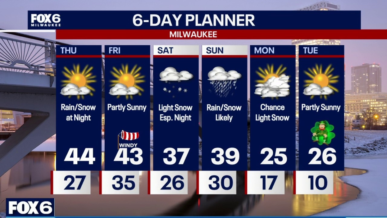
We are tracking several chances of snow for the remainder of the week.
We are tracking several chances of snow for the remainder of the week.
Weather Webcast with Stephanie Barichello
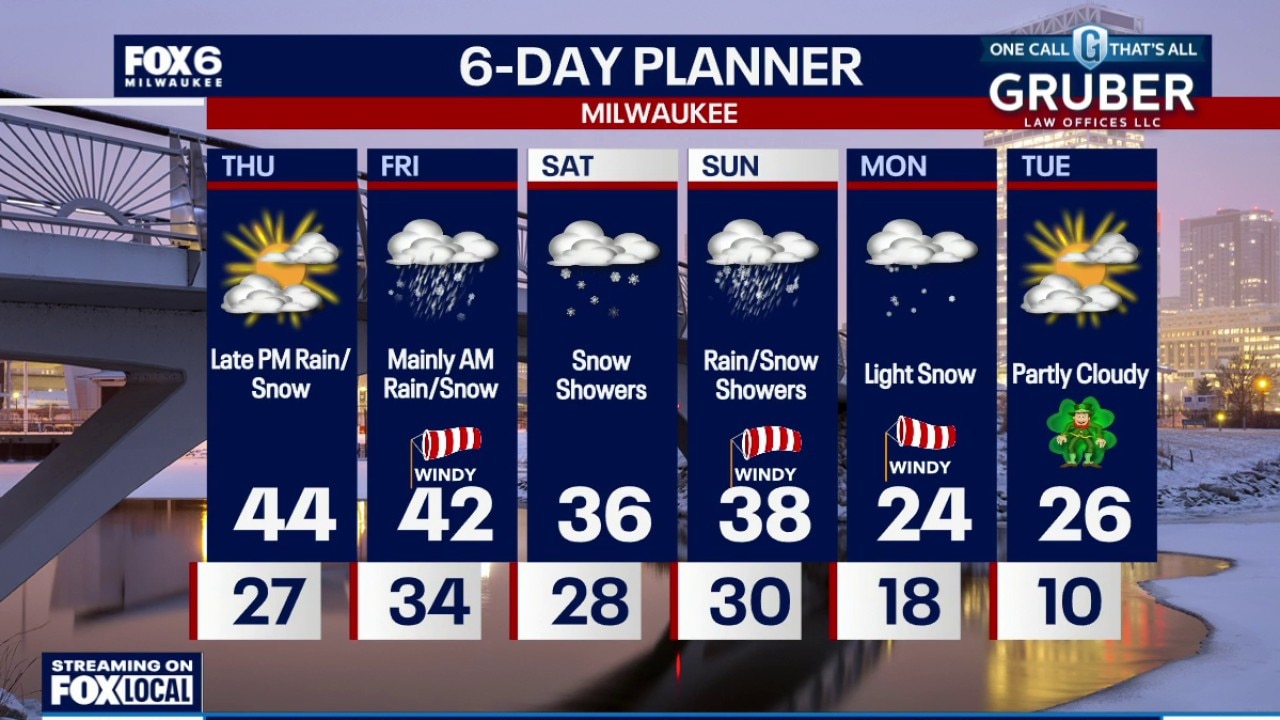
Clearing clouds tonight and colder with low temperatures in the 20s. Some sunshine on Thursday then another chance for light rain/snow mix at night into Friday morning. A bigger system is expected over the weekend, with mainly snow Saturday then a mix of rain and snow on Sunday. It's still too early for snowfall totals but accumulation looks likely. It will heavily on depend on storm track. Stay tuned!
Clearing clouds tonight and colder with low temperatures in the 20s. Some sunshine on Thursday then another chance for light rain/snow mix at night into Friday morning. A bigger system is expected over the weekend, with mainly snow Saturday then a mix of rain and snow on Sunday. It's still too early for snowfall totals but accumulation looks likely. It will heavily on depend on storm track. Stay tuned!
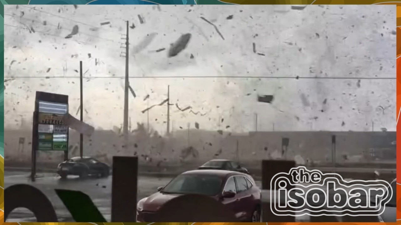
The Isobar: Great Lakes spring flip
On this episode of The Isobar, Rob, Rich, and guest Mike Caplan talk spring’s early fog and warmth, Michigan’s severe weather, storm messaging, the latest outlooks, and the spring traditions they love most around the Great Lakes.
On this episode of The Isobar, Rob, Rich, and guest Mike Caplan talk spring’s early fog and warmth, Michigan’s severe weather, storm messaging, the latest outlooks, and the spring traditions they love most around the Great Lakes.
Milwaukee Weather: Snow ending this evening, another system Thursday night
Snow ends this evening and clouds clear overnight. Temperatures will drop below freezing by morning and could cause slippery spots.
Snow ends this evening and clouds clear overnight. Temperatures will drop below freezing by morning and could cause slippery spots.
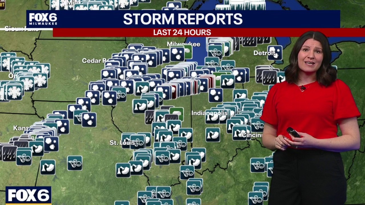
Wisconsin Weather Experts: Severe storms hit Wisconsin
A very busy 24 hours unpacked today on Wisconsin Weather Experts with an in-depth look at the storms, the damage and what comes next as snow moves in. Plus allergy season is coming. What you need to know to keep the sniffles at a minimum.
A very busy 24 hours unpacked today on Wisconsin Weather Experts with an in-depth look at the storms, the damage and what comes next as snow moves in. Plus allergy season is coming. What you need to know to keep the sniffles at a minimum.
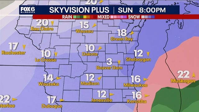

Southeast Wisconsin weekend snow; significant accumulation possible
A developing storm could bring significant accumulating snow this weekend, but the exact track and totals remain uncertain.
A developing storm could bring significant accumulating snow this weekend, but the exact track and totals remain uncertain.
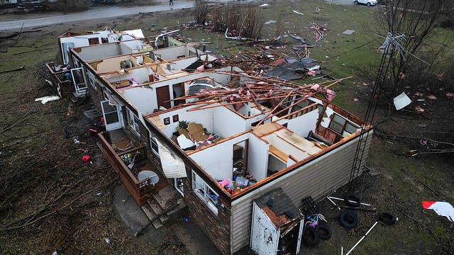

Tornadoes rip through Chicago-area, NW Indiana, killing 2 and leaving widespread damage
At least four tornadoes from a powerful supercell tore across parts of Illinois and Indiana Tuesday, killing two people in Lake Village, injuring others, damaging homes and infrastructure, and producing destructive hail across the region.
At least four tornadoes from a powerful supercell tore across parts of Illinois and Indiana Tuesday, killing two people in Lake Village, injuring others, damaging homes and infrastructure, and producing destructive hail across the region.
Weather webcast with Stephanie Barichello
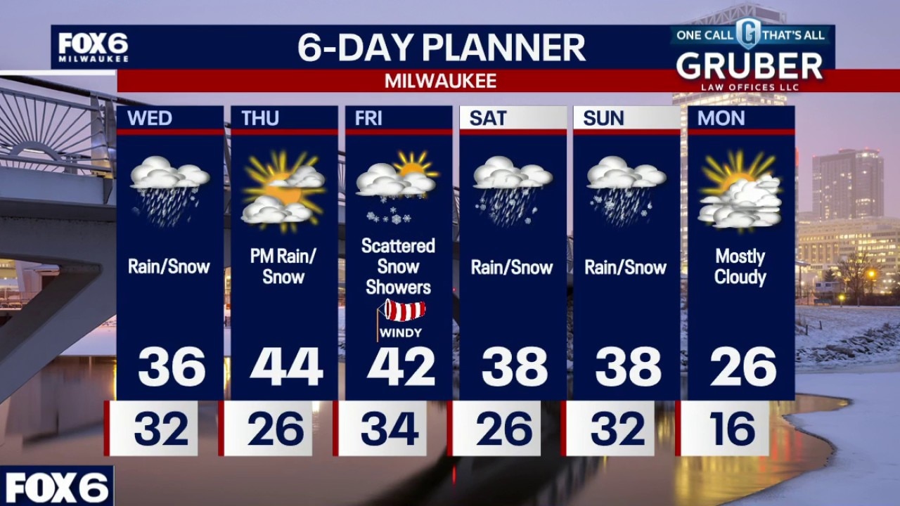
Southern Wisconsin remains in an active late-winter pattern with several quick-hitting systems over the next several days. Early Wednesday brings a risk of freezing drizzle, followed by a brief burst of light snow.
Southern Wisconsin remains in an active late-winter pattern with several quick-hitting systems over the next several days. Early Wednesday brings a risk of freezing drizzle, followed by a brief burst of light snow.

Flooding, hail in Racine County after strong storms Tuesday night
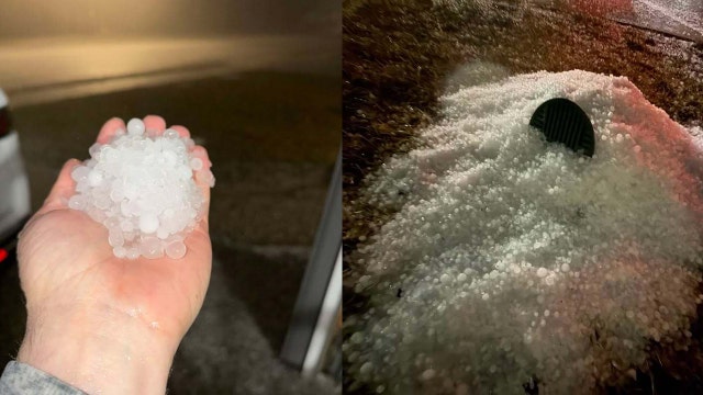
Thunderstorms moved across southeast Wisconsin on Tuesday evening, March 10. Racine County saw hail and flooding.
Thunderstorms moved across southeast Wisconsin on Tuesday evening, March 10. Racine County saw hail and flooding.
Weather webcast with Rob Haswell
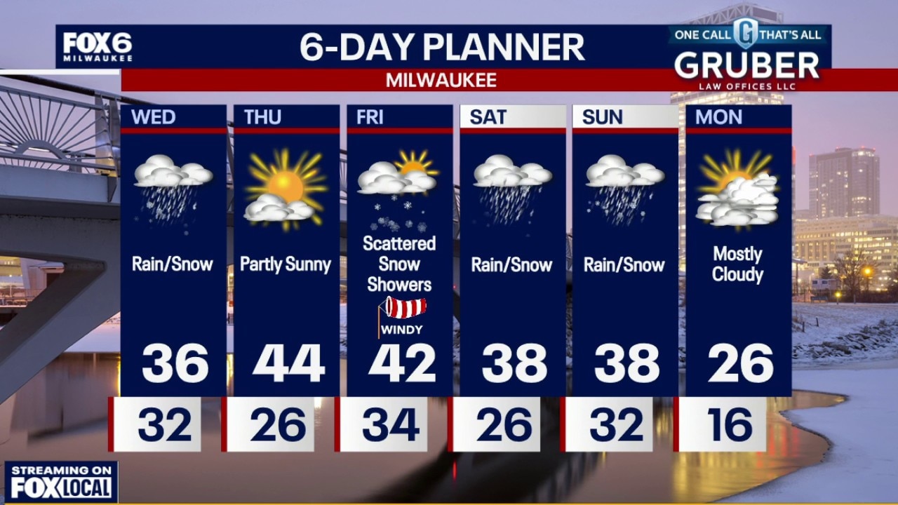
Southern Wisconsin remains in an active late-winter pattern with several quick-hitting systems over the next several days. Early Wednesday brings a risk of freezing drizzle, followed by a brief burst of light snow.
Southern Wisconsin remains in an active late-winter pattern with several quick-hitting systems over the next several days. Early Wednesday brings a risk of freezing drizzle, followed by a brief burst of light snow.
Weather Webcast with Chief Meteorologist Tom Wachs
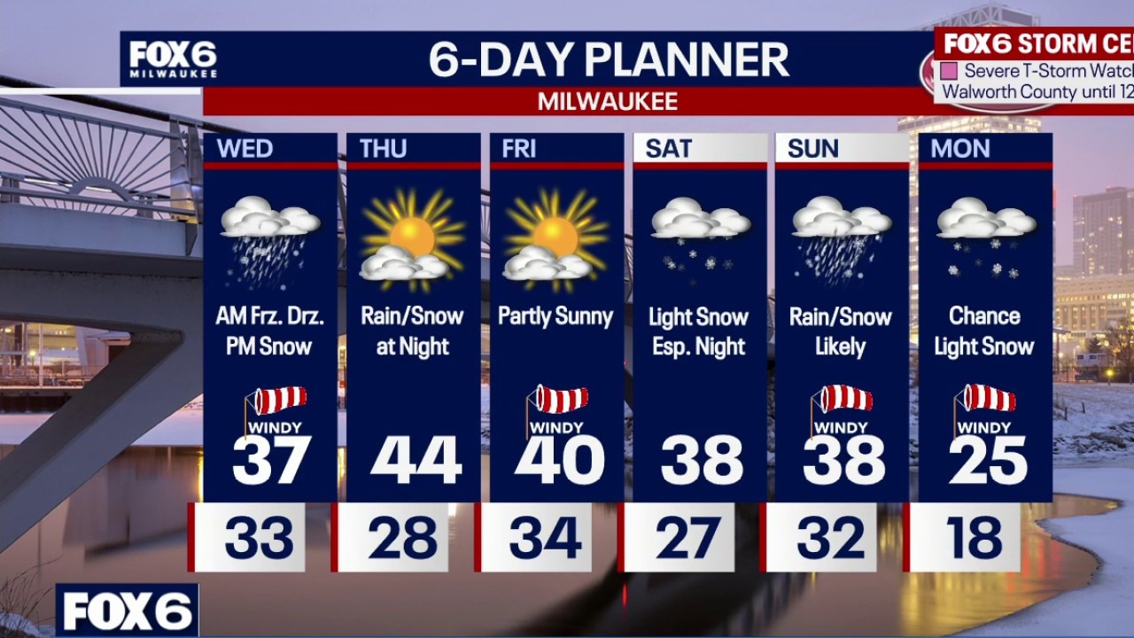
Winter Weather Advisory Sheboygan & Fond du Lac counties from 1am to 1pm on Wednesday Severe T-Storms with hail and wind ending overnight. Windy and cold with temperatures in the 30s. Freezing drizzle and light freezing rain possible on Wednesday morning, especially north of Milwaukee. This could cause a glazing of ice on untreated surfaces. Temperatures at/below 32 north of MKE.
Winter Weather Advisory Sheboygan & Fond du Lac counties from 1am to 1pm on Wednesday Severe T-Storms with hail and wind ending overnight. Windy and cold with temperatures in the 30s. Freezing drizzle and light freezing rain possible on Wednesday morning, especially north of Milwaukee. This could cause a glazing of ice on untreated surfaces. Temperatures at/below 32 north of MKE.
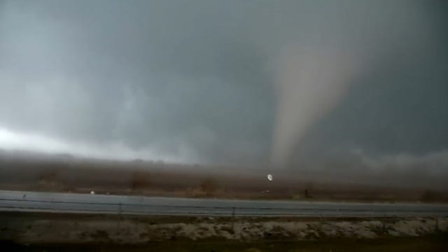

Large tornado tears through Kankakee Co, NW Indiana; minor injuries reported
A large, dangerous tornado touched down in suburban Kankakee on Tuesday, leaving heavy damage.
A large, dangerous tornado touched down in suburban Kankakee on Tuesday, leaving heavy damage.