



Milwaukee Weather: Severe storms ending overnight, snow on Wednesday
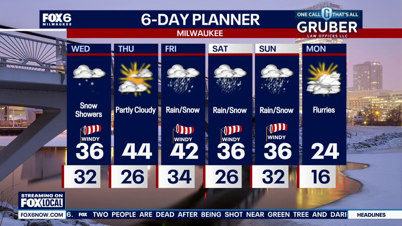
Winter Weather Advisory Sheboygan & Fond du Lac counties from 1am to 1pm on Wednesday Severe T-Storms with hail and wind ending overnight. Windy and cold with temperatures in the 30s. Freezing drizzle and light freezing rain possible on Wednesday morning, especially north of Milwaukee. This could cause a glazing of ice on untreated surfaces. Temperatures at/below 32 north of MKE.
Winter Weather Advisory Sheboygan & Fond du Lac counties from 1am to 1pm on Wednesday Severe T-Storms with hail and wind ending overnight. Windy and cold with temperatures in the 30s. Freezing drizzle and light freezing rain possible on Wednesday morning, especially north of Milwaukee. This could cause a glazing of ice on untreated surfaces. Temperatures at/below 32 north of MKE.
Weather Webcast with Stephanie Barichello
Showers and thunderstorms expected this evening, some potentially severe with hail near the IL state line. Tornadoes are likely south of us in IL. Rain changes to snow Wednesday. A Winter Weather Advisory is in effect across far northern counties. A few more snow and wintry mix chances through the weekend.
Showers and thunderstorms expected this evening, some potentially severe with hail near the IL state line. Tornadoes are likely south of us in IL. Rain changes to snow Wednesday. A Winter Weather Advisory is in effect across far northern counties. A few more snow and wintry mix chances through the weekend.
Wisconsin Weather Experts: Thunderstorms possible
The Wisconsin Weather Experts at FOX6 News Milwaukee share weather forecast trends and much more.
The Wisconsin Weather Experts at FOX6 News Milwaukee share weather forecast trends and much more.

Severe storms possible Tuesday night, winter weather advisory Wednesday
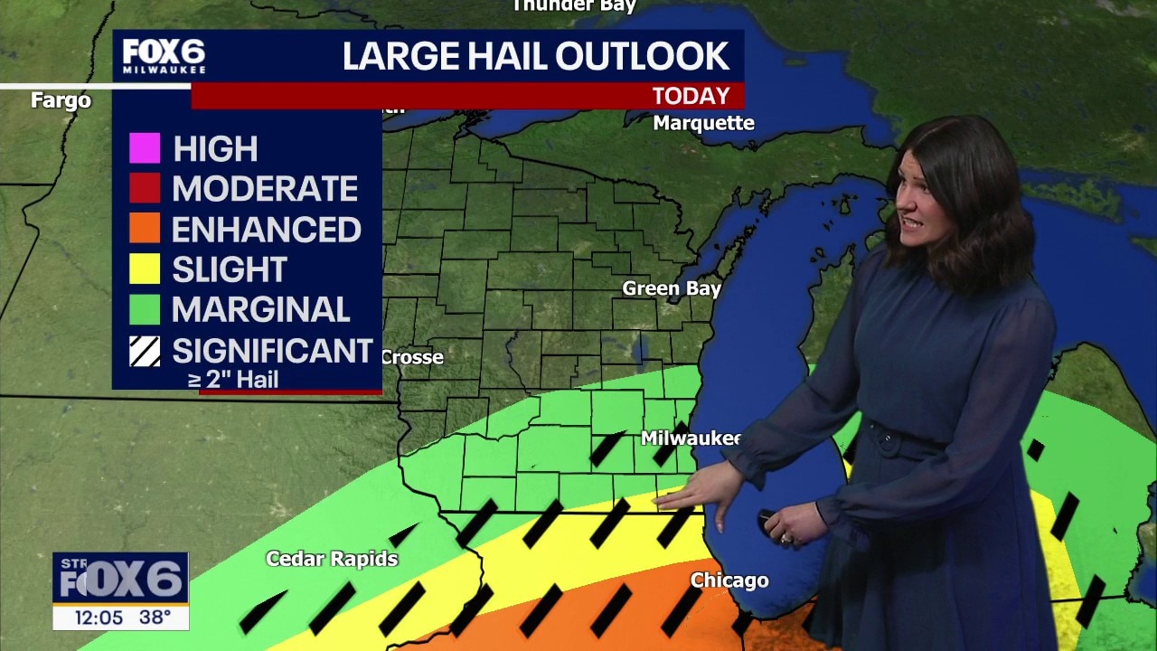
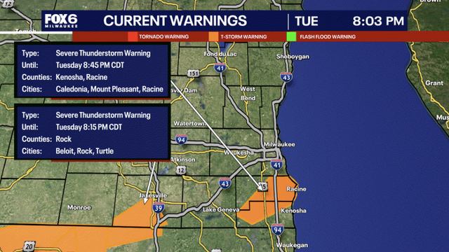
Thunderstorms are possible between 5-10pm, some of which could produce large hail, especially along the WI/IL border. Freezing rain is possible overnight across northern counties, then we'll all see snow Wednesday.
Thunderstorms are possible between 5-10pm, some of which could produce large hail, especially along the WI/IL border. Freezing rain is possible overnight across northern counties, then we'll all see snow Wednesday.
Weather webcast with Stephanie Barichello
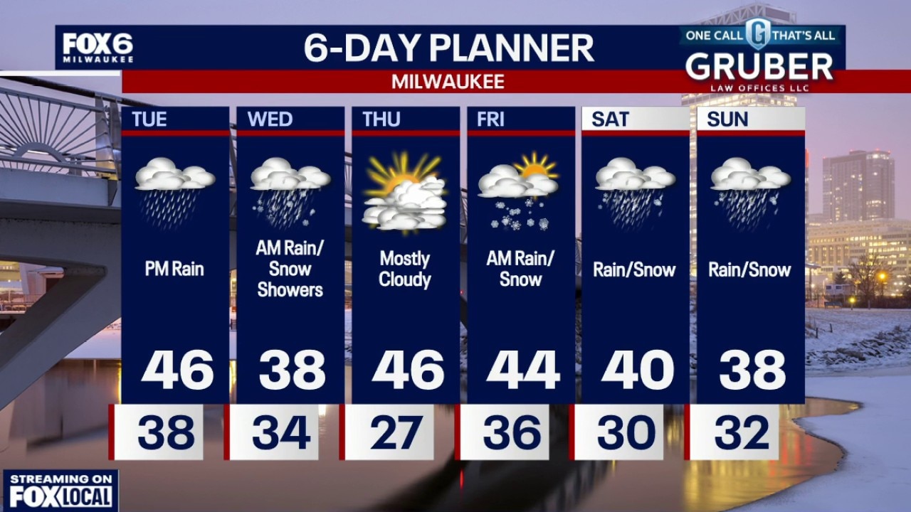
An active stretch of weather is shaping up across southern Wisconsin over the next several days. Thunderstorms move in Tuesday evening, with a few stronger storms possible near the Illinois border.
An active stretch of weather is shaping up across southern Wisconsin over the next several days. Thunderstorms move in Tuesday evening, with a few stronger storms possible near the Illinois border.
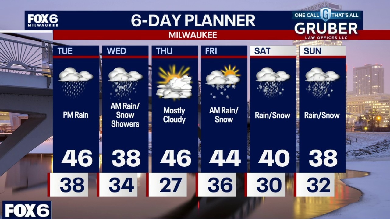
Weather webcast with Rob Haswell
An active stretch of weather is shaping up across southern Wisconsin over the next several days. Thunderstorms move in Tuesday evening, with a few stronger storms possible near the Illinois border.
An active stretch of weather is shaping up across southern Wisconsin over the next several days. Thunderstorms move in Tuesday evening, with a few stronger storms possible near the Illinois border.

Weather Webcast with Chief Meteorologist Tom Wachs
Mostly clear overnight. Lows in the 30s by morning. Increasing clouds on Tuesday, windy and chilly. Highs in the upper 30s near the lake, mid-40s inland. T-Storms are likely on Tuesday evening, some could be severe with wind and hail. The tornado threat will stay to our south, as we will be cold.
Mostly clear overnight. Lows in the 30s by morning. Increasing clouds on Tuesday, windy and chilly. Highs in the upper 30s near the lake, mid-40s inland. T-Storms are likely on Tuesday evening, some could be severe with wind and hail. The tornado threat will stay to our south, as we will be cold.
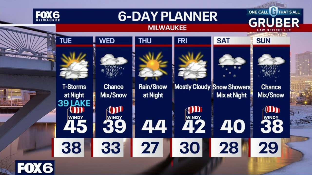
Weather Webcast with Chief Meteorologist Tom Wachs
Mostly clear tonight with temperatures dropping into the 50s this evening and really dropping overnight. Lows in the 30s by morning. Increasing clouds on Tuesday, windy and chilly. Highs in the upper 30s near the lake, mid-40s inland.
Mostly clear tonight with temperatures dropping into the 50s this evening and really dropping overnight. Lows in the 30s by morning. Increasing clouds on Tuesday, windy and chilly. Highs in the upper 30s near the lake, mid-40s inland.
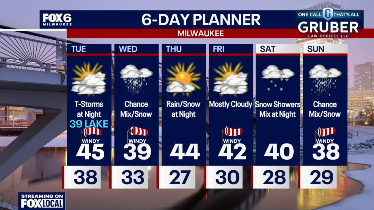
Weather Webcast with Chief Meteorologist Tom Wachs
Mostly clear tonight with temperatures dropping into the 50s this evening and really dropping overnight. Lows in the 30s by morning. Increasing clouds on Tuesday, windy and chilly. Highs in the upper 30s near the lake, mid-40s inland.
Mostly clear tonight with temperatures dropping into the 50s this evening and really dropping overnight. Lows in the 30s by morning. Increasing clouds on Tuesday, windy and chilly. Highs in the upper 30s near the lake, mid-40s inland.
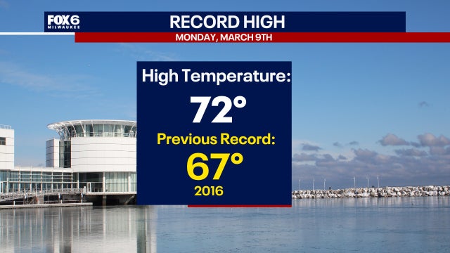

Warm air Monday creates new record temps for Milwaukee, Madison
Milwaukee broke a record high for March 9, hitting 72 degrees. This is not only a record high for the date, but also the warmest since October 18, 2025.
Milwaukee broke a record high for March 9, hitting 72 degrees. This is not only a record high for the date, but also the warmest since October 18, 2025.
Weather Webcast with Stephanie Barichello
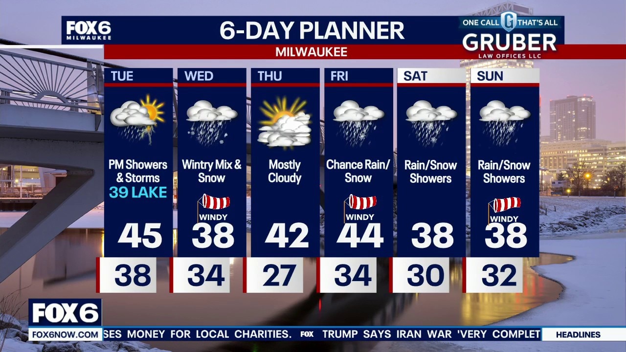
After a record breaking warm day, temperatures Tuesday are back to 30s and 40s. Storms are possible at night, some potentially with hail, then rain changes to snow Wednesday morning. There are multiple chances for wintry mix through the weekend.
After a record breaking warm day, temperatures Tuesday are back to 30s and 40s. Storms are possible at night, some potentially with hail, then rain changes to snow Wednesday morning. There are multiple chances for wintry mix through the weekend.
Milwaukee Weather: Cold Tuesday, severe storms at night
Mostly clear tonight with temperatures dropping into the 50s this evening and really dropping overnight. Lows in the 30s by morning. Increasing clouds on Tuesday, windy and chilly. Highs in the upper 30s near the lake, mid-40s inland. T-Storms are likely on Tuesday evening, some could be severe with wind and hail. The tornado threat will stay to our south, as we will be cold.
Mostly clear tonight with temperatures dropping into the 50s this evening and really dropping overnight. Lows in the 30s by morning. Increasing clouds on Tuesday, windy and chilly. Highs in the upper 30s near the lake, mid-40s inland. T-Storms are likely on Tuesday evening, some could be severe with wind and hail. The tornado threat will stay to our south, as we will be cold.
Wisconsin Weather Experts: From spring-like temps to rain and snow
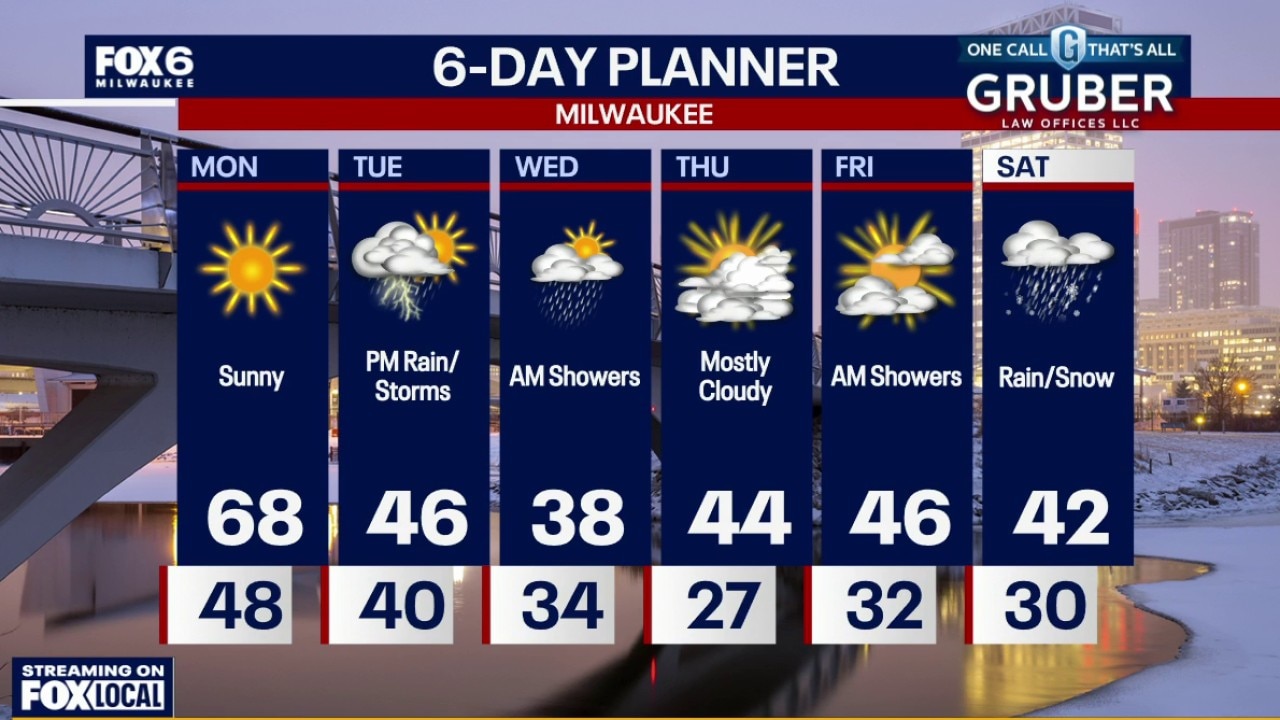
After a pleasant Sunday and Monday, Mother Nature will remind us which month is it -- when rain and snow return to the forecast.
After a pleasant Sunday and Monday, Mother Nature will remind us which month is it -- when rain and snow return to the forecast.
Weather webcast with Stephanie Barichello
Southern Wisconsin starts the week on a spring-like note with temperatures pushing into the upper 60s Monday and potentially tying or breaking daily records.
Southern Wisconsin starts the week on a spring-like note with temperatures pushing into the upper 60s Monday and potentially tying or breaking daily records.
Weather webcast with Rob Haswell
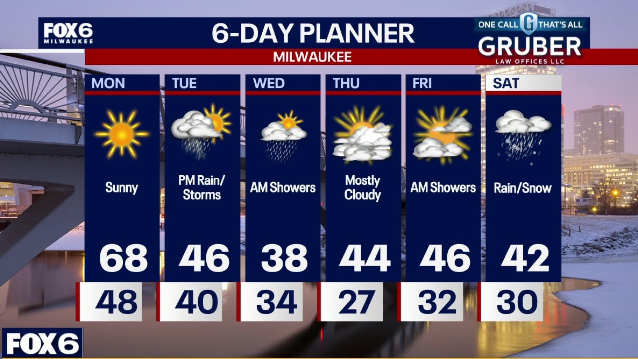
Southern Wisconsin starts the week on a spring-like note with temperatures pushing into the upper 60s Monday and potentially tying or breaking daily records.
Southern Wisconsin starts the week on a spring-like note with temperatures pushing into the upper 60s Monday and potentially tying or breaking daily records.
Weather Webcast with Chief Meteorologist Tom Wachs
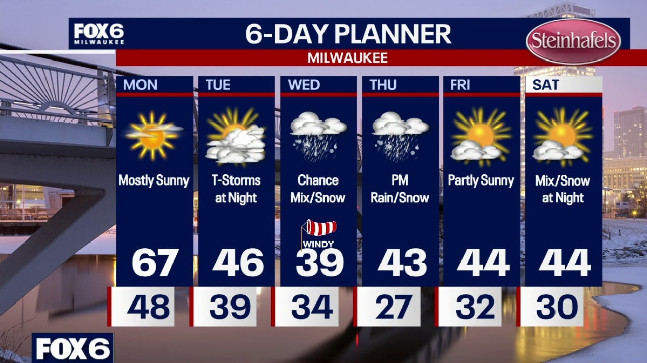
Clear, windy and warm overnight. Temperatures dropping into the upper 40s by sunrise. Mostly sunny and warm on Monday with a high around 67. 67 is also our current record high set in 2016. Windy, especially in the morning.
Clear, windy and warm overnight. Temperatures dropping into the upper 40s by sunrise. Mostly sunny and warm on Monday with a high around 67. 67 is also our current record high set in 2016. Windy, especially in the morning.

Milwaukee spring leaf cleanup; city launches one-time collection
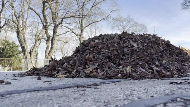
The Milwaukee Department of Public Works will conduct a one-time spring leaf collection starting March 16 after early snow and late-falling leaves disrupted fall pickup and left piles on city streets through winter.
The Milwaukee Department of Public Works will conduct a one-time spring leaf collection starting March 16 after early snow and late-falling leaves disrupted fall pickup and left piles on city streets through winter.
Milwaukee Weather: Near-record high on Monday, t-storms and snow this week
Clear, windy and warm overnight. Temperatures dropping into the upper 40s by sunrise. Mostly sunny and warm on Monday with a high around 67. 67 is also our current record high set in 2016. Windy, especially in the morning.
Clear, windy and warm overnight. Temperatures dropping into the upper 40s by sunrise. Mostly sunny and warm on Monday with a high around 67. 67 is also our current record high set in 2016. Windy, especially in the morning.
Weather Webcast with Chief Meteorologist Tom Wachs
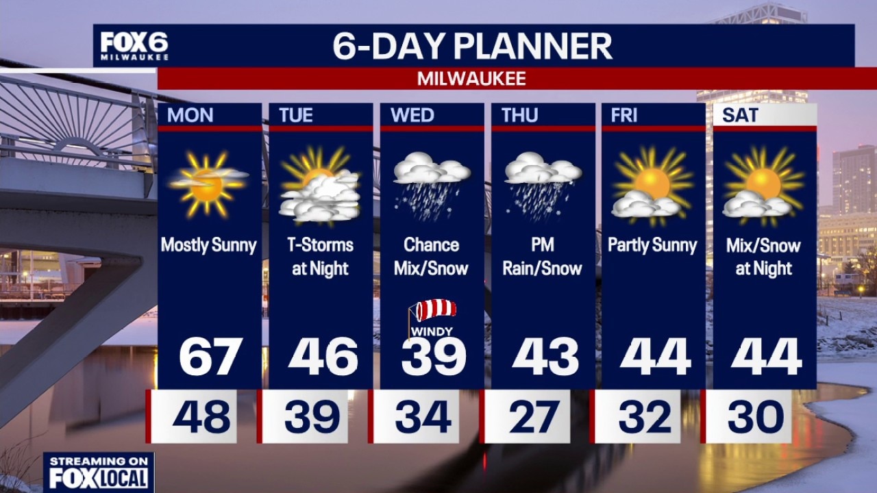
Clear, windy and warm tonight. Temperatures in the 50s this evening and upper 40s overnight. Mostly sunny and warm on Monday with a high around 67. 67 is also our current record high set in 2016. Windy, especially in the morning.
Clear, windy and warm tonight. Temperatures in the 50s this evening and upper 40s overnight. Mostly sunny and warm on Monday with a high around 67. 67 is also our current record high set in 2016. Windy, especially in the morning.
Weather webcast with Lisa Michaels
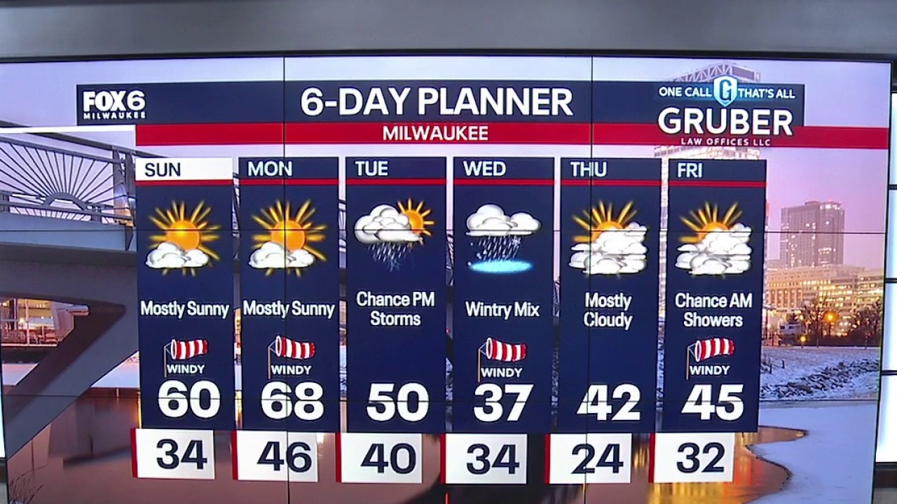
Partly cloudy to mostly sunny morning with temps in the low to mid 30s. Mostly sunny, windy, and warmer on Sunday with a highs near 60F. Getting even warmer on Monday with mostly sunny skies, windy, and highs in the upper 60s!
Partly cloudy to mostly sunny morning with temps in the low to mid 30s. Mostly sunny, windy, and warmer on Sunday with a highs near 60F. Getting even warmer on Monday with mostly sunny skies, windy, and highs in the upper 60s!