

Weather Webcast with Tom Wachs
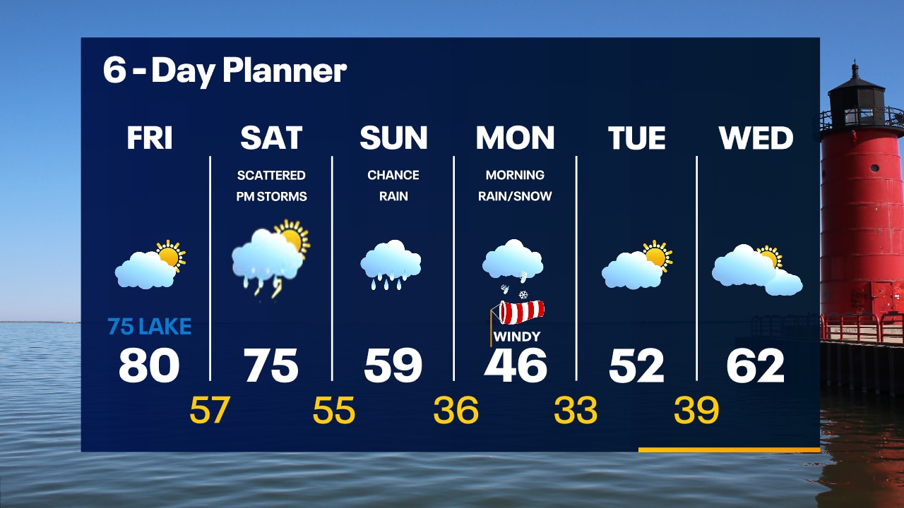
Mostly clear overnight with temperatures in the 50s by sunrise. More heat on the way Friday. Partly sunny with elevated fire danger. High around 80 inland, 70s near the lake.
Mostly clear overnight with temperatures in the 50s by sunrise. More heat on the way Friday. Partly sunny with elevated fire danger. High around 80 inland, 70s near the lake.
Weather Webcast with Tom Wachs
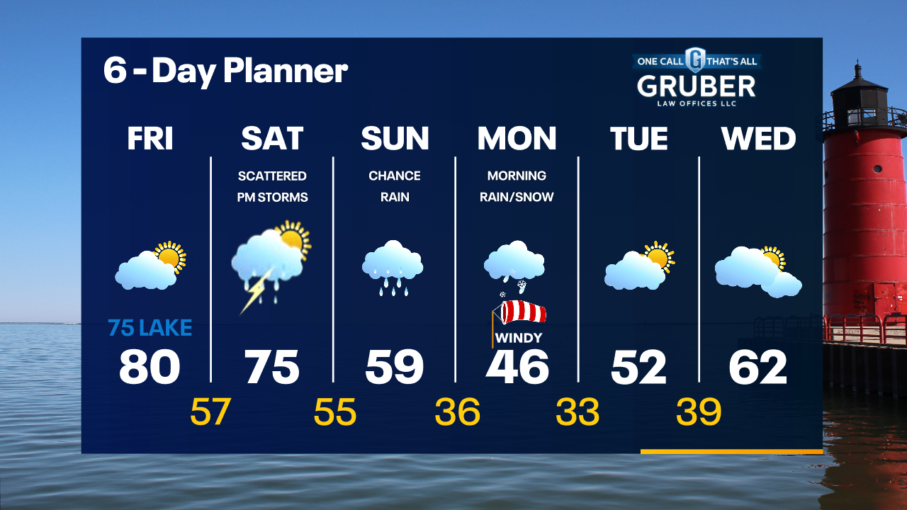
Mostly clear tonight with temperatures dropping through the 60s and into the 50s overnight. Partly sunny and warm on Friday. High around 80 inland, mid-70s near the lake.
Mostly clear tonight with temperatures dropping through the 60s and into the 50s overnight. Partly sunny and warm on Friday. High around 80 inland, mid-70s near the lake.


Wisconsin wildfires: Black Hawk helicopters support firefighting efforts
Two Wisconsin Army National Guard UH-60 Black Hawk helicopters from the Madison area are now supporting wildfire suppression efforts in Juneau County.
Two Wisconsin Army National Guard UH-60 Black Hawk helicopters from the Madison area are now supporting wildfire suppression efforts in Juneau County.
Weather Webcast with Meteorologist Stephanie Barichello
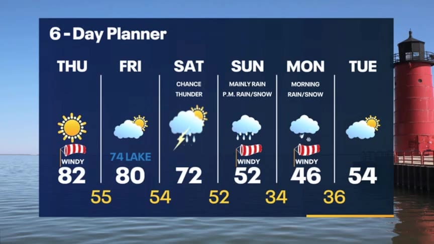
More sunshine and warmth today then slightly cooler lakeside on Friday. There is a chance for storms by Saturday afternoon and evening, then bigger changes Sunday and Monday. It'll be windy and cooler with some snow mixing in Monday morning.
More sunshine and warmth today then slightly cooler lakeside on Friday. There is a chance for storms by Saturday afternoon and evening, then bigger changes Sunday and Monday. It'll be windy and cooler with some snow mixing in Monday morning.

Drone video captures dramatic bird's-eye view of historic Fort Lauderdale flooding
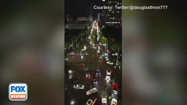
According to the National Weather Service’s Weather Prediction Center, more than 25 inches of rain fell in the Fort Lauderdale area on Wednesday.
According to the National Weather Service’s Weather Prediction Center, more than 25 inches of rain fell in the Fort Lauderdale area on Wednesday.
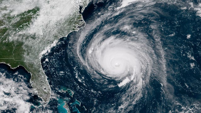

Experts predict slightly below-average hurricane season in Atlantic due to expected El Nino influences
The Colorado State University tropical weather outlook calls for 13 named storms, six of which could become hurricanes with at least 74 mph winds. Phil Klotzbach, the lead author of the forecast, said that two of the hurricanes could be major.
The Colorado State University tropical weather outlook calls for 13 named storms, six of which could become hurricanes with at least 74 mph winds. Phil Klotzbach, the lead author of the forecast, said that two of the hurricanes could be major.
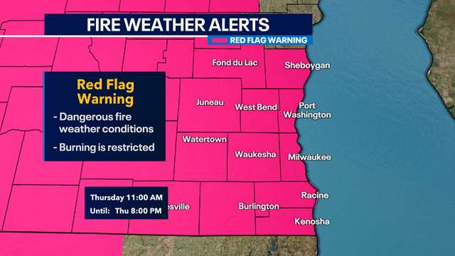

Southeast Wisconsin 'red flag warning' Thursday
The National Weather Service issued a red flag warning once again for all of southeast Wisconsin from 11 a.m. to 8 p.m. Thursday, April 13.
The National Weather Service issued a red flag warning once again for all of southeast Wisconsin from 11 a.m. to 8 p.m. Thursday, April 13.
Weather webcast with Rob Haswell
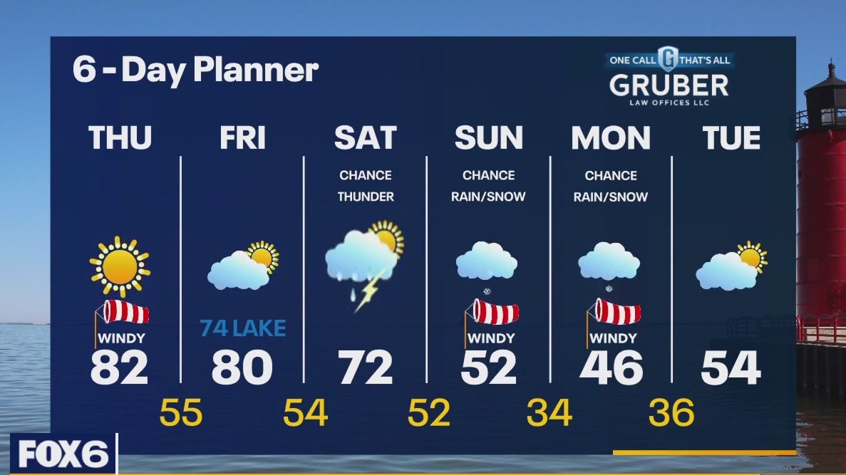
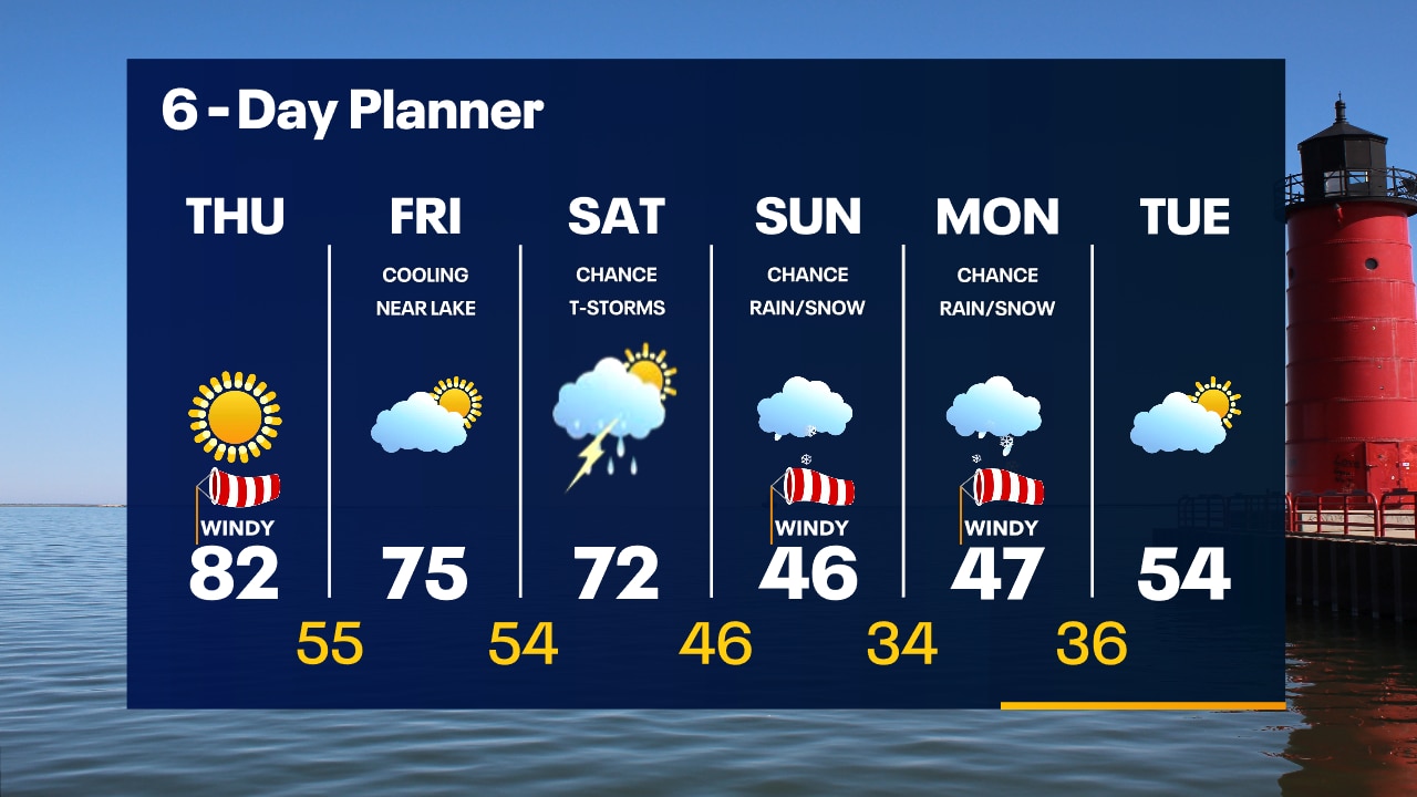
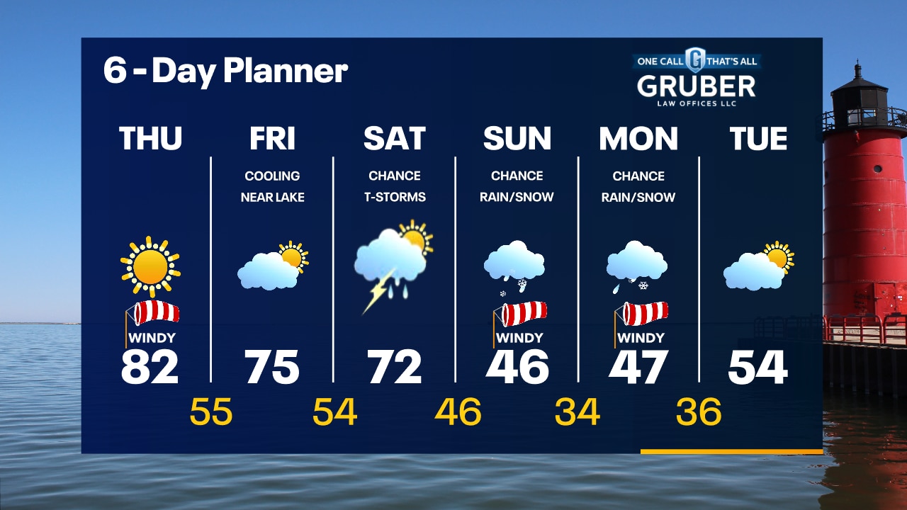
Red Flag Warning today until 8pm. Avoid any open fires or things that may spark a fire today. High pressure still dominates our area keeping us sunny and helping with a strong southwesterly wind to warm us into the low 80s again. We stay mild ahead of a low Friday but will cool down this weekend with rain likely on Saturday and a chance for thunderstorms. Much cooler Sunday and Monday with a chance for rain/snow showers.
Red Flag Warning today until 8pm. Avoid any open fires or things that may spark a fire today. High pressure still dominates our area keeping us sunny and helping with a strong southwesterly wind to warm us into the low 80s again. We stay mild ahead of a low Friday but will cool down this weekend with rain likely on Saturday and a chance for thunderstorms. Much cooler Sunday and Monday with a chance for rain/snow showers.
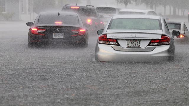

Storms producing heavy rain batter South Florida, close key airport
A low-pressure system developing in the Gulf of Mexico continues to send bands of showers and thunderstorms ashore along the Gulf Coast, with the threat of heavy rain and isolated tornadoes expected through Friday.
A low-pressure system developing in the Gulf of Mexico continues to send bands of showers and thunderstorms ashore along the Gulf Coast, with the threat of heavy rain and isolated tornadoes expected through Friday.
Weather Webcast with Tom Wachs
Clear and breezy overnight with temperatures in the upper 50s to low 60s by sunrise. Sunny, windy and warm again Thursday. Record highs in the low 80s. High fire danger.
Clear and breezy overnight with temperatures in the upper 50s to low 60s by sunrise. Sunny, windy and warm again Thursday. Record highs in the low 80s. High fire danger.
Weather Webcast with Tom Wachs
High fire danger continues with record heat. We broke a record high in Milwaukee Wednesday & will likely do it again Thursday with highs in the 80s.
High fire danger continues with record heat. We broke a record high in Milwaukee Wednesday & will likely do it again Thursday with highs in the 80s.

83° Milwaukee record high, 'feels glorious'
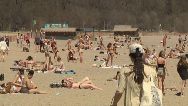
A new record high of 83° was set in Milwaukee Wednesday, April 12. People soaked up the summer-like temperatures at ice cream shops, golf courses and places like Bradford Beach, which was packed.
A new record high of 83° was set in Milwaukee Wednesday, April 12. People soaked up the summer-like temperatures at ice cream shops, golf courses and places like Bradford Beach, which was packed.

Historic storm could form in the Gulf of Mexico this week; earliest named storm since 2017
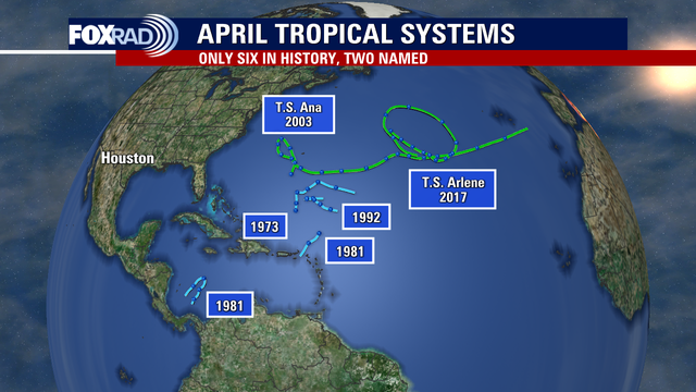
According to National Hurricane Center records, only two named tropical systems occurred in April - Ana in 2003 and Arlene in 2017. Neither of those tropical storms impacted land as Ana made a long trek across the Atlantic Ocean away from the United States and Arlene simply spun around the central Atlantic for one day.
According to National Hurricane Center records, only two named tropical systems occurred in April - Ana in 2003 and Arlene in 2017. Neither of those tropical storms impacted land as Ana made a long trek across the Atlantic Ocean away from the United States and Arlene simply spun around the central Atlantic for one day.

Southeast Wisconsin 'red flag warning' Wednesday; state of emergency declared
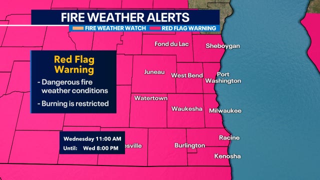
The National Weather Service issued a red flag warning for all of southeast Wisconsin from 11 a.m. to 8 p.m. Wednesday.
The National Weather Service issued a red flag warning for all of southeast Wisconsin from 11 a.m. to 8 p.m. Wednesday.
Weather Webcast with Meteorologist Stephanie Barichello
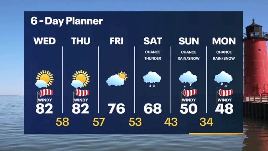
Sunny, windy and warm the next two days with potentially record breaking temperatures. A few more clouds Friday then rain returns Saturday. Much cooler Sunday and Monday with a chance for wintry mix.
Sunny, windy and warm the next two days with potentially record breaking temperatures. A few more clouds Friday then rain returns Saturday. Much cooler Sunday and Monday with a chance for wintry mix.

Wisconsin Severe weather spotter training in Richfield; free to public
A meteorologist from the National Weather Service (NWS) will conduct Severe Weather Safety & Spotter Training Wednesday, April 12 at the Richfield Volunteer Fire Company – Station #1.
A meteorologist from the National Weather Service (NWS) will conduct Severe Weather Safety & Spotter Training Wednesday, April 12 at the Richfield Volunteer Fire Company – Station #1.
Weather webcast with Rob Haswell
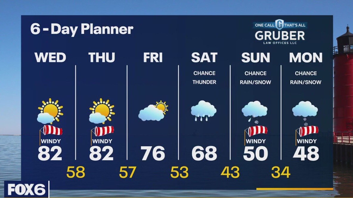
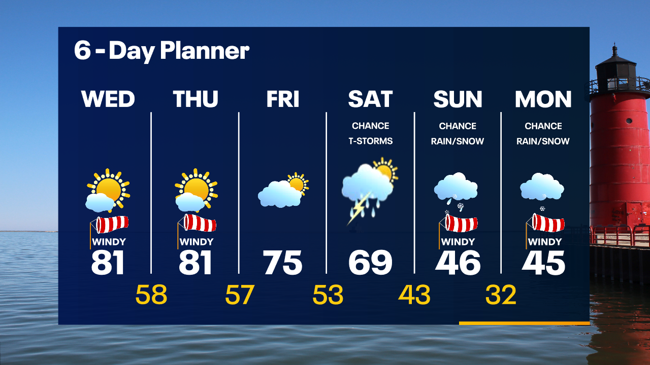
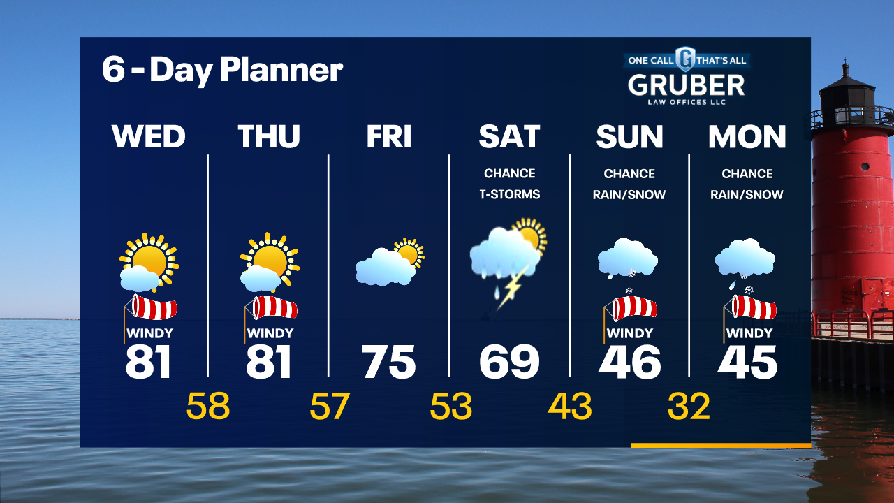
Red Flag Warning Today (Wednesday) From 11am Until 8pm. Caution is advised with any outdoor fires or when using any equipment that may cause sparks. Sunny, windy and warm today with highs in the low 80s. We will see a repeat of this for tomorrow before our pattern changes. Rain and a chance for thunderstorms on Saturday as a cold front passes through. Rain/snow showers possible Sunday and Monday with cooler air returning.
Red Flag Warning Today (Wednesday) From 11am Until 8pm. Caution is advised with any outdoor fires or when using any equipment that may cause sparks. Sunny, windy and warm today with highs in the low 80s. We will see a repeat of this for tomorrow before our pattern changes. Rain and a chance for thunderstorms on Saturday as a cold front passes through. Rain/snow showers possible Sunday and Monday with cooler air returning.
Weather Webcast with Tom Wachs
Mostly clear overnight with temperatures in the upper 50s by sunrise. Mostly sunny, windy and warm on Wednesday with a near-record high in the low 80s. High fire danger Wednesday.
Mostly clear overnight with temperatures in the upper 50s by sunrise. Mostly sunny, windy and warm on Wednesday with a near-record high in the low 80s. High fire danger Wednesday.
Weather Webcast with Tom Wachs
Mostly clear tonight with temperatures falling through the 60s. Mostly sunny, windy and warm on Wednesday with a near-record high in the low 80s.
Mostly clear tonight with temperatures falling through the 60s. Mostly sunny, windy and warm on Wednesday with a near-record high in the low 80s.

Weather Webcast With Lisa Michaels
An area of high pressure to our east helps with a strong southerly flow of very warm air for the next few days. Temperatures will warm into the upper 70s and low 80s for the next three days. Potential record high temps can occur. A cold front arrives late Friday into Saturday. Ahead of that front we will see rain and a chance for thunderstorms. Behind the front, we cool down. We return to more seasonal temperatures in the low 50s next week.
An area of high pressure to our east helps with a strong southerly flow of very warm air for the next few days. Temperatures will warm into the upper 70s and low 80s for the next three days. Potential record high temps can occur. A cold front arrives late Friday into Saturday. Ahead of that front we will see rain and a chance for thunderstorms. Behind the front, we cool down. We return to more seasonal temperatures in the low 50s next week.