



How Mount St. Helens eruption transformed volcanic monitoring in WA
The 1980 Mount St. Helens eruption remains the deadliest in U.S. history, fundamentally changing how scientists monitor volcanic activity.
The 1980 Mount St. Helens eruption remains the deadliest in U.S. history, fundamentally changing how scientists monitor volcanic activity.
Weather webcast with Stephanie Barichello
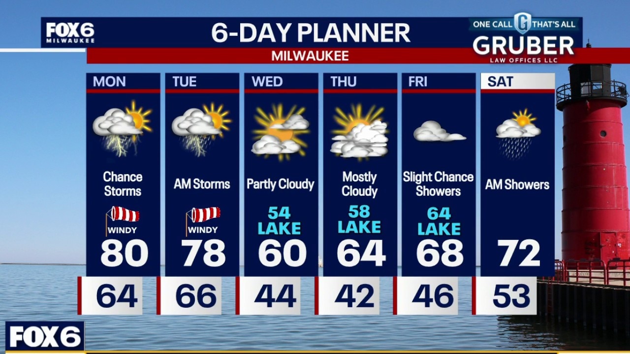
We’ll likely get a break for part of Monday afternoon with some sunshine helping temperatures push close to 80 degrees before another round of storms develops late Monday night into Tuesday.
We’ll likely get a break for part of Monday afternoon with some sunshine helping temperatures push close to 80 degrees before another round of storms develops late Monday night into Tuesday.

Southeast Wisconsin weather: Strong to severe storms into Tuesday
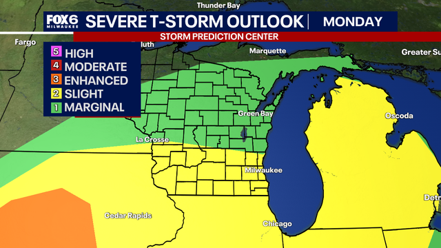
Several days of strong to severe storms are possible early this week. The Storm Prediction Center has put southeastern Wisconsin under a risk level each day.
Several days of strong to severe storms are possible early this week. The Storm Prediction Center has put southeastern Wisconsin under a risk level each day.
Weather webcast with Rob Haswell
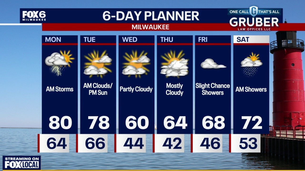
It’s another active stretch across southern Wisconsin with a weakening overnight line of storms still capable of gusty winds early Monday morning.
It’s another active stretch across southern Wisconsin with a weakening overnight line of storms still capable of gusty winds early Monday morning.
Weather Webcast with Chief Meteorologist Tom Wachs
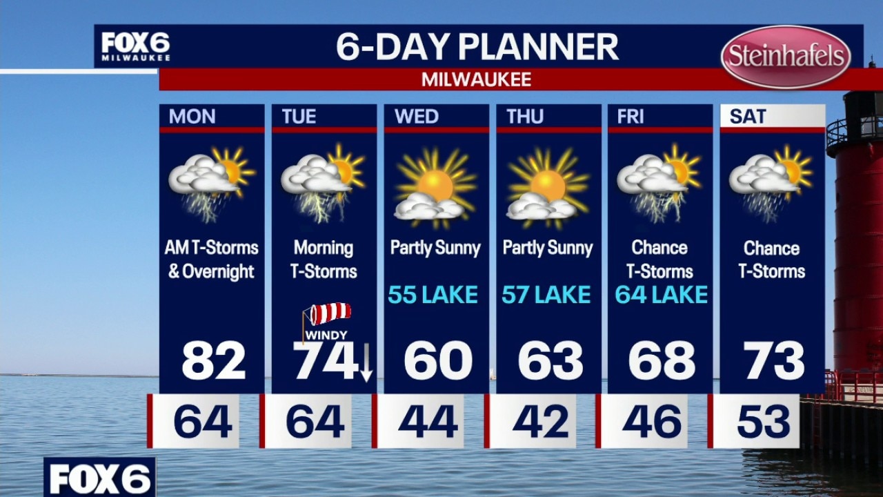
A warm front will push through which means rising temperatures overnight. A weakening line of t-storms is expected overnight as well. Morning showers and t-storms on Monday, otherwise warm by afternoon with highs in the low 80s.
A warm front will push through which means rising temperatures overnight. A weakening line of t-storms is expected overnight as well. Morning showers and t-storms on Monday, otherwise warm by afternoon with highs in the low 80s.


Milwaukee Weather: Warming up on Monday
A warm front will push through which means rising temperatures overnight. A weakening line of t-storms is expected overnight as well. Morning showers and t-storms on Monday, otherwise warm by afternoon with highs in the low 80s.
A warm front will push through which means rising temperatures overnight. A weakening line of t-storms is expected overnight as well. Morning showers and t-storms on Monday, otherwise warm by afternoon with highs in the low 80s.
Weather Webcast with Chief Meteorologist Tom Wachs
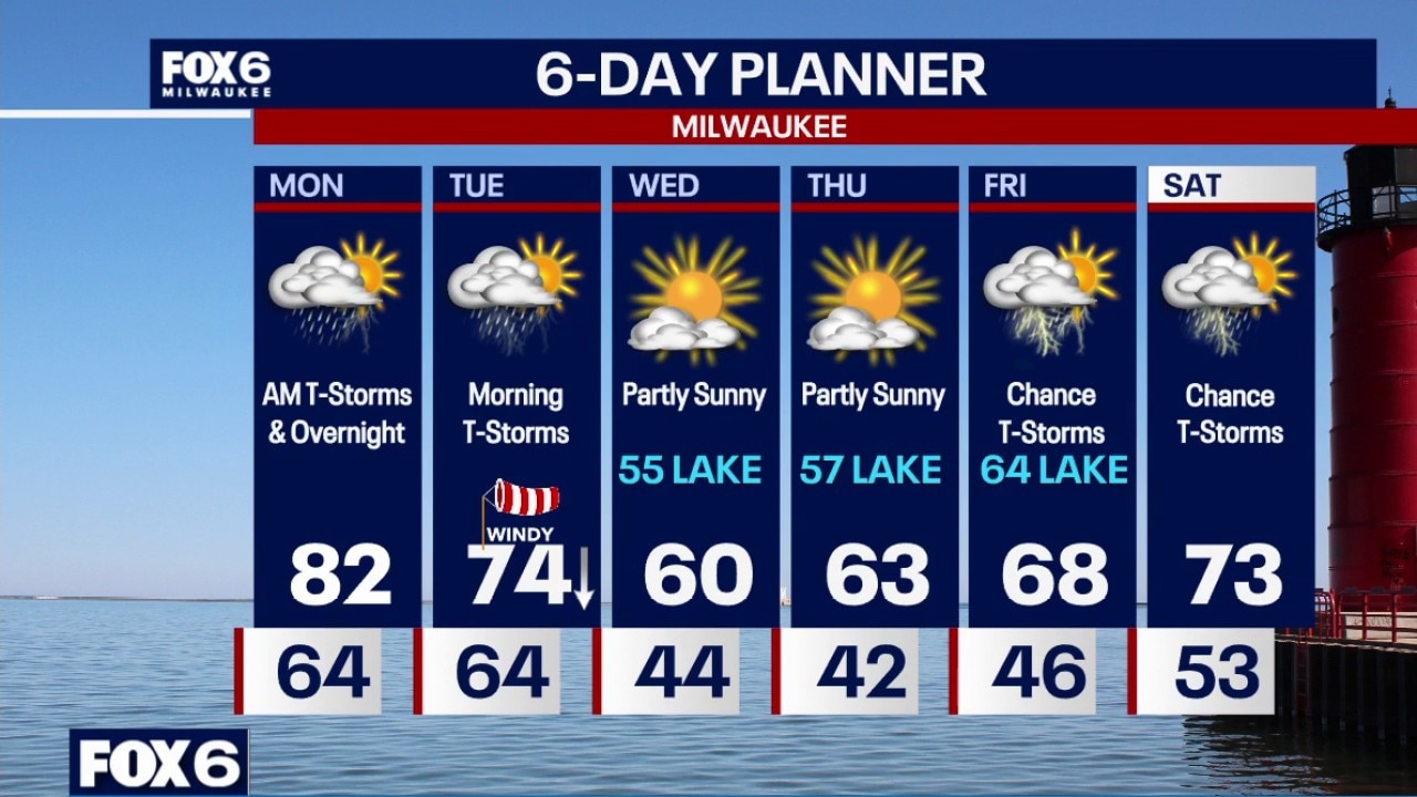
Mostly cloudy tonight. A warm front will push through which means rising temperatures overnight. A weakening line of t-storms is expected overnight as well. Morning showers and t-storms on Monday, otherwise warm by afternoon with highs in the low 80s.
Mostly cloudy tonight. A warm front will push through which means rising temperatures overnight. A weakening line of t-storms is expected overnight as well. Morning showers and t-storms on Monday, otherwise warm by afternoon with highs in the low 80s.
Weather webcast with Meteorologist Lisa Michaels
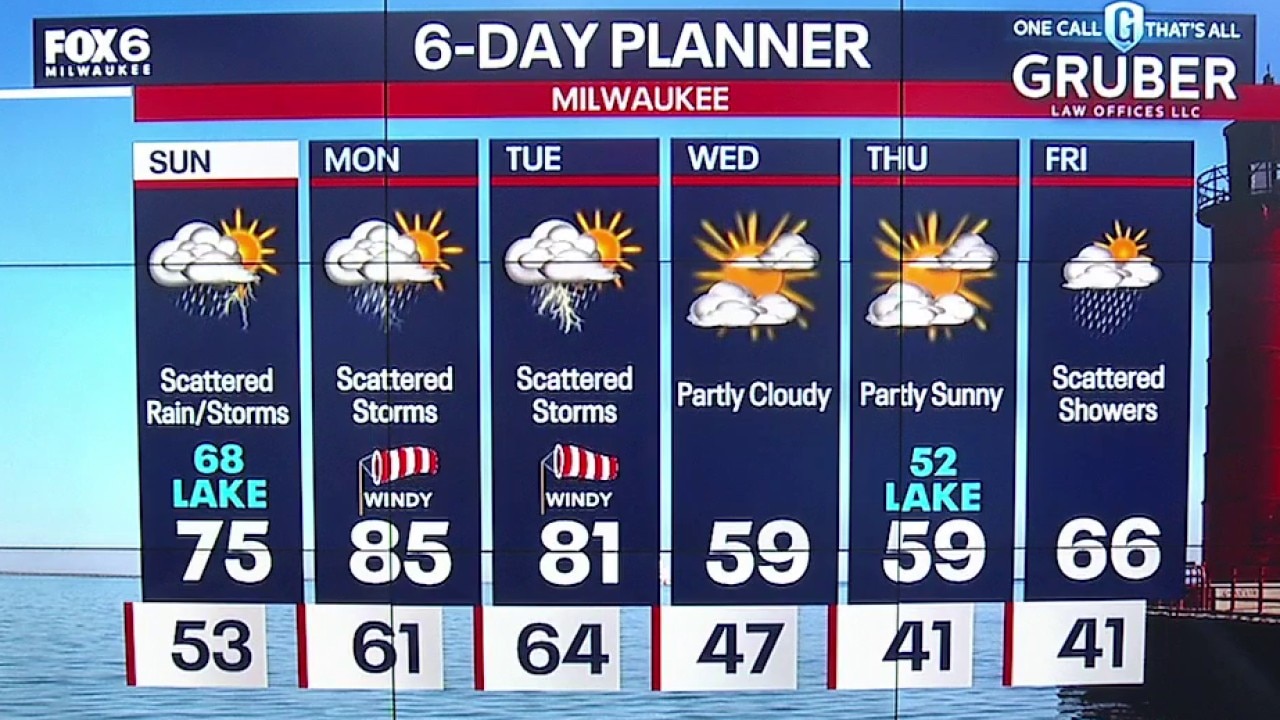
Cloudy Sunday with a chance for scattered rain and storms. A few storms could be strong during the afternoon. High temperatures will be in the upper 60s near the lake to mid 70s inland.
Cloudy Sunday with a chance for scattered rain and storms. A few storms could be strong during the afternoon. High temperatures will be in the upper 60s near the lake to mid 70s inland.
Weather Webcast with Holly Baker
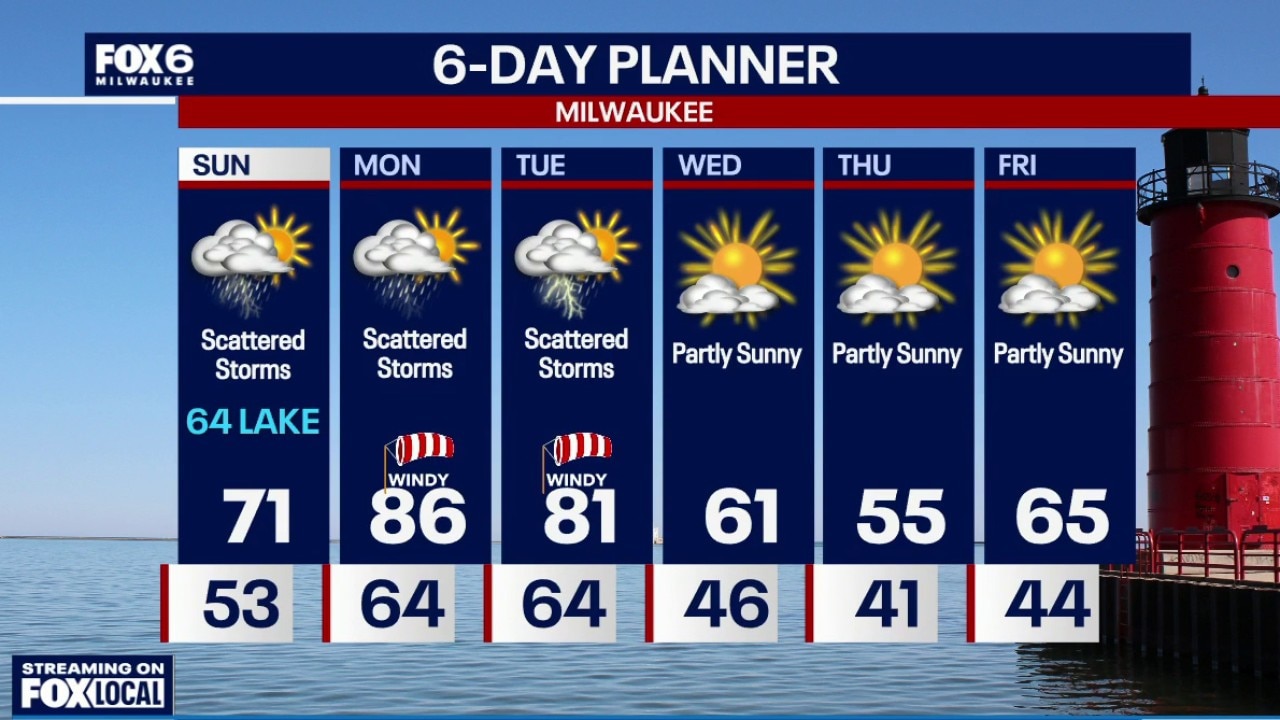
We are tracking a chance for storms overnight into Sunday.
We are tracking a chance for storms overnight into Sunday.
Weather webcast with meteorologist Lisa Michaels
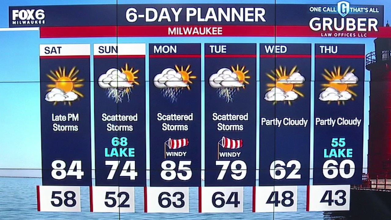
A few lingering showers possible early Saturday. Clearing clouds to mostly sunny and warm. Highs in the mid-80s! Another round of storms is possible Saturday evening into Sunday morning. Hazards include strong winds and hail.
A few lingering showers possible early Saturday. Clearing clouds to mostly sunny and warm. Highs in the mid-80s! Another round of storms is possible Saturday evening into Sunday morning. Hazards include strong winds and hail.
Milwaukee Weather: Mostly Sunny and warm, more storms on the way
A few lingering showers possible early Saturday. Clearing clouds to mostly sunny and warm. Highs in the mid-80s!
A few lingering showers possible early Saturday. Clearing clouds to mostly sunny and warm. Highs in the mid-80s!
Weather Webcast with Holly Baker
We are tracking storms all weekend.
We are tracking storms all weekend.


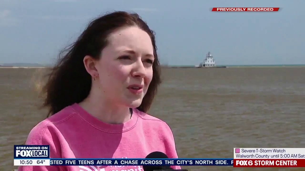
Wisconsin severe thunderstorm watch into Saturday morning
The National Weather Service issued a severe thunderstorm watch for parts of southeast Wisconsin from late Friday night into Saturday morning.
The National Weather Service issued a severe thunderstorm watch for parts of southeast Wisconsin from late Friday night into Saturday morning.
Weather Webcast with Stephanie Barichello
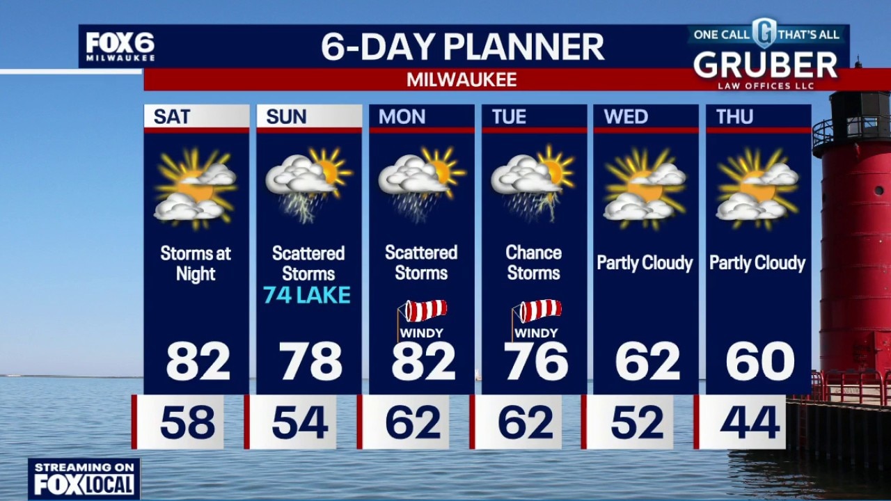
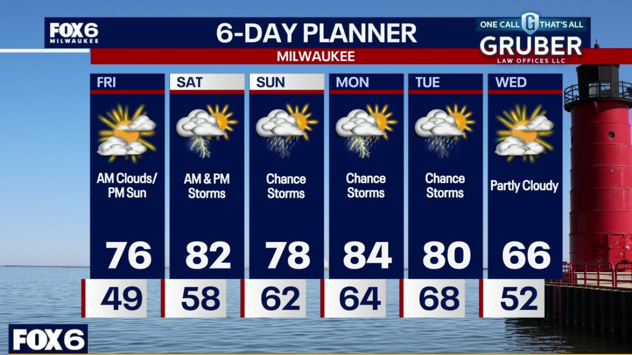
Thunderstorms expected overnight, some of which could be strong to severe. Warm again Saturday with more storms at night, then expect several more rounds of storms through Tuesday.
Thunderstorms expected overnight, some of which could be strong to severe. Warm again Saturday with more storms at night, then expect several more rounds of storms through Tuesday.
Wisconsin Weather Experts: Weekend storms possible
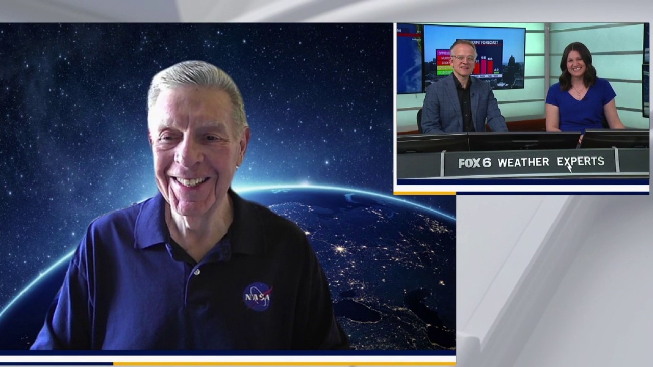
The Wisconsin Weather Experts at FOX6 News Milwaukee share weather forecast trends and much more.
The Wisconsin Weather Experts at FOX6 News Milwaukee share weather forecast trends and much more.
Milwaukee Weather: Overnight storms then 80s Saturday
Mild this evening, then a complex of strong thunderstorms will move through between midnight and 4am Saturday. Storms could produce gusty wind and hail.
Mild this evening, then a complex of strong thunderstorms will move through between midnight and 4am Saturday. Storms could produce gusty wind and hail.
Weather webcast with Stephanie Barichello
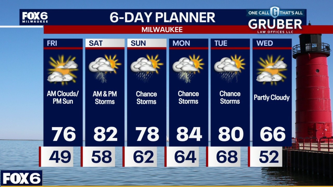
We are heading into a much warmer and more active stretch of weather across southern Wisconsin. Friday looks breezy and warm, but attention quickly turns to a potential thunderstorm complex Friday night that could bring damaging winds.
We are heading into a much warmer and more active stretch of weather across southern Wisconsin. Friday looks breezy and warm, but attention quickly turns to a potential thunderstorm complex Friday night that could bring damaging winds.


Future Forecaster: Meet 9-year-old Carson
Meet 9-year-old Carson - our latest Future Forecaster.
Meet 9-year-old Carson - our latest Future Forecaster.

Future Forecaster: Meet 9-year-old Carson
Meet 9-year-old Carson - our latest Future Forecaster.
Meet 9-year-old Carson - our latest Future Forecaster.
Weather webcast with Rob Haswell
We are heading into a much warmer and more active stretch of weather across southern Wisconsin. Friday looks breezy and warm, but attention quickly turns to a potential thunderstorm complex Friday night that could bring damaging winds.
We are heading into a much warmer and more active stretch of weather across southern Wisconsin. Friday looks breezy and warm, but attention quickly turns to a potential thunderstorm complex Friday night that could bring damaging winds.