

Wisconsin snow potential Friday, mostly to south
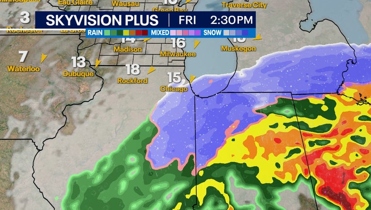
Skyvision Plus for Friday afternoon, Mar. 3
MILWAUKEE - A broad system of heavy snow will pass just south of southeastern Wisconsin Friday, March 3 – and move through Illinois and Michigan. But it is too close for comfort.
The biggest impacts can be expected in the Chicago area with high potential for 6 inches or more of accumulation. Kenosha County and Racine County have the best chance at accumulation, but with current model trends, we'll be right on the edge of this system.
Some atmospheric models forecast as much as 10 inches of snowfall in spots because of this system in areas of Michigan. Southeast Wisconsin lucked out in being too far north for the major impacts.
SIGN UP TODAY: Get daily headlines, breaking news emails from FOX6 News
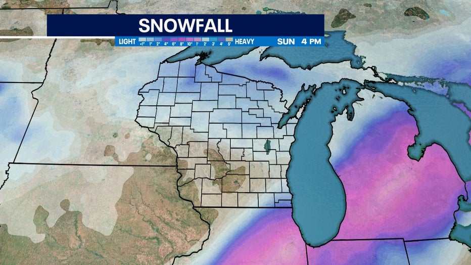
Atmospheric model snow map for accumulation of snow through Sunday, March 5
So far, the consensus is a 100-mile trend south that clears us of most of the higher totals. If you are planning to head into the Chicago area Friday and into the weekend, don't be surprised if there are delays.