

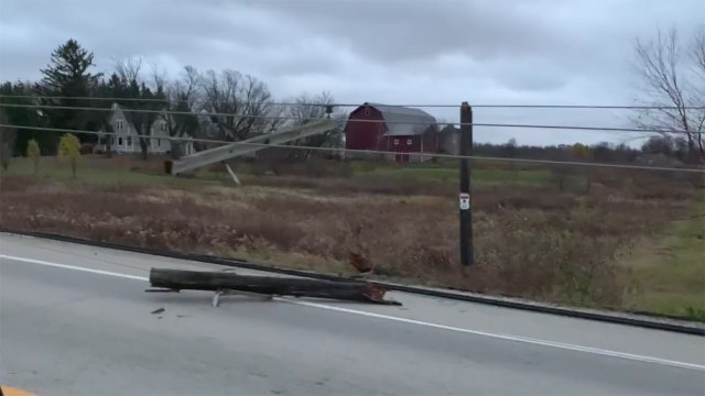

Power outages, strong winds Saturday 'really something'
Strong winds across southeastern Wisconsin knocked out power to thousands and damaged trees and power lines Saturday, Nov. 5.
Strong winds across southeastern Wisconsin knocked out power to thousands and damaged trees and power lines Saturday, Nov. 5.
Weather Webcast
Getting cooler by Monday but big temp drop heading into the weekend.
Getting cooler by Monday but big temp drop heading into the weekend.


Coats for Kids donations making a difference: 'A blessing'
As temperatures drop, it's a reminder that some kids are in need of winter coats this season. FOX6 Coats for Kids 2022 is helping one coat at a time.
As temperatures drop, it's a reminder that some kids are in need of winter coats this season. FOX6 Coats for Kids 2022 is helping one coat at a time.
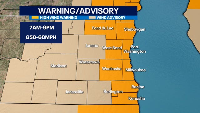

Southeastern Wisconsin wind warning, advisory Saturday
The National Weather Service has issued a wind advisory and high wind warning that cover all of southeastern Wisconsin.
The National Weather Service has issued a wind advisory and high wind warning that cover all of southeastern Wisconsin.
Weather Webcast with Lisa Michaels
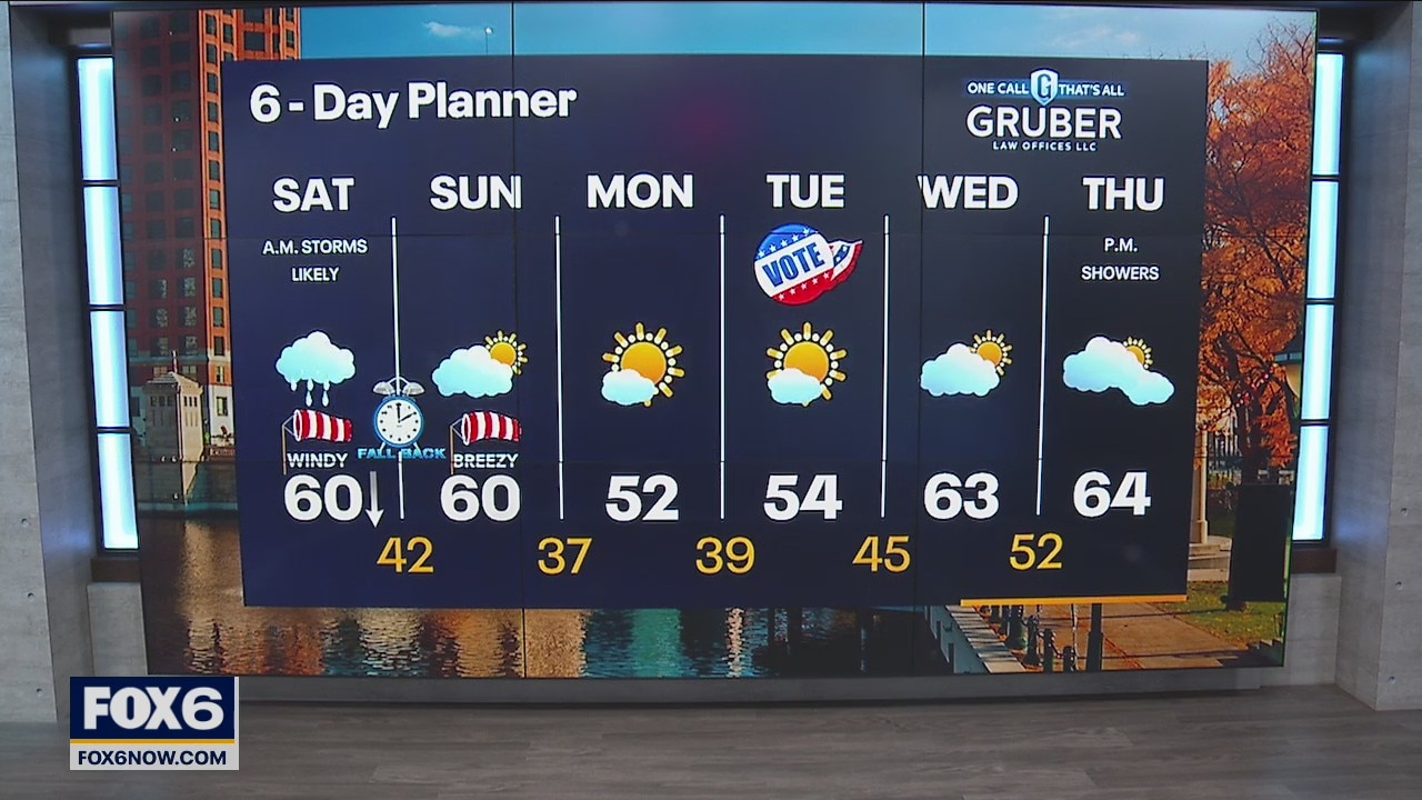
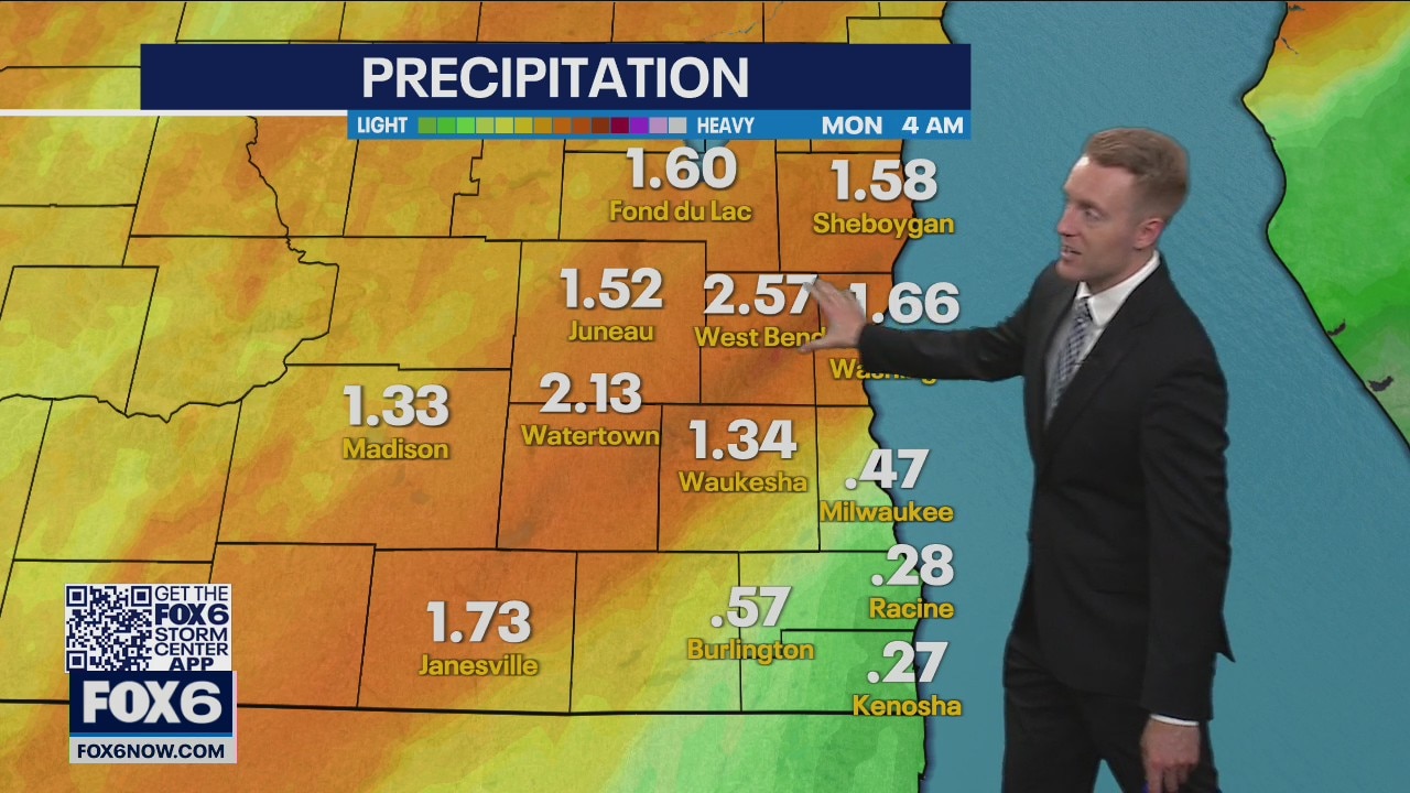
Rain lingers in the morning hours. Isolated storms develop before noon. A few could be strong to severe. After the cold front passes this afternoon, winds will be the primary concern. Sustain winds 20-30mph with gusts ranging from 50-60mph. Breezy on Sunday with sunshine returning. More seasonable temperatures return next week in the 50s.
Rain lingers in the morning hours. Isolated storms develop before noon. A few could be strong to severe. After the cold front passes this afternoon, winds will be the primary concern. Sustain winds 20-30mph with gusts ranging from 50-60mph. Breezy on Sunday with sunshine returning. More seasonable temperatures return next week in the 50s.
Weather Webcast
FOX6 News at 6
FOX6 News at 6


Severe thunderstorm warnings expire, hail reported
The National Weather Service issued a severe thunderstorm warning for parts of Dodge, Fond du Lac, Jefferson, Milwaukee and Waukesha counties.
The National Weather Service issued a severe thunderstorm warning for parts of Dodge, Fond du Lac, Jefferson, Milwaukee and Waukesha counties.

Weather Webcast with Meteorologist Stephanie Barichello
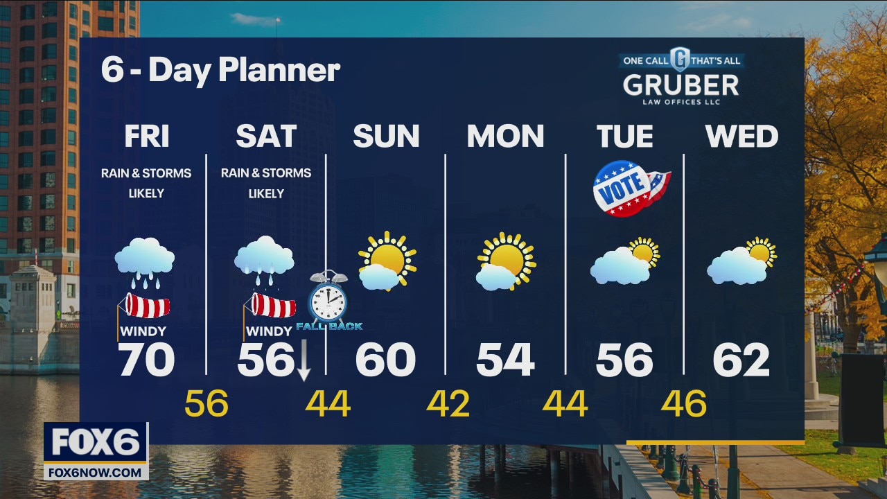
Rain and thunder continue this afternoon, evening and overnight. A few strong to severe storms will be possible mid-morning Saturday then drying quickly but becoming very windy. A Wind Advisory is in effect from 4am to 10pm Saturday for gusts up to 55mph.
Rain and thunder continue this afternoon, evening and overnight. A few strong to severe storms will be possible mid-morning Saturday then drying quickly but becoming very windy. A Wind Advisory is in effect from 4am to 10pm Saturday for gusts up to 55mph.
Weather webcast with Rob Haswell
The frontal boundary to our west will move east and a low will rapidly develop to our southwest. Rain is likely today with a chance for thunderstorms. Rain continues into Saturday with a better chance of thunderstorms. Strong to severe storms are possible on Saturday morning. A Wind Advisory goes into effect for Saturday morning with gusts near 45mph or stronger. We calm down late Saturday and into Sunday.
The frontal boundary to our west will move east and a low will rapidly develop to our southwest. Rain is likely today with a chance for thunderstorms. Rain continues into Saturday with a better chance of thunderstorms. Strong to severe storms are possible on Saturday morning. A Wind Advisory goes into effect for Saturday morning with gusts near 45mph or stronger. We calm down late Saturday and into Sunday.

Weather Webcast
FOX6 News at 5
FOX6 News at 5

November?s near-record warmth draws Wisconsinites outdoors
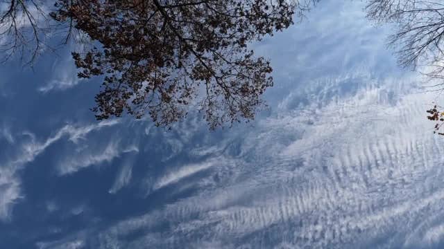
November 3, 2022? For a third day in a row, southeast Wisconsin basked in temperatures hovering around 70 degrees. Normally, high temperatures should be topping out in the low to mid 50s ? with lows dipping into the upper 30s.
November 3, 2022? For a third day in a row, southeast Wisconsin basked in temperatures hovering around 70 degrees. Normally, high temperatures should be topping out in the low to mid 50s ? with lows dipping into the upper 30s.

November's near-record warmth draws Wisconsinites outdoors
November 3, 2022… For a third day in a row, southeast Wisconsin basked in temperatures hovering around 70 degrees.
November 3, 2022… For a third day in a row, southeast Wisconsin basked in temperatures hovering around 70 degrees.
Weather Webcast with Meteorologist Stephanie Barichello
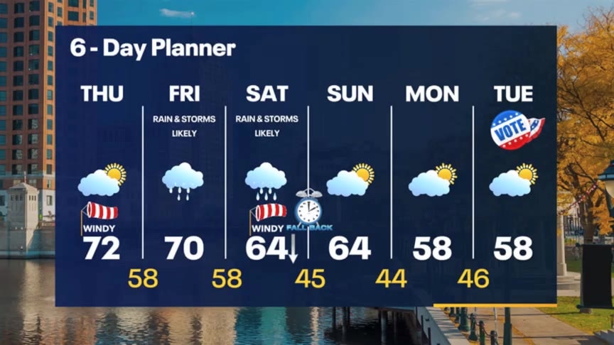
A mix of clouds and sun today with temperatures nearing the record in the low 70s. We only drop into the upper 50s tonight then climb into the 60s and 70s tomorrow. A few spotty morning showers will give way to widespread afternoon rain that will continue into Saturday.
A mix of clouds and sun today with temperatures nearing the record in the low 70s. We only drop into the upper 50s tonight then climb into the 60s and 70s tomorrow. A few spotty morning showers will give way to widespread afternoon rain that will continue into Saturday.
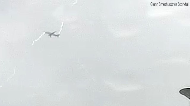

Video captures moment Airbus Beluga is struck by lightning
A dramatic video captured the moment on a dashcam when the plane was struck by the bolt.
A dramatic video captured the moment on a dashcam when the plane was struck by the bolt.
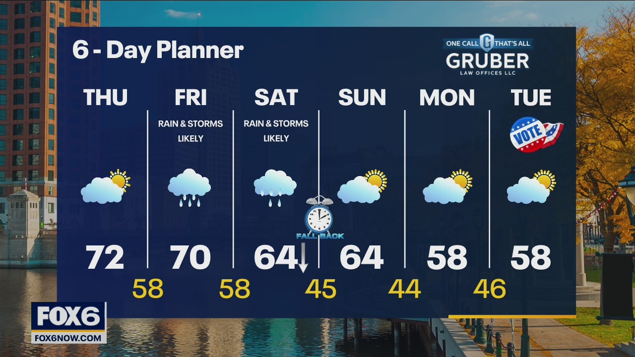
Weather webcast with Rob Haswell
A strong low continues to move our way today. Ahead of the system we warm into the low 70s with a stronger SW wind developing. As the low moves through on Friday we can expect rain and a few thunderstorms. More rain and thunderstorms are likely on Saturday before he system finally exits late Saturday night.
A strong low continues to move our way today. Ahead of the system we warm into the low 70s with a stronger SW wind developing. As the low moves through on Friday we can expect rain and a few thunderstorms. More rain and thunderstorms are likely on Saturday before he system finally exits late Saturday night.
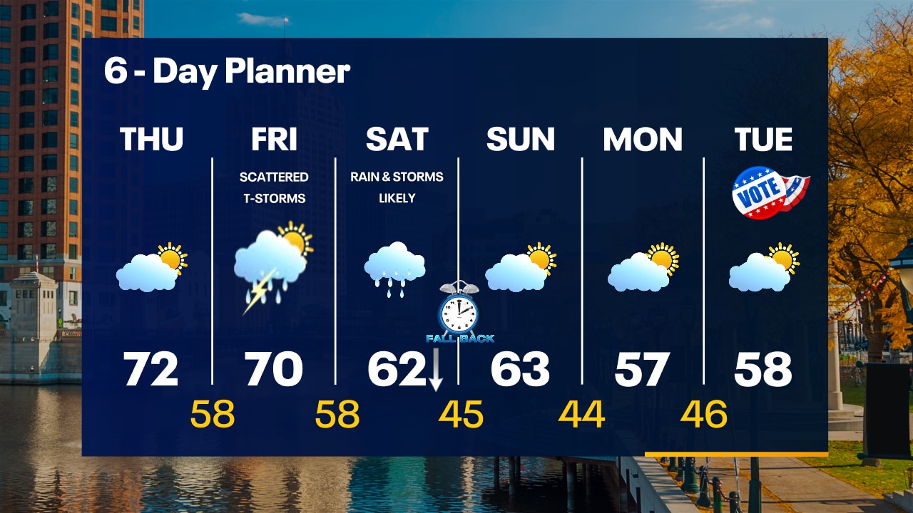
Weather Webcast with Tom Wachs
Patchy fog overnight with temperatures in the upper 40s to low 50s by sunrise. Partly sunny on Thursday with a breezy high in the low 70s. Scattered t-storms Friday.
Patchy fog overnight with temperatures in the upper 40s to low 50s by sunrise. Partly sunny on Thursday with a breezy high in the low 70s. Scattered t-storms Friday.
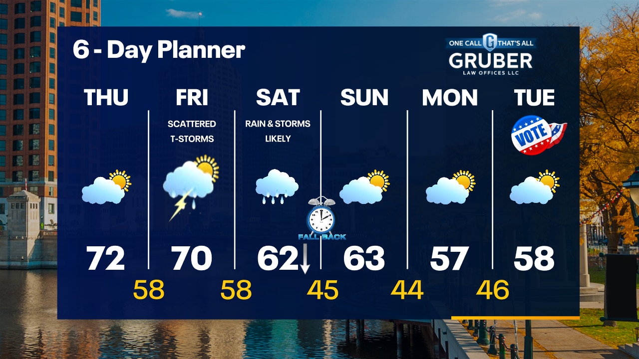
Weather Webcast with Tom Wachs
Clear skies tonight with temperatures falling into the 50s. Breezy and warm on Thursday with increasing clouds. Highs in the low 70s. Scattered t-storms on Friday.
Clear skies tonight with temperatures falling into the 50s. Breezy and warm on Thursday with increasing clouds. Highs in the low 70s. Scattered t-storms on Friday.
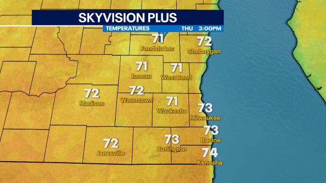

More 70s in the forecast – but don't get used to it
Warmer than average air sticks around heading into the weekend, but looking long term, it'll be harder and harder to hit that mark in Wisconsin
Warmer than average air sticks around heading into the weekend, but looking long term, it'll be harder and harder to hit that mark in Wisconsin
Weather Webcast with Meteorologist Stephanie Barichello
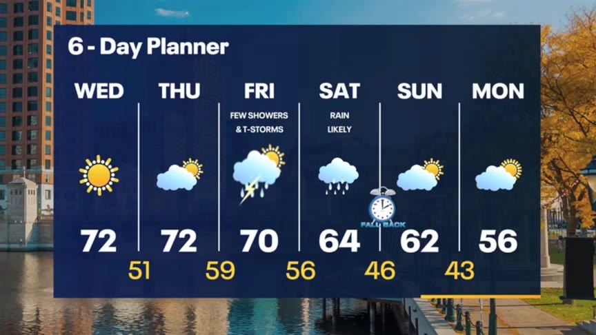
Sunny and warm again today then expect a stronger wind Thursday. Scattered showers Friday then a very soggy Saturday. Drying out but cooling off Sunday into Monday.
Sunny and warm again today then expect a stronger wind Thursday. Scattered showers Friday then a very soggy Saturday. Drying out but cooling off Sunday into Monday.
Weather webcast with Rob Haswell
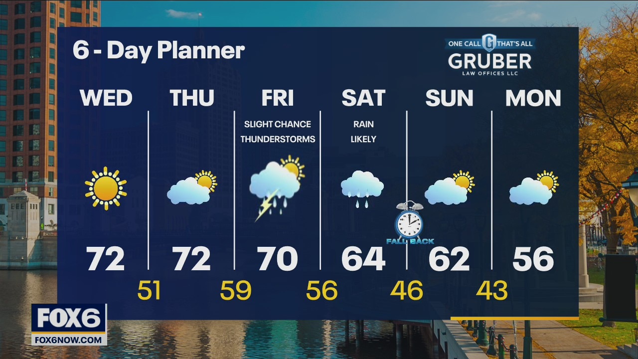
High pressure continues to dominate our forecast along with a push of very warm air for November. Highs today and tomorrow will be in the low 70s with near record values possible tomorrow. A stronger low arrives on Friday with rain and a slight chance for thunderstorms. Rain continues on Saturday and ends in the early hours of Sunday morning.
High pressure continues to dominate our forecast along with a push of very warm air for November. Highs today and tomorrow will be in the low 70s with near record values possible tomorrow. A stronger low arrives on Friday with rain and a slight chance for thunderstorms. Rain continues on Saturday and ends in the early hours of Sunday morning.