

Weather webcast with Rob Haswell
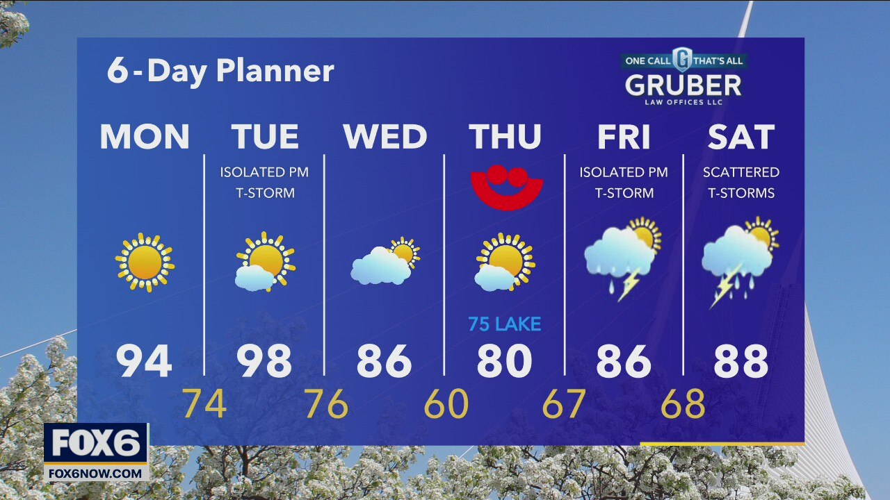
Between a strong high pressure ridge to our East and a cold front to our West, we warm up significantly today with highs well into the 90s! Dewpoints will increase slightly today but will really surge tomorrow along with another push of hot air taking us into the upper 90s with Heat Index values in the 100+ range.
Between a strong high pressure ridge to our East and a cold front to our West, we warm up significantly today with highs well into the 90s! Dewpoints will increase slightly today but will really surge tomorrow along with another push of hot air taking us into the upper 90s with Heat Index values in the 100+ range.

Weather Webcast with A.J. Waterman
More heat on the way for the work week...
More heat on the way for the work week...
Weather Webcast with Eric Manges
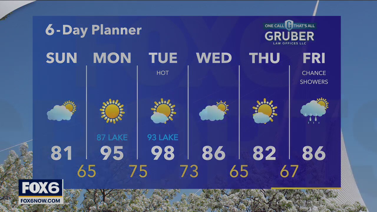
Staying nice today with highs near 80 and partly to mostly sunny skies. Heat is back Monday with highs in the mid-90s and heat index values approaching 100.
Staying nice today with highs near 80 and partly to mostly sunny skies. Heat is back Monday with highs in the mid-90s and heat index values approaching 100.
Weather Webcast with Eric Manges
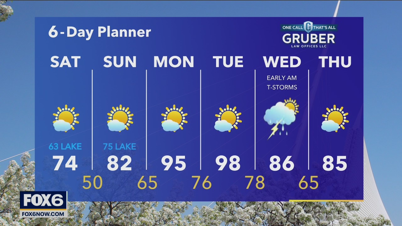
Looking amazing today with highs in the mid-70s and sunshine. Much cooler by the lake. Isolated showers are possible Sunday but insignificant chances overall.
Looking amazing today with highs in the mid-70s and sunshine. Much cooler by the lake. Isolated showers are possible Sunday but insignificant chances overall.
Weather webcast with Stephanie Barichello
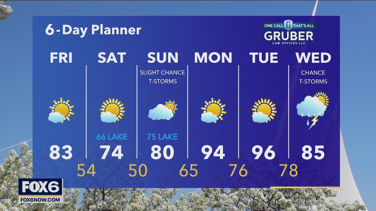
Another beautiful day ahead with sunshine and nice breeze. Temperatures will top out in the low 80s. Cooler tonight with lows in the 50s then a northeast wind returns Saturday keeping lakeshore communities in the 60s, inland spots in the mid 70s. A bit warmer Sunday with a slight chance for a shower or t-storm then the heat sets back in early next week.
Another beautiful day ahead with sunshine and nice breeze. Temperatures will top out in the low 80s. Cooler tonight with lows in the 50s then a northeast wind returns Saturday keeping lakeshore communities in the 60s, inland spots in the mid 70s. A bit warmer Sunday with a slight chance for a shower or t-storm then the heat sets back in early next week.
Weather webcast with Rob Haswell
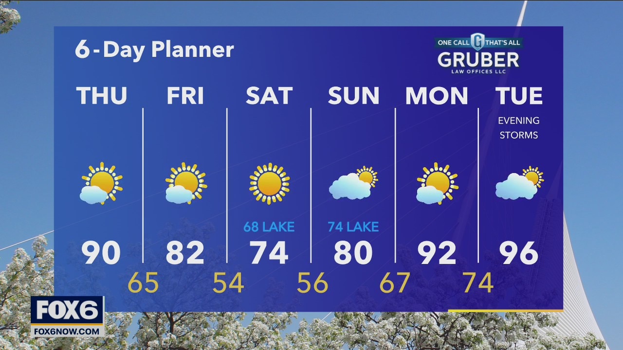
While the initial cold front is now to our East, we are still in a very warm airmass. Highs will be in the upper 80s and low 90s. A secondary cold front passes today to finally break the heat and usher in some drier air. Highs fall to the low 80s tomorrow with dewpoints falling to the upper 40s and low 50s.
While the initial cold front is now to our East, we are still in a very warm airmass. Highs will be in the upper 80s and low 90s. A secondary cold front passes today to finally break the heat and usher in some drier air. Highs fall to the low 80s tomorrow with dewpoints falling to the upper 40s and low 50s.
Weather webcast with Rob Haswell
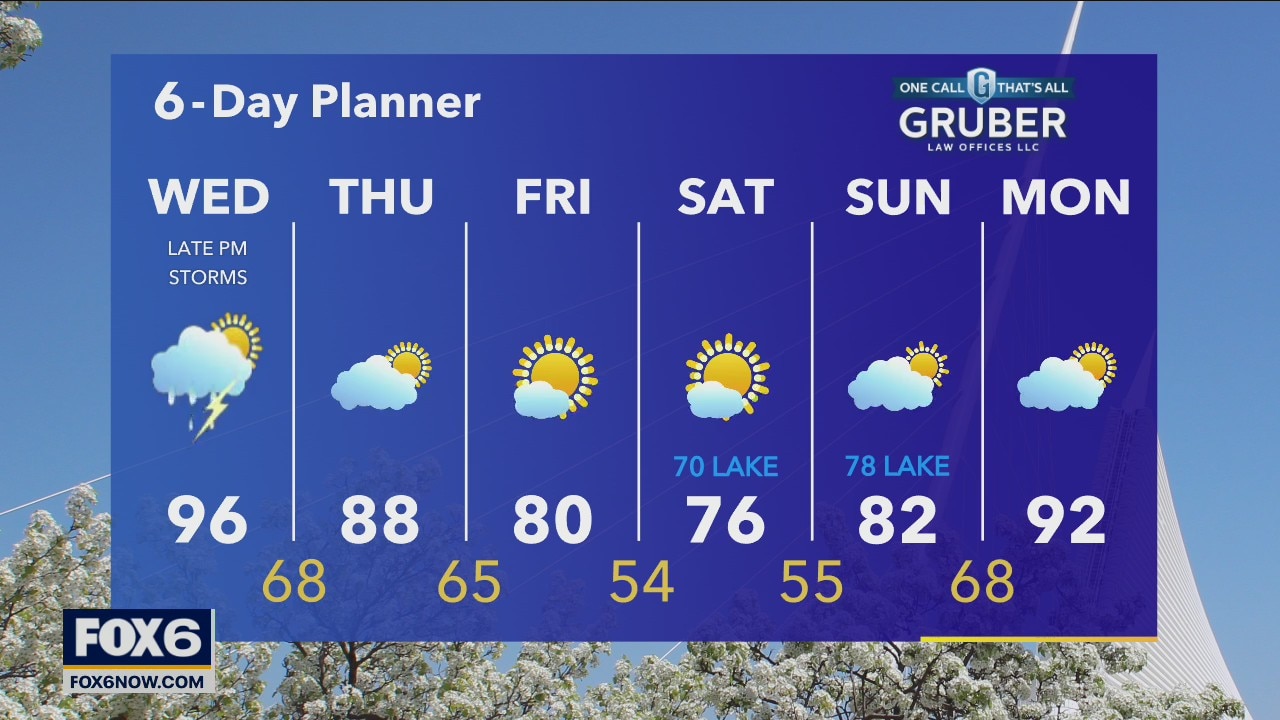
A Heat Advisory continues until 8pm Today for all of SE WI. Hot air continues to surge across our area with highs today again in the upper 90s with Heat Index values in the 100+ range. A cold front arrives overnight and will trigger some rain and thunderstorms. There is a risk for severe weather overnight.
A Heat Advisory continues until 8pm Today for all of SE WI. Hot air continues to surge across our area with highs today again in the upper 90s with Heat Index values in the 100+ range. A cold front arrives overnight and will trigger some rain and thunderstorms. There is a risk for severe weather overnight.
Weather Webcast with Meteorologist Stephanie Barichello
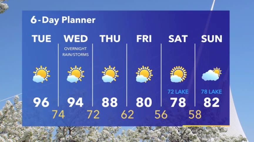
Hot and very humid today and tomorrow. Heat indices may reach into the triple digits at times. A heat advisory continues until 8pm Wednesday. A chance for storms returns Wednesday evening.
Hot and very humid today and tomorrow. Heat indices may reach into the triple digits at times. A heat advisory continues until 8pm Wednesday. A chance for storms returns Wednesday evening.
Weather webcast with Rob Haswell
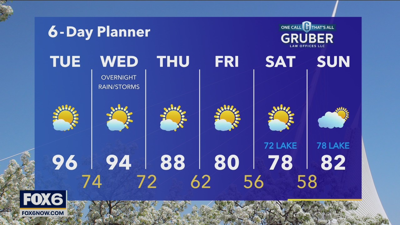
A strong warm front lifts to the north today bringing in some hot air and pushing highs into the 90s for a couple of days. A Heat Advisory starts at 11am today and continues through 8pm on Wednesday. We cool slightly to the upper 80s on Thursday but stay sunny and calm.
A strong warm front lifts to the north today bringing in some hot air and pushing highs into the 90s for a couple of days. A Heat Advisory starts at 11am today and continues through 8pm on Wednesday. We cool slightly to the upper 80s on Thursday but stay sunny and calm.

Weather Webcast with Tom Wachs
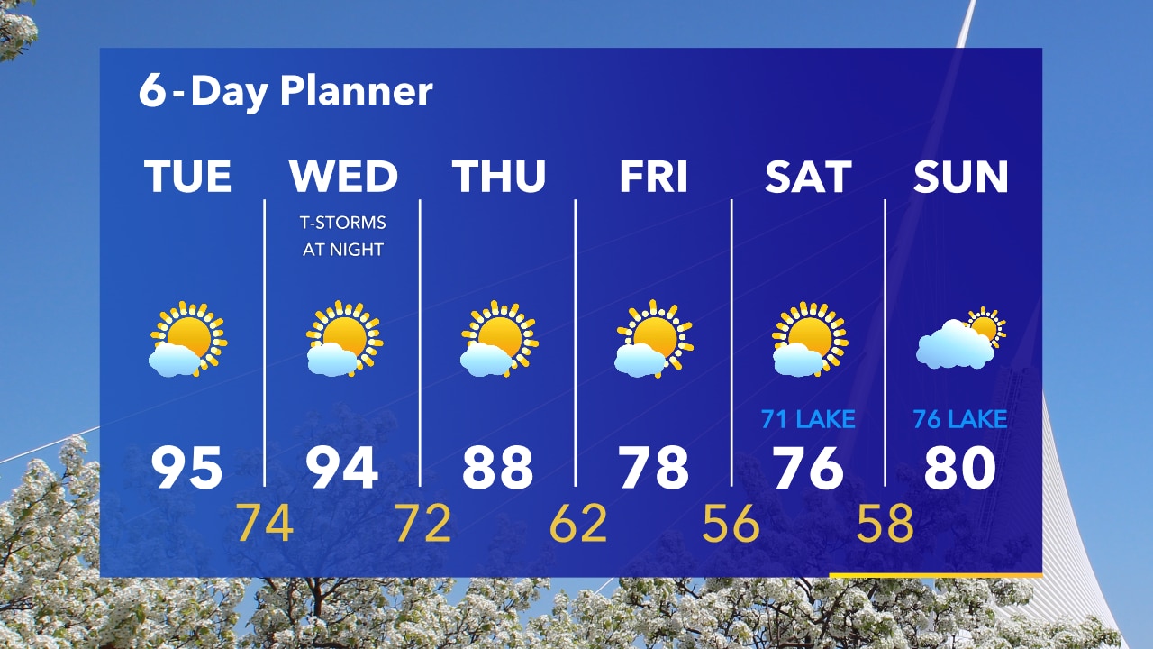
Heat Advisory from 11am Tuesday to 8pm Wednesday. Heat Index over 100 on Tuesday and around 100 on Wednesday. Use caution in this heat!
Heat Advisory from 11am Tuesday to 8pm Wednesday. Heat Index over 100 on Tuesday and around 100 on Wednesday. Use caution in this heat!
Weather Webcast with Tom Wachs
The severe cell has moved east of Milwaukee which means mainly a quiet night for most. Can't rule out a stray strong storm this evening. Otherwise a Heat Advisory Tuesday & Wednesday.
The severe cell has moved east of Milwaukee which means mainly a quiet night for most. Can't rule out a stray strong storm this evening. Otherwise a Heat Advisory Tuesday & Wednesday.
Weather Webcast with Meteorologist Stephanie Barichello
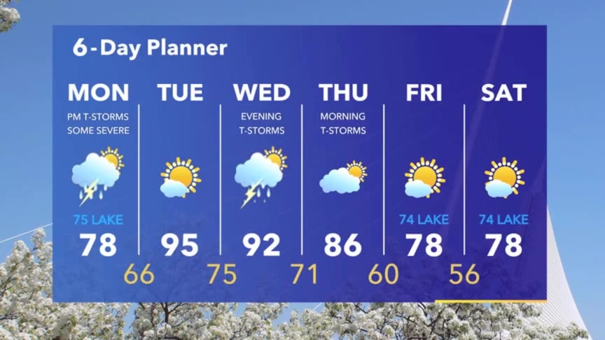
Showers and thunderstorms this afternoon, ending this evening, then extreme heat sets in Tuesday and Wednesday. A Heat Advisory is in effect from 11am Tuesday until 8pm Wednesday for heat indices in the 100s.
Showers and thunderstorms this afternoon, ending this evening, then extreme heat sets in Tuesday and Wednesday. A Heat Advisory is in effect from 11am Tuesday until 8pm Wednesday for heat indices in the 100s.
Weather webcast with Rob Haswell
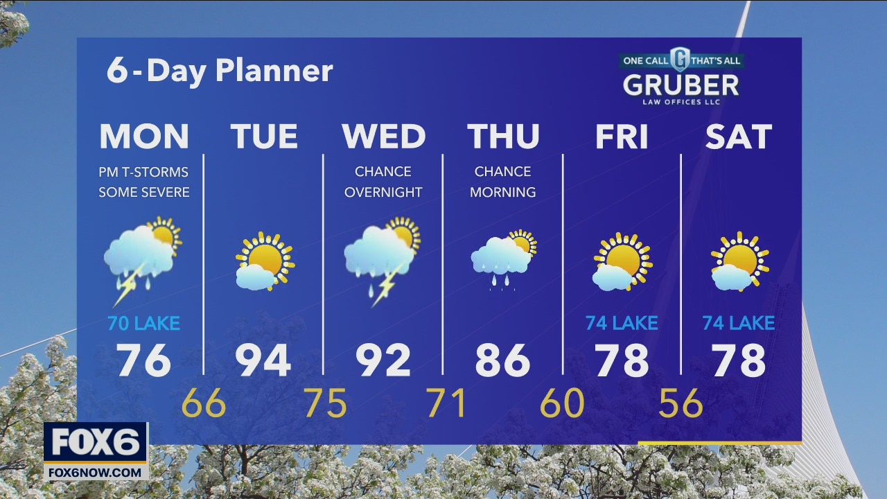
Watching a strong complex of storms and a warm front over the next 24 hours. The complex of storms moving in later this morning through the afternoon is capable of producing strong to severe storms. We have a SLIGHT risk of severe storms today per the Storm Prediction Center. Highs today will be in the low to mid 70s inland but cooler near Lake Michigan. We will warm well into the 90s tomorrow with high dewpoints. A Heat Advisory goes into effect Tuesday at 11am.
Watching a strong complex of storms and a warm front over the next 24 hours. The complex of storms moving in later this morning through the afternoon is capable of producing strong to severe storms. We have a SLIGHT risk of severe storms today per the Storm Prediction Center. Highs today will be in the low to mid 70s inland but cooler near Lake Michigan. We will warm well into the 90s tomorrow with high dewpoints. A Heat Advisory goes into effect Tuesday at 11am.
Weather Webcast with Tom Wachs
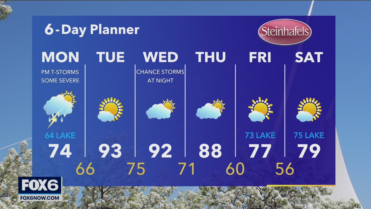
Thunderstorms back in the forecast tomorrow, some could be severe...
Thunderstorms back in the forecast tomorrow, some could be severe...
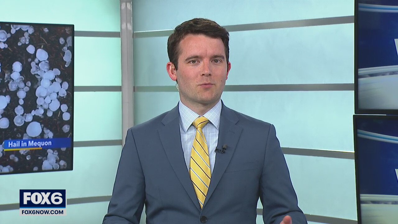
Hail storms in SE Wisconsin
Hail storms moving through Wisconsin
Hail storms moving through Wisconsin
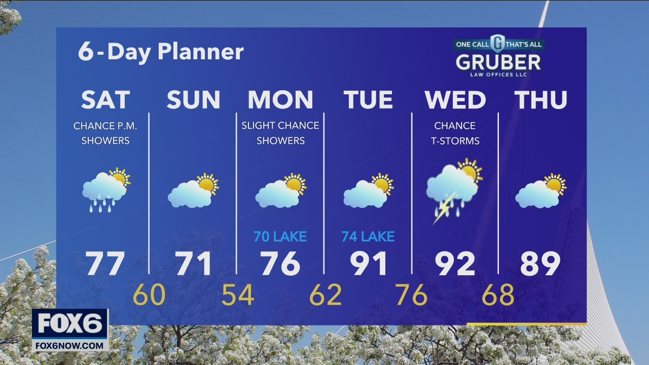
Weather Webcast with A.J. Waterman
Hail storms moving through SE Wisconsin
Hail storms moving through SE Wisconsin
Weather Webcast with Tom Wachs
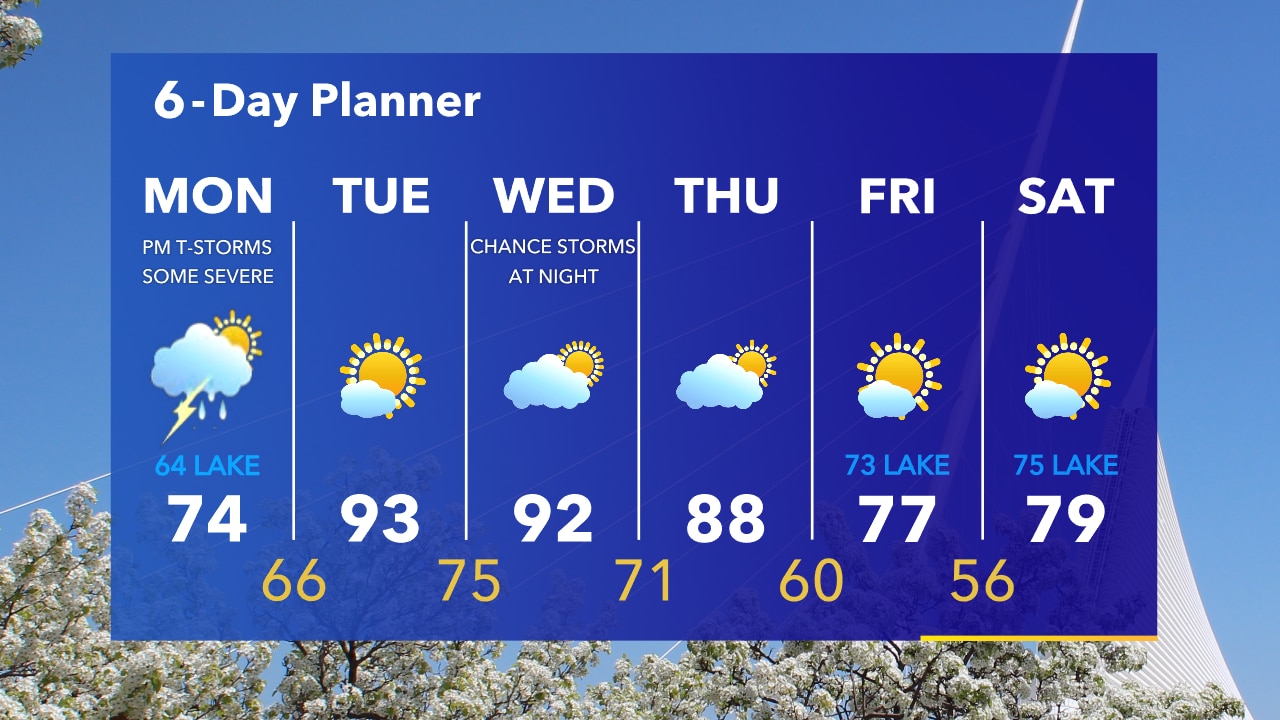
Strong to severe t-storms possible midday into the afternoon Monday. Damaging winds will be the main threat. Highs in the 70s. Heat index over 100 on Tuesday & Wednesday.
Strong to severe t-storms possible midday into the afternoon Monday. Damaging winds will be the main threat. Highs in the 70s. Heat index over 100 on Tuesday & Wednesday.
Weather Webcast with Tom Wachs
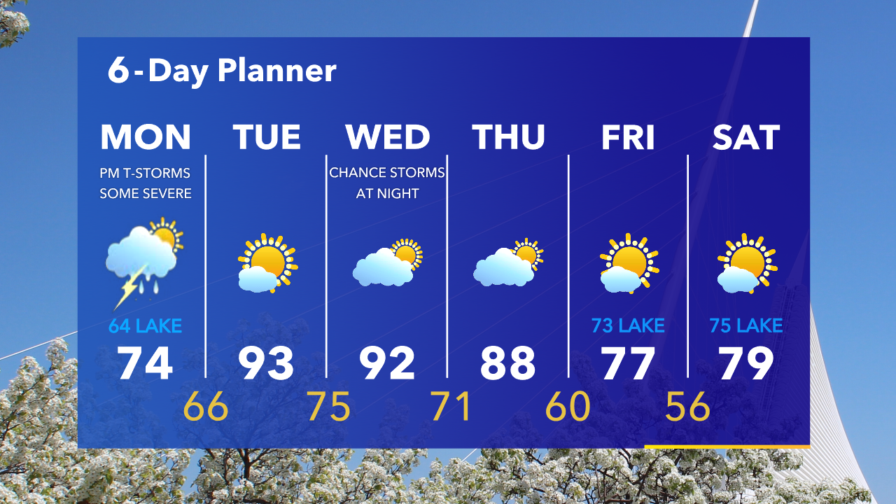
Severe t-storms are possible with wind damage on Monday afternoon. Please stay up to date with evolving forecasts and make sure to check the weather throughout the day Monday.
Severe t-storms are possible with wind damage on Monday afternoon. Please stay up to date with evolving forecasts and make sure to check the weather throughout the day Monday.
Weather Webcast with Eric Manges
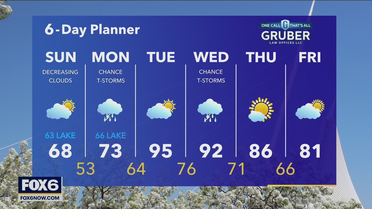
Decreasing clouds throughout the day starting with fog and then ending with sunshine for the late afternoon. Chance of storms Monday afternoon and a few showers, this line has the potential to be strong to severe.
Decreasing clouds throughout the day starting with fog and then ending with sunshine for the late afternoon. Chance of storms Monday afternoon and a few showers, this line has the potential to be strong to severe.

Weather Webcast with Eric Manges
Scattered afternoon showers possible mostly NW otherwise mostly cloudy and warm. Slightly cooler tomorrow with partly sunny skies as highs struggle to reach 70.
Scattered afternoon showers possible mostly NW otherwise mostly cloudy and warm. Slightly cooler tomorrow with partly sunny skies as highs struggle to reach 70.