

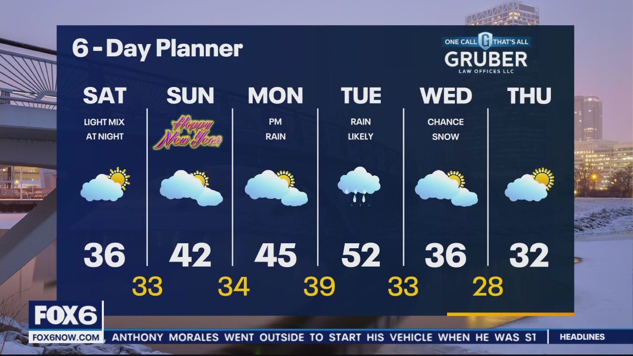
Weather Webcast with Meteorologist Eric Manges
FOX6 News at 5 offers the day's news, weather, and sports in southeast Wisconsin, the nation, and the world.
FOX6 News at 5 offers the day's news, weather, and sports in southeast Wisconsin, the nation, and the world.
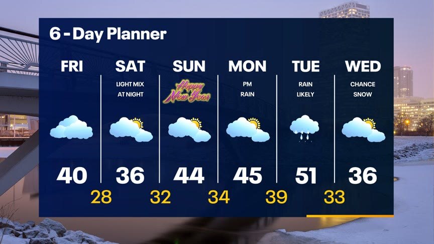
Weather Webcast With Lisa Michaels
A cold front is causing temperatures to drop into the 30s today. The cold air doesn't last for long due to another round of mild temperatures coming back in time for the new year. Light rain mixed with snow is possible Saturday night into early Sunday. Another chance of 50F is possible early next week with additional chances of rain Monday night into Tuesday.
A cold front is causing temperatures to drop into the 30s today. The cold air doesn't last for long due to another round of mild temperatures coming back in time for the new year. Light rain mixed with snow is possible Saturday night into early Sunday. Another chance of 50F is possible early next week with additional chances of rain Monday night into Tuesday.

Meditate Milwaukee New Year's Day Event at Riverside Theater
Meditate Milwaukee has a New Year's Day Event at Riverside Theater to set collective intentions for peace, compassion, and understanding on Sunday, Jan. 1.
Meditate Milwaukee has a New Year's Day Event at Riverside Theater to set collective intentions for peace, compassion, and understanding on Sunday, Jan. 1.
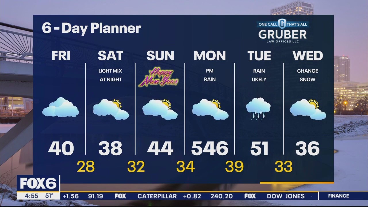
Weather Webcast with Meteorologist Lisa Michaels
A cold front will move through today causing temperatures to drop into the 30s this afternoon. The cold air doesn't last for long due to another round of mild temperatures coming back in time for the new year. Light rain mixed with snow is possible Saturday night into early Sunday. Another chance of 50F is possible early next week with additional chances of rain Monday night into Tuesday.
A cold front will move through today causing temperatures to drop into the 30s this afternoon. The cold air doesn't last for long due to another round of mild temperatures coming back in time for the new year. Light rain mixed with snow is possible Saturday night into early Sunday. Another chance of 50F is possible early next week with additional chances of rain Monday night into Tuesday.
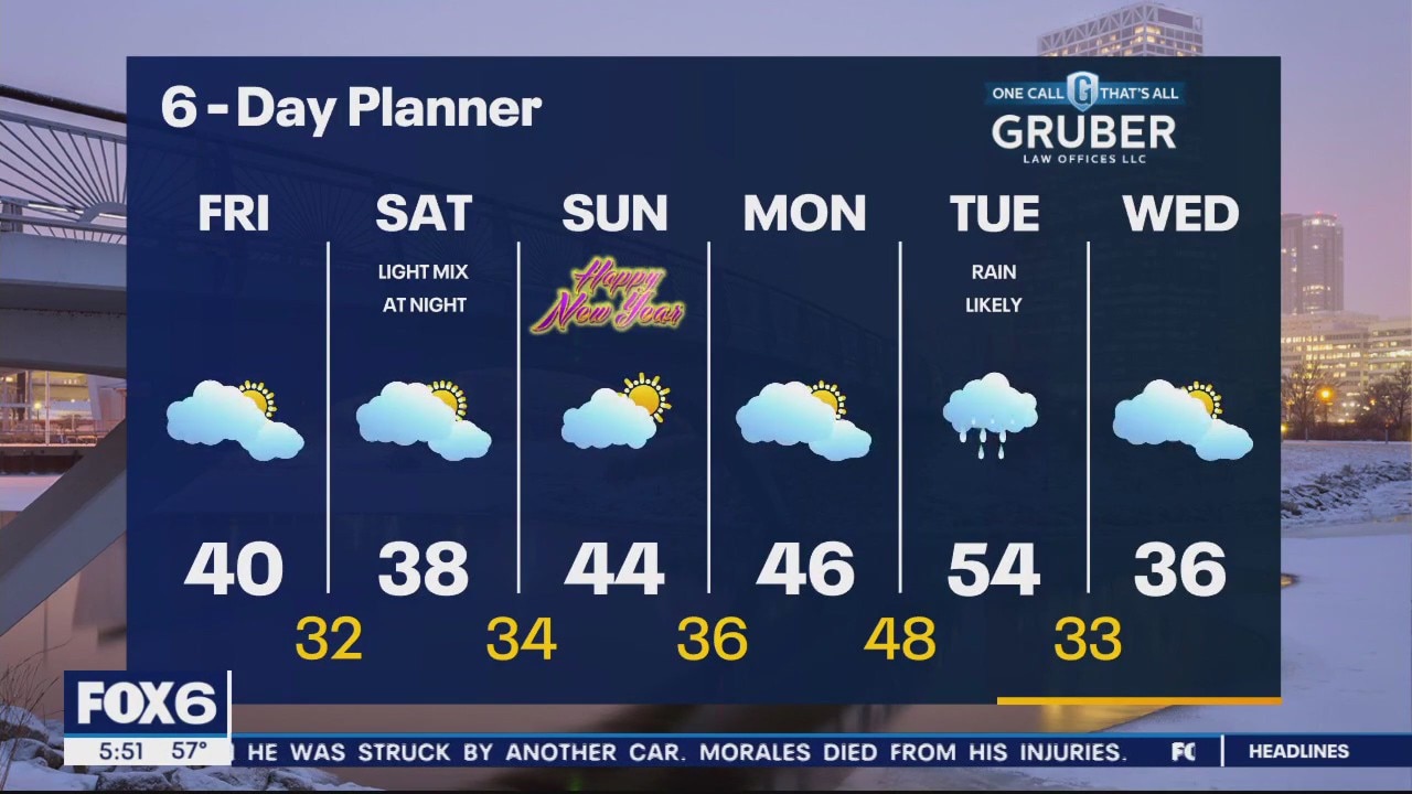
Weather Webcast with Meteorologist Eric Manges
FOX6 News at 5 offers the day's news, weather, and sports in southeast Wisconsin, the nation, and the world.
FOX6 News at 5 offers the day's news, weather, and sports in southeast Wisconsin, the nation, and the world.
Weather Webcast with Meteorologist Stephanie Barichello
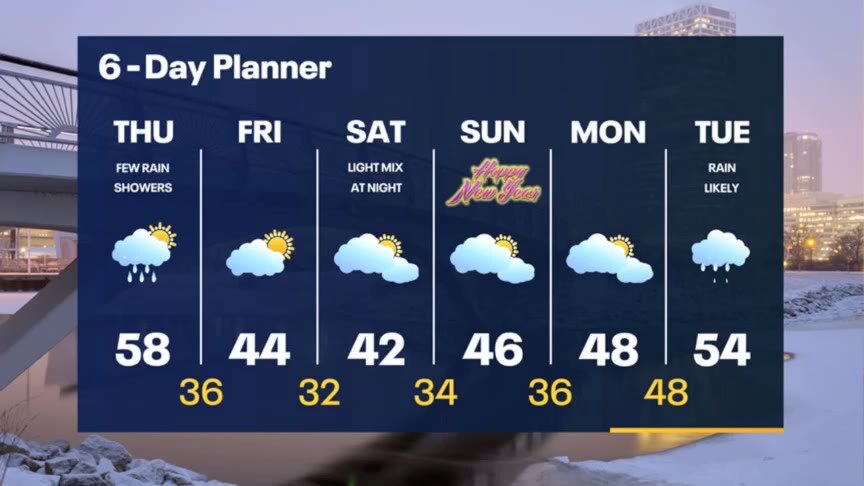
Warm and windy today with a few sprinkles or rain showers by evening. Drying out Friday with falling temperatures. Some light wintry mix possible Saturday night, so be prepared if heading out for the holiday. Still mild next week.
Warm and windy today with a few sprinkles or rain showers by evening. Drying out Friday with falling temperatures. Some light wintry mix possible Saturday night, so be prepared if heading out for the holiday. Still mild next week.

FOX6 WakeUp News at 4:30
A warm front lifts through our area today and helps to warm us into the low to mid 50s! With a push of warmer air comes more moisture and a chance for a few showers today and tonight. Even after the cold front clears we stay mild with highs in the low to mid 40s Friday and Saturday.We have a slight risk for showers or a wintry mix New Years Eve. So far 2023 looks mild with 50s returning by the 3rd!
A warm front lifts through our area today and helps to warm us into the low to mid 50s! With a push of warmer air comes more moisture and a chance for a few showers today and tonight. Even after the cold front clears we stay mild with highs in the low to mid 40s Friday and Saturday.We have a slight risk for showers or a wintry mix New Years Eve. So far 2023 looks mild with 50s returning by the 3rd!
Weather Webcast with Meteorologist Stephanie Barichello
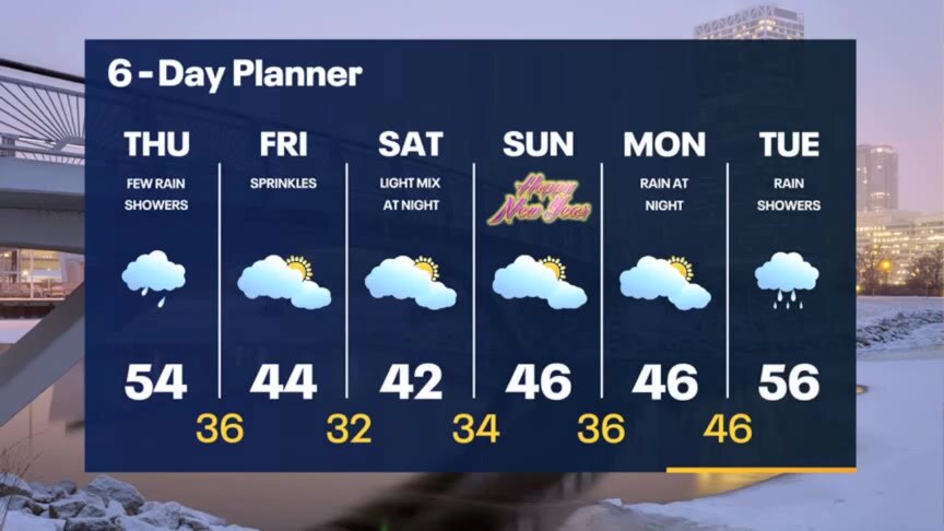
Even warmer Thursday with a few rain showers and some fog. Back to 40s Friday and throughout the holiday weekend. There is just a slight chance for some light rain or wintry mix late Saturday.
Even warmer Thursday with a few rain showers and some fog. Back to 40s Friday and throughout the holiday weekend. There is just a slight chance for some light rain or wintry mix late Saturday.
Weather webcast with Rob Haswell
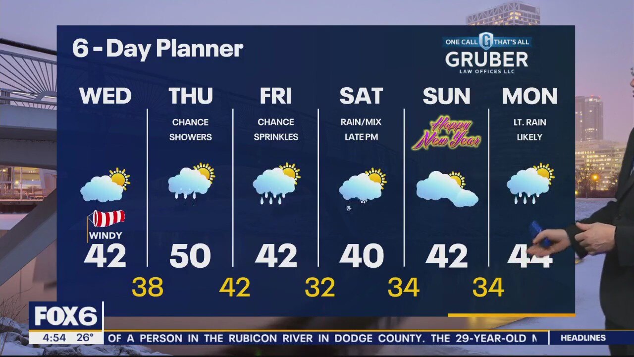
High pressure to our east and a low to our west puts us in the sweet spot to warm up on a stead southwest wind today and tomorrow. Highs will push to near 40 today and near 50 tomorrow. A few rain showers are expected Thursday with a few sprinkles possible Friday.
High pressure to our east and a low to our west puts us in the sweet spot to warm up on a stead southwest wind today and tomorrow. Highs will push to near 40 today and near 50 tomorrow. A few rain showers are expected Thursday with a few sprinkles possible Friday.
Weather Webcast with Meteorologist Stephanie Barichello
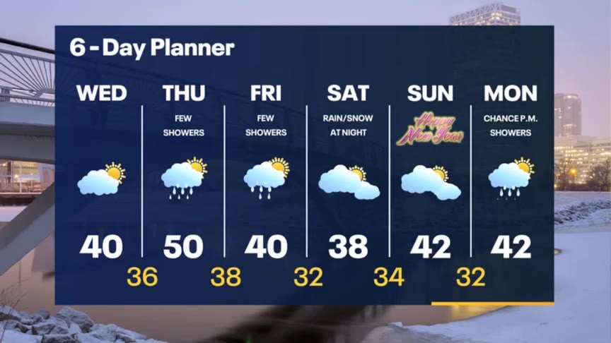
Holding steady in the 20s tonight but becoming windy. Around 40 Wednesday then potentially 50 on Thursday. A few rain showers Thursday and Friday.
Holding steady in the 20s tonight but becoming windy. Around 40 Wednesday then potentially 50 on Thursday. A few rain showers Thursday and Friday.
Weather Webcast With Lisa Michaels
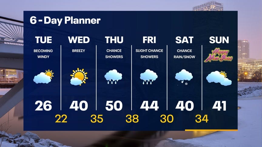
Partly cloudy skies today with increasing winds during the afternoon. Gusts could range from 25-30mph with high temperatures in the middle 20s. Southwesterly flow will continue to really drive in warmer air over the next several days. High temperatures will get close to the 40F on Wednesday and 50F on Thursday. Dry weather over the next 48 hours, but rain showers enter the forecast Thursday through the new year.
Partly cloudy skies today with increasing winds during the afternoon. Gusts could range from 25-30mph with high temperatures in the middle 20s. Southwesterly flow will continue to really drive in warmer air over the next several days. High temperatures will get close to the 40F on Wednesday and 50F on Thursday. Dry weather over the next 48 hours, but rain showers enter the forecast Thursday through the new year.
Weather webcast with Rob Haswell
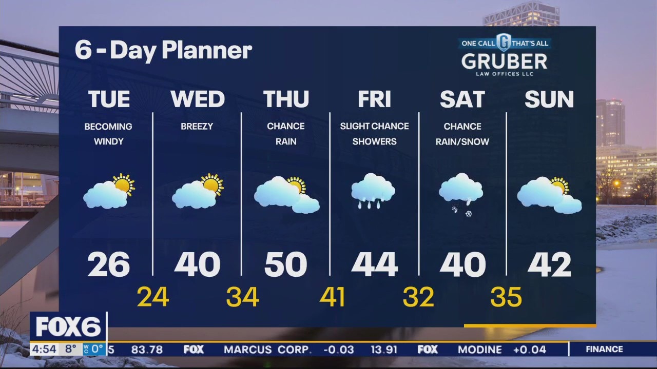
Partly cloudy and getting windy today. After a chillier start we warm into the mid to upper 20s today and keep warming to near 40 tomorrow. We stay dry for the next 48 hours but a system will deliver precipitation by Thursday with a chance for light rain. We warm to near 50 by Thursday and stay well into the 40s Friday with a chance for a few more showers. The weekend and the new year looks mild but a bit wet with a chance for rain on Saturday - possibly even a bit of a wintry mix New Years Eve.
Partly cloudy and getting windy today. After a chillier start we warm into the mid to upper 20s today and keep warming to near 40 tomorrow. We stay dry for the next 48 hours but a system will deliver precipitation by Thursday with a chance for light rain. We warm to near 50 by Thursday and stay well into the 40s Friday with a chance for a few more showers. The weekend and the new year looks mild but a bit wet with a chance for rain on Saturday - possibly even a bit of a wintry mix New Years Eve.
Weather Webcast with Meteorologist Eric Manges
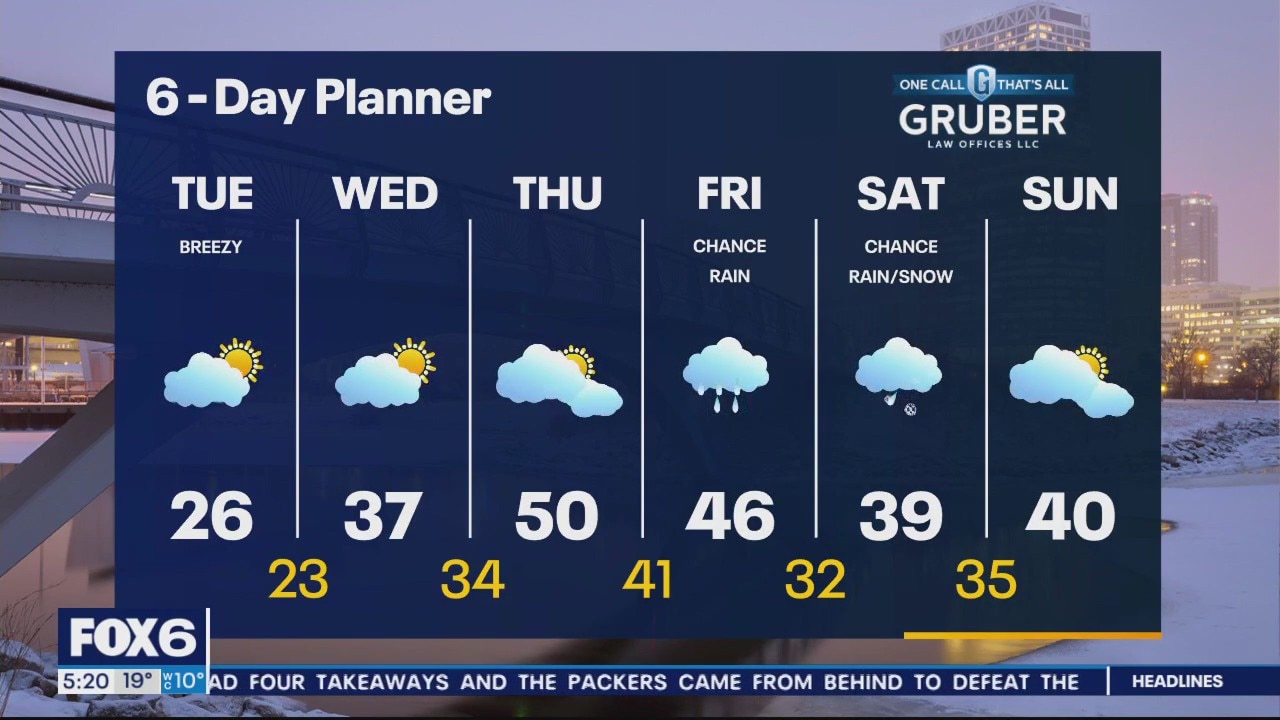
FOX6 News at 5 offers the day's news, weather, and sports in southeast Wisconsin, the nation, and the world.
FOX6 News at 5 offers the day's news, weather, and sports in southeast Wisconsin, the nation, and the world.
Weather Webcast With Lisa Michaels
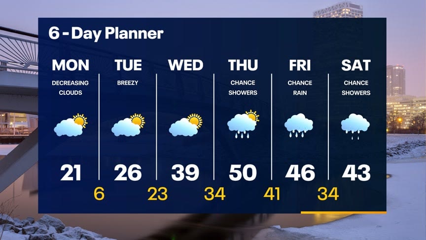
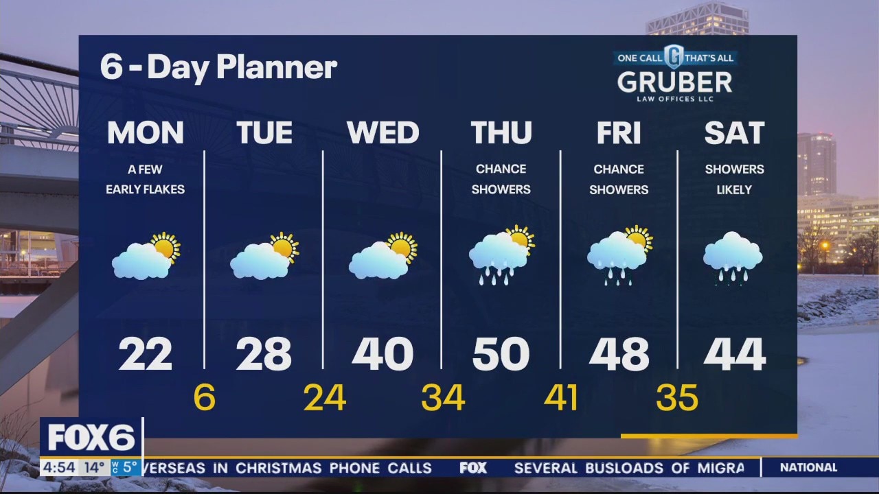
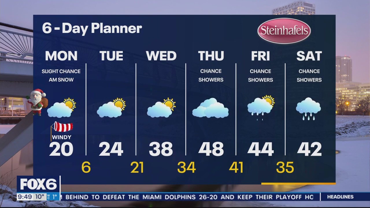
A clipper system can bring snowflakes during the first half of Monday. High pressure takes control and starts to clear clouds out by the afternoon. High temperatures 'warm' into the teens and low 20s by the afternoon. Each day this week temperatures will warm due to southwesterly winds. High will be back in the mid to upper 40s by Thursday. Showers and rain remain in the forecast near the end of this week and into the start of the new year.
A clipper system can bring snowflakes during the first half of Monday. High pressure takes control and starts to clear clouds out by the afternoon. High temperatures 'warm' into the teens and low 20s by the afternoon. Each day this week temperatures will warm due to southwesterly winds. High will be back in the mid to upper 40s by Thursday. Showers and rain remain in the forecast near the end of this week and into the start of the new year.
Weather webcast with Rob Haswell
A clipper type system passes to our south and east today and is immediately followed by a strong ridge of high pressures. Light snow is possible in some areas early this morning then we clear to at least partly cloudy conditions with highs returning to the 20s for the first time in 3 days. We warm into the upper 20s tomorrow and to near 40 on Wednesday. We keep warming Thursday and may hit 50s in some spots with a chance for rain. Showers remain possible on Friday and Saturday with mild highs in the mid to upper 40s.
A clipper type system passes to our south and east today and is immediately followed by a strong ridge of high pressures. Light snow is possible in some areas early this morning then we clear to at least partly cloudy conditions with highs returning to the 20s for the first time in 3 days. We warm into the upper 20s tomorrow and to near 40 on Wednesday. We keep warming Thursday and may hit 50s in some spots with a chance for rain. Showers remain possible on Friday and Saturday with mild highs in the mid to upper 40s.
Weather Webcast with Meteorologist Eric Manges
FOX6 News at 9 offers the day's news. weather, and sports in southeast Wisconsin, the nation, and the world.
FOX6 News at 9 offers the day's news. weather, and sports in southeast Wisconsin, the nation, and the world.

Weather Webcast with Meteorologist Eric Manges
Cold air slowly melts away as we have ourselves a warm-up to end the year
Cold air slowly melts away as we have ourselves a warm-up to end the year

Weather Webcast with Meteorologist Lisa Michaels
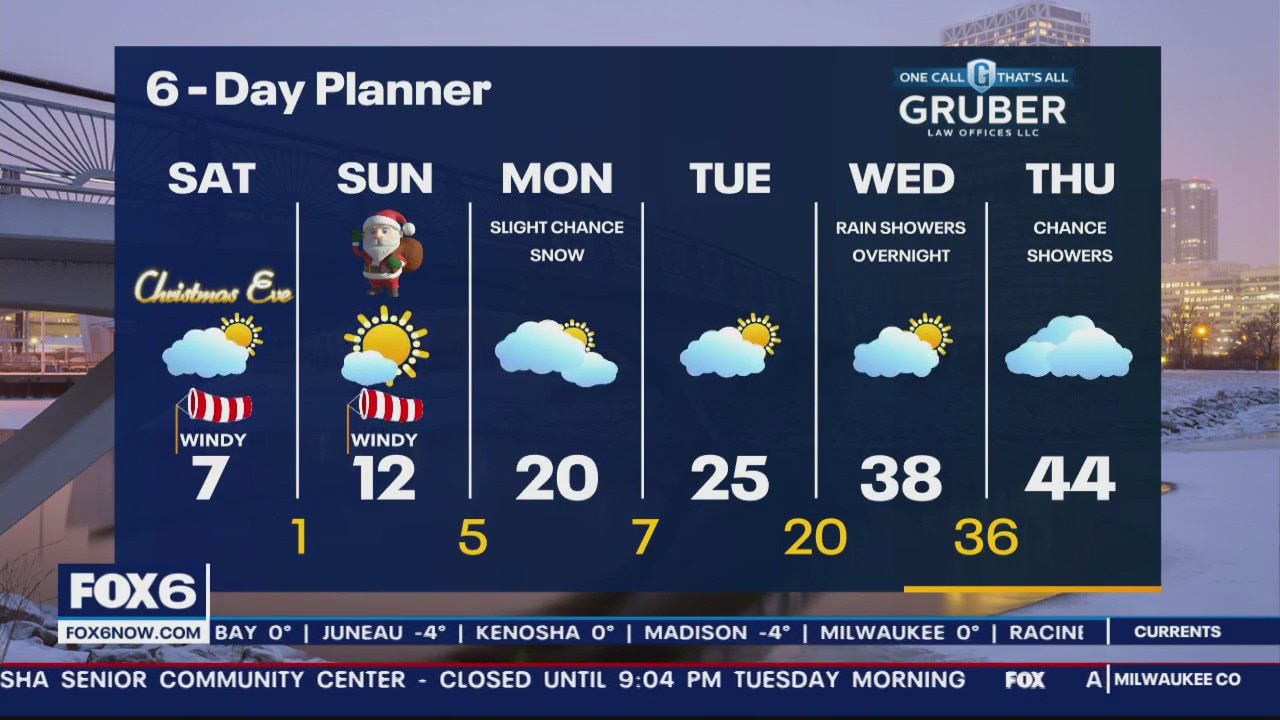
Wind Chill Advisory through 10AM Sunday for wind chills -20 to -35F. Winds gusting up to 40mph today will continue to make it feel bitterly cold and blow some snow. More sunshine arrives by Christmas, but temperatures will remain in the low teens. Warming up near the middle and end of next week back above freezing. This is when we could see rain in the forecast next.
Wind Chill Advisory through 10AM Sunday for wind chills -20 to -35F. Winds gusting up to 40mph today will continue to make it feel bitterly cold and blow some snow. More sunshine arrives by Christmas, but temperatures will remain in the low teens. Warming up near the middle and end of next week back above freezing. This is when we could see rain in the forecast next.
Weather Webcast with Meteorologist Eric Manges
FOX6 News at 6 offers the day's news, weather, and sports in southeast Wisconsin.
FOX6 News at 6 offers the day's news, weather, and sports in southeast Wisconsin.

Weather Webcast With Lisa Michaels
A Winter Storm Warning is in effect until 6am Saturday for all of SE WI. Very windy and cold today with highs only in the single digits and wind chills -20 to -30F. Blowing and drifting snow is likely today with very poor driving conditions in many areas. Light snow is possible tonight. Temperatures stay frigid over the weekend and warm up by the middle of next week.
A Winter Storm Warning is in effect until 6am Saturday for all of SE WI. Very windy and cold today with highs only in the single digits and wind chills -20 to -30F. Blowing and drifting snow is likely today with very poor driving conditions in many areas. Light snow is possible tonight. Temperatures stay frigid over the weekend and warm up by the middle of next week.