

Weather Webcast with Tom Wachs
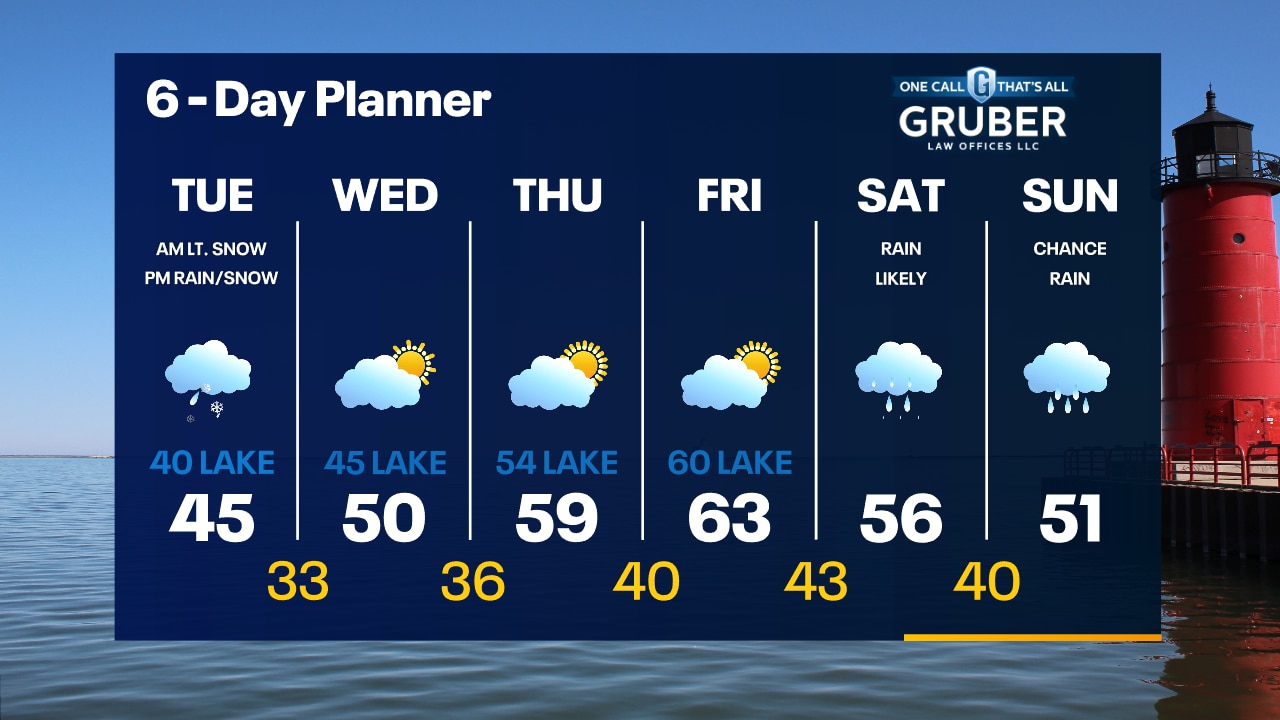
Scattered rain showers this evening with temperatures falling through the 40s. Rain/snow showers overnight and into Tuesday. Chilly on Tuesday with highs in the 40s.
Scattered rain showers this evening with temperatures falling through the 40s. Rain/snow showers overnight and into Tuesday. Chilly on Tuesday with highs in the 40s.
Weather Webcast with Meteorologist Stephanie Barichello
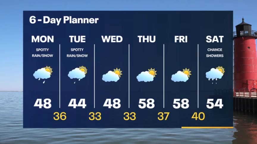
Spotty sprinkles and flurries possible this afternoon and throughout Tuesday, then drying out midweek and warming into the 50s. Rain returns Saturday.
Spotty sprinkles and flurries possible this afternoon and throughout Tuesday, then drying out midweek and warming into the 50s. Rain returns Saturday.

Weather webcast with Lisa Michaels
Cool morning with temps in the low 30s. Partly cloudy to mostly cloudy skies. Best chance of seeing peaks of sunshine will be in the morning. Increasing clouds through the day. A few isolated rain/snow showers this afternoon. Highs will be in the mid to upper 40s. Mostly cloudy on Tuesday with a few spotty light rain/snow showers. Highs in the 40s. Partly sunny mid-to-late week. Highs in the 50s, but cooler near the lake. Rain chances really go up by Saturday.
Cool morning with temps in the low 30s. Partly cloudy to mostly cloudy skies. Best chance of seeing peaks of sunshine will be in the morning. Increasing clouds through the day. A few isolated rain/snow showers this afternoon. Highs will be in the mid to upper 40s. Mostly cloudy on Tuesday with a few spotty light rain/snow showers. Highs in the 40s. Partly sunny mid-to-late week. Highs in the 50s, but cooler near the lake. Rain chances really go up by Saturday.
Weather Webcast with Tom Wachs
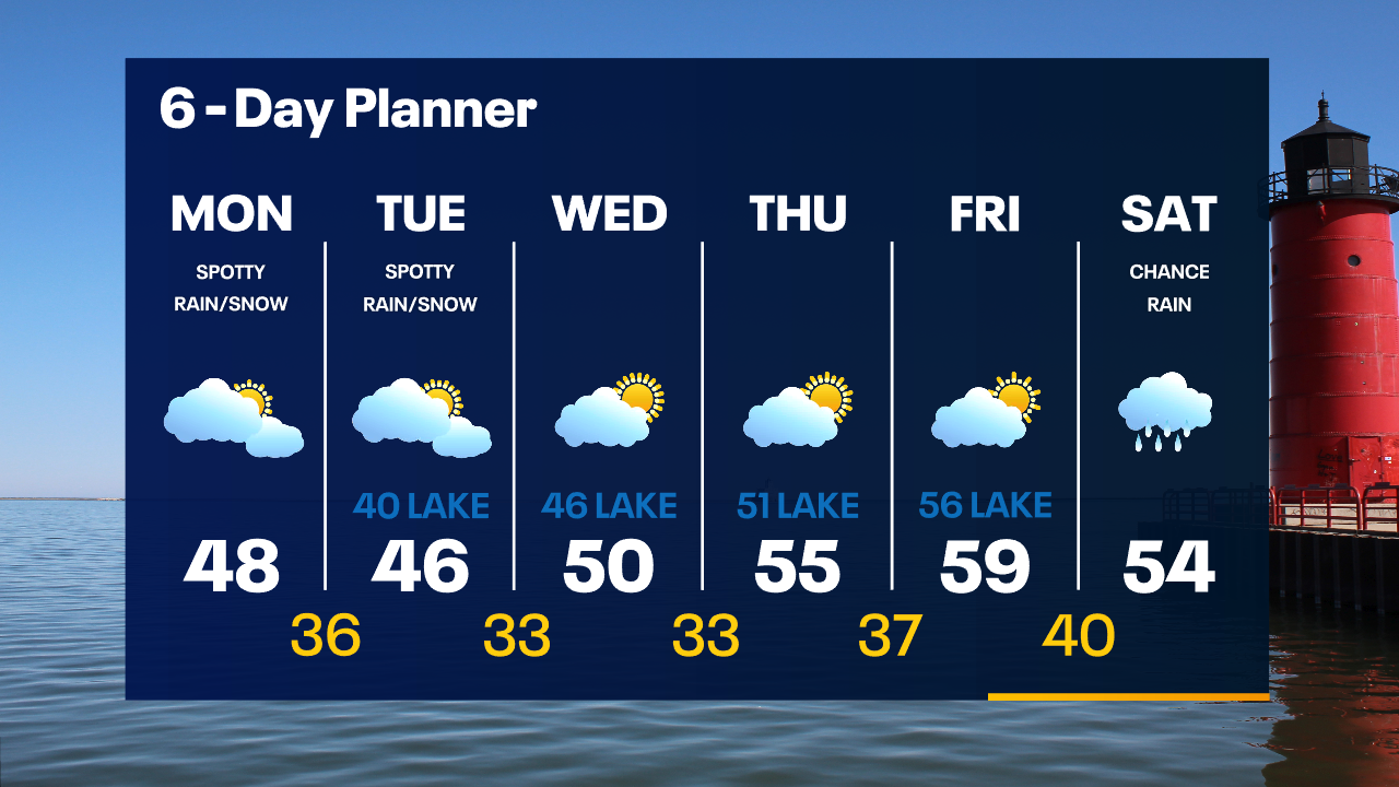
Decreasing clouds overnight with temperatures dropping to around 30 by sunrise. Becoming mostly cloudy on Monday with a few spotty rain/snow showers. Highs in the upper 40s.
Decreasing clouds overnight with temperatures dropping to around 30 by sunrise. Becoming mostly cloudy on Monday with a few spotty rain/snow showers. Highs in the upper 40s.
Weather Webcast with Tom Wachs
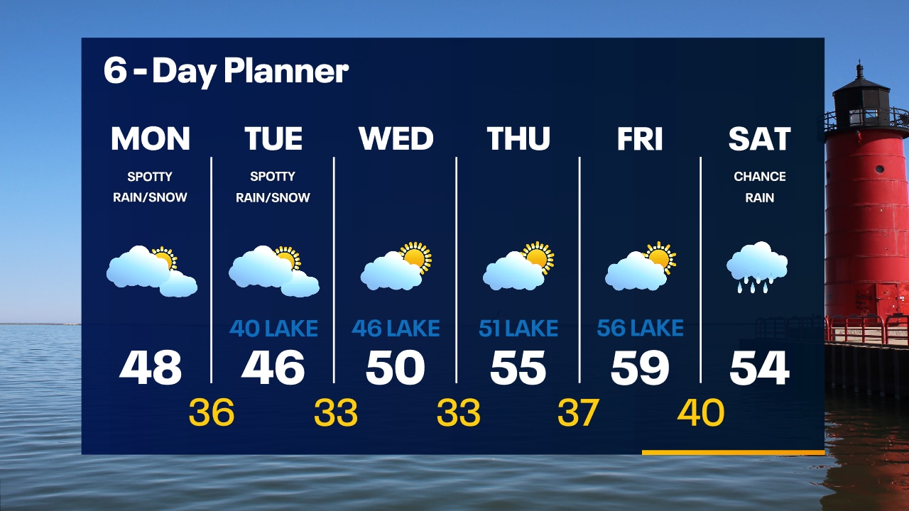
Gradual clearing tonight. IF we can clear out enough the Northern Lights could be visible late tonight as well, especially between 10pm-1am. Increasing clouds on Monday with a few afternoon rain/snow showers.
Gradual clearing tonight. IF we can clear out enough the Northern Lights could be visible late tonight as well, especially between 10pm-1am. Increasing clouds on Monday with a few afternoon rain/snow showers.

Weather Webcast with Meteorologist Eric Manges
Staying chilly with spotty showers today and tomorrow
Staying chilly with spotty showers today and tomorrow
Weather Webcast with Meteorologist Eric Manges
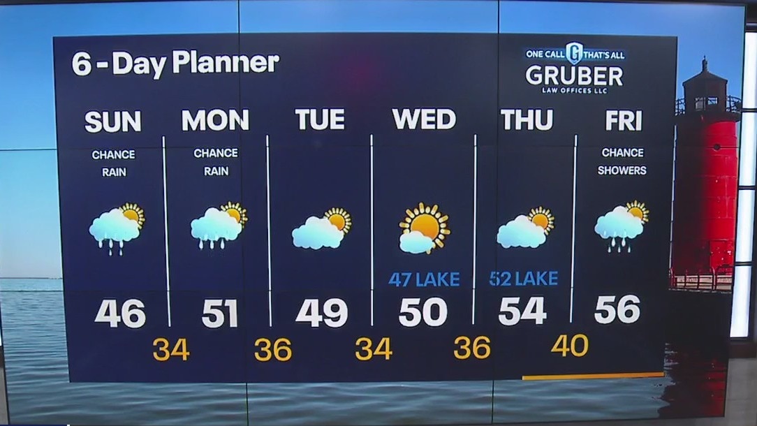
Chance of some spotty showers today; otherwise chilly and cloudy. We try to get back to seasonable temps by Monday with highs near 50.
Chance of some spotty showers today; otherwise chilly and cloudy. We try to get back to seasonable temps by Monday with highs near 50.
Weather Webcast with Meteorologist Eric Manges
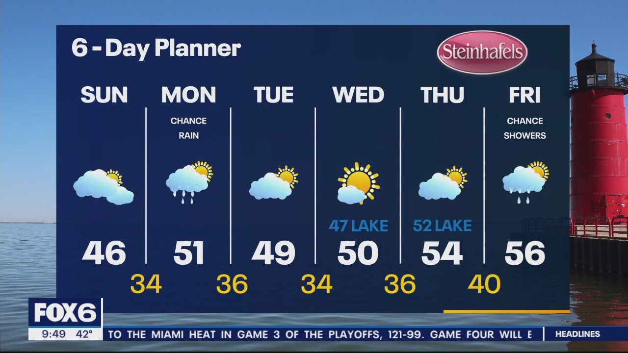
Chilly air stick around for this week
Chilly air stick around for this week
Weather Webcast with Tom Wachs
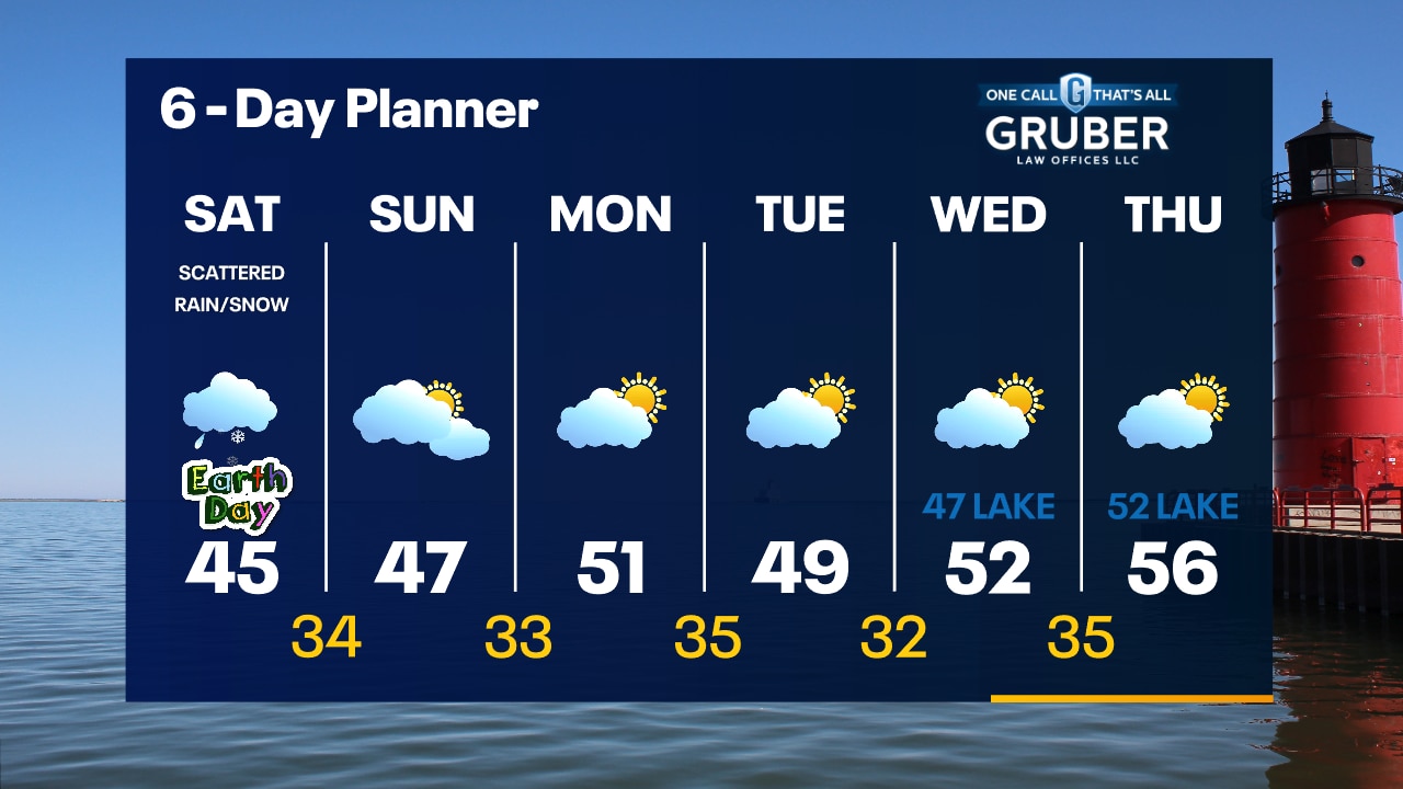
Scattered rain/snow showers today. Brisk with highs in the 40s. Rain/snow showers will taper off late this evening.
Scattered rain/snow showers today. Brisk with highs in the 40s. Rain/snow showers will taper off late this evening.
Weather Webcast with Meteorologist Eric Manges
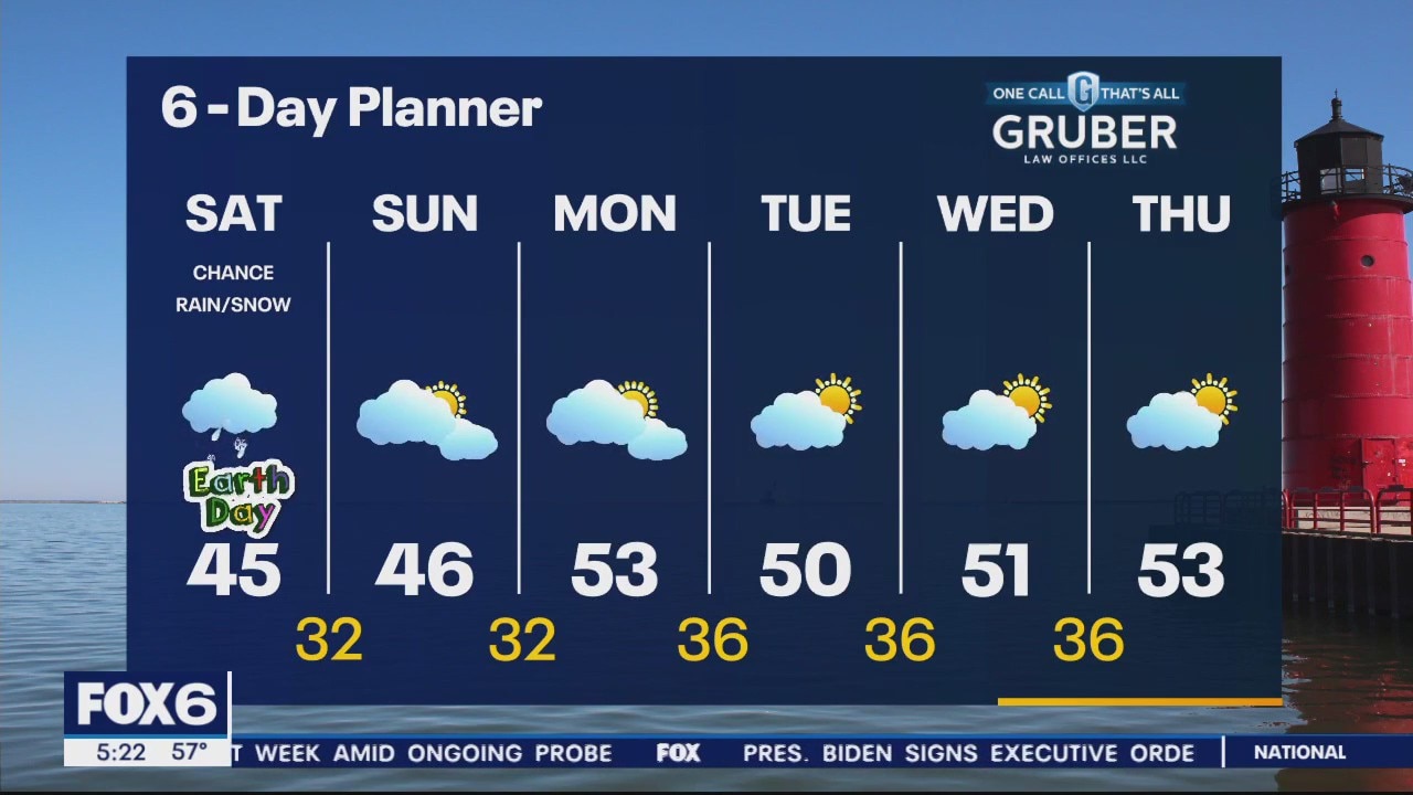
Cooler than average air becomes the theme heading into the weekend
Cooler than average air becomes the theme heading into the weekend
Weather Webcast with Meteorologist Stephanie Barichello
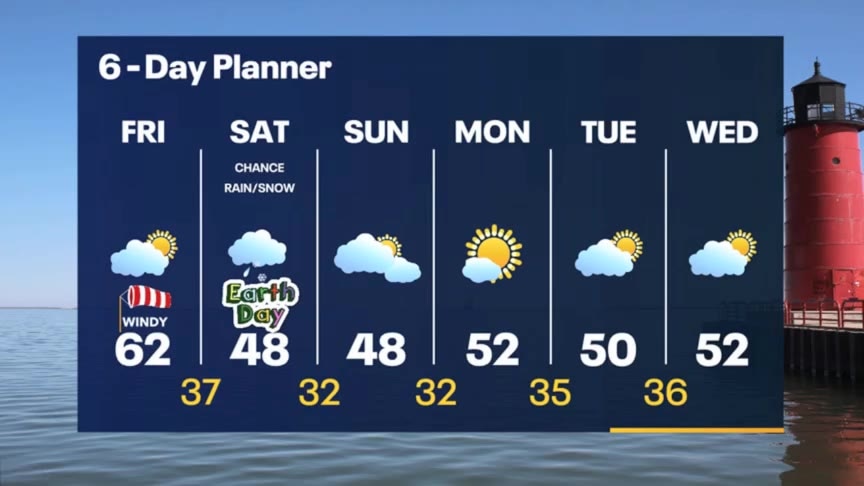
Calmer today with dry conditions then a chance for light rain/mix Saturday and much cooler. Sunshine and low 50s are back next week.
Calmer today with dry conditions then a chance for light rain/mix Saturday and much cooler. Sunshine and low 50s are back next week.
Weather webcast with Rob Haswell
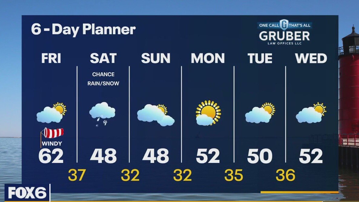
Yesterday's cold front is off to our east but we are still going to be much warmer than average today with highs in the low 60s. Much colder air arrives for the weekend with highs falling into the upper 40s. There is a chance for a few rain or snow showers on Saturday but we should dry up Sunday and through most of next week. Temperatures slowly warm back to seasonal by mid to late next week.
Yesterday's cold front is off to our east but we are still going to be much warmer than average today with highs in the low 60s. Much colder air arrives for the weekend with highs falling into the upper 40s. There is a chance for a few rain or snow showers on Saturday but we should dry up Sunday and through most of next week. Temperatures slowly warm back to seasonal by mid to late next week.
Weather Webcast with Tom Wachs
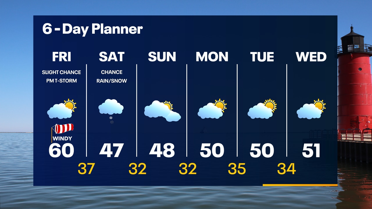
Partly cloudy overnight with temperatures falling into the 40s. Partly sunny, windy and mild on Friday. Highs around 60. A stray afternoon t-storm is possible.
Partly cloudy overnight with temperatures falling into the 40s. Partly sunny, windy and mild on Friday. Highs around 60. A stray afternoon t-storm is possible.
Weather Webcast with Meteorologist Tom Wachs
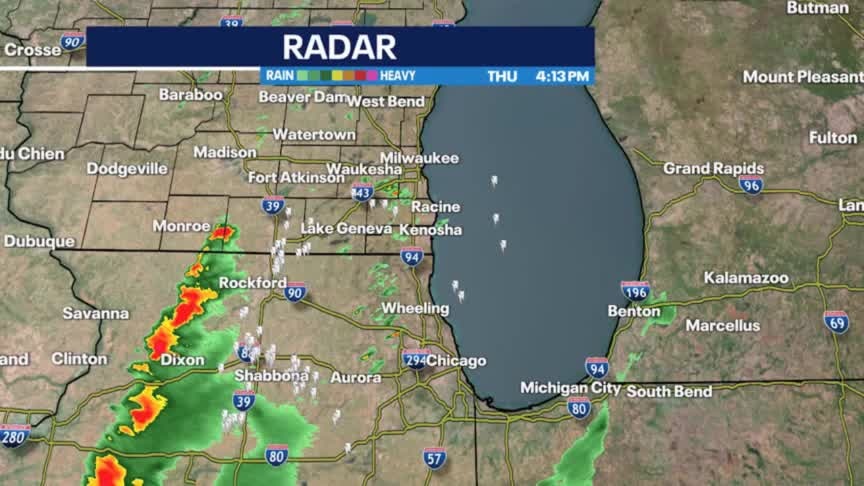
Strong to severe storms possible through 7pm for southeast Wisconsin. Tornado watch expires at 8pm.
Strong to severe storms possible through 7pm for southeast Wisconsin. Tornado watch expires at 8pm.
Weather Webcast with Meteorologist Stephanie Barichello
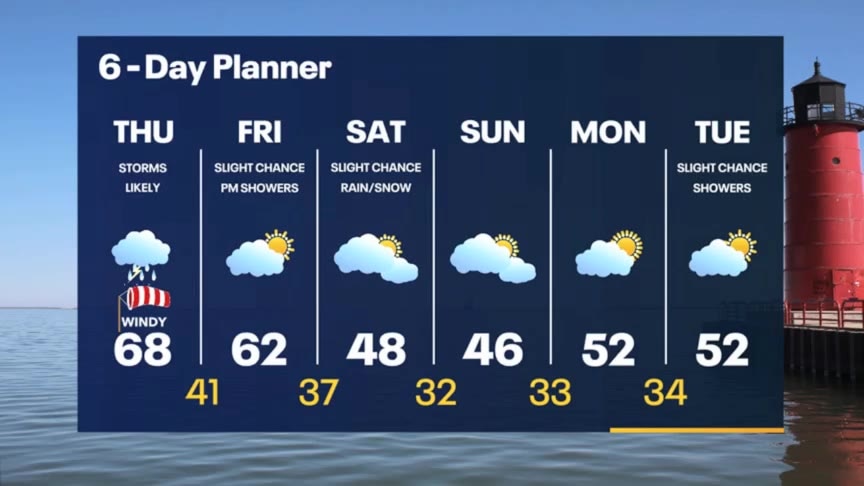
One more round of potentially severe t-storms mid to late afternoon through early evening, then drying out overnight. A stray late-day shower possible Friday and potentially Saturday, otherwise cooler this weekend in the 40s.
One more round of potentially severe t-storms mid to late afternoon through early evening, then drying out overnight. A stray late-day shower possible Friday and potentially Saturday, otherwise cooler this weekend in the 40s.
Weather webcast with Rob Haswell
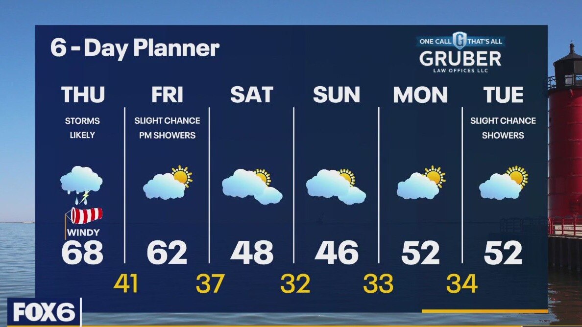
A warm front pushes through our area today with highs warming into the mid to upper 60s. The front also brings rain and a chance for thunderstorms. There is a Marginal Risk for severe weather across our area today and tonight. We calm Friday with comfortable highs and some sun. Then the cold air arrives with temperatures falling to the 40s this weekend. We stay calmer and warm slightly to the low 50s Monday and Tuesday.
A warm front pushes through our area today with highs warming into the mid to upper 60s. The front also brings rain and a chance for thunderstorms. There is a Marginal Risk for severe weather across our area today and tonight. We calm Friday with comfortable highs and some sun. Then the cold air arrives with temperatures falling to the 40s this weekend. We stay calmer and warm slightly to the low 50s Monday and Tuesday.
Weather Webcast with Tom Wachs
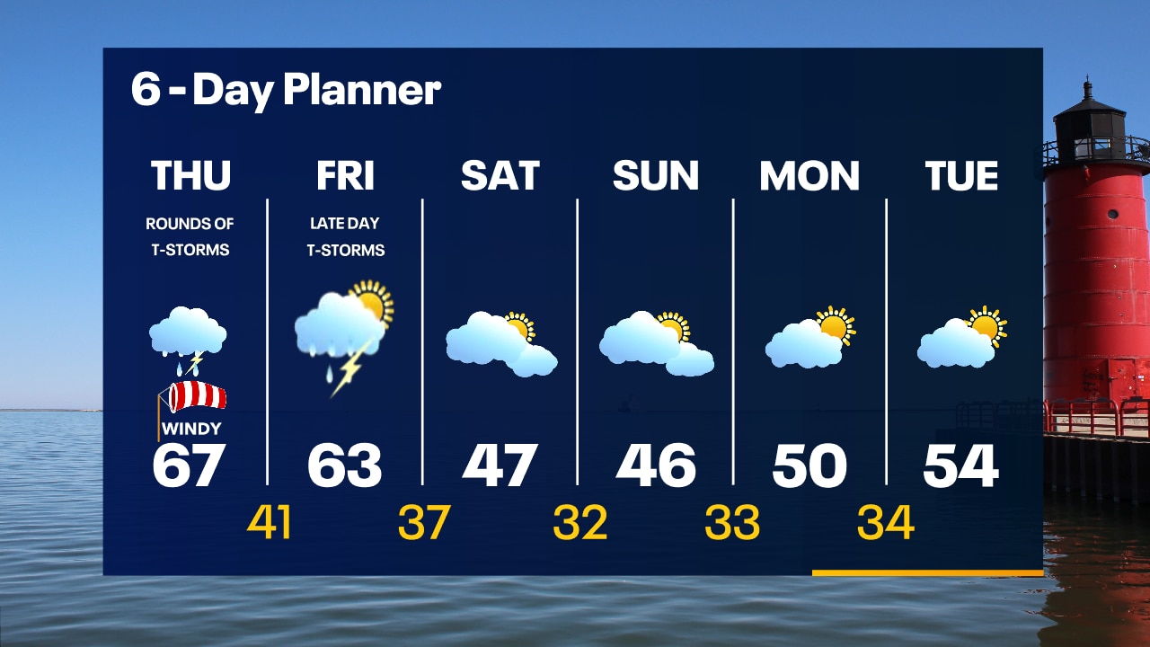
Scattered showers and thunderstorms overnight with temperatures in the 30s and low 40s. Several more rounds of t-storms on Thursday as we warm into the 60s. Some storms could be strong.
Scattered showers and thunderstorms overnight with temperatures in the 30s and low 40s. Several more rounds of t-storms on Thursday as we warm into the 60s. Some storms could be strong.
Weather Webcast with Tom Wachs
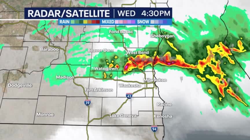
Drying out this evening with scattered t-storms possible late evening and overnight. A repeat of Wednesday is likely on Thursday. Rounds of storms with hail, wind and possible flooding.
Drying out this evening with scattered t-storms possible late evening and overnight. A repeat of Wednesday is likely on Thursday. Rounds of storms with hail, wind and possible flooding.
Weather Webcast with Meteorologist Stephanie Barichello
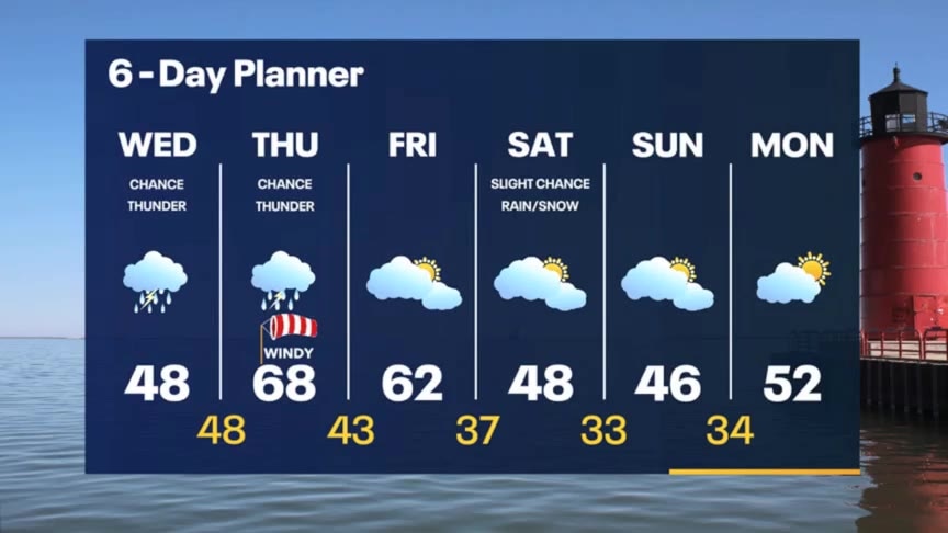
A few rounds of showers and t-storms today into tomorrow, then drying out Friday. Much cooler over the weekend.
A few rounds of showers and t-storms today into tomorrow, then drying out Friday. Much cooler over the weekend.
Weather webcast with Rob Haswell
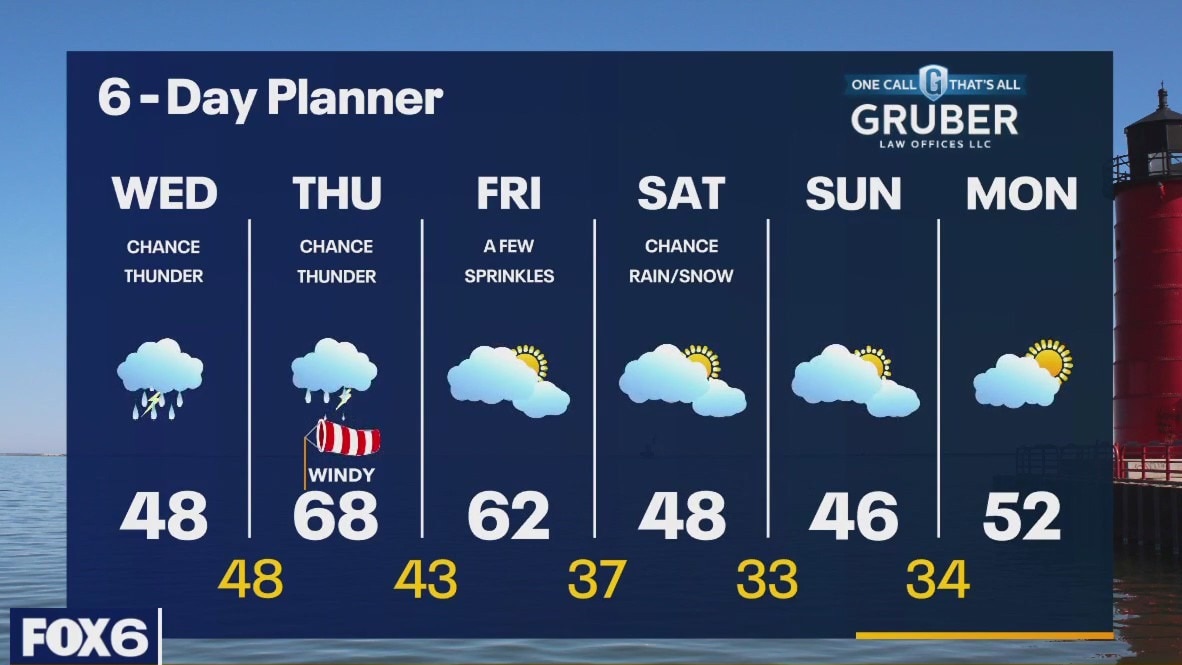
An approaching warm front will stall near the state line with our area getting into the upper 40s and low 50s with cooler conditions in our north counties. Showers and a chance for thunderstorms today and tonight with a better chance of storms on Thursday as the warm front finally pushes to the north. The trailing cold front will cause temperatures to fall later this week and into the weekend. After a pleasant Friday we will cool into the 40s for the weekend. Cooler air remains into the final days of April.
An approaching warm front will stall near the state line with our area getting into the upper 40s and low 50s with cooler conditions in our north counties. Showers and a chance for thunderstorms today and tonight with a better chance of storms on Thursday as the warm front finally pushes to the north. The trailing cold front will cause temperatures to fall later this week and into the weekend. After a pleasant Friday we will cool into the 40s for the weekend. Cooler air remains into the final days of April.