

Weather webcast with Lisa Michaels
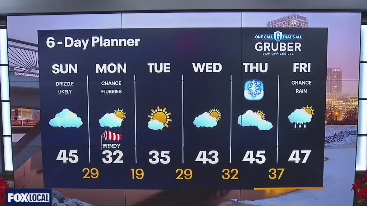
Fog and drizzle start off Sunday. Cloudy skies and drizzle possible through the early afternoon. Highs will reach the low to mid 40s. Winds strengthen tonight into Monday. Gusts reaching between 30-40mph. Wind chills in the low teens and single digits Monday. Slow warm up to end the week with another chance of rain on Friday.
Fog and drizzle start off Sunday. Cloudy skies and drizzle possible through the early afternoon. Highs will reach the low to mid 40s. Winds strengthen tonight into Monday. Gusts reaching between 30-40mph. Wind chills in the low teens and single digits Monday. Slow warm up to end the week with another chance of rain on Friday.
Weather Webcast with Meteorologist Eric Manges
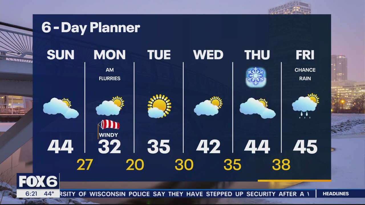
Rain is letting up but colder/windy conditions take it's place on Monday
Rain is letting up but colder/windy conditions take it's place on Monday
Weather webcast with Lisa Michaels
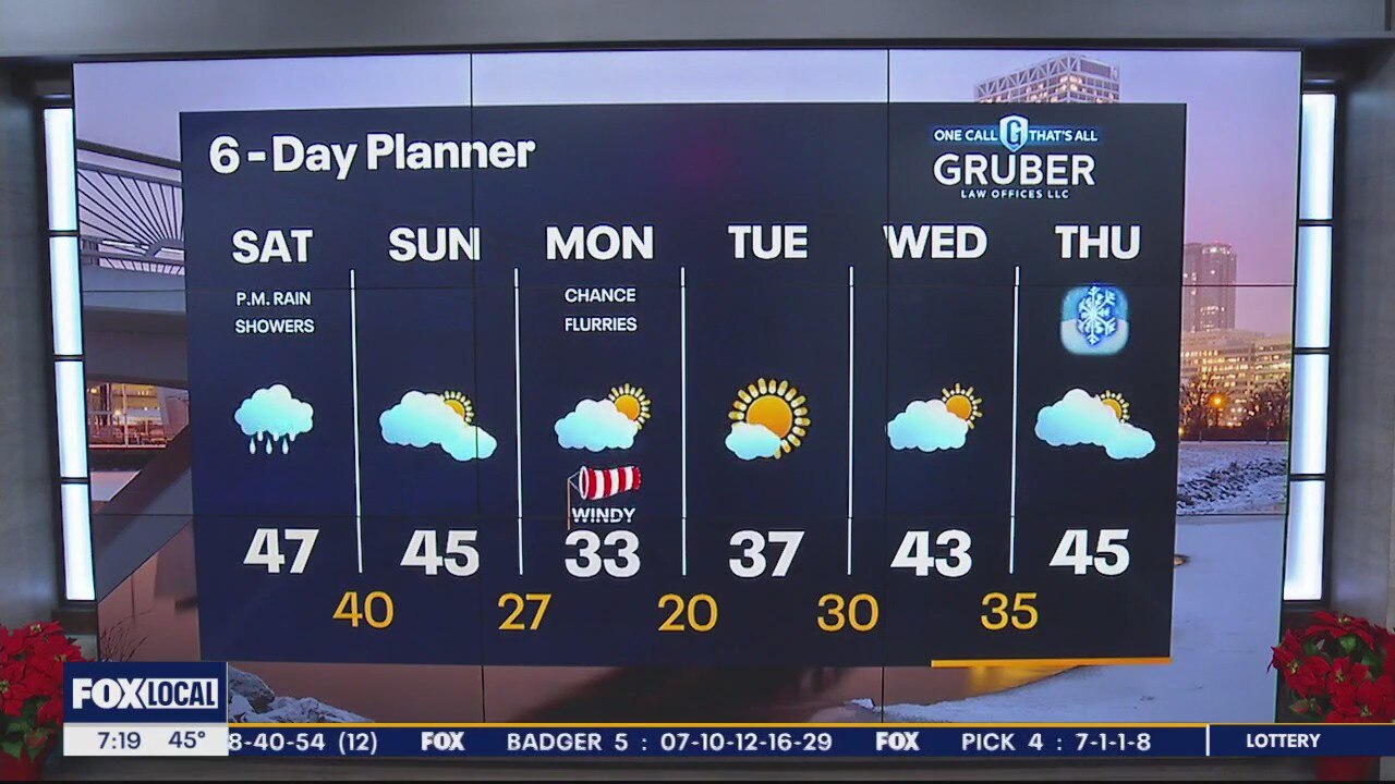
Cloudy Saturday with rain entering by the late morning to early afternoon. Showers will persist through the day.
Cloudy Saturday with rain entering by the late morning to early afternoon. Showers will persist through the day.
Weather Webcast with Meteorologist Eric Manges
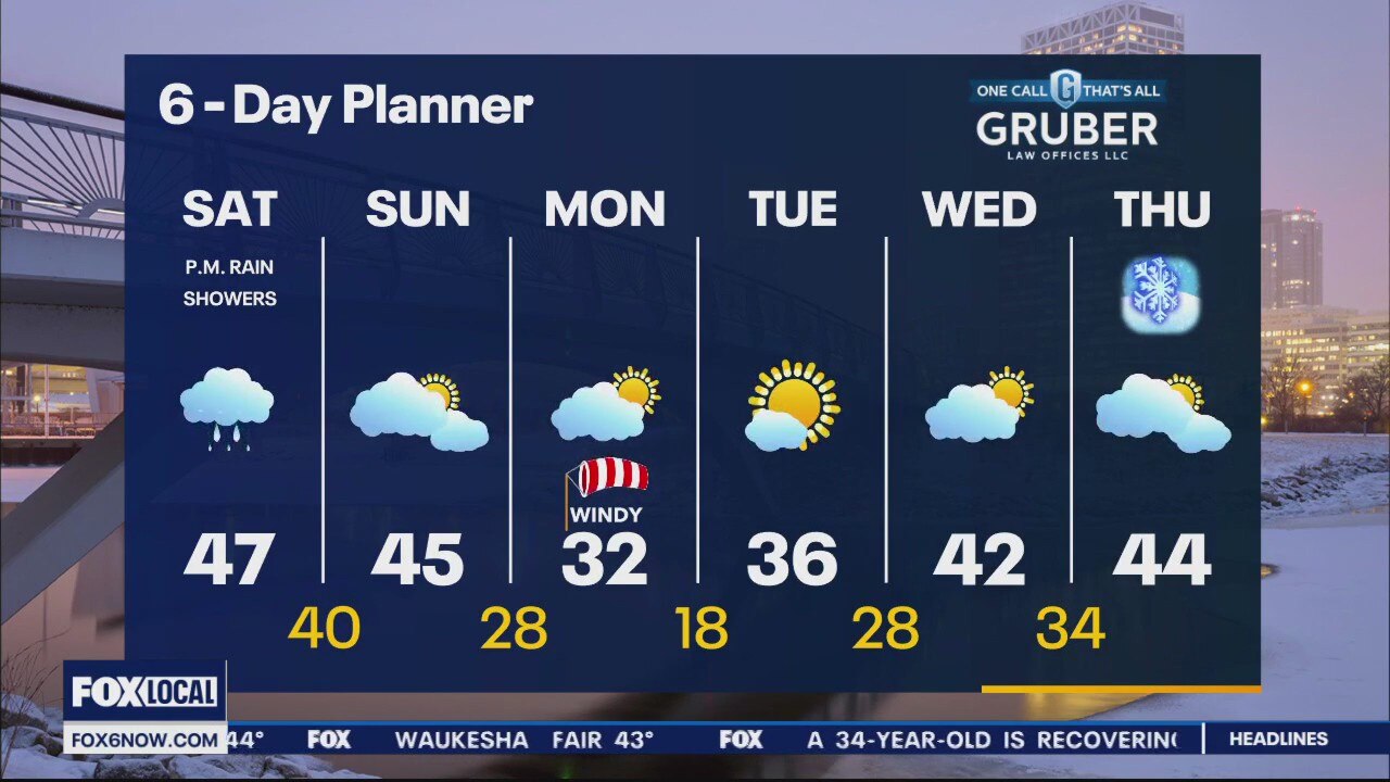
Rain returns Saturday then slightly cooler to start next week
Rain returns Saturday then slightly cooler to start next week
Weather webcast with Rob Haswell
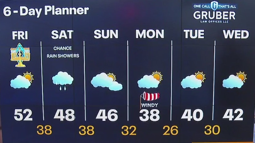
High pressure continues to dominate our forecast giving us some sun early but more clouds are on the way by this afternoon. Highs today will once again be in the low 50s and we stay mild overnight. A low finally breaks through the high pressure ridge Saturday with a chance for a few light showers.
High pressure continues to dominate our forecast giving us some sun early but more clouds are on the way by this afternoon. Highs today will once again be in the low 50s and we stay mild overnight. A low finally breaks through the high pressure ridge Saturday with a chance for a few light showers.
Weather Webcast with Tom Wachs
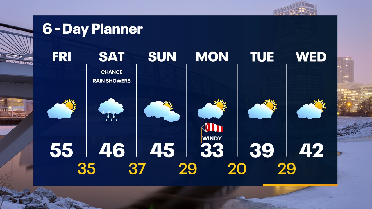
Clear skies overnight with the Geminid Meteor Shower continuing. Temperatures in the 30s. Increasing clouds on Friday with highs in the 50s. Rain chances return Saturday afternoon.
Clear skies overnight with the Geminid Meteor Shower continuing. Temperatures in the 30s. Increasing clouds on Friday with highs in the 50s. Rain chances return Saturday afternoon.
Weather Webcast with Tom Wachs
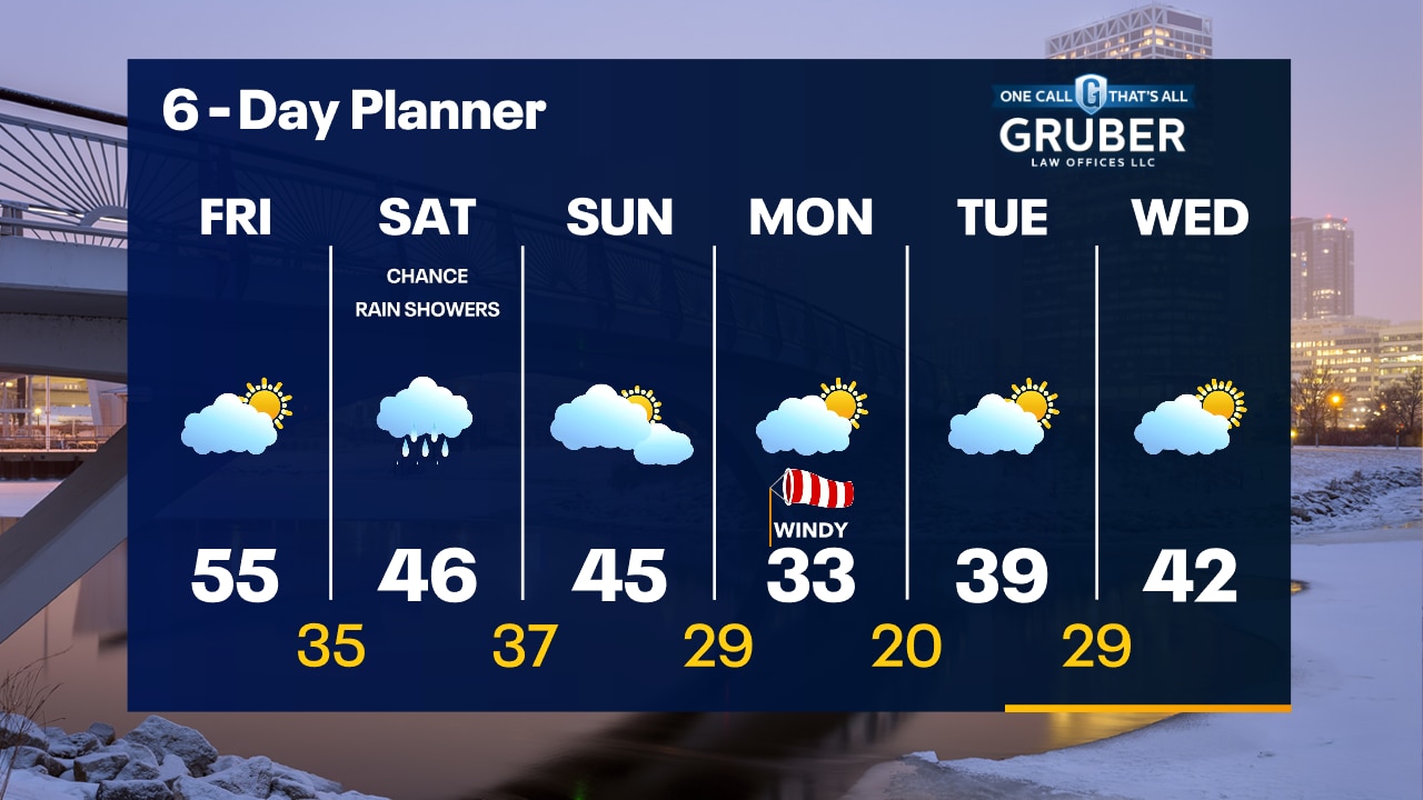
Clear skies tonight with temperatures falling into the 40s and into the 30s overnight. Increasing clouds on Friday with highs in the 50s.
Clear skies tonight with temperatures falling into the 40s and into the 30s overnight. Increasing clouds on Friday with highs in the 50s.

Weather webcast with Rob Haswell
High pressure to our east keeps us sunny and helps with steady flow of mild air with a SW wind at 10-20 mph throughout the day. We stay clear tonight for great Geminid meteor shower viewing conditions. Increasingly cloudy but staying dry Friday. Our next chance for showers comes on Saturday. We stay above average into next week.
High pressure to our east keeps us sunny and helps with steady flow of mild air with a SW wind at 10-20 mph throughout the day. We stay clear tonight for great Geminid meteor shower viewing conditions. Increasingly cloudy but staying dry Friday. Our next chance for showers comes on Saturday. We stay above average into next week.
Weather Webcast with Tom Wachs
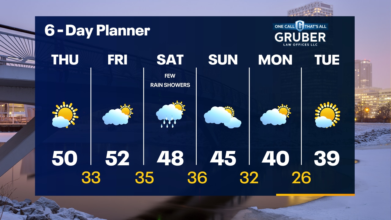
Air pressure remains very high tonight. It will fall on Thursday. Clear and quiet tonight with temperatures dropping through the 30s. Warming up on Thursday with highs around 50.
Air pressure remains very high tonight. It will fall on Thursday. Clear and quiet tonight with temperatures dropping through the 30s. Warming up on Thursday with highs around 50.
Weather webcast with Rob Haswell
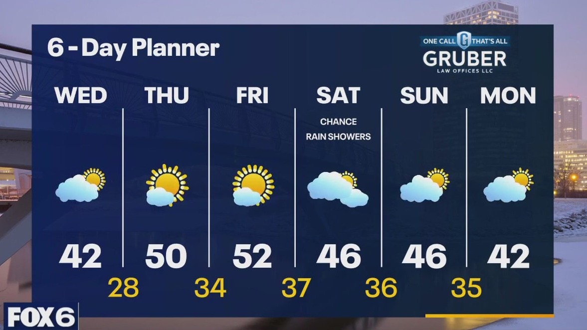
High pressure moves to our east today allowing for a strong southwest wind to help us warm into the low 40s by this afternoon. We keep warming and should crack the low 50s Thursday and Friday. A weak low brings us a chance for a few showers Saturday but otherwise we stay dry. Above average temperatures are expected in the long range.
High pressure moves to our east today allowing for a strong southwest wind to help us warm into the low 40s by this afternoon. We keep warming and should crack the low 50s Thursday and Friday. A weak low brings us a chance for a few showers Saturday but otherwise we stay dry. Above average temperatures are expected in the long range.

Weather Webcast with Tom Wachs
Mostly clear and cold overnight with temperatures in the teens to low 20s by sunrise. Mostly sunny on Wednesday with highs in the 30s. 50 returns on Thursday.
Mostly clear and cold overnight with temperatures in the teens to low 20s by sunrise. Mostly sunny on Wednesday with highs in the 30s. 50 returns on Thursday.
Weather Webcast with Tom Wachs
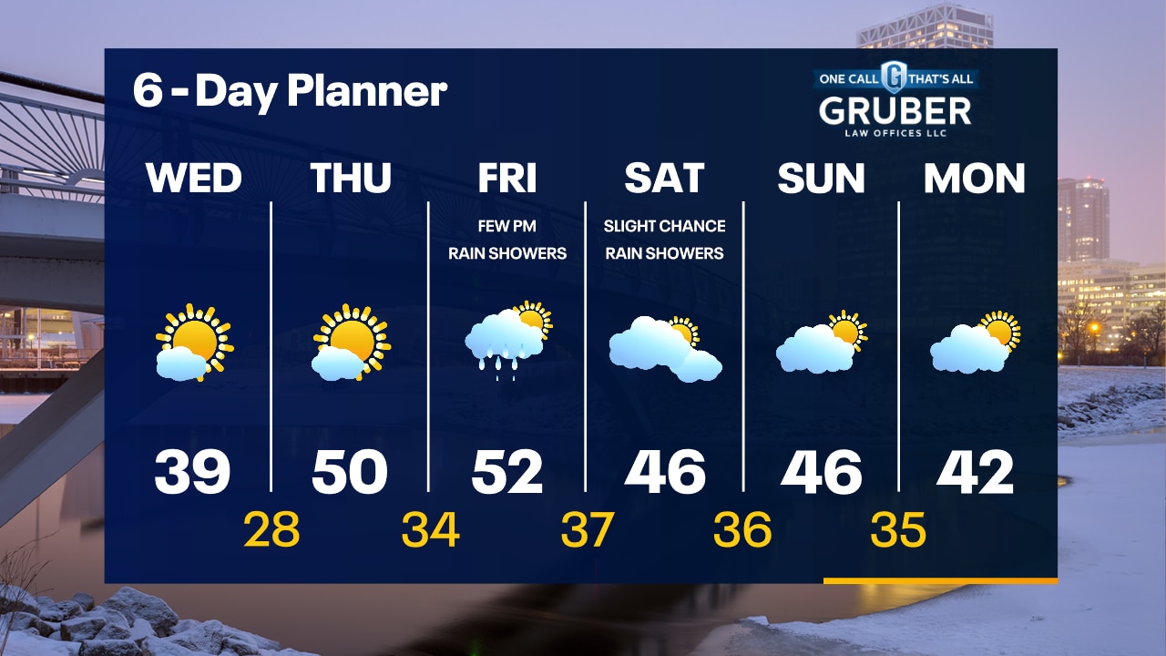
Clear and cold tonight with temperatures dropping through the 20s and into the teens. You might be able to catch the Geminid Meteor Shower tonight. Mostly sunny on Wednesday with highs in the 30s.
Clear and cold tonight with temperatures dropping through the 20s and into the teens. You might be able to catch the Geminid Meteor Shower tonight. Mostly sunny on Wednesday with highs in the 30s.
Weather webcast with Rob Haswell
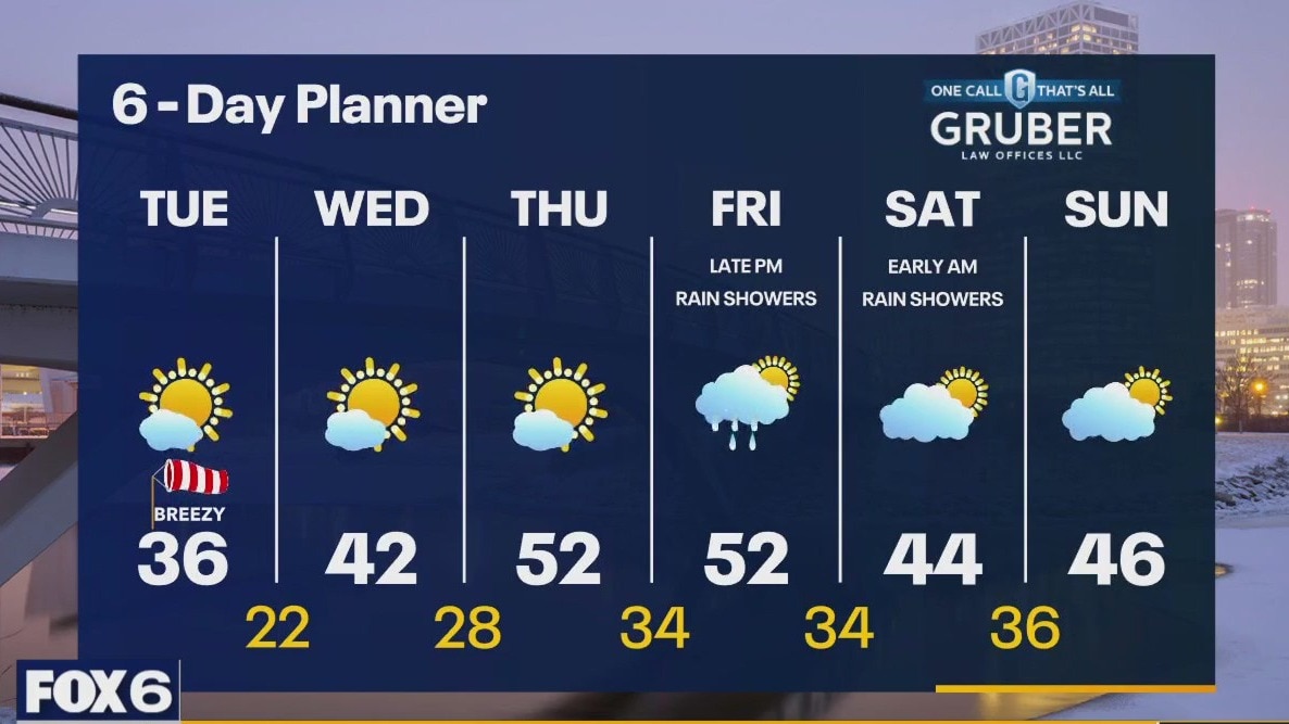
A cold front passes this morning shifting the wind to the NW and bringing in some slightly cooler air. Temperatures will remain steady in the low to mid 30s most of the day and then fall into the low 20 overnight. Warm air begins to move into our area Wednesday with highs warming into the 40s Wednesday and 50s by Thursday and Friday. Our next chance for precipitation is Friday night into Saturday morning. A light rain is possible in the milder air. Highs remain above average into the weekend.
A cold front passes this morning shifting the wind to the NW and bringing in some slightly cooler air. Temperatures will remain steady in the low to mid 30s most of the day and then fall into the low 20 overnight. Warm air begins to move into our area Wednesday with highs warming into the 40s Wednesday and 50s by Thursday and Friday. Our next chance for precipitation is Friday night into Saturday morning. A light rain is possible in the milder air. Highs remain above average into the weekend.
Weather Webcast with Tom Wachs
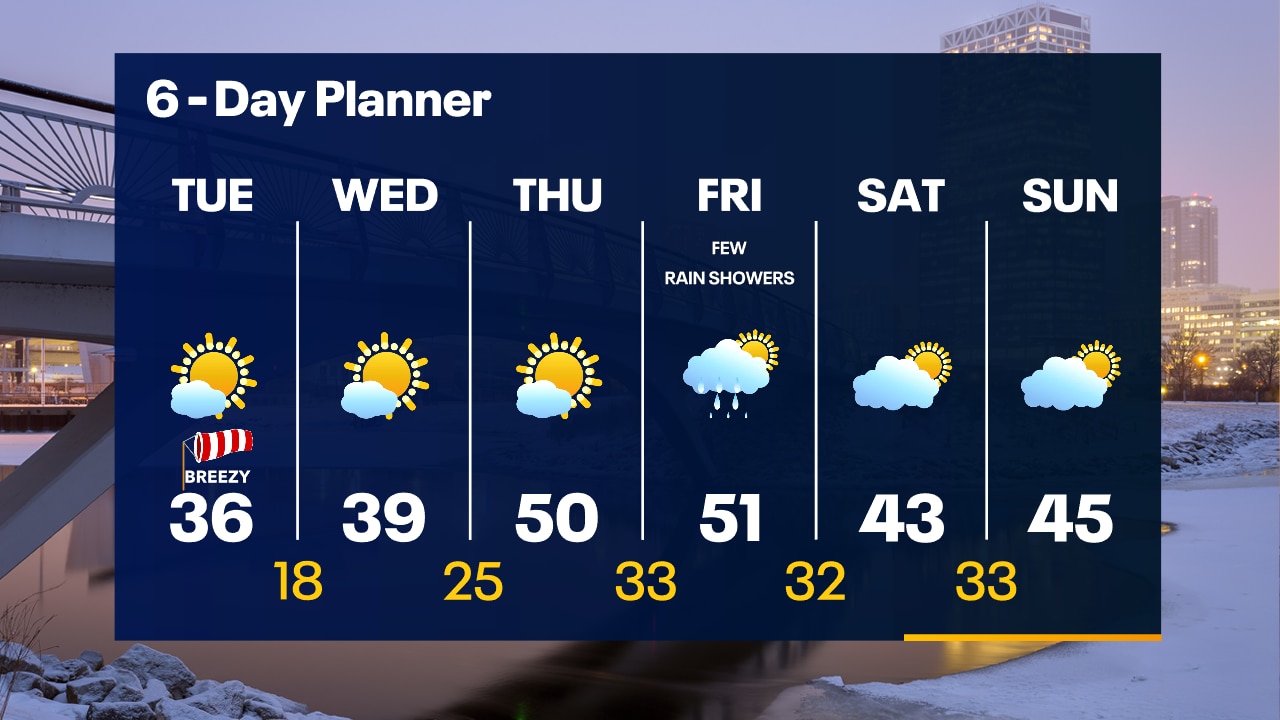
Mostly clear and breezy overnight with temperatures in the 20s and 30s. Mostly sunny and blustery on Tuesday with highs in the 30s.
Mostly clear and breezy overnight with temperatures in the 20s and 30s. Mostly sunny and blustery on Tuesday with highs in the 30s.
Weather Webcast with Tom Wachs
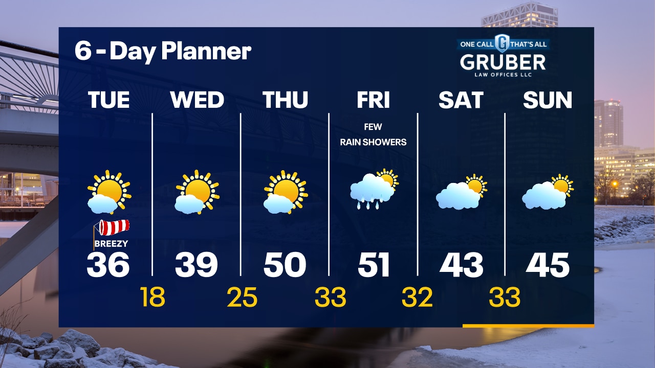
Clear skies tonight with temperatures falling into the 20s. More sun on the way Tuesday but it will be breezy with highs in the low-to-mid 30s.
Clear skies tonight with temperatures falling into the 20s. More sun on the way Tuesday but it will be breezy with highs in the low-to-mid 30s.
Weather webcast with Lisa Michaels
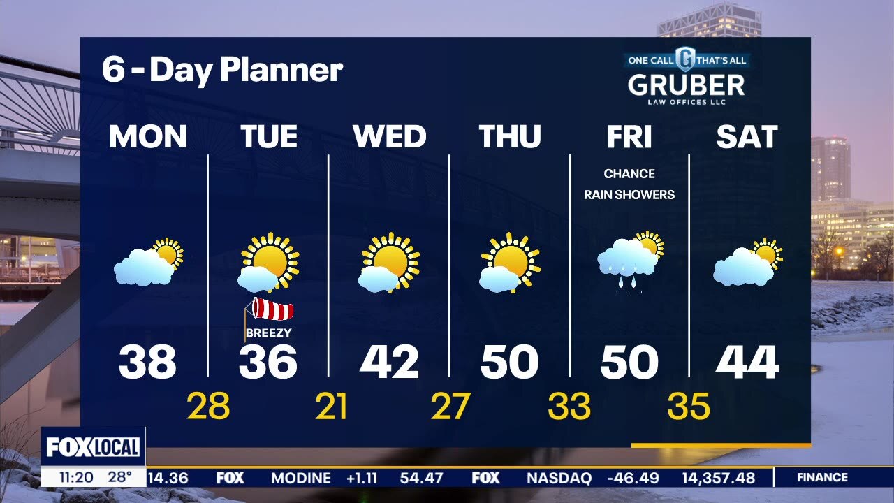
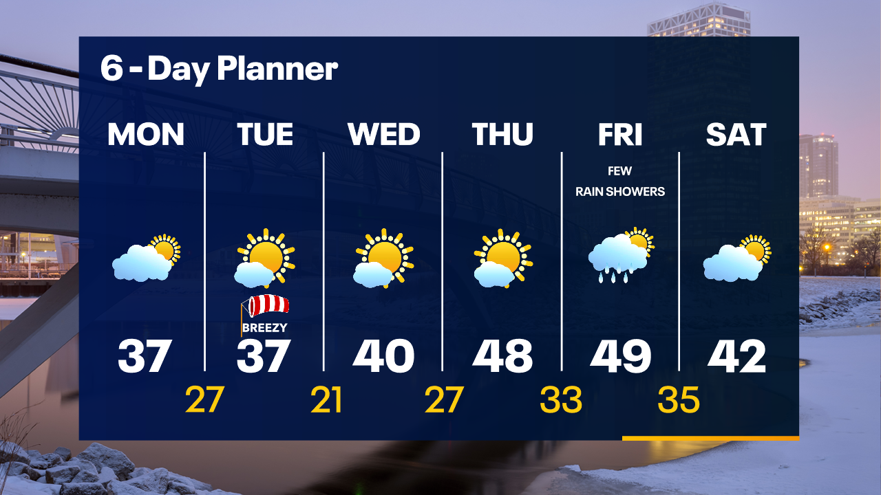
A ridge of high pressure builds across our area and eventually brings us some sunshine. Highs today will be near the seasonal average in the mid to upper 30s. We'll cool slightly behind a dry cold front Tuesday. A war m front pushes across our area mid-week and that warms us back into the 40s and near 50 for several days! We are mostly dry this week with only a slight chance for showers later Friday.
A ridge of high pressure builds across our area and eventually brings us some sunshine. Highs today will be near the seasonal average in the mid to upper 30s. We'll cool slightly behind a dry cold front Tuesday. A war m front pushes across our area mid-week and that warms us back into the 40s and near 50 for several days! We are mostly dry this week with only a slight chance for showers later Friday.
Weather webcast with Rob Haswell
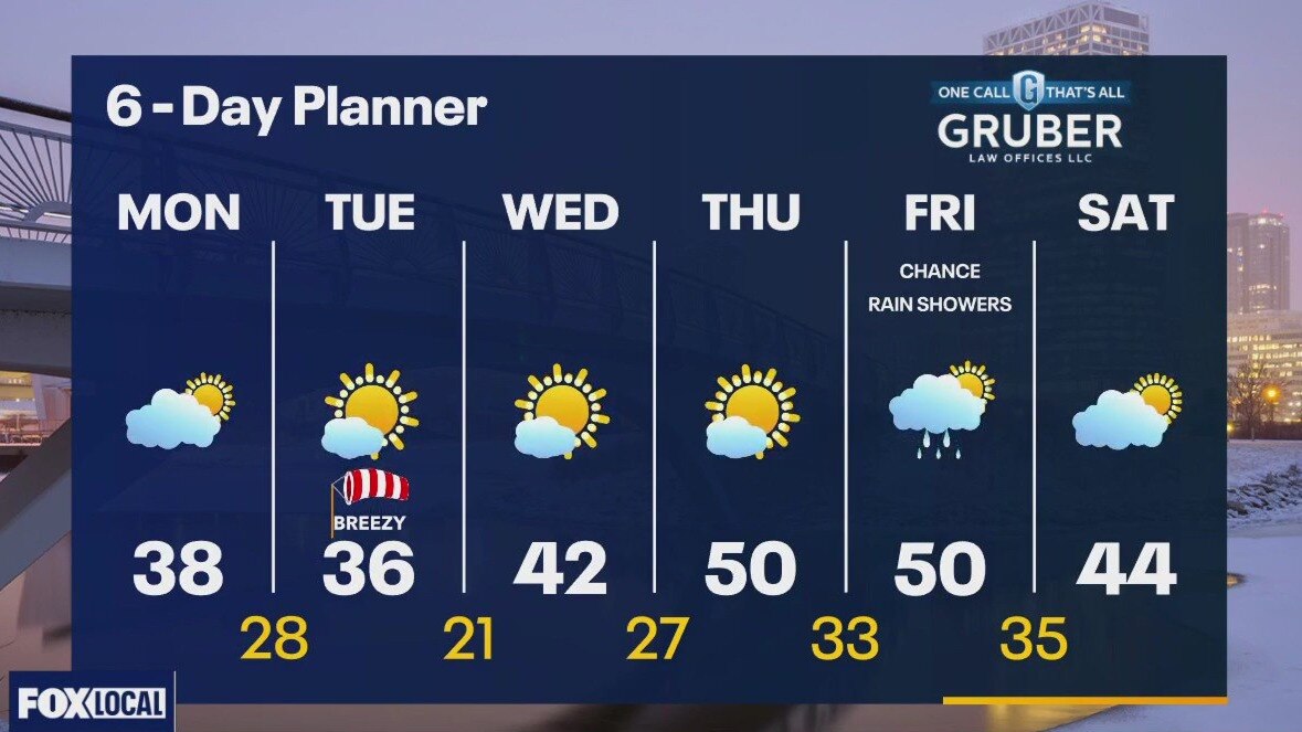
A ridge of high pressure builds across our area and eventually brings us some sunshine. Highs today will be near the seasonal average in the mid to upper 30s. We'll coold slightly behind a dry cold front Tuesday. A war m front pushes across our area mid-week and that warms us back into the 40s and near 50 for several days! We are mostly dry this week with only a slight chance for showers later Friday.
A ridge of high pressure builds across our area and eventually brings us some sunshine. Highs today will be near the seasonal average in the mid to upper 30s. We'll coold slightly behind a dry cold front Tuesday. A war m front pushes across our area mid-week and that warms us back into the 40s and near 50 for several days! We are mostly dry this week with only a slight chance for showers later Friday.
Weather Webcast with Tom Wachs
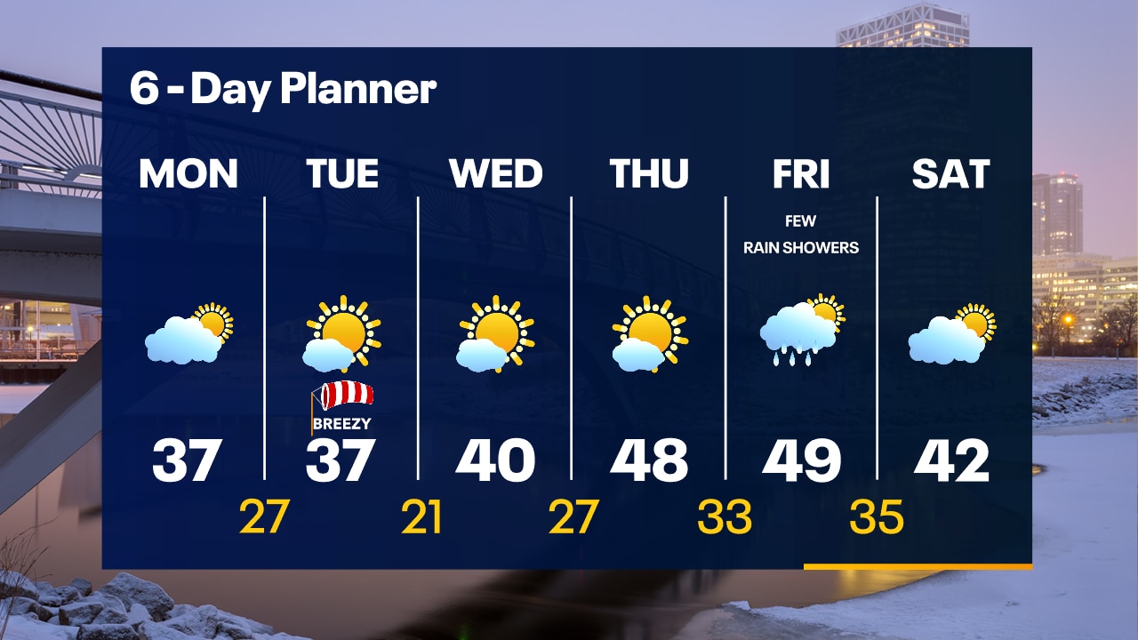
Mostly cloudy and chilly overnight with temperatures in the 20s. The sun returns on Monday...especially by afternoon. Highs in the mid-to-upper 30s. We have a gradual warm up on the way with more sun this week.
Mostly cloudy and chilly overnight with temperatures in the 20s. The sun returns on Monday...especially by afternoon. Highs in the mid-to-upper 30s. We have a gradual warm up on the way with more sun this week.
Weather Webcast with Tom Wachs
Clouds stick around this evening with temperatures in the 20s and 30s. Decreasing clouds Monday morning with lots of sun by afternoon. Highs in the 30s. Warming up later in the week.
Clouds stick around this evening with temperatures in the 20s and 30s. Decreasing clouds Monday morning with lots of sun by afternoon. Highs in the 30s. Warming up later in the week.

Weather webcast with Lisa Michaels
A few isolated flurries north. Otherwise cloudy, cool, and breezy Sunday. Mostly cloudy and breezy on Sunday with highs in the low to mid-30s. We have a quiet week ahead with a gradual warming trend.
A few isolated flurries north. Otherwise cloudy, cool, and breezy Sunday. Mostly cloudy and breezy on Sunday with highs in the low to mid-30s. We have a quiet week ahead with a gradual warming trend.