

Weather Webcast with Stephanie Barichello
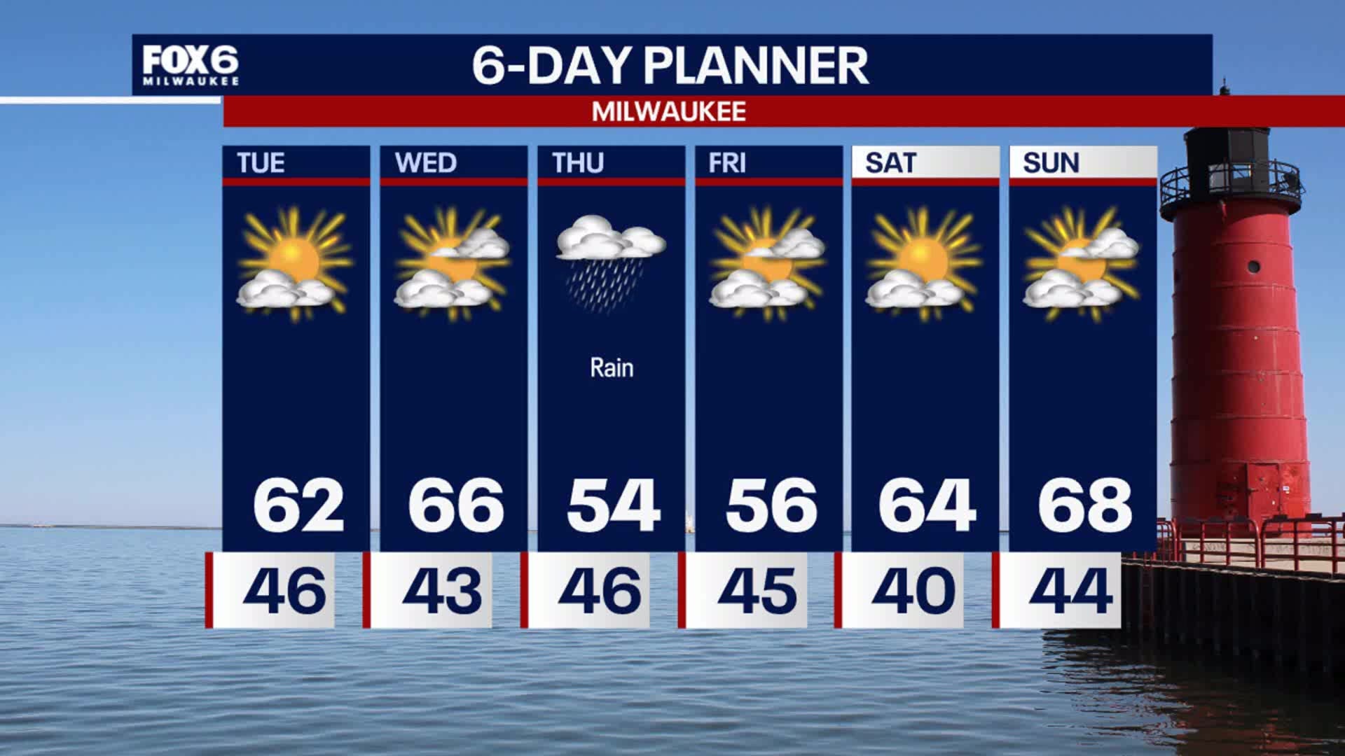
More sunshine today but a bit cooler, than back to middle 60s on Wednesday. Rain showers are likely on Thursday, plus windy and cooler. We're back to sunshine and 60s over the weekend!
More sunshine today but a bit cooler, than back to middle 60s on Wednesday. Rain showers are likely on Thursday, plus windy and cooler. We're back to sunshine and 60s over the weekend!
Weather webcast with Rob Haswell
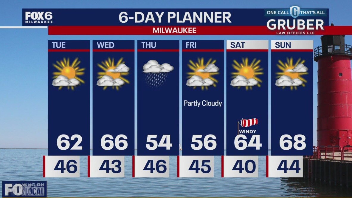
Lots of sun again today and mild temperatures but we will be a few degrees cooler than yesterday. Wednesday brings even warmer temperatures with highs in the upper 60s possible. We will be dry most of the day Wednesday but rain arrives overnight Wednesday and into Thursday. Around a half inch of precipitation is possible. We should dry up for most of the weekend with highs in the 60s.
Lots of sun again today and mild temperatures but we will be a few degrees cooler than yesterday. Wednesday brings even warmer temperatures with highs in the upper 60s possible. We will be dry most of the day Wednesday but rain arrives overnight Wednesday and into Thursday. Around a half inch of precipitation is possible. We should dry up for most of the weekend with highs in the 60s.
Weather Webcast with Tom Wachs
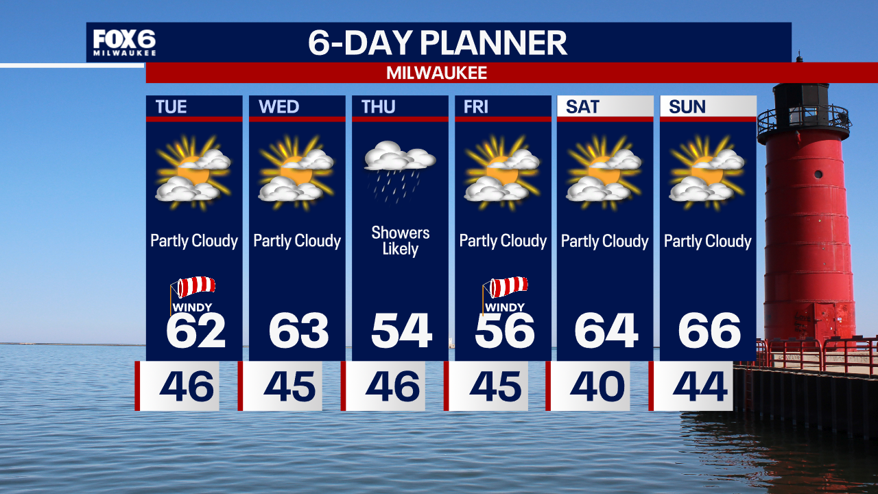
Quiet overnight with temperatures falling into the 40s. Partly sunny, windy and warm again on Tuesday. Highs in the low 60s.
Quiet overnight with temperatures falling into the 40s. Partly sunny, windy and warm again on Tuesday. Highs in the low 60s.
Weather Webcast with Tom Wachs
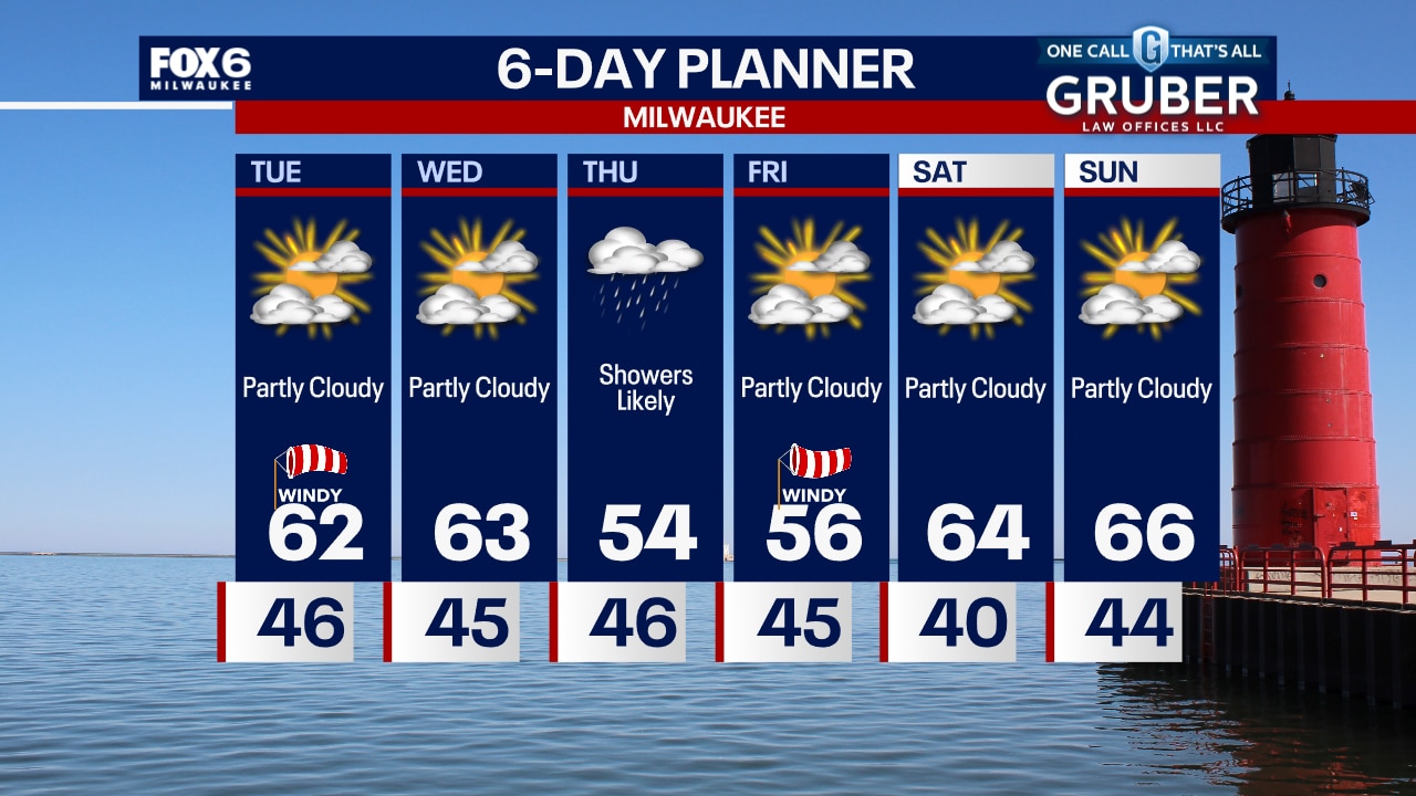
Mostly clear tonight with temperatures dropping into the 50s this evening and 40s overnight. Partly sunny, windy and warm on Tuesday. Highs in the low 60s.
Mostly clear tonight with temperatures dropping into the 50s this evening and 40s overnight. Partly sunny, windy and warm on Tuesday. Highs in the low 60s.
Weather webcast with Rob Haswell
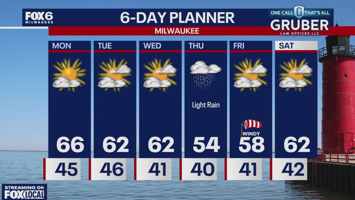
A few clouds this morning but we should clear nicely through the midday into the afternoon, giving us good viewing conditions for the solar eclipse. We will be mild with a high well into the 60s today and we stay in the low 60s Tuesday and Wednesday. Our dry weather continues through the mid week but rain returns Thursday into Friday morning. Temperatures dip a bit into the mid to upper 50s late week but we should be back in the low 60s by the weekend.
A few clouds this morning but we should clear nicely through the midday into the afternoon, giving us good viewing conditions for the solar eclipse. We will be mild with a high well into the 60s today and we stay in the low 60s Tuesday and Wednesday. Our dry weather continues through the mid week but rain returns Thursday into Friday morning. Temperatures dip a bit into the mid to upper 50s late week but we should be back in the low 60s by the weekend.
Weather Webcast with Tom Wachs
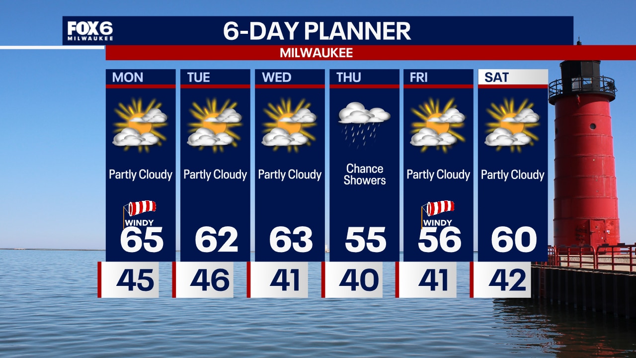
Partly cloudy overnight with temperatures in the 40s. Partly sunny, windy and warm on Monday. Highs in the low-to-mid 60s. Decent viewing for the solar eclipse on Monday afternoon.
Partly cloudy overnight with temperatures in the 40s. Partly sunny, windy and warm on Monday. Highs in the low-to-mid 60s. Decent viewing for the solar eclipse on Monday afternoon.

Weather Webcast with Tom Wachs
Rain will come to an end this evening. Temperatures in the 40s with blustery southeast winds continuing. Some clearing is expected for the Solar Eclipse on Monday. Windy and warm with highs in the 60s.
Rain will come to an end this evening. Temperatures in the 40s with blustery southeast winds continuing. Some clearing is expected for the Solar Eclipse on Monday. Windy and warm with highs in the 60s.
Weather webcast with Chief Meteorologist Rob Haswell
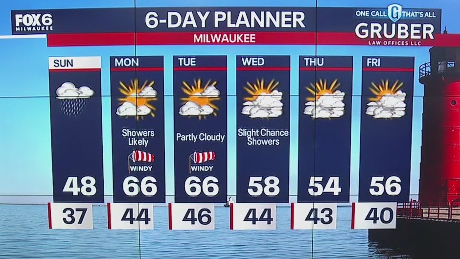
A warm front is lifting into the area today and bringing with it some more clouds and rain. Highs won't move much today ahead of the front, likely topping out in the upper 40s but we should warm into the 60s for Monday. We will be dry by Monday morning and clouds will clear slowly. We hope to have at least partial visibility for the eclipse. We stay above the seasonal norms for the week.
A warm front is lifting into the area today and bringing with it some more clouds and rain. Highs won't move much today ahead of the front, likely topping out in the upper 40s but we should warm into the 60s for Monday. We will be dry by Monday morning and clouds will clear slowly. We hope to have at least partial visibility for the eclipse. We stay above the seasonal norms for the week.

Weather Webcast with Tom Wachs
Rain will move in between 12pm-8pm on Sunday. Steadiest in the afternoon. Windy with highs in the 40s. 60s return on Monday with some clearing for the Solar Eclipse.
Rain will move in between 12pm-8pm on Sunday. Steadiest in the afternoon. Windy with highs in the 40s. 60s return on Monday with some clearing for the Solar Eclipse.

Weather Webcast with Tom Wachs
Clear this evening with clouds increasing overnight. Rainy and windy on Sunday, with the greatest chance for rain from 12pm-8pm. Skies are looking a little better for the solar eclipse on Monday.
Clear this evening with clouds increasing overnight. Rainy and windy on Sunday, with the greatest chance for rain from 12pm-8pm. Skies are looking a little better for the solar eclipse on Monday.

Weather webcast with Lisa Michaels
Isoalted morning frost.Otherwise, mostly sunny Saturday with highs in the mid 40s lakeside and around 50 inland. Clouds move in Sunday with a chance of showers by the afternoon. Showers may linger Monday morning then we'll dry out. Peeks of sun will be possible throughout the afternoon, which is great news for the solar eclipse! Temperatures will warm into the 60s for a few days, then fall back into the 50s. Chances of rain throughout next week.
Isoalted morning frost.Otherwise, mostly sunny Saturday with highs in the mid 40s lakeside and around 50 inland. Clouds move in Sunday with a chance of showers by the afternoon. Showers may linger Monday morning then we'll dry out. Peeks of sun will be possible throughout the afternoon, which is great news for the solar eclipse! Temperatures will warm into the 60s for a few days, then fall back into the 50s. Chances of rain throughout next week.

Weather Webcast with Stephanie Barichello
More sunshine on Saturday then rain returns on Sunday. Monday is trending dry, which is great news for the afternoon solar eclipse, but there will likely still be some clouds. A few slight rain chances the rest of the week.
More sunshine on Saturday then rain returns on Sunday. Monday is trending dry, which is great news for the afternoon solar eclipse, but there will likely still be some clouds. A few slight rain chances the rest of the week.
Weather webcast with Rob Haswell
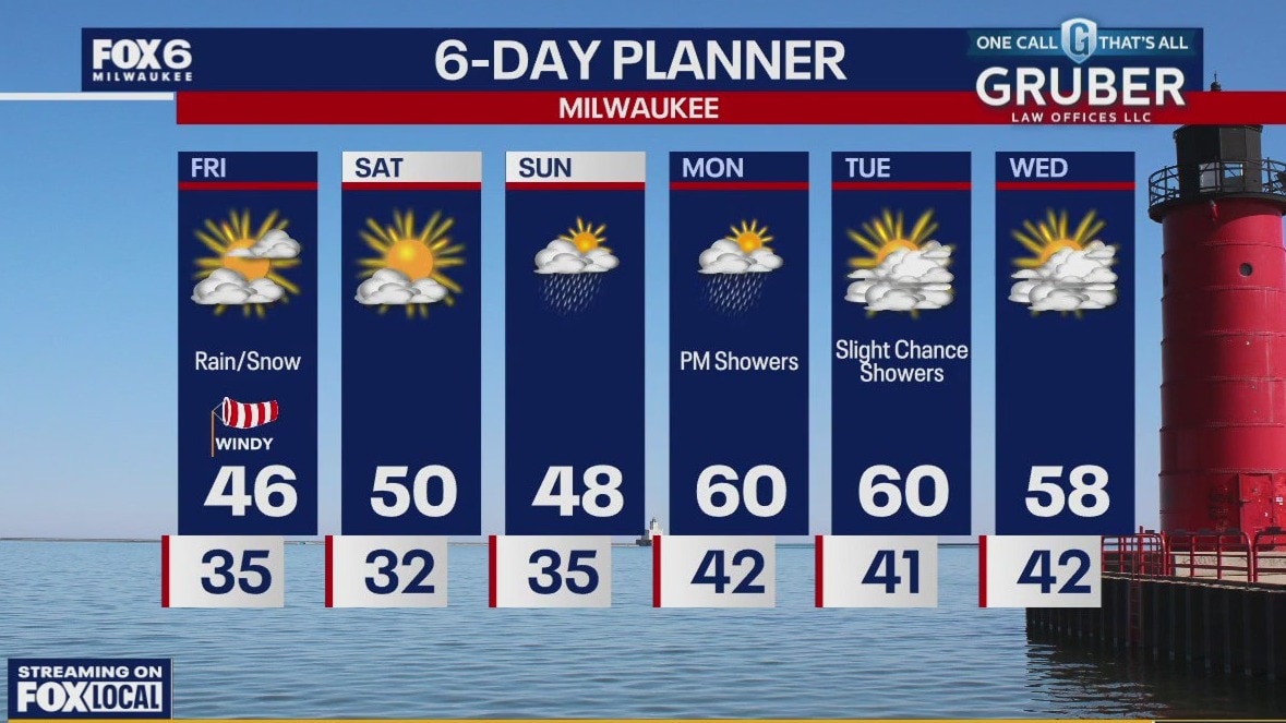
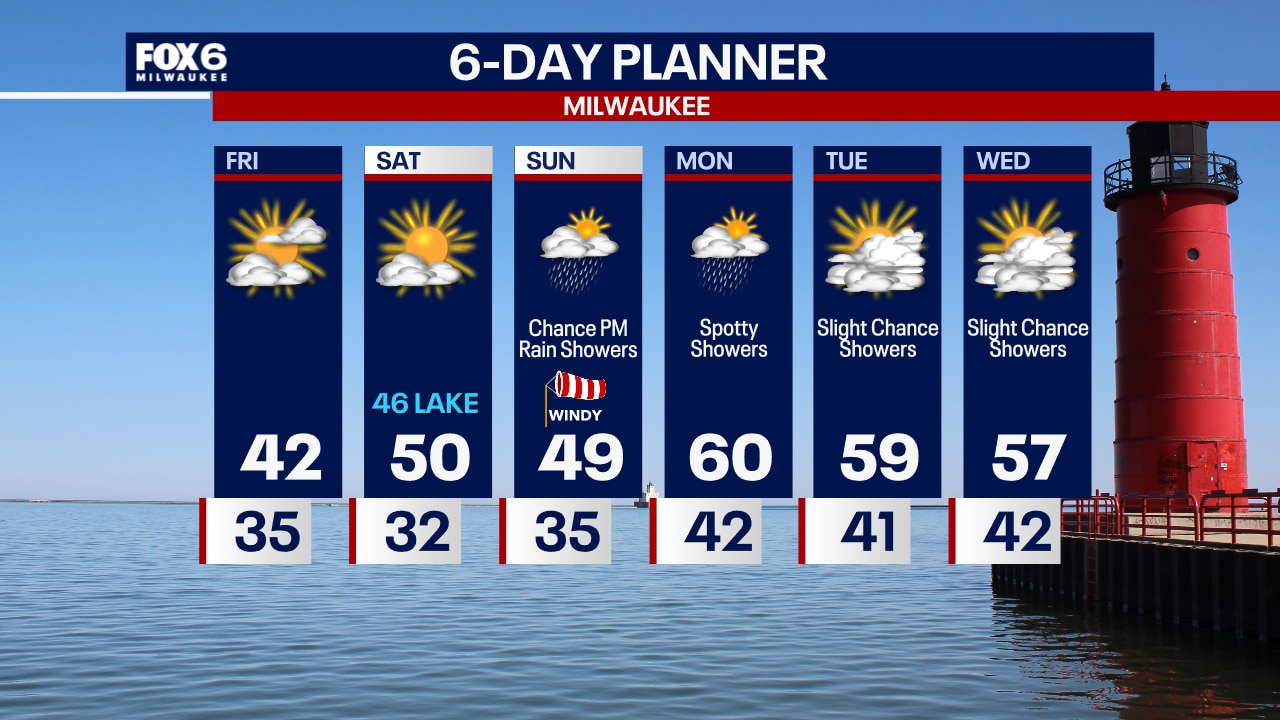
High pressure finally breaks through and dries us up with some sunshine today. Highs will warm a bit from past days but still fall a bit short of average in the mid to upper 40s. More sun for Saturday as we get back to near 50. Rain returns by later Sunday and lingers into Monday. There is some hope we may see at least partial clearing for the eclipse on Monday.
High pressure finally breaks through and dries us up with some sunshine today. Highs will warm a bit from past days but still fall a bit short of average in the mid to upper 40s. More sun for Saturday as we get back to near 50. Rain returns by later Sunday and lingers into Monday. There is some hope we may see at least partial clearing for the eclipse on Monday.
Weather Webcast with Tom Wachs
Clearing skies overnight with temperatures in the 30s. Partly sunny and blustery on Friday with highs in the low 40s. Abundant sunshine on Saturday.
Clearing skies overnight with temperatures in the 30s. Partly sunny and blustery on Friday with highs in the low 40s. Abundant sunshine on Saturday.

Weather Webcast with Tom Wachs
A few spotty showers are possible tonight with temperatures falling into the 30s. Gradual clearing on Friday with a blustery high in the low 40s. Sun returns on Saturday.
A few spotty showers are possible tonight with temperatures falling into the 30s. Gradual clearing on Friday with a blustery high in the low 40s. Sun returns on Saturday.

Weather webcast with Lisa Michaels
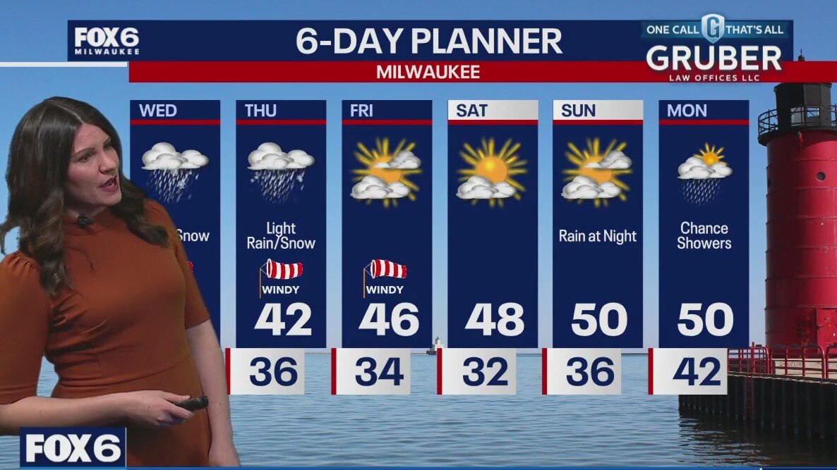
Last of the rain/snow mix will be today. High temperatures reach the low 40s this afternoon with breezy winds gusting near 30mph. (.5"-1") Clouds start to clear by Friday with highs in the low to mid 40s. Gradual warming temps into the 50s by Sunday. The weekend looks mainly dry Rain will enter back into the forecast late Sunday and into early Monday.
Last of the rain/snow mix will be today. High temperatures reach the low 40s this afternoon with breezy winds gusting near 30mph. (.5"-1") Clouds start to clear by Friday with highs in the low to mid 40s. Gradual warming temps into the 50s by Sunday. The weekend looks mainly dry Rain will enter back into the forecast late Sunday and into early Monday.

Weather webcast with Rob Haswell
As the storm low lingers over Michigan, we are on its Western side dealing with periods of wet snow and rain. Winter Weather Advisories continue for all inland and northern counties today with another 2-4" of wet snow possible. More rain and snow showers Thursday before we dry up on Friday and into the weekend. Highs today will be near 40 and stay in the 40s tomorrow and Friday but warm into the 50s for the weekend and early next week.
As the storm low lingers over Michigan, we are on its Western side dealing with periods of wet snow and rain. Winter Weather Advisories continue for all inland and northern counties today with another 2-4" of wet snow possible. More rain and snow showers Thursday before we dry up on Friday and into the weekend. Highs today will be near 40 and stay in the 40s tomorrow and Friday but warm into the 50s for the weekend and early next week.
Weather webcast with Stephanie Barichello
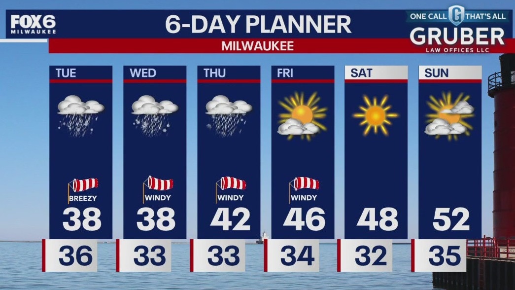
Windy and messy this evening with rain changing to snow from west to east this evening, although the southern lakeshore may stay mainly rain.
Windy and messy this evening with rain changing to snow from west to east this evening, although the southern lakeshore may stay mainly rain.
Weather webcast with Chief Meteorologist Rob Haswell
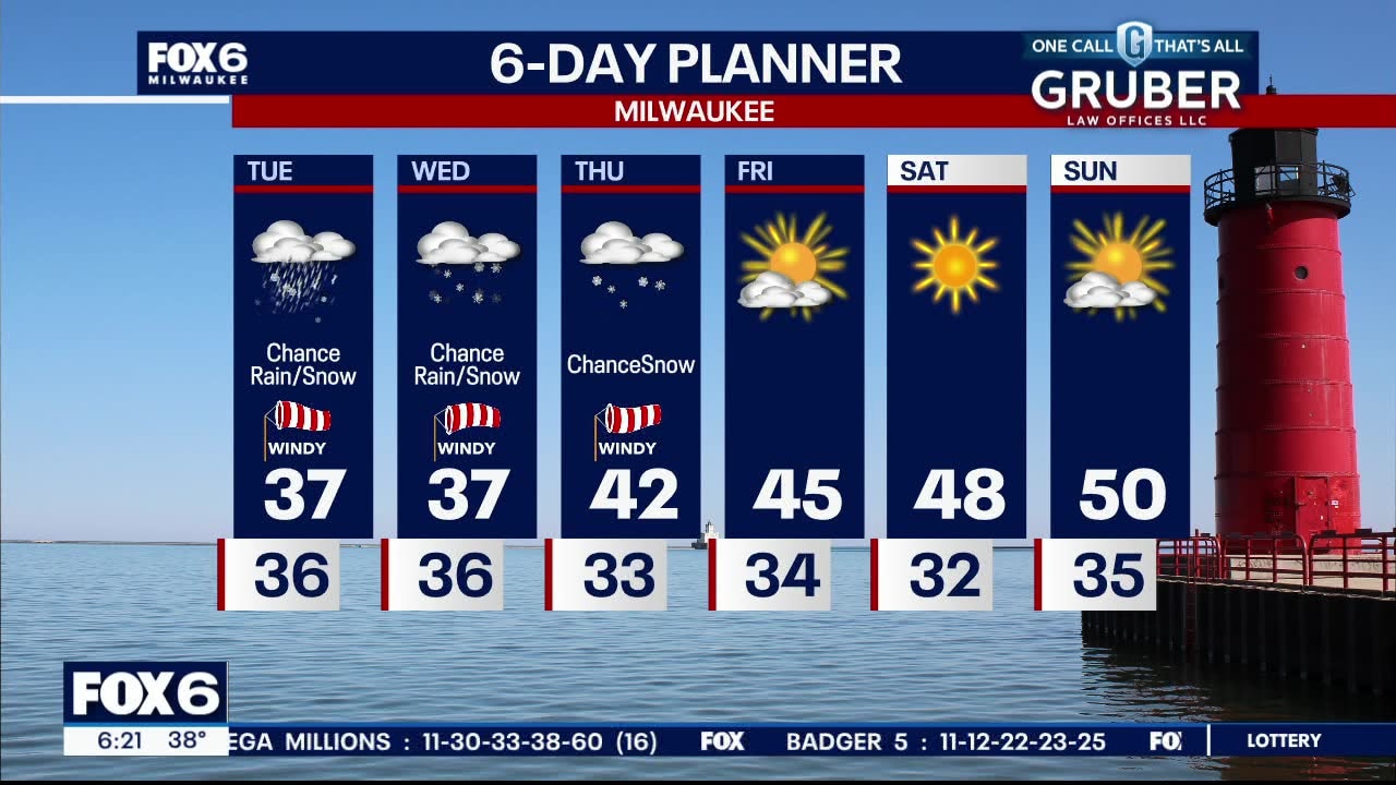
A low passes from Missouri into Michigan today where it stalls for several hours, sending us bands of rain and snow. A Winter Weather Advisory goes into effect for Washington, Dodge, Sheboygan and Jefferson counties at 4pm and lasts through 10pm. A few inches of wet snow is expected with the lowest amounts in the far southeast counties and lakeside. Heaviest accumulations will be in our northwest counties. Snow will taper off through the early part of Thursday and the sun and warmer conditions return late week and into the weekend.
A low passes from Missouri into Michigan today where it stalls for several hours, sending us bands of rain and snow. A Winter Weather Advisory goes into effect for Washington, Dodge, Sheboygan and Jefferson counties at 4pm and lasts through 10pm. A few inches of wet snow is expected with the lowest amounts in the far southeast counties and lakeside. Heaviest accumulations will be in our northwest counties. Snow will taper off through the early part of Thursday and the sun and warmer conditions return late week and into the weekend.
Weather webcast with Lisa Michaels
A parade of low pressure systems passes to our south in the next couple of days. A wintry mix tonight with the chance of rain and snow through Thursday. A slushy accumulation is possible. Fond du Lac and Sheboygan counties could see higher amounts. Temperatures will max out in the upper 30s and low 40s through Thursday and then warm into the 50s by the weekend.
A parade of low pressure systems passes to our south in the next couple of days. A wintry mix tonight with the chance of rain and snow through Thursday. A slushy accumulation is possible. Fond du Lac and Sheboygan counties could see higher amounts. Temperatures will max out in the upper 30s and low 40s through Thursday and then warm into the 50s by the weekend.