

Weather Webcast with Chief Meteorologist Tom Wachs
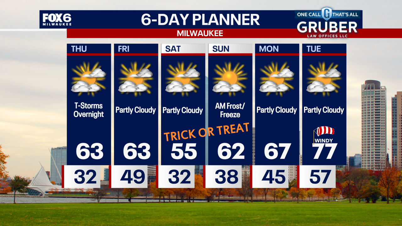
A frost near the lake and a freeze inland overnight. Temperatures dropping into the 30s. Partly sunny on Thursday with highs in the low 60s. T-Storms are possible late Thursday night.
A frost near the lake and a freeze inland overnight. Temperatures dropping into the 30s. Partly sunny on Thursday with highs in the low 60s. T-Storms are possible late Thursday night.

Weather webcast with Holly Baker
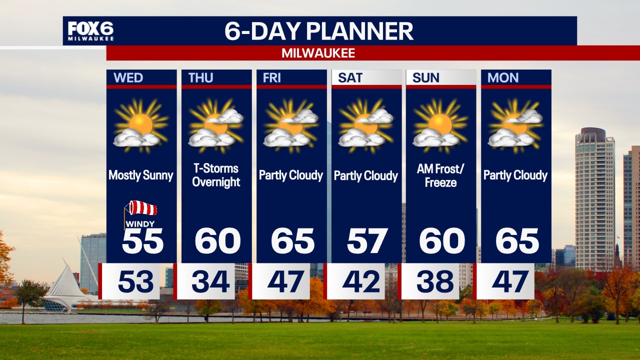
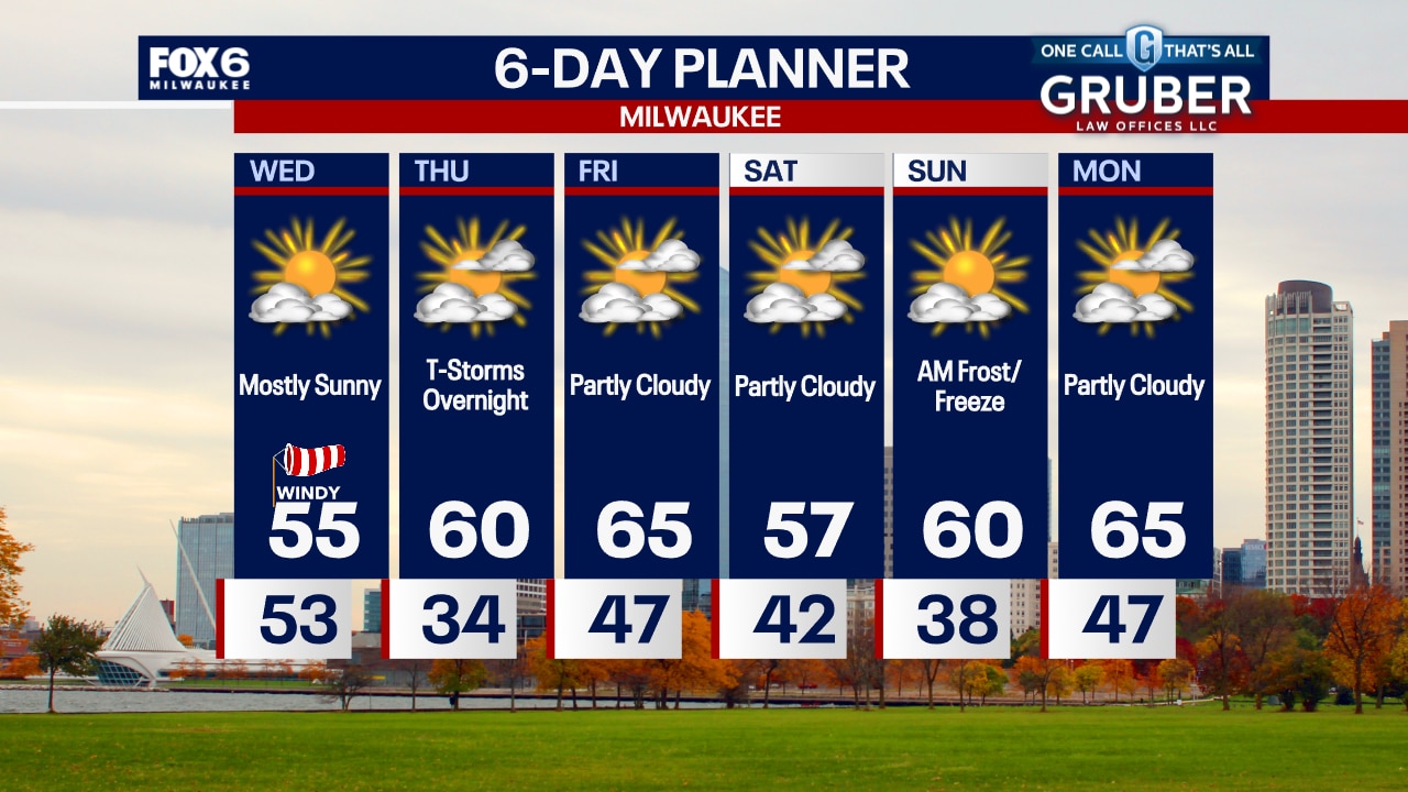
Wednesday could start off blustery with strong northwest winds behind a cold front. Temperatures will be seasonably with highs in the 50's. Thursday morning will be cold in the 30's. Another frontal system on Thursday night could bring better chances of rain through Friday morning. A quiet and dry weekend is ahead with a fall like temperature trend.
Wednesday could start off blustery with strong northwest winds behind a cold front. Temperatures will be seasonably with highs in the 50's. Thursday morning will be cold in the 30's. Another frontal system on Thursday night could bring better chances of rain through Friday morning. A quiet and dry weekend is ahead with a fall like temperature trend.
Weather Webcast with Chief Meteorologist Tom Wachs
A cold front will move through overnight with the wind picking up. Temperatures in the 40s and 50s overnight. Gradual clearing on Wednesday with highs in the 50s along with gusty northwest winds.
A cold front will move through overnight with the wind picking up. Temperatures in the 40s and 50s overnight. Gradual clearing on Wednesday with highs in the 50s along with gusty northwest winds.
Weather Webcast with Chief Meteorologist Tom Wachs
Partly cloudy tonight with temperatures dropping into the 50s. Mostly sunny, windy and much cooler on Wednesday with highs in the mid-50s.
Partly cloudy tonight with temperatures dropping into the 50s. Mostly sunny, windy and much cooler on Wednesday with highs in the mid-50s.

Weather webcast with Holly Baker
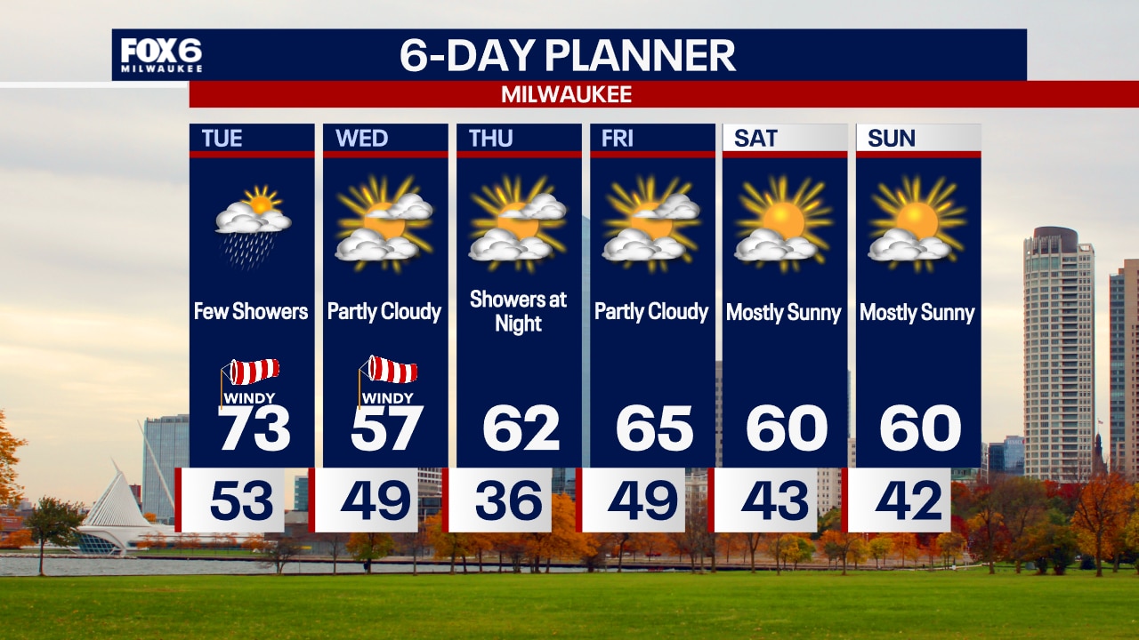
Increasing clouds throughout the day with a chance for showers midday. Temperatures will be slightly above average and reach into the low 70s. A cold front pushes through Wednesday leaving behind cooler temperatures. Thursday morning will be quite frigid in the mid 30's. Another frontal system on Thursday night could bring better chances of rain through Friday morning.
Increasing clouds throughout the day with a chance for showers midday. Temperatures will be slightly above average and reach into the low 70s. A cold front pushes through Wednesday leaving behind cooler temperatures. Thursday morning will be quite frigid in the mid 30's. Another frontal system on Thursday night could bring better chances of rain through Friday morning.
Weather Webcast with Chief Meteorologist Tom Wachs
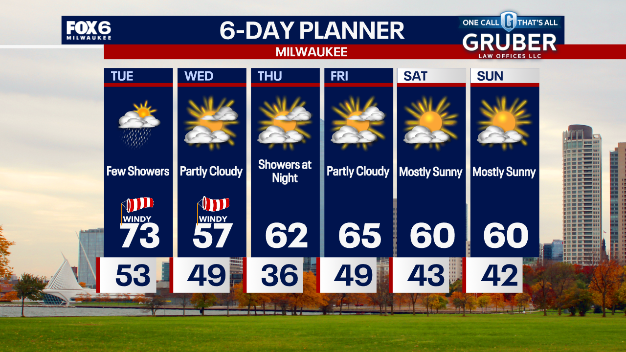
Partly cloudy overnight with temperatures in the 50s. Increasing clouds on Tuesday, windy and warm with highs in the 70s. A few light rain showers are possible early Tuesday afternoon. Much cooler on Wednesday.
Partly cloudy overnight with temperatures in the 50s. Increasing clouds on Tuesday, windy and warm with highs in the 70s. A few light rain showers are possible early Tuesday afternoon. Much cooler on Wednesday.
Weather Webcast with Chief Meteorologist Tom Wachs
Mostly clear and breezy tonight with temperatures falling through the 60s and ending up in the 50s overnight. Increasing clouds on Tuesday with a chance for a few early afternoon rain showers. Windy with highs in the low 70s.
Mostly clear and breezy tonight with temperatures falling through the 60s and ending up in the 50s overnight. Increasing clouds on Tuesday with a chance for a few early afternoon rain showers. Windy with highs in the low 70s.
Weather Webcast with Stephanie Barichello
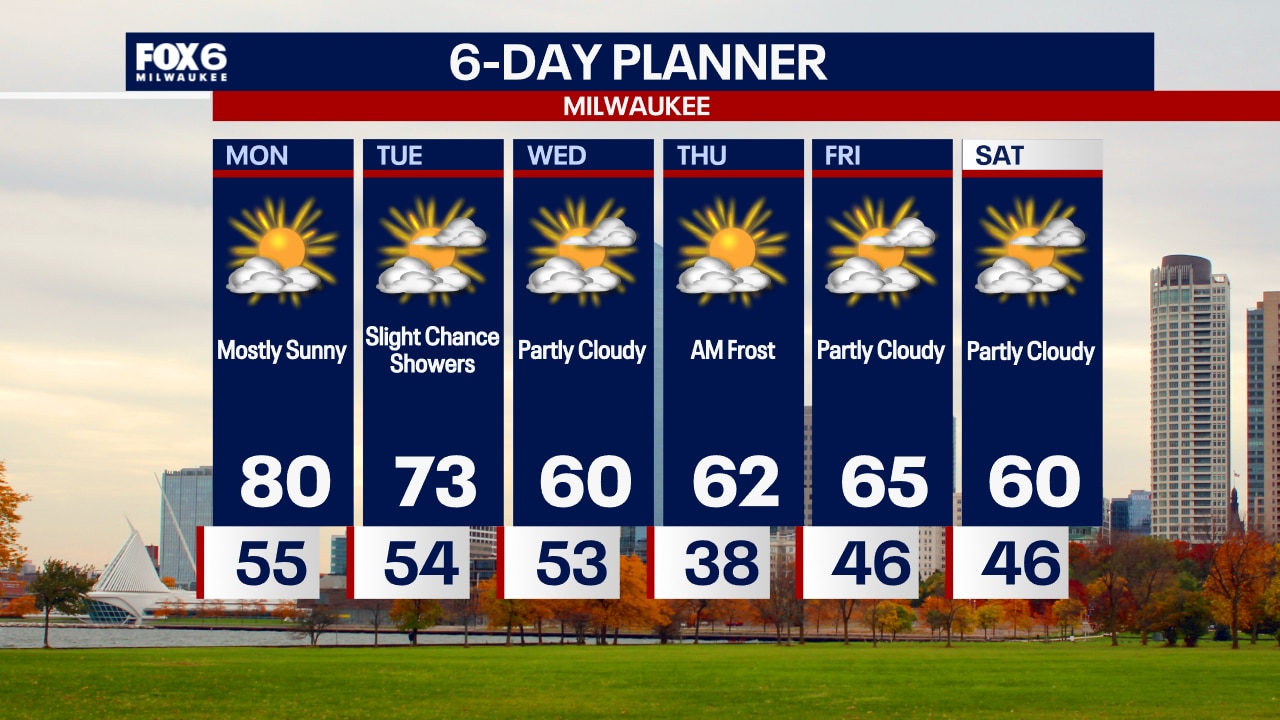
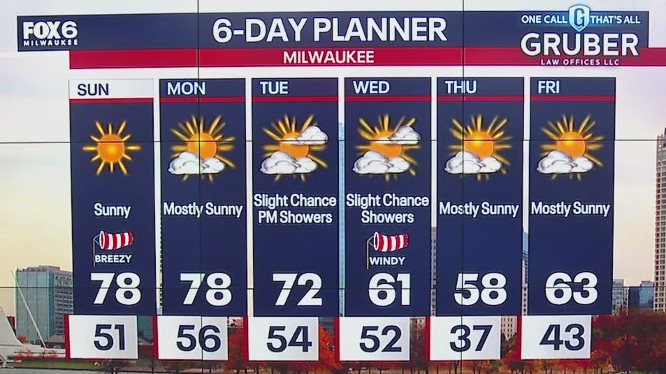
Sunny and warm again today then cooling the rest of the week. Slight chance for showers Tuesday, and again Thursday evening. No major storms in sight.
Sunny and warm again today then cooling the rest of the week. Slight chance for showers Tuesday, and again Thursday evening. No major storms in sight.
Weather webcast with Lisa Michaels
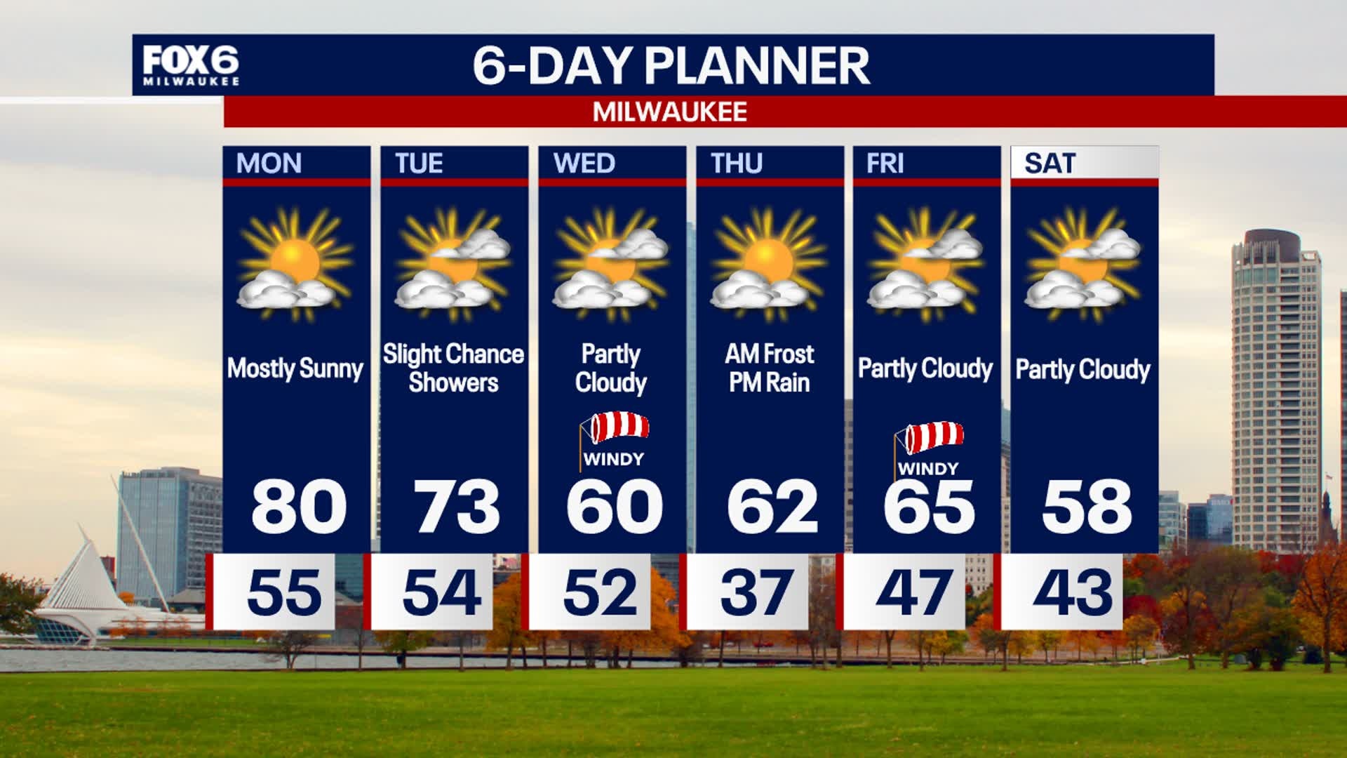
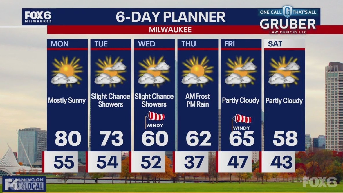
Unseasonably warm temperatures reaching 80F on Monday under mostly sunny skies. Slight chance of showers associated with an incoming cold front on Tuesday. Minimal amounts if any. A cold front moves through by Wednesday morning. This will drop temperatures back into the low 60s midweek. Another frontal system on Thursday night could bring better chances of rain.
Unseasonably warm temperatures reaching 80F on Monday under mostly sunny skies. Slight chance of showers associated with an incoming cold front on Tuesday. Minimal amounts if any. A cold front moves through by Wednesday morning. This will drop temperatures back into the low 60s midweek. Another frontal system on Thursday night could bring better chances of rain.

Weather Webcast with Chief Meteorologist Tom Wachs
Clear skies overnight with temperatures in the 50s. Another warm and breezy day on Monday with highs around 80.
Clear skies overnight with temperatures in the 50s. Another warm and breezy day on Monday with highs around 80.
Weather Webcast with Chief Meteorologist Tom Wachs
Clear skies tonight with temperatures dropping into the 50s. Mostly sunny, breezy and warm again on Monday with a high around 80.
Clear skies tonight with temperatures dropping into the 50s. Mostly sunny, breezy and warm again on Monday with a high around 80.
Weather webcast with Lisa Michaels
Unseasonably warm temperatures over the next several days with highs reaching the upper 70s Sunday and Monday. Stronger winds today with low relative humidity and dry vegetation will lead to an elevated fire risk today.
Unseasonably warm temperatures over the next several days with highs reaching the upper 70s Sunday and Monday. Stronger winds today with low relative humidity and dry vegetation will lead to an elevated fire risk today.

Weather Webcast with Holly Baker
Warmer temperatures are in full effect.
Warmer temperatures are in full effect.
Weather webcast with Lisa Michaels
High pressure pattern keeps weather warm and dry over the weekend and heading into early next week. Temperatures will warm into the low 70s on Saturday but back into the upper 70s on Sunday and Monday!
High pressure pattern keeps weather warm and dry over the weekend and heading into early next week. Temperatures will warm into the low 70s on Saturday but back into the upper 70s on Sunday and Monday!

Weather Webcast with Holly Baker
A warm up in temperatures are expected over the weekend.
A warm up in temperatures are expected over the weekend.
Weather Webcast with Stephanie Barichello
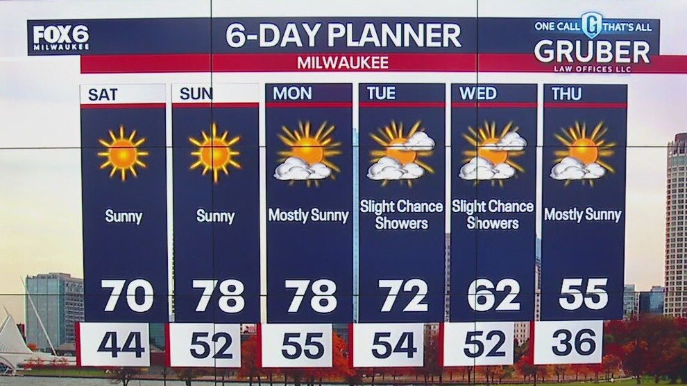
Sunny, breezy and much warmer today and over the weekend. Slim chance for showers by Tuesday then cooler Wednesday.
Sunny, breezy and much warmer today and over the weekend. Slim chance for showers by Tuesday then cooler Wednesday.

Weather webcast with Rob Haswell
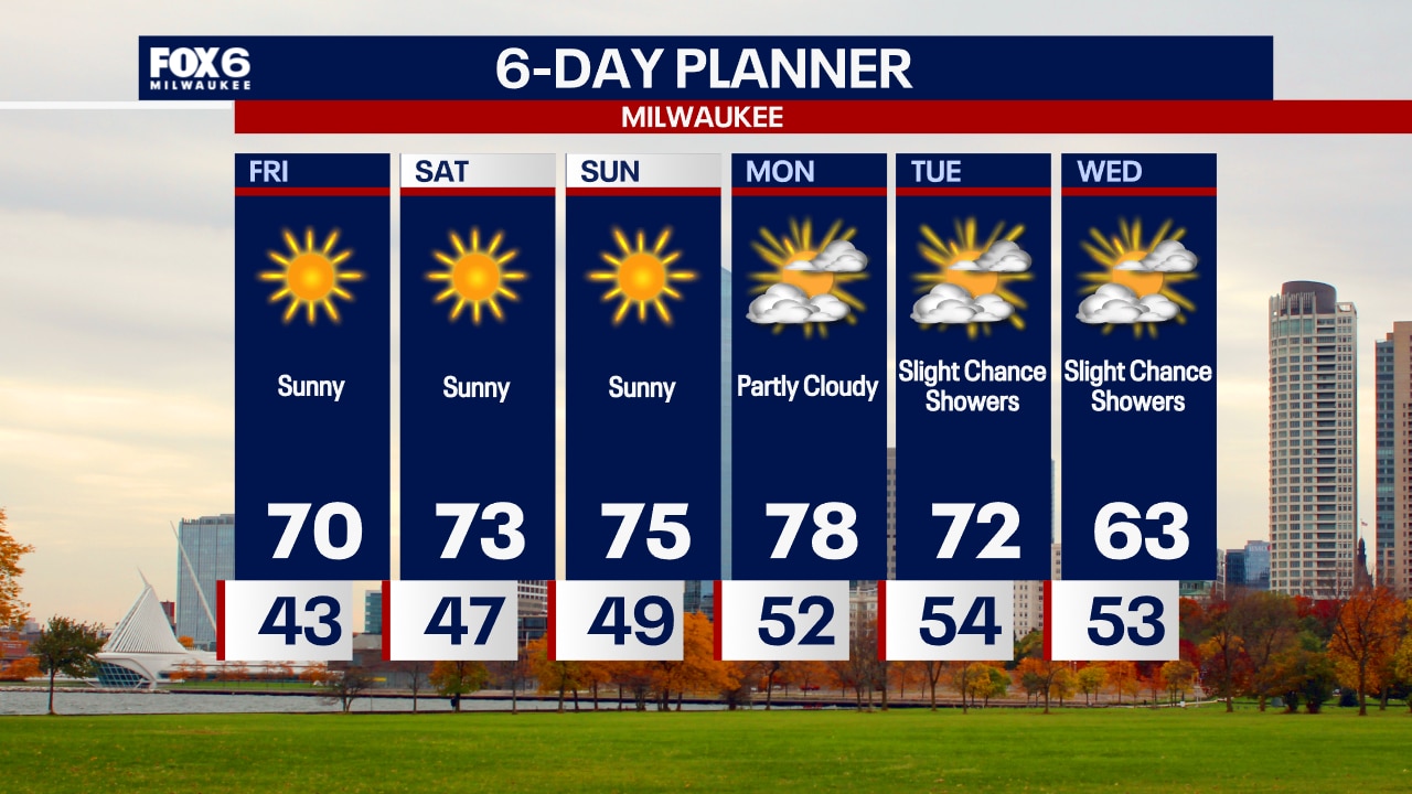
Another sunny day and warming up with highs reaching 70 this afternoon. We continue to warm up this weekend with highs in the mid to upper 70s through early next week. Our dry stretch continues with no chance of rain through Monday. We may see showers Tuesday night and into Wednesday. We will cool back to near seasonal by mid-week.
Another sunny day and warming up with highs reaching 70 this afternoon. We continue to warm up this weekend with highs in the mid to upper 70s through early next week. Our dry stretch continues with no chance of rain through Monday. We may see showers Tuesday night and into Wednesday. We will cool back to near seasonal by mid-week.
Weather Webcast with Chief Meteorologist Tom Wachs
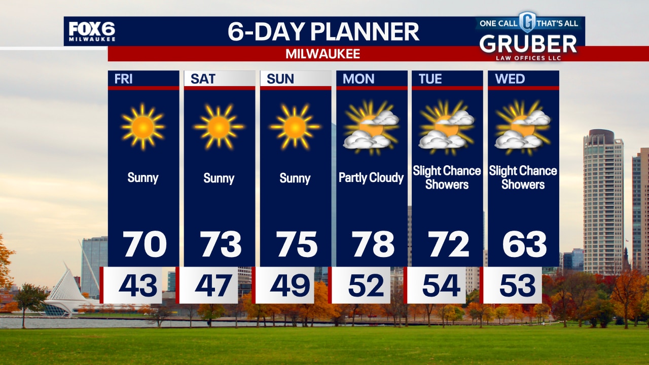
Clear skies overnight, not as cold. Temperatures dropping into the upper 30s to low 40s by sunrise. Patchy frost is possible inland. Sunny and breezy on Friday with highs in the upper 60s to around 70.
Clear skies overnight, not as cold. Temperatures dropping into the upper 30s to low 40s by sunrise. Patchy frost is possible inland. Sunny and breezy on Friday with highs in the upper 60s to around 70.
Weather Webcast with Chief Meteorologist Tom Wachs
Clear skies tonight with temperatures dropping into the 40s late this evening. 30s inland overnight with patchy frost away from the lake, but not as cold as the past few nights. Sunny and breezy on Friday with highs around 70.
Clear skies tonight with temperatures dropping into the 40s late this evening. 30s inland overnight with patchy frost away from the lake, but not as cold as the past few nights. Sunny and breezy on Friday with highs around 70.
Weather webcast with Rob Haswell
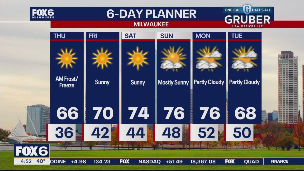
Another chilly start with ample frost and morning lows below freezing but we start warming up today on a southwest wind. That warming wind and a sunny sky will bring us into the mid to upper 60s today - a few degrees above the climate normal for the 24 hour high. We keep warming into the weekend with highs well into the 70s by Sunday and Monday. We stay dry through early next week.
Another chilly start with ample frost and morning lows below freezing but we start warming up today on a southwest wind. That warming wind and a sunny sky will bring us into the mid to upper 60s today - a few degrees above the climate normal for the 24 hour high. We keep warming into the weekend with highs well into the 70s by Sunday and Monday. We stay dry through early next week.