

Southeastern Wisconsin prolonged drought eases with incoming rain
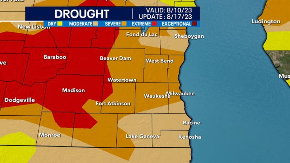
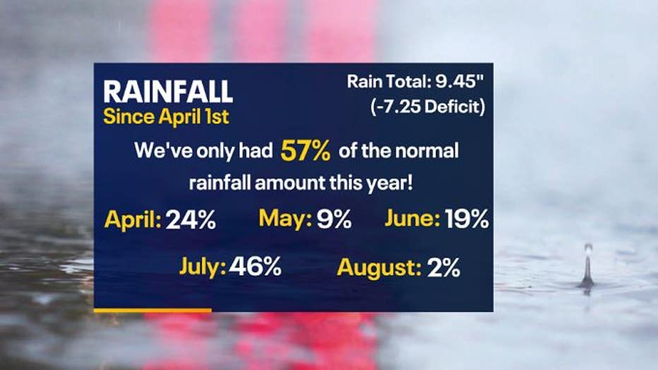
April 1st through Aug. 12 is ranked the 15th driest period, with a precipitation accumulation of only 9.45" when we should have had 16.70". No wonder we are still in moderate to extreme drought conditions since we have a rainfall deficit of 7.25".
This means Milwaukee has only experienced 57% of the normal amount of rain. The wettest month that helped us out was July, with a total of 4.33", equating to about 46% of the rain during this period.
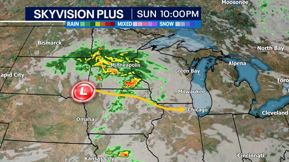
Some relief will be on the way as a low-pressure system moving southeast will bring rain starting as early as Sunday, Aug. 13, through Tuesday, Aug. 15.
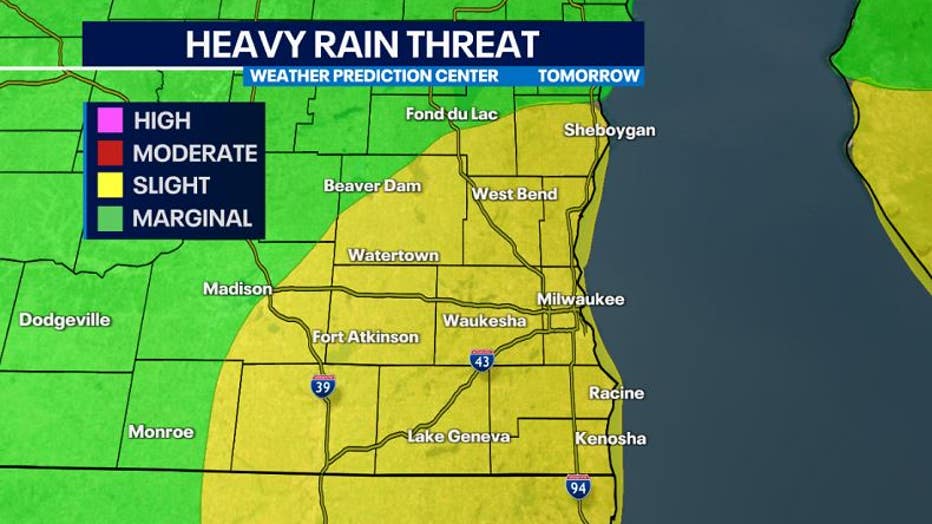
While a long soaking of rain is needed, a long duration rain event will heighten the risk of flash flooding. Due to this potential impact, the WPC (Weather Prediction Center) has issued a slight risk for flash flooding across much of southeast Wisconsin for Monday, August 14th.
The exact track of the center of low pressure will determine where the heaviest locations of rain will occur at times. Overall, almost everyone should see 0.75" to 1" of rain, with some counties that could see 2"+.

A 12+ hours long event can start as early as Sunday, Aug. 13, during the afternoon. A few isolated light showers and/or drizzle is possible, but since there will be a lot of dry air still near the surface, anything that falls will be light.

The main event will begin to move in during the morning on Monday, Aug. 14. This could cause for more time needed during the Monday morning commute hours.

The intensity of rain will pick up at mid to late Monday morning through the afternoon, with embedded storms possible too. Strong winds and moderate to heavy rain at times will cause difficult driving conditions and reduce visibility.

Since the low-pressure will ride close to the Wisconsin-Illinois border, this shuts off the severe weather threat since we are to the north. We are not anticipating any severe weather, but it's possible there could be a few stronger storms closer to the borderline.
Rain will still recirculate around the slow moving area of low pressure by Monday night.

As the low ejects off to the southeast, the last round of light rain could linger into Tuesday morning as it continues to circulate around the low. Gusty winds up to 30 mph are possible through early Tuesday.

Despite the rain and cloudy skies starting off the week, sunshine will return by Tuesday, Aug. 15, during the afternoon.