

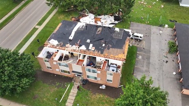

Horicon, Lomira see significant storm damage
The FOX6 Weather Experts are tracking severe weather that has the potential to impact all of southeast Wisconsin on Wednesday, June 10. While not everyone will see severe weather, any storm that develops could become strong quickly. Thunderstorms, damaging wind, large hail and isolated tornadoes are possible. Those threats remain possible into Wednesday night before a brief lull develops. Another round is expected Thursday.
The FOX6 Weather Experts are tracking severe weather that has the potential to impact all of southeast Wisconsin on Wednesday, June 10. While not everyone will see severe weather, any storm that develops could become strong quickly. Thunderstorms, damaging wind, large hail and isolated tornadoes are possible. Those threats remain possible into Wednesday night before a brief lull develops. Another round is expected Thursday.
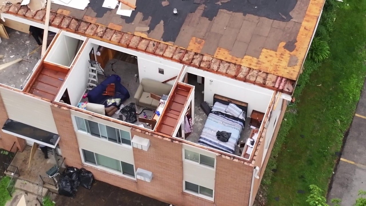
Storm damage in Lomira, Wisconsin
SKYFOX shows you damage to an apartment building in Lomira, Wisconsin.
SKYFOX shows you damage to an apartment building in Lomira, Wisconsin.
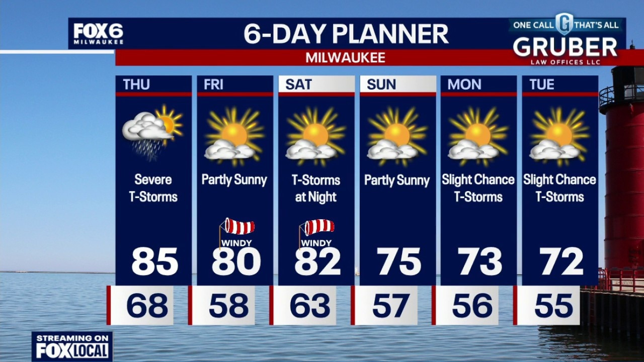
Weather Webcast with Chief Meteorologist Tom Wachs
There is a chance we could see more storms through 2am. We are watching closely. Temperatures around 70 all night. Partly to mostly cloudy on Thursday. Severe t-storms. Midday severe t-storms are possible, but the worst of the storms will be 4pm-9pm. Tornadoes are expected along with very strong winds and large hail. Flooding is also possible. This is a volatile setup. It is imperative to stay weather aware and have sheltering plans.
There is a chance we could see more storms through 2am. We are watching closely. Temperatures around 70 all night. Partly to mostly cloudy on Thursday. Severe t-storms. Midday severe t-storms are possible, but the worst of the storms will be 4pm-9pm. Tornadoes are expected along with very strong winds and large hail. Flooding is also possible. This is a volatile setup. It is imperative to stay weather aware and have sheltering plans.
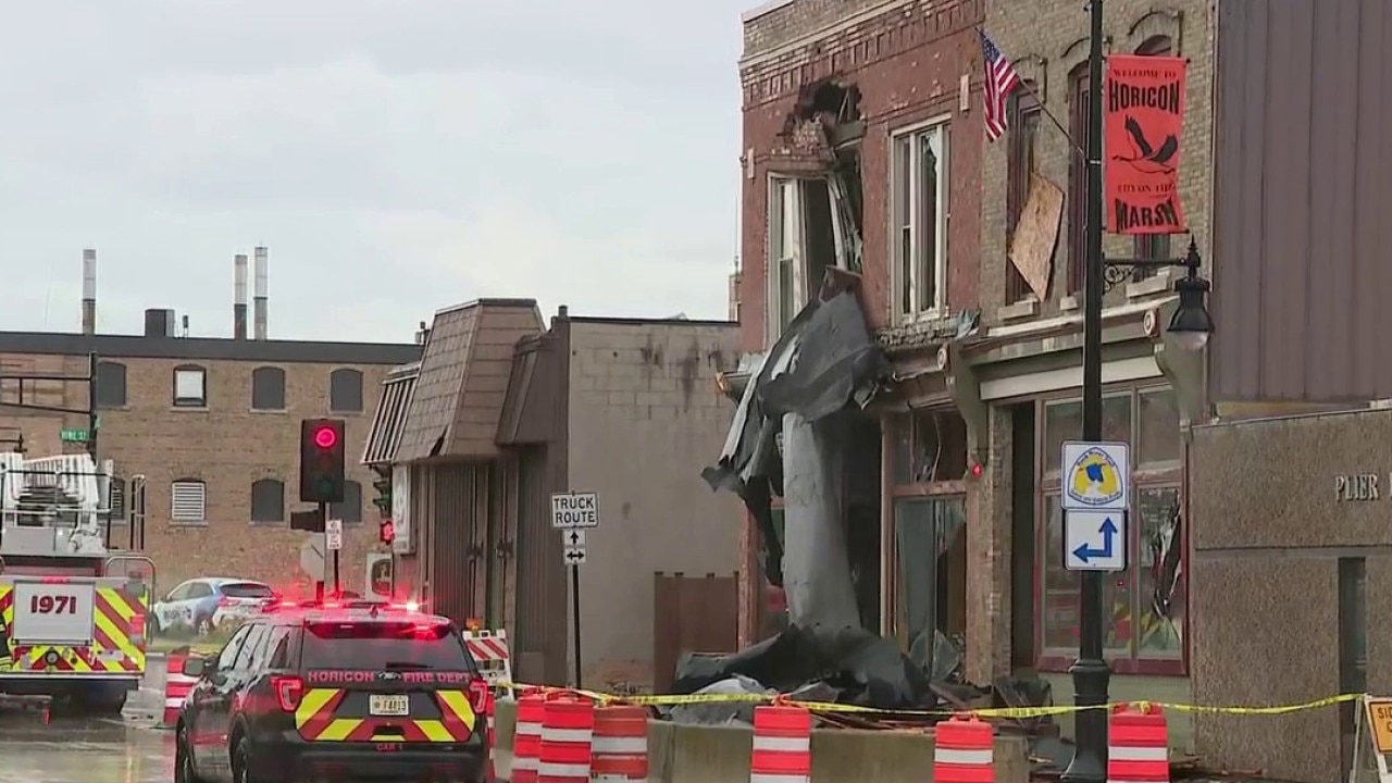
Horicon storm damage; buildings hit in downtown area
The FOX6 News team takes you to communities in southeast Wisconsin that suffered damage from a line of severe weather that blew through on Wednesday, June 10.
The FOX6 News team takes you to communities in southeast Wisconsin that suffered damage from a line of severe weather that blew through on Wednesday, June 10.

Horicon roof blown off captured by women in area
FOX6 News viewer Kelly O. shared video from Horicon that appears to show a roof blowing away after it was ripped off a building on Wednesday, June 10. She and a friend spoke with FOX6 News.
FOX6 News viewer Kelly O. shared video from Horicon that appears to show a roof blowing away after it was ripped off a building on Wednesday, June 10. She and a friend spoke with FOX6 News.
Heavy rain enters Milwaukee County
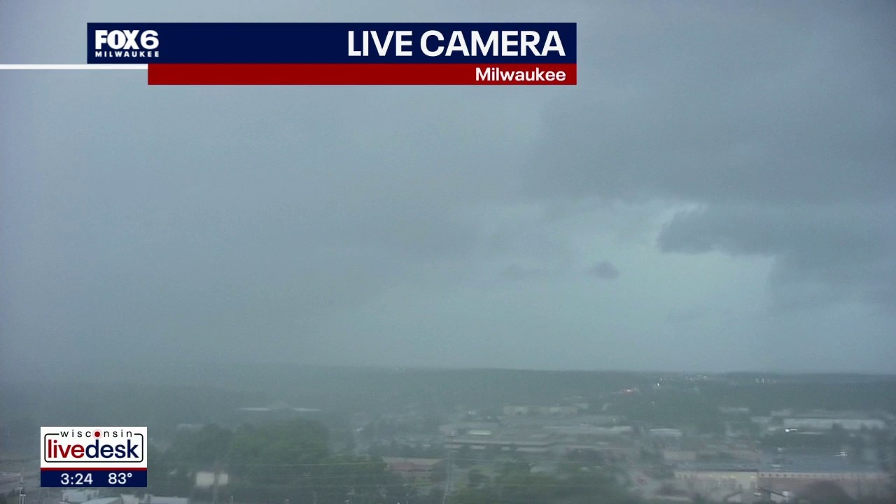
A FOX6 News tower camera captured a wall of heavy rain entering Milwaukee County on Wednesday afternoon, June 10.
A FOX6 News tower camera captured a wall of heavy rain entering Milwaukee County on Wednesday afternoon, June 10.

Southeast Wisconsin severe thunderstorm watch Wednesday; what to expect
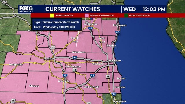
After a muggy start to Wednesday, the atmosphere will become increasingly unstable through the afternoon, setting the stage for thunderstorms capable of damaging winds, large hail, and perhaps a few isolated tornadoes.
After a muggy start to Wednesday, the atmosphere will become increasingly unstable through the afternoon, setting the stage for thunderstorms capable of damaging winds, large hail, and perhaps a few isolated tornadoes.
Weather webcast with Stephanie Barichello
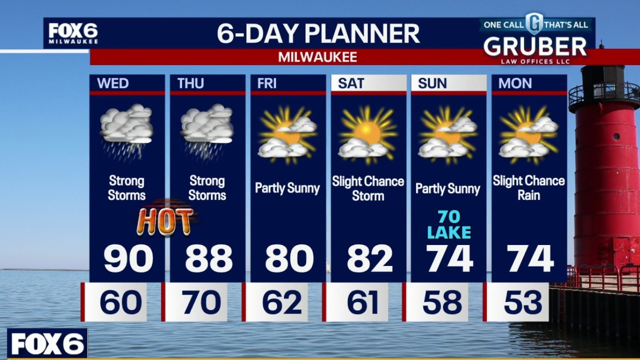
Breezy, hot and humid on Wednesday with highs near 90F and an afternoon heat index around 100. A round of severe t-storms is likely between 1pm-6pm on Wednesday with tornadoes, wind and hail possible.
Breezy, hot and humid on Wednesday with highs near 90F and an afternoon heat index around 100. A round of severe t-storms is likely between 1pm-6pm on Wednesday with tornadoes, wind and hail possible.
Weather webcast with Lisa Michaels
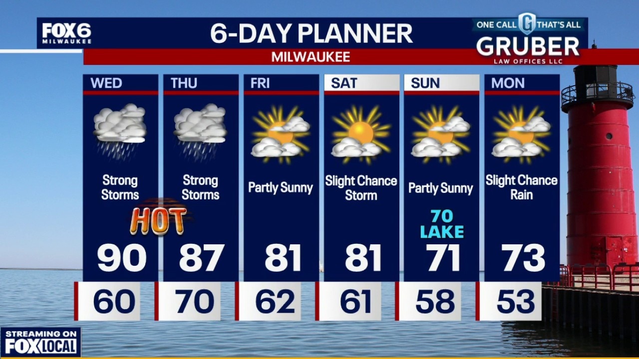
Dense fog advisory until 7am for counties closer to the lake. Windy, hot and humid on Wednesday with highs near 90F and an afternoon heat index around 100.
Dense fog advisory until 7am for counties closer to the lake. Windy, hot and humid on Wednesday with highs near 90F and an afternoon heat index around 100.
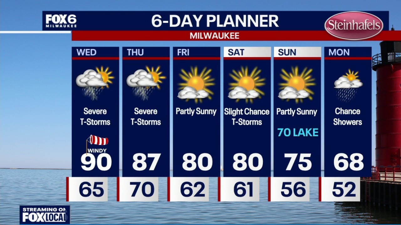
Weather Webcast with Chief Meteorologist Tom Wachs
Dense fog overnight with temperatures dropping into the 60s. Slim chance for t-storms on Wednesday morning, but chances are going down. Windy, hot and humid on Wednesday with an afternoon heat index around 100. A round of severe t-storms is likely between 11am-5pm on Wednesday with tornadoes, wind and hail possible. A second round is expected between 7pm-2am with all threats again on the table.
Dense fog overnight with temperatures dropping into the 60s. Slim chance for t-storms on Wednesday morning, but chances are going down. Windy, hot and humid on Wednesday with an afternoon heat index around 100. A round of severe t-storms is likely between 11am-5pm on Wednesday with tornadoes, wind and hail possible. A second round is expected between 7pm-2am with all threats again on the table.


Milwaukee Weather: Severe T-Storms and Heat
Dense fog overnight with temperatures dropping into the 60s. Slim chance for t-storms on Wednesday morning, but chances are going down. Windy, hot and humid on Wednesday with an afternoon heat index around 100. A round of severe t-storms is likely between 11am-5pm on Wednesday with tornadoes, wind and hail possible. A second round is expected between 7pm-2am with all threats again on the table.
Dense fog overnight with temperatures dropping into the 60s. Slim chance for t-storms on Wednesday morning, but chances are going down. Windy, hot and humid on Wednesday with an afternoon heat index around 100. A round of severe t-storms is likely between 11am-5pm on Wednesday with tornadoes, wind and hail possible. A second round is expected between 7pm-2am with all threats again on the table.
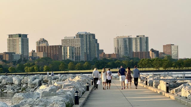

Heat, humidity return to Milwaukee; where to cool off
Dangerous heat and humidity are expected in southeast Wisconsin on Wednesday, and Milwaukee health officials are sharing cooling sites and safety tips.
Dangerous heat and humidity are expected in southeast Wisconsin on Wednesday, and Milwaukee health officials are sharing cooling sites and safety tips.
Weather Webcast with Chief Meteorologist Tom Wachs
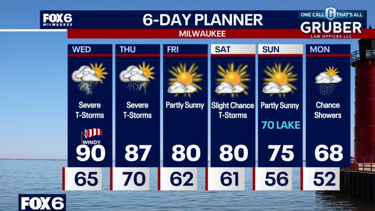
Dense fog developing tonight with temperatures dropping into the 60s. Slim chance for t-storms on Wednesday morning, but chances are going down. Windy, hot and humid on Wednesday with an afternoon heat index around 100.
Dense fog developing tonight with temperatures dropping into the 60s. Slim chance for t-storms on Wednesday morning, but chances are going down. Windy, hot and humid on Wednesday with an afternoon heat index around 100.
Weather Webcast with Stephanie Barichello
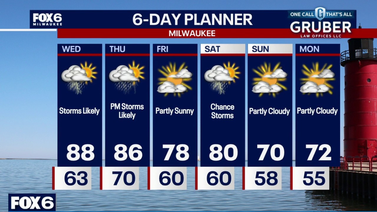
Multiple rounds of severe weather possible Wednesday afternoon and evening, and again Thursday afternoon and evening. All rounds could produce damaging wind over 70mph and tornadoes, along with hail and flash flooding. It's possible parts of SE WI pick up over 2" of rain between the two rounds. It'll also be hot and humid Wednesday with heat indices near 100. Calmer Friday then a chance of storms to start the weekend.
Multiple rounds of severe weather possible Wednesday afternoon and evening, and again Thursday afternoon and evening. All rounds could produce damaging wind over 70mph and tornadoes, along with hail and flash flooding. It's possible parts of SE WI pick up over 2" of rain between the two rounds. It'll also be hot and humid Wednesday with heat indices near 100. Calmer Friday then a chance of storms to start the weekend.
Weather webcast with Stephanie Barichello
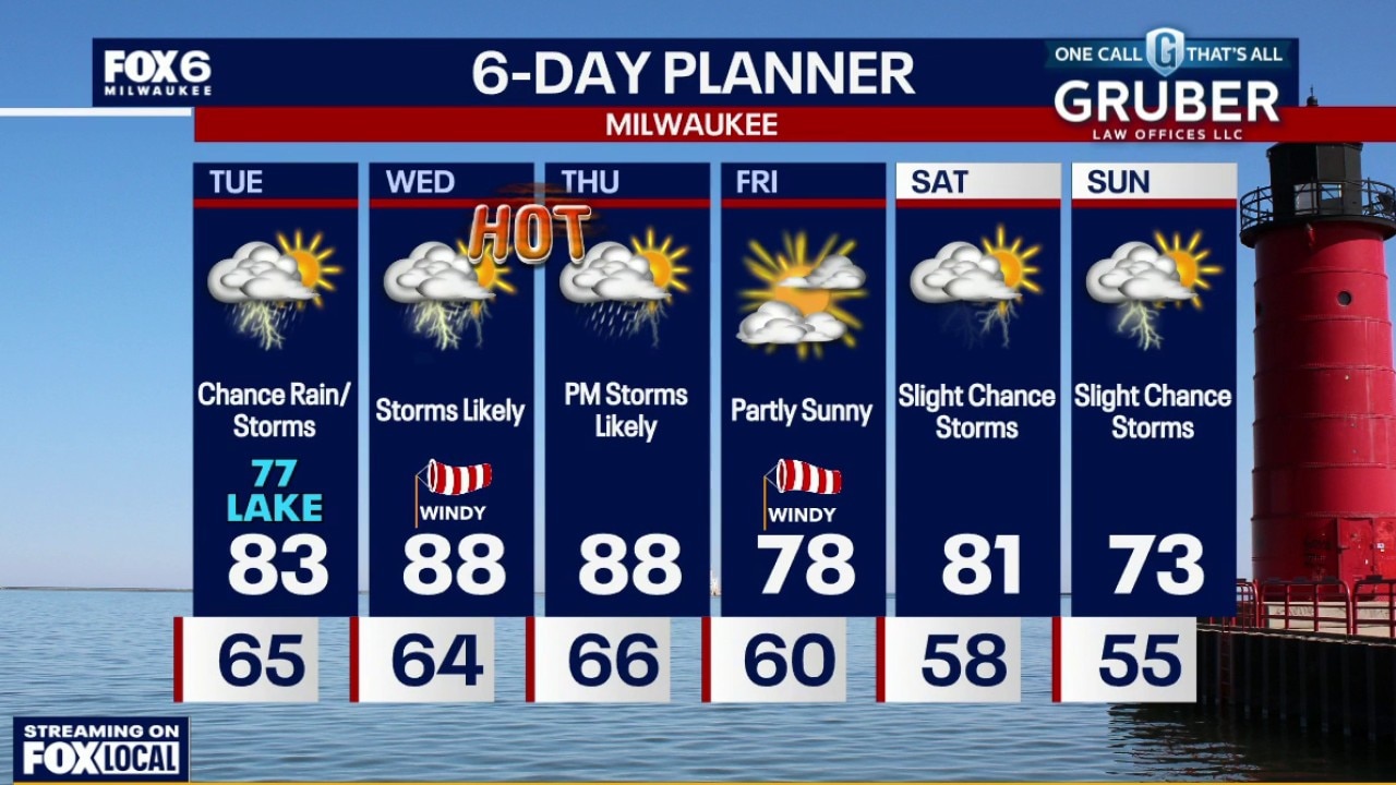
Scattered rain showers and a few storms Tuesday morning. Highs in the low 80s inland and upper 70s lakeside. Muggy. Storm chances increase Wednesday morning with patchy fog possible.
Scattered rain showers and a few storms Tuesday morning. Highs in the low 80s inland and upper 70s lakeside. Muggy. Storm chances increase Wednesday morning with patchy fog possible.
Weather webcast with Lisa Michaels
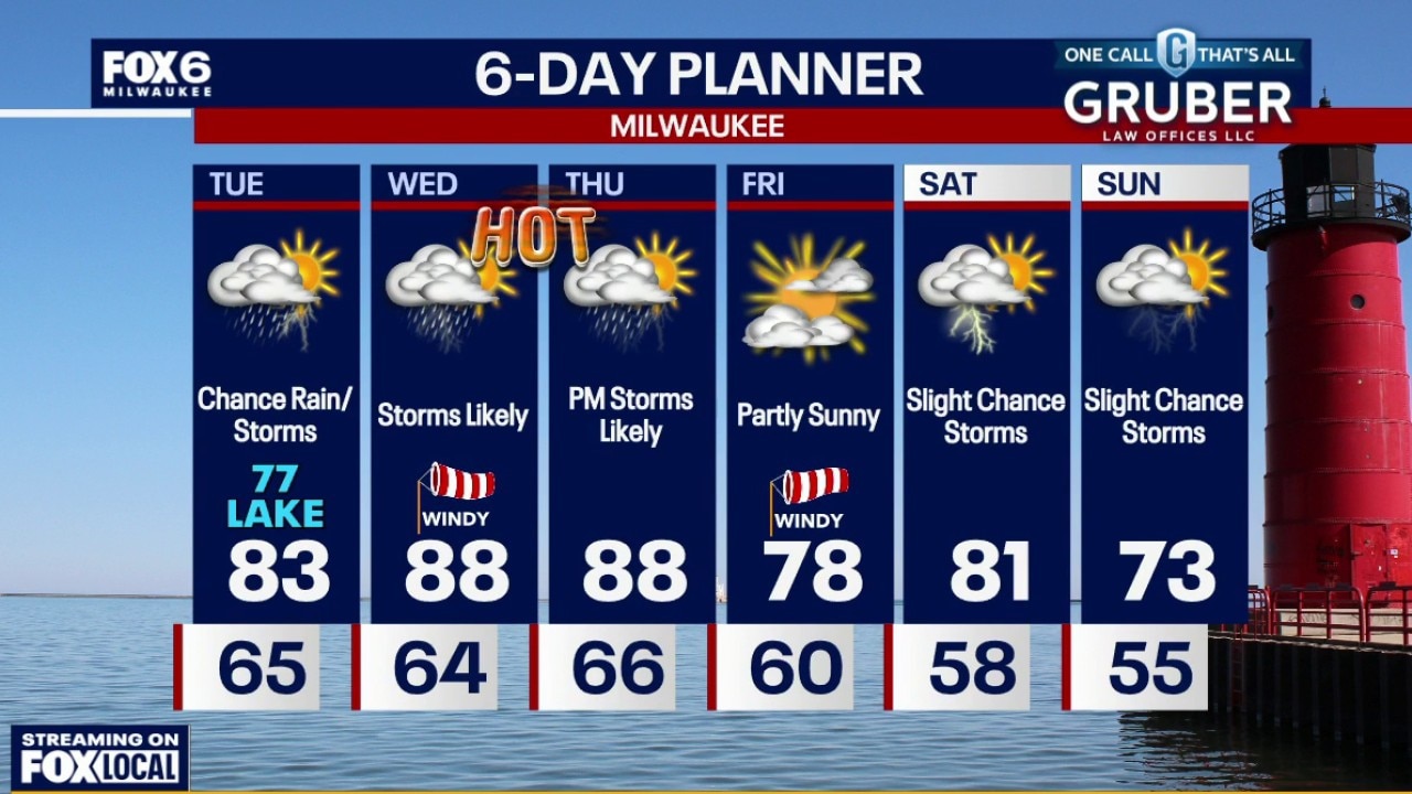
Scattered rain showers and a few storms Tuesday morning. Highs in the low 80s inland and upper 70s lakeside. Muggy. Storm chances increase Wednesday morning with patchy fog possible. Lows in the mid 60s.
Scattered rain showers and a few storms Tuesday morning. Highs in the low 80s inland and upper 70s lakeside. Muggy. Storm chances increase Wednesday morning with patchy fog possible. Lows in the mid 60s.
Weather Webcast with Chief Meteorologist Tom Wachs
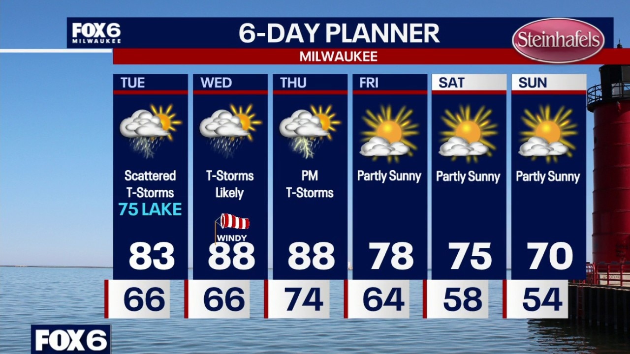
An isolated t-storm is possible overnight with patchy fog. Temperatures in the 60s. Scattered showers and t-storms (widespread) on Tuesday. Highs in the mid-70s near the lake, low 80s inland.
An isolated t-storm is possible overnight with patchy fog. Temperatures in the 60s. Scattered showers and t-storms (widespread) on Tuesday. Highs in the mid-70s near the lake, low 80s inland.
Milwaukee Weather: Isolated t-storm and fog overnight
An isolated t-storm is possible overnight with patchy fog. Temperatures in the 60s. Scattered showers and t-storms (widespread) on Tuesday. Highs in the mid-70s near the lake, low 80s inland.
An isolated t-storm is possible overnight with patchy fog. Temperatures in the 60s. Scattered showers and t-storms (widespread) on Tuesday. Highs in the mid-70s near the lake, low 80s inland.
Weather Webcast with Chief Meteorologist Tom Wachs
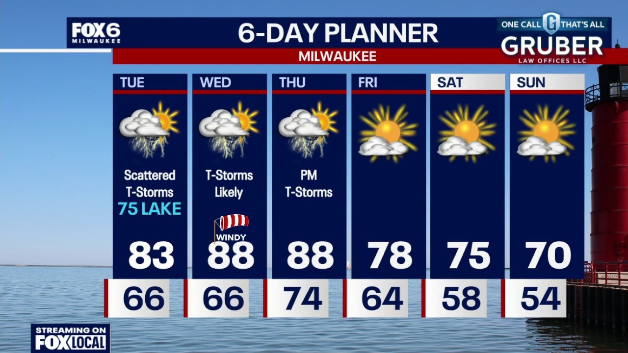
Scattered showers and t-storms tonight. Temperatures dropping into the 60s. Scattered showers and t-storms (widespread) on Tuesday. Highs in the mid-70s near the lake, low 80s inland.
Scattered showers and t-storms tonight. Temperatures dropping into the 60s. Scattered showers and t-storms (widespread) on Tuesday. Highs in the mid-70s near the lake, low 80s inland.
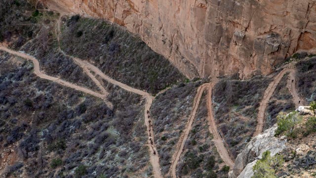

Teen hiker dies from heat-related illness at Grand Canyon National Park
An 18-year-old hiker died after suffering heat-related distress in Grand Canyon National Park. Here's what to know.
An 18-year-old hiker died after suffering heat-related distress in Grand Canyon National Park. Here's what to know.