


Snow postpones Sheboygan trick-or-treating
Halloween snow and a winter weather advisory pushed Sheboygan trick-or-treating back from Tuesday to Wednesday. Some braved the elements.
Halloween snow and a winter weather advisory pushed Sheboygan trick-or-treating back from Tuesday to Wednesday. Some braved the elements.
Weather Webcast with Tom Wachs
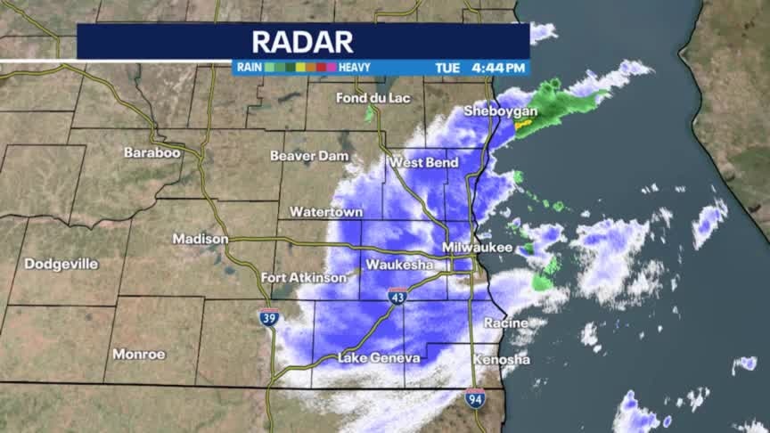
Snow ending this evening with skies rapidly clearing. Watch out for slick roads. Temperatures dropping into the 20s. Partly sunny on Wednesday with highs in the low 40s.
Snow ending this evening with skies rapidly clearing. Watch out for slick roads. Temperatures dropping into the 20s. Partly sunny on Wednesday with highs in the low 40s.

Another Wisconsin Halloween snow; just how rare is this?
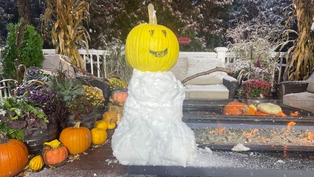
With snow reports over 3” in southeast Wisconsin, Halloween 2023 will go down as our second-snowiest Halloween on record.
With snow reports over 3” in southeast Wisconsin, Halloween 2023 will go down as our second-snowiest Halloween on record.

Halloween snow; winter weather advisory for lakeshore counties
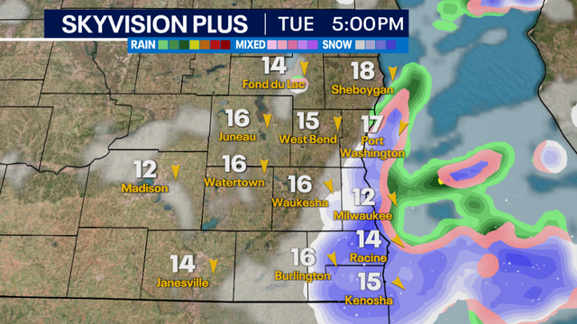
Scattered snow showers will continue at times this Halloween afternoon, with some peeks of sun in between. Snow showers may still reduce visibility at times and drop minor accumulation.
Scattered snow showers will continue at times this Halloween afternoon, with some peeks of sun in between. Snow showers may still reduce visibility at times and drop minor accumulation.
Weather webcast with Rob Haswell
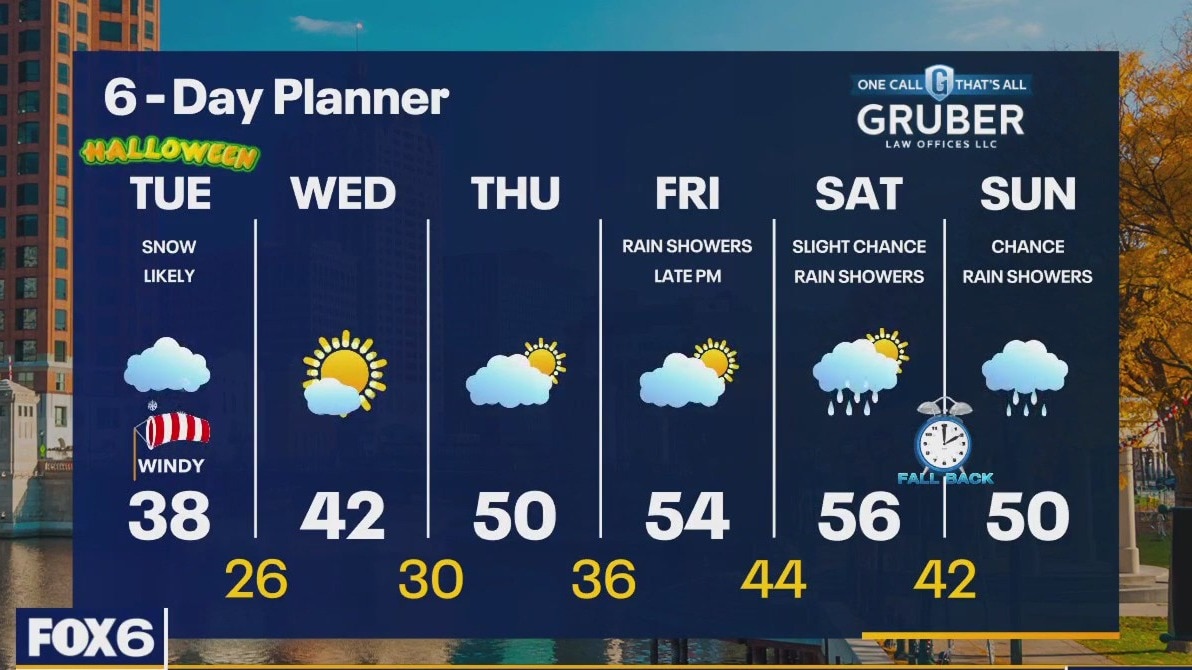
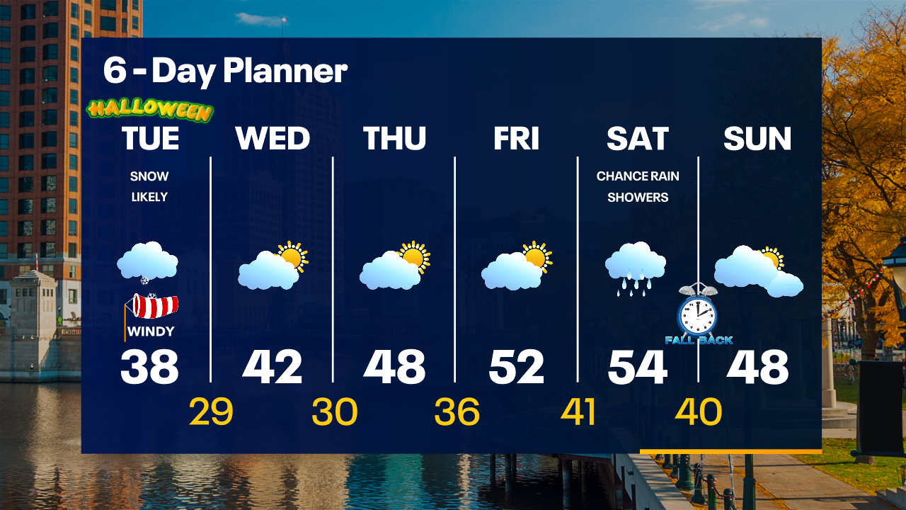
A fast moving low passes over our area today with snow showers likely this morning and through the afternoon. Accumulations should be around 1" in most areas. Snow will start around 5 a.m. in our western counties and closer to 7 a.m. for the Milwaukee city center areas. The morning commute will likely be significantly impacted. Take care. We dry up and clear up overnight with chilly lows expected. A sunny Wednesday warms us slightly with highs cracking the 40s again. We keep warming into the low 50s by late week. Rain showers return late Friday with a slight chance Saturday and a better chance on Sunday.
A fast moving low passes over our area today with snow showers likely this morning and through the afternoon. Accumulations should be around 1" in most areas. Snow will start around 5 a.m. in our western counties and closer to 7 a.m. for the Milwaukee city center areas. The morning commute will likely be significantly impacted. Take care. We dry up and clear up overnight with chilly lows expected. A sunny Wednesday warms us slightly with highs cracking the 40s again. We keep warming into the low 50s by late week. Rain showers return late Friday with a slight chance Saturday and a better chance on Sunday.
Weather Webcast with Tom Wachs
Snow starts between 5-8am. Scattered snow midday with another batch of snow mid-afternoon to early evening. Slick roads are possible along with accumulation and strong winds/low visibility.
Snow starts between 5-8am. Scattered snow midday with another batch of snow mid-afternoon to early evening. Slick roads are possible along with accumulation and strong winds/low visibility.
Weather Webcast with Tom Wachs
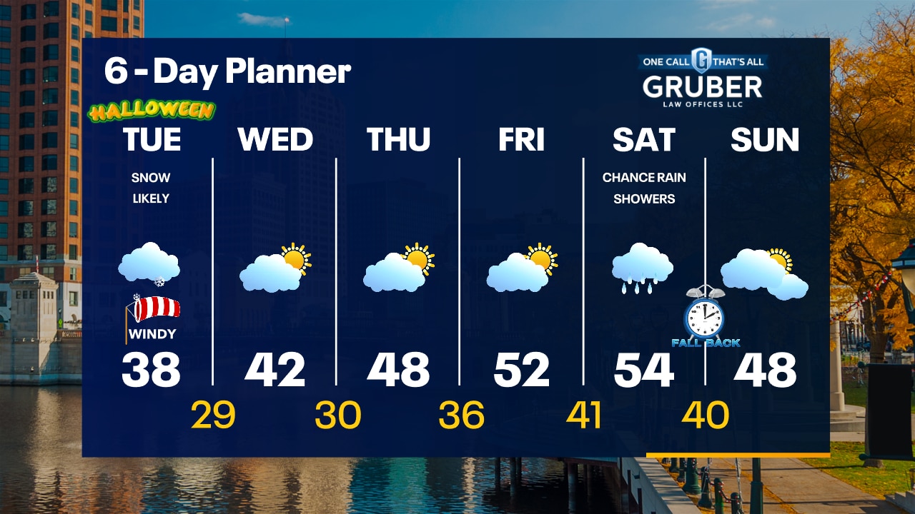
Clear and cold tonight with temperatures dropping into the 20s overnight. Snow moves in between 5-8am Tuesday with the first batch. It will become scattered midday with a possible additional band for the evening commute.
Clear and cold tonight with temperatures dropping into the 20s overnight. Snow moves in between 5-8am Tuesday with the first batch. It will become scattered midday with a possible additional band for the evening commute.
Weather webcast with Rob Haswell
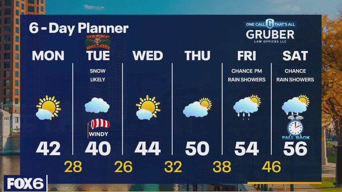
High pressure keeps us clear and cold today with morning lows below freezing and afternoon highs in the low 40s. We drop back into the 20s and low 30s overnight tonight and stay cold Tuesday with light snow expected. Around 1" of accumulation is expected. The snow won't last long as we warm back into the upper 40s Wednesday and low to mid 50s by the end of the week.
High pressure keeps us clear and cold today with morning lows below freezing and afternoon highs in the low 40s. We drop back into the 20s and low 30s overnight tonight and stay cold Tuesday with light snow expected. Around 1" of accumulation is expected. The snow won't last long as we warm back into the upper 40s Wednesday and low to mid 50s by the end of the week.
Weather Webcast with Tom Wachs
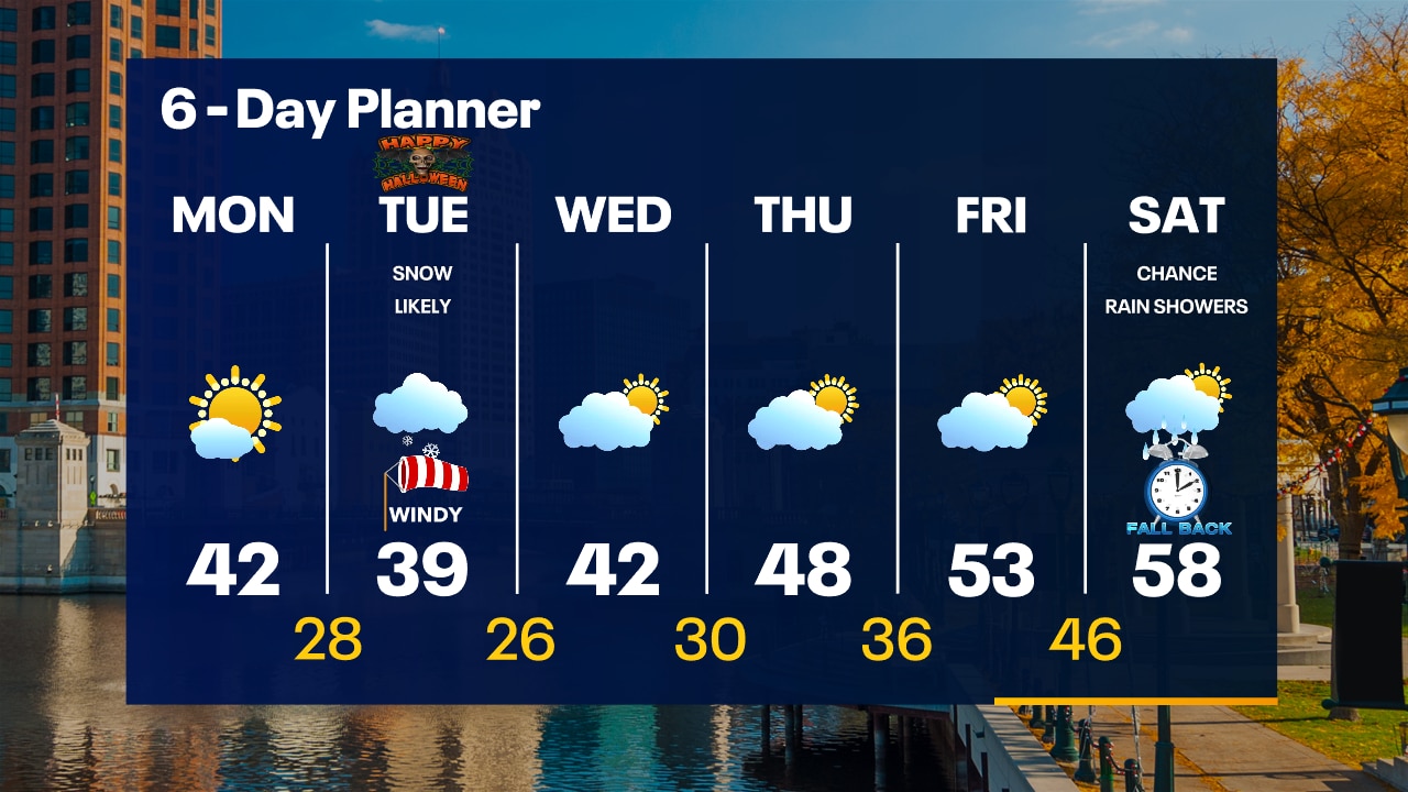
Freeze Warning overnight with temperatures in the 20s by sunrise. Mostly sunny on Monday with highs in the low 40s. Snow moves in Tuesday morning.
Freeze Warning overnight with temperatures in the 20s by sunrise. Mostly sunny on Monday with highs in the low 40s. Snow moves in Tuesday morning.


Hurricane Otis: Death toll rises to 48 as search, cleanup continue in Acapulco
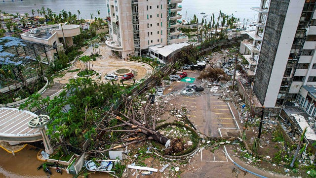
In Acapulco, families held funerals for the dead on Sunday and continued the search for essentials while government workers and volunteers cleared streets clogged with muck and debris.
In Acapulco, families held funerals for the dead on Sunday and continued the search for essentials while government workers and volunteers cleared streets clogged with muck and debris.

Weather Webcast with Tom Wachs
Freeze Warning overnight. Temperatures in the 20s by morning. Mostly sunny on Monday with highs in the low 40s. Up to 1" of snow possible on Tuesday with gusty northwest winds.
Freeze Warning overnight. Temperatures in the 20s by morning. Mostly sunny on Monday with highs in the low 40s. Up to 1" of snow possible on Tuesday with gusty northwest winds.
Weather webcast with Lisa Michaels
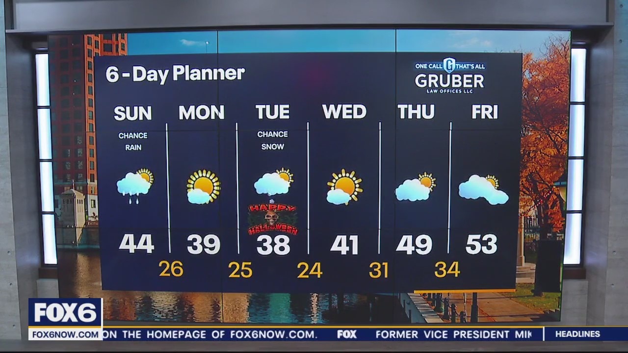
First hard freeze of the season-a freeze warning is in place from 8pm Sunday to 10am Monday. Temperatures in the mid 20s.
First hard freeze of the season-a freeze warning is in place from 8pm Sunday to 10am Monday. Temperatures in the mid 20s.
Weather webcast with Lisa Michaels
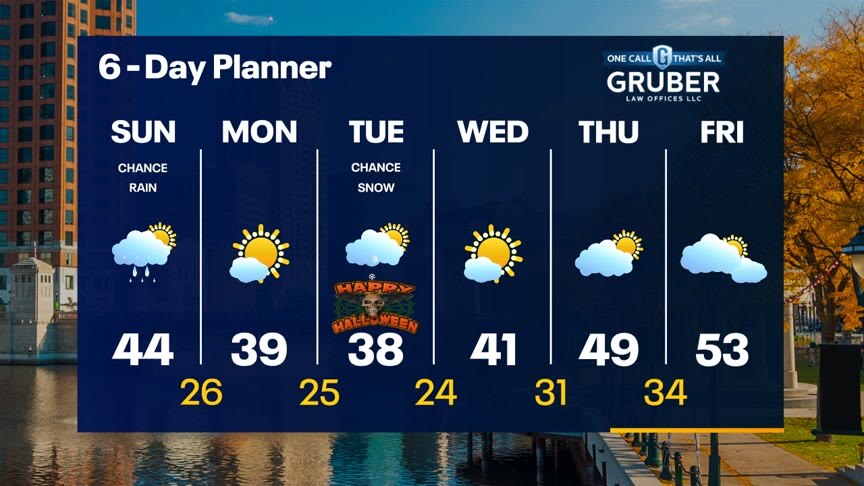
Mostly cloudy to cloudy skies return Sunday with a chance of a light drizzle/shower during the afternoon. A few flurries possible too. First hard freeze of the season-a freeze warning is in place from 8pm Sunday to 10am Monday. Temperatures in the mid 20s. Cold start to the week with snow showers in the forecast on Tuesday for Halloween. Minor accumulations are possible. Warmer temperatures will return back into the 50s by the end of the week.
Mostly cloudy to cloudy skies return Sunday with a chance of a light drizzle/shower during the afternoon. A few flurries possible too. First hard freeze of the season-a freeze warning is in place from 8pm Sunday to 10am Monday. Temperatures in the mid 20s. Cold start to the week with snow showers in the forecast on Tuesday for Halloween. Minor accumulations are possible. Warmer temperatures will return back into the 50s by the end of the week.
Weather Webcast with Meteorologist Eric Manges
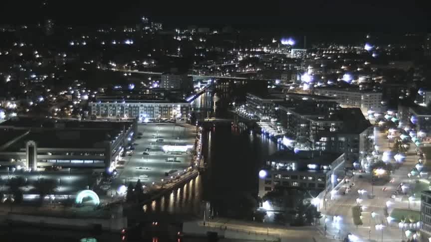
Colder air settles in Monday and snow chances on Halloween
Colder air settles in Monday and snow chances on Halloween
Weather webcast with Lisa Michaels
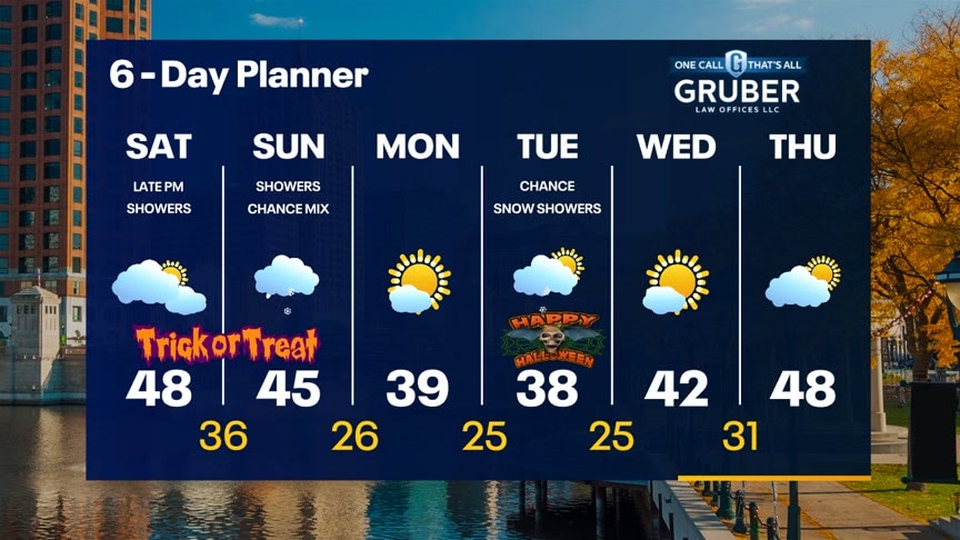
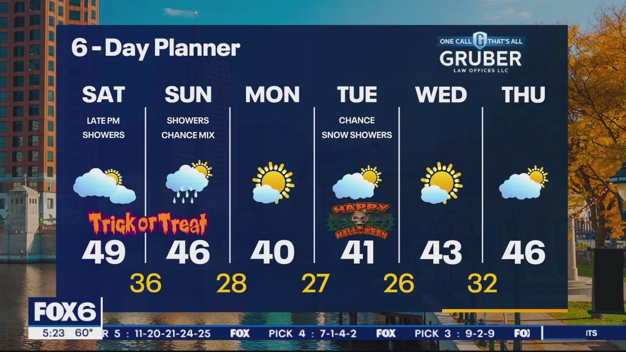
Chilly morning compared to this past week in the low to mid 30s. Some sunshine starting off Saturday with increasing clouds through the day. There is a small chance of a few showers tonight. Better chance Sunday of rain/snow mix especially near the lake. Cool temperatures stick around this weekend through the first half of next week.
Chilly morning compared to this past week in the low to mid 30s. Some sunshine starting off Saturday with increasing clouds through the day. There is a small chance of a few showers tonight. Better chance Sunday of rain/snow mix especially near the lake. Cool temperatures stick around this weekend through the first half of next week.
Weather Webcast with Meteorologist Eric Manges
Big temperature trend from this afternoon into tomorrow morning and this cool air is here to stay
Big temperature trend from this afternoon into tomorrow morning and this cool air is here to stay


See Hurricane Otis' widespread damage to Acapulco, Mexico through satellite images
The images reveal the extensive damage to the Pearl of the Pacific, which has resulted in the tragic loss of at least 27 lives. Four people were still missing at last check from Mexico’s Minister of Security and Civil Protection.
The images reveal the extensive damage to the Pearl of the Pacific, which has resulted in the tragic loss of at least 27 lives. Four people were still missing at last check from Mexico’s Minister of Security and Civil Protection.

Hurricane Otis: Mexican officials say supplies are getting into Acapulco, people are getting out
Mexican officials say they are moving supplies into Acapulco and getting people out of the devastated city three days after Hurricane Otis pummeled Mexico’s Pacific coast.
Mexican officials say they are moving supplies into Acapulco and getting people out of the devastated city three days after Hurricane Otis pummeled Mexico’s Pacific coast.
Weather webcast with Lisa Michaels
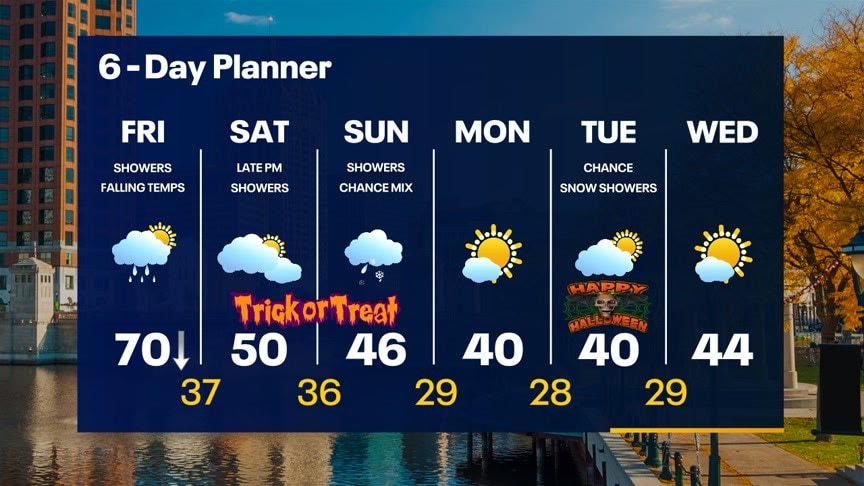
A cold front approaches the area today. Ahead of it, we stay mild with an early high near 70. Once it passes, temperatures fall rapidly. We should be in the 30s overnight. A few more showers and possibly an isolated thunderstorm as this front passes then we calm down for a few hours with showers returning late Saturday evening. More showers likely on Sunday and staying chilly through the weekend. Cold early next week with lows in the 20s and highs in the low 40s. Flurries possible Tuesday.
A cold front approaches the area today. Ahead of it, we stay mild with an early high near 70. Once it passes, temperatures fall rapidly. We should be in the 30s overnight. A few more showers and possibly an isolated thunderstorm as this front passes then we calm down for a few hours with showers returning late Saturday evening. More showers likely on Sunday and staying chilly through the weekend. Cold early next week with lows in the 20s and highs in the low 40s. Flurries possible Tuesday.


We Energies: Lower heating bills expected for customers this winter
We Energies announced on Friday, Oct. 27 that its customers should see lower heating bills this winter.
We Energies announced on Friday, Oct. 27 that its customers should see lower heating bills this winter.