

Weather Webcast with Stephanie Barichello
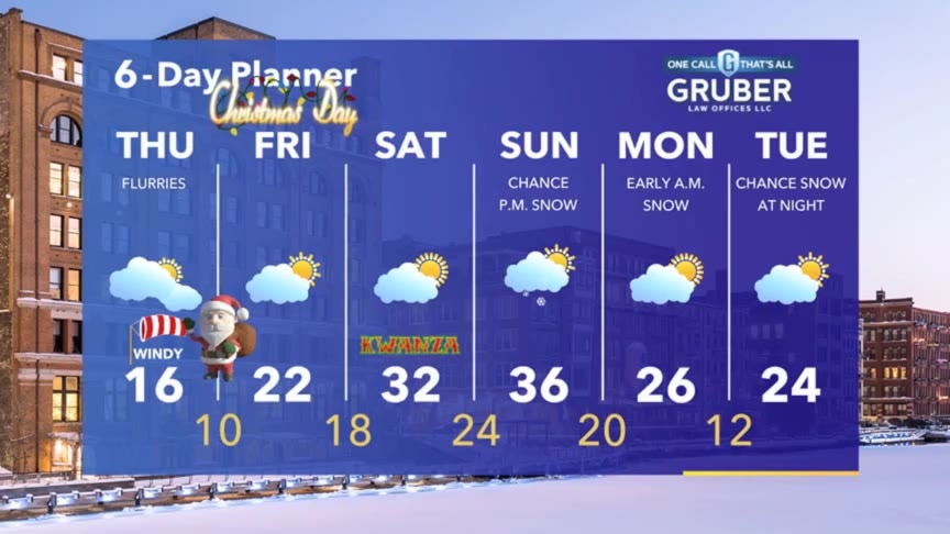
Temperatures drop all the way into the teens by Thursday morning. Flurries are possible overnight and Thursday then some sun, but still cold, for Christmas.
Temperatures drop all the way into the teens by Thursday morning. Flurries are possible overnight and Thursday then some sun, but still cold, for Christmas.
Weather webcast with Rob Haswell
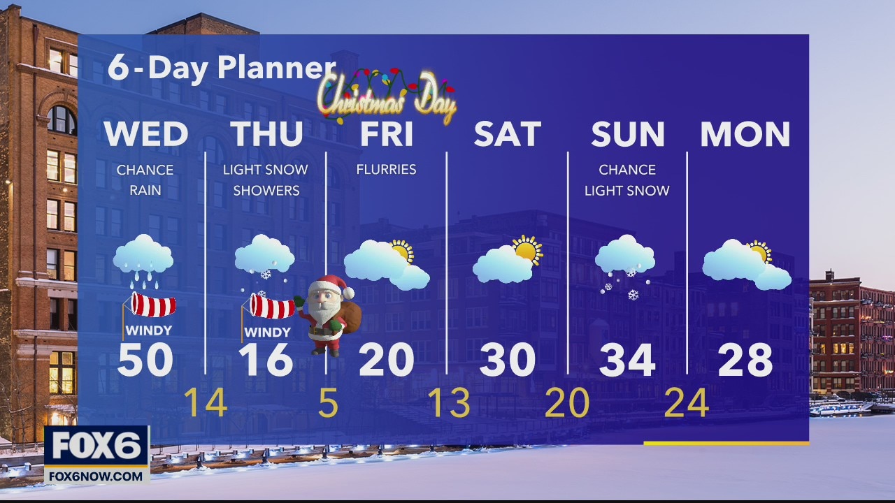
A strengthening low moves through today bringing us some light rain and windy conditions. Wind gusts today will be near 40mph. Temperatures will warm to near 50 this afternoon but as the low exits, colder air arrives and we drop into the teens overnight.
A strengthening low moves through today bringing us some light rain and windy conditions. Wind gusts today will be near 40mph. Temperatures will warm to near 50 this afternoon but as the low exits, colder air arrives and we drop into the teens overnight.
Weather Webcast with Tom Wachs
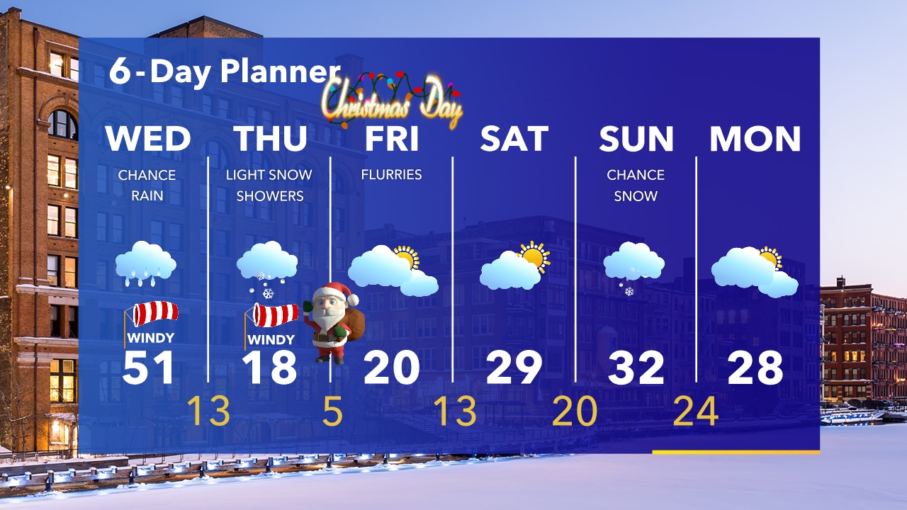
Windy with rising temperatures overnight. Windy and warm on Wednesday before light rain moves in later in the day. A few light snow showers on Wednesday night. Very cold Christmas Eve and Christmas Day.
Windy with rising temperatures overnight. Windy and warm on Wednesday before light rain moves in later in the day. A few light snow showers on Wednesday night. Very cold Christmas Eve and Christmas Day.
Weather Webcast with Tom Wachs
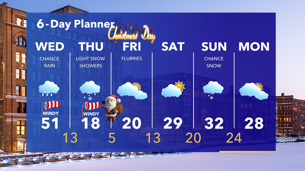
The wind will pick up tonight as temperatures rise. Windy and warm on Wednesday with afternoon rain and a few evening snow showers. Much colder Christmas Eve and Christmas Day.
The wind will pick up tonight as temperatures rise. Windy and warm on Wednesday with afternoon rain and a few evening snow showers. Much colder Christmas Eve and Christmas Day.
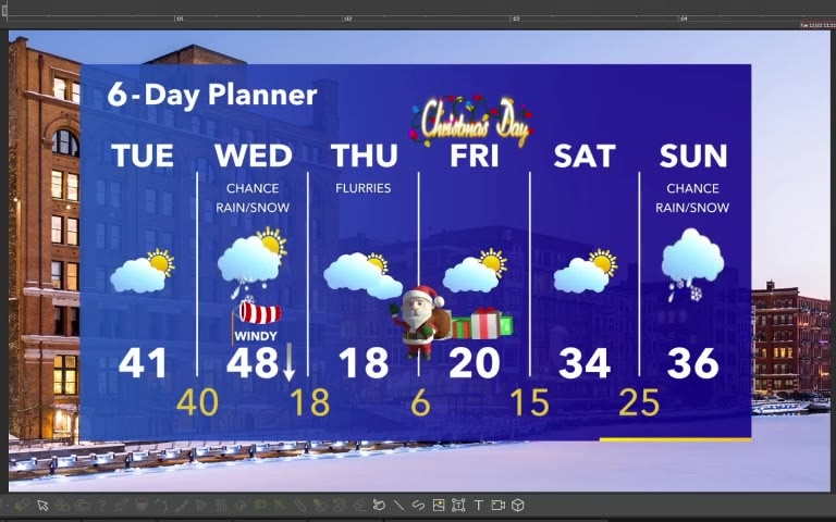
Forecast from Meteorologist Stephanie Barichello
Some sunshine this afternoon then a chance for rain and light snow on Wednesday. Much colder for Christmas Eve and Christmas Day.
Some sunshine this afternoon then a chance for rain and light snow on Wednesday. Much colder for Christmas Eve and Christmas Day.
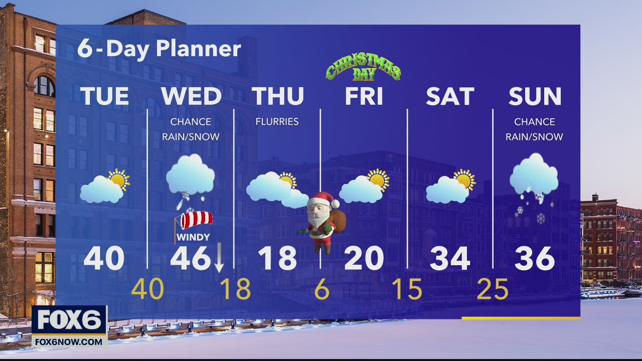
Weather webcast with Rob Haswell
A developing low slowly moves our way over the next couple of days. Ahead of that low we warm up and eventually get some rain and snow. Today we'll be partly cloudy and stay dry with a high near 40.
A developing low slowly moves our way over the next couple of days. Ahead of that low we warm up and eventually get some rain and snow. Today we'll be partly cloudy and stay dry with a high near 40.
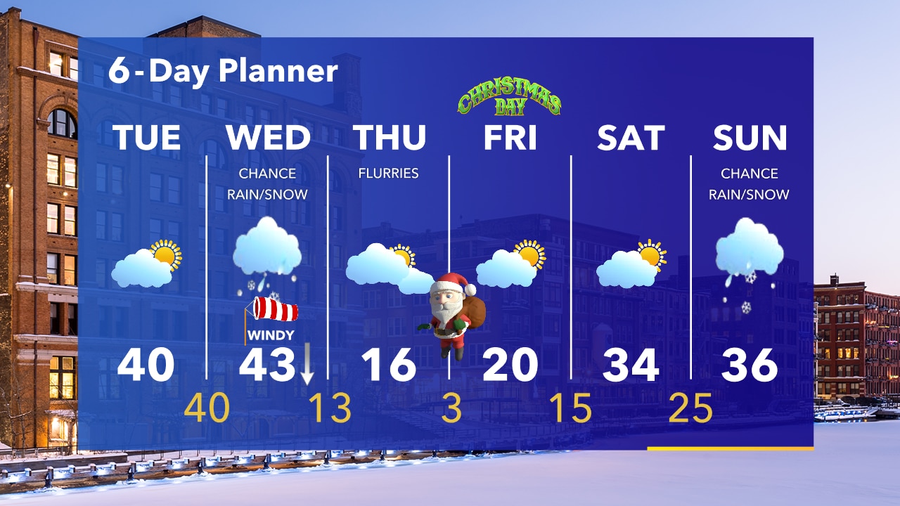
Weather Webcast with Tom Wachs
Clearing skies overnight. Temperatures dropping into the upper 20s to low 30s by sunrise. Partly sunny on Tuesday with a high around 40. Rain will change to snow during the day Wednesday as a sharp cold front swings through.
Clearing skies overnight. Temperatures dropping into the upper 20s to low 30s by sunrise. Partly sunny on Tuesday with a high around 40. Rain will change to snow during the day Wednesday as a sharp cold front swings through.
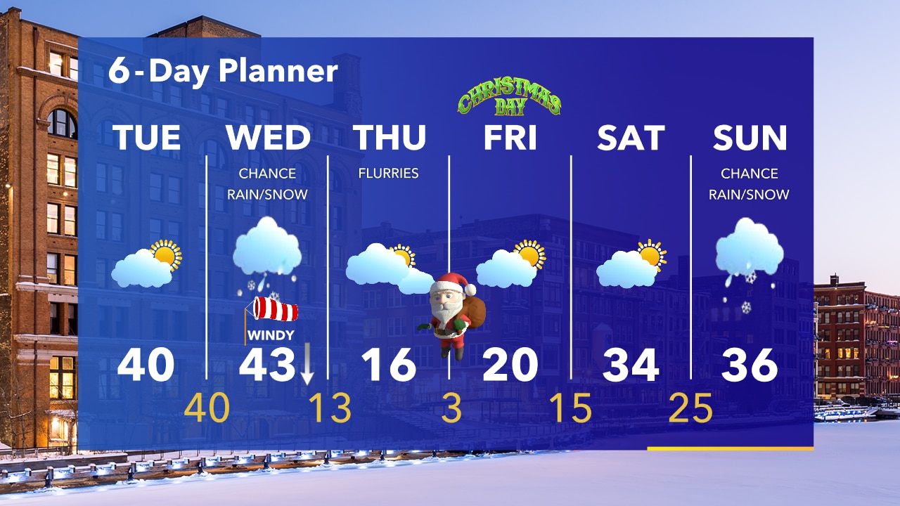
Weather Webcast with Tom Wachs
Light rain mixed with snow will taper off this evening. We will see some sun on Tuesday before a sharp cold front moves in Wednesday. This will mean some of the coldest temperatures since February for Christmas Eve and Christmas Day.
Light rain mixed with snow will taper off this evening. We will see some sun on Tuesday before a sharp cold front moves in Wednesday. This will mean some of the coldest temperatures since February for Christmas Eve and Christmas Day.
Forecast from Meteorologist Stephanie Barichello
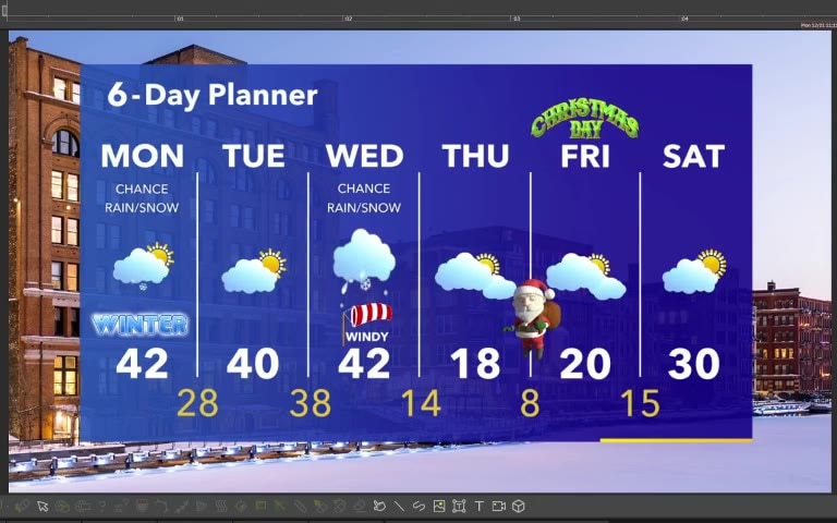
Starting off the first day of winter with mixed precip and temperatures around 40. Some sun Tuesday then another round of rain and snow Wednesday. Coldest air of the season so far for Christmas.
Starting off the first day of winter with mixed precip and temperatures around 40. Some sun Tuesday then another round of rain and snow Wednesday. Coldest air of the season so far for Christmas.

Weather webcast with Rob Haswell
An area of low pressure moves over northern Wisconsin today with the occluded front passing through our areas. Ahead of that front we could get some light rain and snow across southeastern Wisconsin. A light accumulation is possible causing slick roads in some areas.
An area of low pressure moves over northern Wisconsin today with the occluded front passing through our areas. Ahead of that front we could get some light rain and snow across southeastern Wisconsin. A light accumulation is possible causing slick roads in some areas.
Weather Webcast with Tom Wachs
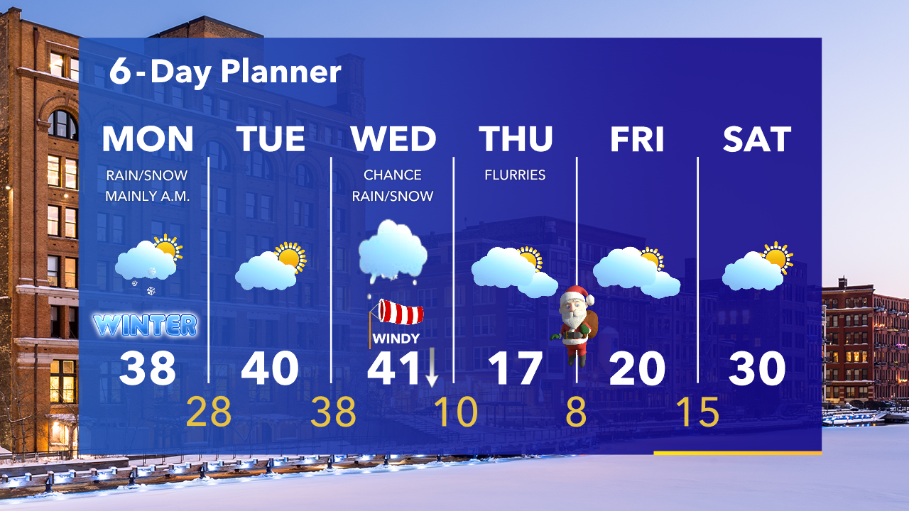
A few light snow showers (possibly mixed with rain) will move through from 4am-9am Monday, with scattered rain/snow showers Monday afternoon. There could be just enough snow in the morning for a few slick spots.
A few light snow showers (possibly mixed with rain) will move through from 4am-9am Monday, with scattered rain/snow showers Monday afternoon. There could be just enough snow in the morning for a few slick spots.
Weather Webcast with Tom Wachs
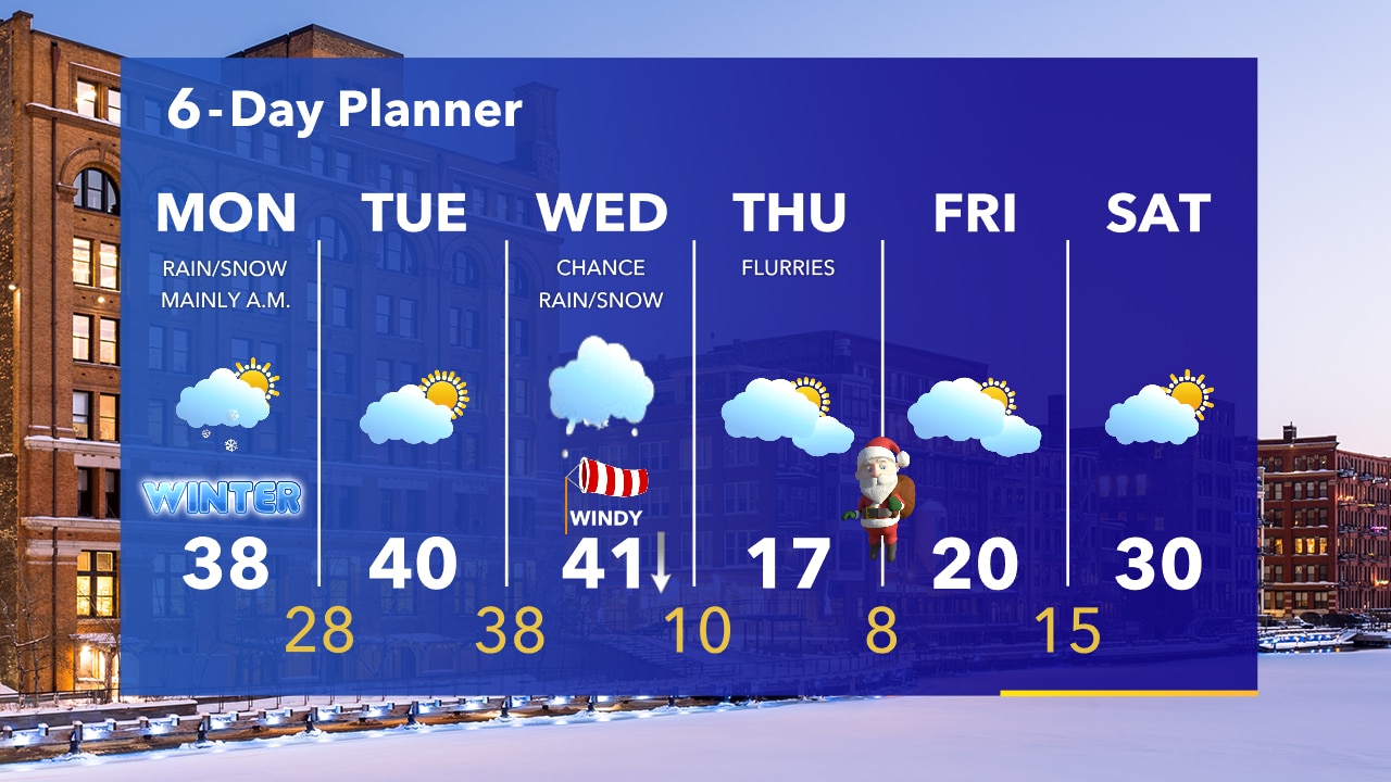
Light snow (possibly a rain/snow mix in spots) will move in after 4am. Roads could briefly become slick, as a few tenths of an inch of snow are possible in a short amount of time Monday morning.
Light snow (possibly a rain/snow mix in spots) will move in after 4am. Roads could briefly become slick, as a few tenths of an inch of snow are possible in a short amount of time Monday morning.
Weather Webcast with Eric Manges
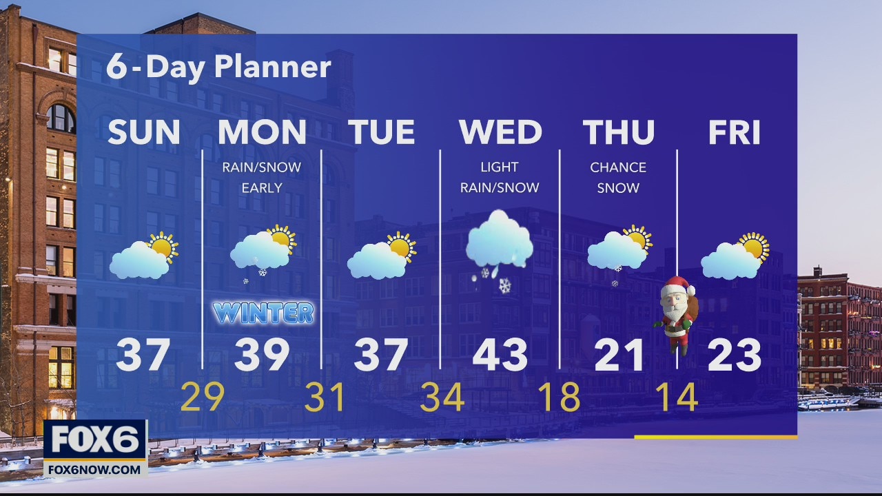
Chances of a white Christmas are looking pretty good, according to FOX6 Weather Expert Eric Manges.
Chances of a white Christmas are looking pretty good, according to FOX6 Weather Expert Eric Manges.
Weather Webcast with A.J. Waterman
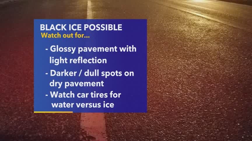
A few slick spots possible overnight (mainly untreated surfaces) then a partly to mostly cloudy day Sunday, with another chance of rain and snow Sunday night.
A few slick spots possible overnight (mainly untreated surfaces) then a partly to mostly cloudy day Sunday, with another chance of rain and snow Sunday night.
Weather Webcast with Eric Manges
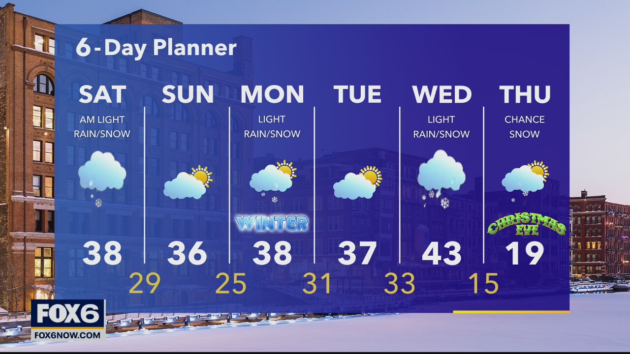
Will we have a white Christmas? Eric answers that in his forecast.
Will we have a white Christmas? Eric answers that in his forecast.
Weather Webcast with Stephanie Barichello
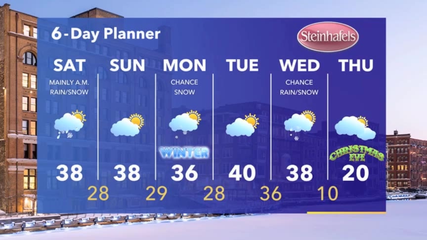
Light snow, mix and drizzle possible Saturday morning then drying out this weekend. A few more precip chances next week...
Light snow, mix and drizzle possible Saturday morning then drying out this weekend. A few more precip chances next week...
Weather Webcast with Stephanie Barichello
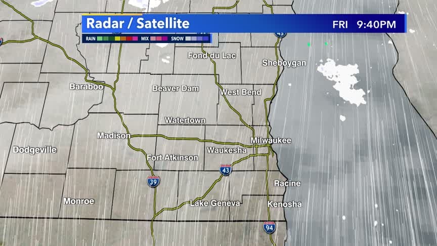
Some light rain, mix and snow expected Saturday morning then drying out the rest of the weekend. Mild with temperatures in the upper 30s. A few more chances for precip next week.
Some light rain, mix and snow expected Saturday morning then drying out the rest of the weekend. Mild with temperatures in the upper 30s. A few more chances for precip next week.
Weather Webcast with Stephanie Barichello
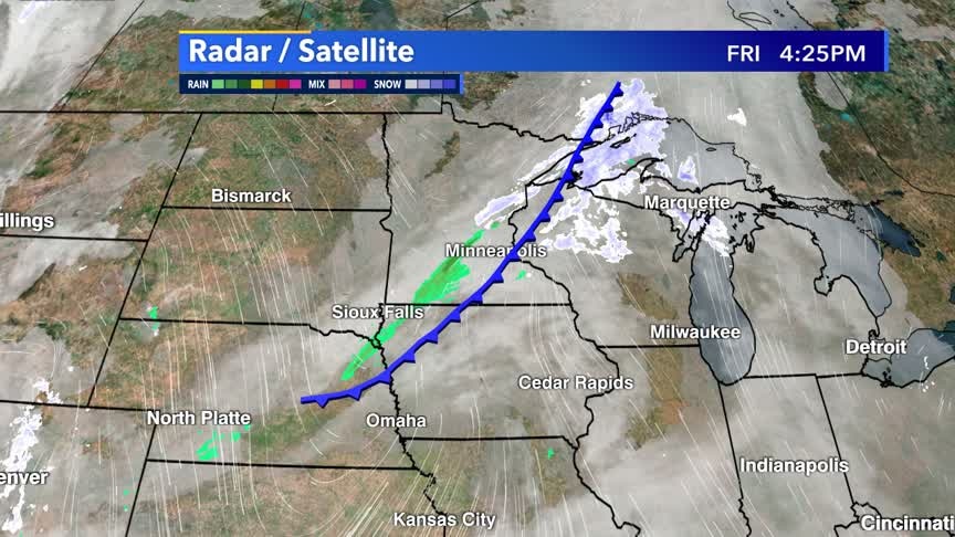
Light, mixed precip expected overnight into Saturday morning. Drying out the rest of the weekend. Another chance for some snow Monday and mix on Wednesday.
Light, mixed precip expected overnight into Saturday morning. Drying out the rest of the weekend. Another chance for some snow Monday and mix on Wednesday.
Weather webcast with Rob Haswell
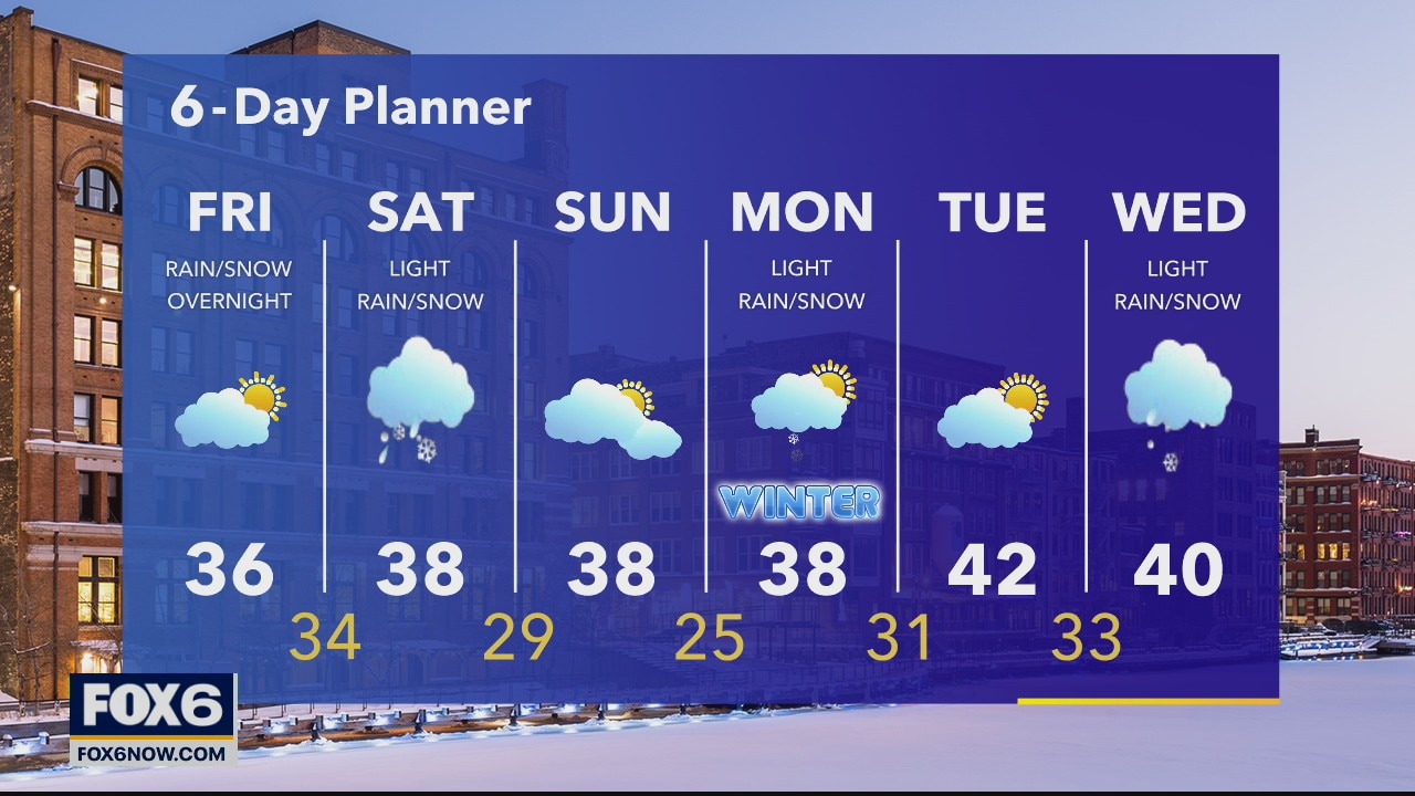
A bit of sun early today then the clouds returns. Highs will again be slightly above average in the mid to upper 30s. Light rain and snow showers are possible late tonight and into Saturday. Highs will be in the upper 30s again Saturday.
A bit of sun early today then the clouds returns. Highs will again be slightly above average in the mid to upper 30s. Light rain and snow showers are possible late tonight and into Saturday. Highs will be in the upper 30s again Saturday.
Weather Webcast with Tom Wachs
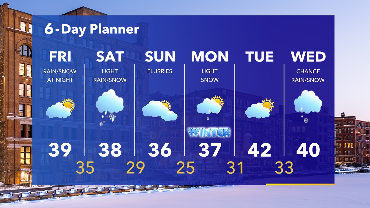
Clearing skies overnight with temperatures in the 20s. We will wake up to some sun on Friday before clouds increase. Highs near 40. Our next chance for a few rain/snow showers moves in Friday night into Saturday.
Clearing skies overnight with temperatures in the 20s. We will wake up to some sun on Friday before clouds increase. Highs near 40. Our next chance for a few rain/snow showers moves in Friday night into Saturday.