


Weather Webcast with Meteorologist Lisa Michaels
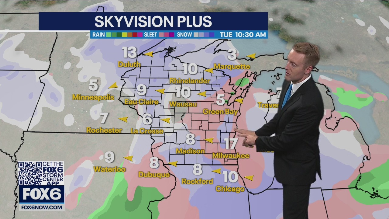
Chilly temperatures take over the weekend forecast. High temperatures will stay in the mid to upper 30s. Flurries and isolated snow showers today. Little to no accumulation expected. Another system comes in from the south will bring a mixture of rain/snow in our area. Minor accumulations are possible. Cold air holds in place across southeast Wisconsin. Highs stay in the 30s and lows in the 20s for the extended forecast.
Chilly temperatures take over the weekend forecast. High temperatures will stay in the mid to upper 30s. Flurries and isolated snow showers today. Little to no accumulation expected. Another system comes in from the south will bring a mixture of rain/snow in our area. Minor accumulations are possible. Cold air holds in place across southeast Wisconsin. Highs stay in the 30s and lows in the 20s for the extended forecast.
Weather Webcast
FOX6 News at 6
FOX6 News at 6

Weather Webcast with Meteorologist Stephanie Barichello
More sunshine this afternoon but MUCH colder compared to yesterday - in fact, most spots will be 35-40 degrees colder than yesterday. We drop into the 20s and 30s tonight then only climb into the middle and upper 30s Saturday and Sunday. Light snow and flurries possible Saturday.
More sunshine this afternoon but MUCH colder compared to yesterday - in fact, most spots will be 35-40 degrees colder than yesterday. We drop into the 20s and 30s tonight then only climb into the middle and upper 30s Saturday and Sunday. Light snow and flurries possible Saturday.
Weather webcast with Rob Haswell
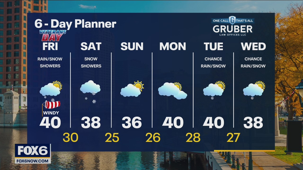
Rain showers and possibly a wintry mix this morning as a narrow line of precipitation finally makes its exit! Colder air continues to take over and temperatures fall to near 40 and stay in that range through the afternoon but feeling colder with a strong NW wind. More snow showers are likely on Saturday with cold air firmly in place. We should stay chilly but return to some sun for Sunday.
Rain showers and possibly a wintry mix this morning as a narrow line of precipitation finally makes its exit! Colder air continues to take over and temperatures fall to near 40 and stay in that range through the afternoon but feeling colder with a strong NW wind. More snow showers are likely on Saturday with cold air firmly in place. We should stay chilly but return to some sun for Sunday.
Weather Webcast with Tom Wachs
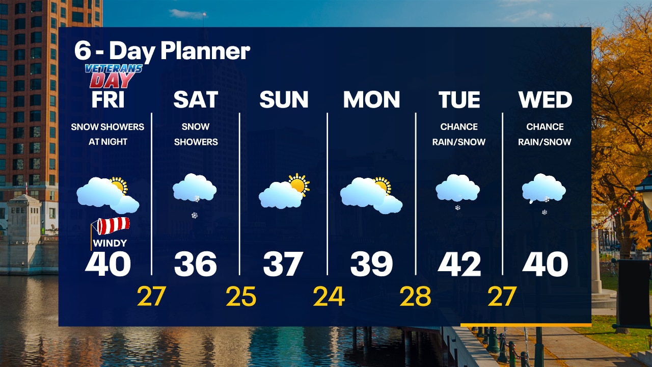
Areas of showers overnight as a cold front crosses. Temperatures in the upper 30s by sunrise. Mostly cloudy, cold and windy on Friday with a few flurries. High around 40. Snow showers late Friday night.
Areas of showers overnight as a cold front crosses. Temperatures in the upper 30s by sunrise. Mostly cloudy, cold and windy on Friday with a few flurries. High around 40. Snow showers late Friday night.
Weather Webcast with Tom Wachs
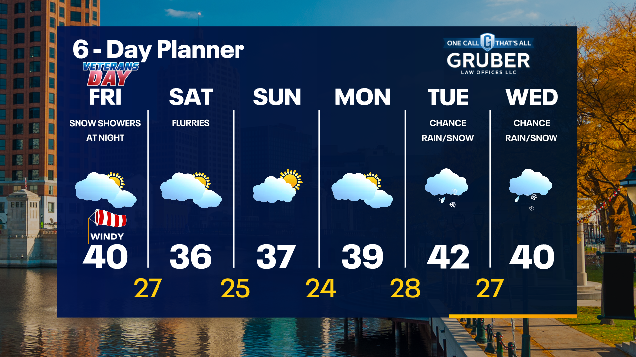
Windy tonight with a few showers and t-storms. A strong cold front comes through around midnight. Windy and cold on Friday with temperatures around 40 and wind chills in the 20s/30s.
Windy tonight with a few showers and t-storms. A strong cold front comes through around midnight. Windy and cold on Friday with temperatures around 40 and wind chills in the 20s/30s.

Weather Webcast with Meteorologist Stephanie Barichello
Record-breaking warmth today then a big drop in temperatures tomorrow, on into next week. Showers and thunderstorms possible this evening and overnight, then some light snow possible as the system exits early Friday. A few flurries the rest of Friday and Saturday.
Record-breaking warmth today then a big drop in temperatures tomorrow, on into next week. Showers and thunderstorms possible this evening and overnight, then some light snow possible as the system exits early Friday. A few flurries the rest of Friday and Saturday.
Weather webcast with Rob Haswell
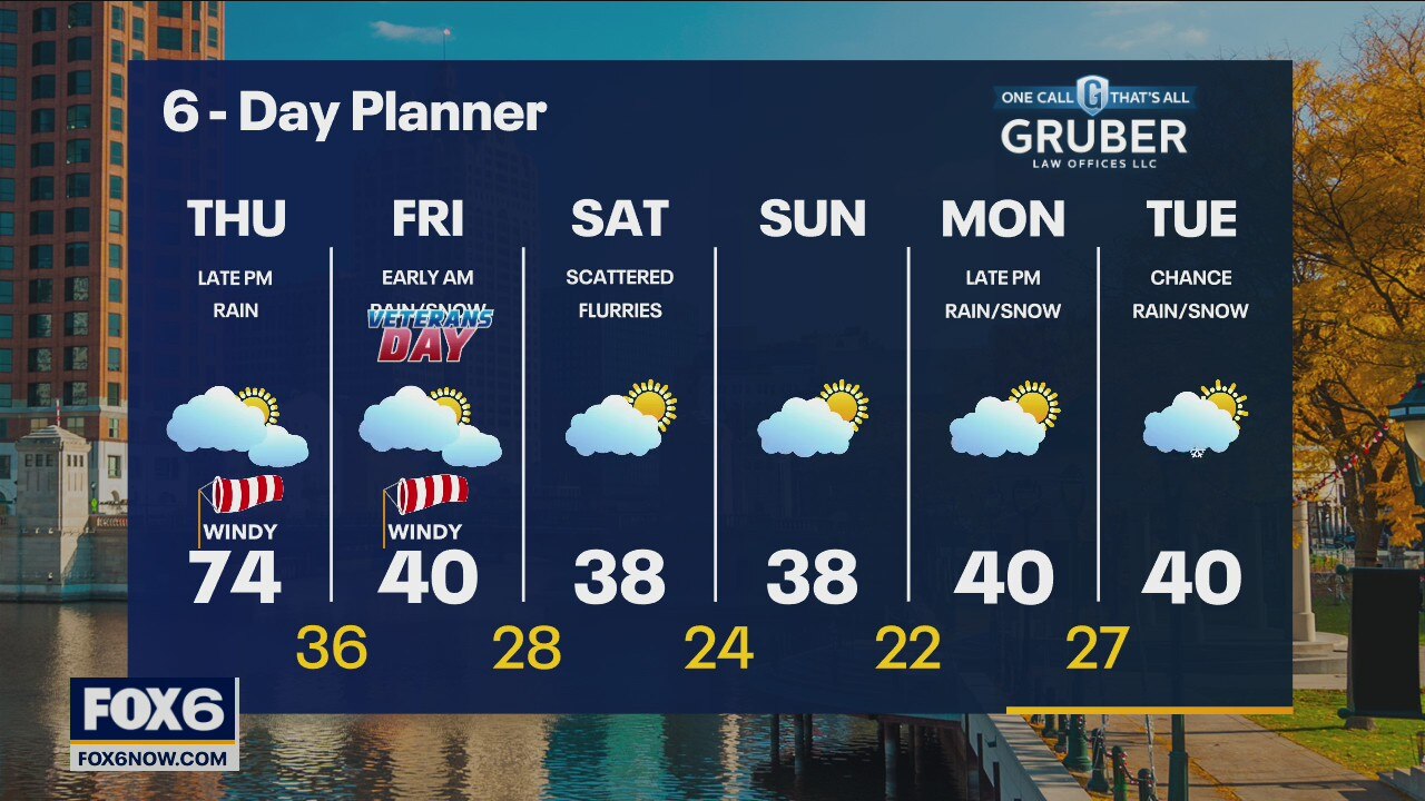
Partly to mostly cloudy but warm today with a high in the low to mid 70s! A strong SW wind all day gusts to 35 mph at times. Rain and a slight chance for thunderstorms arrives this evening and slowly moves east overnight. A times we may see a wintry mix as temperatures fall into early Friday morning. Much colder behind that cold front with highs in the upper 30s and low 40s From Friday through early next week.
Partly to mostly cloudy but warm today with a high in the low to mid 70s! A strong SW wind all day gusts to 35 mph at times. Rain and a slight chance for thunderstorms arrives this evening and slowly moves east overnight. A times we may see a wintry mix as temperatures fall into early Friday morning. Much colder behind that cold front with highs in the upper 30s and low 40s From Friday through early next week.
Weather Webcast with Tom Wachs
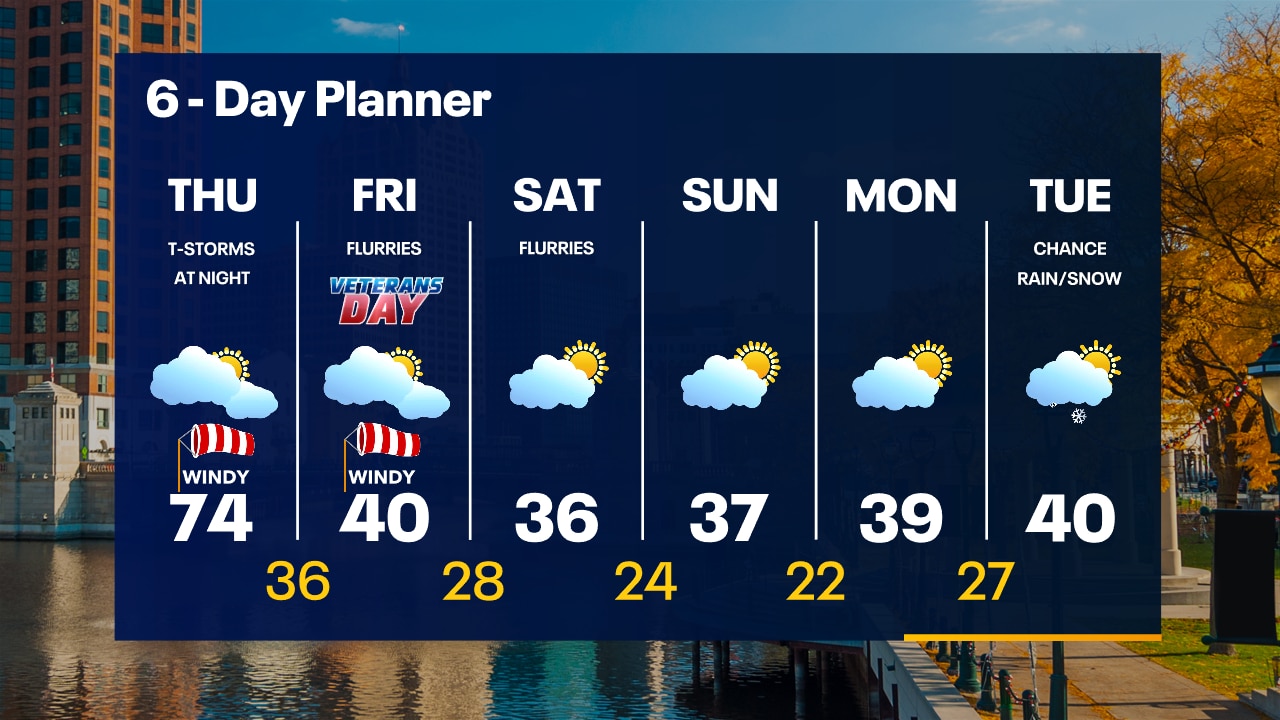
Partly cloudy and mild overnight with temperatures in the 50s. Windy and warm on Thursday with a record-tying high of 74. A few t-storms are possible Thursday night.
Partly cloudy and mild overnight with temperatures in the 50s. Windy and warm on Thursday with a record-tying high of 74. A few t-storms are possible Thursday night.
Weather Webcast with Tom Wachs
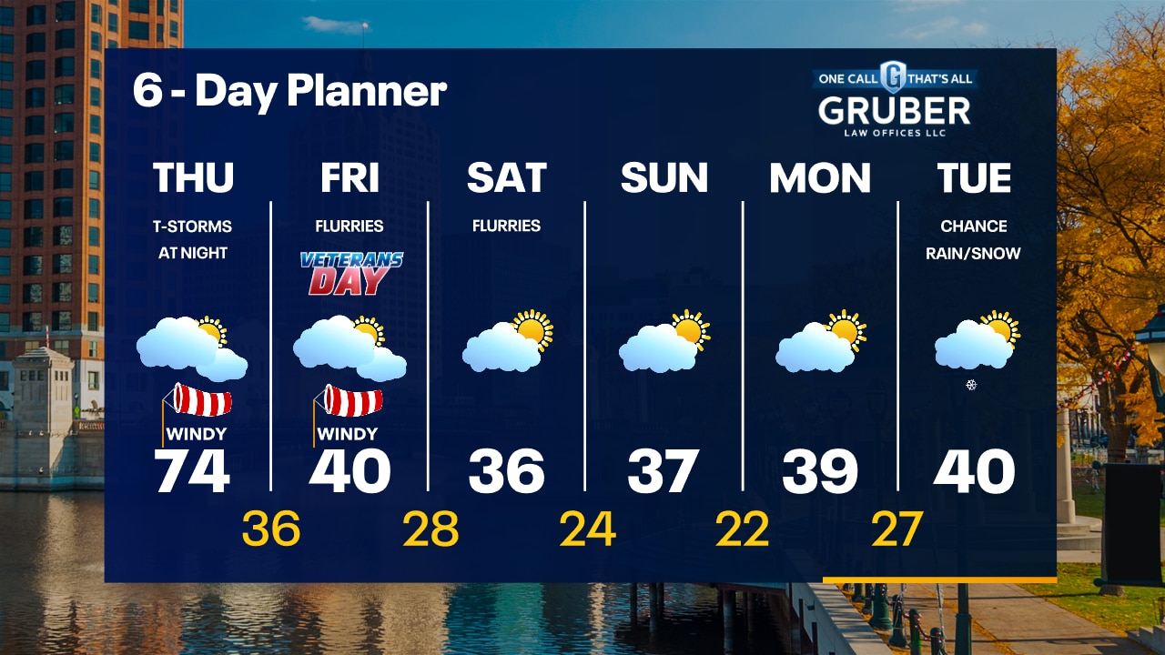
Quiet and mild tonight with temperatures in the upper 50s. Partly to mostly cloudy on Thursday with a record-tying high of 74. T-Storms possible Thursday night.
Quiet and mild tonight with temperatures in the upper 50s. Partly to mostly cloudy on Thursday with a record-tying high of 74. T-Storms possible Thursday night.

Weather Webcast with Meteorologist Stephanie Barichello
Partly sunny and warm this afternoon then even warmer Thursday! Showers and storms return Thursday afternoon then a few flurries Friday into the weekend, plus MUCH colder in the 30s.
Partly sunny and warm this afternoon then even warmer Thursday! Showers and storms return Thursday afternoon then a few flurries Friday into the weekend, plus MUCH colder in the 30s.

Weather webcast with Rob Haswell
A warm front lifts to the north of us today and with a strong ridge of high pressure to the east, we warm up nicely on a strong SW wind. Highs today will get into the mid 60s and warm to the low 70s tomorrow. A stronger cold front arrives Thursday night into Friday and temperatures go into freefall with highs in the low 40s Friday and 30s for the weekend and into early next week.
A warm front lifts to the north of us today and with a strong ridge of high pressure to the east, we warm up nicely on a strong SW wind. Highs today will get into the mid 60s and warm to the low 70s tomorrow. A stronger cold front arrives Thursday night into Friday and temperatures go into freefall with highs in the low 40s Friday and 30s for the weekend and into early next week.
Weather Webcast with Tom Wachs
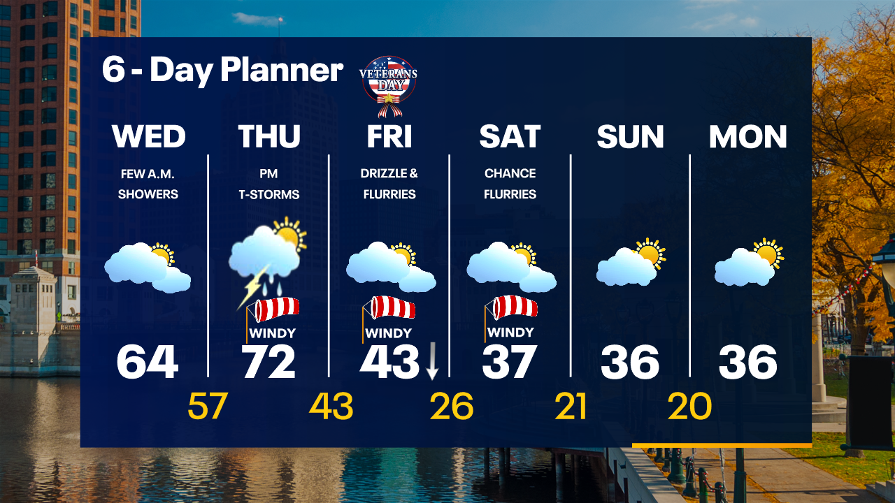
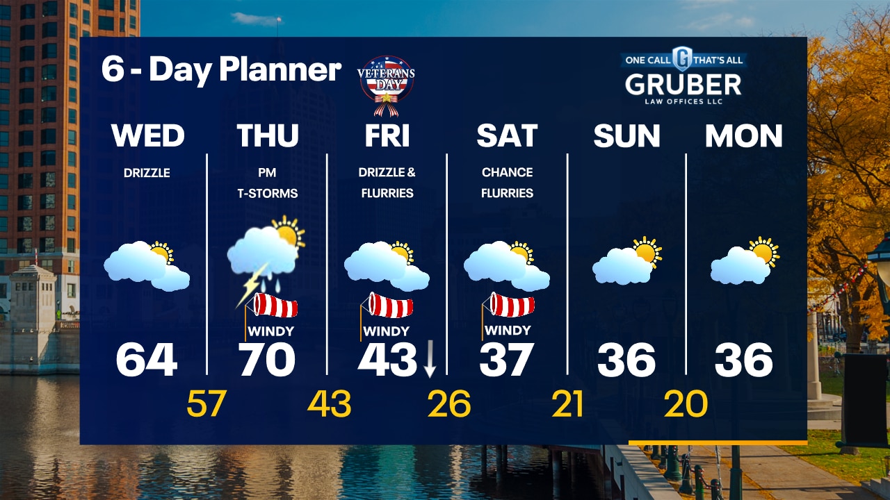
Partly cloudy and breezy overnight with temperatures in the 40s. Mostly cloudy with a few spotty morning light rain showers. Otherwise mostly cloudy, breezy and warmer with highs in the 60s.
Partly cloudy and breezy overnight with temperatures in the 40s. Mostly cloudy with a few spotty morning light rain showers. Otherwise mostly cloudy, breezy and warmer with highs in the 60s.
Weather Webcast
Cold air moves in by the weekend
Cold air moves in by the weekend
Weather Webcast With Lisa Michaels
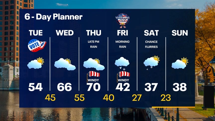
High pressure keeps weather quiet in our area today. Highs will be slightly warmer in the low to middle 50s under partly sunny skies. A warm front from a stronger low passes to our north Wednesday pushing highs into the mid to upper 60s and near 70 by Thursday. A cold front pushes in by Friday bringing a very chilly air mass. Chances of snowflakes are possible into the weekend. Cold temperatures in the 30s take over the weekend.
High pressure keeps weather quiet in our area today. Highs will be slightly warmer in the low to middle 50s under partly sunny skies. A warm front from a stronger low passes to our north Wednesday pushing highs into the mid to upper 60s and near 70 by Thursday. A cold front pushes in by Friday bringing a very chilly air mass. Chances of snowflakes are possible into the weekend. Cold temperatures in the 30s take over the weekend.
Weather webcast with Rob Haswell
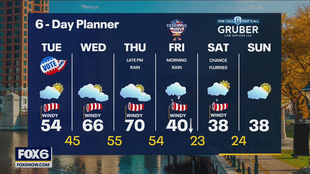
A Polar high continues to move east allowing us to warm a little today with highs in the low to mid 50s under partly sunny skies. A warm front from a stronger low passes to our north Wednesday pushing highs into the mid to upper 60s and near 70 by Thursday. The trailing cold front arrives by Friday morning bringing much colder air and a chance for showers.
A Polar high continues to move east allowing us to warm a little today with highs in the low to mid 50s under partly sunny skies. A warm front from a stronger low passes to our north Wednesday pushing highs into the mid to upper 60s and near 70 by Thursday. The trailing cold front arrives by Friday morning bringing much colder air and a chance for showers.
Weather Webcast with Tom Wachs
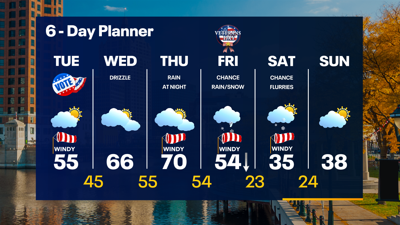
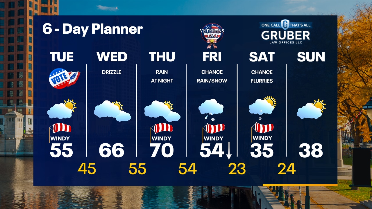
A Total Lunar Eclipse will occur at 5am Tuesday as the full moon is fully enveloped in the Earth's shadow. Partly sunny on Tuesday and windy with highs in the middle 50s.
A Total Lunar Eclipse will occur at 5am Tuesday as the full moon is fully enveloped in the Earth's shadow. Partly sunny on Tuesday and windy with highs in the middle 50s.
Weather Webcast with Tom Wachs
Partly cloudy tonight with temperatures in the 30s. A Total Lunar Eclipse will happen at 5am Tuesday. Partly sunny and windy on Tuesday with highs in the middle 50s.
Partly cloudy tonight with temperatures in the 30s. A Total Lunar Eclipse will happen at 5am Tuesday. Partly sunny and windy on Tuesday with highs in the middle 50s.
Weather Webcast with Meteorologist Stephanie Barichello
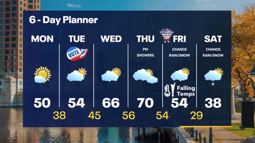
Sunny and seasonable for a few days then warming Wednesday into Thursday. A big system will bring a chance for rain/snow and dropping temperatures by the weekend.
Sunny and seasonable for a few days then warming Wednesday into Thursday. A big system will bring a chance for rain/snow and dropping temperatures by the weekend.
Weather webcast with Rob Haswell
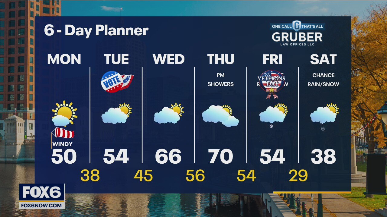
A cooler area of high pressure settles in for the next couple of days keeping us dry and calm with at least partly sunny conditions. Highs today will be a bit on the cooler side but return to near average for Tuesday. A warm front pushes to our north midweek and helps us warm into the upper 60s and near 70s Wednesday and Thursday.
A cooler area of high pressure settles in for the next couple of days keeping us dry and calm with at least partly sunny conditions. Highs today will be a bit on the cooler side but return to near average for Tuesday. A warm front pushes to our north midweek and helps us warm into the upper 60s and near 70s Wednesday and Thursday.