

Weather Webcast with Tom Wachs
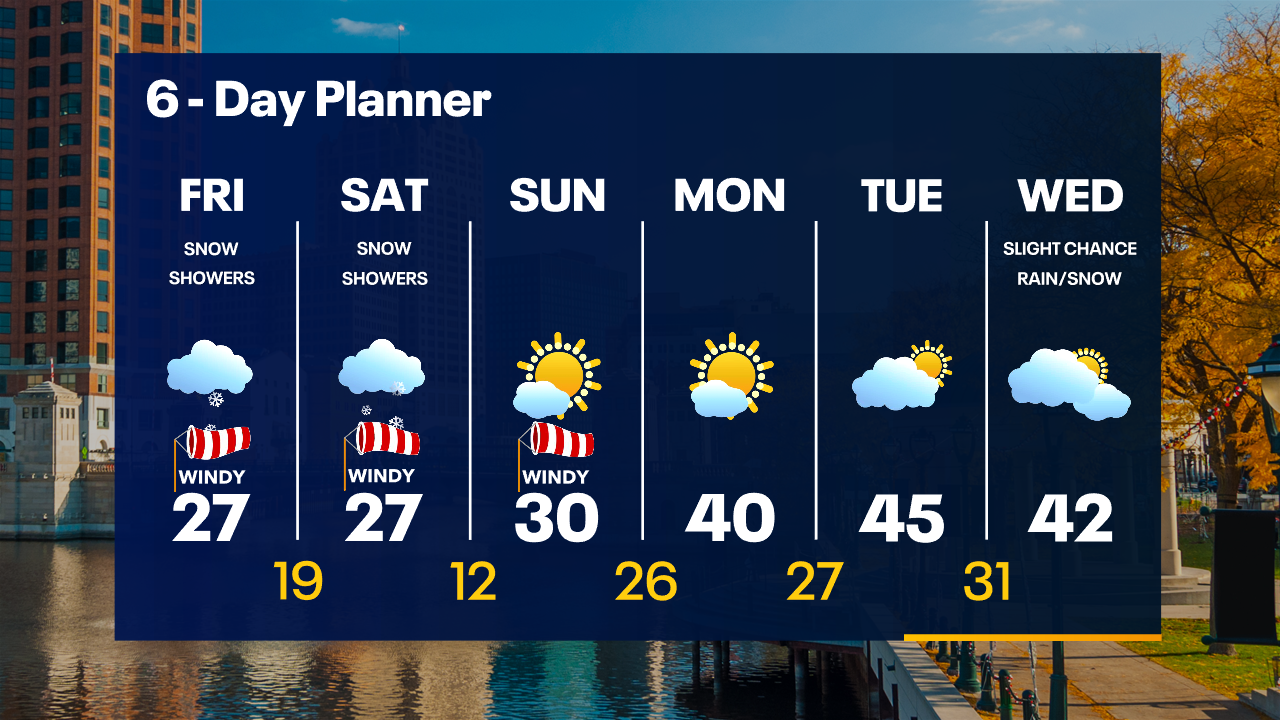
Snow showers ending overnight BUT roads are slick. Multiple accidents have been reported, please use caution. More snow showers are possible Friday afternoon with highs in the 20s and wind chills in the teens.
Snow showers ending overnight BUT roads are slick. Multiple accidents have been reported, please use caution. More snow showers are possible Friday afternoon with highs in the 20s and wind chills in the teens.
Weather Webcast with Tom Wachs
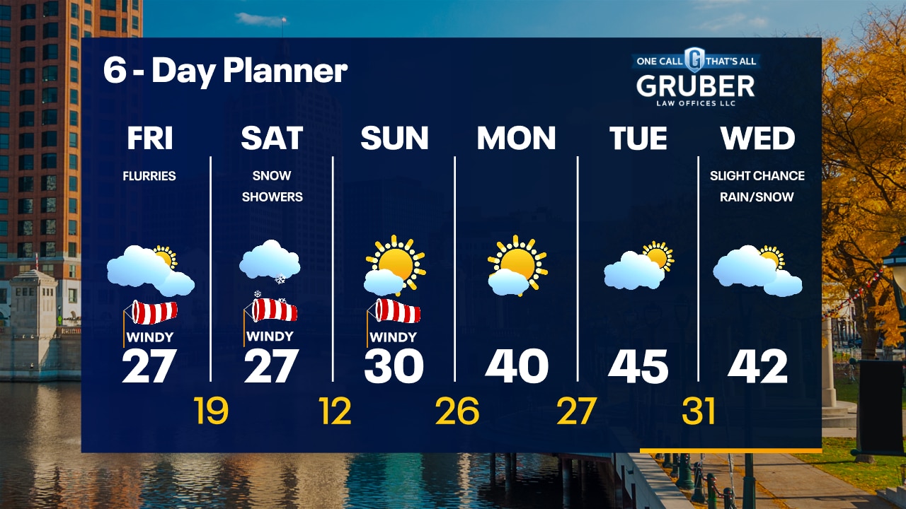
Scattered snow showers tapering off this evening. Windy and cold. Wind chills in the single digits by morning. Mostly cloudy with a few flurries on Friday with highs in the 20s.
Scattered snow showers tapering off this evening. Windy and cold. Wind chills in the single digits by morning. Mostly cloudy with a few flurries on Friday with highs in the 20s.
Weather Webcast with Meteorologist Stephanie Barichello
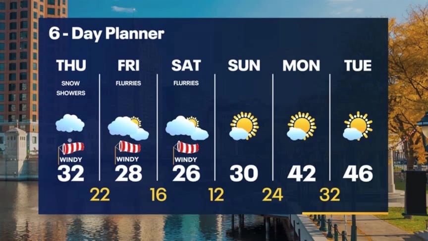
Scattered snow showers today, plus blustery and cold, with more of the day through the weekend. Warming up with more sunshine by early next week.
Scattered snow showers today, plus blustery and cold, with more of the day through the weekend. Warming up with more sunshine by early next week.
Weather webcast with Rob Haswell
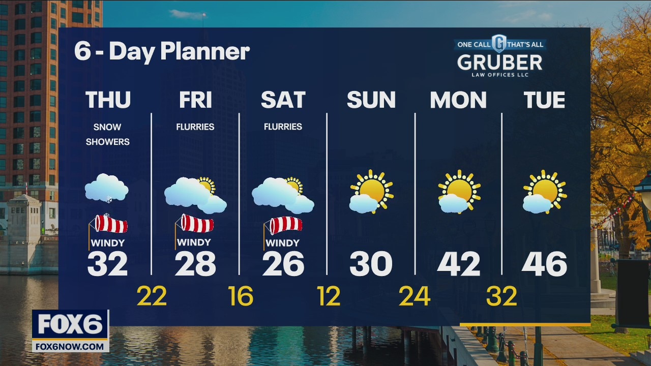
We stay on the cloudy side for the next few days with a chance for a few snow showers today and a few flurries Friday and Saturday. Highs today will be in the low 30s but even colder air arrives by Friday with highs in the 20s into the weekend and low temperatures in record territory as some inland areas may fall to single digits.
We stay on the cloudy side for the next few days with a chance for a few snow showers today and a few flurries Friday and Saturday. Highs today will be in the low 30s but even colder air arrives by Friday with highs in the 20s into the weekend and low temperatures in record territory as some inland areas may fall to single digits.

Weather Webcast with Tom Wachs
A few snow showers are possible overnight with temperatures in the 20s. Windy and cold on Thursday with afternoon scattered snow showers. Reduced visibility possible at times.
A few snow showers are possible overnight with temperatures in the 20s. Windy and cold on Thursday with afternoon scattered snow showers. Reduced visibility possible at times.
Weather Webcast with Tom Wachs
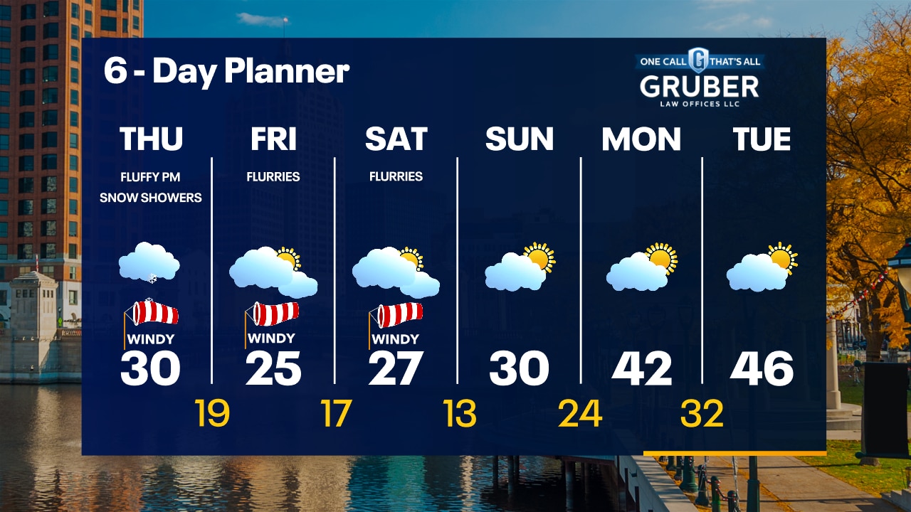
Mostly cloudy and chilly tonight with temperatures falling into the 20s. Windy on Thursday with highs around 30 and wind chills in the teens. Fluffy snow showers are expected on Thursday afternoon.
Mostly cloudy and chilly tonight with temperatures falling into the 20s. Windy on Thursday with highs around 30 and wind chills in the teens. Fluffy snow showers are expected on Thursday afternoon.
Weather Webcast with Meteorologist Stephanie Barichello
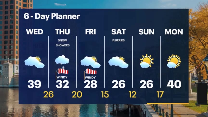
Peeks of sunshine today then another round of scattered snow showers on the Thursday afternoon. Up to 1" of accumulation will be possible. Very cold Friday into the weekend. Record lows in the teens likely over the weekend.
Peeks of sunshine today then another round of scattered snow showers on the Thursday afternoon. Up to 1" of accumulation will be possible. Very cold Friday into the weekend. Record lows in the teens likely over the weekend.
Weather webcast with Rob Haswell
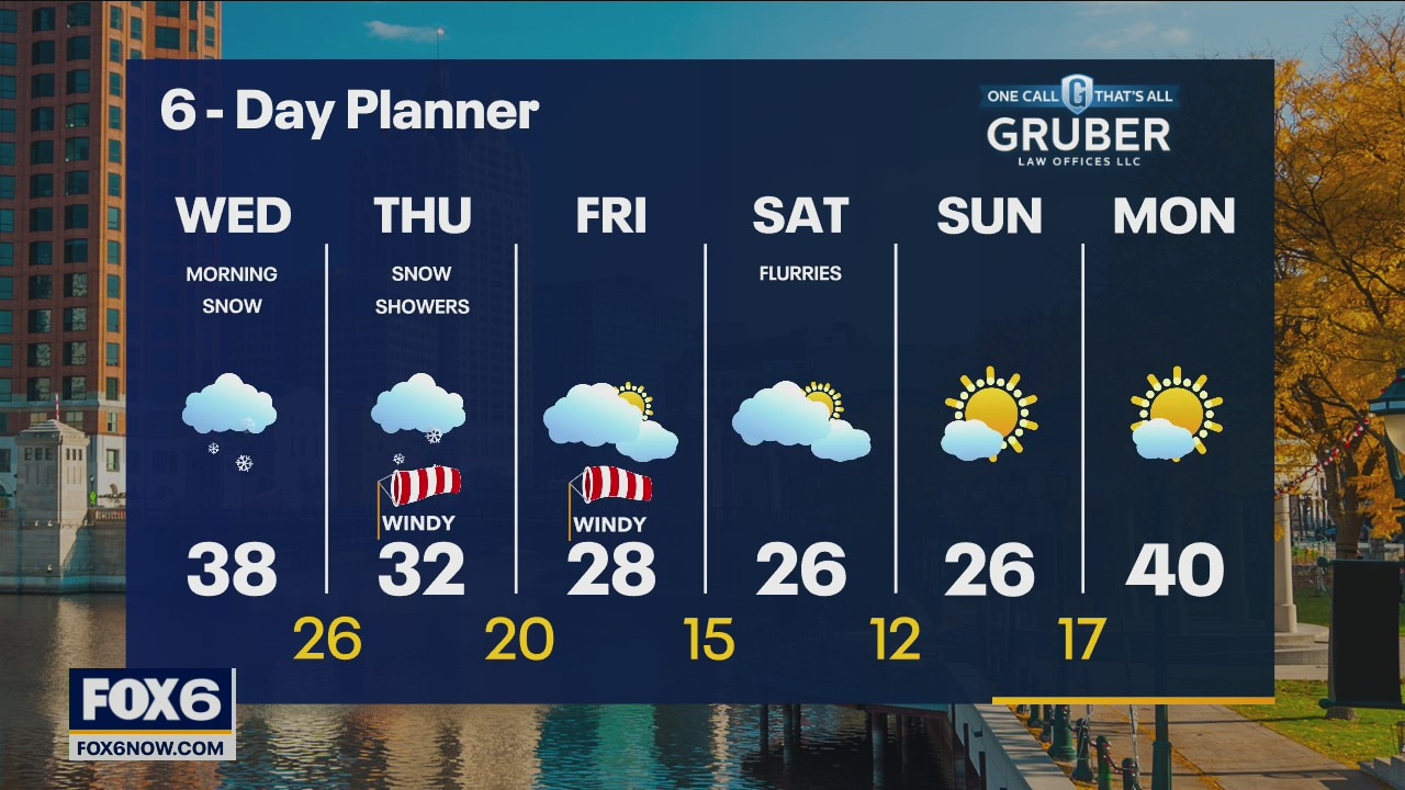
Morning rain and snow showers likely with a chance for a band of lake effect snow to develop. We should dry up this afternoon. We should see a few more snow showers on Thursday with less than an inch of accumulation likely. Highs will be in the 30s today and tomorrow but fall into the 20s with lows in the low teens from Friday through Sunday.
Morning rain and snow showers likely with a chance for a band of lake effect snow to develop. We should dry up this afternoon. We should see a few more snow showers on Thursday with less than an inch of accumulation likely. Highs will be in the 30s today and tomorrow but fall into the 20s with lows in the low teens from Friday through Sunday.
Weather Webcast with Tom Wachs
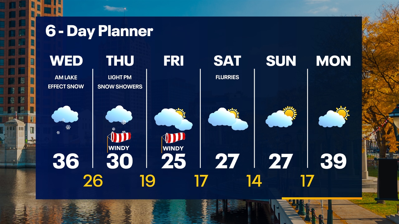
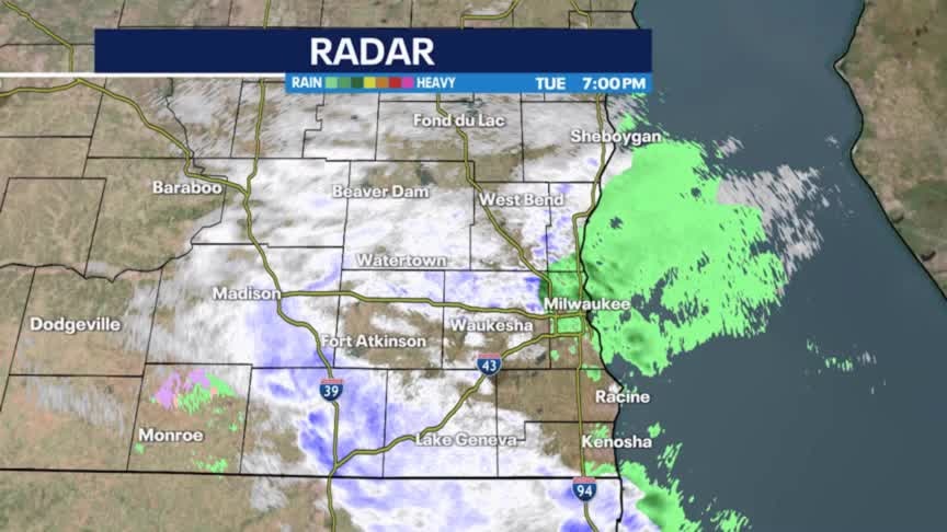
Inland snow will come to an end overnight with a lake effect snow band possible in our lakeshore counties overnight. Keep a close eye on the forecast in the morning if you live near the lake.
Inland snow will come to an end overnight with a lake effect snow band possible in our lakeshore counties overnight. Keep a close eye on the forecast in the morning if you live near the lake.
Weather Webcast with Tom Wachs
Lake effect snow possible in our lakeshore counties on Wednesday morning.
Lake effect snow possible in our lakeshore counties on Wednesday morning.

Weather Webcast with Meteorologist Stephanie Barichello
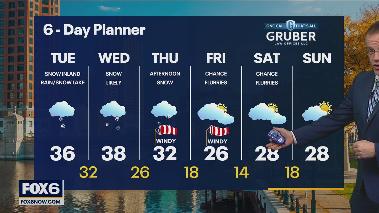
Snow and rain/snow lakeside will continue this afternoon and evening, wrapping up inland by morning. A lake effect band may still impact lakeshore counties through midday with more rain/snow mix. 2-4" for most, less right near the lakeshore. Light snow again Thursday afternoon then very cold.
Snow and rain/snow lakeside will continue this afternoon and evening, wrapping up inland by morning. A lake effect band may still impact lakeshore counties through midday with more rain/snow mix. 2-4" for most, less right near the lakeshore. Light snow again Thursday afternoon then very cold.
Weather webcast with Rob Haswell
A disturbance in the mid to upper levels of the atmosphere moves over our area today helping to generate some snow, mixing in with some rain in a few areas. We expect 2-4" for most areas away from the lake. Lakeside areas will be closer to an inch or so. This is a long duration event, starting today and not ending until Wednesday afternoon. Highs today will be in the mid 30s and will stay in the mid to upper 30s for tomorrow. Colder air arrives on Thursday and into the weekend with highs falling into the 20s for an extended stretch.
A disturbance in the mid to upper levels of the atmosphere moves over our area today helping to generate some snow, mixing in with some rain in a few areas. We expect 2-4" for most areas away from the lake. Lakeside areas will be closer to an inch or so. This is a long duration event, starting today and not ending until Wednesday afternoon. Highs today will be in the mid 30s and will stay in the mid to upper 30s for tomorrow. Colder air arrives on Thursday and into the weekend with highs falling into the 20s for an extended stretch.
Weather Webcast with Tom Wachs
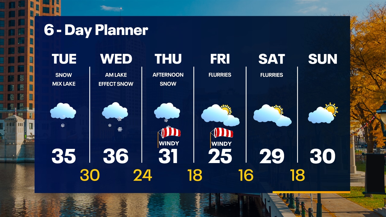
Snow moves in from the south after 6am. It will be a snowy Tuesday with low visibility and slushy roads. The snow will change to rain near the lake in the afternoon/evening.
Snow moves in from the south after 6am. It will be a snowy Tuesday with low visibility and slushy roads. The snow will change to rain near the lake in the afternoon/evening.
Weather Webcast with Tom Wachs
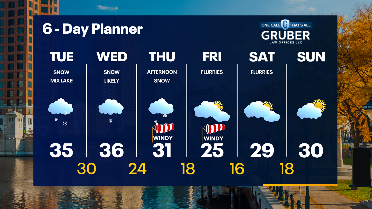
Snow moves in from the south between 6-8am on Tuesday. It will change to rain near the lake in the afternoon/evening but stay as snow inland. Snow tapers off Wednesday. 2-4" inland, lower amounts near the lake.
Snow moves in from the south between 6-8am on Tuesday. It will change to rain near the lake in the afternoon/evening but stay as snow inland. Snow tapers off Wednesday. 2-4" inland, lower amounts near the lake.

Weather Webcast with Meteorologist Stephanie Barichello
Quiet today then snow and wintry mix expected Tuesday through midday Wednesday. A few inches of slush possible, although potentially less lakeside.
Quiet today then snow and wintry mix expected Tuesday through midday Wednesday. A few inches of slush possible, although potentially less lakeside.
Weather webcast with Lisa Michaels
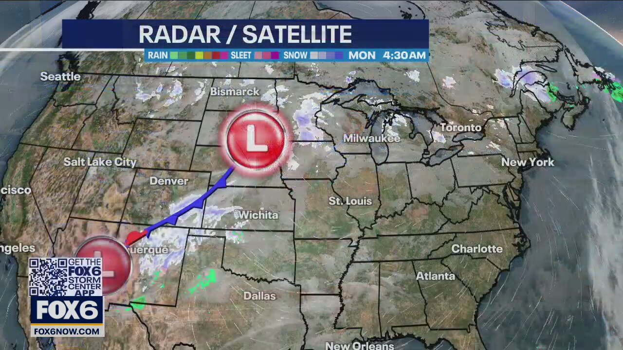
Cold start to the week with morning temps in the 20s and afternoon temps reaching the middle to upper 30s. Chance of accumulating rain and snow enter the forecast Tuesday through Wednesday. Isolated activity may continue into Thursday. Snowfall could accumulate 1-3" of heavy/wet snow. Areas could transition into rain during the afternoons. Most will accumulate on grassy/elevated surfaces, but slushy roads are possible.
Cold start to the week with morning temps in the 20s and afternoon temps reaching the middle to upper 30s. Chance of accumulating rain and snow enter the forecast Tuesday through Wednesday. Isolated activity may continue into Thursday. Snowfall could accumulate 1-3" of heavy/wet snow. Areas could transition into rain during the afternoons. Most will accumulate on grassy/elevated surfaces, but slushy roads are possible.
Weather Webcast with Tom Wachs
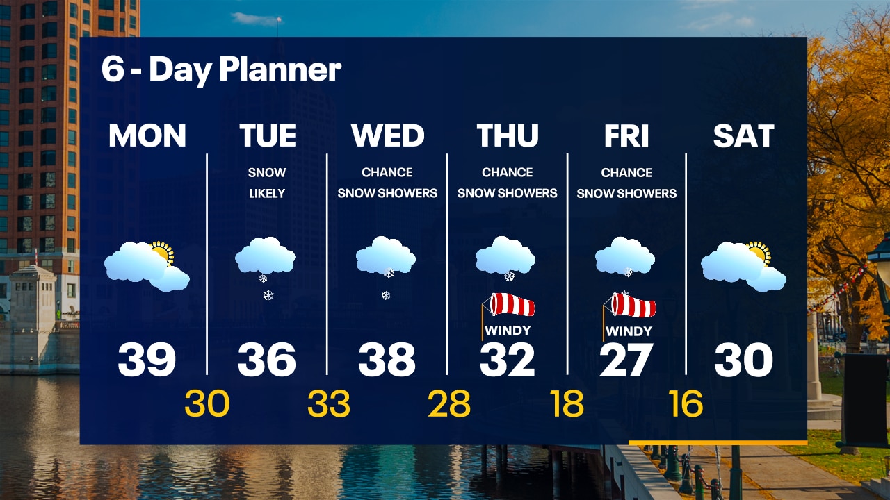
Partly to mostly cloudy and cold overnight. Temperatures dropping into the 20s. Dry on Monday with highs in the upper 30s. 1-3" of snow possible Tuesday.
Partly to mostly cloudy and cold overnight. Temperatures dropping into the 20s. Dry on Monday with highs in the upper 30s. 1-3" of snow possible Tuesday.
Weather Webcast with Tom Wachs
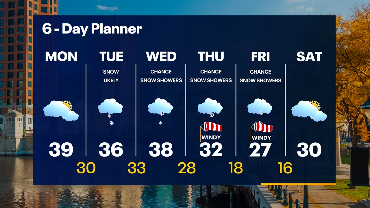
Partly to mostly cloudy and cold tonight. Temperatures dropping into the teens/20s overnight. Dry on Monday with highs in the upper 30s. 1-3" of snow possible Tuesday.
Partly to mostly cloudy and cold tonight. Temperatures dropping into the teens/20s overnight. Dry on Monday with highs in the upper 30s. 1-3" of snow possible Tuesday.

Weather Webcast with Meteorologist Lisa Michaels
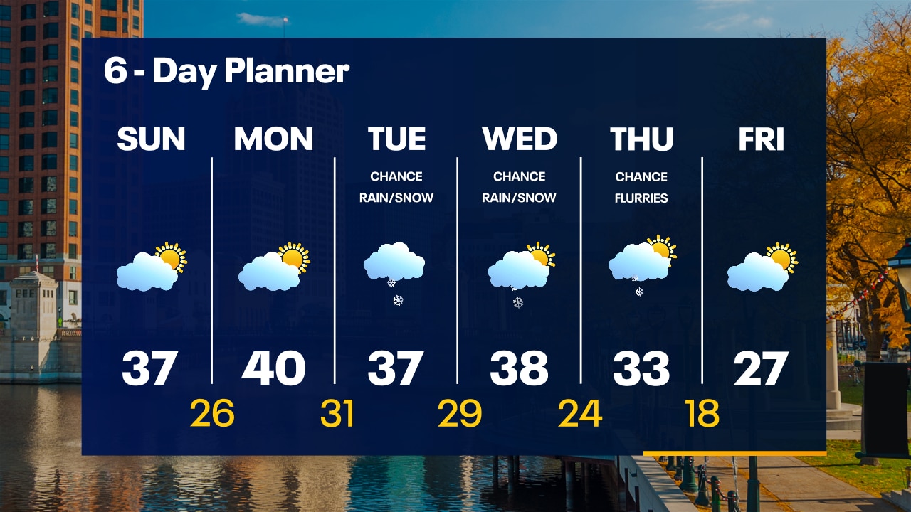
Coldest air of the season Sunday morning. Temps in the 20s with wind chills in the teens. Our first accumulating snow chances move in Tuesday and continue through Wednesday. Even colder air looks to stick around long term. Drier conditions arrive near the end of next week.
Coldest air of the season Sunday morning. Temps in the 20s with wind chills in the teens. Our first accumulating snow chances move in Tuesday and continue through Wednesday. Even colder air looks to stick around long term. Drier conditions arrive near the end of next week.
Weather Webcast
Cold air tonight with lows in the 20s and snow chances with low accumulations Tuesday and Wednesday
Cold air tonight with lows in the 20s and snow chances with low accumulations Tuesday and Wednesday