

Weather Webcast with Stephanie Barichello
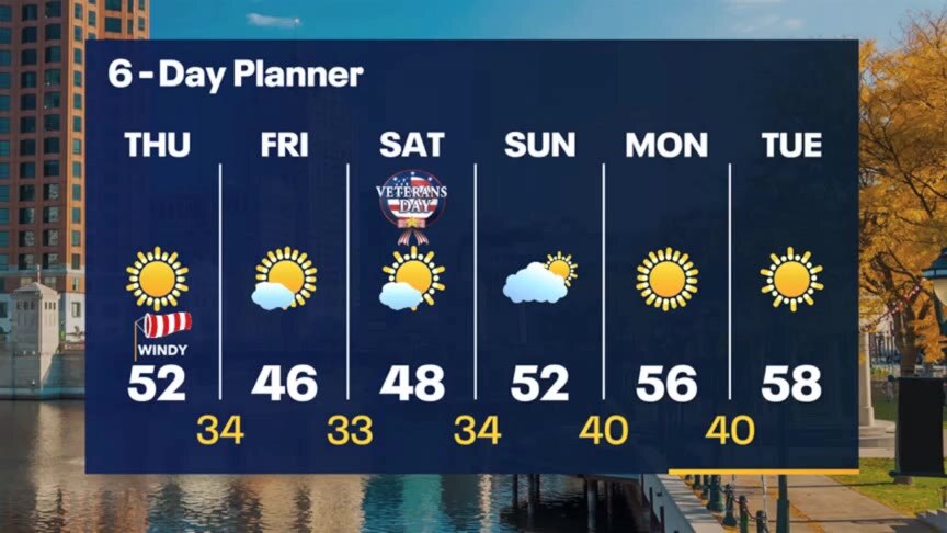
Sunny but windy today with highs in the 50s. Cooler Friday and Saturday with temperatures in the 40s, then gradually warming next week. Staying sunny and dry.
Sunny but windy today with highs in the 50s. Cooler Friday and Saturday with temperatures in the 40s, then gradually warming next week. Staying sunny and dry.
Weather webcast with Rob Haswell
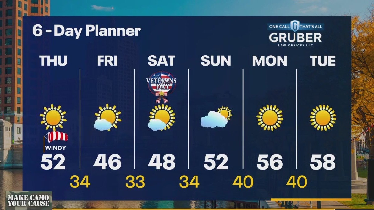
A very tight pressure gradient between a low over the lower lakes and a strong high to our west means strong west winds for our area. Gusts will hit 40mph at times today but should calm overnight. We should still hit the low 50s today but cool to the 40s Friday and Saturday before starting a long range warm up. We stay dry through Tuesday with highs pushing into the upper 50s.
A very tight pressure gradient between a low over the lower lakes and a strong high to our west means strong west winds for our area. Gusts will hit 40mph at times today but should calm overnight. We should still hit the low 50s today but cool to the 40s Friday and Saturday before starting a long range warm up. We stay dry through Tuesday with highs pushing into the upper 50s.
Weather Webcast with Tom Wachs
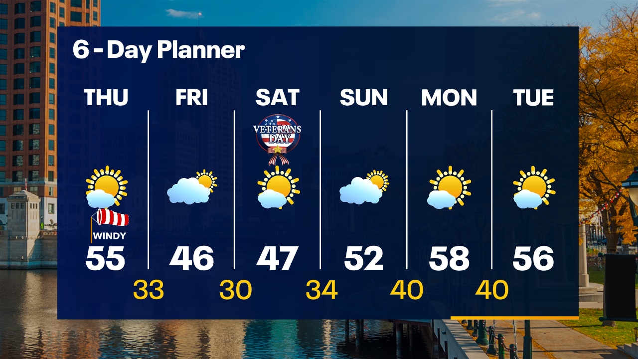
Clearing skies overnight but staying windy. Temperatures dropping through the 40s. Lots of sun on Thursday, windy and warmer with highs in the low-to-mid 50s.
Clearing skies overnight but staying windy. Temperatures dropping through the 40s. Lots of sun on Thursday, windy and warmer with highs in the low-to-mid 50s.
Weather Webcast with Tom Wachs
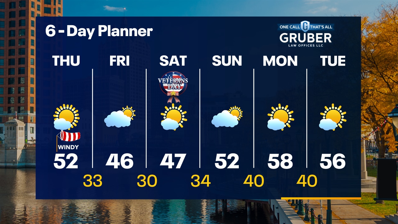
Rain will end this evening but the wind remains. Temperatures dropping through the 40s. Lots of sun on Thursday, windy and warmer with highs in the mid-50s.
Rain will end this evening but the wind remains. Temperatures dropping through the 40s. Lots of sun on Thursday, windy and warmer with highs in the mid-50s.
Weather webcast with Rob Haswell
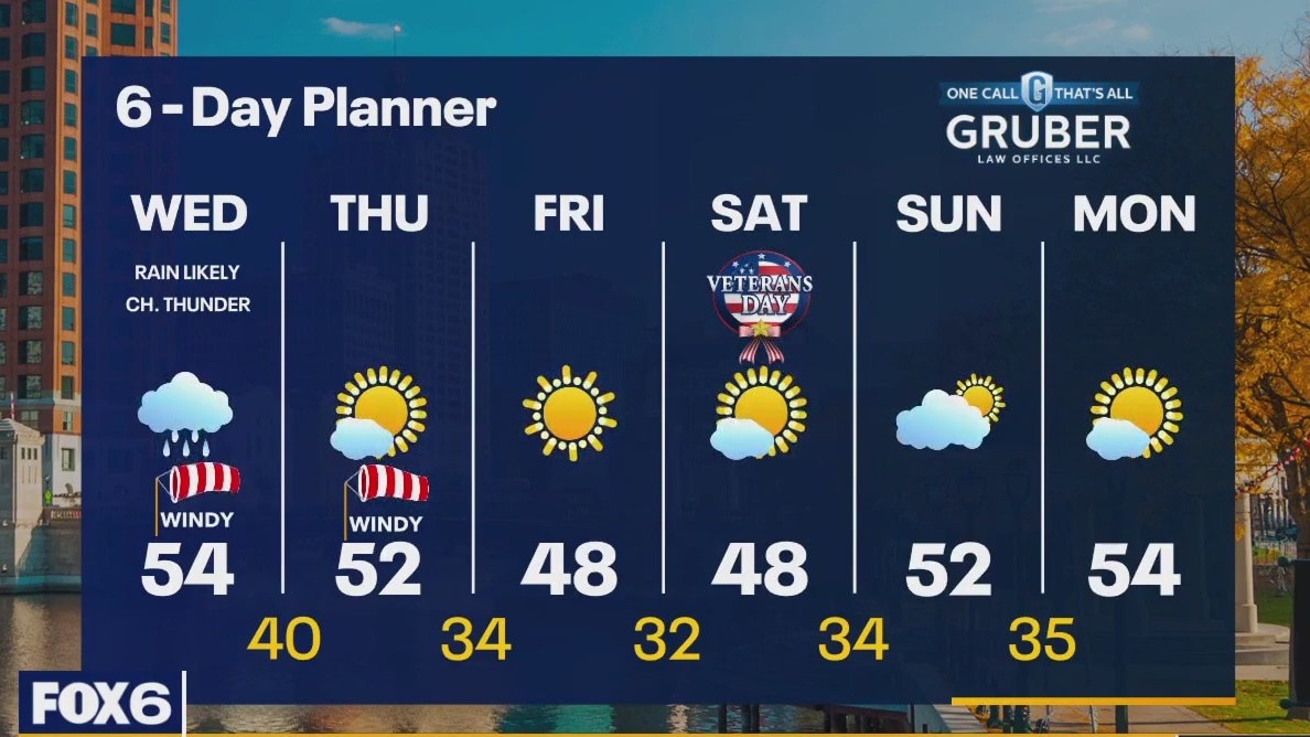
A low passes to our southeast today moving from Kansas this morning into the lower Great Lakes by Thursday. As this system moves through our area, it will generate rain and a few rumbles of thunder. We can expect rain to continue through the later evening hours. Most areas will see at least 1/3rd of rain and some spots, where thunder happens, will see around 1". We dry up Thursday and stay dry through the weekend.
A low passes to our southeast today moving from Kansas this morning into the lower Great Lakes by Thursday. As this system moves through our area, it will generate rain and a few rumbles of thunder. We can expect rain to continue through the later evening hours. Most areas will see at least 1/3rd of rain and some spots, where thunder happens, will see around 1". We dry up Thursday and stay dry through the weekend.
Weather Webcast with Tom Wachs
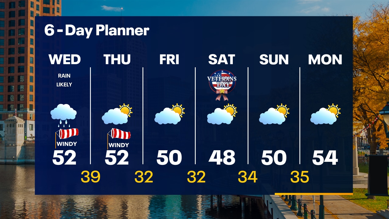
The wind picks up overnight with rain moving in after 2am. Rain and a few rumbles of thunder possible on Wednesday. Windy in the morning with a high in the low 50s. Over 0.50" rain possible in spots.
The wind picks up overnight with rain moving in after 2am. Rain and a few rumbles of thunder possible on Wednesday. Windy in the morning with a high in the low 50s. Over 0.50" rain possible in spots.
Weather Webcast with Tom Wachs
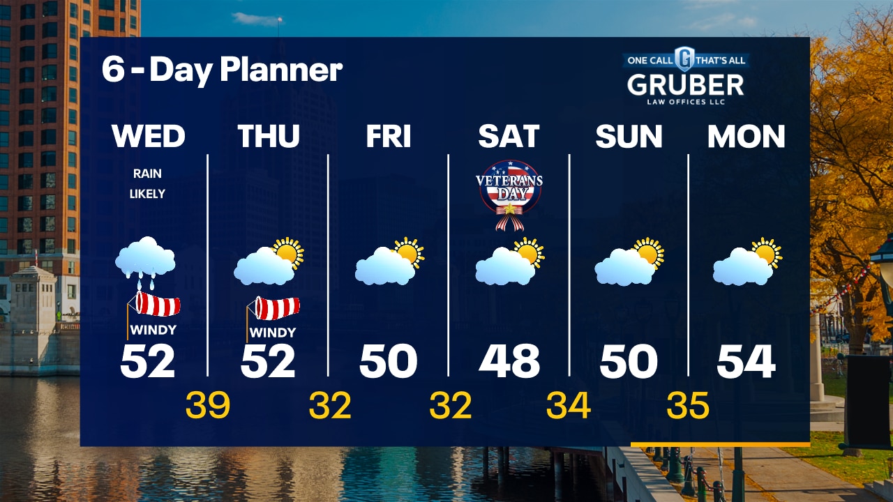
Quiet this evening with rain moving in after 2am. It will be windy on Wednesday morning and rainy for most of the day. Highs in the low 50s.
Quiet this evening with rain moving in after 2am. It will be windy on Wednesday morning and rainy for most of the day. Highs in the low 50s.
Weather webcast with Lisa Michaels
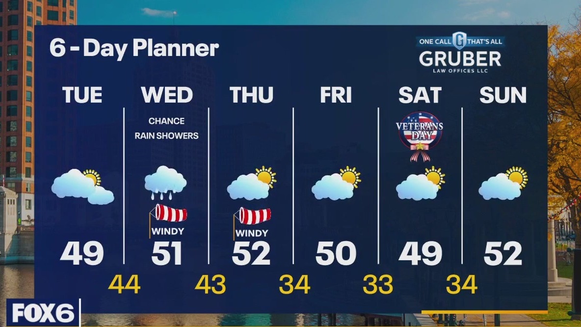
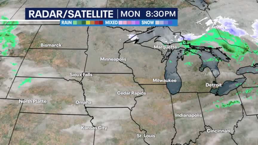
Mostly cloudy skies on Tuesday with highs struggling to get out of the 40s. Rain chances return late Tuesday night into Wednesday. A quarter of an inch possible. Winds pick back up on Wednesday and Thursday. More seasonable highs temps this week in the upper 40s to lower 50s.
Mostly cloudy skies on Tuesday with highs struggling to get out of the 40s. Rain chances return late Tuesday night into Wednesday. A quarter of an inch possible. Winds pick back up on Wednesday and Thursday. More seasonable highs temps this week in the upper 40s to lower 50s.
Weather Webcast with Tom Wachs
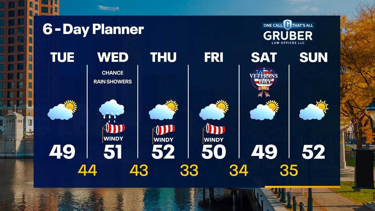
Increasing clouds overnight, still breezy with temperatures dropping into the 40s. Mostly cloudy and much cooler on Tuesday with highs in the 40s. Rain chances return Wednesday.
Increasing clouds overnight, still breezy with temperatures dropping into the 40s. Mostly cloudy and much cooler on Tuesday with highs in the 40s. Rain chances return Wednesday.
Weather Webcast with Tom Wachs
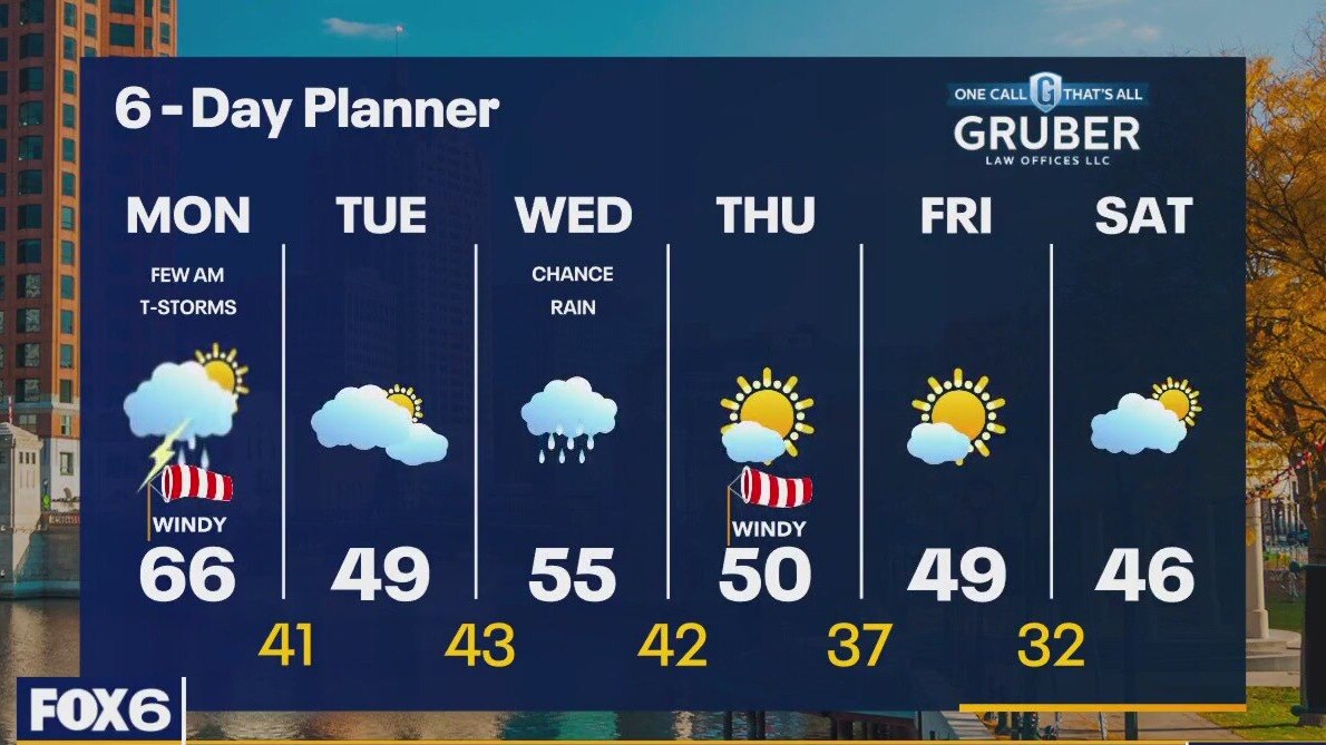
Mostly clear and windy this evening, increasing clouds overnight. Temperatures dropping into the 40s. Mostly cloudy and much cooler on Tuesday with highs in the upper 40s.
Mostly clear and windy this evening, increasing clouds overnight. Temperatures dropping into the 40s. Mostly cloudy and much cooler on Tuesday with highs in the upper 40s.
Weather webcast with Lisa Michaels
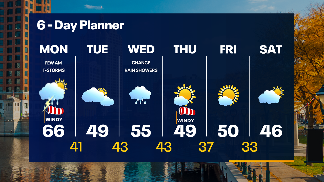
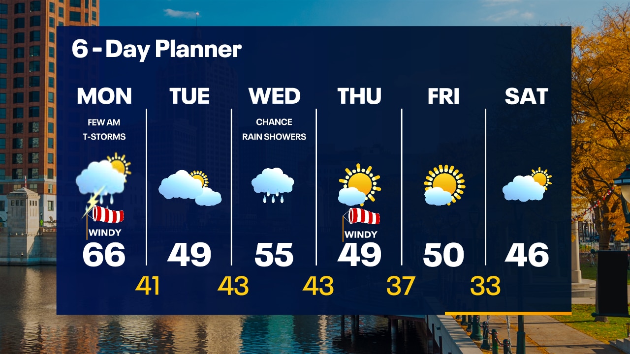
Morning showers and isolated t-storms possible. Mild morning in the 50s with breezy conditions. Rain moves out this afternoon. Sunshine likely with highs in the mid to upper 60s. Very windy with gusts near 40mph. Cooling down on Tuesday with partly to mostly cloudy skies. Highs in the upper 40s with the wind off of the lake. Rain chances return on Wednesday with a high in the mid-50s. Cooling to around 50 late in the week with sunshine returning.
Morning showers and isolated t-storms possible. Mild morning in the 50s with breezy conditions. Rain moves out this afternoon. Sunshine likely with highs in the mid to upper 60s. Very windy with gusts near 40mph. Cooling down on Tuesday with partly to mostly cloudy skies. Highs in the upper 40s with the wind off of the lake. Rain chances return on Wednesday with a high in the mid-50s. Cooling to around 50 late in the week with sunshine returning.
Weather Webcast with Tom Wachs
Very windy on Monday morning with southwest winds gusting over 40 mph at times. Rain and possibly a rumble of thunder moves out by 9am. Some sun will come out late in the AM into the afternoon. Highs in the mid-60s.
Very windy on Monday morning with southwest winds gusting over 40 mph at times. Rain and possibly a rumble of thunder moves out by 9am. Some sun will come out late in the AM into the afternoon. Highs in the mid-60s.
Weather Webcast with Tom Wachs
A few spotty rain showers possible tonight, breezy and mild. Temperatures holding in the 50s. A few morning showers/t-storms possible, otherwise some afternoon sun. Windy & warm with highs in the mid-60s.
A few spotty rain showers possible tonight, breezy and mild. Temperatures holding in the 50s. A few morning showers/t-storms possible, otherwise some afternoon sun. Windy & warm with highs in the mid-60s.
Weather webcast with Lisa Michaels
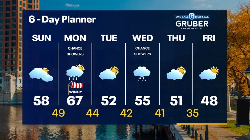
Partly sunny skies during Sunday morning with increasing clouds in the afternoon. Highs in the upper 50s. Small chance of a shower late tonight, otherwise additional chances arrive early Monday. Another system could bring rain Wednesday. Seasonable temps in the 50s this week.
Partly sunny skies during Sunday morning with increasing clouds in the afternoon. Highs in the upper 50s. Small chance of a shower late tonight, otherwise additional chances arrive early Monday. Another system could bring rain Wednesday. Seasonable temps in the 50s this week.
Weather webcast with Lisa Michaels
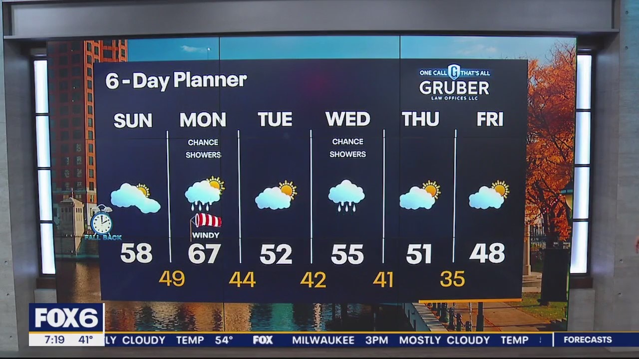
Partly sunny skies during Sunday morning with increasing clouds in the afternoon. Highs in the upper 50s. Small chance of a shower late tonight.
Partly sunny skies during Sunday morning with increasing clouds in the afternoon. Highs in the upper 50s. Small chance of a shower late tonight.

Weather Webcast with Meteorologist Eric Manges
Warming trend to next week with rain chances Monday morning and Wednesday
Warming trend to next week with rain chances Monday morning and Wednesday
Weather webcast with Lisa Michaels
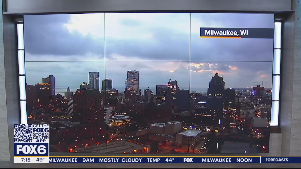
Mostly cloudy skies turning to partly cloudy this afternoon. Highs in the low 50s Saturday.
Mostly cloudy skies turning to partly cloudy this afternoon. Highs in the low 50s Saturday.
Weather Webcast with Meteorologist Eric Manges
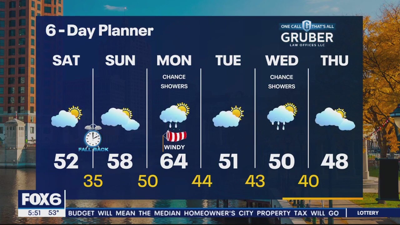
Relaxing weekend weather wise with a slow warm up into next week
Relaxing weekend weather wise with a slow warm up into next week
Weather webcast with Rob Haswell
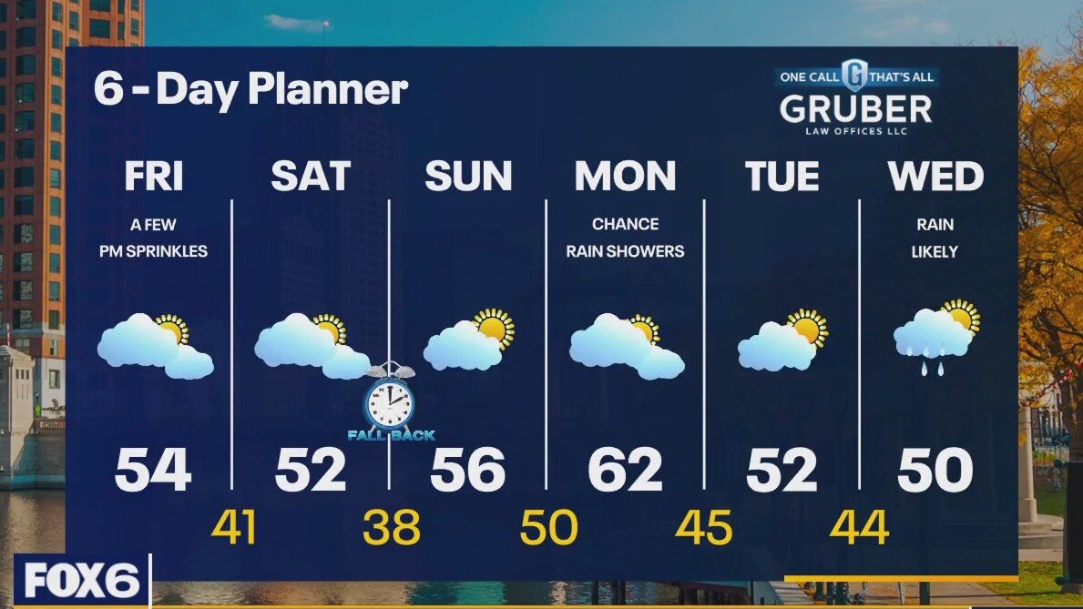
A weak front drops through Wisconsin today and tonight. That front may have just enough moisture to generate a few sprinkles - mostly at night but the dry air in place may overcome that. Ahead of that front we will be windy with highs in the low to mid 50s. We stay seasonally mild tonight. The front only drops our highs by a couple of degrees heading into Saturday but we remain near seasonal all weekend. We should be mostly dry this weekend with a chance for showers returning late Sunday night and into Monday. Monday will be a very windy day with strong wind gusts. Mild nights ahead with lows in the 40s and near 50 from Sunday night through Tuesday night.
A weak front drops through Wisconsin today and tonight. That front may have just enough moisture to generate a few sprinkles - mostly at night but the dry air in place may overcome that. Ahead of that front we will be windy with highs in the low to mid 50s. We stay seasonally mild tonight. The front only drops our highs by a couple of degrees heading into Saturday but we remain near seasonal all weekend. We should be mostly dry this weekend with a chance for showers returning late Sunday night and into Monday. Monday will be a very windy day with strong wind gusts. Mild nights ahead with lows in the 40s and near 50 from Sunday night through Tuesday night.
Weather Webcast with Tom Wachs
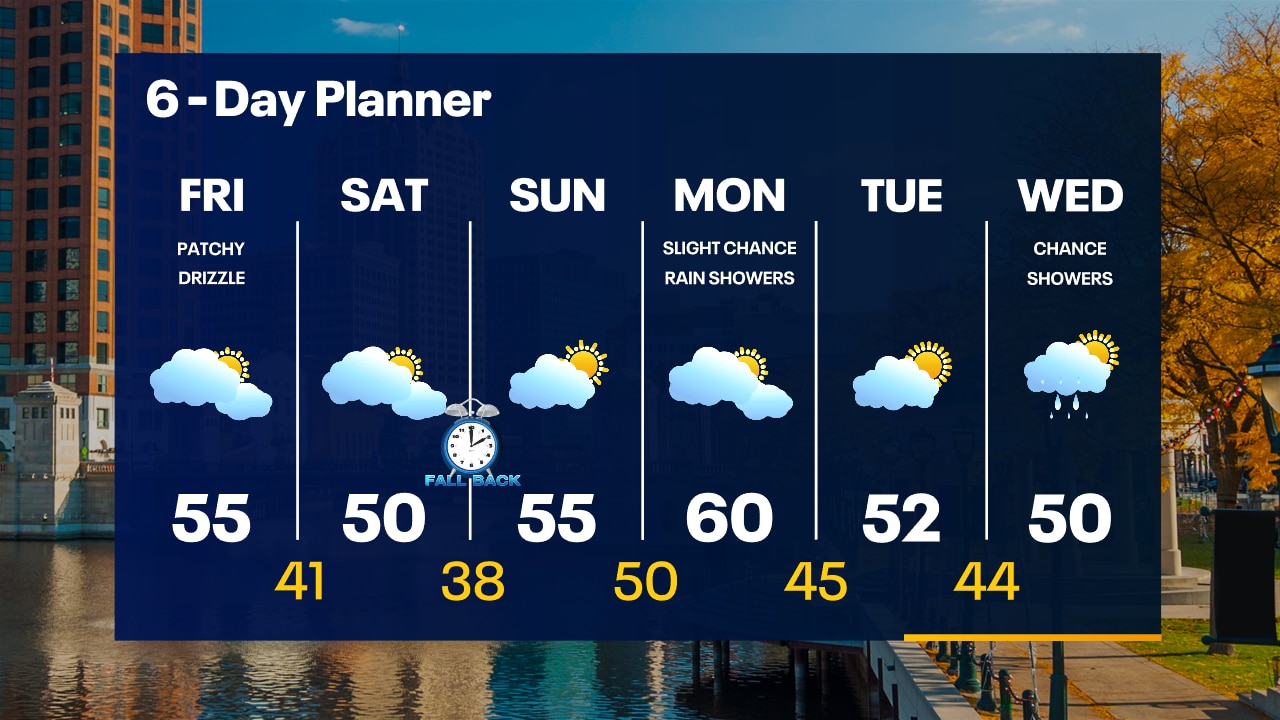
Increasing clouds overnight with temperatures in the upper 30s to low 40s by sunrise. Mostly cloudy with patchy drizzle on Friday. Mild and breezy with highs in the mid-50s.
Increasing clouds overnight with temperatures in the upper 30s to low 40s by sunrise. Mostly cloudy with patchy drizzle on Friday. Mild and breezy with highs in the mid-50s.