

Multiple twisters touch down in Alabama, Mississippi as wave of tornadoes moves through South

LOS ANGELES - A significant tornado outbreak in the South on Wednesday is expected to continue with numerous strong, potentially violent tornadoes likely to impact the region into Thursday.
"Tornadoes are not all that rare in the Southeast in March, but outbreaks where so many tornadoes are expected to occur in a one- or two-day timeframe is something we don't see every year," Bill Bunting, the chief of forecast operations at the National Weather Service's Storm Prediction Center (SPC), told FOX Television stations.
The SPC issued its highest threat level forecast category for severe weather — "high risk" — from parts of the lower-Mississippi Valley into Alabama. The last time a high-risk severe weather forecast was issued in the Southeast U.S. was in April 2017.
According to the SPC, the initial round will continue across Alabama Wednesday afternoon, and a separate swath should emanate from far northeast Louisiana and spread across Mississippi and Alabama Wednesday night before heading toward the southeast.
"As of 6 p.m. CDT we have received 18 reports of tornadoes, with three current Tornado Warnings in effect in Alabama. We've also received 54 reports of damaging thunderstorm straight-line winds and large hail," said Bunting.
Severe weather forecast for the South
On Thursday, a regional outbreak of severe storms and tornadoes could be possible from parts of the Florida Panhandle and east-central Georgia northeastward across South Carolina and North Carolina.
"Severe thunderstorms are expected to continue into the evening and overnight with a continued risk for strong tornadoes and damaging winds. The risk area will shift east on Thursday and extend from northern Florida northward into the mid-Atlantic states," Bunting said.
The line of strong-to-severe storms will likely develop Thursday morning and main threats include damaging wind gusts up to 60 mph and embedded tornadoes.
"Significant tornadoes, wind damage and large hail will be possible from morning into afternoon. Severe thunderstorms will also be possible from parts of the eastern Gulf Coast into the southern and central Appalachians," the SPC wrote in its convective outlook.
RELATED: Storm Alert Day: Georgia braces for severe weather threat including tornadoes
According to FOX 5 Atlanta, the impending weather has already caused some schools, government offices and businesses to close, delay or change plans for Thursday.
While the storm system is expected to weaken by the time it hits western Georgia later on Wednesday, it will still remain a level 3 or enhanced threat until Thursday.
Twisters and damage reported Wednesday
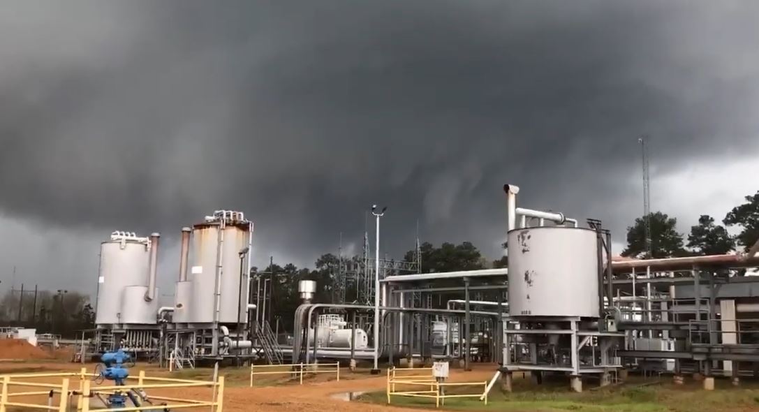
Supercell thunderstorms already spawned several tornadoes on Wednesday in Alabama and Mississippi.
Hundreds of schools, businesses and COVID-19 vaccination clinics were shut down in the Deep South Wednesday as forecasters warned of severe weather in the states.
In Alabama, a massive funnel cloud was spotted near Billingsley, north of Montgomery. Multiple twisters were confirmed near the town of Selma, and there have been multiple reports of damage including loss of power.
RELATED: Wind gusts of 70 MPH in early morning storms across North Texas
Much of Alabama remains under a threat of severe weather through Thursday, and severe storms placed Mississippi and Alabama in a "particularly dangerous situation," with "numerous tornadoes expected and a few intense tornadoes likely," the National Weather Service (NWS) reported.
Footage from southern Tuscaloosa County showed a possible tornado, captured by Derek Osborn.
The NWS reported multiple tornadoes in the area across Jefferson, Tuscaloosa and Coosa counties. Tornado sirens can be heard in Osborn’s footage.
Residents in the storm’s path were advised to take cover and to take official warnings seriously.
The National Weather Service also warned people in the Demopolis area of Alabama to take cover as a storm moved through the area. The footage was captured by Michael O Clements in Demopolis.
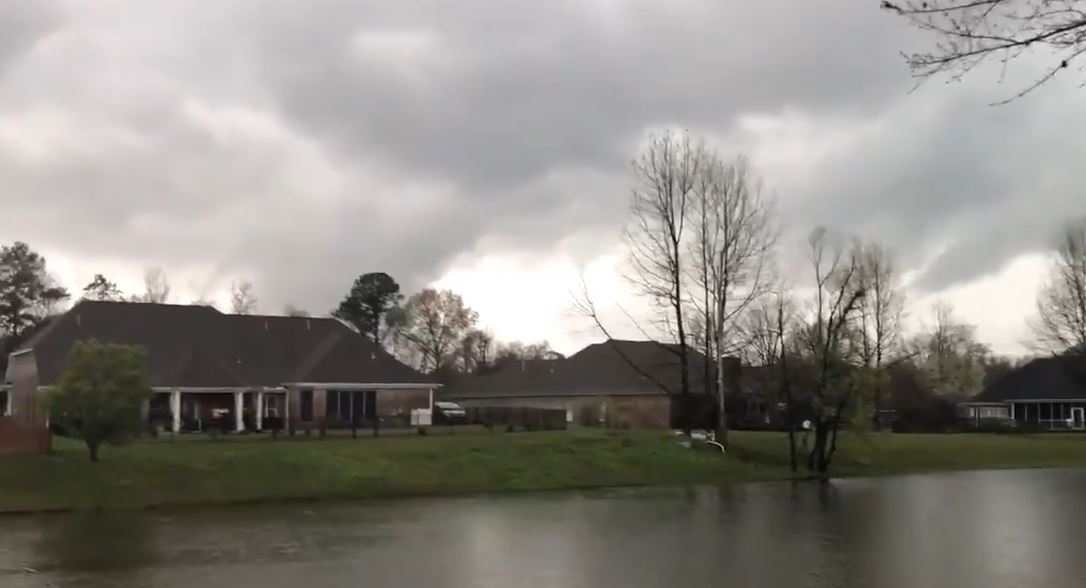
Clancie Daley captured video of an ominous funnel cloud in southeast Brookhaven, Mississippi, around 12:45 p.m. local time on Wednesday. Brookhaven was under a tornado warning until 1:45 p.m., per the NWS.
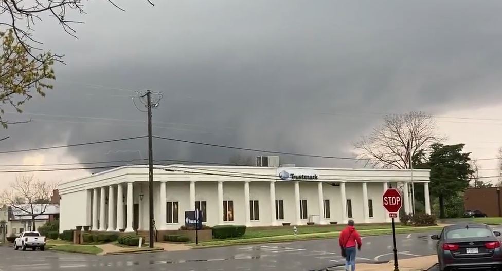
A possible tornado was spotted east of Laurel, Mississippi on Wednesday amid a flurry of severe weather warnings in the southern United States.
At 12:20 pm, the National Weather Service’s Mobile office tweeted that a tornado was moving through Mississippi’s Wayne County, where it had already caused damage to homes.
Video footage showing the possible tornado was recorded by Shana Hodge shortly after noon on March 17. Hodge said it was filmed on Highway 84, about 20 miles east of Laurel, in Wayne County.
"People in the affected areas need to make sure that they have a severe weather safety plan that includes where to take shelter in the event a severe storm approaches, and have more than one way of receiving severe thunderstorm and tornado warnings," Bunting said.
"A NOAA Weather Radio can be programmed to alert you when warnings are issued for your county or parish, and can wake you up if the storm occurs when you are sleeping," Bunting continued. "It's very important to have thought about safety before the warnings are issued."