

Widespread wintry weather likely Friday; SE Wisconsin on the edge
Widespread winter weather is likely Friday, Dec. 9 as a broad system pushes into the Great Lakes. This will be a messy forecast as plenty of areas will be too warm at the surface to see impactful snow totals, but rain and wintry mix will be possible.
The highest confidence for snow is in areas toward central Wisconsin. As of now, that's the sweet spot – but southeastern Wisconsin will be right on the edge of being too warm.
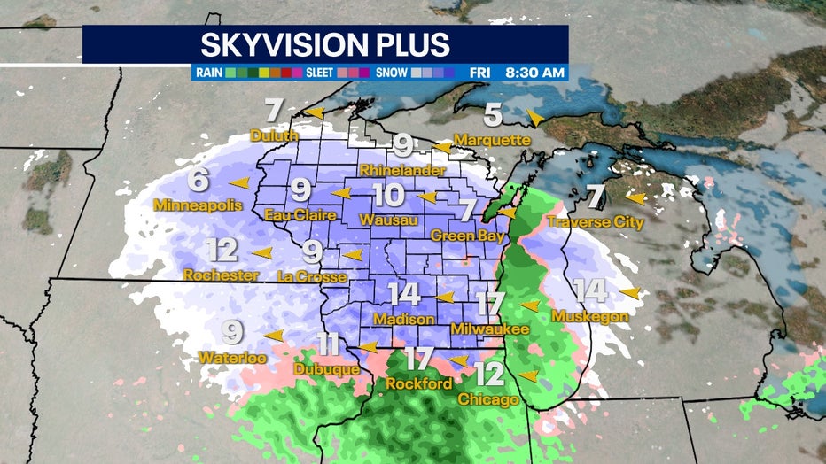
Friday morning, Dec. 9 into Friday evening, Dec. 9 wintry precipe will be widespread across the state of Wisconsin
Starting Friday morning, snow bands begin moving into the region with air temperatures likely as cold as they'll be all day. If we see accumulations close to the lake, this will be our best shot.
As the day goes on, temperatures near the lake increase and likely at the surface this switches over to rain.
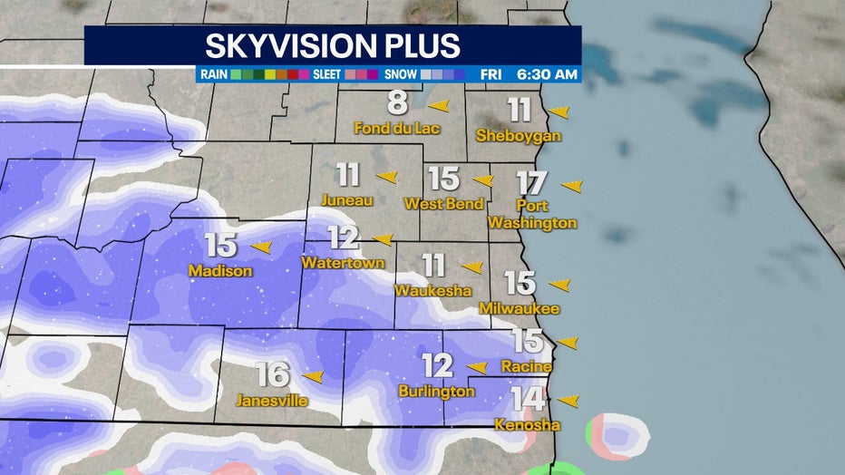
Snow chances begin early Friday morning, Dec. 9
Warmer air temperatures and dryer air overall brought in from Lake Michigan will be the big issue for counties closest to the lake. Areas a county or more inland could see precipitation stay as snow, but it'll still be very close to freezing. Heavy and wet snow that could accumulate quickly will be possible with this scenario.
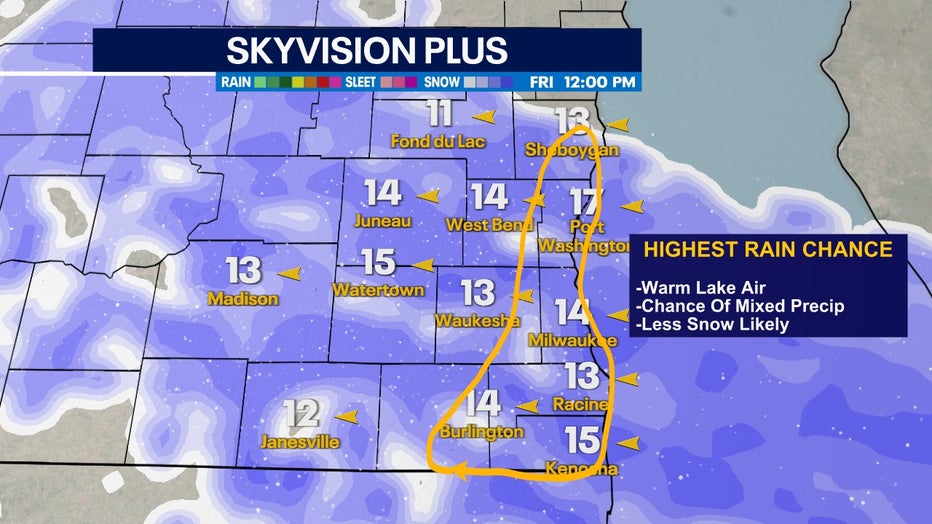
It'll be hard for this snow to reach the ground with Lake Michigan air keeping counties along the lake well over 32°F
How far this warm zone in yellow extends will be the biggest variable for accumulation potential for southeastern Wisconsin.
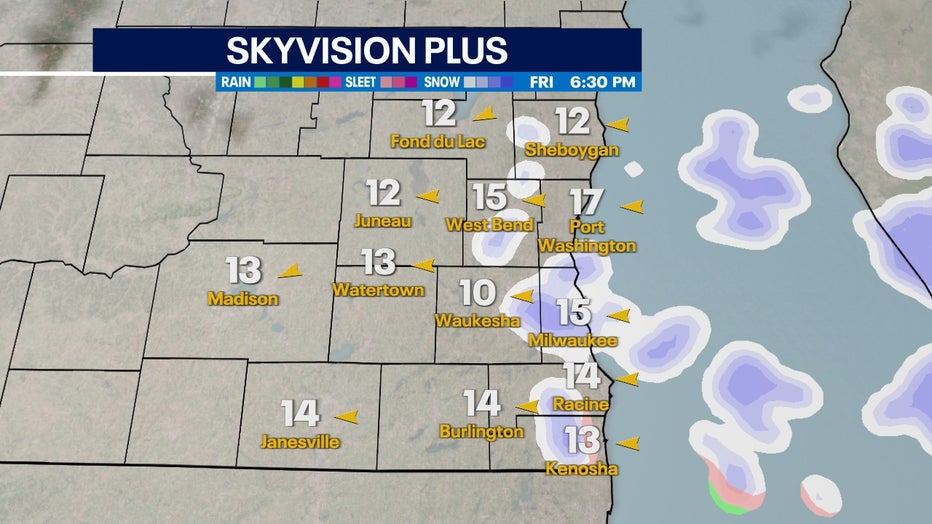
Snow chances begin letting up by Friday evening, Dec. 9
Snow chances start to let up by Friday evening and eventually transition into flurries. Interestingly, with this low, we won't be rushing in cold air like our last few broad systems. Temperatures stay consistently in the 30s heading into the weekend.