

Seasonal snowfall, spring in Wisconsin; what else is in store?
The arrival of meteorological spring started off warm, but it took a turn with cold temperatures and loads of snow during the second week.
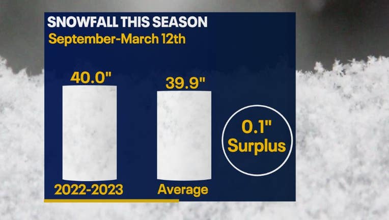
During most of this season, southeastern Wisconsin was below normal for snowfall. However, with help from the last event that occurred on Thursday, March 9 through Friday, March 10 – and an additional short system on Sunday, March 12 – snowfall accumulation is right where it needs to be! From Sept. 1 to March 12, Milwaukee has received 40 inches of snow, which is 0.1 inch above average.
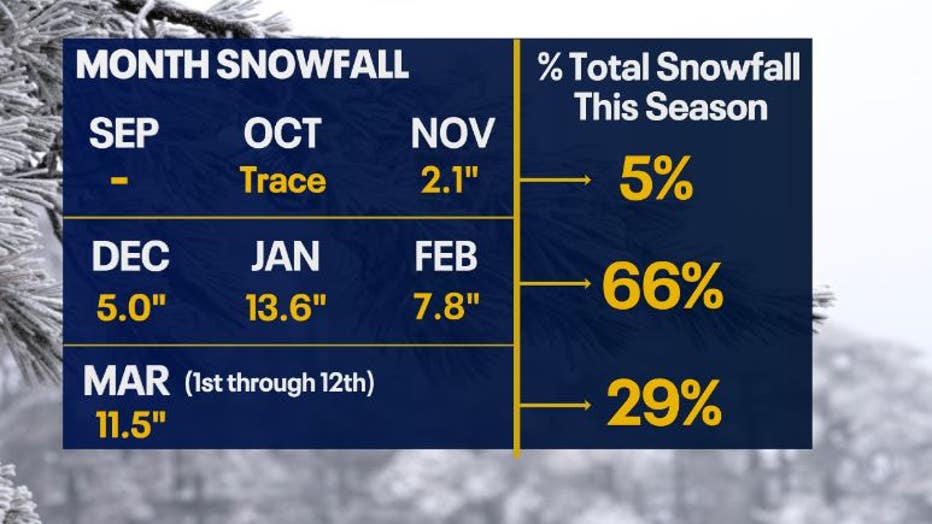
Meteorological fall (September through November) is the time of the year when temperatures start trending cooler. Snow can occur, but it isn't as likely to bring Wisconsin major amounts. This is why we only had 5% of our total snowfall from this time period. Meteorological winter (December through February) is typically when we experience the coldest temperatures, but we ended up having a very warm winter providing more rain than snow. That being said, southeastern Wisconsin still saw 66% of total snowfall during this time.
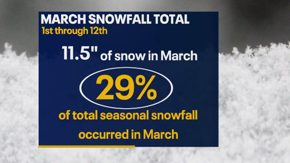
The previous big snow event on March 9 and March 10 accounted for 29% of the total snowfall so far this season. It really helped push our snow totals back to the normal mark. Keep in mind that we aren't even halfway through March, and we saw almost as much snow as the entire month of January.
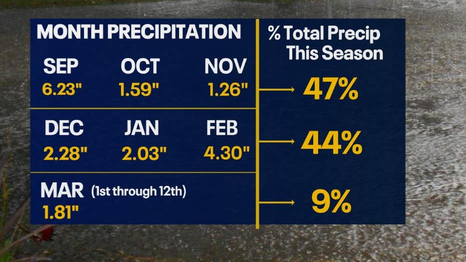
It wasn't just snow that we have seen this season, but warmer temperatures brought more rain than average. Fall and winter were unseasonably warm. These two seasons brought 44% and 47% of our total precipitation so far.
Credit: The U.S. Drought Monitor is produced through a partnership between the National Drought Mitigation Center at the University of Nebraska-Lincoln, the United States Department of Agriculture, and the National Oceanic and Atmospheric Administrat
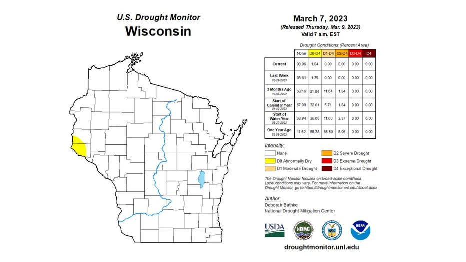
The higher amounts of precipitation and near average snowfall, has really helped southeastern Wisconsin from dealing with drought conditions. More impactful snowfall events occurred in central and northern Wisconsin this season which brought more snow rather than rain – so central and northern portions of the state aren't experiencing drought problems either.
Credit: The U.S. Drought Monitor is produced through a partnership between the National Drought Mitigation Center at the University of Nebraska-Lincoln, the United States Department of Agriculture, and the National Oceanic and Atmospheric Administrat
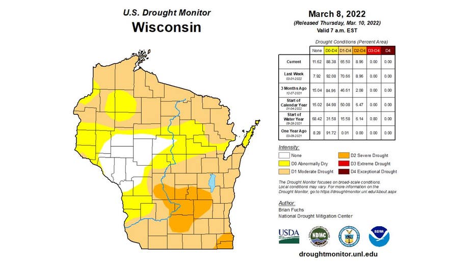
While this year has been rather mild, last year was a completely different story; about three-fourths of the state was experiencing drought conditions on March 8, 2022.
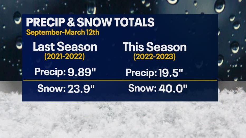
This was due to the lack of precipitation and snowfall from September through the first half of March. Overall, last year had 9.61 inches less precipitation and 16.1 inches less snowfall than this year. Less snow pact and water in the soil lead to worse drought conditions.
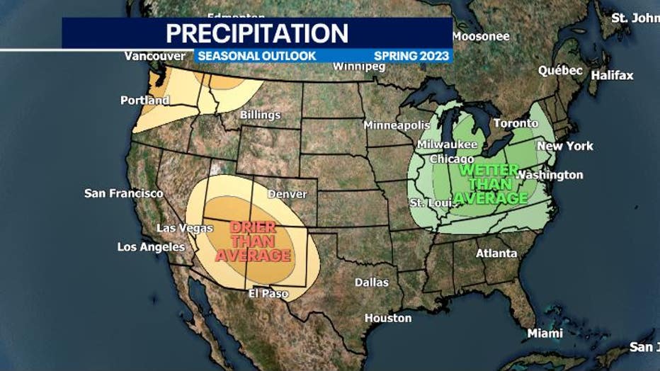
So what does that mean for the rest of spring? The seasonal outlook for southeastern Wisconsin shows higher chances for wetter-than-average conditions. That does not mean that every day will be wet, but rather there is a greater probability that Milwaukee and the surrounding areas could see more precipitation and/or snowfall than average.
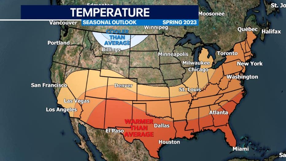
The seasonal outlook for spring shows that southeastern Wisconsin has equal chances, no color on the map, of seeing warmer- or cooler-than-average temperatures. Of course, temperatures will play a big role in whether we see snow or rain through meteorological spring (March through May).