High uncertainty with weekend snow potential at this time
Bottom line, Friday night, Dec. 11 into Saturday, Dec. 12 is looking to be our first widespread winter weather event of the season. At this time, there is still too much uncertainty to talk totals as atmospheric models are highly variable in timing and location from run to run, and this far out, they are expected to behave that way.
Each model we look at has different biases and strengths which are factored in for the overall forecast. By Thursday night, Dec. 10 we will have a better picture of the overall potential but here are our thoughts at this time.
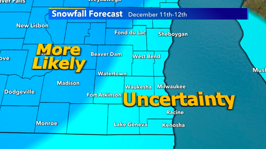
Due to atmospheric inconsistencies on timing and totals, most of southeast Wisconsin won't have a clear picture on totals for awhile
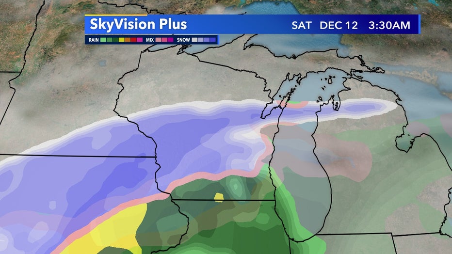
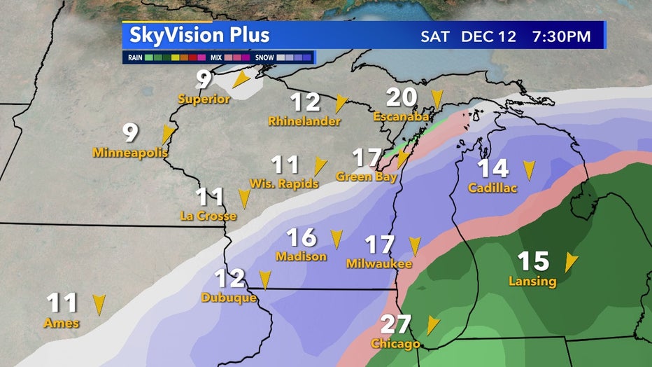
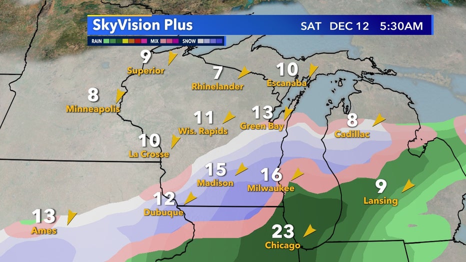
Snowfall for all of southeast Wisconsin is likely but so is rain and the chance for a wintry mix. Regardless of how much snow we do receive, it is highly likely travel will be a concern across most of the state into Illinois. Currently, snowfall forecasts are highly variable and will continue to change right up to the event. It all depends on how the low of this system tracks and if Lake Michigan's warmer surface air influence keeps our temperatures too warm for snow.
If the low track stays south and mostly in Illinois, that will keep Wisconsin in the coldest of air, allowing a majority of our precip to come as snowfall. Due to how warm our ground is still, a lot of this snowfall would melt on contact with the ground but on elevated roadways and grassy surfaces snow could add up quickly in this scenario.
Another possibility is we could be right in the middle of a transition zone which gives the risk of a wintry mix along with rain and snow. Snowfall we receive would be heavy and wet and could result in mostly slush on roads.
It is also possible at this time the system could shift north and much of this event will be rainfall as we'll be too warm to support frozen precipitation. Lake Michigan, as we enter winter, is generally warmer than the air temperatures, this can cause lots of forecast issues with frontal boundaries as they move in.
It's not out of the question that along the lake most of the precip stays as rain.