

Large air mass moves down from Canada next week, cooler than average conditions expected in Midwest
SOUTHEAST WISCONSIN - A large air mass of cooler air moves down from Canada next week and puts the entire Midwest into cooler than average conditions all the way into mid-month, at least. Sept. 1 marked the start of Meteorological Fall but Calendar Fall doesn't begin until Sept. 22.
With that in mind, it's likely that we'll be feeling like fall on Sept. 7th.
Our average high from Sept. 9 -15 slides down from 74˚F to 72˚F and during this stretch forecast highs will be lucky to get out of the mid-60s. This month is a big transition into a new season and sadly by Sept. 21, the average high goes down to 69˚F.
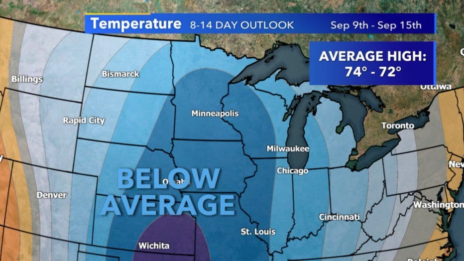
8-14 temperature outlook for September 9-15
It's possible this could be our last week of multiple 80˚F high temps until 2021 based on climate averages and our below-average outlook. It won't be until Monday, Sept. 7 do high temps really take a dive, so enjoy the warm weather while we have it.
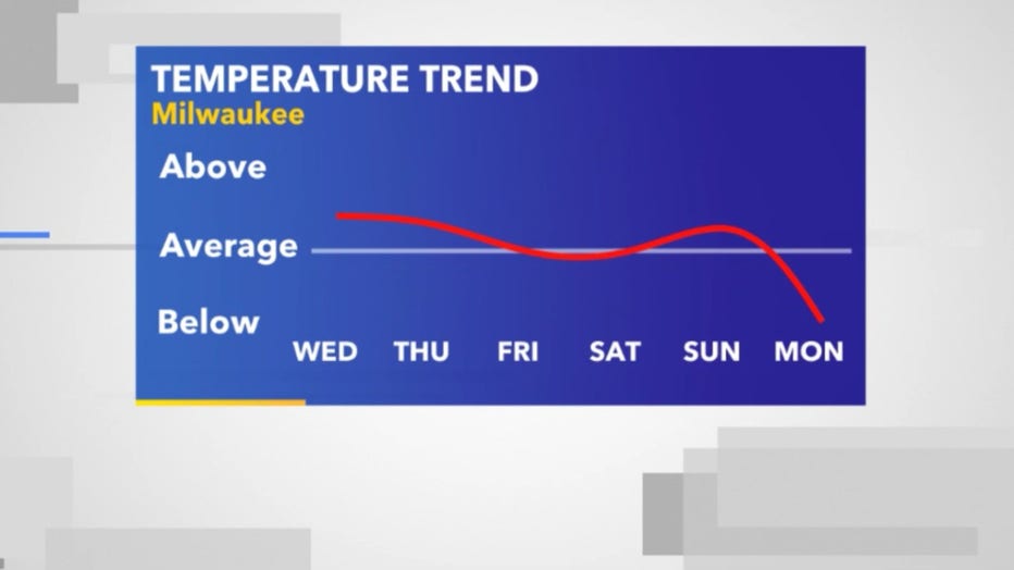
High-temperature forecast form September 2-7 in relation to average
While long-term temperature forecasts are tricky when it comes to exact numbers most long-term model forecasts keep us at least in the 60s. It is possible we could get even cooler with the coldest air staying in Minnesota. Multiple boundary and lows will pass next week that should give us a healthy dose of rain along with it.
Keep an eye on those Sugar Maples and our shortening daylight is bound to cause the start of color-changing soon!
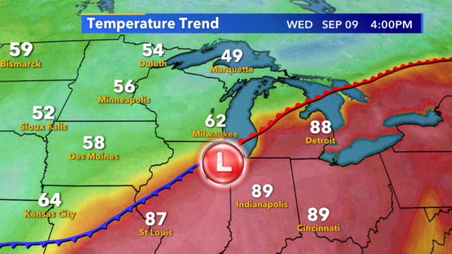
High-temperature forecast for September 9 for the Midwest