

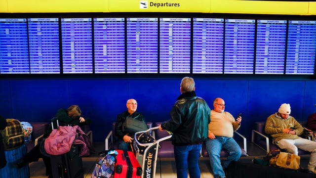

Airlines - not weather - blamed for rising flight cancellations, new report finds
Airlines are to blame for the recent post-pandemic surge in flight cancellations, according to findings from a new government report.
Airlines are to blame for the recent post-pandemic surge in flight cancellations, according to findings from a new government report.

Weather Webcast with Lisa Michaels
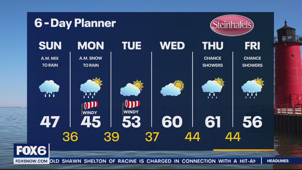
Cool Sunday with temps in the lower 40s. Scattered rain showers today around an occluded low pressure. Snow showers possible Monday that could stick to grassy/elevated surfaces. Transitioning back into rain Monday afternoon.
Cool Sunday with temps in the lower 40s. Scattered rain showers today around an occluded low pressure. Snow showers possible Monday that could stick to grassy/elevated surfaces. Transitioning back into rain Monday afternoon.
Weather Webcast with Meteorologist Eric Manges
Big snow totals possible for the UP through Monday, we could even get some accumulation Monday morning.
Big snow totals possible for the UP through Monday, we could even get some accumulation Monday morning.


Suspected tornado flips cars, leaves damage trail in South Florida as storms race across state
The first round of storms triggered severe weather warnings and likely produced a tornado in northern Palm Beach County on Saturday.
The first round of storms triggered severe weather warnings and likely produced a tornado in northern Palm Beach County on Saturday.

Weather Webcast with Meteorologist Lisa Michaels
Brief sunshine this morning with rain moving in early. Scattered showers through Saturday with highs in the upper 40s to low 50s.
Brief sunshine this morning with rain moving in early. Scattered showers through Saturday with highs in the upper 40s to low 50s.

Weather Webcast with Meteorologist Eric Manges
Rainy and windy this weekend into next week a long with cooler temps
Rainy and windy this weekend into next week a long with cooler temps
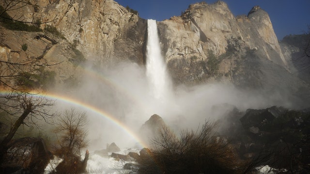

Yosemite's epic snowmelt could spell trouble for national park bracing for spring closure
In February, vast amounts of snow closed roads into the park and made some facilities inaccessible. Now, the meltwater from that same snow is pouring into Yosemite Valley, forcing the park service to close most of the park by Friday night.
In February, vast amounts of snow closed roads into the park and made some facilities inaccessible. Now, the meltwater from that same snow is pouring into Yosemite Valley, forcing the park service to close most of the park by Friday night.

Weather Webcast with Meteorologist Stephanie Barichello
Pleasant this afternoon then a chance for rain showers Saturday, mainly in the morning. Some rain/snow mix will be possible Sunday morning then primarily rain, plus cooler. Drying out next week and slowly warming.
Pleasant this afternoon then a chance for rain showers Saturday, mainly in the morning. Some rain/snow mix will be possible Sunday morning then primarily rain, plus cooler. Drying out next week and slowly warming.
Weather webcast with Rob Haswell
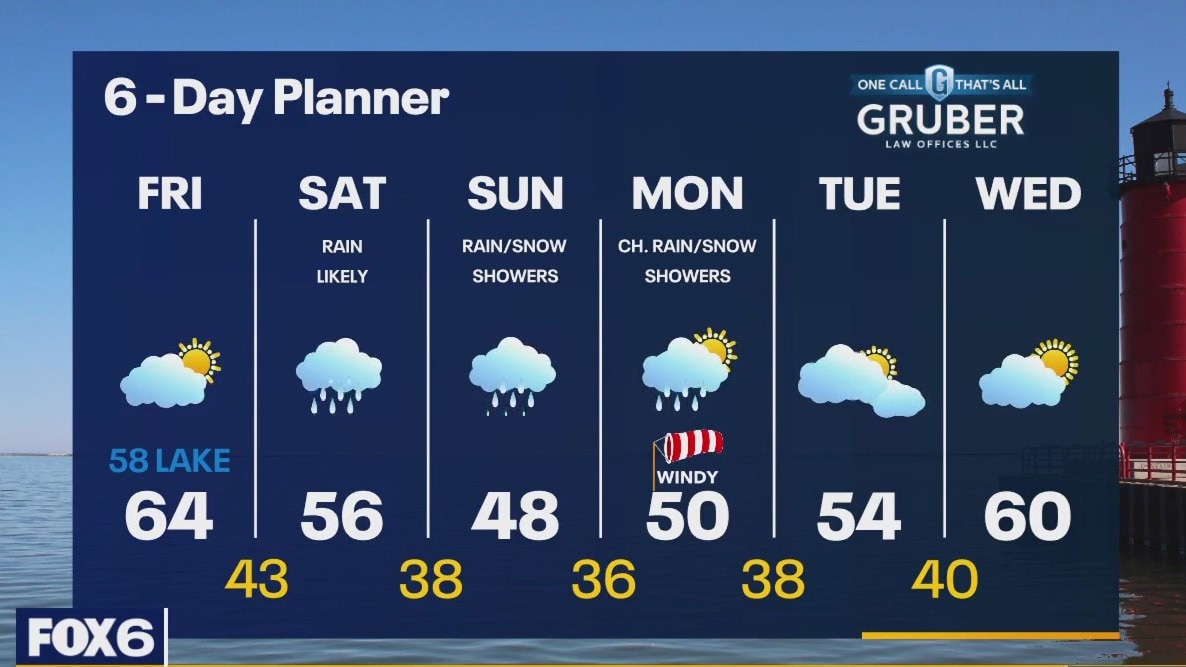
Another day with some sun and a breeze off of Lake Michigan keeping it in the upper 50s lakeside while we warm into the low to mid 60s inland. A low arrives for the weekend with rain likely Saturday and a chance for showers - possibly even snow showers - on Sunday. Highs will fall to the low to mid 50s Saturday and into the upper 40s Sunday. We should slowly warm up again later next week.
Another day with some sun and a breeze off of Lake Michigan keeping it in the upper 50s lakeside while we warm into the low to mid 60s inland. A low arrives for the weekend with rain likely Saturday and a chance for showers - possibly even snow showers - on Sunday. Highs will fall to the low to mid 50s Saturday and into the upper 40s Sunday. We should slowly warm up again later next week.
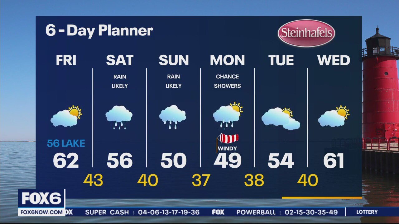
Weather Webcast with Meteorologist Eric Manges
Nice for Friday but then rain and cooler weather into the weekend
Nice for Friday but then rain and cooler weather into the weekend
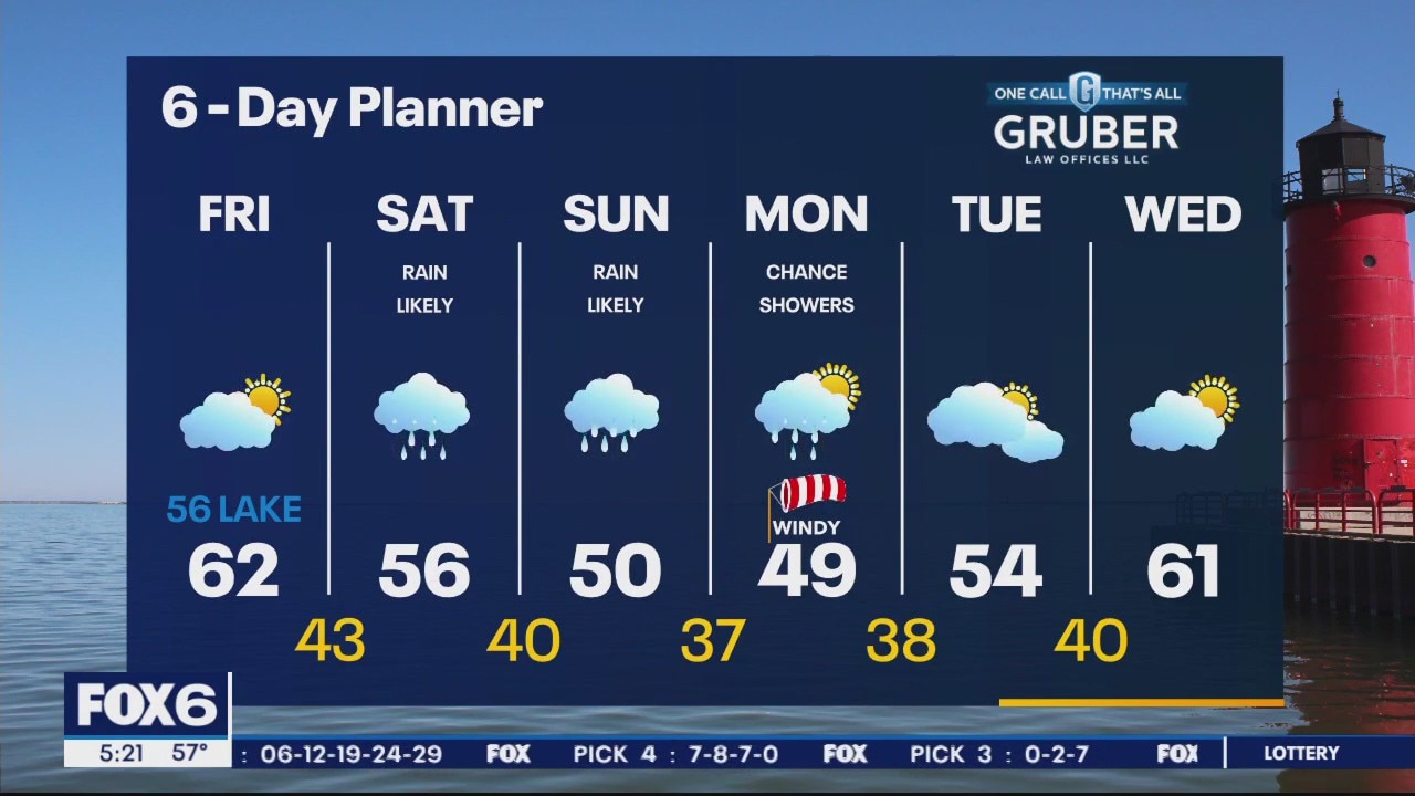
Weather Webcast with Meteorologist Eric Manges
One more day of nice weather then rain returns into the weekend
One more day of nice weather then rain returns into the weekend
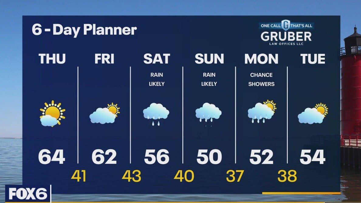
Weather webcast with Rob Haswell
A stronger southerly wind today will help us warm into the low 60s today with ample sunshine. We stay dry and on the sunny side again tomorrow with highs again in the 60s. A low arrives this weekend with a chance of showers Saturday and Sunday with temperatures falling into the 50s. We expect to warm up again later next week.
A stronger southerly wind today will help us warm into the low 60s today with ample sunshine. We stay dry and on the sunny side again tomorrow with highs again in the 60s. A low arrives this weekend with a chance of showers Saturday and Sunday with temperatures falling into the 50s. We expect to warm up again later next week.
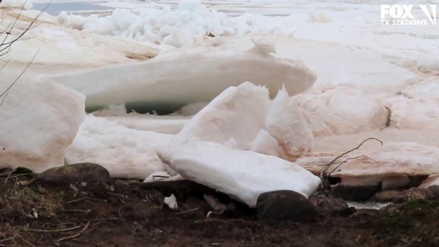

Massive ‘ice shoves’ pile up on Wisconsin shoreline of Lake Superior
The springtime phenomenon can cause damage to shorelines and nearby structures.
The springtime phenomenon can cause damage to shorelines and nearby structures.
Weather Webcast with Meteorologist Eric Manges
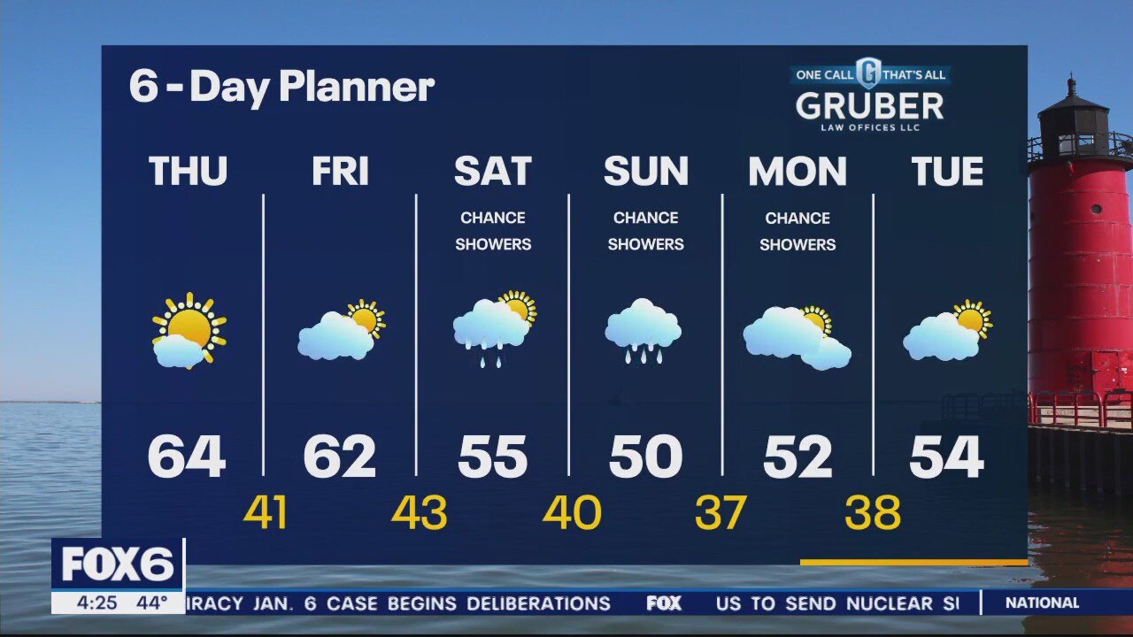
Warmer to end the week then rain by the weekend
Warmer to end the week then rain by the weekend
Weather Webcast With Lisa Michaels
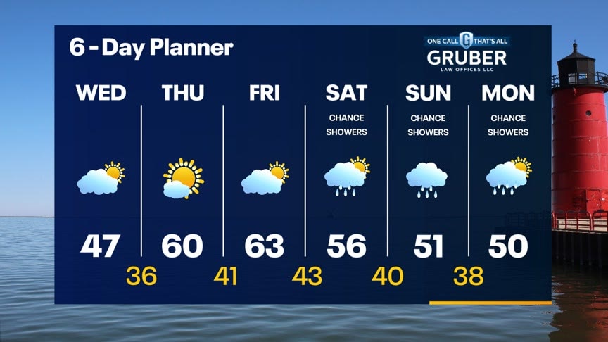
High pressure north of Wisconsin brings another cool day across the state. High temps in the low to mid 40s near the lake. Upper 40s to low 50s inland. Party cloudy skies. More seasonable temperatures return on Thursday and Friday back in the upper 50s/low 60s. Mainly dry weather ending off the week. A cut-off low will bring chances of rain through the weekend into early next week.
High pressure north of Wisconsin brings another cool day across the state. High temps in the low to mid 40s near the lake. Upper 40s to low 50s inland. Party cloudy skies. More seasonable temperatures return on Thursday and Friday back in the upper 50s/low 60s. Mainly dry weather ending off the week. A cut-off low will bring chances of rain through the weekend into early next week.
Weather webcast with Lisa Michaels
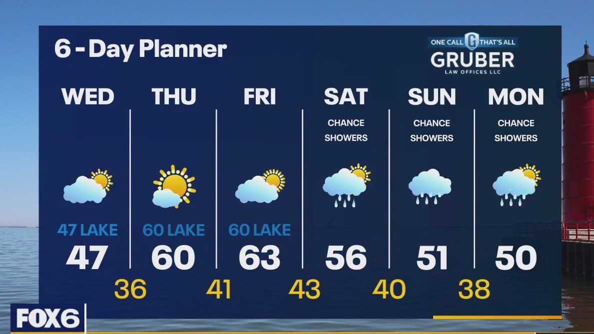
Partly cloudy and dry morning. Temperatures in the low to middle 30s. High pressure north of Wisconsin brings another cool day across the state. High temps in the middle 40s. More seasonable temperatures return on Thursday and Friday back in the upper 50s/low 60s. A cut-off low will bring chances of rain through the weekend into early next week.
Partly cloudy and dry morning. Temperatures in the low to middle 30s. High pressure north of Wisconsin brings another cool day across the state. High temps in the middle 40s. More seasonable temperatures return on Thursday and Friday back in the upper 50s/low 60s. A cut-off low will bring chances of rain through the weekend into early next week.

Garden supply prices up about 15%, cost of fertilizer triples
If you're thinking about warm weather and planning your landscaping, experts say your garden might cost more this spring.
If you're thinking about warm weather and planning your landscaping, experts say your garden might cost more this spring.
Weather Webcast with Meteorologist Eric Manges
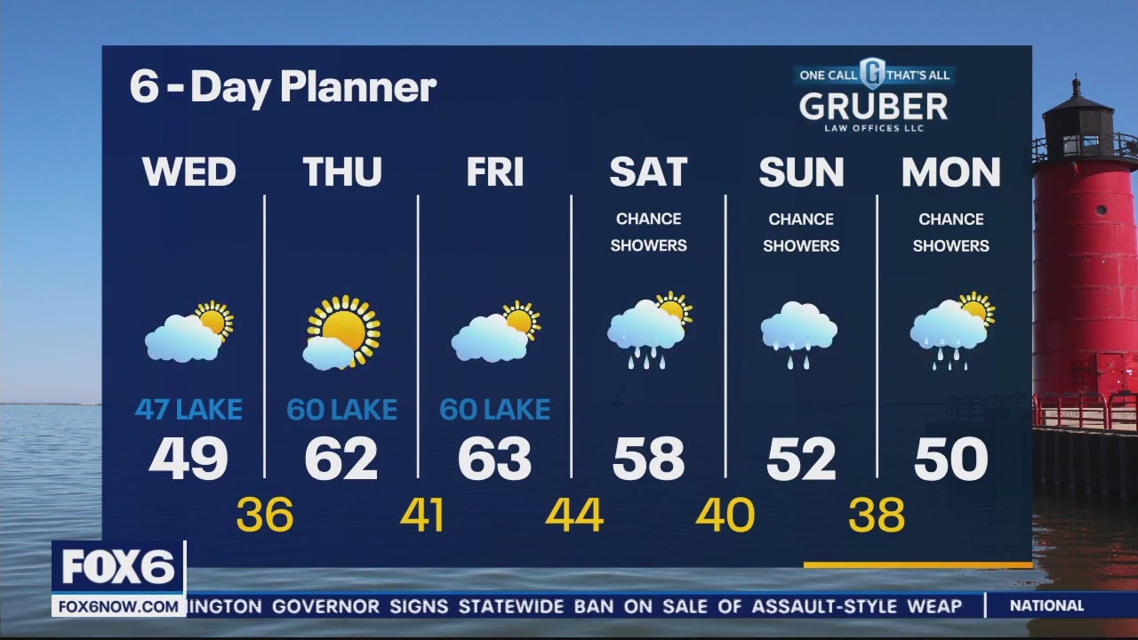
More seasonable by Thursday and Friday and finally the return of 60s
More seasonable by Thursday and Friday and finally the return of 60s
Weather Webcast with Meteorologist Stephanie Barichello
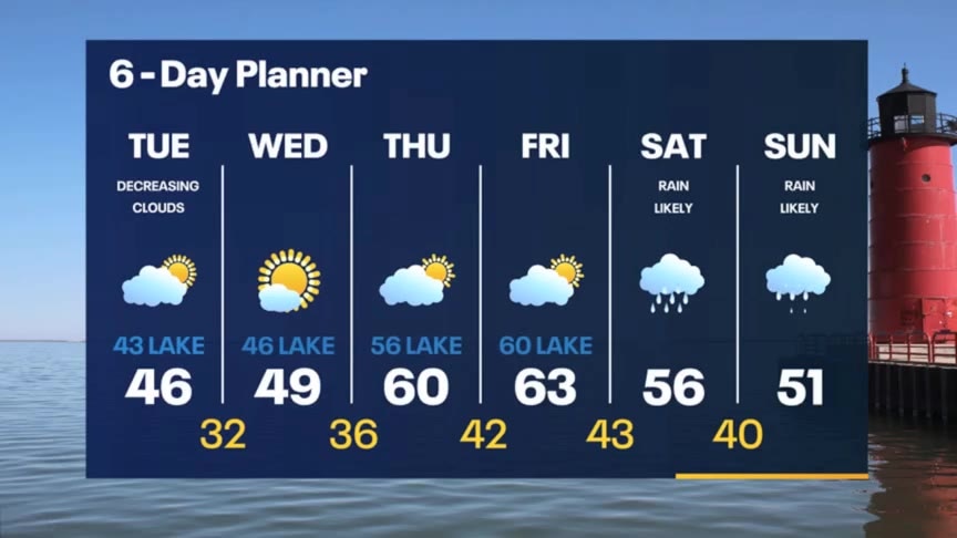
Partly sunny the next couple of days with temperatures in the 40s, then 50s and 60s by Thursday and Friday. Rain returns over the weekend.
Partly sunny the next couple of days with temperatures in the 40s, then 50s and 60s by Thursday and Friday. Rain returns over the weekend.
Weather webcast with Lisa Michaels
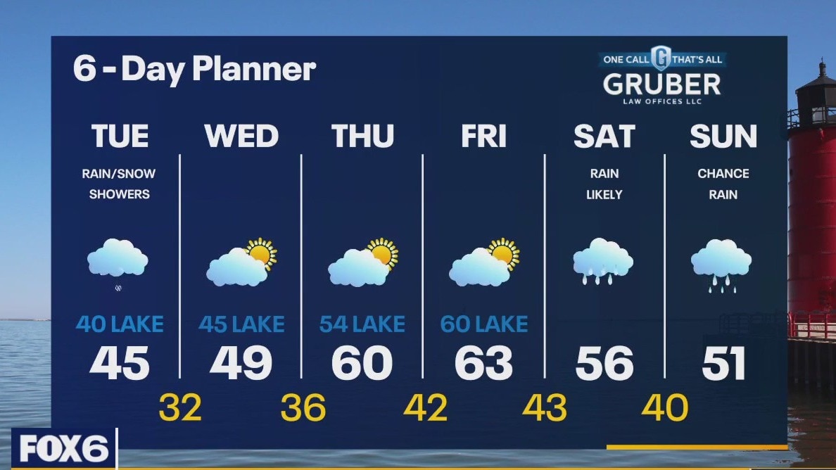
Rain activity this morning could mix with snowflakes while cooler temps are around. Lows will sit in the low to middle 30s. Morning fog can reduce visibility. A few isolated light rain/snow showers can occur early this afternoon. Activity should diminish as clouds will slowly move out. Highs in the low to mid 40s today. Partly sunny mid-to-late week with warming temperatures. 60s return by Thursday and Friday. Rain chances return this weekend with highs in the 50s.
Rain activity this morning could mix with snowflakes while cooler temps are around. Lows will sit in the low to middle 30s. Morning fog can reduce visibility. A few isolated light rain/snow showers can occur early this afternoon. Activity should diminish as clouds will slowly move out. Highs in the low to mid 40s today. Partly sunny mid-to-late week with warming temperatures. 60s return by Thursday and Friday. Rain chances return this weekend with highs in the 50s.