


Weather Webcast with Tom Wachs
Severe t-storms possible between 8pm and 12am. Damaging winds, large hail and embedded tornadoes possible. Tornado Watch for inland areas until 12am.
Severe t-storms possible between 8pm and 12am. Damaging winds, large hail and embedded tornadoes possible. Tornado Watch for inland areas until 12am.
Weather webcast with Rob Haswell
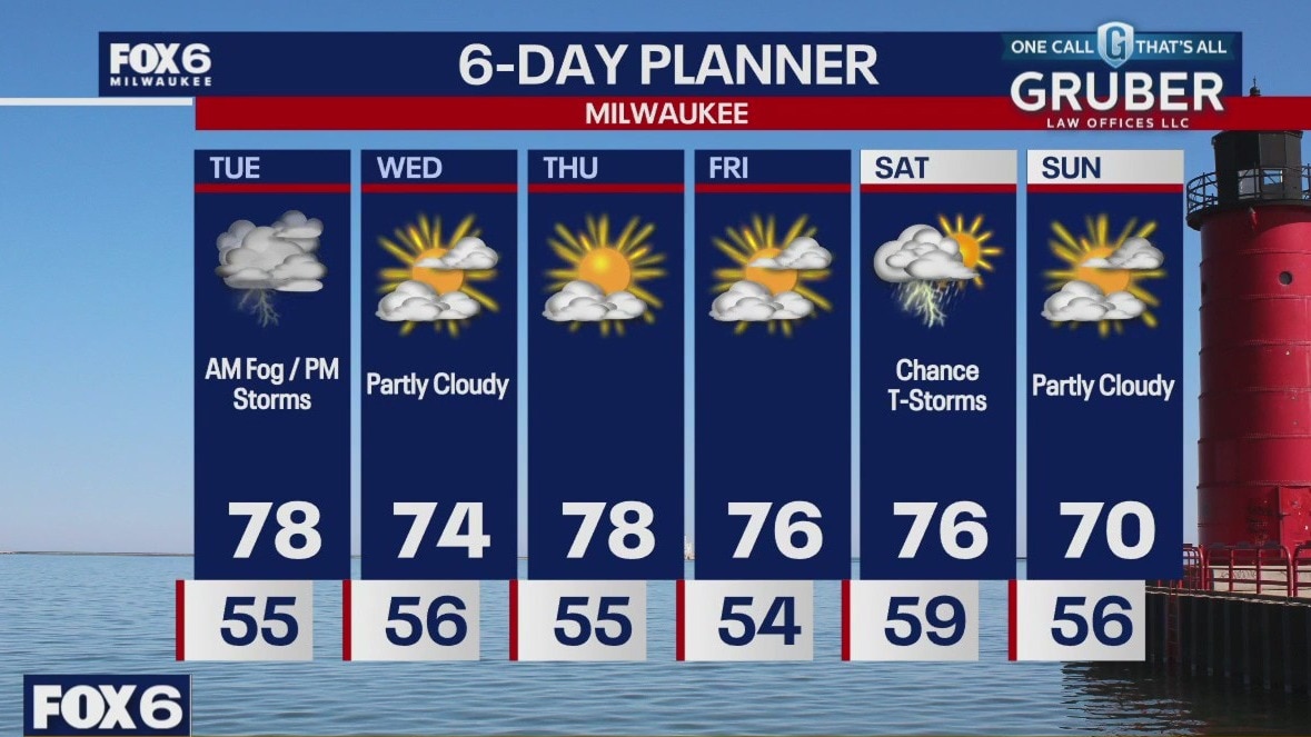
Our west and northwest counties will see some early rounds of thunderstorms but most of the Milwaukee Metro area will wait until the afternoon and evening for storms.
Our west and northwest counties will see some early rounds of thunderstorms but most of the Milwaukee Metro area will wait until the afternoon and evening for storms.
Weather Webcast with Tom Wachs
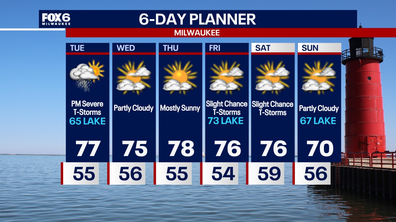
Dense fog overnight into Tuesday morning. Temperatures in the 50s. A few t-storms are possible during the day Tuesday, but the greatest chance will be Tuesday evening. Severe t-storms are likely on Tuesday evening.
Dense fog overnight into Tuesday morning. Temperatures in the 50s. A few t-storms are possible during the day Tuesday, but the greatest chance will be Tuesday evening. Severe t-storms are likely on Tuesday evening.

Weather Webcast with Tom Wachs
Areas of dense fog developing late tonight. Temperatures in the 50s. Scattered t-storms are possible on Tuesday with the strongest of storms possible Tuesday night. Severe thunderstorms likely on Tuesday night.
Areas of dense fog developing late tonight. Temperatures in the 50s. Scattered t-storms are possible on Tuesday with the strongest of storms possible Tuesday night. Severe thunderstorms likely on Tuesday night.
Weather Webcast with Stephanie Barichello
Severe thunderstorms possible both today and Tuesday, with all threats possible. Tuesday evening poses the greatest threat. Drying out for a few days to end the week.
Severe thunderstorms possible both today and Tuesday, with all threats possible. Tuesday evening poses the greatest threat. Drying out for a few days to end the week.

Southeast Wisconsin severe weather; share pictures from your neighborhood
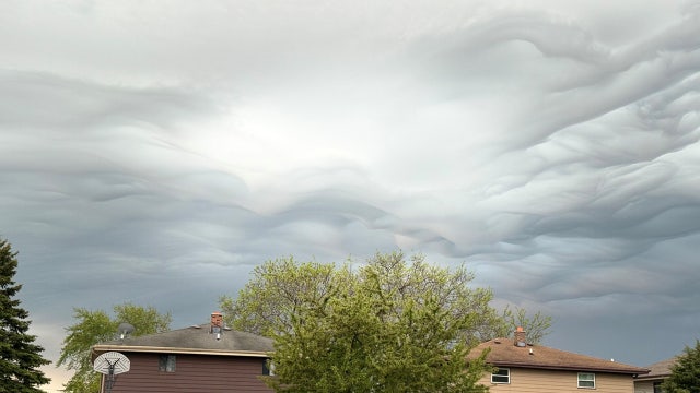
With rounds of storms and possible severe weather running through Tuesday night, May 21, FOX6 wants to see your weather photos!
With rounds of storms and possible severe weather running through Tuesday night, May 21, FOX6 wants to see your weather photos!
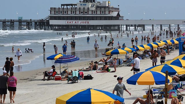

Memorial Day forecast shows which parts of US will likely have best weather
The Northeast could be graced with potentially perfect Memorial Day weekend weather, according to the FOX Forecast Center.
The Northeast could be graced with potentially perfect Memorial Day weekend weather, according to the FOX Forecast Center.

Weather webcast with Rob Haswell
A strong low is pushing a warm front through our area today, creating a very unstable air mass. Rain and thunderstorms are likely this morning and again this afternoon and evening.
A strong low is pushing a warm front through our area today, creating a very unstable air mass. Rain and thunderstorms are likely this morning and again this afternoon and evening.
Weather webcast with Lisa Michaels
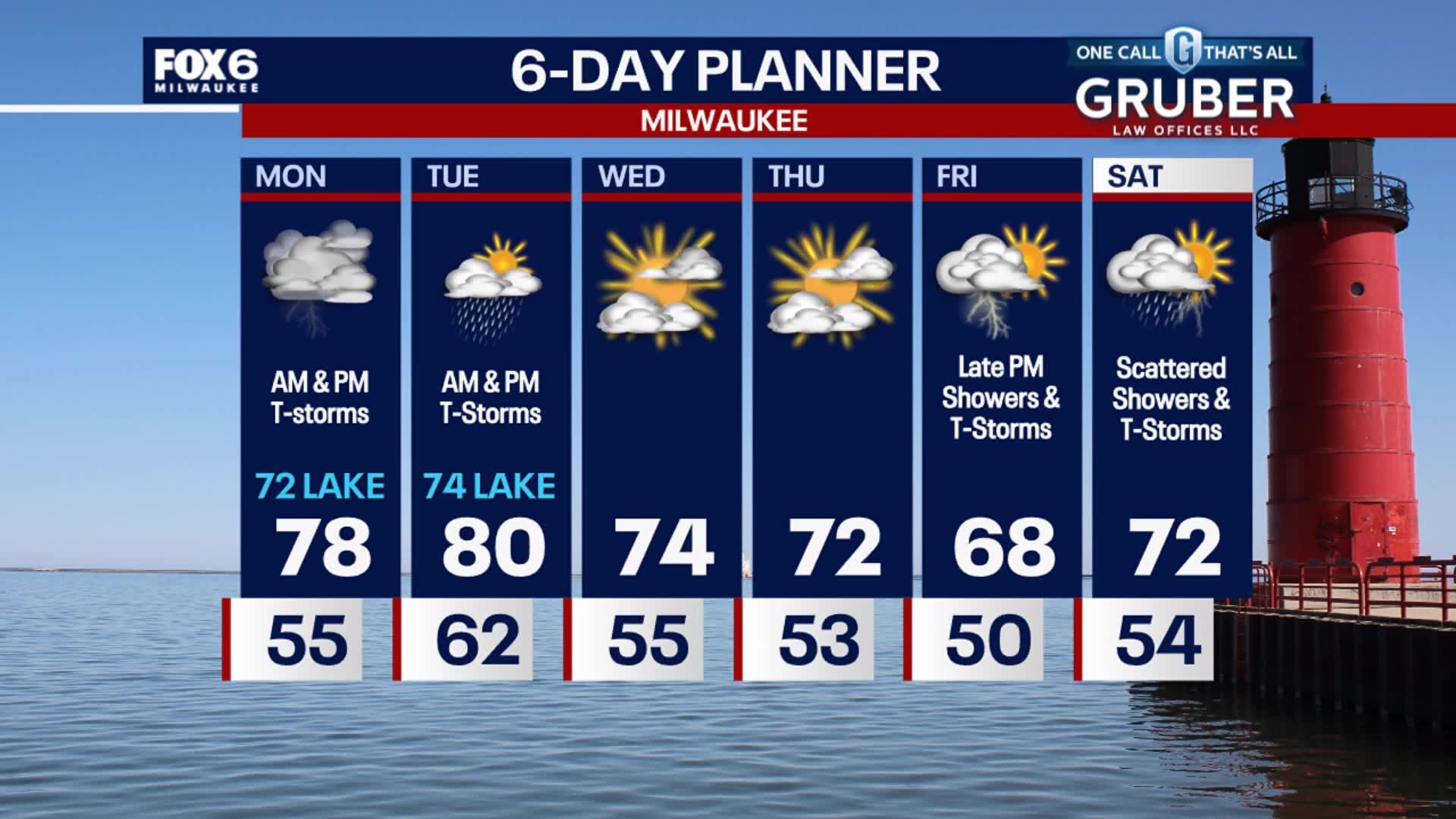
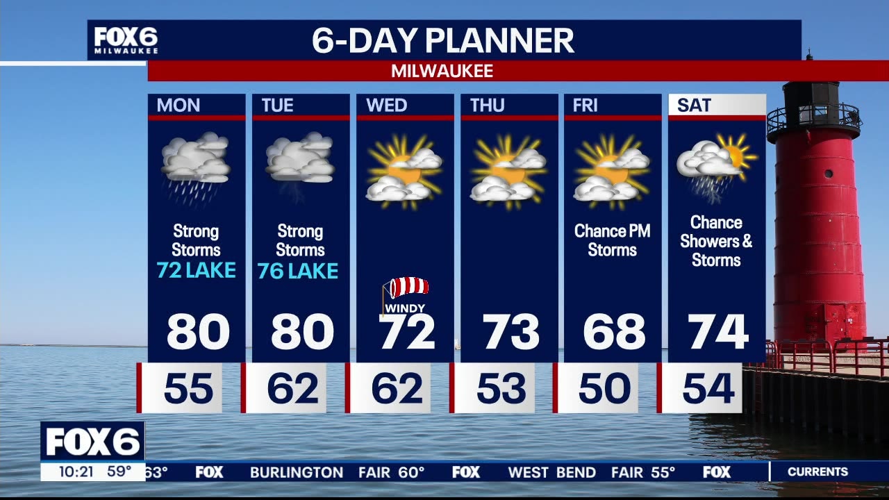
Clouds increase Sunday night with rain arriving early Monday morning. Lows in the mid to upper 50s. Strong to severe storms possible during Monday afternoon. Winds and hail will be the primary threats. More chances for severe storms continue on Tuesday especially in the afternoon and evening hours. All types of sever weather are possible. Sunny and calm the rest of the week with temperatures around normal, in the 60s and 70s. Tonight: Increasing Clouds. Rain late. Low: 55° Wind: E 5 Monday: 72 Lake. Rounds of showers and thunderstorms. Some could be strong to severe. High: 80° Wind: SE 5-15 Tuesday: 76 Lake. Showers and thunderstorms. Strong to severe likely. AM Low: 62° High: 80° Wind: SSE 5-15 Wednesday:Partly sunny. AM Low: 62° High: 72° Wind: SW 10-25 Thursday: Partly sunny. AM Low: 53° High: 73° Wind: SW 5-15 Friday: Partly sunny. Possible PM rain/storms. AM Low: 50° High: 68° Wind: SE 5-15 Saturday: Scattered rain/storms. AM Low: 54° High: 74° Wind: NE 5-10
Clouds increase Sunday night with rain arriving early Monday morning. Lows in the mid to upper 50s. Strong to severe storms possible during Monday afternoon. Winds and hail will be the primary threats. More chances for severe storms continue on Tuesday especially in the afternoon and evening hours. All types of sever weather are possible. Sunny and calm the rest of the week with temperatures around normal, in the 60s and 70s. Tonight: Increasing Clouds. Rain late. Low: 55° Wind: E 5 Monday: 72 Lake. Rounds of showers and thunderstorms. Some could be strong to severe. High: 80° Wind: SE 5-15 Tuesday: 76 Lake. Showers and thunderstorms. Strong to severe likely. AM Low: 62° High: 80° Wind: SSE 5-15 Wednesday:Partly sunny. AM Low: 62° High: 72° Wind: SW 10-25 Thursday: Partly sunny. AM Low: 53° High: 73° Wind: SW 5-15 Friday: Partly sunny. Possible PM rain/storms. AM Low: 50° High: 68° Wind: SE 5-15 Saturday: Scattered rain/storms. AM Low: 54° High: 74° Wind: NE 5-10


Tennessee boy, 10, dies days after being swept into neighborhood storm drain
A 10-year-old boy swept into a storm drain after a severe weather outbreak in Tennessee has officially died nearly 10 days after the tragic accident, according to his father.
A 10-year-old boy swept into a storm drain after a severe weather outbreak in Tennessee has officially died nearly 10 days after the tragic accident, according to his father.
Weather webcast with Stephanie Barichello
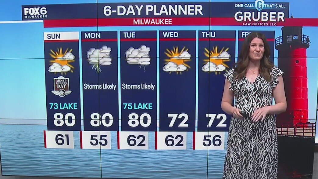
Sunny again today and warm with highs around 80 inland, likely hovering in the low to mid 70s lakeside. Clouds increase this evening then there is a chance for showers and thunderstorms both Monday and Tuesday. Severe weather is possible on Tuesday, stay tuned. Both days will be warm and a bit muggy with dewpoints around 60. Sunny and calm the rest of the week with temperatures around normal, in the 60s and 70s.
Sunny again today and warm with highs around 80 inland, likely hovering in the low to mid 70s lakeside. Clouds increase this evening then there is a chance for showers and thunderstorms both Monday and Tuesday. Severe weather is possible on Tuesday, stay tuned. Both days will be warm and a bit muggy with dewpoints around 60. Sunny and calm the rest of the week with temperatures around normal, in the 60s and 70s.

Weather webcast with Lisa Michaels
A cold front will pass through tonight. A few showers and/or isolated storms is possible early. Most areas will stay dry. Sunday morning lows in the low to mid 60s. Mostly sunny with high temps in the mid to upper 70s. All eyes are on Tuesday next week as a broad area of heavy rain and the potential of severe storms sets up across our region. Please stay tuned for updates as we get closer. Cooler temperatures return near the end of next week.
A cold front will pass through tonight. A few showers and/or isolated storms is possible early. Most areas will stay dry. Sunday morning lows in the low to mid 60s. Mostly sunny with high temps in the mid to upper 70s. All eyes are on Tuesday next week as a broad area of heavy rain and the potential of severe storms sets up across our region. Please stay tuned for updates as we get closer. Cooler temperatures return near the end of next week.
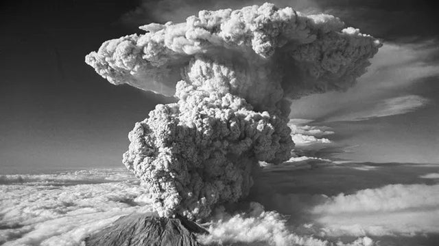

Mount St. Helens' eruption: Survivors recount the 'darker than midnight' fury in 1980
The Mount St. Helens' eruption in Washington on May 18, 1980 is the worst volcanic eruption in U.S. history, killing 57 people and spewing 520 million tons of ash across the U.S.
The Mount St. Helens' eruption in Washington on May 18, 1980 is the worst volcanic eruption in U.S. history, killing 57 people and spewing 520 million tons of ash across the U.S.
Weather webcast with Chief Meteorologist Rob Haswell
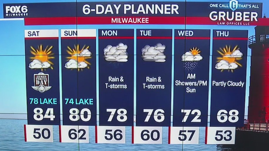
Sunny and warmer this weekend with 80s on Saturday then a mix of 70s and 80s Sunday. There is a slim chance for passing shower Saturday night. Thunderstorms return early next week. Chance for strong to severe storms possible on Tuesday. Temperatures cool later on next week.
Sunny and warmer this weekend with 80s on Saturday then a mix of 70s and 80s Sunday. There is a slim chance for passing shower Saturday night. Thunderstorms return early next week. Chance for strong to severe storms possible on Tuesday. Temperatures cool later on next week.

Weather webcast with Lisa Michaels
Fog is possible again tonight and tomorrow morning, with lows in the low 50s. Sunny and warmer this weekend with 80s on Saturday then a mix of 70s and 80s Sunday. There is a slim chance for passing shower Saturday night. Thunderstorms return early next wee. Chance for strong to severe storms possible on Tuesday. Temperatures cool later on next week.
Fog is possible again tonight and tomorrow morning, with lows in the low 50s. Sunny and warmer this weekend with 80s on Saturday then a mix of 70s and 80s Sunday. There is a slim chance for passing shower Saturday night. Thunderstorms return early next wee. Chance for strong to severe storms possible on Tuesday. Temperatures cool later on next week.
Weather Webcast with Stephanie Barichello
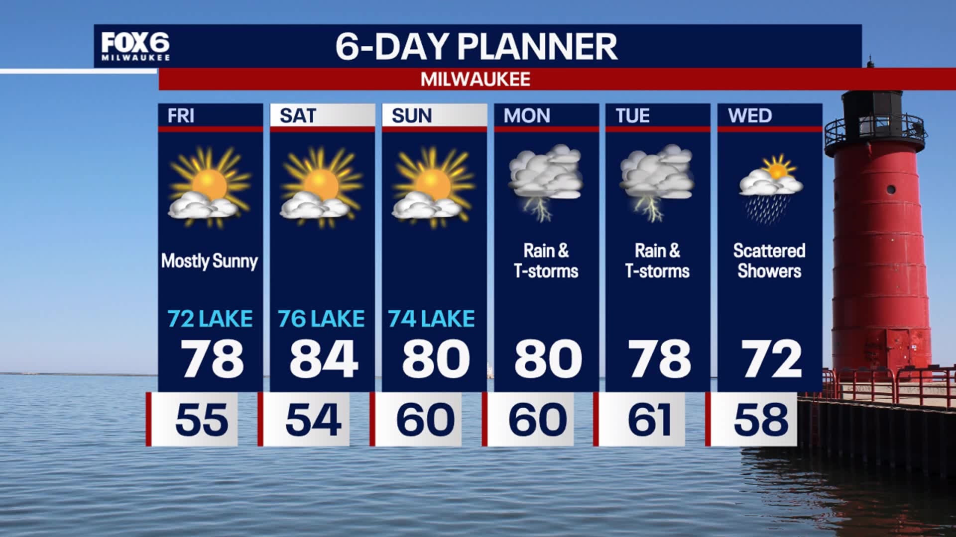
Sunny and mild today with temperatures in the low 70s lakeside, upper 70s far inland. Even warmer over the weekend! Rain and thunderstorms return Tuesday.
Sunny and mild today with temperatures in the low 70s lakeside, upper 70s far inland. Even warmer over the weekend! Rain and thunderstorms return Tuesday.


Future Forecaster: Meet 9-year-old Taylor
She wanted to be a Future Forecaster and that's exactly what FOX6 WakeUp News is helping her accomplish. Meet 9-year-old Taylor, the latest FOX6 Future Forecaster.
She wanted to be a Future Forecaster and that's exactly what FOX6 WakeUp News is helping her accomplish. Meet 9-year-old Taylor, the latest FOX6 Future Forecaster.

9-year-old Taylor has a blast as a Future Forecaster
9-year-old Taylor has a blast as a Future Forecaster
9-year-old Taylor has a blast as a Future Forecaster

Meet 9-year-old Taylor
Meet 9-year-old Taylor, our latest Future Forecaster.
Meet 9-year-old Taylor, our latest Future Forecaster.

Weather webcast with Chief Meteorologist Rob Haswell
Patchy dense fog for most of our area this morning with thicker and more widespread fog to our north. Sheboygan and Fond du Lac counties have been added to the Dense Fog Advisory until 8am. We should dry out starting today and lasting through late Sunday. Temperatures will warm into the upper 70s and low 80s through early next week. Our next focus for severe storms and heavy rainfall will be later Monday and Tuesday. Stay tuned.
Patchy dense fog for most of our area this morning with thicker and more widespread fog to our north. Sheboygan and Fond du Lac counties have been added to the Dense Fog Advisory until 8am. We should dry out starting today and lasting through late Sunday. Temperatures will warm into the upper 70s and low 80s through early next week. Our next focus for severe storms and heavy rainfall will be later Monday and Tuesday. Stay tuned.