

Weather Webcast with Tom Wachs
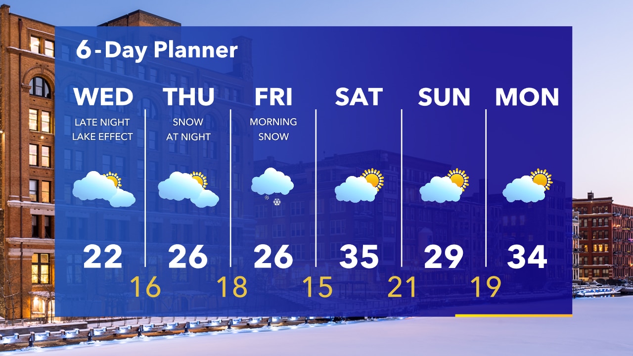
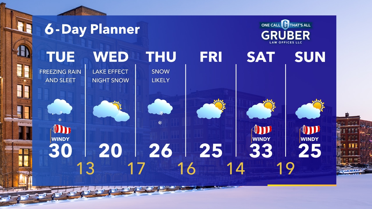
A few snow showers ending overnight. Cold with temperatures in the single digits and teens by sunrise. Mostly cloudy on Wednesday. Lake effect snow possible late Wednesday night.
A few snow showers ending overnight. Cold with temperatures in the single digits and teens by sunrise. Mostly cloudy on Wednesday. Lake effect snow possible late Wednesday night.
Weather Webcast with Tom Wachs
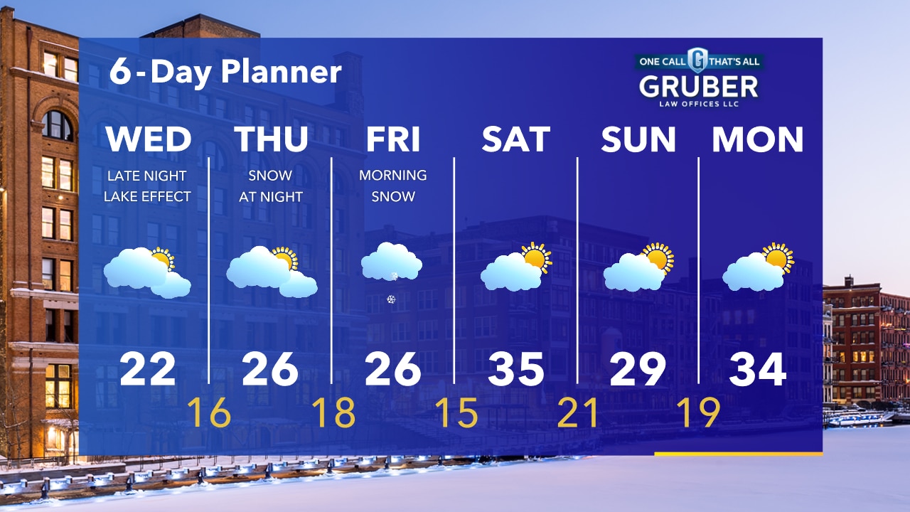
Wintry precipitation ending but untreated roads will remain slick. Temperatures dropping into the teens with wind chills around 0 by morning. Lake effect snow is possible late Wednesday night.
Wintry precipitation ending but untreated roads will remain slick. Temperatures dropping into the teens with wind chills around 0 by morning. Lake effect snow is possible late Wednesday night.
Weather Webcast with A.J. Waterman
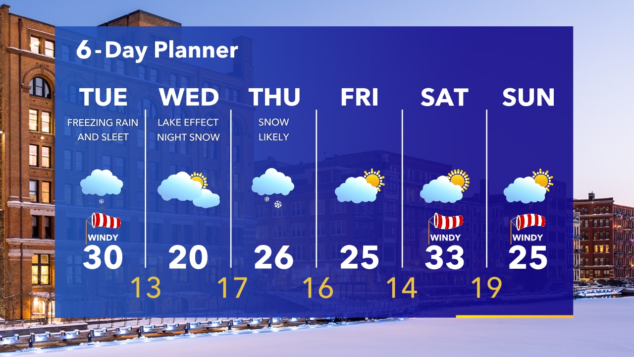
Wintry precip. comes to an end this afternoon. Then a drier, colder day on Wednesday before another storm arrives...
Wintry precip. comes to an end this afternoon. Then a drier, colder day on Wednesday before another storm arrives...

Weather Webcast with A.J. Waterman
Wintry precip. comes to an end this afternoon, then a drier, colder day on Wednesday before another storm arrives...
Wintry precip. comes to an end this afternoon, then a drier, colder day on Wednesday before another storm arrives...

Weather webcast with Rob Haswell
Winter Weather Advisory in effect until 6pm today. A low passing to our south and east today and tonight will bring an extended period of mixed precipitation to our area including freezing rain. Untreated area roads will be slippery and power outages are possible with icing of up to two tenths of an inch is possible.
Winter Weather Advisory in effect until 6pm today. A low passing to our south and east today and tonight will bring an extended period of mixed precipitation to our area including freezing rain. Untreated area roads will be slippery and power outages are possible with icing of up to two tenths of an inch is possible.
Weather Webcast with Tom Wachs
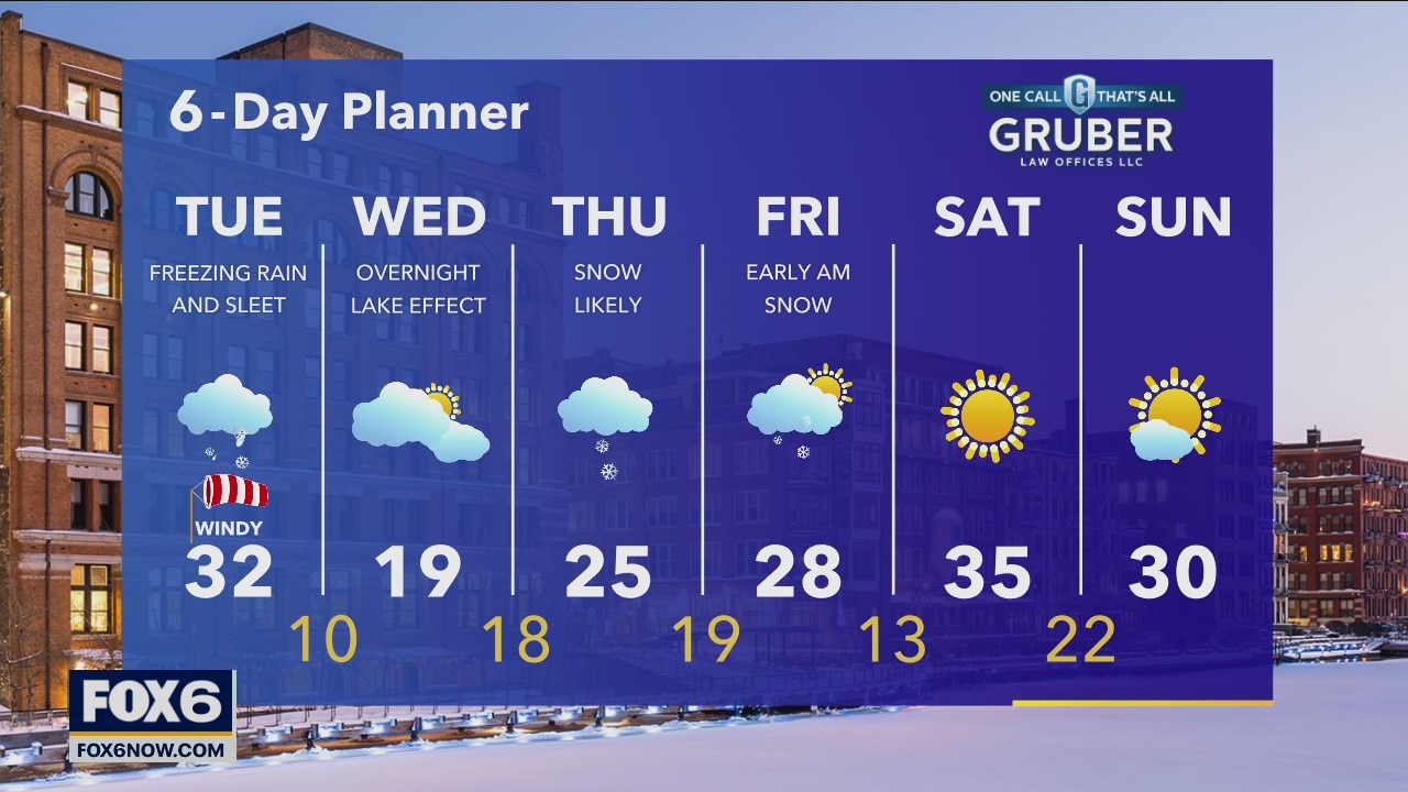
Rain changing to freezing rain across SE WI overnight. Freezing rain and sleet likely on Tuesday, thundersleet is possible. The heaviest precipitation will fall from mid-morning through mid-afternoon. Please be careful on the roads.
Rain changing to freezing rain across SE WI overnight. Freezing rain and sleet likely on Tuesday, thundersleet is possible. The heaviest precipitation will fall from mid-morning through mid-afternoon. Please be careful on the roads.
Weather Webcast with Tom Wachs
Precipitation starts after 8pm tonight. Rain Milwaukee and south to start and freezing rain north of Milwaukee. Everyone will change to freezing rain overnight. A mix of freezing rain and sleet on Tuesday. Expect an icy mess.
Precipitation starts after 8pm tonight. Rain Milwaukee and south to start and freezing rain north of Milwaukee. Everyone will change to freezing rain overnight. A mix of freezing rain and sleet on Tuesday. Expect an icy mess.
Weather Webcast with A.J. Waterman
Freezing rain in the forecast overnight could make for hazardous road conditions...
Freezing rain in the forecast overnight could make for hazardous road conditions...
Weather Webcast with A.J. Waterman
Snow squalls moving through SE Wisconsin...
Snow squalls moving through SE Wisconsin...
Weather Webcast with A.J. Waterman
Snow squalls headed through SE Wisconsin...
Snow squalls headed through SE Wisconsin...
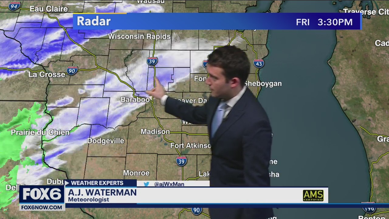
Thundersnow squalls moving through SE Wisconsin
Thundersnow squalls moving through SE Wisconsin
Thundersnow squalls moving through SE Wisconsin

Weather webcast with Rob Haswell
Cloudy and mild today with highs in the mid to upper 30s. Rain is likely later on today, changing to freezing rain tonight. A Winter Weather Advisory goes into effect at 11pm and lasts through 6pm on Tuesday. We can expect significant icing on untreated surfaces tonight and Tuesday.
Cloudy and mild today with highs in the mid to upper 30s. Rain is likely later on today, changing to freezing rain tonight. A Winter Weather Advisory goes into effect at 11pm and lasts through 6pm on Tuesday. We can expect significant icing on untreated surfaces tonight and Tuesday.
Weather Webcast with Tom Wachs
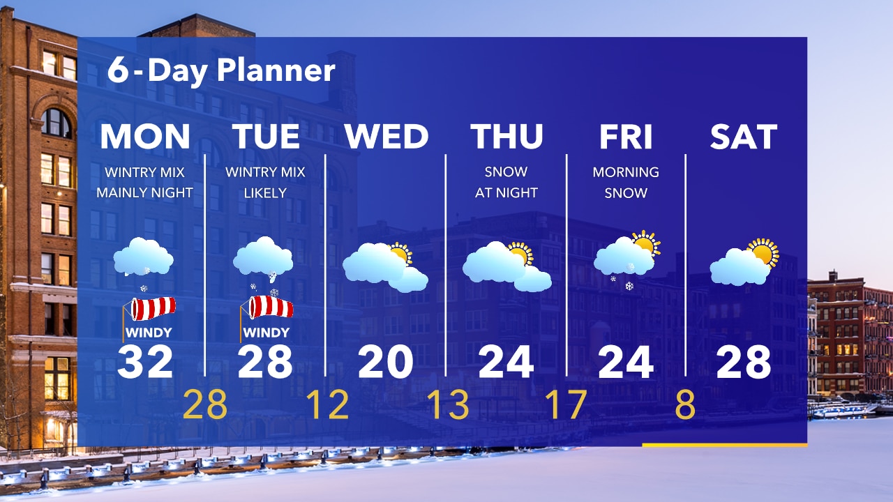
A Winter Weather Advisory takes effect on Monday evening and expires Tuesday evening. Get ready for an icy mess Monday night and Tuesday. Slick roads and power outages possible.
A Winter Weather Advisory takes effect on Monday evening and expires Tuesday evening. Get ready for an icy mess Monday night and Tuesday. Slick roads and power outages possible.
Weather Webcast with Tom Wachs
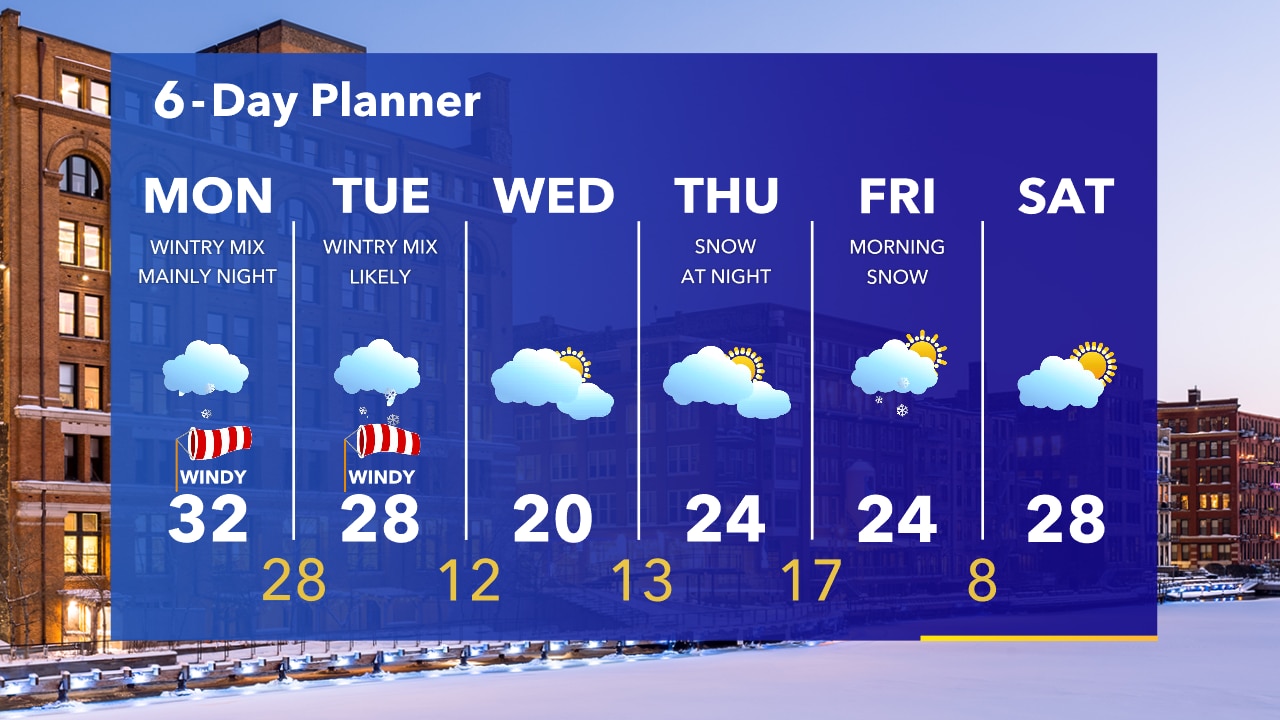
An icy mess is likely Monday night through Tuesday night. Winter Weather Advisory for all of SE WI Monday evening through Tuesday evening. 0.25" of ice from freezing rain/sleet likely. Watch out for freezing drizzle before this during the day Monday.
An icy mess is likely Monday night through Tuesday night. Winter Weather Advisory for all of SE WI Monday evening through Tuesday evening. 0.25" of ice from freezing rain/sleet likely. Watch out for freezing drizzle before this during the day Monday.
Weather Webcast with Eric Manges
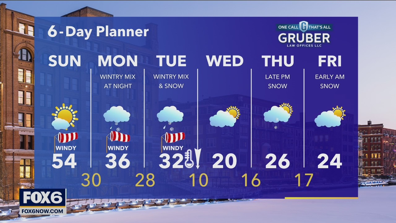
Much warmer today with highs near 50 and mostly sunny skies. Winds finally calm down tonight but another messy system arrives Monday night into Tuesday.
Much warmer today with highs near 50 and mostly sunny skies. Winds finally calm down tonight but another messy system arrives Monday night into Tuesday.
Weather Webcast with A.J. Waterman
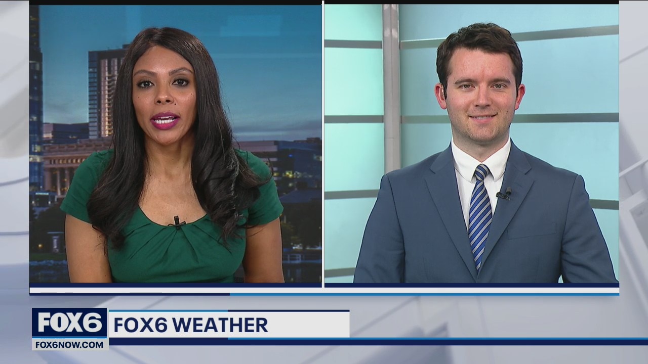
Warm day on the way Sunday, then a winter storm arrives Monday night...
Warm day on the way Sunday, then a winter storm arrives Monday night...
Weather Webcast with Eric Manges
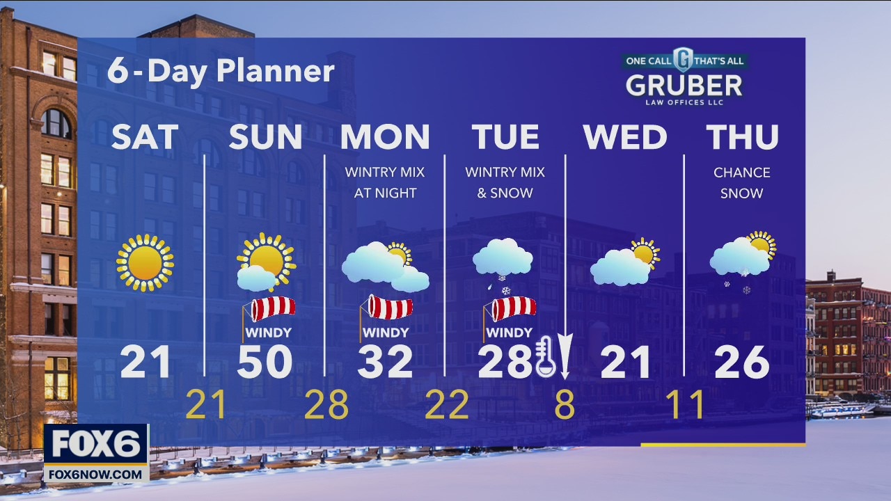
Cold air is back today with highs struggling to hit 20 and breezy winds. Winds pick up even more but rushing in warmer air for tomorrow, highs back to the upper 40s.
Cold air is back today with highs struggling to hit 20 and breezy winds. Winds pick up even more but rushing in warmer air for tomorrow, highs back to the upper 40s.
Weather Webcast with Meteorologist Stephanie Barichello
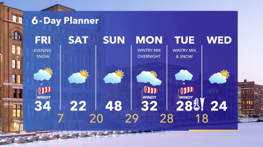
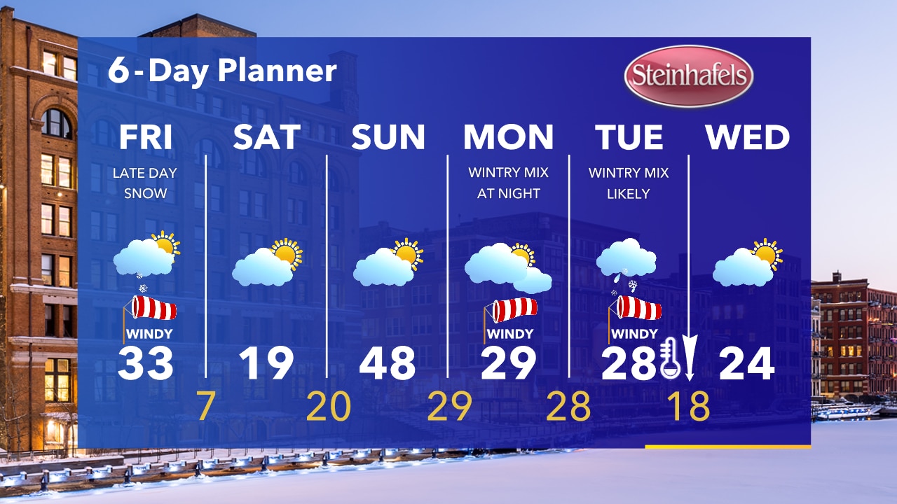
A band of snow moves through between 4-8pm and could reduce visibility for a brief time, leading to messy travel. Cold Saturday then warming up Sunday. Another storm system brings wintry mix Tuesday.
A band of snow moves through between 4-8pm and could reduce visibility for a brief time, leading to messy travel. Cold Saturday then warming up Sunday. Another storm system brings wintry mix Tuesday.
Weather webcast with Rob Haswell
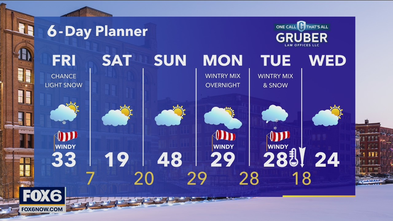
A clipper type system races across the map today bringing a chance for some light snow and some very strong wind gusts. A Wind Advisory goes into effect today at 2pm and remains in effect until 4a on Friday. Wind gusts will be in excess of 40mph at times. We do warm up as the clipper moves in but as it exits, we cool down significantly with lows in the single digits.
A clipper type system races across the map today bringing a chance for some light snow and some very strong wind gusts. A Wind Advisory goes into effect today at 2pm and remains in effect until 4a on Friday. Wind gusts will be in excess of 40mph at times. We do warm up as the clipper moves in but as it exits, we cool down significantly with lows in the single digits.
Weather Webcast with Tom Wachs
Cold on Friday morning with temperatures in the single digits. Warming into the 30s by afternoon but strong winds will gust over 40mph out of the southwest. 0.5"-1.0" of snow possible Friday evening.
Cold on Friday morning with temperatures in the single digits. Warming into the 30s by afternoon but strong winds will gust over 40mph out of the southwest. 0.5"-1.0" of snow possible Friday evening.