

Weather Webcast with Holly Baker
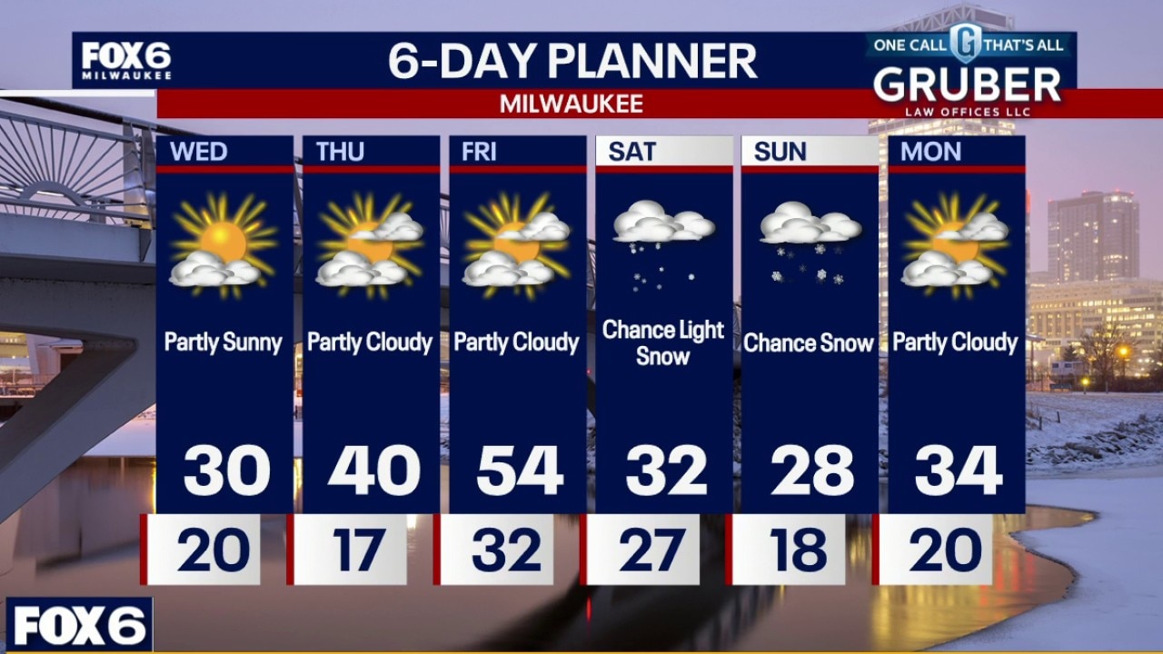
Temperatures will be a little warmer for the remainder of the work week.
Temperatures will be a little warmer for the remainder of the work week.
Weather webcast with Stephanie Barichello
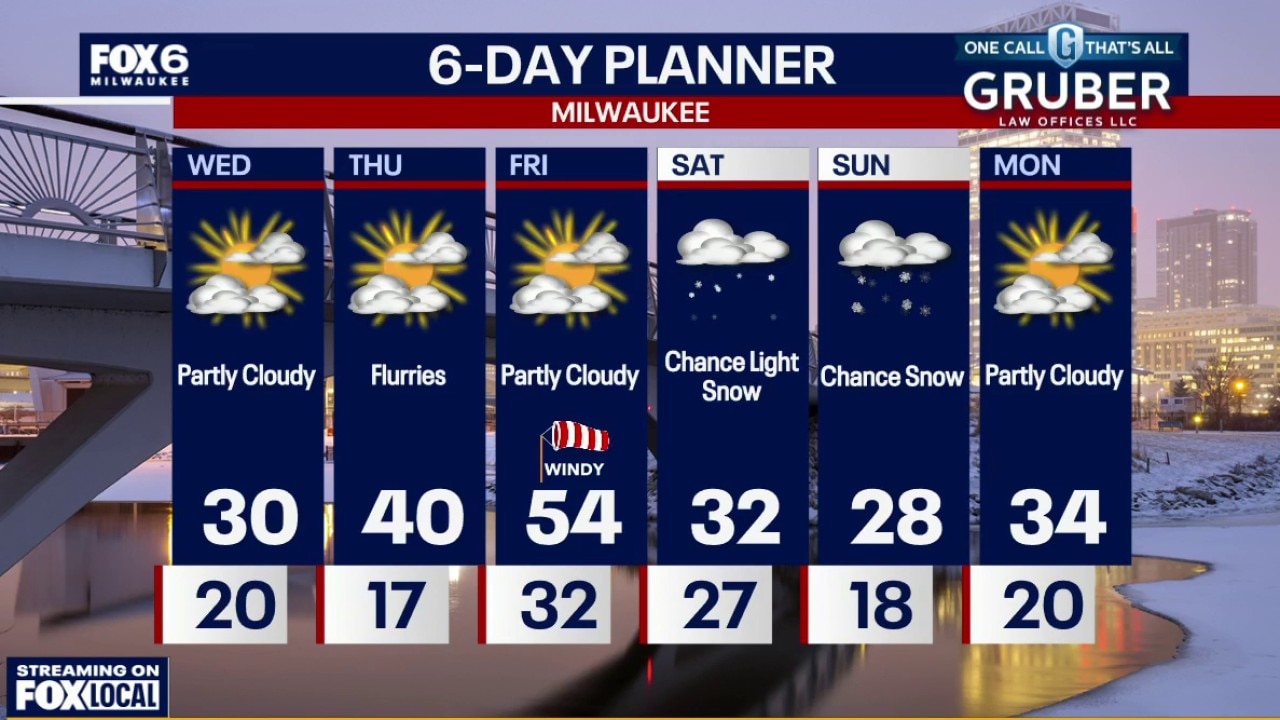
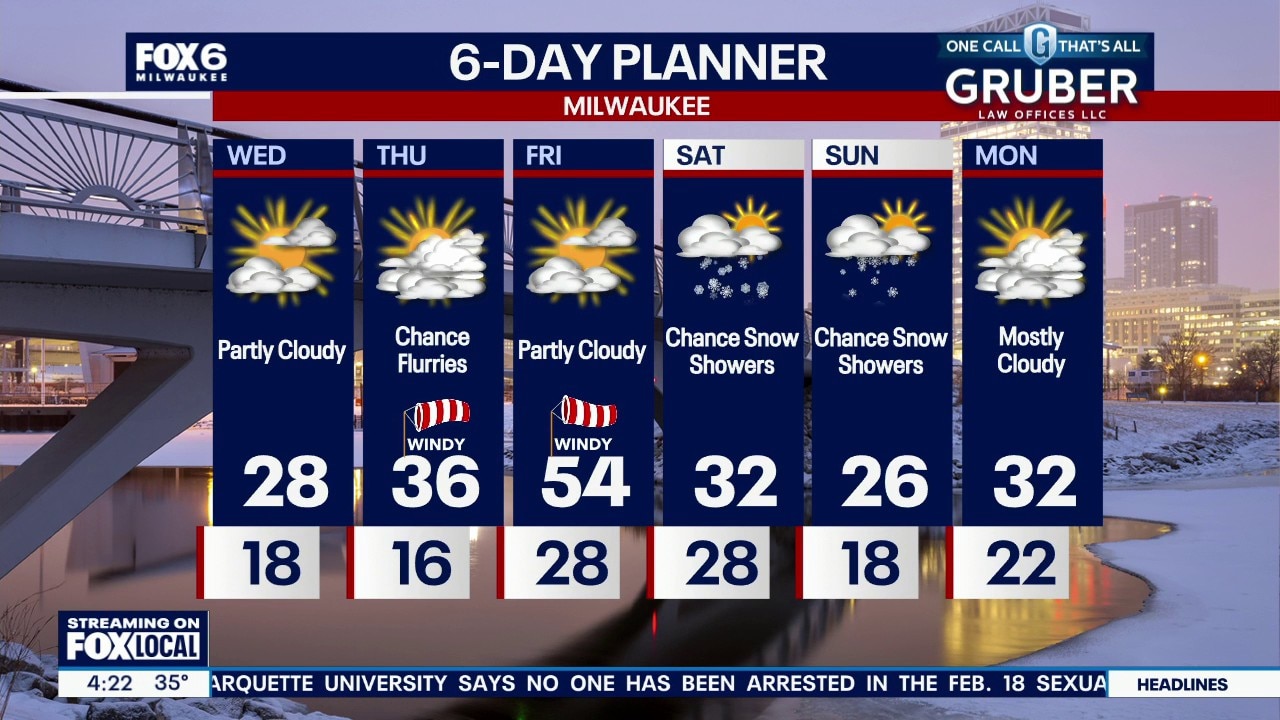
Brisk northwest winds and a few early flurries give way to clearing skies and colder air midweek, with lows dropping into the teens Wednesday night.
Brisk northwest winds and a few early flurries give way to clearing skies and colder air midweek, with lows dropping into the teens Wednesday night.
Weather webcast with Rob Haswell
Brisk northwest winds and a few early flurries give way to clearing skies and colder air midweek, with lows dropping into the teens Wednesday night.
Brisk northwest winds and a few early flurries give way to clearing skies and colder air midweek, with lows dropping into the teens Wednesday night.
Weather Webcast with Chief Meteorologist Tom Wachs
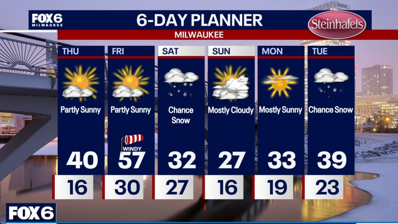
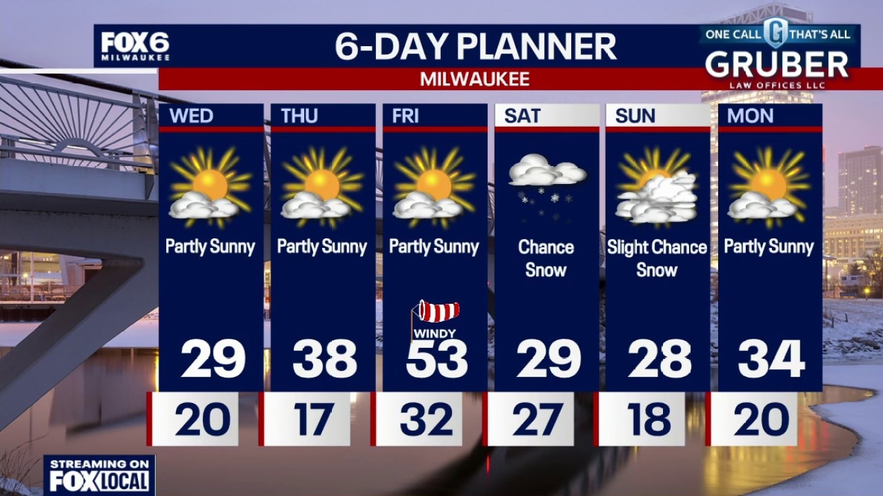
Clearing skies overnight with temperatures dropping into the teens to around 20 by sunrise. It will stay windy. Partly sunny, blustery and cool on Wednesday with highs in the upper 20s. Warming up on Thursday with highs around 40.
Clearing skies overnight with temperatures dropping into the teens to around 20 by sunrise. It will stay windy. Partly sunny, blustery and cool on Wednesday with highs in the upper 20s. Warming up on Thursday with highs around 40.
Weather Webcast with Chief Meteorologist Tom Wachs
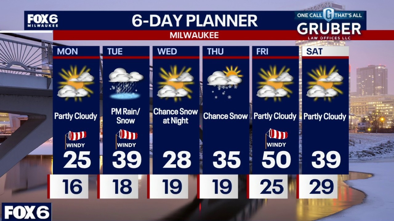
A brief band of snow mixed with rain will move through early this evening, moving out by 7pm. It could create a few slick spots/brief drops in visibility. Becoming partly cloudy later tonight with temperatures dropping into the 20s. It will stay windy.
A brief band of snow mixed with rain will move through early this evening, moving out by 7pm. It could create a few slick spots/brief drops in visibility. Becoming partly cloudy later tonight with temperatures dropping into the 20s. It will stay windy.
Weather Webcast with Stephanie Barichello
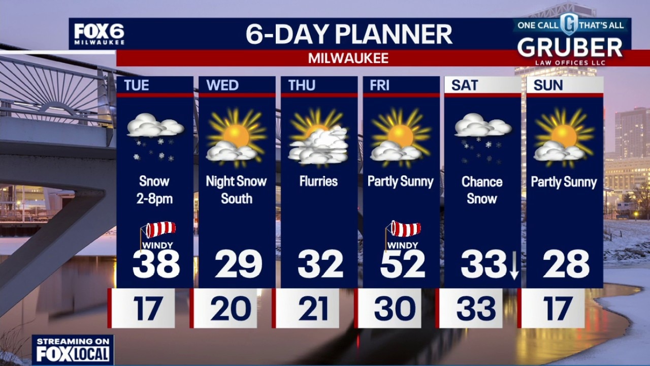
A burst of moderate snow expected early this evening with reduced visibility and light accumulation. It may cause headaches for the evening commute. Colder on Wednesday, especially in the morning, but a one-day warm up arrives Friday! Snow chances return this weekend, along with chilly temperatures.
A burst of moderate snow expected early this evening with reduced visibility and light accumulation. It may cause headaches for the evening commute. Colder on Wednesday, especially in the morning, but a one-day warm up arrives Friday! Snow chances return this weekend, along with chilly temperatures.
Weather webcast with Lisa Michaels
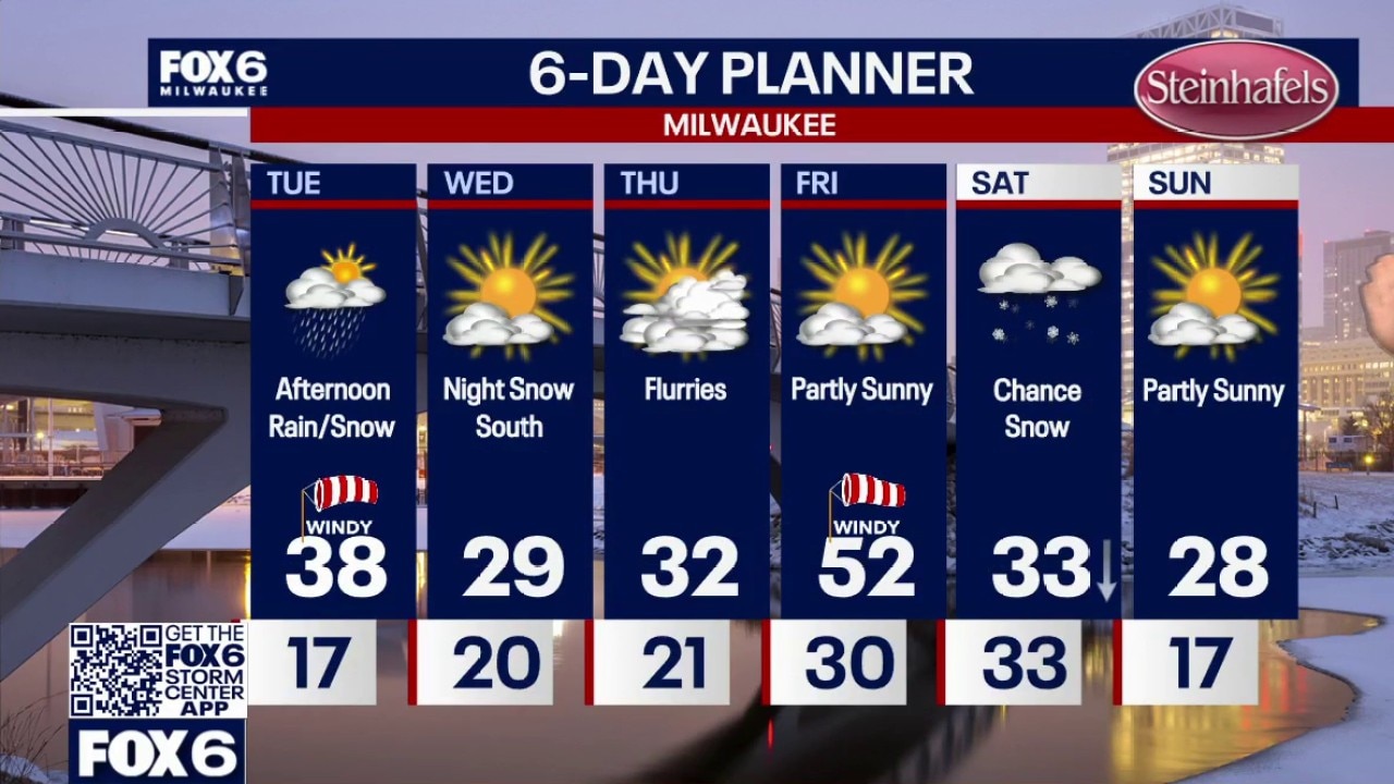
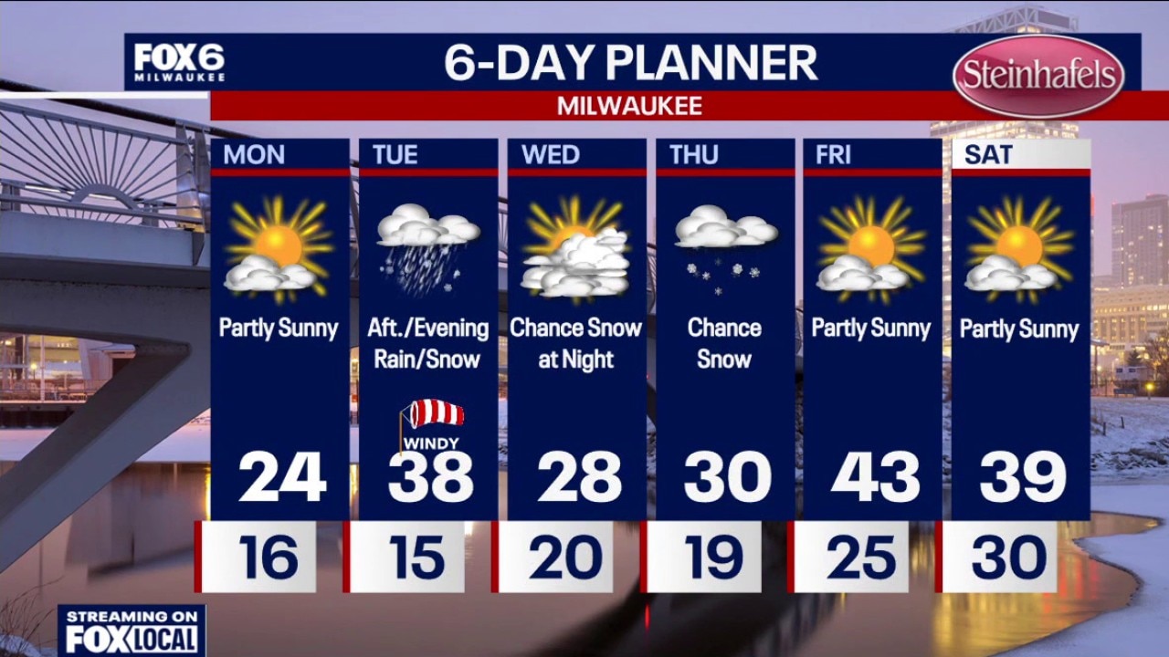
Windy on Tuesday and warmer with highs in the upper 30s. Snow moves in after 2pm (possibly some rain mixed in). This will impact the evening commute with low visibility. Around 0.5" of snow is possible with a quick-moving band from northwest to southeast.
Windy on Tuesday and warmer with highs in the upper 30s. Snow moves in after 2pm (possibly some rain mixed in). This will impact the evening commute with low visibility. Around 0.5" of snow is possible with a quick-moving band from northwest to southeast.
Weather webcast with Lisa Michaels
Windy on Tuesday and warmer with highs in the upper 30s. Snow moves in after 2pm (possibly some rain mixed in). This will impact the evening commute with low visibility. Around 0.5" of snow is possible with a quick-moving band from northwest to southeast.
Windy on Tuesday and warmer with highs in the upper 30s. Snow moves in after 2pm (possibly some rain mixed in). This will impact the evening commute with low visibility. Around 0.5" of snow is possible with a quick-moving band from northwest to southeast.
Weather Webcast with Chief Meteorologist Tom Wachs
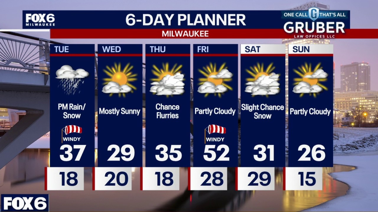
Mostly clear overnight and chilly. Temperatures settling in the teens. Windy on Tuesday and warmer with highs in the upper 30s to around 40. Rain/snow showers after 2pm. Little accumulation is expected, but low visibility is possible at times.
Mostly clear overnight and chilly. Temperatures settling in the teens. Windy on Tuesday and warmer with highs in the upper 30s to around 40. Rain/snow showers after 2pm. Little accumulation is expected, but low visibility is possible at times.
Weather Webcast with Chief Meteorologist Tom Wachs
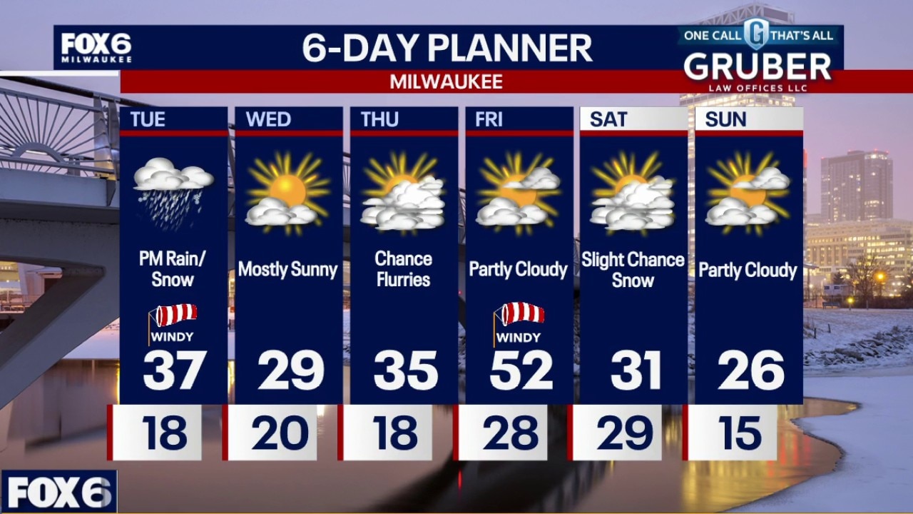
Mostly clear tonight and chilly. Temperatures dropping through the 20s and settling in the teens overnight. Windy on Tuesday and warmer with highs in the upper 30s. Snow moves in after 2pm (possibly some rain mixed in). This will impact the evening commute with low visibility.
Mostly clear tonight and chilly. Temperatures dropping through the 20s and settling in the teens overnight. Windy on Tuesday and warmer with highs in the upper 30s. Snow moves in after 2pm (possibly some rain mixed in). This will impact the evening commute with low visibility.
Weather Webcast with Stephanie Barichello
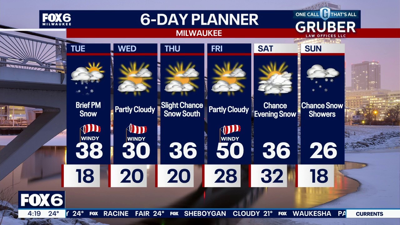
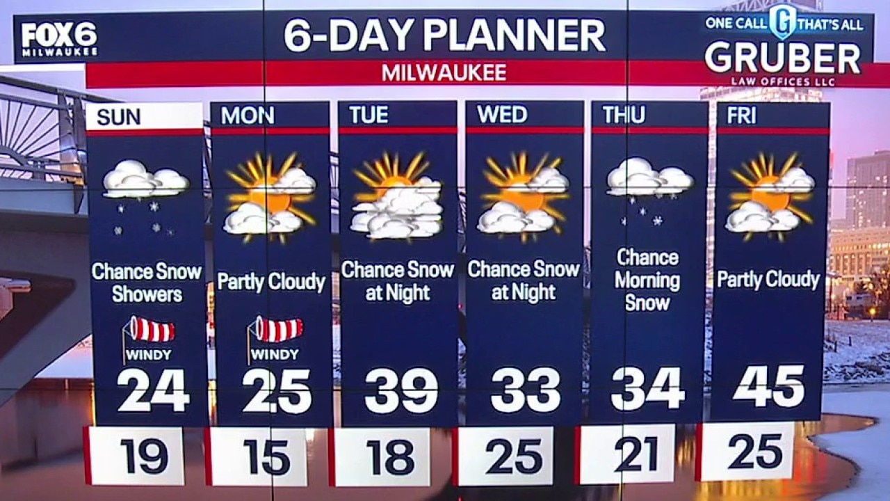
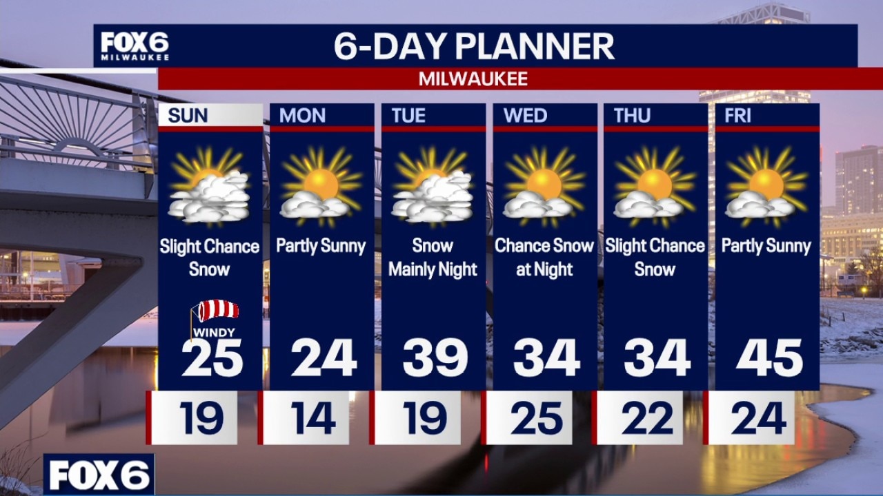
Quiet and cold again tonight, then windy Tuesday with a chance for snow showers during the afternoon. It may be more of a wintry in spots. Slight chance for snow again Thursday, although that system is trending south of us. Friday will be warm and windy before a bigger drop over the weekend. Sunday could be snowy.
Quiet and cold again tonight, then windy Tuesday with a chance for snow showers during the afternoon. It may be more of a wintry in spots. Slight chance for snow again Thursday, although that system is trending south of us. Friday will be warm and windy before a bigger drop over the weekend. Sunday could be snowy.
Weather webcast with Stephanie Barichello
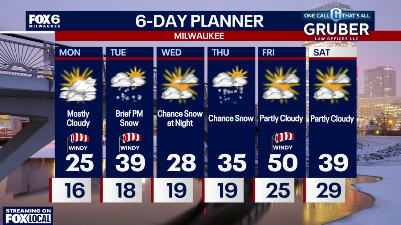
Monday morning wind chills: 0 to -5. Becoming partly cloudy on Monday with the strongest winds in the morning. Chilly with an afternoon high in the mid-20s.
Monday morning wind chills: 0 to -5. Becoming partly cloudy on Monday with the strongest winds in the morning. Chilly with an afternoon high in the mid-20s.
Weather webcast with Lisa Michaels
Monday morning wind chills: 0 to -5. Becoming partly cloudy on Monday with the strongest winds in the morning. Chilly with an afternoon high in the mid-20s.
Monday morning wind chills: 0 to -5. Becoming partly cloudy on Monday with the strongest winds in the morning. Chilly with an afternoon high in the mid-20s.
Weather Webcast with Chief Meteorologist Tom Wachs
Windy tonight with snow showers tapering off overnight. Temperatures will drop into the teens by morning. Monday morning wind chills: 0 to -5. Becoming partly cloudy on Monday with the strongest winds in the morning. Chilly with an afternoon high in the mid-20s.
Windy tonight with snow showers tapering off overnight. Temperatures will drop into the teens by morning. Monday morning wind chills: 0 to -5. Becoming partly cloudy on Monday with the strongest winds in the morning. Chilly with an afternoon high in the mid-20s.
Weather webcast with meteorologist Lisa Michaels
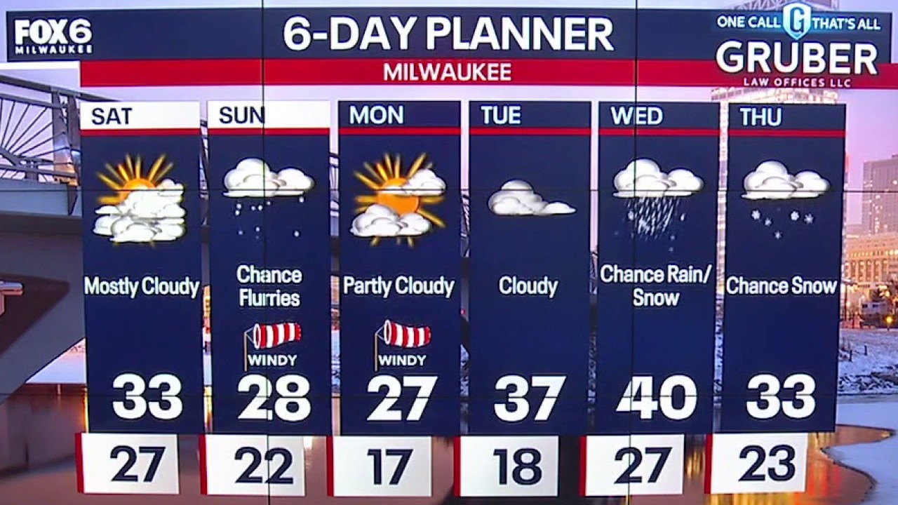
Light flurries and snow showers on Sunday. Morning temps in the teens and low-20s with wind chills in the single digits. Mostly cloudy and windy on Sunday with a slight chance for snow showers.
Light flurries and snow showers on Sunday. Morning temps in the teens and low-20s with wind chills in the single digits. Mostly cloudy and windy on Sunday with a slight chance for snow showers.
Weather Webcast with Chief Meteorologist Tom Wachs
Cloudy and blustery overnight with a a few snow showers. Temperatures settling in the teens by sunrise. Mostly cloudy and windy on Sunday with a slight chance for snow showers. Highs in the mid-20s with afternoon wind chills between +10 and +15.
Cloudy and blustery overnight with a a few snow showers. Temperatures settling in the teens by sunrise. Mostly cloudy and windy on Sunday with a slight chance for snow showers. Highs in the mid-20s with afternoon wind chills between +10 and +15.
Weather webcast with meteorologist Lisa Michaels
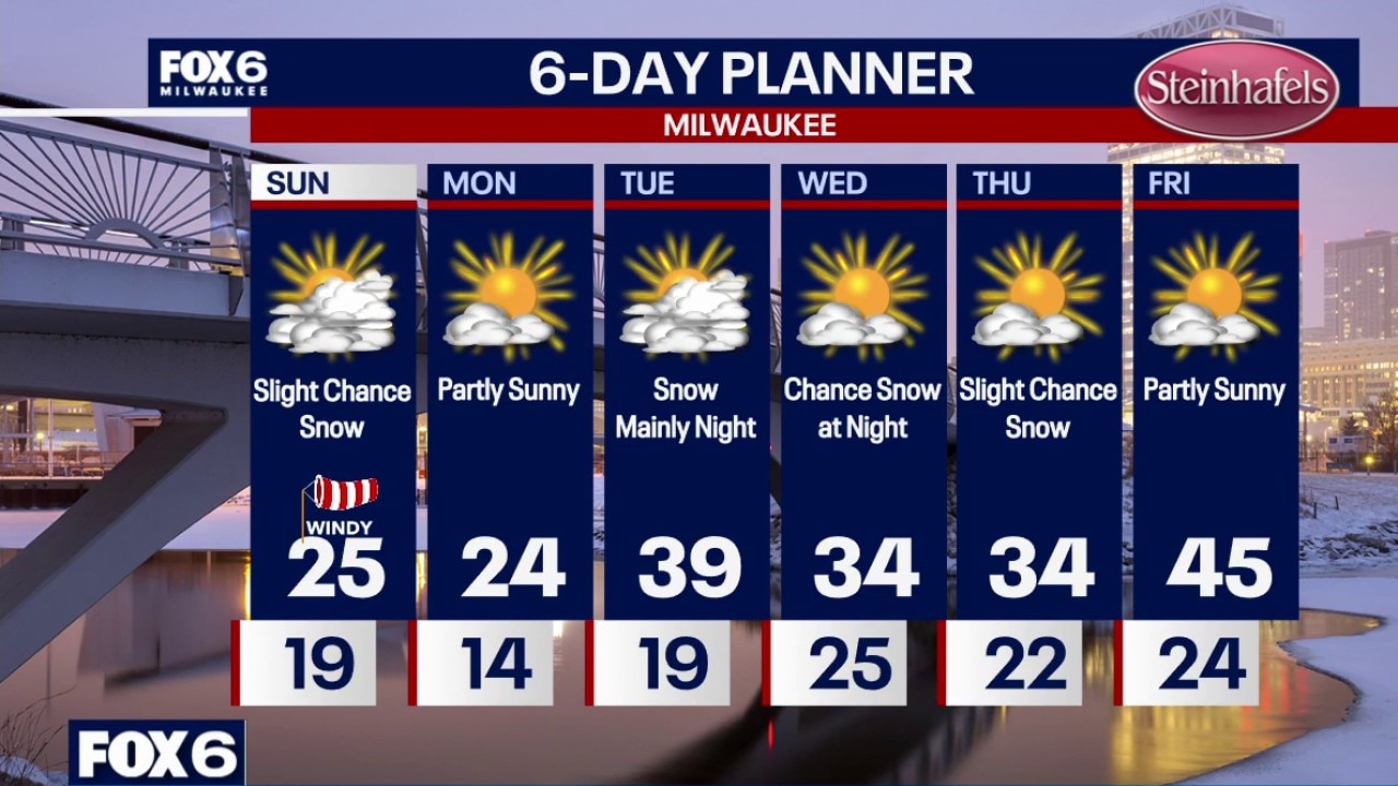
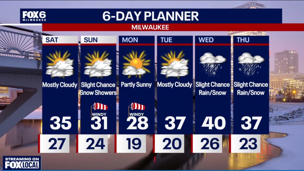
Sunshine in the morning with increasing clouds through the day. High temps in the low 30s. Light snow is possible, especially near the lake, Saturday night into Sunday. Amounts half an inch or less. Lows in the lower 20s.
Sunshine in the morning with increasing clouds through the day. High temps in the low 30s. Light snow is possible, especially near the lake, Saturday night into Sunday. Amounts half an inch or less. Lows in the lower 20s.
Webcast Weather with Holly Baker
Cooler temperatures on the way.
Cooler temperatures on the way.
Weather Webcast with Stephanie Barichello
Staying cloudy, chilly and blustery this weekend. There is a chance for light snow Saturday night into Sunday morning, then a few more chances for snow and wintry mix next week.
Staying cloudy, chilly and blustery this weekend. There is a chance for light snow Saturday night into Sunday morning, then a few more chances for snow and wintry mix next week.