

Weather webcast with Rob Haswell
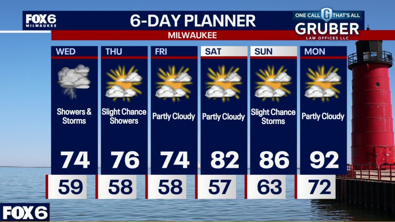
Southern Wisconsin will deal with several rounds of showers and thunderstorms today as a warm front lifts north and a cold front sweeps through later this afternoon and evening.
Southern Wisconsin will deal with several rounds of showers and thunderstorms today as a warm front lifts north and a cold front sweeps through later this afternoon and evening.
Weather Webcast with Chief Meteorologist Tom Wachs
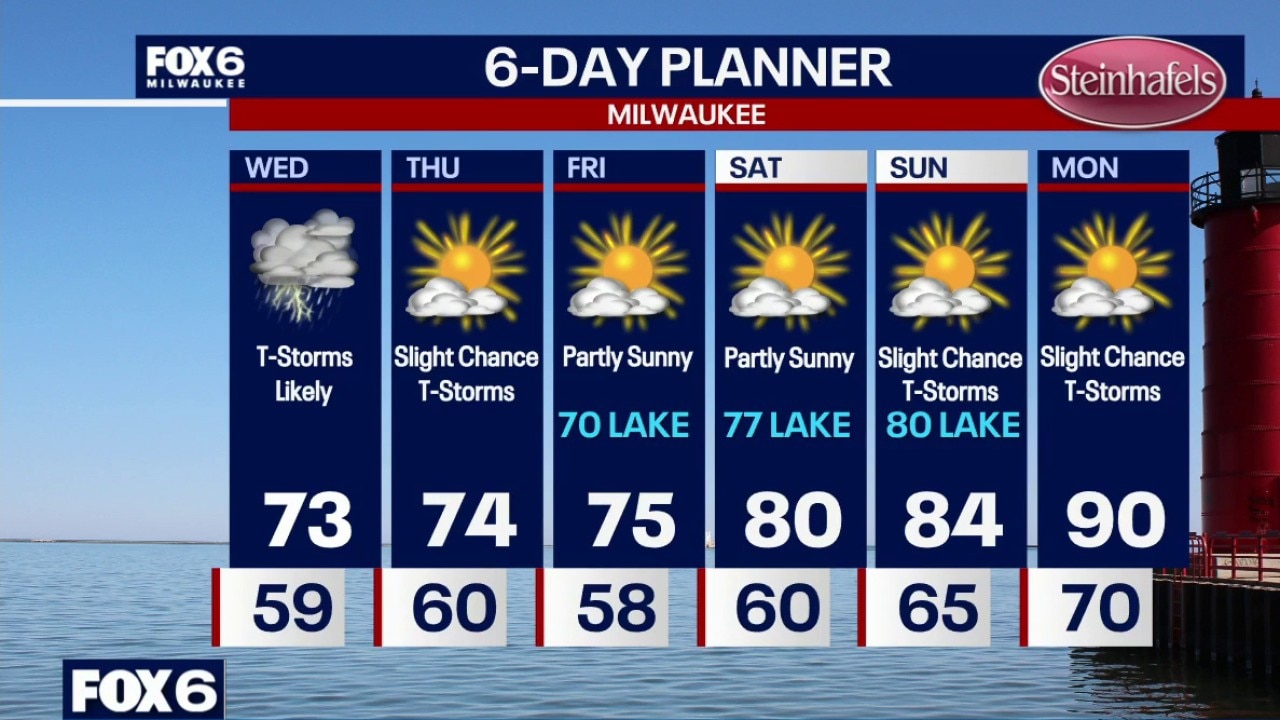
T-storms moving in from the northwest overnight.. Temperatures dropping into the upper 50s by sunrise. Showers and t-storms likely in the morning (heavy rain possible), scattered strong t-storms possible in the afternoon/evening. Wind/hail possible in the afternoon/evening. Highs in the low 70s with dew points in the 60s.
T-storms moving in from the northwest overnight.. Temperatures dropping into the upper 50s by sunrise. Showers and t-storms likely in the morning (heavy rain possible), scattered strong t-storms possible in the afternoon/evening. Wind/hail possible in the afternoon/evening. Highs in the low 70s with dew points in the 60s.
Weather Webcast with Chief Meteorologist Tom Wachs
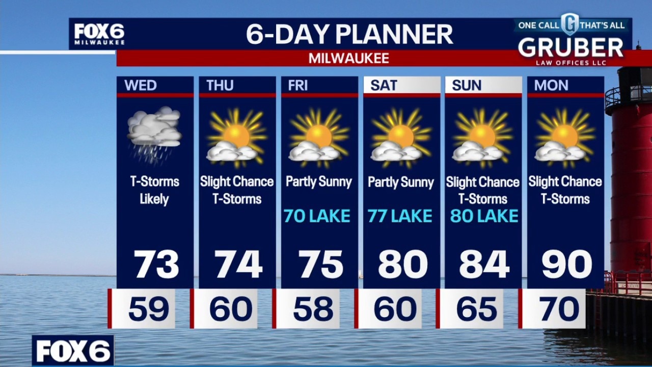
Increasing clouds tonight with a chance for t-storms overnight. Temperatures dropping through the 60s. Showers and t-storms likely in the morning, scattered strong t-storms possible in the afternoon/evening. Wind/hail possible in the afternoon/evening. Highs in the low 70s with dew points in the 60s.
Increasing clouds tonight with a chance for t-storms overnight. Temperatures dropping through the 60s. Showers and t-storms likely in the morning, scattered strong t-storms possible in the afternoon/evening. Wind/hail possible in the afternoon/evening. Highs in the low 70s with dew points in the 60s.
Weather webcast with Lisa Michaels
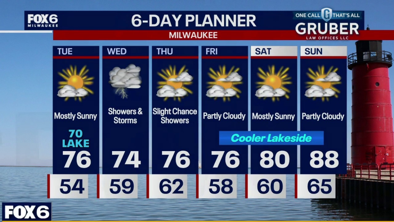
Southern Wisconsin gets one more quiet and comfortable day today before thunderstorms move in late tonight and continue through Wednesday.
Southern Wisconsin gets one more quiet and comfortable day today before thunderstorms move in late tonight and continue through Wednesday.
Weather webcast with Rob Haswell
Southern Wisconsin gets one more quiet and comfortable day today before thunderstorms move in late tonight and continue through Wednesday.
Southern Wisconsin gets one more quiet and comfortable day today before thunderstorms move in late tonight and continue through Wednesday.
Weather Webcast with Chief Meteorologist Tom Wachs
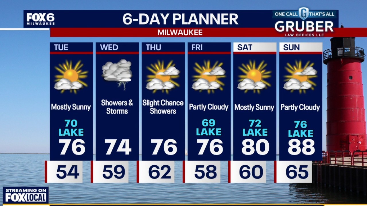
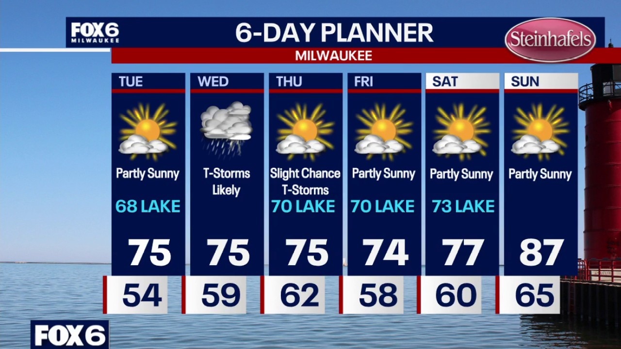
Clear skies overnight with temperatures settling in the 50s. Partly sunny on Tuesday, cooler near the lake once again. Highs in the mid-70s inland, upper 60s near the lake. T-Storm chances return on Wednesday. Scattered severe cells are possible in the afternoon with hail/wind. A low level severe risk is in place right now. Highs in the mid-70s.
Clear skies overnight with temperatures settling in the 50s. Partly sunny on Tuesday, cooler near the lake once again. Highs in the mid-70s inland, upper 60s near the lake. T-Storm chances return on Wednesday. Scattered severe cells are possible in the afternoon with hail/wind. A low level severe risk is in place right now. Highs in the mid-70s.
Weather Webcast with Chief Meteorologist Tom Wachs
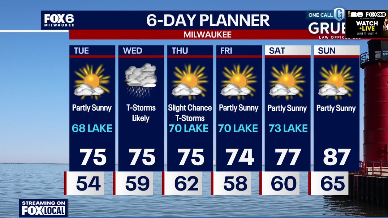
Clear skies tonight with temperatures dropping through the 60s and settling in the 50s overnight. Partly sunny on Tuesday, cooler near the lake once again. Highs in the mid-70s inland, upper 60s near the lake.
Clear skies tonight with temperatures dropping through the 60s and settling in the 50s overnight. Partly sunny on Tuesday, cooler near the lake once again. Highs in the mid-70s inland, upper 60s near the lake.
Weather Webcast with Stephanie Barichello
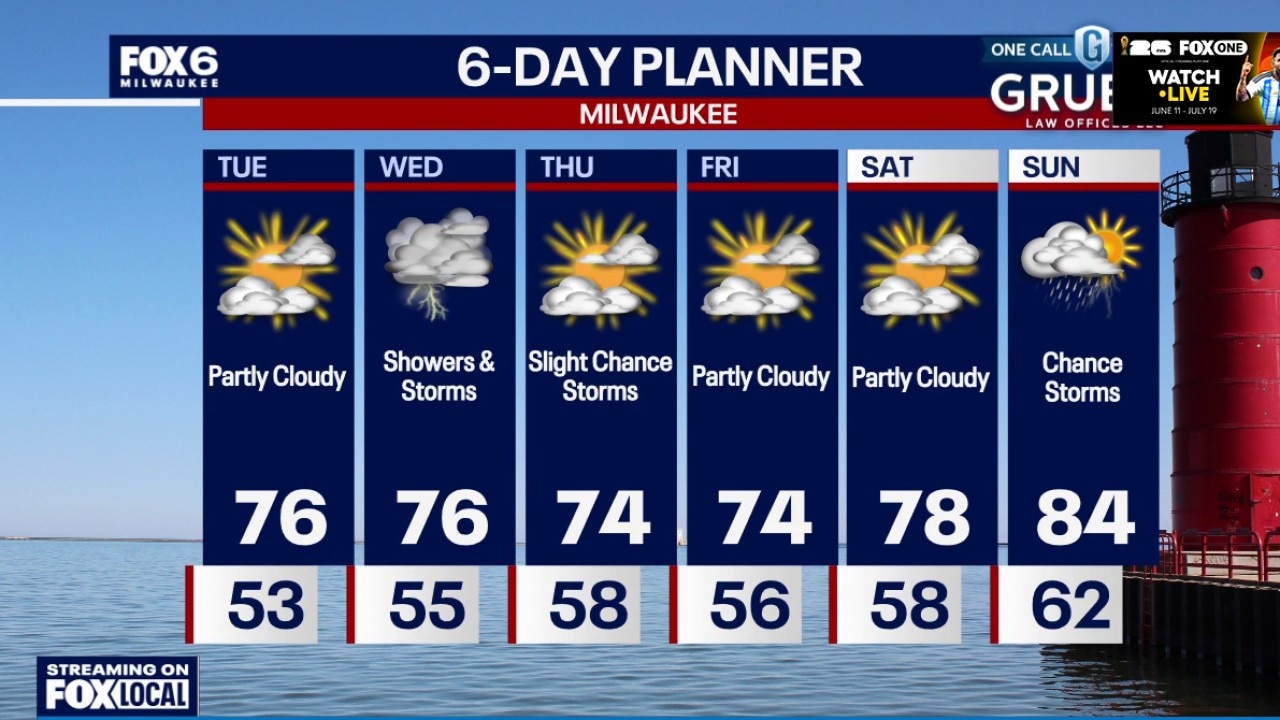
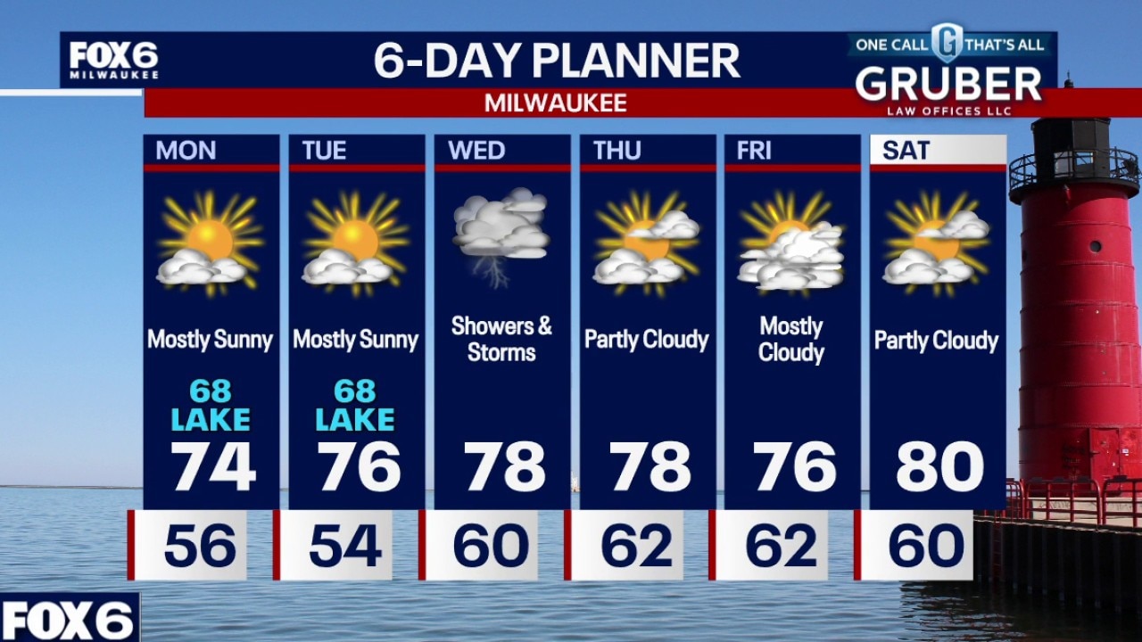
Another quiet day Tuesday then rain and thunder likely at times on Wednesday. A few storms in the afternoon could produce hail. Slight chance for an afternoon pop-up on Thursday then quiet to start the weekend. The heat returns by Sunday.
Another quiet day Tuesday then rain and thunder likely at times on Wednesday. A few storms in the afternoon could produce hail. Slight chance for an afternoon pop-up on Thursday then quiet to start the weekend. The heat returns by Sunday.
Weather webcast with Stephanie Barichello
Southern Wisconsin is drying out as the weekend storm system pulls away, setting up a much quieter start to the week. Monday looks comfortable with sunshine returning, though lakeshore communities will stay noticeably cooler.
Southern Wisconsin is drying out as the weekend storm system pulls away, setting up a much quieter start to the week. Monday looks comfortable with sunshine returning, though lakeshore communities will stay noticeably cooler.
Weather webcast with Rob Haswell
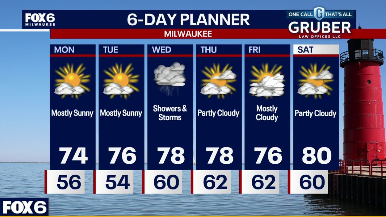
Southern Wisconsin is drying out as the weekend storm system pulls away, setting up a much quieter start to the week. Monday looks comfortable with sunshine returning, though lakeshore communities will stay noticeably cooler.
Southern Wisconsin is drying out as the weekend storm system pulls away, setting up a much quieter start to the week. Monday looks comfortable with sunshine returning, though lakeshore communities will stay noticeably cooler.
Weather Webcast with Chief Meteorologist Tom Wachs
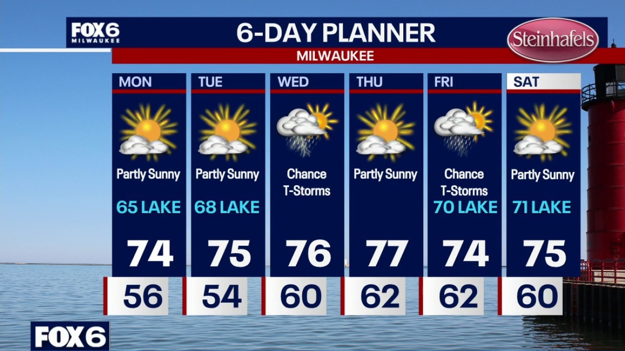
Rain moving out overnight with skies starting to clear. Temperatures in the 50s. Partly sunny on Monday with highs in the mid-70s inland (Waukesha and west) but in the mid-60s near the lake with a stiff wind off of the lake out of the northeast. Partly sunny on Tuesday with highs in the mid-70s inland, upper 60s near the lake with an easterly wind.
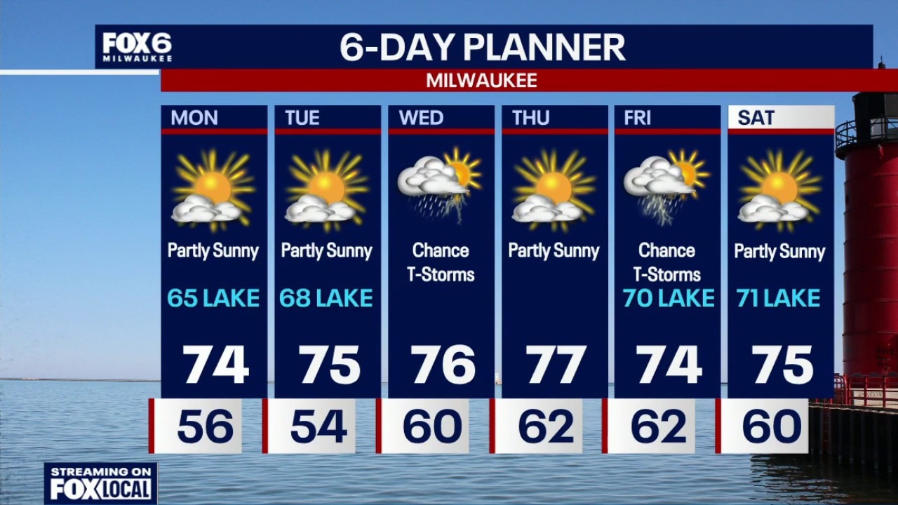
Rain moving out overnight with skies starting to clear. Temperatures in the 50s. Partly sunny on Monday with highs in the mid-70s inland (Waukesha and west) but in the mid-60s near the lake with a stiff wind off of the lake out of the northeast. Partly sunny on Tuesday with highs in the mid-70s inland, upper 60s near the lake with an easterly wind.
Weather Webcast with Chief Meteorologist Tom Wachs
Rain this evening, steadiest near the IL border. The rain will come to an end overnight. Temperatures will drop into the 50s. 0.25"-0.75" near the IL border, 0.10"-0.25" around Milwaukee. Lesser north. Partly sunny on Monday with highs in the mid-70s inland (Waukesha and west) but in the mid-60s near the lake with a stiff wind off of the lake out of the northeast.
Rain this evening, steadiest near the IL border. The rain will come to an end overnight. Temperatures will drop into the 50s. 0.25"-0.75" near the IL border, 0.10"-0.25" around Milwaukee. Lesser north. Partly sunny on Monday with highs in the mid-70s inland (Waukesha and west) but in the mid-60s near the lake with a stiff wind off of the lake out of the northeast.
Weather webcast with Meteorologist Holly Baker
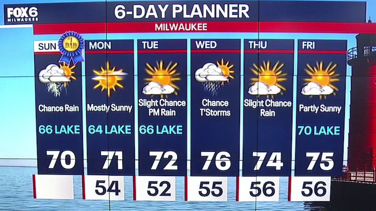
Rain chances are likely Sunday afternoon/evening, steadiest along the Illinois border. Highs in the middle 60s lakeside and low 70s inland. Cooler by the lake conditions last through Tuesday.
Rain chances are likely Sunday afternoon/evening, steadiest along the Illinois border. Highs in the middle 60s lakeside and low 70s inland. Cooler by the lake conditions last through Tuesday.
Weather Webcast with Holly Baker
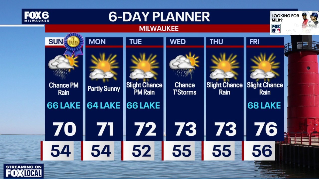
We are tracking a chance for rain to return on Sunday afternoon.
We are tracking a chance for rain to return on Sunday afternoon.
Weather webcast with Meteorologist Lisa Michaels
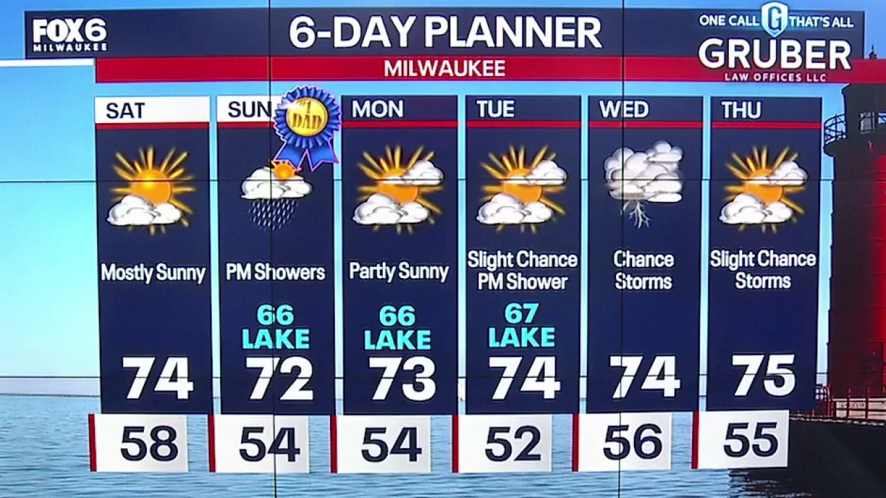
Mostly sunny and calm Saturday with high temperatures in the low to middle 70s. Partly cloudy Saturday night into Sunday with temperatures dropping into the middle 50s.
Mostly sunny and calm Saturday with high temperatures in the low to middle 70s. Partly cloudy Saturday night into Sunday with temperatures dropping into the middle 50s.
Weather Webcast with Holly Baker
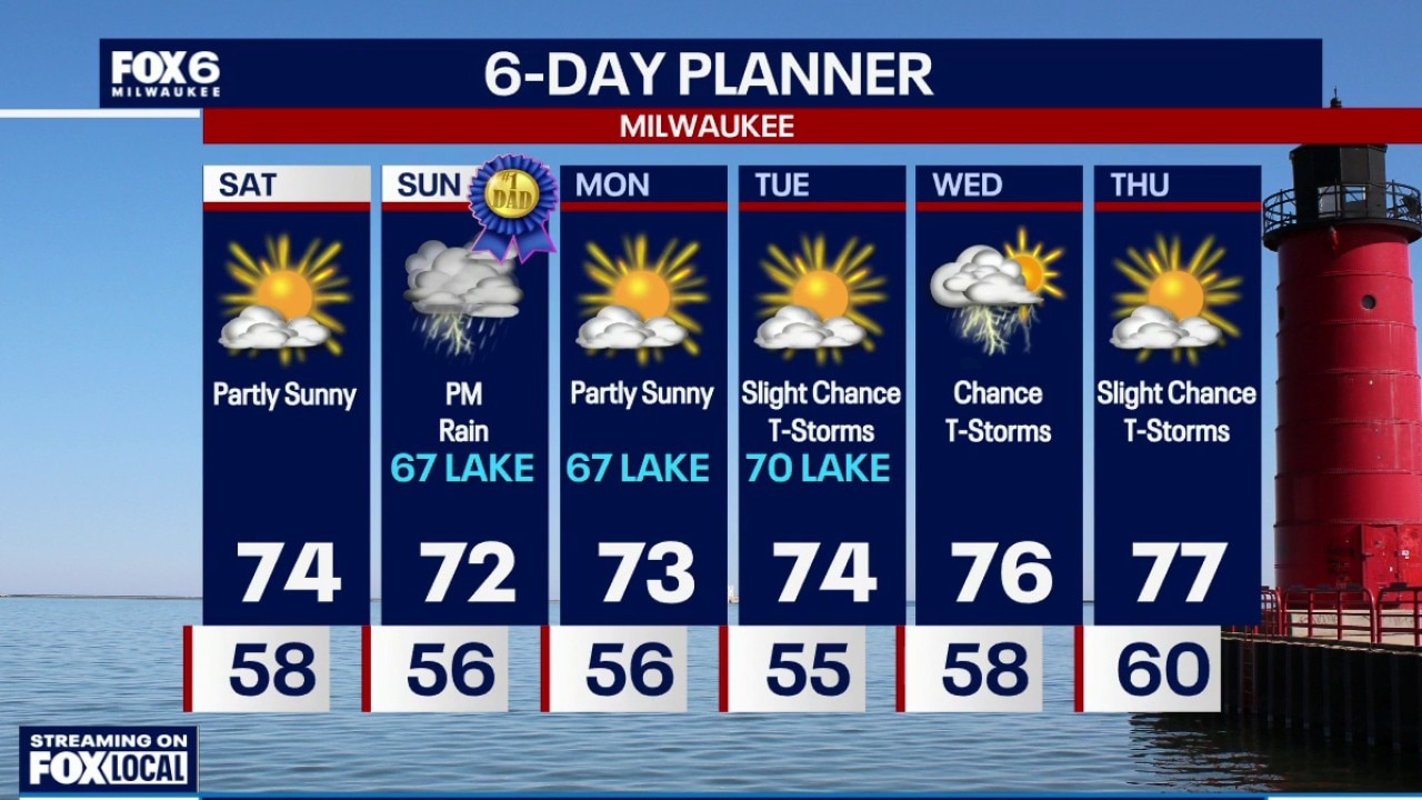
A beautiful start to the weekend is on the way.
A beautiful start to the weekend is on the way.
Weather Webcast with Chief Meteorologist Tom Wachs
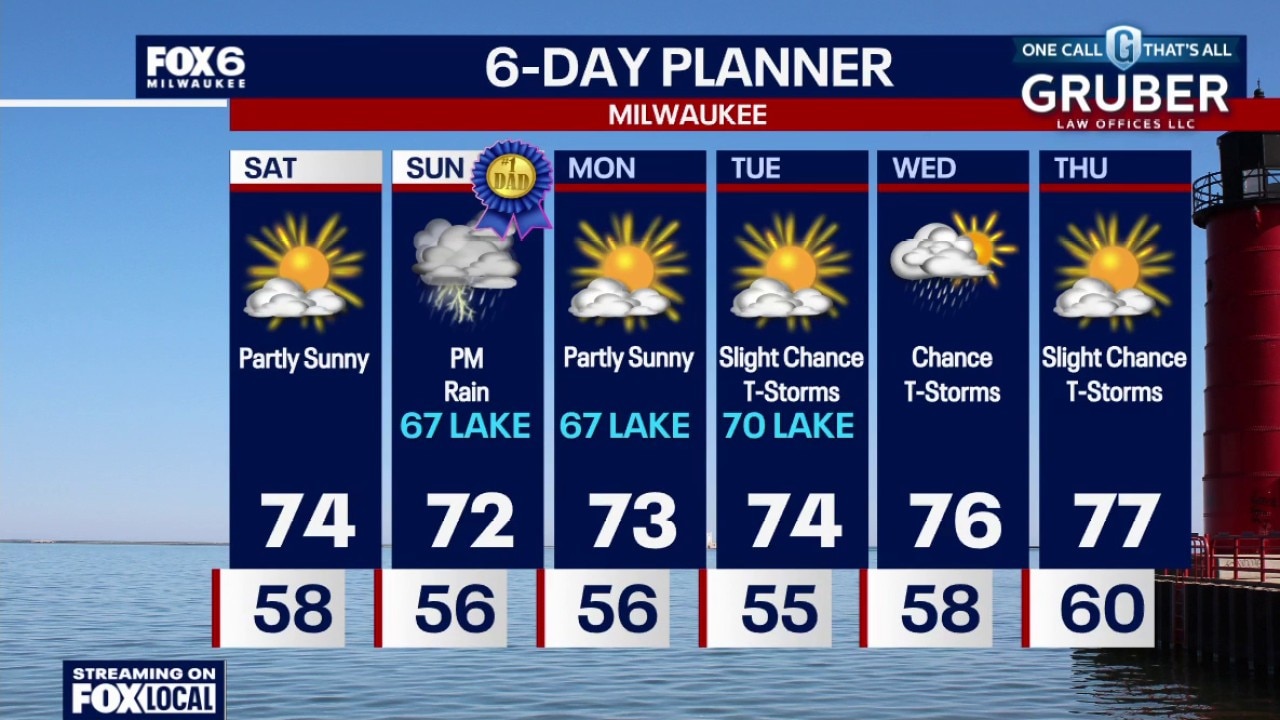
Showers and a few t-storms this evening, ending overnight. Less than 0.25" of rain expected. Temperatures dropping through the 60s this evening. Partly sunny and beautiful on Saturday with highs in the mid-70s. Rain chances return on Sunday afternoon/evening, steadiest along the IL border. Highs in the upper 60s to low 70s.
Showers and a few t-storms this evening, ending overnight. Less than 0.25" of rain expected. Temperatures dropping through the 60s this evening. Partly sunny and beautiful on Saturday with highs in the mid-70s. Rain chances return on Sunday afternoon/evening, steadiest along the IL border. Highs in the upper 60s to low 70s.
Weather webcast with Stephanie Barichello
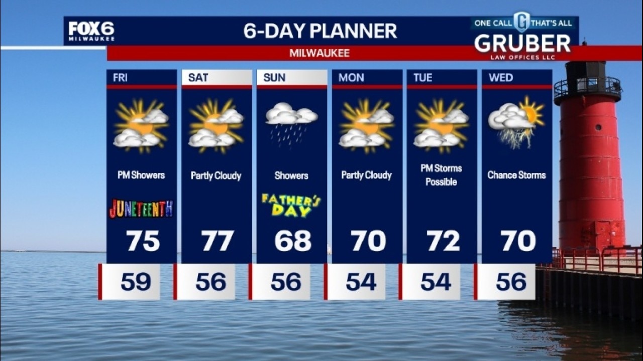
A mix of clouds and sun today with temperatures reaching the low to mid 70s. Showers and a rumble of thunder possible tonight with lows in the 50s.
A mix of clouds and sun today with temperatures reaching the low to mid 70s. Showers and a rumble of thunder possible tonight with lows in the 50s.
Weather webcast with Stephanie Barichello
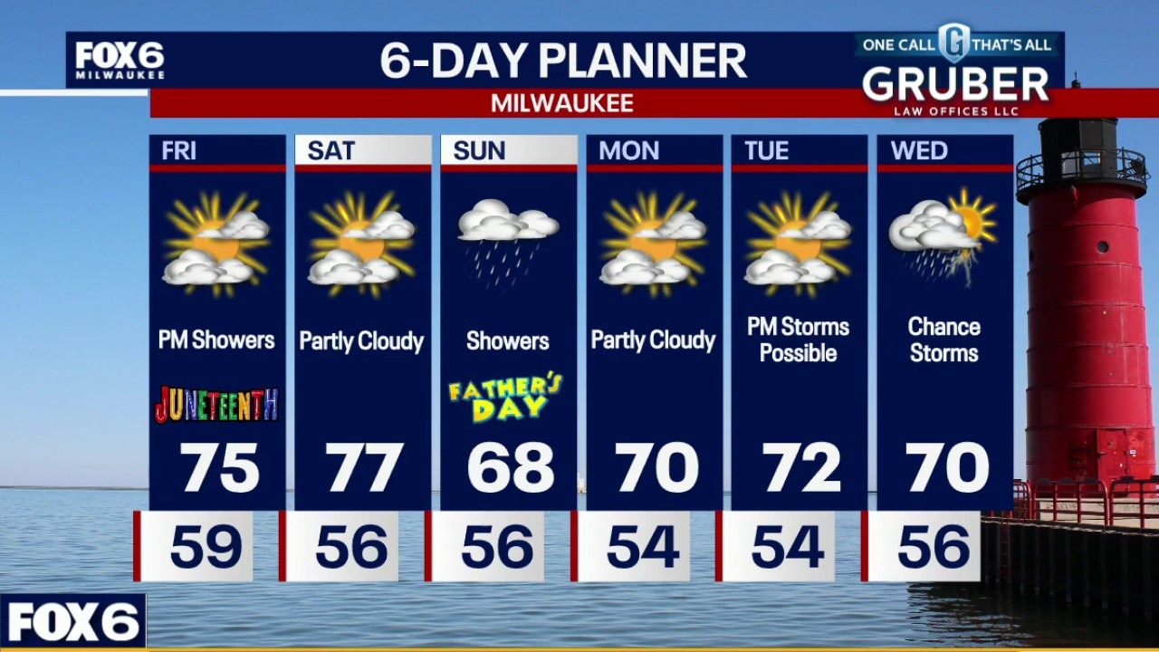
A mix of clouds and sun today with temperatures reaching the low to mid 70s. Showers and a rumble of thunder possible tonight with lows in the 50s.
A mix of clouds and sun today with temperatures reaching the low to mid 70s. Showers and a rumble of thunder possible tonight with lows in the 50s.
Weather webcast with Stephanie Barichello
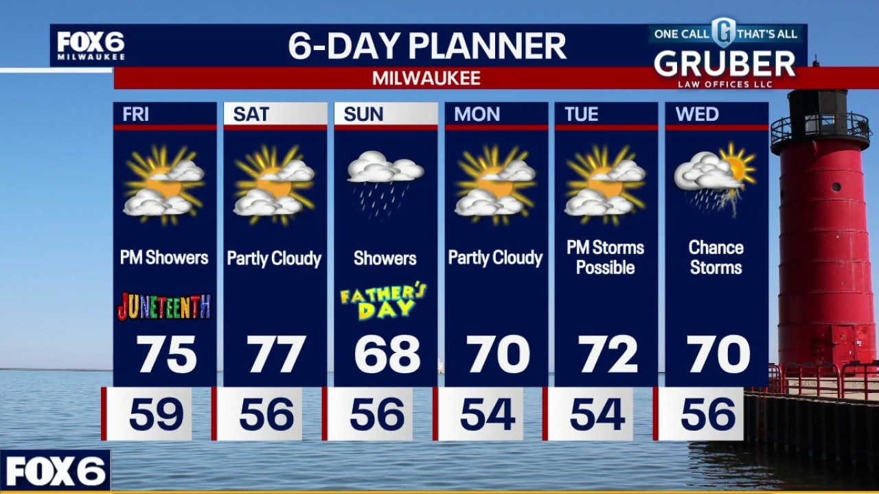
mix of clouds and sun today with temperatures reaching the low to mid 70s. Showers and a rumble of thunder possible tonight with lows in the 50s.
mix of clouds and sun today with temperatures reaching the low to mid 70s. Showers and a rumble of thunder possible tonight with lows in the 50s.