

Weather webcast with Rob Haswell
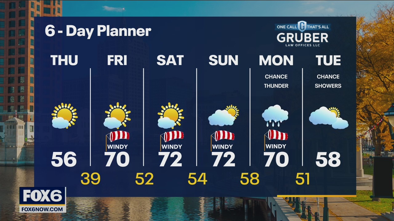
As that stubborn low finally winds down to our east, we clear to mostly sunny conditions this afternoon. We should warm into the mid to upper 50s today and get to the upper 60s and low 70s Friday through Monday! Our next chance for rain comes overnight Sunday into Monday with a chance for thunderstorms.
As that stubborn low finally winds down to our east, we clear to mostly sunny conditions this afternoon. We should warm into the mid to upper 50s today and get to the upper 60s and low 70s Friday through Monday! Our next chance for rain comes overnight Sunday into Monday with a chance for thunderstorms.
Weather Webcast with Tom Wachs
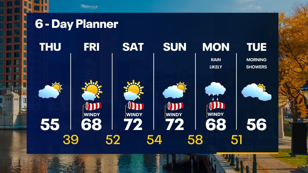
Cold overnight with temperatures in the mid-20s to around 30 by sunrise. Partly to mostly sunny on Thursday with a warmer high in the mid-50s. Much warmer Friday into the weekend. 70s return Saturday & Sunday.
Cold overnight with temperatures in the mid-20s to around 30 by sunrise. Partly to mostly sunny on Thursday with a warmer high in the mid-50s. Much warmer Friday into the weekend. 70s return Saturday & Sunday.
Weather Webcast with Tom Wachs
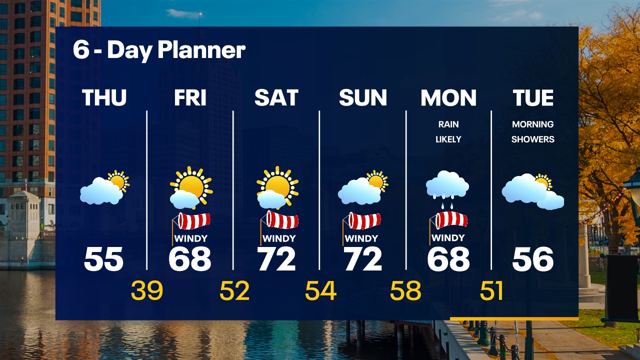
Cold tonight with temperatures dropping into the 30s this evening and 20s away from the lake overnight. Partly to mostly sunny and warmer on Thursday with highs in the middle 50s.
Cold tonight with temperatures dropping into the 30s this evening and 20s away from the lake overnight. Partly to mostly sunny and warmer on Thursday with highs in the middle 50s.

Weather Webcast with Meteorologist Stephanie Barichello
Still chilly and breezy today then warming into the 50s tomorrow. 60s and 70s are back over the weekend. There will still be windy days here and there.
Still chilly and breezy today then warming into the 50s tomorrow. 60s and 70s are back over the weekend. There will still be windy days here and there.
Weather webcast with Rob Haswell
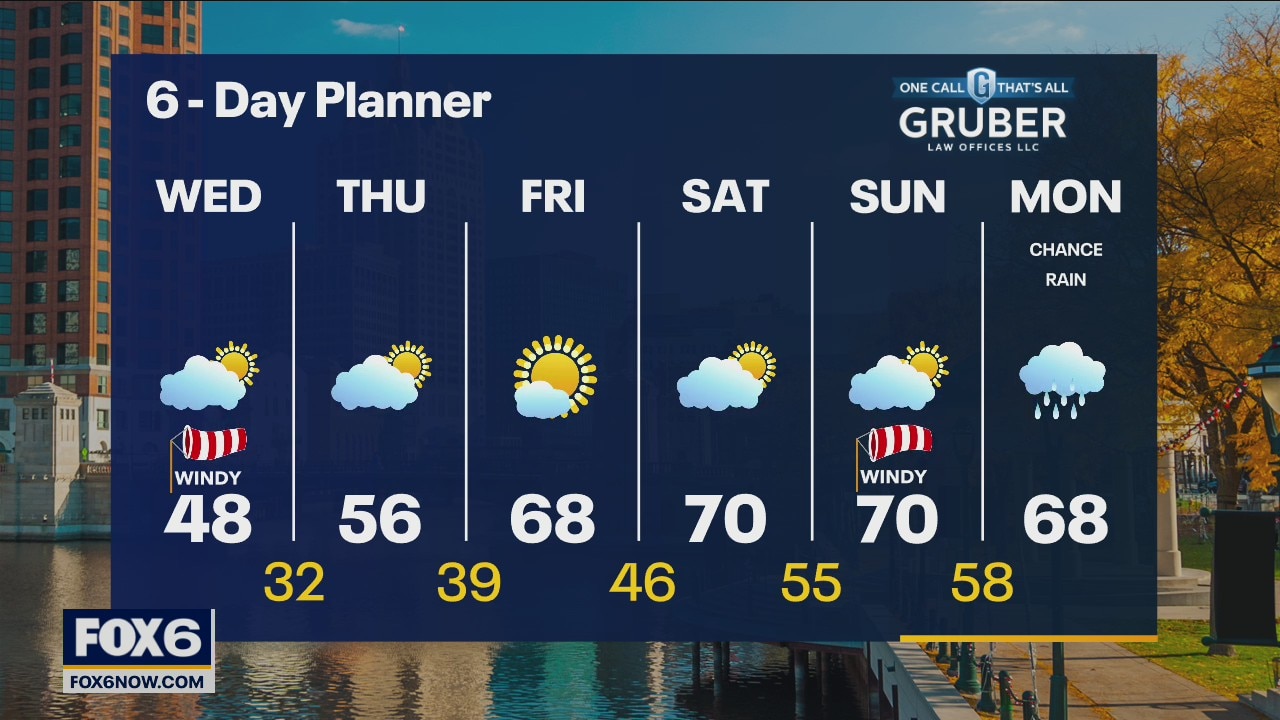
With a strong upper level low nearly stationary over the lower Great Lakes and a ridge of high pressure to our west, we remain windy. Cold air remains in place with highs in the upper 40s again today but feeling colder with a northwest wind speeds 10-20mph and gusting higher at times. We warm slightly tomorrow with highs in the mid to upper 50s but then a warm front pushes our way and temperatures really start to warm
With a strong upper level low nearly stationary over the lower Great Lakes and a ridge of high pressure to our west, we remain windy. Cold air remains in place with highs in the upper 40s again today but feeling colder with a northwest wind speeds 10-20mph and gusting higher at times. We warm slightly tomorrow with highs in the mid to upper 50s but then a warm front pushes our way and temperatures really start to warm
Weather Webcast with Tom Wachs
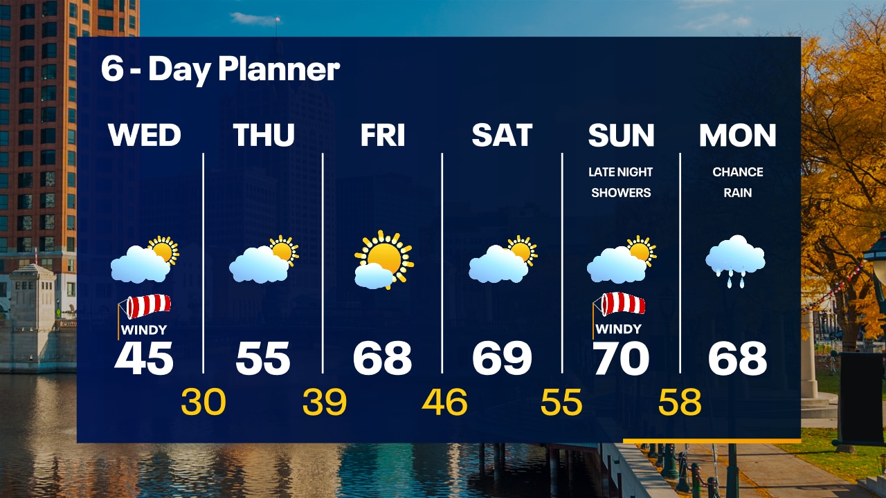
Windy and chilly overnight with temperatures in the 30s and wind chills in the 20s by sunrise. Gradual clearing on Wednesday with a windy high in the 40s. 50s return Thursday...60s on Friday.
Windy and chilly overnight with temperatures in the 30s and wind chills in the 20s by sunrise. Gradual clearing on Wednesday with a windy high in the 40s. 50s return Thursday...60s on Friday.
Weather Webcast with Tom Wachs
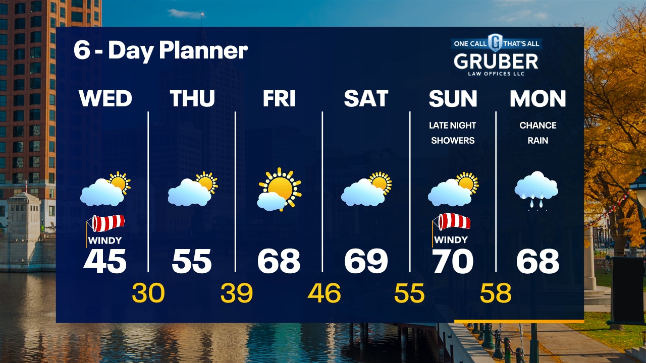
More chilly temperatures and strong winds tonight & Wednesday. Warming up late this week with highs in the 50s Thursday and upper 60s on Friday.
More chilly temperatures and strong winds tonight & Wednesday. Warming up late this week with highs in the 50s Thursday and upper 60s on Friday.
Weather Webcast with Meteorologist Stephanie Barichello
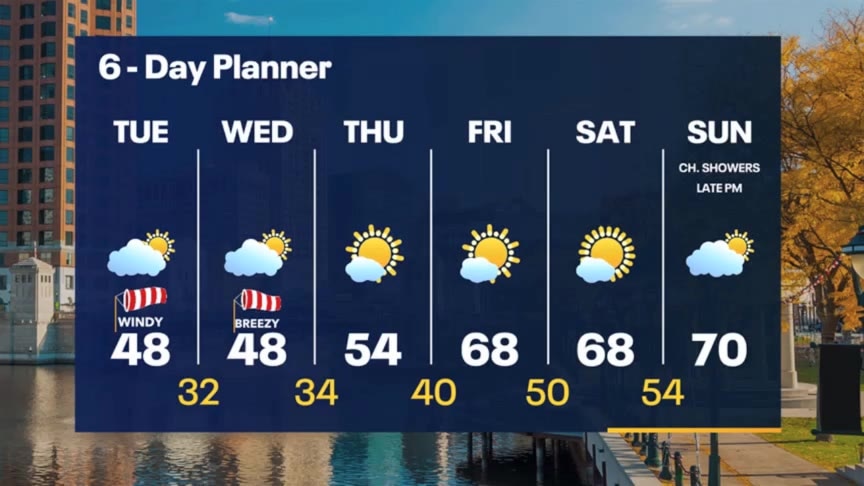
Another windy and cool day today and tomorrow then we gradually warm by the weekend. Plenty of sunshine in the extended forecast.
Another windy and cool day today and tomorrow then we gradually warm by the weekend. Plenty of sunshine in the extended forecast.
Weather webcast with Rob Haswell
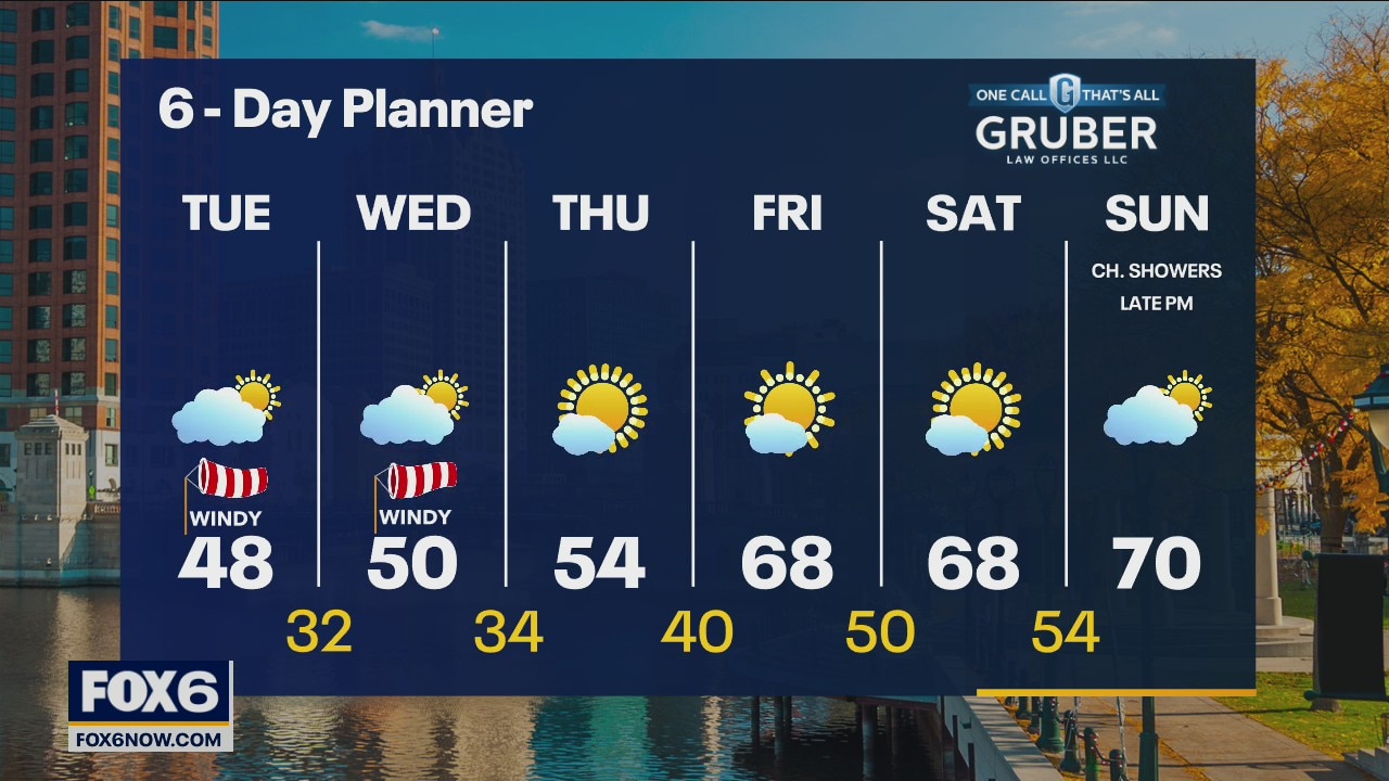
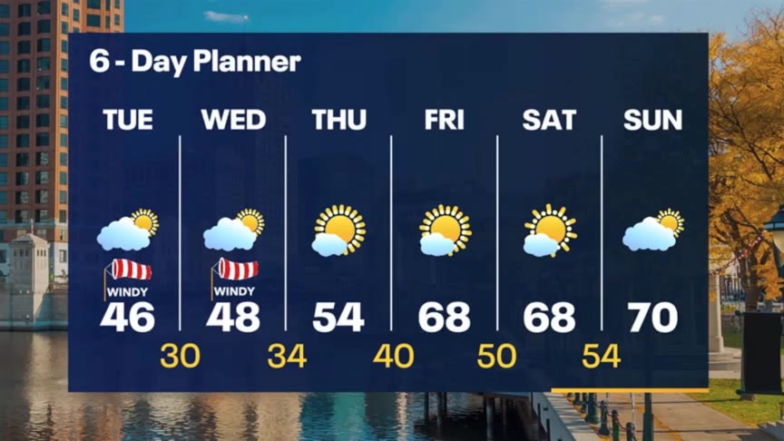
High pressure builds over the region today drying our area but also bringing cold air into our region and keeping highs in the 40s. Wind speeds will remain strong today averaging 15-25mph and gusting into the 40mph range. Wind speeds will calm by Wednesday and we start a slow warming trend with highs in the 50s Wednesday and Thursday.
High pressure builds over the region today drying our area but also bringing cold air into our region and keeping highs in the 40s. Wind speeds will remain strong today averaging 15-25mph and gusting into the 40mph range. Wind speeds will calm by Wednesday and we start a slow warming trend with highs in the 50s Wednesday and Thursday.
Weather Webcast with Meteorologist Stephanie Barichello
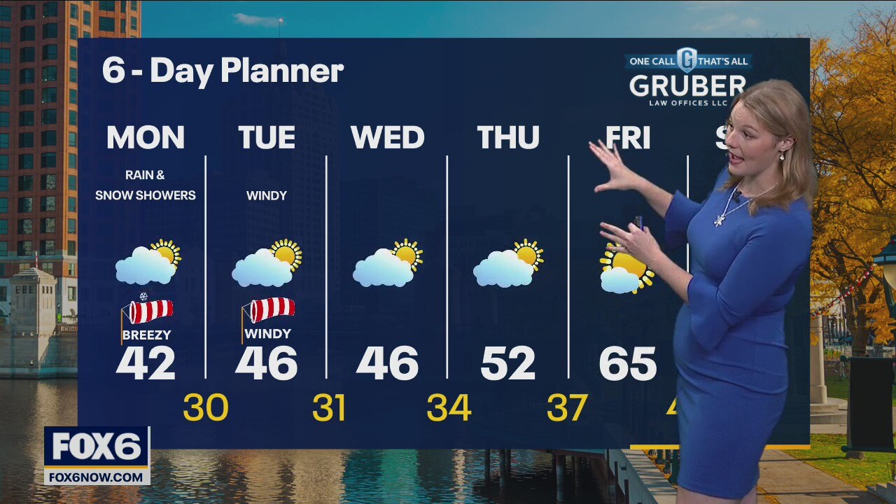
Could see a few more light rain or snow showers this evening then cold and windy tonight. Partly to mostly cloudy the next few days plus staying windy and cold. Gradually warm through the weekend.
Could see a few more light rain or snow showers this evening then cold and windy tonight. Partly to mostly cloudy the next few days plus staying windy and cold. Gradually warm through the weekend.
Weather webcast with Lisa Michaels
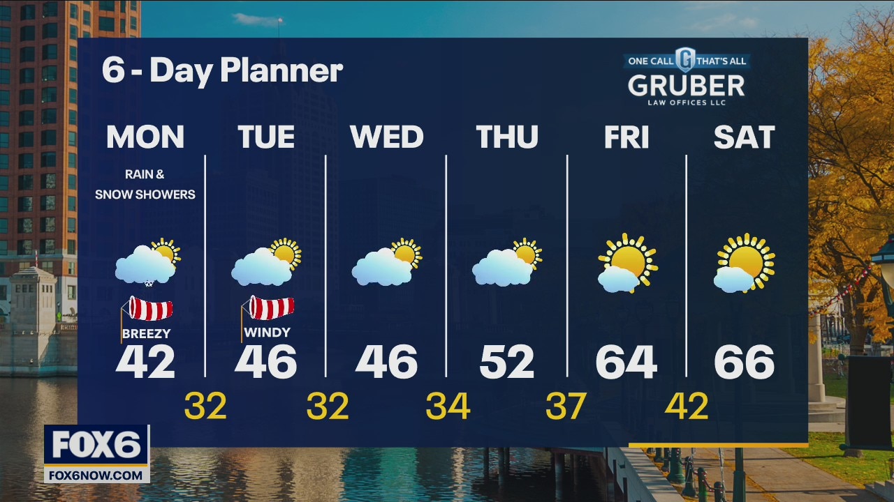
A cold front moving through Wisconsin and strong low pressure system to the east will bring very strong winds today with the show showers mixing in with rain. Temps struggle to reach the upper 30s to low 40s.
A cold front moving through Wisconsin and strong low pressure system to the east will bring very strong winds today with the show showers mixing in with rain. Temps struggle to reach the upper 30s to low 40s.
Weather webcast with Rob Haswell
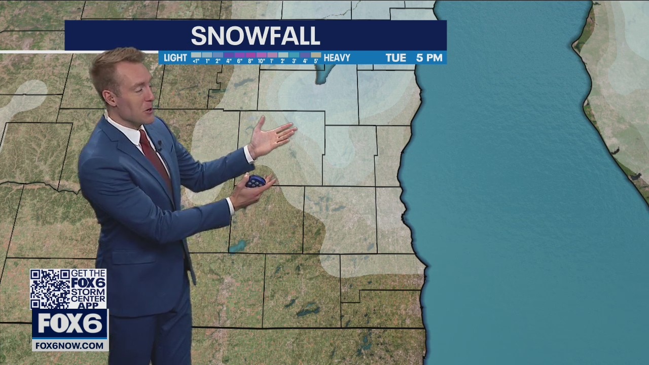
A cold front slowly drops across Wisconsin today helping to whip up the wind and trigger a few rain and snow showers. Temperatures struggle today with most areas only in the upper 30s and low 40s. We stay windy and cold tomorrow but as high pressure builds in from the west we clear up and bit and stay dry. A slow warming trend starts later this week with highs returning to the 50s by Thursday and into the mid to upper 60s by the weekend!
A cold front slowly drops across Wisconsin today helping to whip up the wind and trigger a few rain and snow showers. Temperatures struggle today with most areas only in the upper 30s and low 40s. We stay windy and cold tomorrow but as high pressure builds in from the west we clear up and bit and stay dry. A slow warming trend starts later this week with highs returning to the 50s by Thursday and into the mid to upper 60s by the weekend!
Weather Webcast
FOX6 News at 5
FOX6 News at 5
Weather Webcast with Meteorologist Lisa Michaels
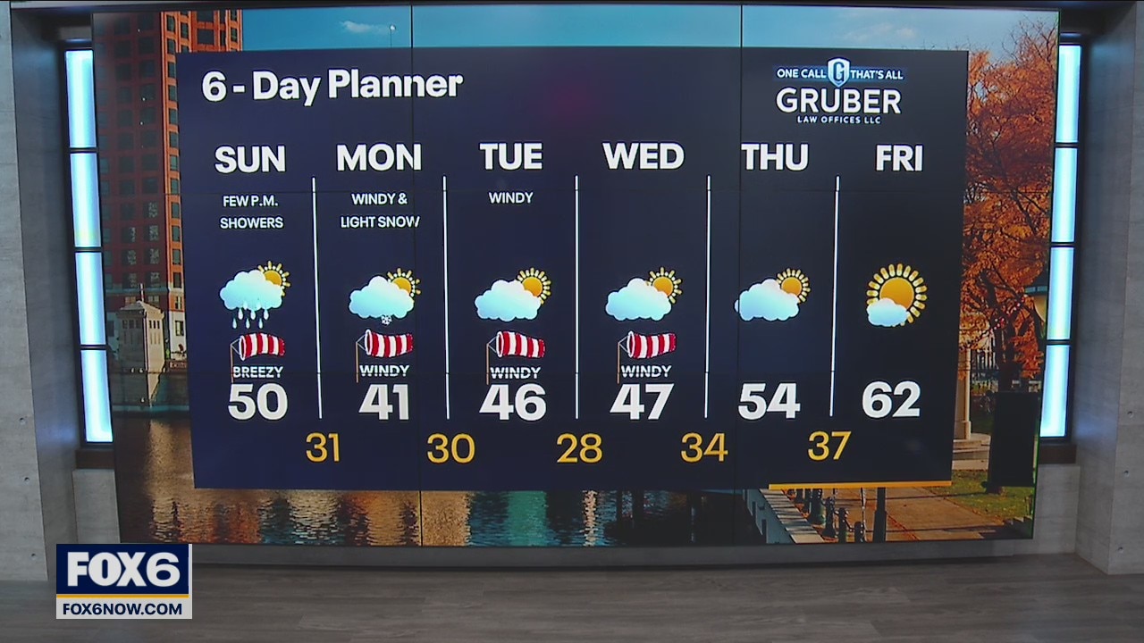
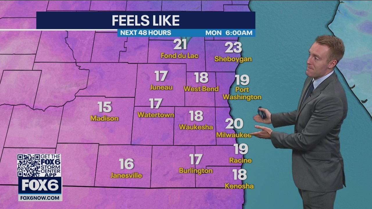
Peeks of sunshine early today with increasing clouds this afternoon. Scattered rain is possible. Strong winds on Monday causing temperatures to feel like the teens in the AM and the 30s in the PM. Morning and afternoon chances for snow.
Peeks of sunshine early today with increasing clouds this afternoon. Scattered rain is possible. Strong winds on Monday causing temperatures to feel like the teens in the AM and the 30s in the PM. Morning and afternoon chances for snow.
Weather Webcast
FOX6 News at 10
FOX6 News at 10
Weather Webcast with Meteorologist Lisa Michaels
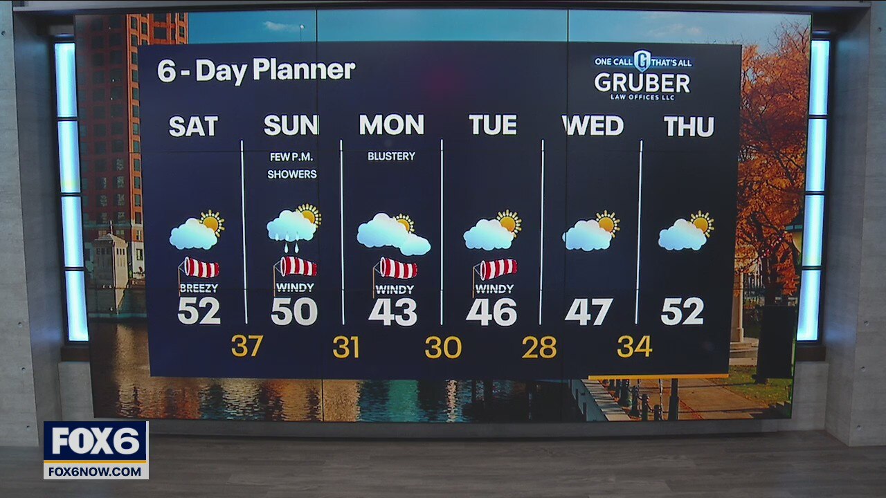
Partly cloudy skies today with dry weather conditions. Highs in the upper 40s to low 50s. Cooler air slides in by Sunday with the passing of a cold front. Isolated showers in the afternoon.
Partly cloudy skies today with dry weather conditions. Highs in the upper 40s to low 50s. Cooler air slides in by Sunday with the passing of a cold front. Isolated showers in the afternoon.
Weather Webcast with Meteorologist Lisa Michaels
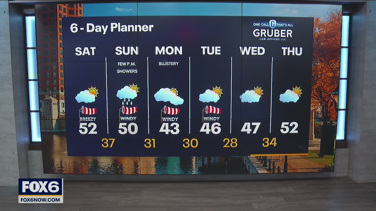
Partly cloudy skies today with dry weather conditions. Highs in the upper 40s to low 50s. Cooler air slides in by Sunday with the passing of a cold front. Isolated showers in the afternoon.
Partly cloudy skies today with dry weather conditions. Highs in the upper 40s to low 50s. Cooler air slides in by Sunday with the passing of a cold front. Isolated showers in the afternoon.
Weather Webcast with Meteorologist Stephanie Barichello
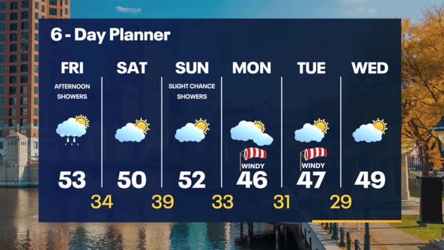
Scattered rain showers this afternoon with a few snowflakes at times. Mainly dry over the weekend but there is slight chance for showers Sunday. It'll also stay chilly and blustery. Even colder next week.
Scattered rain showers this afternoon with a few snowflakes at times. Mainly dry over the weekend but there is slight chance for showers Sunday. It'll also stay chilly and blustery. Even colder next week.
Weather webcast with Lisa Michaels
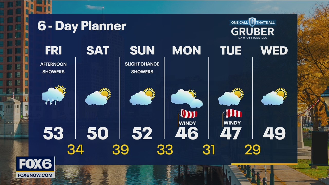
Some sunshine this morning with increasing clouds this afternoon. A few rain showers possible with isolated snowflakes mixed in. Highs in the lower 50s. Cooler temps hold on in the long term forecast dropping into the 40s for highs next week. Partly sunny on Saturday with highs around 50. Blustery conditions behind systems arrive early next week as well.
Some sunshine this morning with increasing clouds this afternoon. A few rain showers possible with isolated snowflakes mixed in. Highs in the lower 50s. Cooler temps hold on in the long term forecast dropping into the 40s for highs next week. Partly sunny on Saturday with highs around 50. Blustery conditions behind systems arrive early next week as well.
Weather Webcast with Tom Wachs
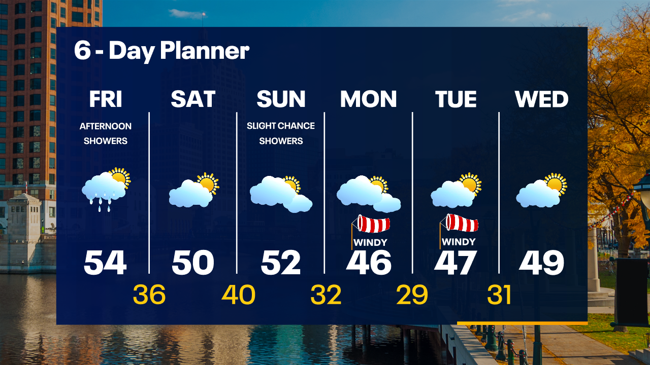
Frost Advisory overnight. Temperatures dipping into the low 30s by sunrise. Increasing clouds on Friday with a chance for afternoon rain showers possibly mixed with a snowflake. Highs in the low-to-mid 50s.
Frost Advisory overnight. Temperatures dipping into the low 30s by sunrise. Increasing clouds on Friday with a chance for afternoon rain showers possibly mixed with a snowflake. Highs in the low-to-mid 50s.