

Weather webcast with Rob Haswell
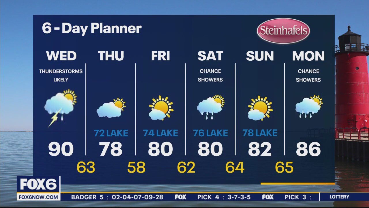
Ahead of a cold front for most of the day, we warm into the upper 80s and low 90s with high dewpoints making it feel hotter. As the front moves through, we can expect rain and thunderstorms.
Ahead of a cold front for most of the day, we warm into the upper 80s and low 90s with high dewpoints making it feel hotter. As the front moves through, we can expect rain and thunderstorms.
Weather Webcast with Meteorologist Eric Manges
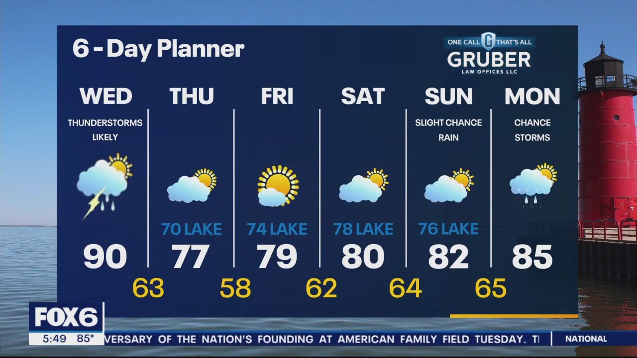
Scattered storms giving us our next widespread chance of rain Wednesday afternoon and evening
Scattered storms giving us our next widespread chance of rain Wednesday afternoon and evening

Weather webcast with Rob Haswell
Lots of heat and humidity today with highs reaching the low 90s and dewpoints well into the 60s. With the heat and humidity of the day, we could also see some instability leading to isolated showers and thunderstorms this afternoon and evening.
Lots of heat and humidity today with highs reaching the low 90s and dewpoints well into the 60s. With the heat and humidity of the day, we could also see some instability leading to isolated showers and thunderstorms this afternoon and evening.

Weather Webcast with Tom Wachs
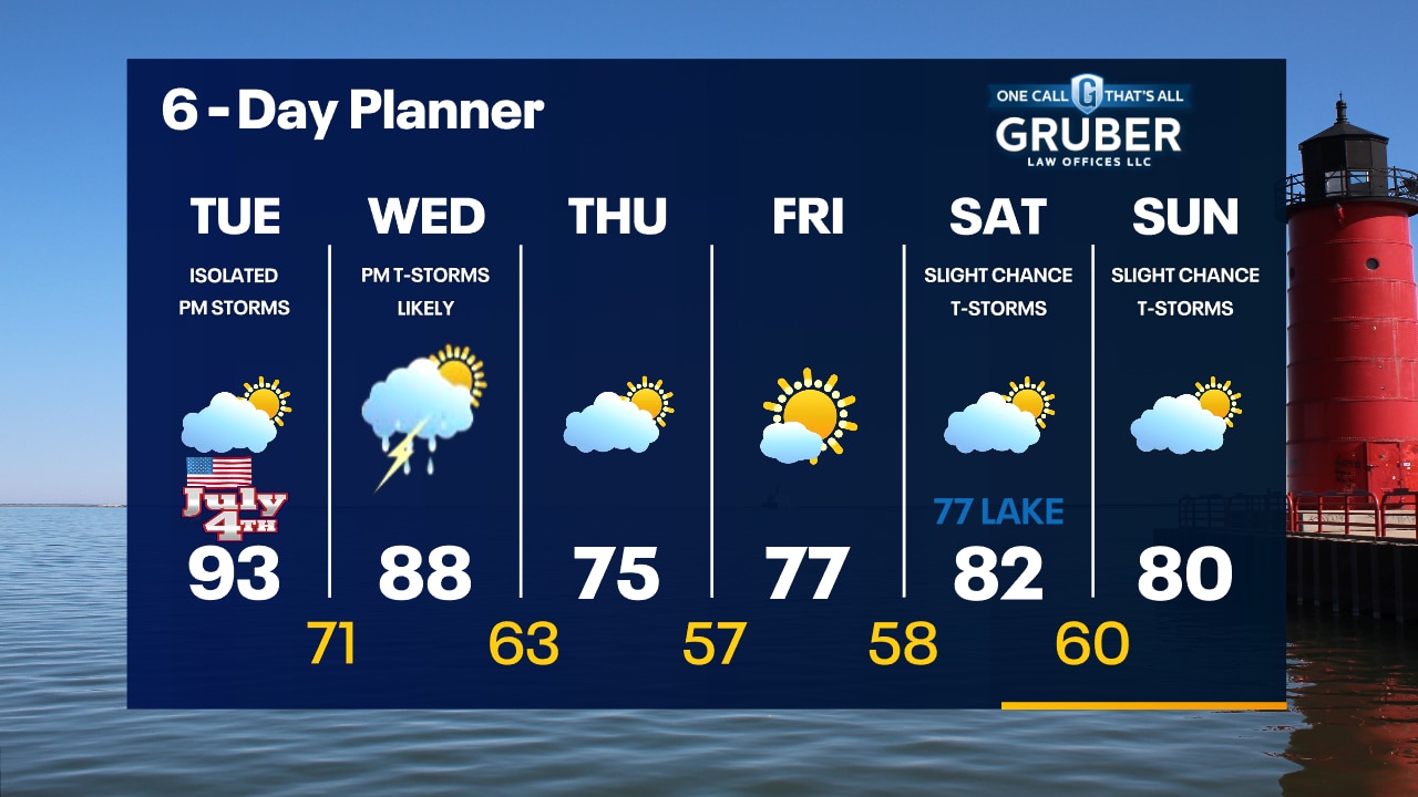
Hottest day of the year so far expected on July 4th. Highs in the low-to-mid 90s with a few isolated afternoon/evening t-storms. Strong to severe storms possible Wednesday afternoon.
Hottest day of the year so far expected on July 4th. Highs in the low-to-mid 90s with a few isolated afternoon/evening t-storms. Strong to severe storms possible Wednesday afternoon.
Weather Webcast with Tom Wachs
Clear skies tonight with temperatures falling into the 70s. The hottest day of the year so far on the way for the 4th of July. Highs in the 90s. A few isolated t-storms are possible later in the day into the evening.
Clear skies tonight with temperatures falling into the 70s. The hottest day of the year so far on the way for the 4th of July. Highs in the 90s. A few isolated t-storms are possible later in the day into the evening.
Weather Webcast with Rob Haswell
Ample heat and humidity for the next three days until a cold front cuts through the area dropping temperatures. Highs will be in the upper 80s to near 90 today through Wednesday. There is a chance for showers and thunderstorms Tuesday and again Wednesday.
Ample heat and humidity for the next three days until a cold front cuts through the area dropping temperatures. Highs will be in the upper 80s to near 90 today through Wednesday. There is a chance for showers and thunderstorms Tuesday and again Wednesday.
Weather Webcast with Tom Wachs
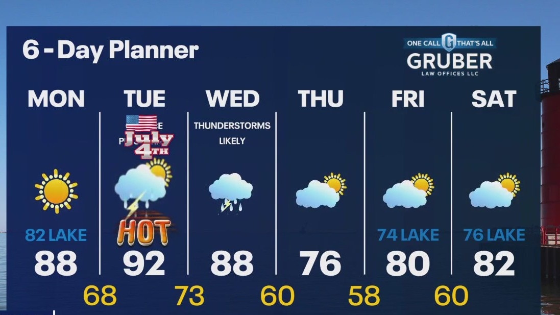
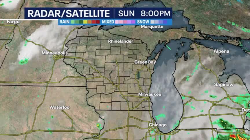
Mostly sunny, warm and humid on Monday. High around 90 west of Waukesha, low 80s near the lake. 70s for the fireworks at the lakefront Monday evening. Hot and humid on the 4th with highs in the 90s.
Mostly sunny, warm and humid on Monday. High around 90 west of Waukesha, low 80s near the lake. 70s for the fireworks at the lakefront Monday evening. Hot and humid on the 4th with highs in the 90s.

Weather Webcast with Tom Wachs
Clearing skies tonight with temperatures dropping into the 60s. Warm and humid on Monday. High around 90 west of Waukesha, low 80s along the lake. Hot and humid for the 4th of July.
Clearing skies tonight with temperatures dropping into the 60s. Warm and humid on Monday. High around 90 west of Waukesha, low 80s along the lake. Hot and humid for the 4th of July.

Weather Webcast with Meteorologist Lisa Michaels
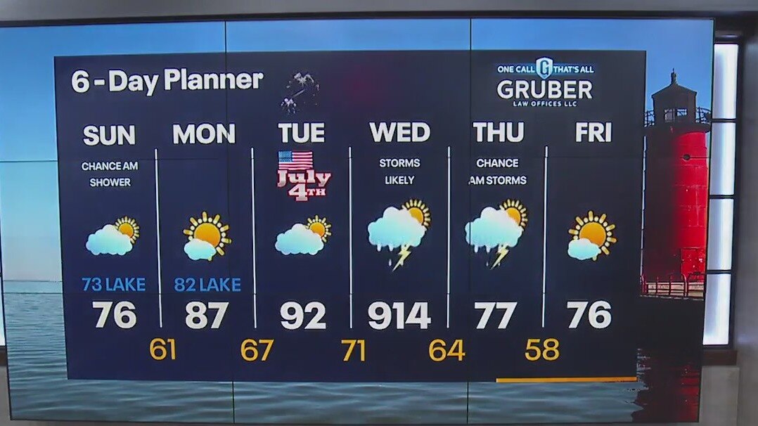
Slight chance of rain and drizzle in the morning. Otherwise, starting cloudy, transitioning to partly cloudy this afternoon. Cooler temps today in the mid to upper 70s. Back to Summer heat for the 4th of July, evening showers are possible, but favored rain chances are Wednesday into Thursday.
Slight chance of rain and drizzle in the morning. Otherwise, starting cloudy, transitioning to partly cloudy this afternoon. Cooler temps today in the mid to upper 70s. Back to Summer heat for the 4th of July, evening showers are possible, but favored rain chances are Wednesday into Thursday.
Weather Webcast with Meteorologist Lisa Michaels
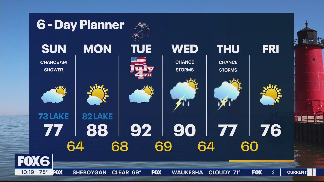
Slight chance of rain and drizzle in the morning. Otherwise, starting cloudy, transitioning to partly cloudy this afternoon. Cooler temps today in the mid to upper 70s. Back to Summer heat for the 4th of July, evening showers are possible, but favored rain chances are Wednesday into Thursday.
Slight chance of rain and drizzle in the morning. Otherwise, starting cloudy, transitioning to partly cloudy this afternoon. Cooler temps today in the mid to upper 70s. Back to Summer heat for the 4th of July, evening showers are possible, but favored rain chances are Wednesday into Thursday.
Weather Webcast with Meteorologist Eric Manges
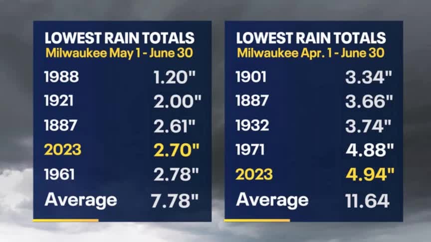
Heating up just in time for the 4th with widespread rain return Wednesday
Heating up just in time for the 4th with widespread rain return Wednesday
Weather Webcast with Meteorologist Eric Manges
Isolated rain chances tonight then the heat is on for the 4th of July
Isolated rain chances tonight then the heat is on for the 4th of July
Weather Webcast with Meteorologist Lisa Michaels
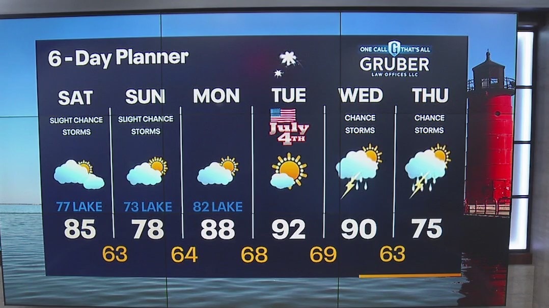
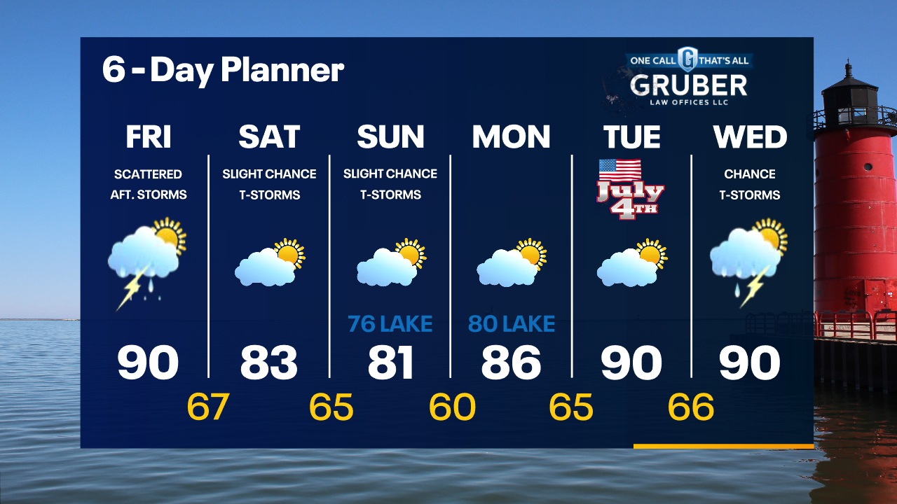
Humid conditions continue into tomorrow with highs in the mid-80s. Slight chance showers/storms Saturday and Sunday afternoons. Temperatures heat up back into the upper 80s to low 90s early next week.
Humid conditions continue into tomorrow with highs in the mid-80s. Slight chance showers/storms Saturday and Sunday afternoons. Temperatures heat up back into the upper 80s to low 90s early next week.
Weather Webcast with Meteorologist Eric Manges
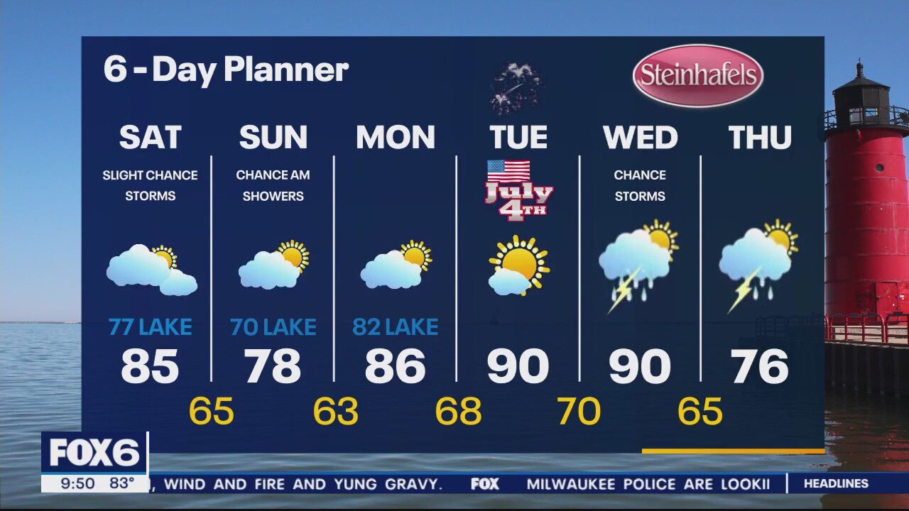
Isolated chances for rain moving forward and hot for the 4th of July
Isolated chances for rain moving forward and hot for the 4th of July

Weather Webcast with Meteorologist Eric Manges
Isolated showers are the theme heading into the holiday weekend
Isolated showers are the theme heading into the holiday weekend

Weather Webcast With Lisa Michaels
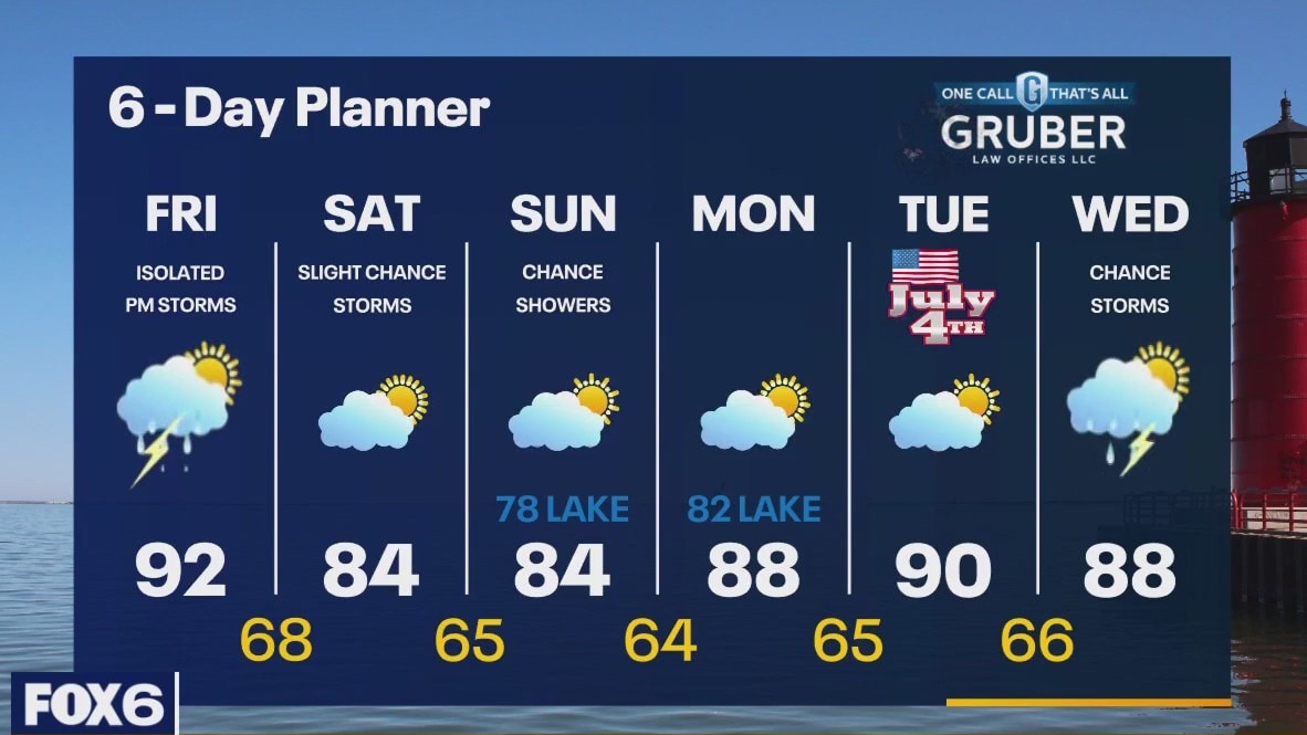
Air Quality Alert for all of SE WI until Noon Today - Smoke levels will improve through the morning. A very hot day today with highs in the low 90s - even by the lake. There is a slight chance for showers and isolated thunderstorms again this afternoon and early evening. Another chance for showers and storms this weekend with more comfortable temperatures.
Air Quality Alert for all of SE WI until Noon Today - Smoke levels will improve through the morning. A very hot day today with highs in the low 90s - even by the lake. There is a slight chance for showers and isolated thunderstorms again this afternoon and early evening. Another chance for showers and storms this weekend with more comfortable temperatures.
Weather webcast with Rob Haswell
Air Quality Alert for all of SE WI until Noon Today - Smoke levels will improve through the morning. A very hot day today with highs in the low 90s - even by the lake. There is a slight chance for showers and isolated thunderstorms again this afternoon and early evening. Another chance for showers and storms this weekend with more comfortable temperatures.
Air Quality Alert for all of SE WI until Noon Today - Smoke levels will improve through the morning. A very hot day today with highs in the low 90s - even by the lake. There is a slight chance for showers and isolated thunderstorms again this afternoon and early evening. Another chance for showers and storms this weekend with more comfortable temperatures.
Weather Webcast with Tom Wachs
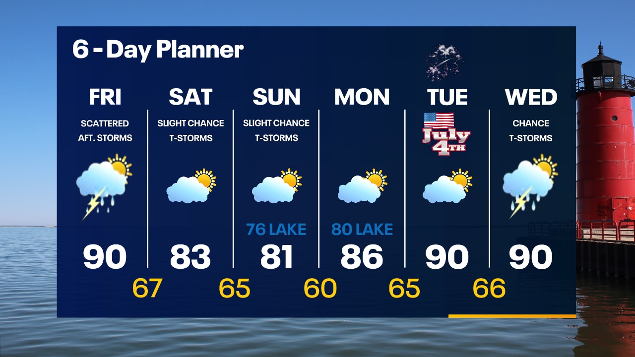
Humid overnight with temperatures in the upper 60s by sunrise. Not as smoky on Friday with a few afternoon scattered storms. Hot and humid with a high around 90.
Humid overnight with temperatures in the upper 60s by sunrise. Not as smoky on Friday with a few afternoon scattered storms. Hot and humid with a high around 90.
Weather Webcast with Tom Wachs
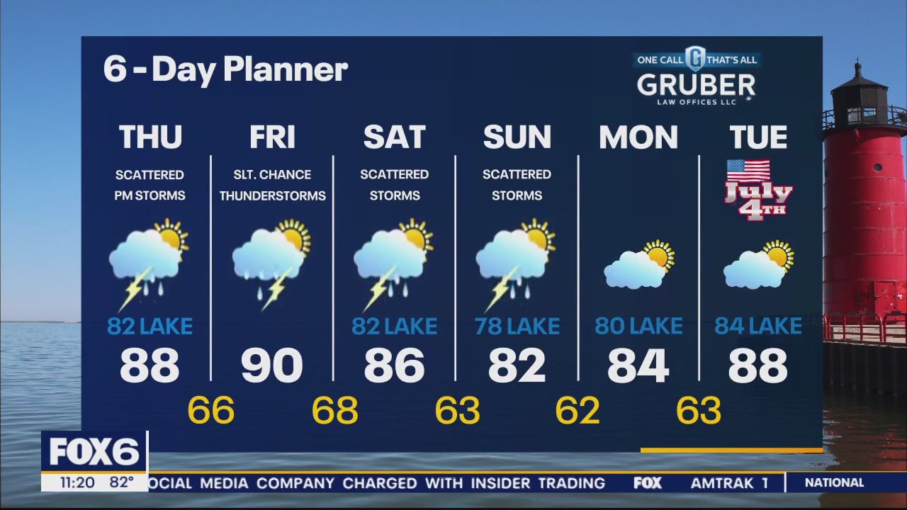
An isolated t-storm possible this evening otherwise still a bit smoky. Humid with temperatures in the 70s. Hot and humid Friday with a few afternoon storms. High around 90.
An isolated t-storm possible this evening otherwise still a bit smoky. Humid with temperatures in the 70s. Hot and humid Friday with a few afternoon storms. High around 90.
Weather Webcast with Meteorologist Eric Manges
Strong storm chances this afternoon and wildfire smoke improvements
Strong storm chances this afternoon and wildfire smoke improvements