

Weather Webcast with Tom Wachs
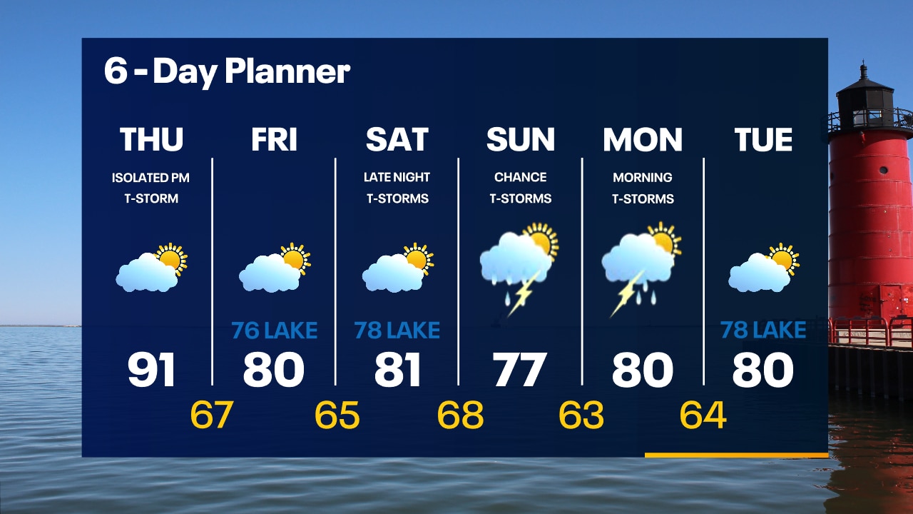
Patchy fog overnight with temperatures in the 60s. Partly sunny, hot and humid on Thursday. Highs in the low 90s with a heat index in the mid-90s. An isolated t-storm is possible on Thursday night.
Patchy fog overnight with temperatures in the 60s. Partly sunny, hot and humid on Thursday. Highs in the low 90s with a heat index in the mid-90s. An isolated t-storm is possible on Thursday night.
Weather Webcast with Tom Wachs
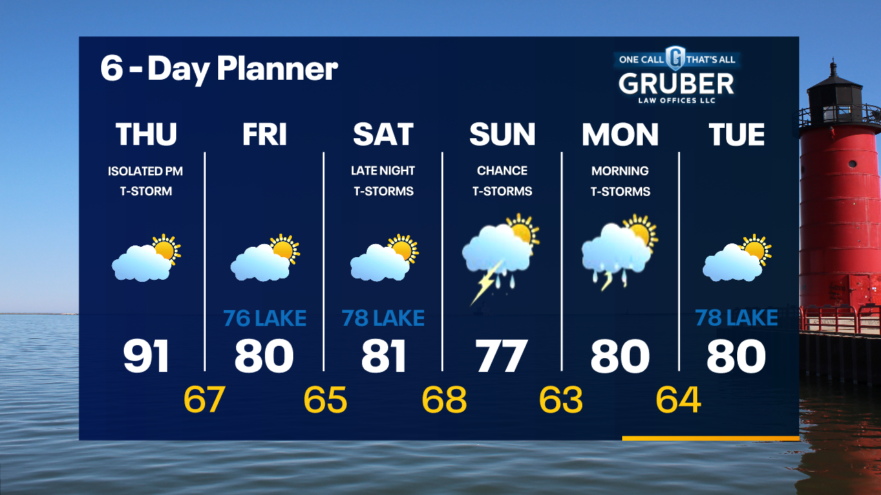
Partly cloudy tonight with temperatures dropping through the 70s and into the 60s. Partly sunny, hot and humid on Thursday with a high in the low 90s and a heat index in the mid-90s.
Partly cloudy tonight with temperatures dropping through the 70s and into the 60s. Partly sunny, hot and humid on Thursday with a high in the low 90s and a heat index in the mid-90s.

Weather Webcast with Meteorologist Eric Manges
Hot today and tomorrow with a chance for isolated showers
Hot today and tomorrow with a chance for isolated showers
Weather webcast with Rob Haswell
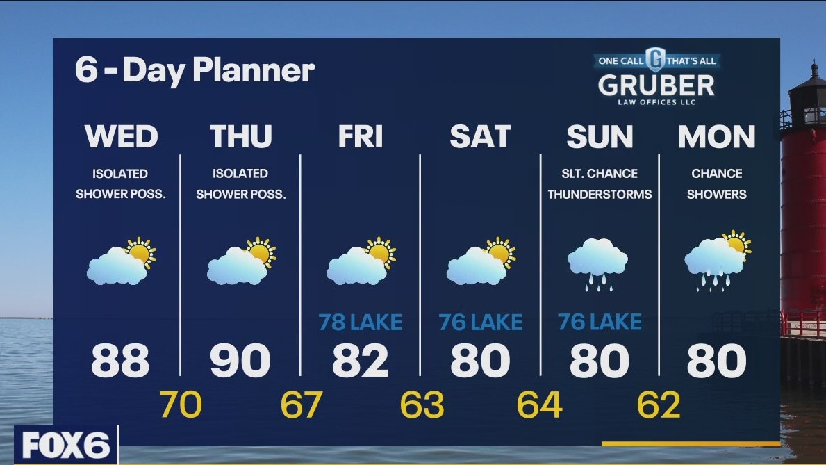
High pressure is still the big player in our forecast giving us ample sun again today. We warm up on a SW wind today, pushing highs in the upper 80s. We should warm to near 90 by Thursday. There will be just enough instability, heat and humidity the next two days for very isolated showers or thundershowers to pop up today and tomorrow. We should cool down Friday and through the weekend. There is a chance for rain Sunday and Monday.
High pressure is still the big player in our forecast giving us ample sun again today. We warm up on a SW wind today, pushing highs in the upper 80s. We should warm to near 90 by Thursday. There will be just enough instability, heat and humidity the next two days for very isolated showers or thundershowers to pop up today and tomorrow. We should cool down Friday and through the weekend. There is a chance for rain Sunday and Monday.
Weather Webcast with Tom Wachs
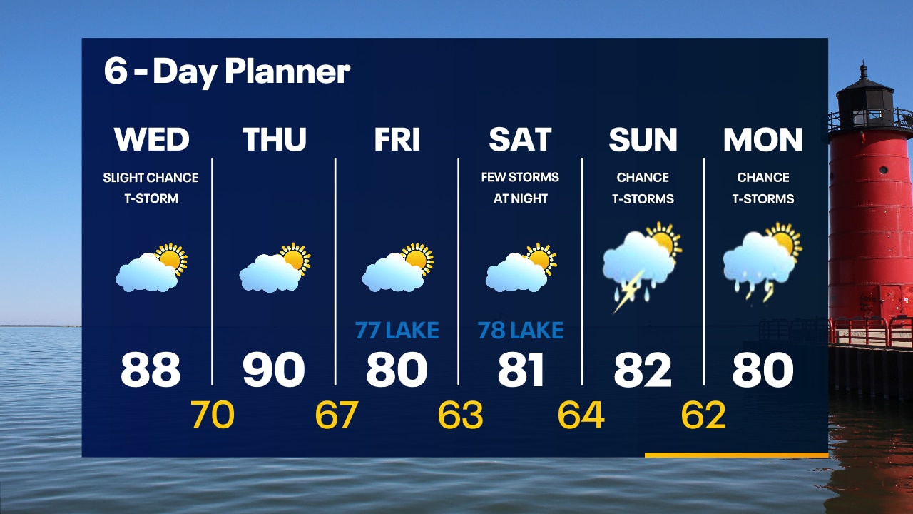
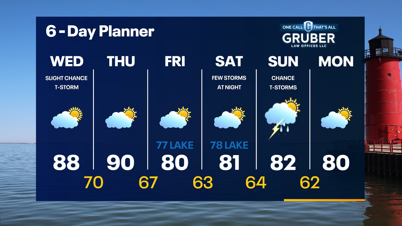
Partly cloudy overnight with a full moon in the sky. Temperatures in the 60s by sunrise. Partly sunny, breezy, hot and humid on Wednesday. Highs in the upper 80s. A few isolated t-storms are possible.
Partly cloudy overnight with a full moon in the sky. Temperatures in the 60s by sunrise. Partly sunny, breezy, hot and humid on Wednesday. Highs in the upper 80s. A few isolated t-storms are possible.
Weather Webcast with Tom Wachs
Isolated rain showers taper off this evening with a full moon rising in the eastern sky. Temperatures in the 70s this evening. Warm and humid Wednesday and Thursday.
Isolated rain showers taper off this evening with a full moon rising in the eastern sky. Temperatures in the 70s this evening. Warm and humid Wednesday and Thursday.
Weather webcast with Rob Haswell
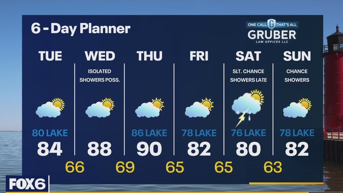
An area of high pressure again dominates our forecast keeping things calm and on the sunny side. There will be a bit of smoke in the air from the wildfire smoke but it shouldn't mix down to the surface at a level that will be of concern. Highs today will reach the low to mid 80s with cooler conditions lakeside. We warm into the upper 80s and near 90 for Wednesday and Thursday.
An area of high pressure again dominates our forecast keeping things calm and on the sunny side. There will be a bit of smoke in the air from the wildfire smoke but it shouldn't mix down to the surface at a level that will be of concern. Highs today will reach the low to mid 80s with cooler conditions lakeside. We warm into the upper 80s and near 90 for Wednesday and Thursday.
Weather Webcast with Tom Wachs
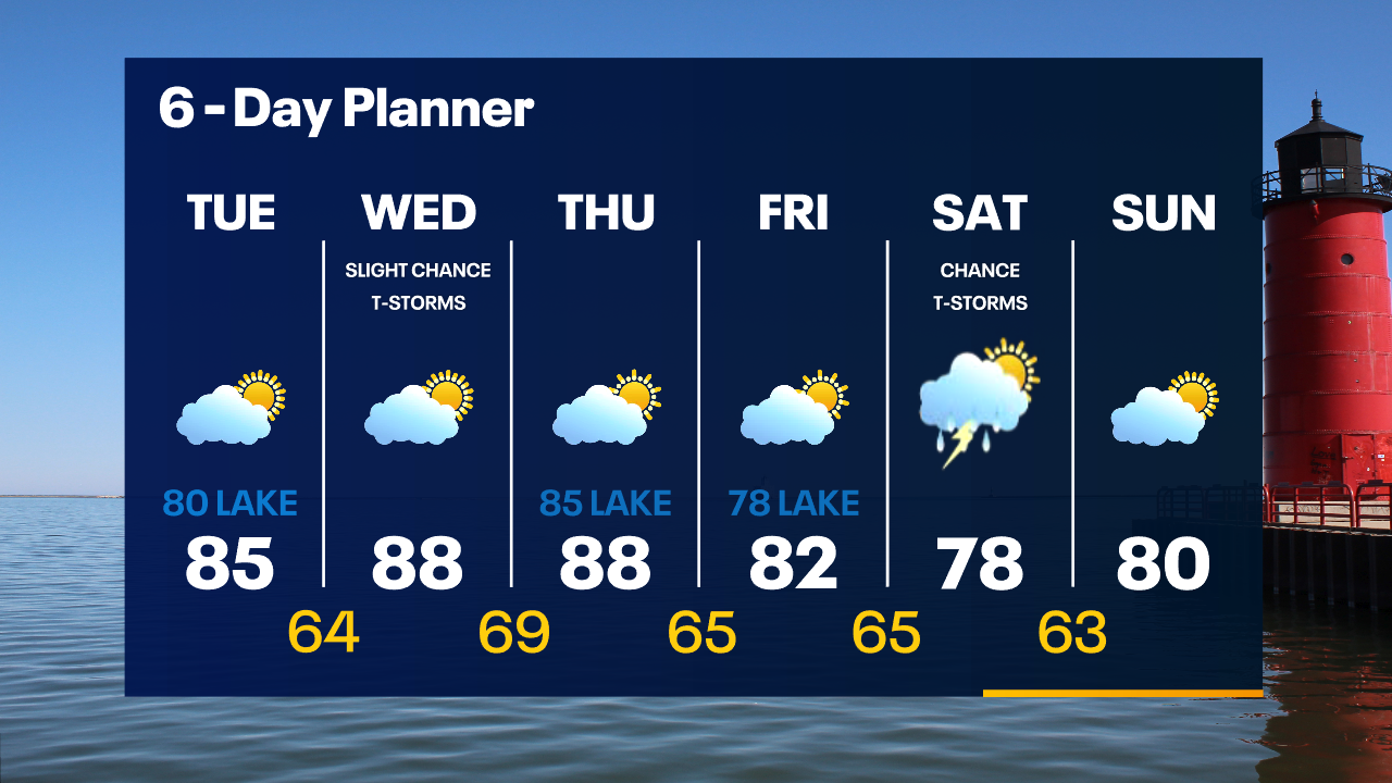
Mostly clear overnight with temperatures in the 50s and 60s by sunrise. Partly sunny on Tuesday with highs in the mid-80s inland, around 80 near the lake.
Mostly clear overnight with temperatures in the 50s and 60s by sunrise. Partly sunny on Tuesday with highs in the mid-80s inland, around 80 near the lake.
Weather Webcast with Tom Wachs
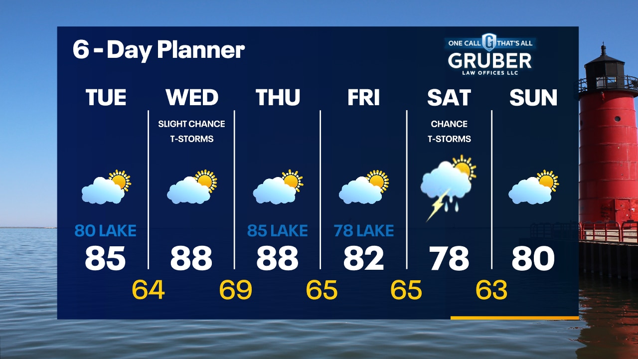
Quiet tonight with temperatures dropping into the 60s. Partly sunny with some elevated wildfire smoke possible on Tuesday. Highs in the 80s.
Quiet tonight with temperatures dropping into the 60s. Partly sunny with some elevated wildfire smoke possible on Tuesday. Highs in the 80s.
Weather Webcast With Lisa Michaels
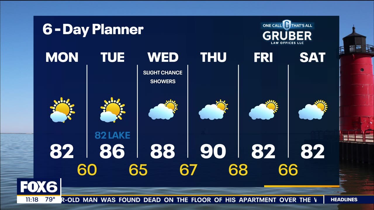
An area of high pressure dominates our region for the next couple of days. We will see ample sunshine today and tomorrow. We may see some wildfire smoke later today and again on Tuesday. We warm slightly into the low 80s today and Tuesdya and the realy heat returns Wednesday and Thursday with highs pushing 90. Few chances of showers Wednesday and Thursday.
An area of high pressure dominates our region for the next couple of days. We will see ample sunshine today and tomorrow. We may see some wildfire smoke later today and again on Tuesday. We warm slightly into the low 80s today and Tuesdya and the realy heat returns Wednesday and Thursday with highs pushing 90. Few chances of showers Wednesday and Thursday.
Weather webcast with Rob Haswell
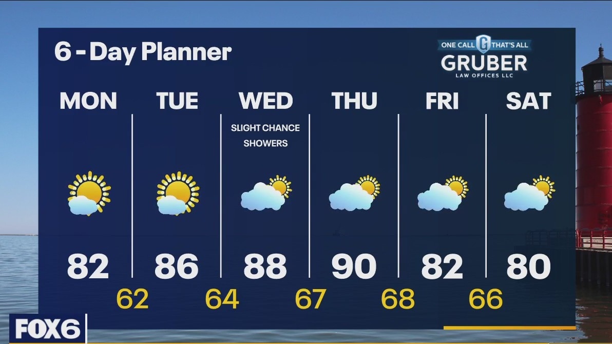
An area of high pressure dominates our region for the next couple of days. We will see ample sunshine today and tomorrow. We may see some wildfire smoke later today and again on Tuesday. We warm slightly into the low 80s today and Tuesday and the real heat returns Wednesday and Thursday with highs pushing 90. Comfortable low 80s return for the weekend.
An area of high pressure dominates our region for the next couple of days. We will see ample sunshine today and tomorrow. We may see some wildfire smoke later today and again on Tuesday. We warm slightly into the low 80s today and Tuesday and the real heat returns Wednesday and Thursday with highs pushing 90. Comfortable low 80s return for the weekend.
Weather Webcast with Meteorologist Eric Manges
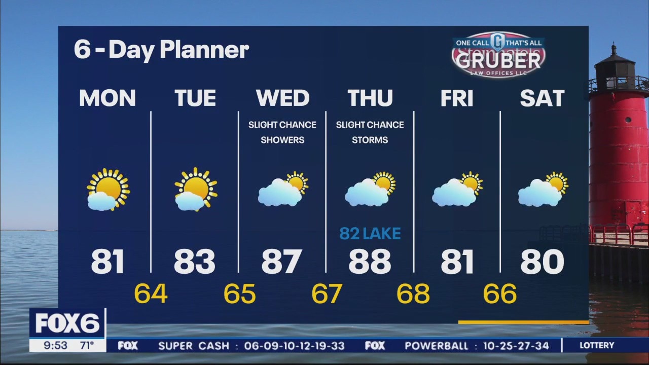
Warmer by Wednesday and Thursday but long term still looking cooler than average
Warmer by Wednesday and Thursday but long term still looking cooler than average

Weather Webcast with Meteorologist Eric Manges
Get ready for a smooth weather week and temps looking cooler than average to begin August
Get ready for a smooth weather week and temps looking cooler than average to begin August

Weather Webcast with Meteorologist Lisa Michaels
Partly cloudy to mostly sunny skies Sunday. High temps will touch 80F inland with the mid 70s near the lake. What a relief it will feel with near average temps and low dew points back starting next week.
Partly cloudy to mostly sunny skies Sunday. High temps will touch 80F inland with the mid 70s near the lake. What a relief it will feel with near average temps and low dew points back starting next week.
Weather Webcast with Meteorologist Eric Manges
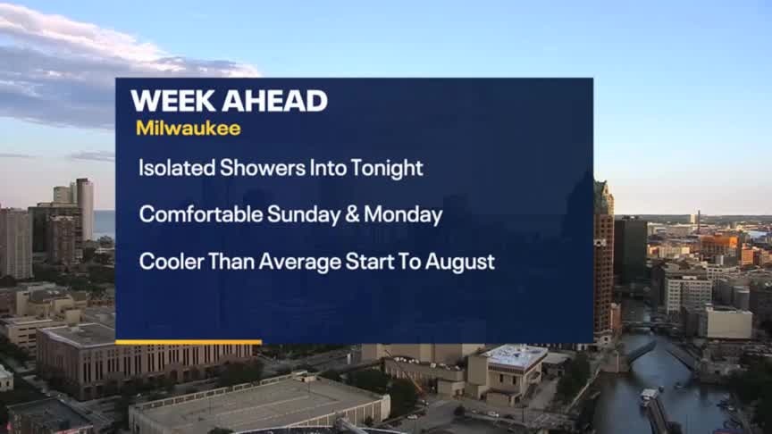
Even more comfortable on Sunday and Monday
Even more comfortable on Sunday and Monday
Weather Webcast With Lisa Michaels
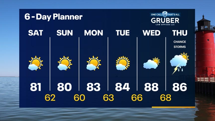
Mostly sunny skies with cooler temps back in the low 80s. Dew points will drop over the weekend as drier air moves in making it feel more comfortable. Calm and more seasonal weather this weekend and into next week. Warmer temps come back in the upper 80s by Wednesday. No significant rain chances in the short term. Scattered rain/storms possible by next Thursday.
Mostly sunny skies with cooler temps back in the low 80s. Dew points will drop over the weekend as drier air moves in making it feel more comfortable. Calm and more seasonal weather this weekend and into next week. Warmer temps come back in the upper 80s by Wednesday. No significant rain chances in the short term. Scattered rain/storms possible by next Thursday.
Weather Webcast with Meteorologist Eric Manges
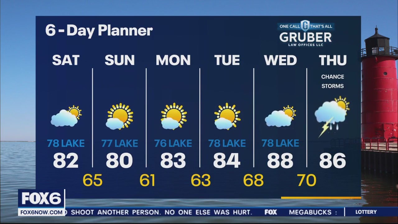
Strong to severe storms possible tonight then nicer for the weekend
Strong to severe storms possible tonight then nicer for the weekend
Weather Webcast With Lisa Michaels
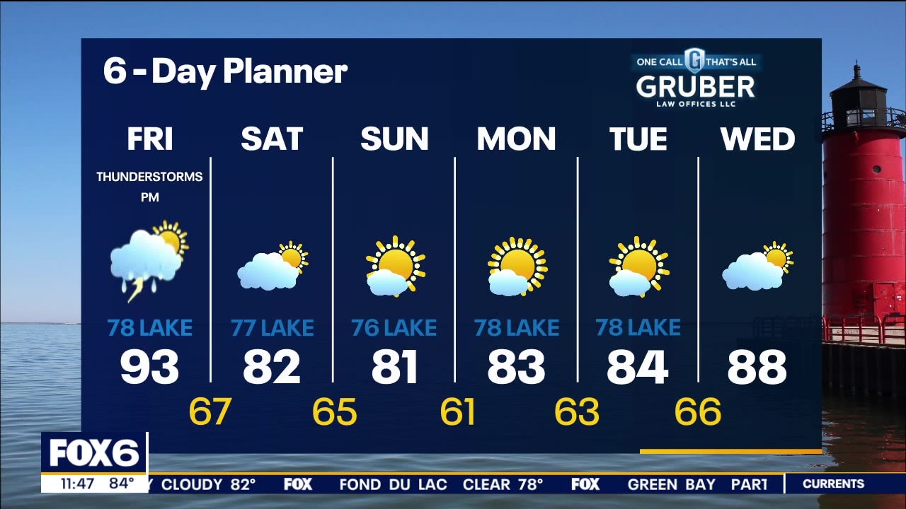
The last hot and sticky day of the week. Areas inland will see the low 90s with heat indices in the low 100s. Cooler near the lake. Heat advisory for Jefferson, Walworth, and Rock counties through 8PM. There is a risk for severe storms today - Isolated this afternoon with a higher threat between 7 and 9PM. Cooler and less humid this weekend with highs in the 70s to low 80s. Gradually warming up next week.
The last hot and sticky day of the week. Areas inland will see the low 90s with heat indices in the low 100s. Cooler near the lake. Heat advisory for Jefferson, Walworth, and Rock counties through 8PM. There is a risk for severe storms today - Isolated this afternoon with a higher threat between 7 and 9PM. Cooler and less humid this weekend with highs in the 70s to low 80s. Gradually warming up next week.

Weather webcast with Rob Haswell
Another hot, sticky and at times stormy day with highs in the low to mid 90 - slightly cooler near the lake. There is a risk for severe storms today - mostly in the afternoon and evening. A Heat Advisory begins at Noon today for Walworth and Jefferson Counties. It runs through 8pm. Cooler and less humid this weekend with highs in the 70s to low 80s. Gradually warming up next week.
Another hot, sticky and at times stormy day with highs in the low to mid 90 - slightly cooler near the lake. There is a risk for severe storms today - mostly in the afternoon and evening. A Heat Advisory begins at Noon today for Walworth and Jefferson Counties. It runs through 8pm. Cooler and less humid this weekend with highs in the 70s to low 80s. Gradually warming up next week.
Weather Webcast with Tom Wachs
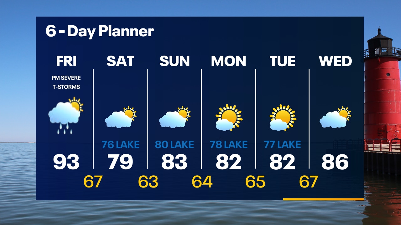
A few t-storms are possible overnight with warm and humid air remaining in place. Hot and humid on Friday with a heat index around 100. Late day and evening severe t-storms likely.
A few t-storms are possible overnight with warm and humid air remaining in place. Hot and humid on Friday with a heat index around 100. Late day and evening severe t-storms likely.