

Weather Webcast with Tom Wachs
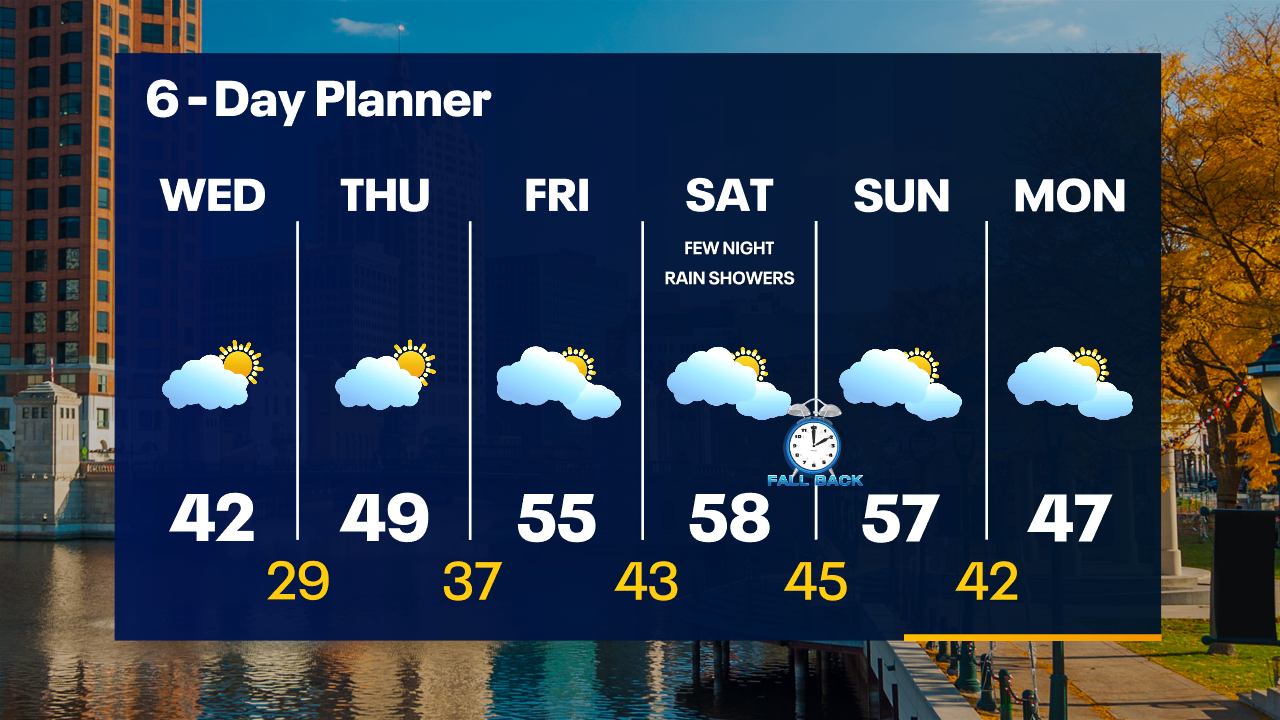
Refreeze/icy patches likely overnight. Clear skies with temperatures in the 20s. Mostly sunny Wednesday AM becoming partly sunny during the day. Highs in the low 40s.
Refreeze/icy patches likely overnight. Clear skies with temperatures in the 20s. Mostly sunny Wednesday AM becoming partly sunny during the day. Highs in the low 40s.
Weather Webcast with Tom Wachs
Snow ending this evening with skies rapidly clearing. Watch out for slick roads. Temperatures dropping into the 20s. Partly sunny on Wednesday with highs in the low 40s.
Snow ending this evening with skies rapidly clearing. Watch out for slick roads. Temperatures dropping into the 20s. Partly sunny on Wednesday with highs in the low 40s.
Weather webcast with Rob Haswell
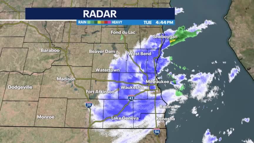
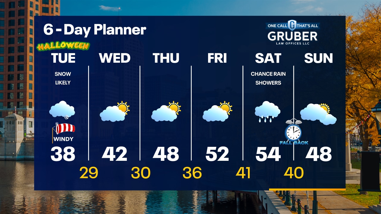
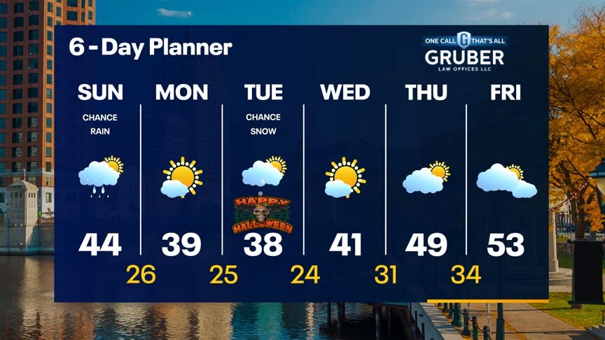
A fast moving low passes over our area today with snow showers likely this morning and through the afternoon. Accumulations should be around 1" in most areas. Snow will start around 5 a.m. in our western counties and closer to 7 a.m. for the Milwaukee city center areas. The morning commute will likely be significantly impacted. Take care. We dry up and clear up overnight with chilly lows expected. A sunny Wednesday warms us slightly with highs cracking the 40s again. We keep warming into the low 50s by late week. Rain showers return late Friday with a slight chance Saturday and a better chance on Sunday.
A fast moving low passes over our area today with snow showers likely this morning and through the afternoon. Accumulations should be around 1" in most areas. Snow will start around 5 a.m. in our western counties and closer to 7 a.m. for the Milwaukee city center areas. The morning commute will likely be significantly impacted. Take care. We dry up and clear up overnight with chilly lows expected. A sunny Wednesday warms us slightly with highs cracking the 40s again. We keep warming into the low 50s by late week. Rain showers return late Friday with a slight chance Saturday and a better chance on Sunday.
Weather Webcast with Tom Wachs
Snow starts between 5-8am. Scattered snow midday with another batch of snow mid-afternoon to early evening. Slick roads are possible along with accumulation and strong winds/low visibility.
Snow starts between 5-8am. Scattered snow midday with another batch of snow mid-afternoon to early evening. Slick roads are possible along with accumulation and strong winds/low visibility.
Weather Webcast with Tom Wachs
Clear and cold tonight with temperatures dropping into the 20s overnight. Snow moves in between 5-8am Tuesday with the first batch. It will become scattered midday with a possible additional band for the evening commute.
Clear and cold tonight with temperatures dropping into the 20s overnight. Snow moves in between 5-8am Tuesday with the first batch. It will become scattered midday with a possible additional band for the evening commute.
Weather webcast with Rob Haswell
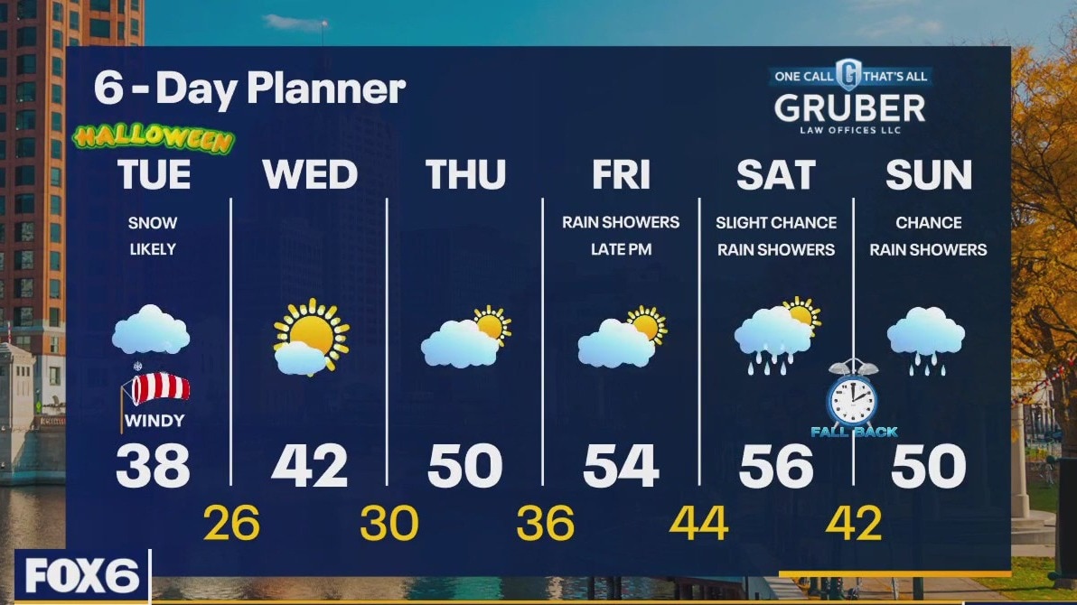
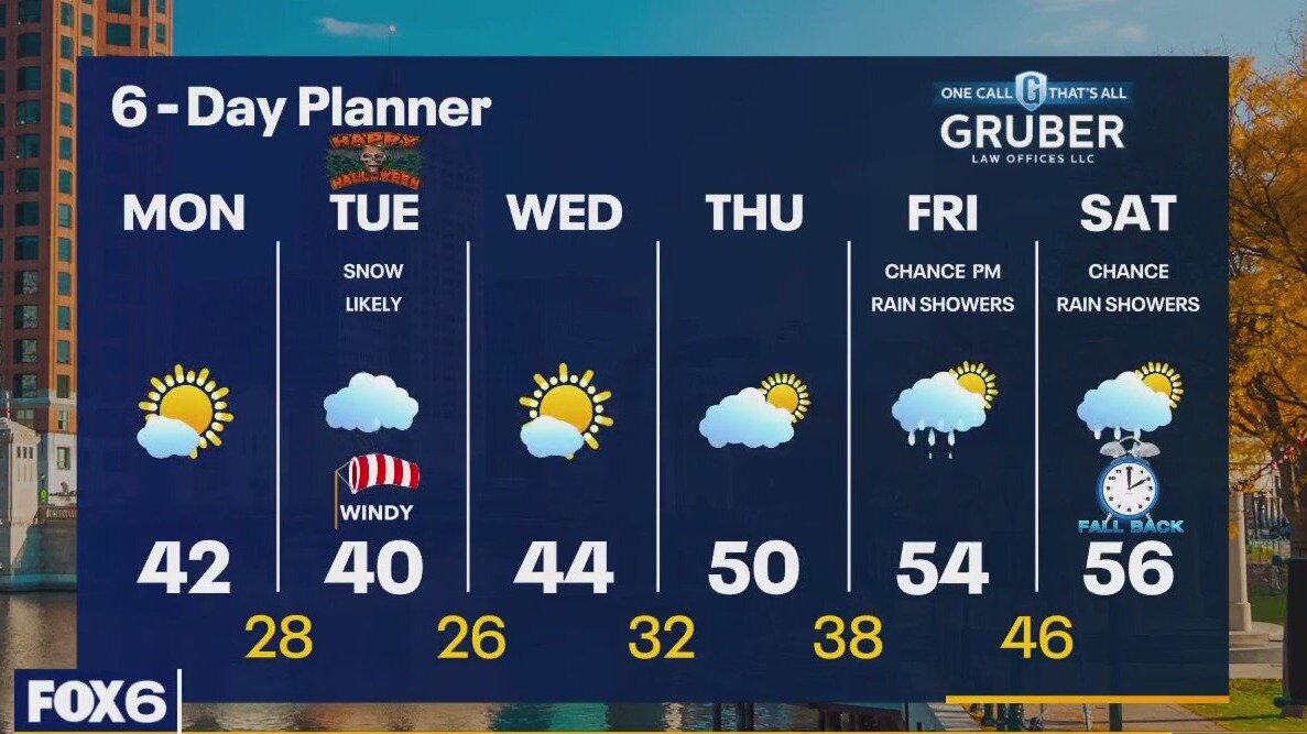
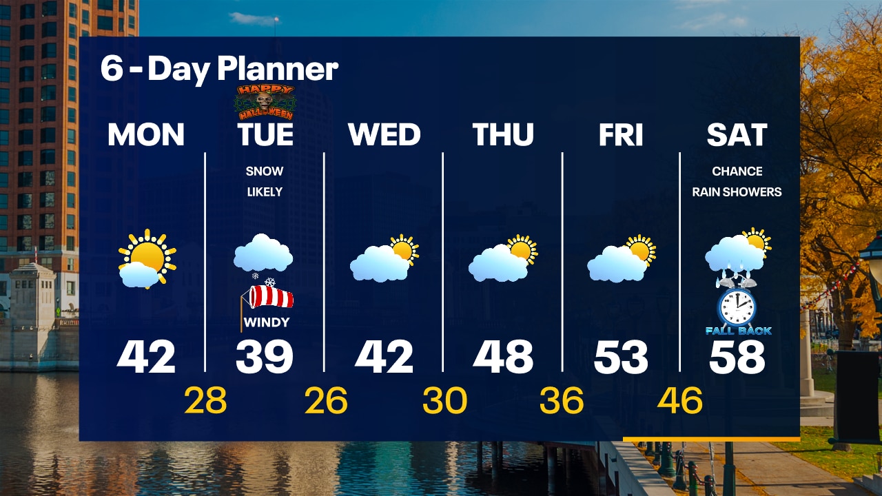
High pressure keeps us clear and cold today with morning lows below freezing and afternoon highs in the low 40s. We drop back into the 20s and low 30s overnight tonight and stay cold Tuesday with light snow expected. Around 1" of accumulation is expected. The snow won't last long as we warm back into the upper 40s Wednesday and low to mid 50s by the end of the week.
High pressure keeps us clear and cold today with morning lows below freezing and afternoon highs in the low 40s. We drop back into the 20s and low 30s overnight tonight and stay cold Tuesday with light snow expected. Around 1" of accumulation is expected. The snow won't last long as we warm back into the upper 40s Wednesday and low to mid 50s by the end of the week.
Weather Webcast with Tom Wachs
Freeze Warning overnight with temperatures in the 20s by sunrise. Mostly sunny on Monday with highs in the low 40s. Snow moves in Tuesday morning.
Freeze Warning overnight with temperatures in the 20s by sunrise. Mostly sunny on Monday with highs in the low 40s. Snow moves in Tuesday morning.

Weather Webcast with Tom Wachs
Freeze Warning overnight. Temperatures in the 20s by morning. Mostly sunny on Monday with highs in the low 40s. Up to 1" of snow possible on Tuesday with gusty northwest winds.
Freeze Warning overnight. Temperatures in the 20s by morning. Mostly sunny on Monday with highs in the low 40s. Up to 1" of snow possible on Tuesday with gusty northwest winds.
Weather webcast with Lisa Michaels
First hard freeze of the season-a freeze warning is in place from 8pm Sunday to 10am Monday. Temperatures in the mid 20s.
First hard freeze of the season-a freeze warning is in place from 8pm Sunday to 10am Monday. Temperatures in the mid 20s.
Weather webcast with Lisa Michaels
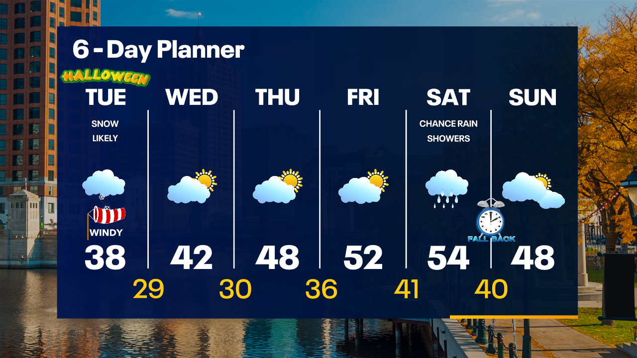
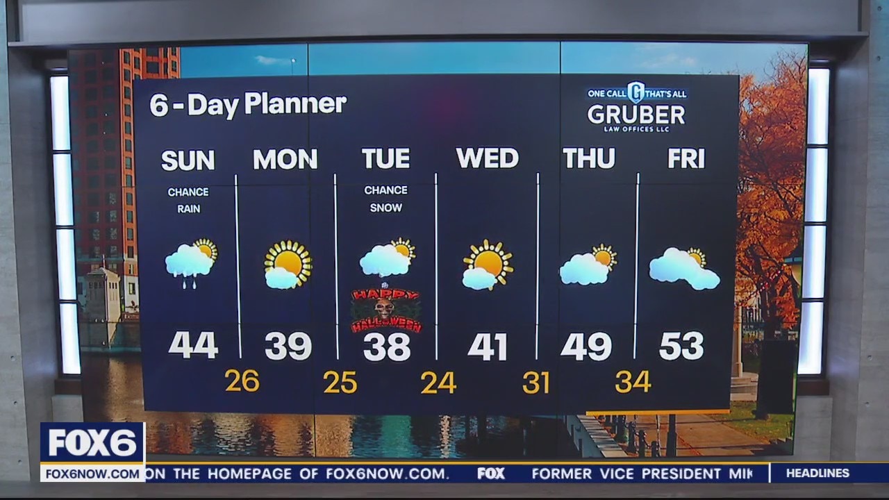
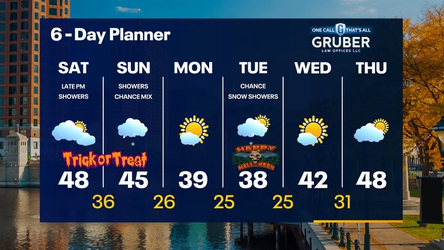
Mostly cloudy to cloudy skies return Sunday with a chance of a light drizzle/shower during the afternoon. A few flurries possible too. First hard freeze of the season-a freeze warning is in place from 8pm Sunday to 10am Monday. Temperatures in the mid 20s. Cold start to the week with snow showers in the forecast on Tuesday for Halloween. Minor accumulations are possible. Warmer temperatures will return back into the 50s by the end of the week.
Mostly cloudy to cloudy skies return Sunday with a chance of a light drizzle/shower during the afternoon. A few flurries possible too. First hard freeze of the season-a freeze warning is in place from 8pm Sunday to 10am Monday. Temperatures in the mid 20s. Cold start to the week with snow showers in the forecast on Tuesday for Halloween. Minor accumulations are possible. Warmer temperatures will return back into the 50s by the end of the week.
Weather Webcast with Meteorologist Eric Manges
Colder air settles in Monday and snow chances on Halloween
Colder air settles in Monday and snow chances on Halloween
Weather webcast with Lisa Michaels
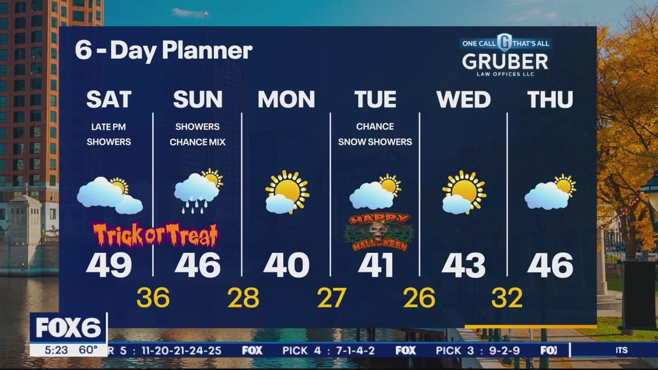
Chilly morning compared to this past week in the low to mid 30s. Some sunshine starting off Saturday with increasing clouds through the day. There is a small chance of a few showers tonight. Better chance Sunday of rain/snow mix especially near the lake. Cool temperatures stick around this weekend through the first half of next week.
Chilly morning compared to this past week in the low to mid 30s. Some sunshine starting off Saturday with increasing clouds through the day. There is a small chance of a few showers tonight. Better chance Sunday of rain/snow mix especially near the lake. Cool temperatures stick around this weekend through the first half of next week.
Weather Webcast with Meteorologist Eric Manges
Big temperature trend from this afternoon into tomorrow morning and this cool air is here to stay
Big temperature trend from this afternoon into tomorrow morning and this cool air is here to stay
Weather webcast with Lisa Michaels
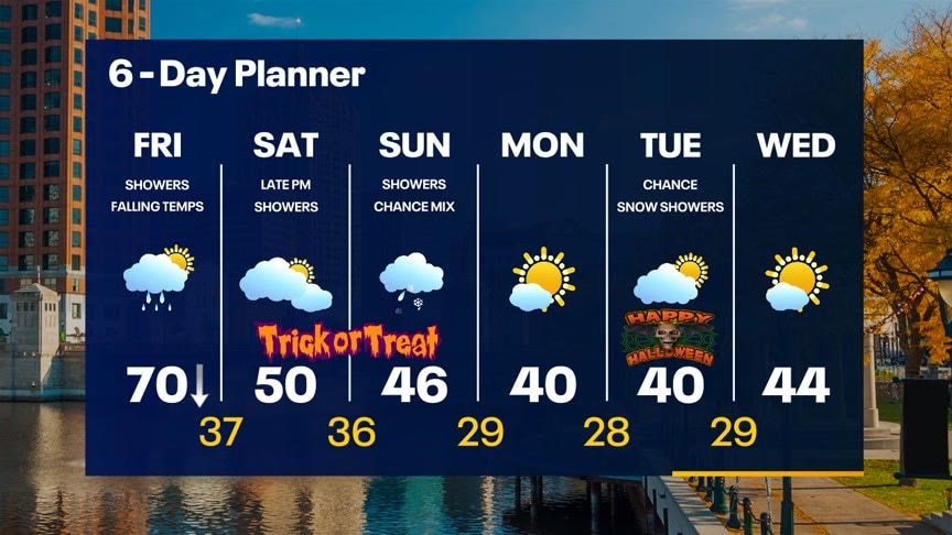
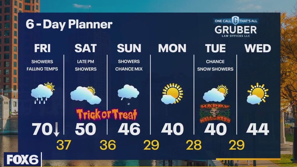
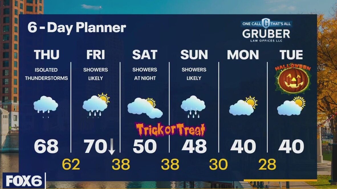
A cold front approaches the area today. Ahead of it, we stay mild with an early high near 70. Once it passes, temperatures fall rapidly. We should be in the 30s overnight. A few more showers and possibly an isolated thunderstorm as this front passes then we calm down for a few hours with showers returning late Saturday evening. More showers likely on Sunday and staying chilly through the weekend. Cold early next week with lows in the 20s and highs in the low 40s. Flurries possible Tuesday.
A cold front approaches the area today. Ahead of it, we stay mild with an early high near 70. Once it passes, temperatures fall rapidly. We should be in the 30s overnight. A few more showers and possibly an isolated thunderstorm as this front passes then we calm down for a few hours with showers returning late Saturday evening. More showers likely on Sunday and staying chilly through the weekend. Cold early next week with lows in the 20s and highs in the low 40s. Flurries possible Tuesday.
Weather webcast with Rob Haswell
A cold front approaches the area today. Ahead of it, we stay mild with an early high near 70. Once it passes, temperatures fall rapidly. We should be in the 30s overnight. A few more showers and possibly an isolated thunderstorm as this front passes then we calm down for a few hours with showers returning late Saturday evening. More showers likely on Sunday and staying chilly through the weekend. Cold early next week with lows in the 20s and highs in the low 40s. Flurries possible Tuesday.
A cold front approaches the area today. Ahead of it, we stay mild with an early high near 70. Once it passes, temperatures fall rapidly. We should be in the 30s overnight. A few more showers and possibly an isolated thunderstorm as this front passes then we calm down for a few hours with showers returning late Saturday evening. More showers likely on Sunday and staying chilly through the weekend. Cold early next week with lows in the 20s and highs in the low 40s. Flurries possible Tuesday.
Weather Webcast with Tom Wachs
Rain tapering off overnight. Scattered rain showers on Friday ahead of a cold front that will move through early in the afternoon. A BIG temperature drop expected. 60s through early afternoon, 40s by early evening.
Rain tapering off overnight. Scattered rain showers on Friday ahead of a cold front that will move through early in the afternoon. A BIG temperature drop expected. 60s through early afternoon, 40s by early evening.
Weather Webcast with Tom Wachs
Rain gradually tapering off tonight with temperatures in the 60s all night. A BIG temperature drop is on the way Friday. Light rain showers through midday with AM temperatures in the 60s. Temperatures drop into the 40s late in the day.
Rain gradually tapering off tonight with temperatures in the 60s all night. A BIG temperature drop is on the way Friday. Light rain showers through midday with AM temperatures in the 60s. Temperatures drop into the 40s late in the day.

Weather Webcast with Meteorologist Eric Manges
Rainy conditions continue through Friday but then the colder air returns this weekend
Rainy conditions continue through Friday but then the colder air returns this weekend
Weather webcast with Rob Haswell
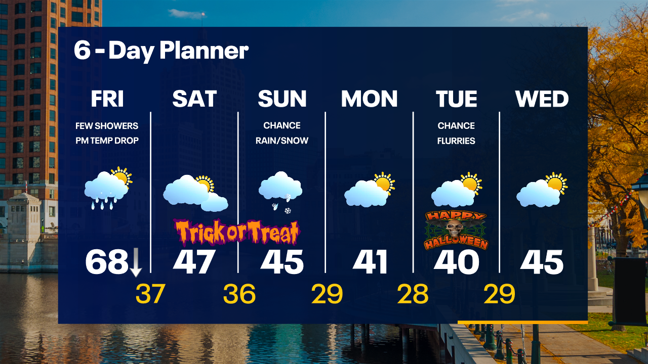
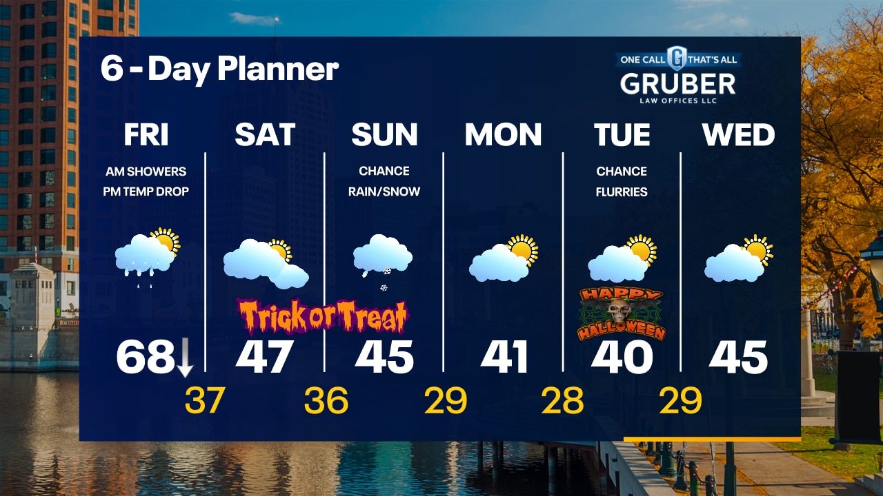
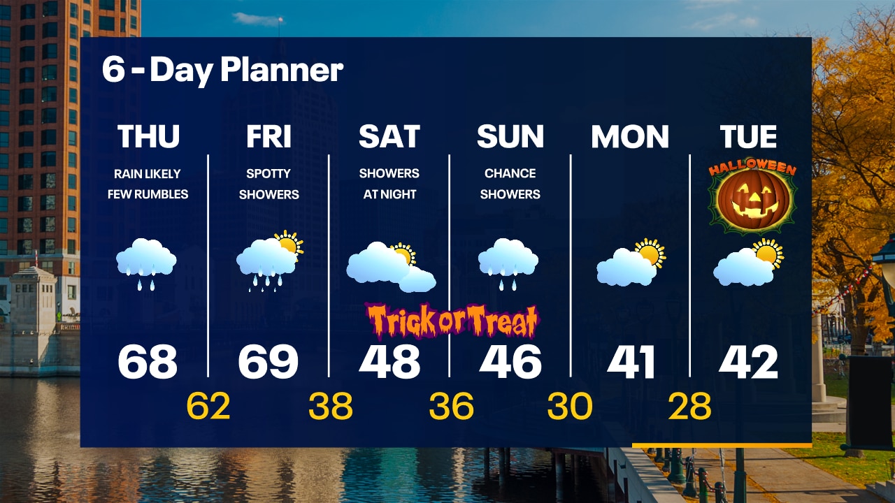
A surge of moisture travels Northeast into our area bringing periods of rain today and tapering to showers tonight. We stay on the warm side of the front today with highs in the upper 60s and should get to near 70 early Friday before a strong cold front drops us into the 30s. We stay on the chilly side from Friday night through the middle of next week. Highs will be in the low 50s this weekend with showers late Saturday and periods of light rain Sunday. Chilly Halloween forecast with highs barely reaching 40.
A surge of moisture travels Northeast into our area bringing periods of rain today and tapering to showers tonight. We stay on the warm side of the front today with highs in the upper 60s and should get to near 70 early Friday before a strong cold front drops us into the 30s. We stay on the chilly side from Friday night through the middle of next week. Highs will be in the low 50s this weekend with showers late Saturday and periods of light rain Sunday. Chilly Halloween forecast with highs barely reaching 40.
Weather Webcast with Tom Wachs
Rain moving in overnight with areas of fog. Temperatures in the 60s. Soggy on Thursday with showers and embedded t-storms. Breezy with highs in the 60s.
Rain moving in overnight with areas of fog. Temperatures in the 60s. Soggy on Thursday with showers and embedded t-storms. Breezy with highs in the 60s.