

Lake Michigan stops warm fronts in their tracks, here is why
Why is it always cooler by the lake in spring? Tuesday, April 27 was a great example of why Lake Michigan is where warm fronts go to die. Many cities quickly jumped up to the 60s and 70s in the early afternoon but then by 3 p.m., we fell by as much as 20°F in some places.
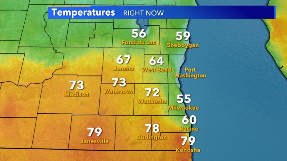
1 pm temperatures April 27th
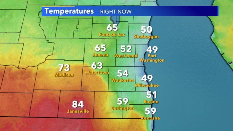
3 pm temperatures April 27th
It all has to do with cool Lake Michigan water. Cold air sinks and warm air rises. This simple physics principle dictates the circulation of the atmosphere. The sun heats the surface of the earth at different rates depending on how much moisture content they have and their color.
Air over water heats up much slower than air over land due to the sun's energy absorbed by the water. This can cause massive temperature differences across a short distance but it also causes a large difference in pressure.
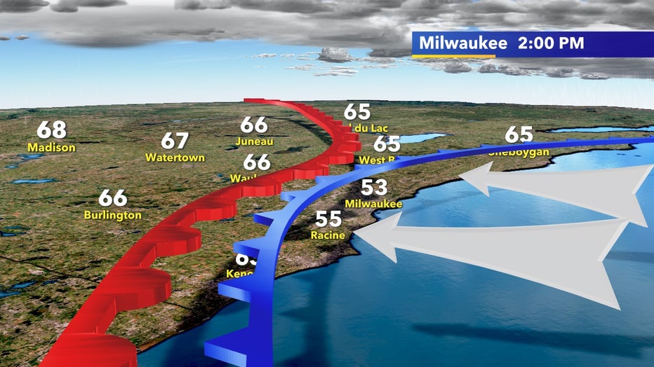
The cooler and denser air that sinks to the surface over water wants to move to low pressure and the rising air over land creates just that. In the afternoon, a lake breeze develops as cooler air moves from high to low pressure on land and can quickly drop temperatures near Lake Michigan.
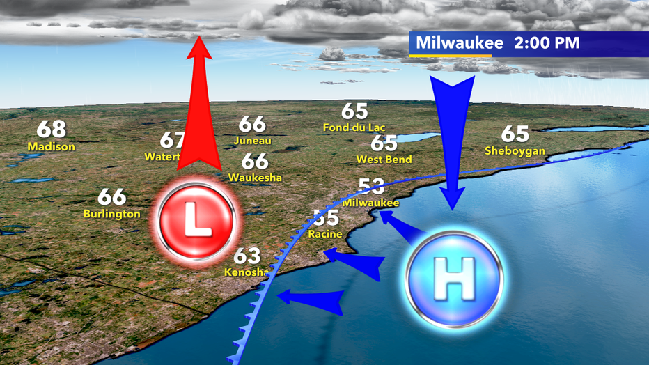
Warm air rising on land creates low pressure at the surface. Sinking cooler and denser air over Lake Michigan creates high pressure. Nature always takes the path of least resistance and air moves from high to low pressure.
This lake breeze can also act as a blockade to warm fronts. Cold air is so much denser than warm air that it stops warm fronts in their tracks and can push them backward in many cases. Lake Michigan's breeze creates a mini cold front just about every afternoon as long as it's cooler than the air over land.
This is exactly what occurred on April 27 and occurs many times each year.
Cold front created by cooler lake air halts many Spring warm fronts from reaching Milwaukee and other lake communities