

Southeast Wisconsin weather: watches, warnings expire
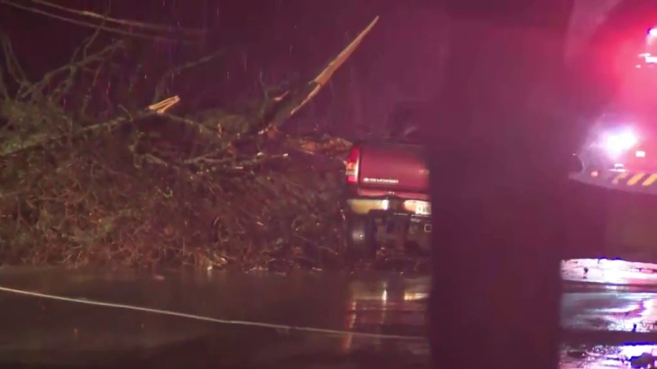
Kenosha damage following SE Wisconsin severe storms
A wild weather day across Wisconsin and beyond, with strong storms moving through the southern part of the state and prompting tornado warnings on Thursday, April 2. Sam Kraemer surveys Kenosha after reports of damage.
MILWAUKEE - The Storm Prediction Center has issued southern Wisconsin under an enhanced risk for severe storms Thursday afternoon and evening.
This only happens several times a year to be placed in this category. However, there will be either a lower or higher risk for severe storms depending on how the atmosphere responds to the morning rain.
Weather Alerts
What we know:
A Tornado Watch was issued for several southeastern Wisconsin counties until 11 p.m. but was canceled shortly after 8:30 p.m. It remained in effect until shortly after 9 p.m. for Kenosha and Racine counties.
Several Severe Thunderstorm Warnings were issued for southeast Wisconsin as well. Check out the FOX6 Weather Alerts page for the latest updates.

Power outages
Local perspective:
Those experiencing power outages or wanting to report one can visit We Energies' outage map.
Hazards
What we know:
The highest hazard will be damaging winds, but large hail and tornadoes are also favorable for this storm event. Long duration, widespread rain Thursday morning has already caused soaking grounds, and more rain could lead to low-lying flooding Thursday night.


There are two scenarios that can play out for this event: the first is a lower risk for severe storms if there is a short or no break from the afternoon rain to the evening storms when the cold front moves through.
The atmosphere will not have enough energy to help storms grow in a more stable environment and the temperatures could remain cooler. This does not mean there will be no strong storms, but rather, there will be more isolated potential warnings.

The second scenario would be for a higher risk for severe storms with more of them. This would occur if there is a longer break between the rain in the afternoon to the storms at night. The atmosphere could get warmer and gain more energy, allowing for storms to grow stronger and taller.

The low pressure will bring a warm front over southern Wisconsin, setting up a short time frame where storms can get out of hand.
There is a threat for storms in the afternoon, with a more significant threat from 6 p.m. to 10 p.m.
We will have to watch if any supercells form ahead of the cold front. This would post a risk for stronger tornadoes and larger hail. If no cells form, a line of storms will carry through with the cold front tonight, bringing higher threats of damaging winds and a spin-up tornado.
Be weather aware today and download the free FOX6 Storm Center App to get live notifications if severe weather is in your area.
FOX6 Weather Extras
Local perspective:
Meanwhile, FOX6Now.com offers a variety of extremely useful weather tools to help you navigate the stormy season. They include the following:
FOX6 Storm Center app

FOX LOCAL Mobile app
FOX Weather app
What is the FOX Model?

What is the FOX Model?
FOX Weather Expert Tom Wachs explains the value of the FOX Model for our team -- and our viewers.
FOX Weather
Maps and radar
We have a host of maps and radars on the FOX6 Weather page that are updating regularly — to provide you the most accurate assessment of the weather. From a county-by-county view to the Midwest regional radar and a national view — it’s all there.
School and business closings
When the weather gets a little dicey, schools and businesses may shut down. Monitor the latest list of closings, cancellations, and delays reported in southeast Wisconsin.

FOX6 Weather Experts in social media
- CLICK HERE to "Like" the FOX6 Weather Team on Facebook
- CLICK HERE to "Like" Rob Haswell on Facebook
- CLICK HERE to "Like" Tom Wachs on Facebook
- CLICK HERE to "Like" Stephanie Barichello on Facebook
- CLICK HERE to "Like" Lisa Michaels on Facebook
- CLICK HERE to "Like" Holly Baker on Facebook
- CLICK HERE to "Follow" the FOX6 Weather Team on X
- CLICK HERE to "Follow" Rob Haswell on X
- CLICK HERE to "Follow" Tom Wachs on X
- CLICK HERE to "Follow" Stephanie Barichello on X
- CLICK HERE to "Follow" Lisa Michaels on X
- CLICK HERE to "Follow" Holly Baker on X
The Source: Information in this post was provided by the FOX6 Weather Experts and National Weather Service - Sullivan.