Wintry mix expected this weekend, 1-6 inches of snow possible
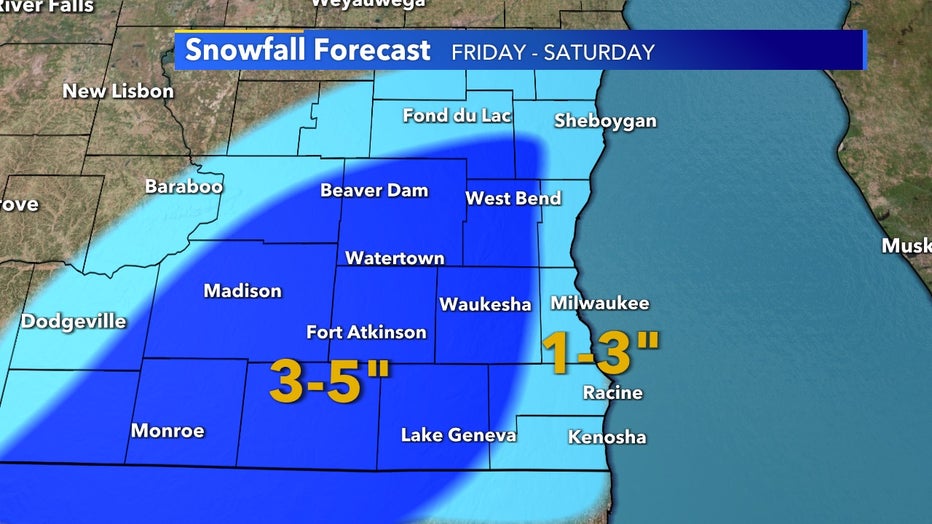
A preliminary look at expected snow totals when it's all said and done by Saturday night, Dec. 12 will be a range of 1-6 inches across southeast Wisconsin. A large swath west of Lake Michigan is favored to see the most, between 3-5 inches with isolated spots as much as 6 inches, but it all depends on how quickly the rain turns over to snow Friday night, Dec. 11 into Saturday morning, Dec. 12 due to warm air.
More likely than not, lakeside will see mostly rain out of this system with most of the accumulations coming Saturday, Dec. 12 but a lot can still change leading up to the event.
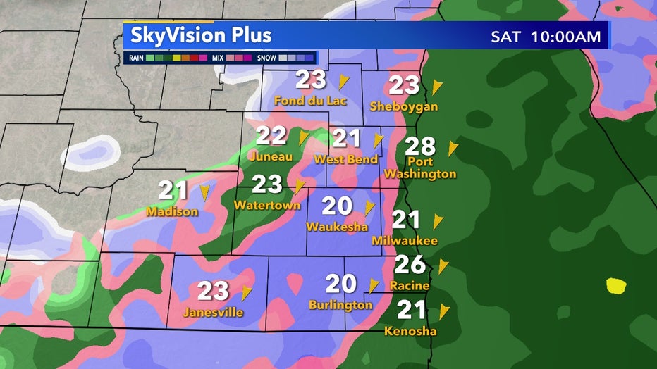
Generally, models continue to output a snow/rain/mix as the greatest variable in the forecast at this time. The picture below from SkyVision paints a good picture of what we expect radar to look like throughout the span of the system being in southeast Wisconsin.