

Snow chances finally return just days after 70s for southeast Wisconsin
From the mid-70s on Nov. 10 to now snow chances Thursday night, Nov. 12, no doubt cooler air has returned. Our snow potential is thanks to a cold front which is slowly working its way through Minnesota and arrives in southeast Wisconsin around 9 p.m., Nov. 12.
The best chance for small accumulations will be near Madison but a few flurries and a dusting is possible all the way to Milwaukee.
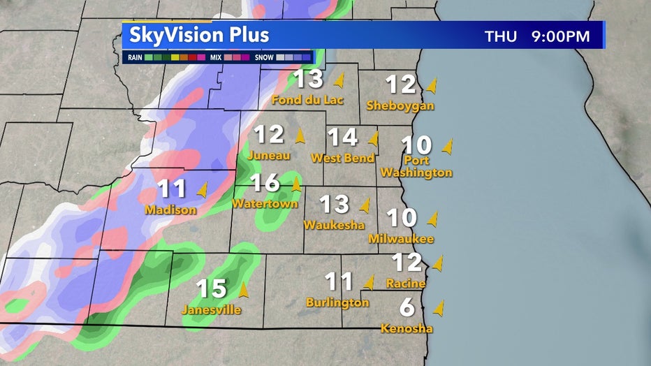
SkyVision Plus Thursday, Nov. 12 at 9pm
Lake Michigan will likely keep areas along the lakefront too warm for any snow to stick but areas farther inland could see some grassy surfaces hold frozen precip for a little while. By midnight and into the early morning on Friday, Nov. 13 this boundary begins to slowly get less organized and precip chances begin to fall apart.
This is not a significant chance of widespread snow but isolated locations could receive some.
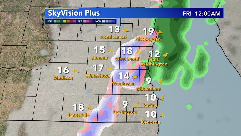
SkyVision Plus Thursday, Nov. 13 at 12am
The sunrise will be quite nice Friday, Nov. 13 as clouds clear out just in time for the start of the day but then temperatures will become the bigger story. Highs aren't expected to get out of the 30s as colder Canadian air takes the place of the seasonable airmass we experienced Thursday, Nov. 12.
Temperatures do rebound back to average for the weekend but more snow chances are possible in the near future.
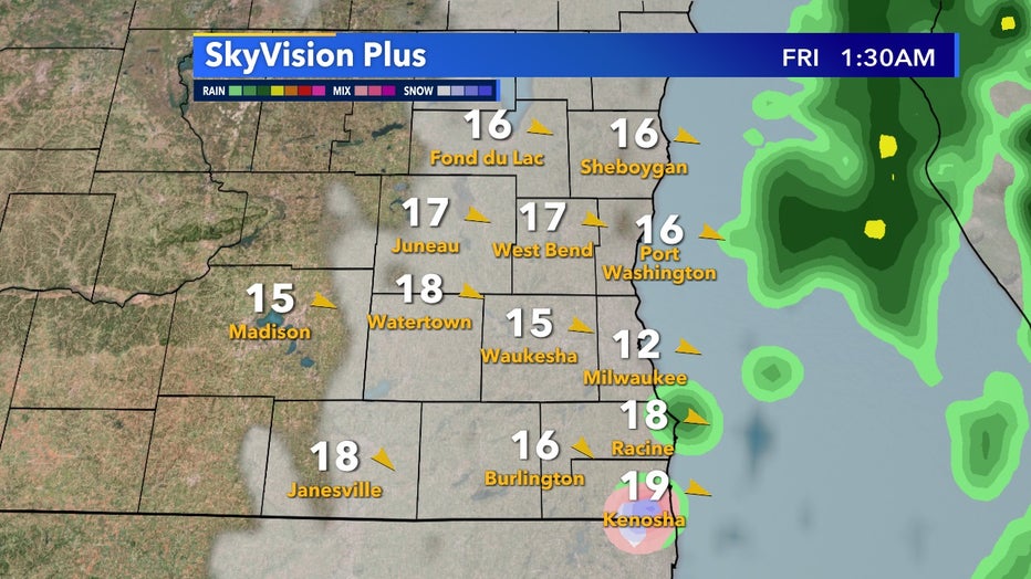
SkyVision Plus Thursday, Nov. 13 at 1:30am