

Slight risk for severe weather overnight Tuesday
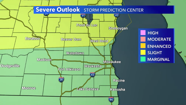
Milwaukee - The Storm Prediction Center has issued a "Slight Risk" of severe weather for parts of central and southern Wisconsin for storms expected to develop later Tuesday evening, April 27.
Parts of southeastern Wisconsin are in this risk -- including all of Fond du Lac and Sheboygan counties and northern Dodge, Washington and Ozaukee counties. The rest of the area remains in a "Marginal Risk."
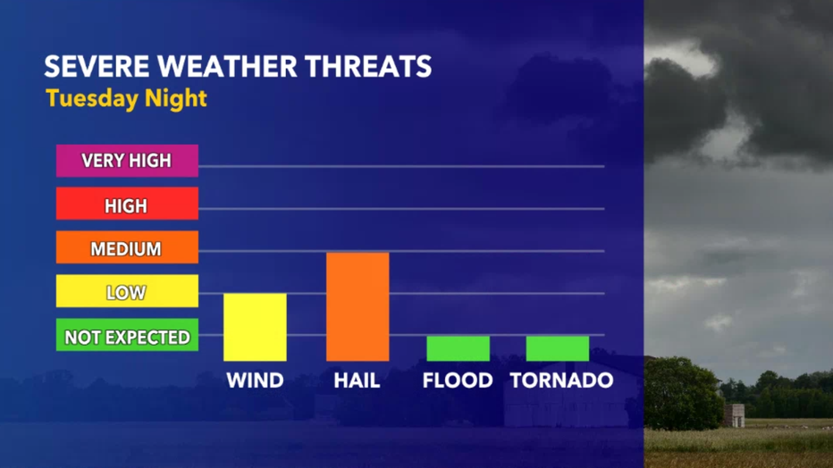
Any severe storm that develops Tuesday night will have the potential to produce small- to medium-sized hail and wind gusts in excess of 40 mph. The greatest risk for such storms will be in the "Slight Risk" area (one to two severe storms possible) with lesser probability in the "Marginal Risk" area.
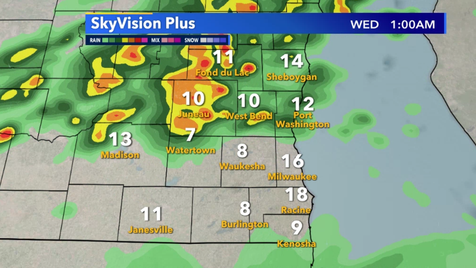
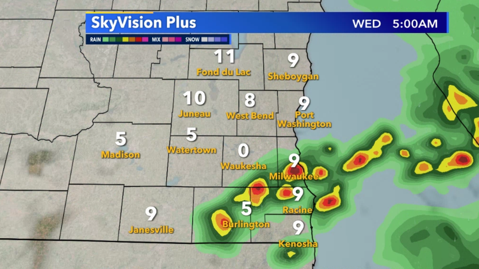
Storms will develop after 7 p.m. in central and western Wisconsin and slowly make their way southeastward. The strongest storms will arrive along a cold front after 10 p.m., with scattered storm chances continuing into early Wednesday morning.
If a severe warning is issued in your area, remember to stay inside until the storm passes. Download the FOX6 Storm Center App to track the storms, and stay tuned to the latest forecast from the FOX6 Weather Team.
FREE DOWNLOAD: Get breaking news alerts in the FOX6 News app for iOS or Android.

Weather Webcast with Tom Wachs
Scattered thunderstorms developing tonight, especially overnight. Small hail is possible. Temperatures in the 40s. 50s across the area on Wednesday with scattered morning t-storms.