

Slight risk for severe storms in SE Wisconsin Friday, weekend should be mostly calm
MILWAUKEE -- We'll be watching for severe storm potential late afternoon on Friday, June 26. A few thunderstorms will be possible earlier in the day, but the strongest line will be associated with a cold front that will take longer to arrive.
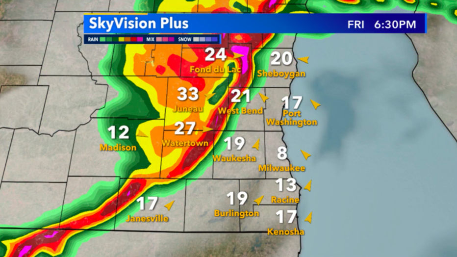
Skyvision Plus look at future radar for Friday, June 25 at 6pm
The National Weather Service has put just about the entire state in an area of slight risk for severe storms. This classification in terms of severity is a 2 out of 5, but still needs to be taken seriously. Severe potential in slight risk zones are generally scattered and short-lived, but the threat for intense isolated storms still remains.
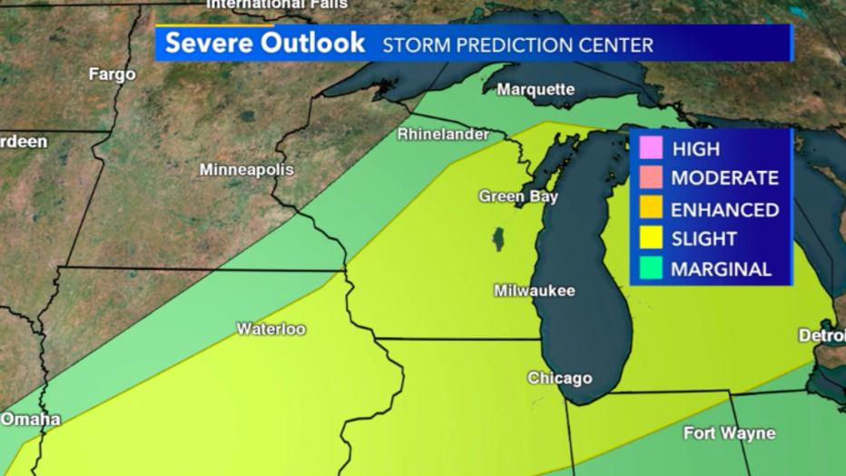
SPC forecast for Friday, June 25 putting most of us in a slight risk
Future radar continues to favor the development of a squall line as this system approaches. Typically, with a squall line, damaging winds and hail are the most impactful storm characteristics, but quick spin-up tornadoes are still possible. Overall, in southeast Wisconsin, we'll be watching for a medium to low severe threat for our region.
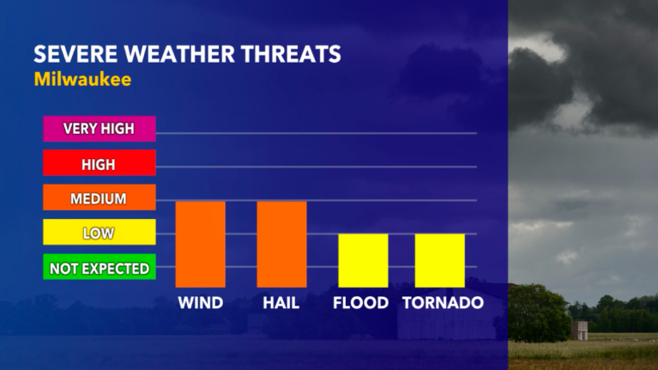
Severe weather threats for SE Wisconsin