

Severe weather possible Thursday in parts of Wisconsin
MILWAUKEE - After all the snow this week in parts of the Midwest, the next weather system is looking to bring thunderstorms back in the forecast on Thursday, Oct. 22, and even the potential for severe weather in parts of the region.
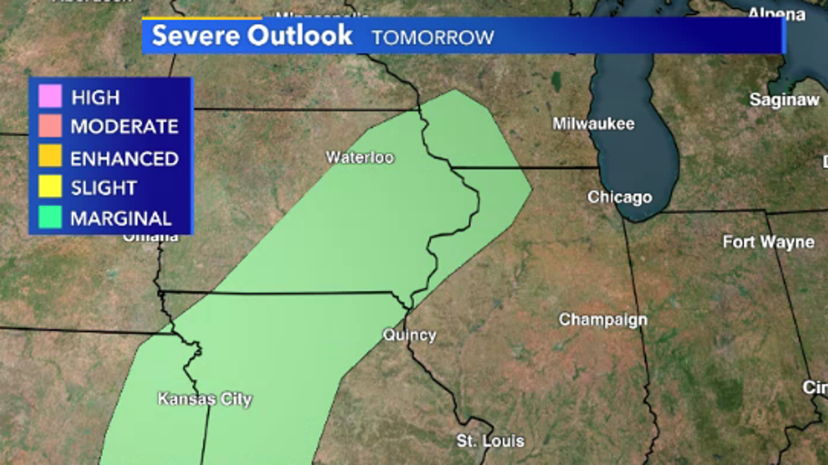
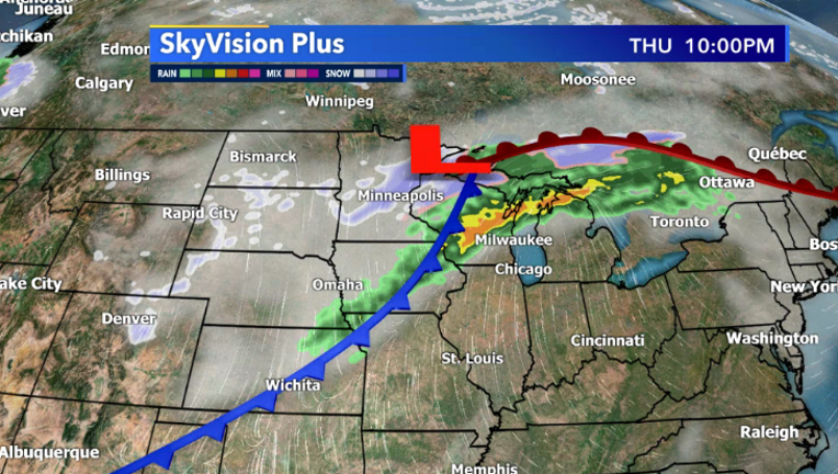
A developing low is expected to form over the Plains along a boundary of cold air to the north and warm air over the Central Plains. This will be a good setup for thunderstorms to develop, and even a few severe storms along a cold front stretching from southwestern Wisconsin to northeastern Oklahoma. Although the threat for severe weather is low, there is a chance for hail, gusty winds and even a brief tornado in these locations. This comes just days after snow impacted the same locations in Wisconsin and Iowa.
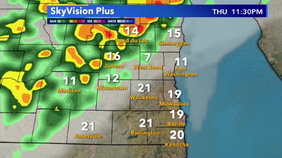
In southeastern Wisconsin, we can expect the threat of a few storms late Thursday, with storms remaining below severe criteria. That being said, there is a chance if temperatures increase higher than expected (into the low 70s) and the cold front arrives earlier than expected, we could see a strong to severe storm even in our area.
FREE DOWNLOAD: Get breaking news alerts in the FOX6 News app for iOS or Android
Stay tuned to the latest forecast by downloading the FOX6 Storm Center app where you can get the latest updates from the FOX6 Weather Experts.