

Wisconsin's severe weather season off to quiet start
MILWAUKEE - May's outlook is shaping up to be a quiet pattern that is likely to suppress severe weather chances to start the season.
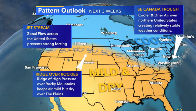
Over the next few weeks, a trough over southeastern Canada will force cooler and more seasonable air over Wisconsin, creating a dismal environment for storm development.
In addition to the trough, ridging out west and a zonal jet stream (westerly flow) will also prevent the development of large pressure systems that trigger severe events.

Severe weather season begins; how to stay safe
Do you and your family have a plan in the event of severe weather? The FOX6 Weather Experts have some great advice.
In order for severe weather opportunities to occur in the upper midwest, certain ingredients are required:
- First and foremost, instability, which basically occurs when you have abundant cool air over warmer air at the ground. Just think of those hot summer days.
- Secondly, moisture is needed to fuel storm development. Without moisture, storm development is deprived of its main fuel.
- Third, a lifting mechanism is required to force unstable air into the upper atmosphere along with moisture.
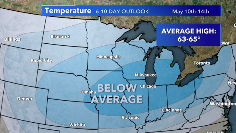
With the upcoming pattern forcing cooler and drier air over the region and suppressing the development of pressure systems and fronts, we can expect relatively tranquil conditions over the region for most of May. Although this type of pattern is great for preventing severe weather outbreaks, it is likely to change, and severe chances will return to the forecast.
Take this extra time to prepare for severe weather by practicing your severe weather plan and downloading our FOX6 Storm Center App to make sure you stay ahead of the storm.
FREE DOWNLOAD: Get breaking news alerts in the FOX6 News app for iOS or Android.