

More snow in SE Wisconsin Thursday night; roads a concern
MILWAUKEE - Snow totals across the region in multiple spots have already surpassed 2" with plenty more on the way into Thursday night, Feb. 16 with the highest totals expected southeast.
There have been all kinds of backups because of accidents, so motorists are urged to travel with caution.
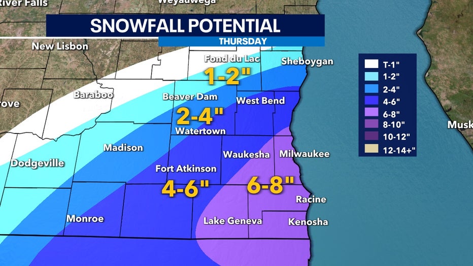
Snow totals forecast for southeast Wisconsin for Thursday, Feb. 16
Visibility will be the main concern as heavier bands of snow move into southeast Wisconsin by late afternoon, Thursday – and extend into the evening.
Snowfall is still likely into the night. By 7 p.m. Thursday evening, snow rates will begin to wind down and most of the accumulation will start wrapping up.
SIGN UP TODAY: Get daily headlines, breaking news emails from FOX6 News
It's possible for flurries to be falling in the region into late Thursday night, but clearer skies move in heading into Friday.
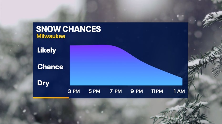
Snow chances heading into Thursday evening, Feb. 16
FREE DOWNLOAD: Get breaking news alerts in the FOX6 News app for iOS or Android
Our snowfall totals are still expected to range mostly between 4-6" with higher totals near Lake Michigan and areas southeast. Lake enhancement producing heavier snow rates will be the big variable that allows totals to increase with moisture being drawn in from the east.