

Bitter cold air returns for the 1st day of winter
So far the end of 2022 has only flirted with true winter cold a handful of times, but right on time for the start of the calendar, winter cold air rushes in.
From Dec. 21-25 a majority of the eastern U.S. including Wisconsin will be well below average. Arctic air rushes in, dropping temperatures easily 15 degrees below average.
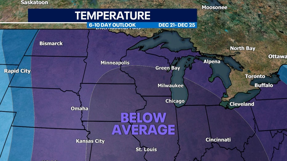
Temperature outlook from Dec. 21 through Dec. 25
Snow-covered areas to the northwest will be much colder by Tuesday, Dec. 20 but this is right when an arctic low swoops down from the north and gives us a solid chance of lows back in the single digits. Some atmospheric models even bring negatives to southeastern Wisconsin as we approach Christmas. Average highs during this time sit in the mid to low 30s to end of December.
SIGN UP TODAY: Get daily headlines, breaking news emails from FOX6 News
With this kind of temperature pattern, many of us will be missing the mild December we've had so far.
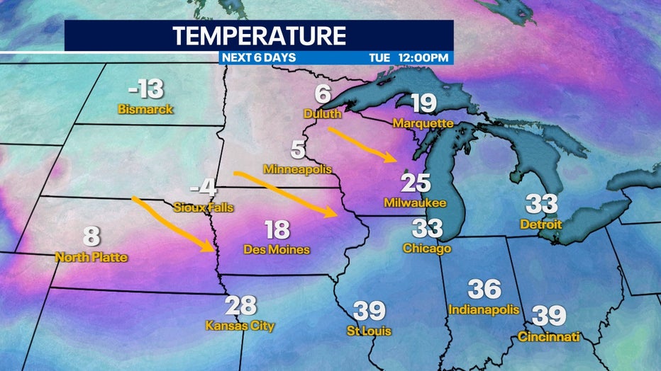
Tuesday afternoon, Dec. 20 cold air moves in from the NW
Fortunately, this temperature shift won't happen all at once. This gradual cool-down starts Sunday, Dec. 18 but really comes to a head Tuesday night, Dec. 20 if current trends hold.
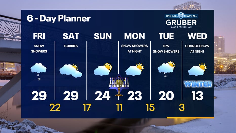
6-Day Planner from Dec. 16 through Dec. 21
One interesting fact: In 2021, we set a record high of 68 degrees on Dec. 16 and drastically dropped by 32 degrees in 24 hours to Dec. 17. This temperature drop won't be so drastically to ring in the new season.