

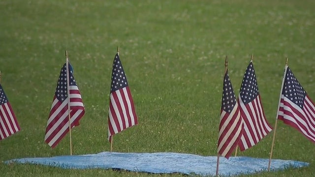

Communities postpone July 4th fireworks; severe weather concerns
Multiple communities made the decision on Monday, July 4 to postpone their local fireworks displays over concerns about severe weather that is forecasted for the evening.
Multiple communities made the decision on Monday, July 4 to postpone their local fireworks displays over concerns about severe weather that is forecasted for the evening.
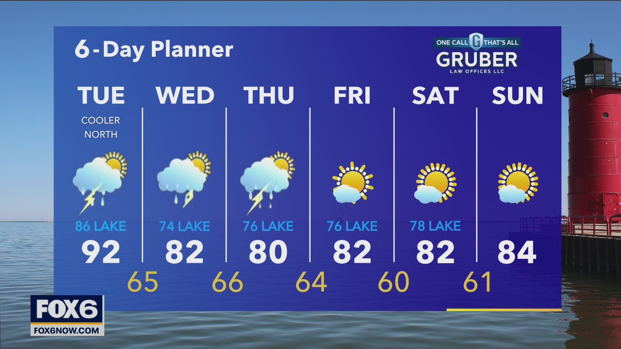
Weather webcast with Rob Haswell
Another active day today with rain and thunderstorms returning to the area this afternoon. Strong to severe storms are possible again today. Temperatures will vary across the area with highs well into the 90s west and southwest of Milwaukee where there is a Heat Advisory and in the 80s for areas east and north of the metro.
Another active day today with rain and thunderstorms returning to the area this afternoon. Strong to severe storms are possible again today. Temperatures will vary across the area with highs well into the 90s west and southwest of Milwaukee where there is a Heat Advisory and in the 80s for areas east and north of the metro.
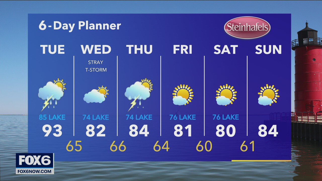
Weather Webcast with A.J. Waterman
Scattered storms moving through the area, with strong winds and small to medium-size hail possible.
Scattered storms moving through the area, with strong winds and small to medium-size hail possible.

Weather Webcast with A.J. Waterman
Tracking strong to severe storms across SE Wisconsin...
Tracking strong to severe storms across SE Wisconsin...
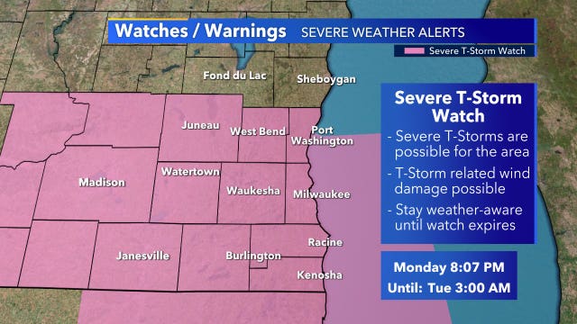

Severe T-storm watch through early Tuesday
The National Weather Service issued a severe thunderstorm watch for most of southeast Wisconsin until 3 a.m. Tuesday.
The National Weather Service issued a severe thunderstorm watch for most of southeast Wisconsin until 3 a.m. Tuesday.

Communities postpone July 4th fireworks; severe weather concerns
Multiple communities made the decision to postpone their July 4 fireworks displays over concerns about severe weather Monday.
Multiple communities made the decision to postpone their July 4 fireworks displays over concerns about severe weather Monday.
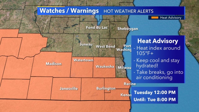

Heat advisory for parts of SE Wisconsin, noon-8 p.m. Tuesday
The National Weather Service has issued a heat advisory to be in effect for several counties in southeast Wisconsin from noon to 8 p.m. on Tuesday, July 5.
The National Weather Service has issued a heat advisory to be in effect for several counties in southeast Wisconsin from noon to 8 p.m. on Tuesday, July 5.
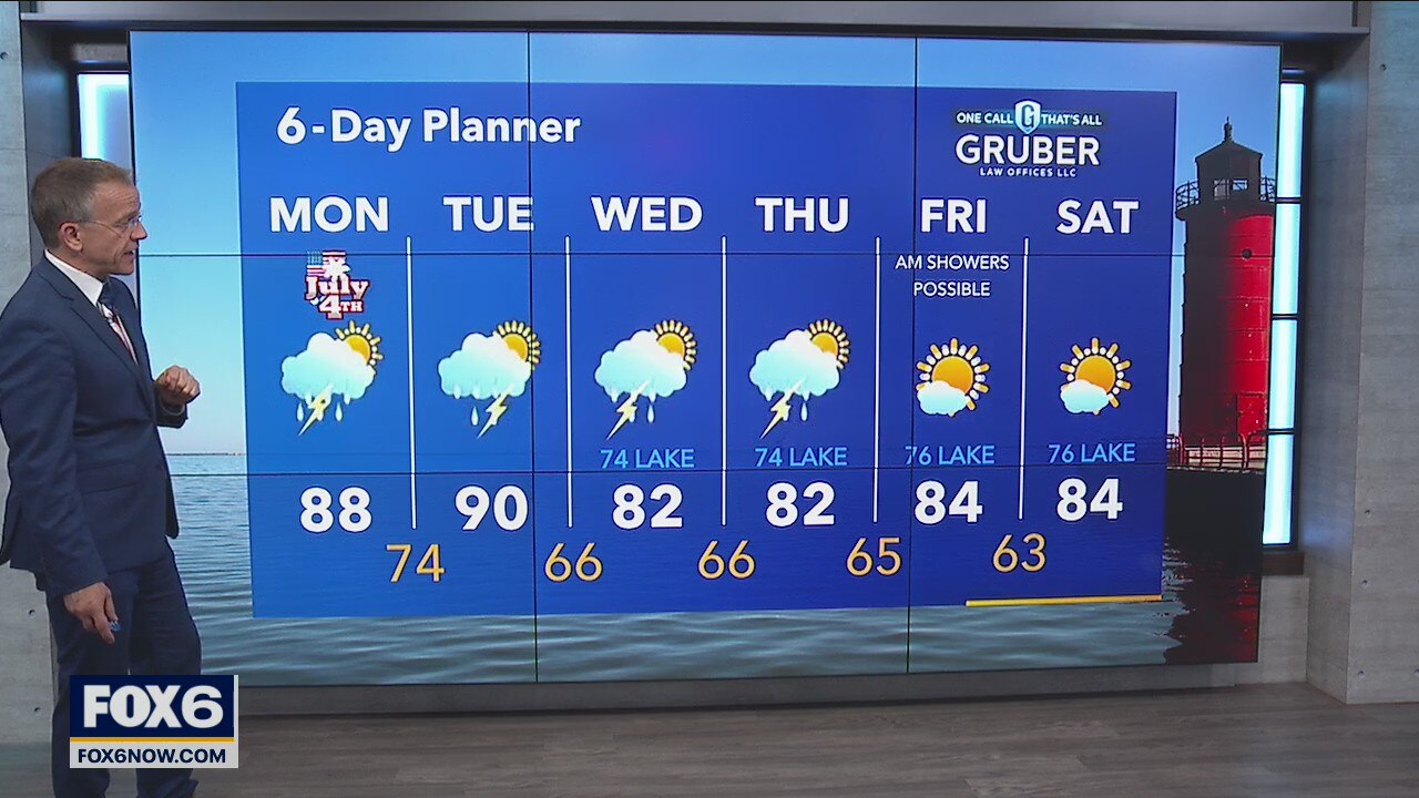
Weather Webcast with Rob Haswell
A warm front will move north of us today and heat us into the upper 80s with dewpoints increasing. As the front moves through we have a chance for rain and thunderstorms. There is a Slight Risk from the SPC for severe storms today.
A warm front will move north of us today and heat us into the upper 80s with dewpoints increasing. As the front moves through we have a chance for rain and thunderstorms. There is a Slight Risk from the SPC for severe storms today.
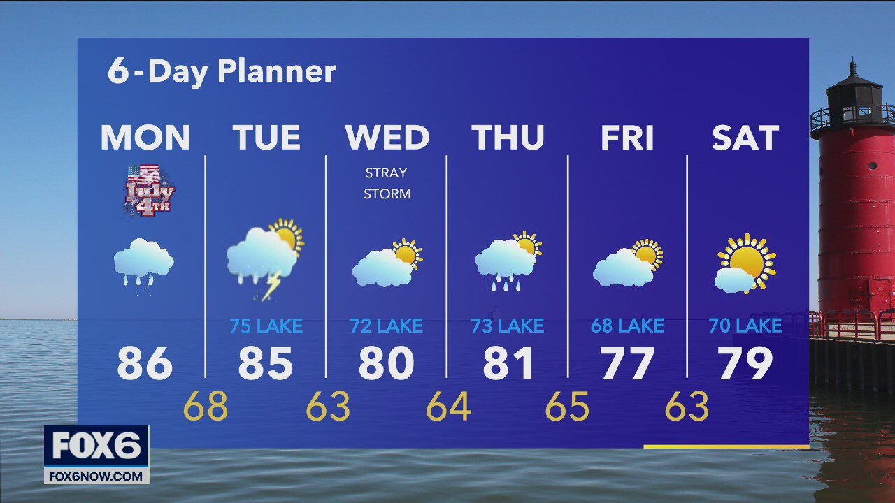
Weather Webcast with A.J. Waterman
Storms return for the 4th, and there could be severe weather...
Storms return for the 4th, and there could be severe weather...
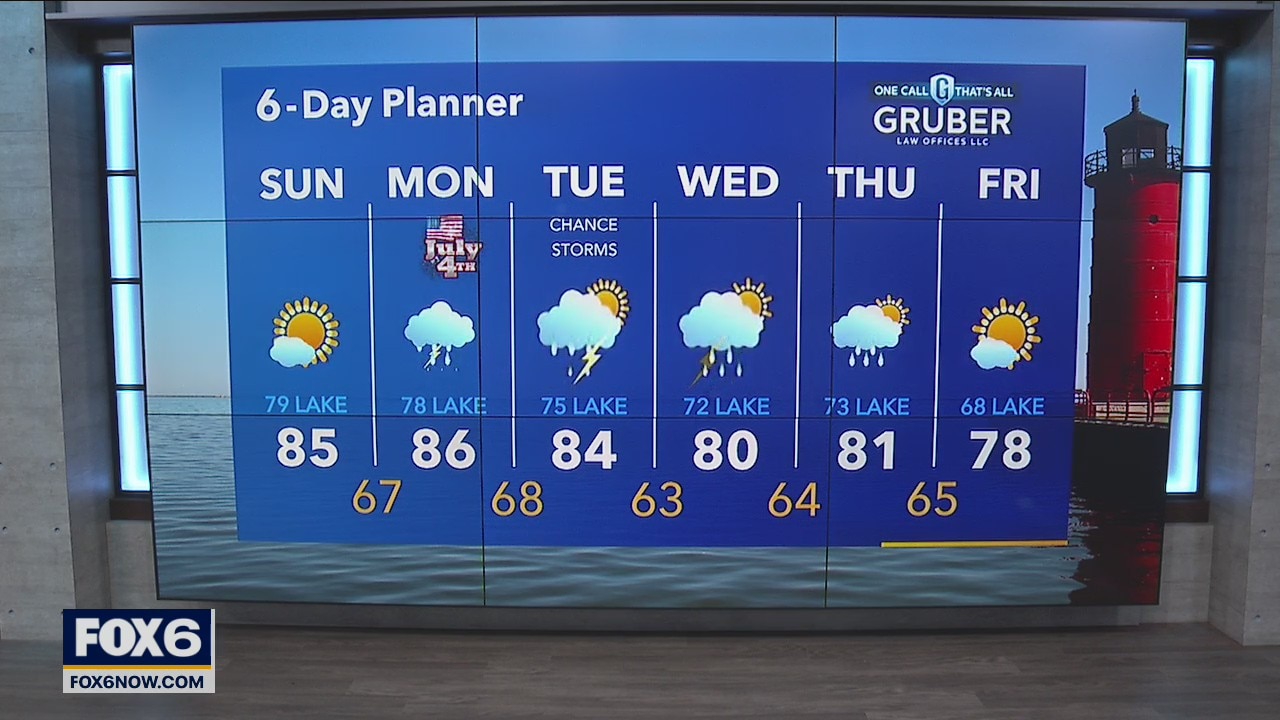
Weather Webcast with Eric Manges
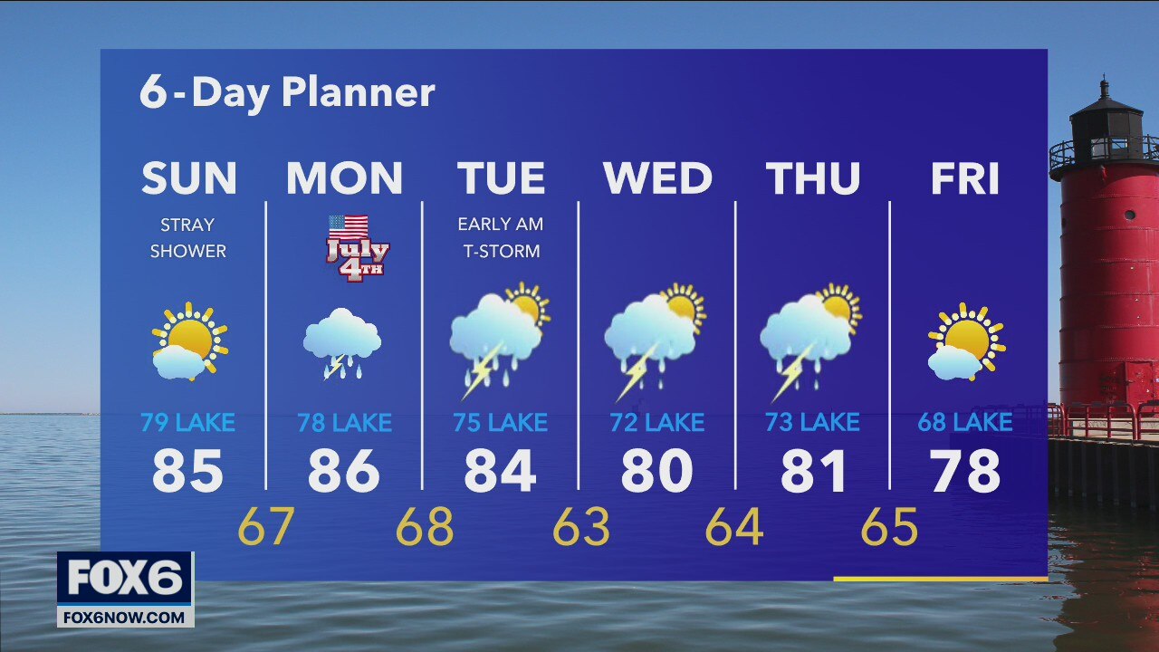
Partly to mostly sunny today with highs getting into the mid-80s. Rain returns tomorrow afternoon and chances continue into Monday night.
Partly to mostly sunny today with highs getting into the mid-80s. Rain returns tomorrow afternoon and chances continue into Monday night.
Weather Webcast with A.J. Waterman
More rain is in the forecast for the holiday weekend.
More rain is in the forecast for the holiday weekend.


The secret to winning the annual Nathan's Hot Dog Eating Contest could be the weather
The world-famous contest will grip the eyes and stomachs of spectators on July 4th, but some insiders say Mother Nature might hold the keys as to who ranks supreme.
The world-famous contest will grip the eyes and stomachs of spectators on July 4th, but some insiders say Mother Nature might hold the keys as to who ranks supreme.
Weather Webcast with Eric Manges
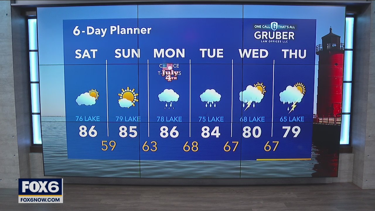
Slowly increasing clouds today with a low chance of some isolated showers in the afternoon. Mostly sunny Sunday with temperatures staying in the low 80s.
Slowly increasing clouds today with a low chance of some isolated showers in the afternoon. Mostly sunny Sunday with temperatures staying in the low 80s.
Weather Webcast with Eric Manges
The overnight cold front didn't bring rain but it did bring cooler air heading into the weekend. North winds keep us cooler lakeside but otherwise comfortable tonight.
The overnight cold front didn't bring rain but it did bring cooler air heading into the weekend. North winds keep us cooler lakeside but otherwise comfortable tonight.

Weather Webcast with Rob Haswell
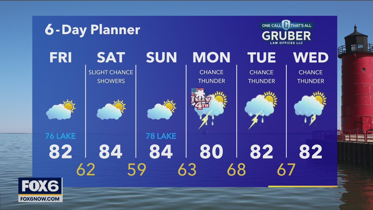
High pressure builds in behind this morning's passing cold front. After a few early showers we dry up and clear to partly sunny conditions. Saturday will be slightly warmer and dry with just a slight chance of a few showers later in the day in our far west counties.
High pressure builds in behind this morning's passing cold front. After a few early showers we dry up and clear to partly sunny conditions. Saturday will be slightly warmer and dry with just a slight chance of a few showers later in the day in our far west counties.
Weather Webcast with Tom Wachs
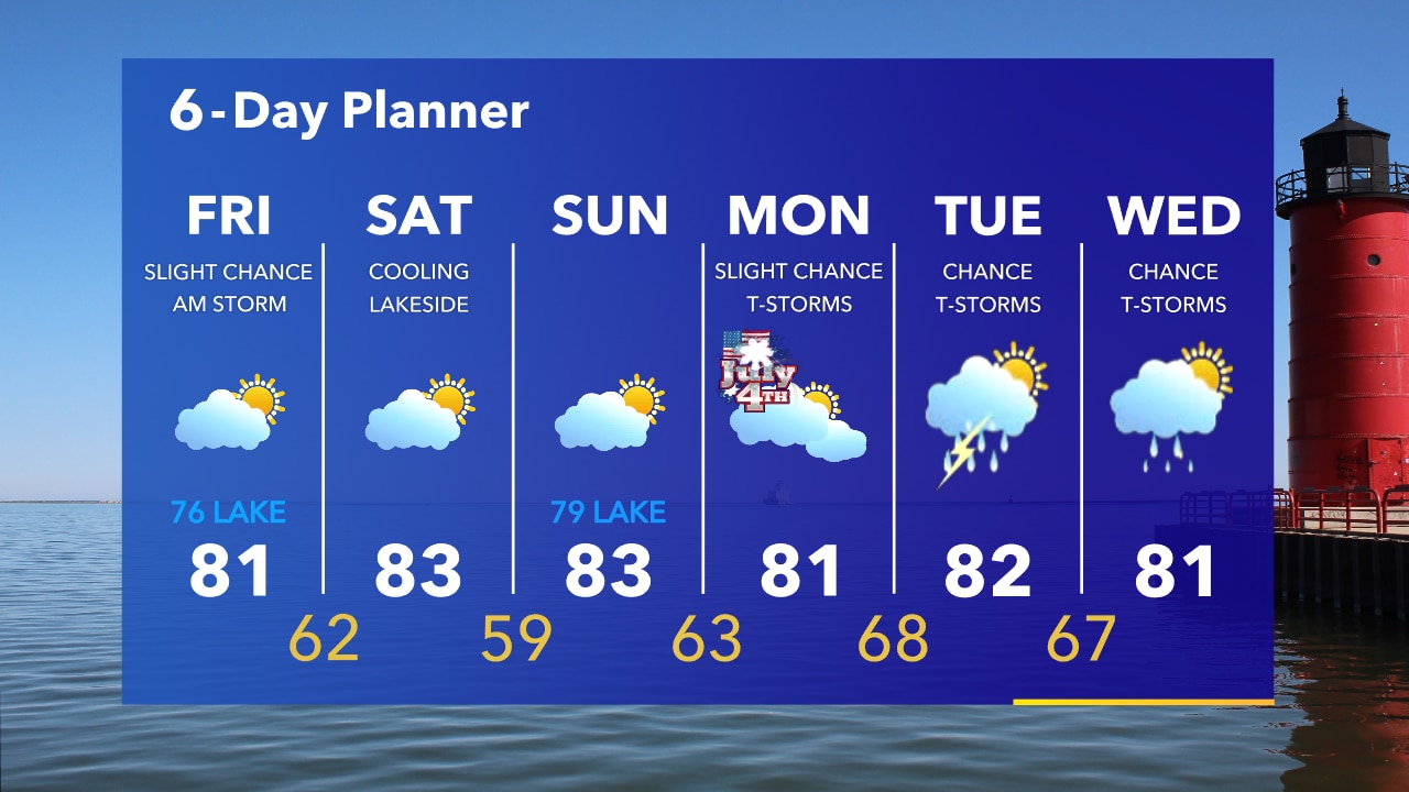
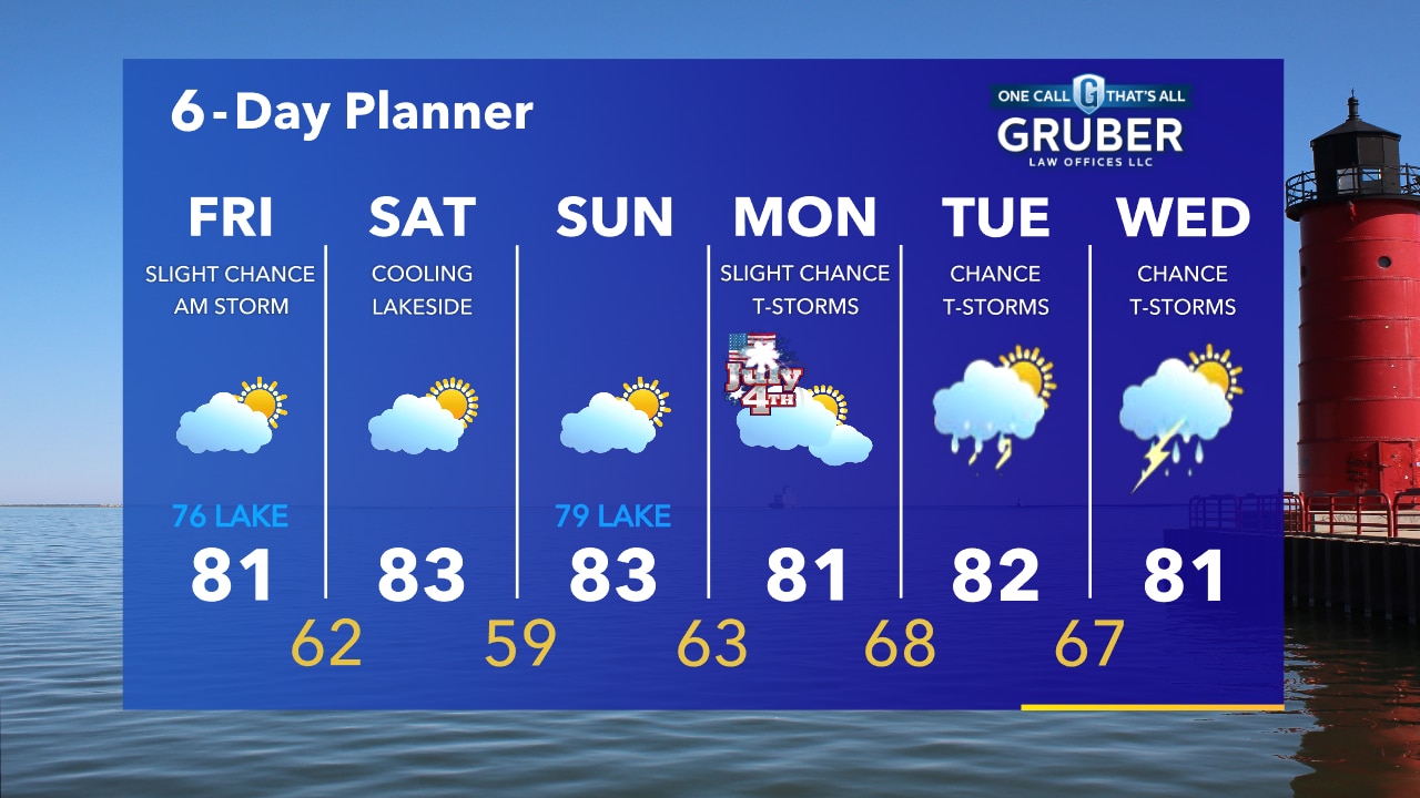
An isolated shower or t-storm is possible overnight and into Friday morning. Temperatures in the 70s. Mostly cloudy and mild on Friday with highs in the 80s, 70s near the lake.
An isolated shower or t-storm is possible overnight and into Friday morning. Temperatures in the 70s. Mostly cloudy and mild on Friday with highs in the 80s, 70s near the lake.
Weather Webcast with Tom Wachs
Increasing clouds tonight, staying warm. A stray shower or t-storm possible. Temperatures dropping into the 70s. An isolated t-storm Friday morning otherwise mostly cloudy with highs in the 80s inland, 70s near the lake.
Increasing clouds tonight, staying warm. A stray shower or t-storm possible. Temperatures dropping into the 70s. An isolated t-storm Friday morning otherwise mostly cloudy with highs in the 80s inland, 70s near the lake.
Weather Webcast with Meteorologist Stephanie Barichello
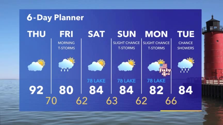
Hot and windy today then a chance for thunderstorms Friday morning will cool us down. Expect temperatures in the 70s and 80s over the holiday weekend. Still a chance for a stray thunderstorm or two at times.
Hot and windy today then a chance for thunderstorms Friday morning will cool us down. Expect temperatures in the 70s and 80s over the holiday weekend. Still a chance for a stray thunderstorm or two at times.

Weather webcast with Rob Haswell
With a warm front to our north, we start to warm up today with highs in the upper 80s and low 90s. A strong SW wind develops as the cold front begins to move our way today with wind gusts in the 30-35mph range at times. As the cold front passes overnight we may see some showers or thunderstorms. Those should dissipate by midday on Friday.
With a warm front to our north, we start to warm up today with highs in the upper 80s and low 90s. A strong SW wind develops as the cold front begins to move our way today with wind gusts in the 30-35mph range at times. As the cold front passes overnight we may see some showers or thunderstorms. Those should dissipate by midday on Friday.
Weather Webcast with Tom Wachs
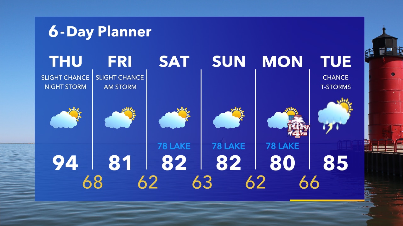
Mostly clear overnight with temperatures in the 60s. Hot, humid and windy on Thursday. Highs in the middle 90s with a heat index around 97.
Mostly clear overnight with temperatures in the 60s. Hot, humid and windy on Thursday. Highs in the middle 90s with a heat index around 97.