


Severe weather hits southeastern Wisconsin
Shortly after 10 p.m., the National Weather Service issued a tornado warning for Dodge County on Saturday, July 23. It expired just before 11 p.m.
Shortly after 10 p.m., the National Weather Service issued a tornado warning for Dodge County on Saturday, July 23. It expired just before 11 p.m.

Weather Webcast with Meteorologist Stephanie Barichello
Severe thunderstorms end this evening but another round of storms with heavy rain will be possible overnight. Drying out Sunday with dewpoints dropping throughout the day.
Severe thunderstorms end this evening but another round of storms with heavy rain will be possible overnight. Drying out Sunday with dewpoints dropping throughout the day.
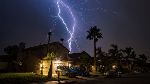

What you should do if your property is damaged by lightning
Florida is the lightning capital of the U.S. and annually sees more damage claims than any other state.
Florida is the lightning capital of the U.S. and annually sees more damage claims than any other state.
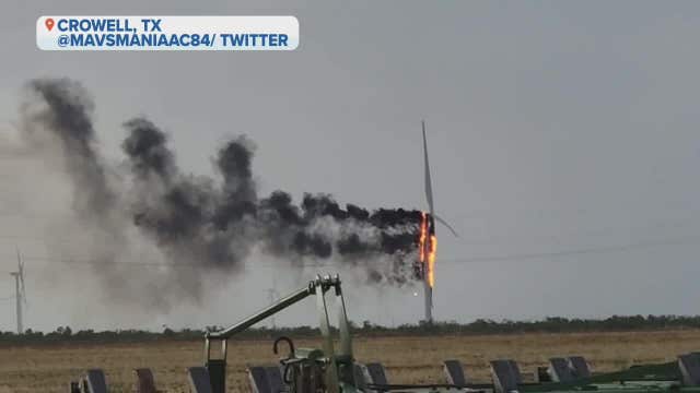

Watch a wind turbine disintegrate in Texas after a lightning strike
"We’re not equipped to handle that kind of fire. Nobody in the area really is to speak of."
"We’re not equipped to handle that kind of fire. Nobody in the area really is to speak of."
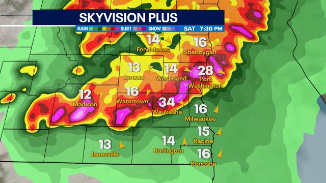

Severe storm chances Saturday afternoon through Sunday early morning
Strong to severe storms will be possible for southeast Wisconsin Saturday afternoon, July 23 through Sunday early morning, July 24.
Strong to severe storms will be possible for southeast Wisconsin Saturday afternoon, July 23 through Sunday early morning, July 24.

Weather Webcast with Eric Manges
Strong to severe storms will be possible this afternoon into tonight. Hail and damaging winds will be the main concern, but an isolated tornado will be possible. Storm chances continue through early Sunday morning, but skies begin to clear after daybreak.
Strong to severe storms will be possible this afternoon into tonight. Hail and damaging winds will be the main concern, but an isolated tornado will be possible. Storm chances continue through early Sunday morning, but skies begin to clear after daybreak.

Weather Webcast with A.J. Waterman
Storms possible overnight then severe weather possible Saturday evening!
Storms possible overnight then severe weather possible Saturday evening!
Funky Wall
Strange wall issues
Strange wall issues

Weather Webcast with Meteorologist Stephanie Barichello
Thunderstorms possible tonight and again Saturday evening, likely severe. Cooler weather ahead next week.
Thunderstorms possible tonight and again Saturday evening, likely severe. Cooler weather ahead next week.
Weather Webcast with Meteorologist Stephanie Barichello
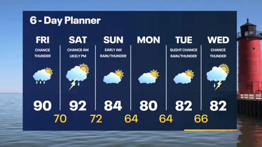
Another warm day ahead with a stray afternoon storm. Storms are also possible later tonight into early Saturday and again Saturday evening into Sunday morning. Hot and humid Saturday.
Another warm day ahead with a stray afternoon storm. Storms are also possible later tonight into early Saturday and again Saturday evening into Sunday morning. Hot and humid Saturday.

Delivering heat: UPS workers plan rallies after a series of heat-related incidents
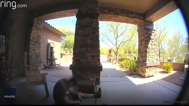
UPS drivers say many trucks don’t have air conditioning.
UPS drivers say many trucks don’t have air conditioning.


NASA imagery shows Lake Mead water levels lowest in more than 80 years
Lake Mead is estimated to be at just 27% of capacity.
Lake Mead is estimated to be at just 27% of capacity.

Weather webcast with Rob Haswell
Another hot day with highs in the upper 80s and low 90s. We will stay in the heat through Saturday and finally get a break early next week. There is another chance for a few showers or thunderstorms this afternoon but a better chance of rain and thunderstorms overnight into early Saturday morning. A more significant disturbance moves through later Saturday bringing rain and thunderstorms later in the day and overnight into early Sunday morning.
Another hot day with highs in the upper 80s and low 90s. We will stay in the heat through Saturday and finally get a break early next week. There is another chance for a few showers or thunderstorms this afternoon but a better chance of rain and thunderstorms overnight into early Saturday morning. A more significant disturbance moves through later Saturday bringing rain and thunderstorms later in the day and overnight into early Sunday morning.

Weather Webcast with A.J. Waterman
Hot and humid for the next 48 hours, then storms look to cool things down...
Hot and humid for the next 48 hours, then storms look to cool things down...
Weather Webcast with Meteorologist Stephanie Barichello
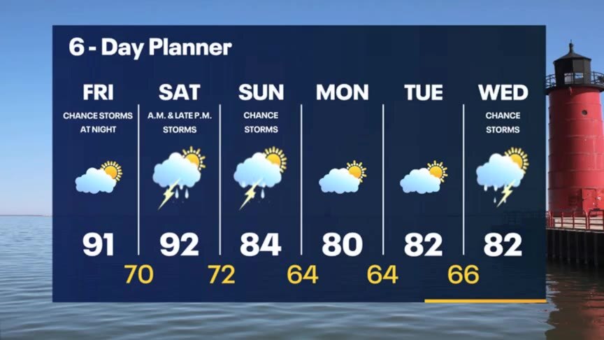
Pop-up thunderstorms possible through sunset tonight then clearing out with lows in the 60s. Another 90? day ahead Friday. Thunderstorms will be possible Friday night into Saturday morning, then again in the evening. In between - hot and humid.
Pop-up thunderstorms possible through sunset tonight then clearing out with lows in the 60s. Another 90? day ahead Friday. Thunderstorms will be possible Friday night into Saturday morning, then again in the evening. In between - hot and humid.
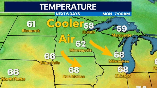

Cooler air returns next week
Finally cooler and more seasonable air returns for the last week of July.
Finally cooler and more seasonable air returns for the last week of July.
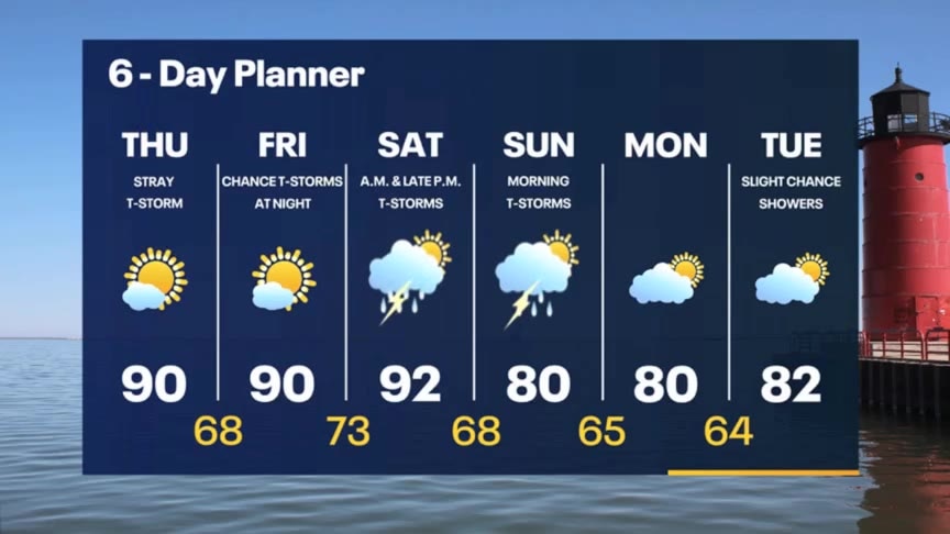
Weather Webcast with Meteorologist Stephanie Barichello
A stray thunderstorm possible this afternoon then a chance for storms early Saturday morning and again at night. Storms Saturday night could be severe.
A stray thunderstorm possible this afternoon then a chance for storms early Saturday morning and again at night. Storms Saturday night could be severe.
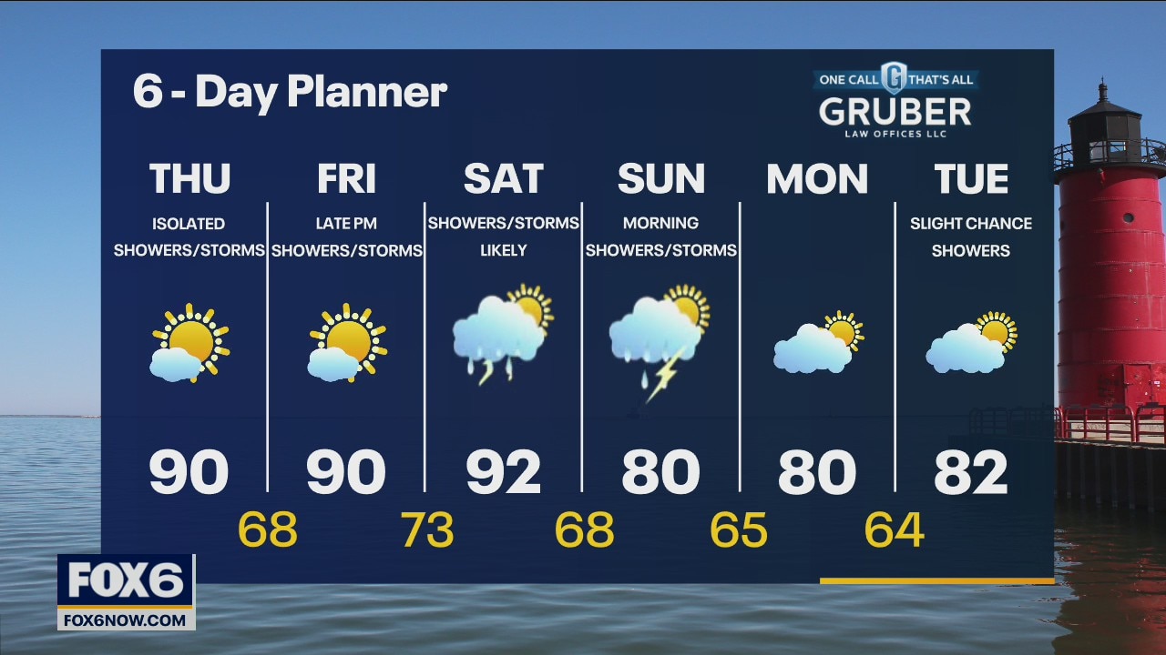
Weather webcast with Rob Haswell
Another breezy and warm day with rising dewpoints. Highs will be in the upper 80s to near 90. A weak disturbance drops into our area today giving us a slight chance for a few showers or isolated thunderstorms. Another hot and increasingly humid day on Friday and into Saturday. Highs will be near 90 again with dewpoints rising to near 70.
Another breezy and warm day with rising dewpoints. Highs will be in the upper 80s to near 90. A weak disturbance drops into our area today giving us a slight chance for a few showers or isolated thunderstorms. Another hot and increasingly humid day on Friday and into Saturday. Highs will be near 90 again with dewpoints rising to near 70.

Weather Webcast with Tom Wachs
Mostly clear overnight with temperatures in the 60s. Get ready for a hot Thursday with highs in the low 90s. Only a slight chance for a t-storm.
Mostly clear overnight with temperatures in the 60s. Get ready for a hot Thursday with highs in the low 90s. Only a slight chance for a t-storm.
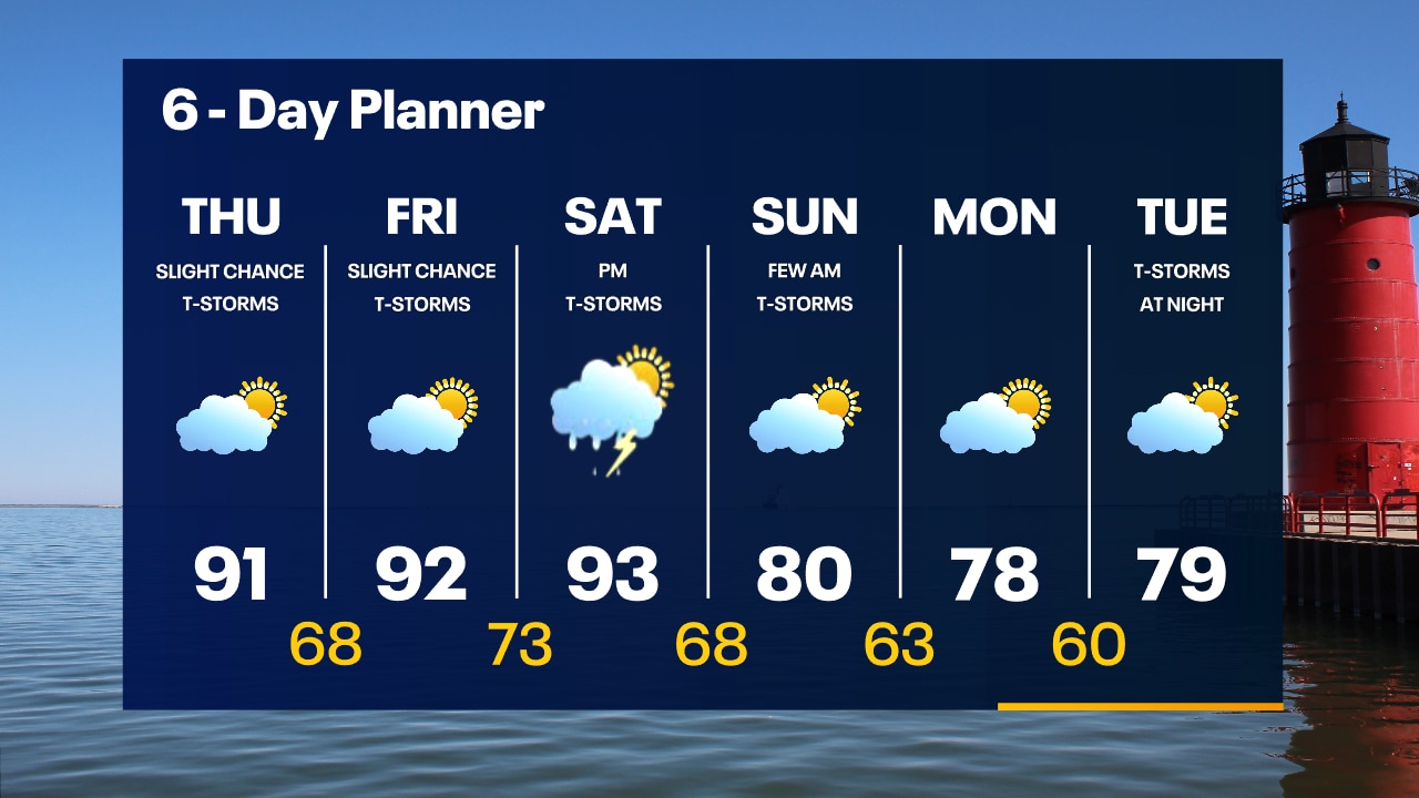
Weather Webcast with Tom Wachs
Slight chance for a shower this evening but most areas will stay dry. The wind will settle down after sunset. Temperatures dropping into the 70s this evening. Hot on Thursday with a high in the low 90s.
Slight chance for a shower this evening but most areas will stay dry. The wind will settle down after sunset. Temperatures dropping into the 70s this evening. Hot on Thursday with a high in the low 90s.