


Memorial Day weekend fire safety, DNR urges campers to stay alert
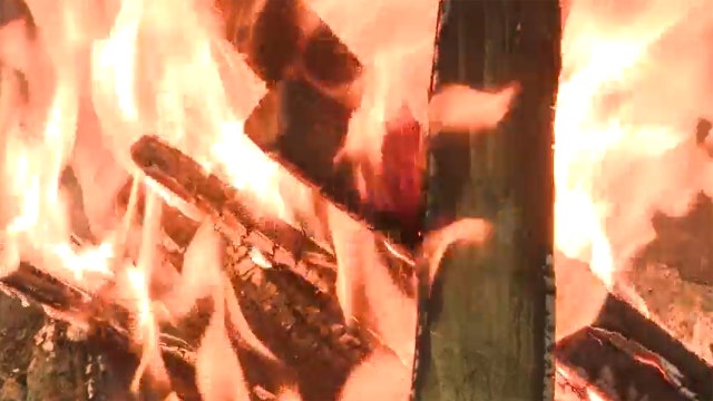
The Wisconsin DNR wants to make sure everyone enjoys Memorial Day weekend without sparking a wildfire, urging campers to be on alert.
The Wisconsin DNR wants to make sure everyone enjoys Memorial Day weekend without sparking a wildfire, urging campers to be on alert.
Weather Webcast with Meteorologist Eric Manges
Temperatures continue to climb and climb as drought concerns also grow
Temperatures continue to climb and climb as drought concerns also grow

Weather Webcast With Lisa Michaels
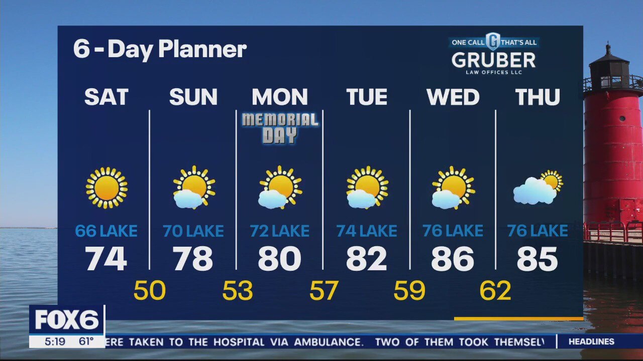
A blocking pattern in the upper atmosphere has us locked into a long stretch of sunny and dry weather. We begin a long warming trend today with highs near 70 inland and 60s lakeside. Warming up each day this weekend. Low to mid 70s Saturday. Mid to upper 70s Sunday. Upper 70s to low 80s Monday. We stay dry for the next several days. Concern for drought will grow in the days ahead.
A blocking pattern in the upper atmosphere has us locked into a long stretch of sunny and dry weather. We begin a long warming trend today with highs near 70 inland and 60s lakeside. Warming up each day this weekend. Low to mid 70s Saturday. Mid to upper 70s Sunday. Upper 70s to low 80s Monday. We stay dry for the next several days. Concern for drought will grow in the days ahead.
Weather webcast with Rob Haswell
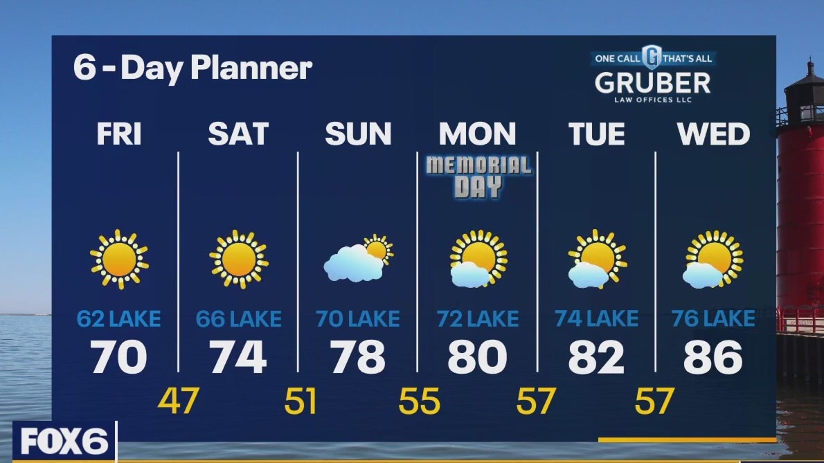
A blocking pattern in the upper atmosphere has us locked into a long stretch of sunny and dry weather. We begin a long warming trend today with highs near 70 inland and 60s lakeside. Highs climb into the mid-80s by Wednesday and look to hold for the long term. We stay dry for the next several days. Concern for drought will grow in the days ahead.
A blocking pattern in the upper atmosphere has us locked into a long stretch of sunny and dry weather. We begin a long warming trend today with highs near 70 inland and 60s lakeside. Highs climb into the mid-80s by Wednesday and look to hold for the long term. We stay dry for the next several days. Concern for drought will grow in the days ahead.
Weather Webcast with Meteorologist Eric Manges
Temps continue to climb into the weekend with sunshine but no rain in sight
Temps continue to climb into the weekend with sunshine but no rain in sight


Near-average 2023 Atlantic hurricane season expected with up to 17 named storms, NOAA says
The upcoming Atlantic hurricane season is expected to be less active than recent years, with a forecast of a near-average season.
The upcoming Atlantic hurricane season is expected to be less active than recent years, with a forecast of a near-average season.
Weather webcast with Rob Haswell
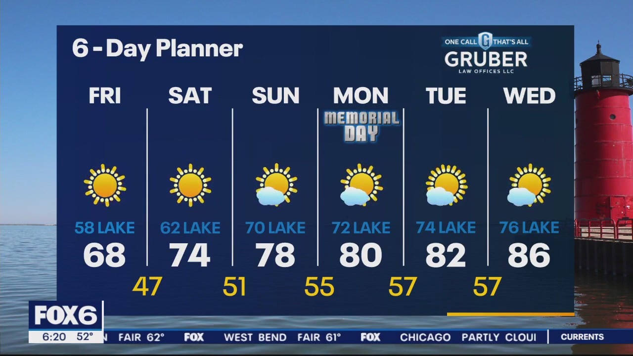
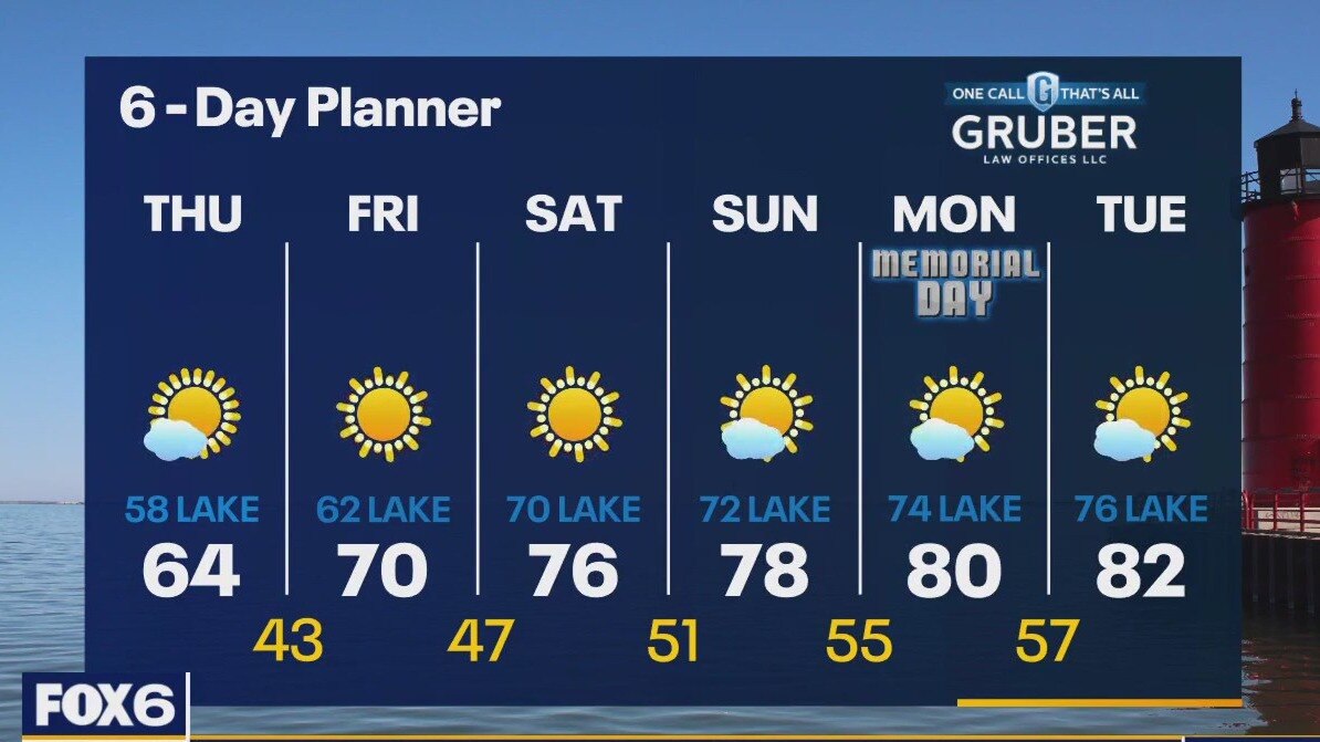
High pressure settles into today delivering more sun but still slightly cooler temperatures. A blocking pattern known as a Rex Block will establish itself in the upper atmosphere resulting in a long sunny dry stretch with steadily warming temperatures. We warm into the mid to upper 70s by the weekend and into the 80s by Memorial Day. Current warming trend will take us into the upper 80s to near 90 by the middle of next week!
High pressure settles into today delivering more sun but still slightly cooler temperatures. A blocking pattern known as a Rex Block will establish itself in the upper atmosphere resulting in a long sunny dry stretch with steadily warming temperatures. We warm into the mid to upper 70s by the weekend and into the 80s by Memorial Day. Current warming trend will take us into the upper 80s to near 90 by the middle of next week!
Weather Webcast with Meteorologist Eric Manges
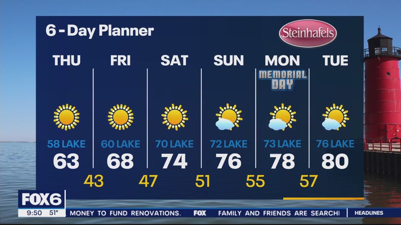
Chilly Thursday but also bone dry and warmer long term
Chilly Thursday but also bone dry and warmer long term
Weather Webcast with Meteorologist Eric Manges
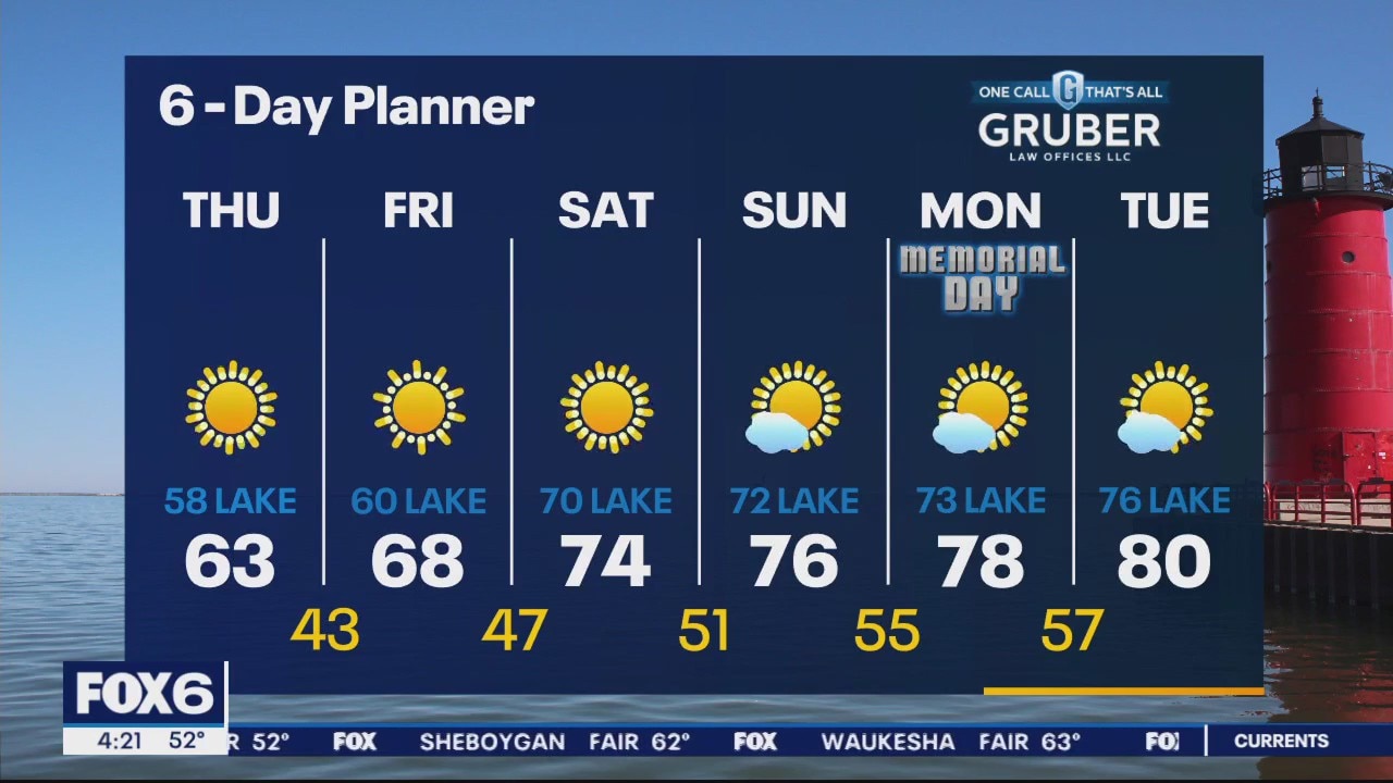
Staying cooler tomorrow but temperatures rebound quickly into the weekend
Staying cooler tomorrow but temperatures rebound quickly into the weekend

Weather Webcast With Lisa Michaels
A "backdoor cold front" moved through this morning dropping our temperatures and creating a gusty NE wind today . Temperatures will be in the 50s and 60s today and feel cooler with a NE wind gusting into the 30mph range at times. We will get back to sun by later today and stay sunny and cooler tomorrow. We warm back up later this week and into the long weekend. Highs will be in the mid to upper70s and low 80s for the Memorial Day weekend.
A "backdoor cold front" moved through this morning dropping our temperatures and creating a gusty NE wind today . Temperatures will be in the 50s and 60s today and feel cooler with a NE wind gusting into the 30mph range at times. We will get back to sun by later today and stay sunny and cooler tomorrow. We warm back up later this week and into the long weekend. Highs will be in the mid to upper70s and low 80s for the Memorial Day weekend.
Weather webcast with Rob Haswell
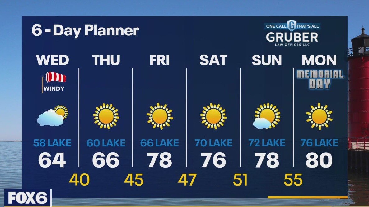
A "backdoor cold front" completes its push through our area this morning dropping our temperatures and creating a gusty NE wind. Temperatures will be in the 50s and 60s today and feel cooler with a NE wind gusting into the 30mph range at times. We will get back to sun by later today and stay sunny and cooler tomorrow. We warm back up later this week and into the long weekend. Highs will be in the mid to upper70s and low 80s for the Memorial Day weekend.
A "backdoor cold front" completes its push through our area this morning dropping our temperatures and creating a gusty NE wind. Temperatures will be in the 50s and 60s today and feel cooler with a NE wind gusting into the 30mph range at times. We will get back to sun by later today and stay sunny and cooler tomorrow. We warm back up later this week and into the long weekend. Highs will be in the mid to upper70s and low 80s for the Memorial Day weekend.
Weather Webcast with Tom Wachs
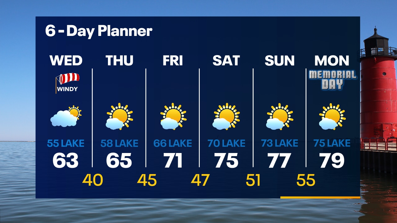
A cold front will move through overnight ushering in big changes on Wednesday. Windy and chilly with highs in the 50s near the lake and low 60s inland.
A cold front will move through overnight ushering in big changes on Wednesday. Windy and chilly with highs in the 50s near the lake and low 60s inland.
Weather Webcast with Tom Wachs
Clear and quiet tonight with temperatures dropping through the 60s and into the 50s overnight. Much cooler on Wednesday with highs in the 50s/60s with a strong NE wind.
Clear and quiet tonight with temperatures dropping through the 60s and into the 50s overnight. Much cooler on Wednesday with highs in the 50s/60s with a strong NE wind.
Weather Webcast with Meteorologist Eric Manges
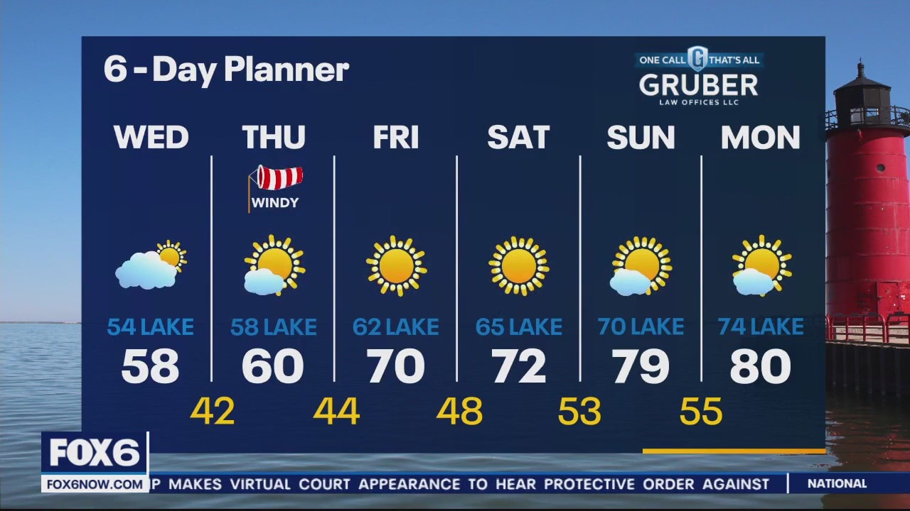
Much cooler air tomorrow thanks to a "Back-Door" cold front
Much cooler air tomorrow thanks to a "Back-Door" cold front

'Back-door' cold front; how it works
FOX6 Weather Expert Eric Manges explains what a "back-door" cold front is, how it works and what it means for southeast Wisconsin.
FOX6 Weather Expert Eric Manges explains what a "back-door" cold front is, how it works and what it means for southeast Wisconsin.
Weather Webcast with Meteorologist Eric Manges
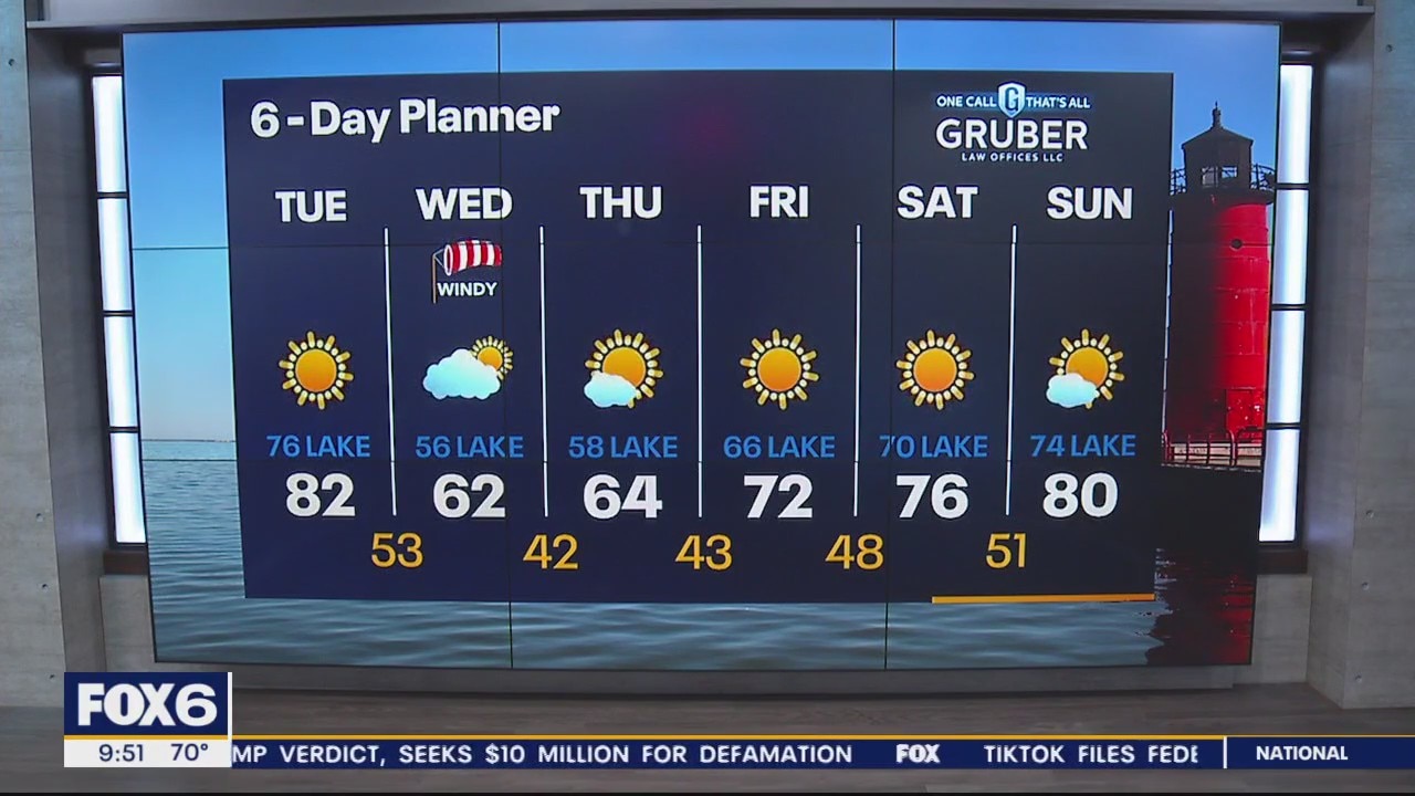
Staying summer like today but much cooler Wednesday and Thursday
Staying summer like today but much cooler Wednesday and Thursday
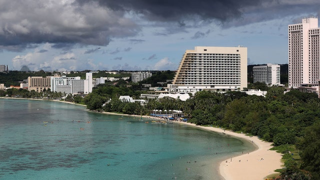

Typhoon Mawar continues to intensify as it barrels towards US territory of Guam
Typhoon Warnings are in effect for Guam and Rota, and forecasters say damaging winds of 39 mph are expected Tuesday evening, with typhoon-force winds of 74 mph or higher expected by Wednesday morning.
Typhoon Warnings are in effect for Guam and Rota, and forecasters say damaging winds of 39 mph are expected Tuesday evening, with typhoon-force winds of 74 mph or higher expected by Wednesday morning.
Weather webcast with Rob Haswell
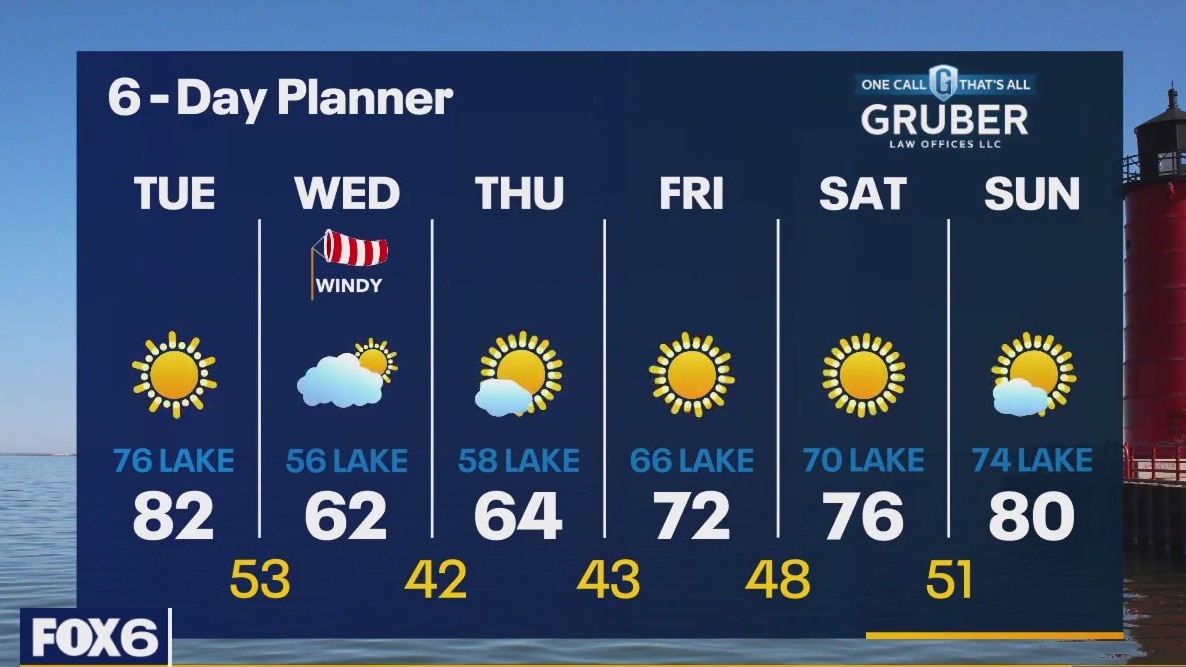
High pressure continues to be the big weather maker today keeping us sunny and mild with a strong south and southeast wind. Highs today will get to near 82 but stay in the 70s near the lake. A stronger lake breeze develops later in the afternoon to further drop temperatures. A strong "backdoor cold front" passes through on Wednesday dropping our highs into the 50s and low 60s and feeling much colder with a strong NE wind developing.
High pressure continues to be the big weather maker today keeping us sunny and mild with a strong south and southeast wind. Highs today will get to near 82 but stay in the 70s near the lake. A stronger lake breeze develops later in the afternoon to further drop temperatures. A strong "backdoor cold front" passes through on Wednesday dropping our highs into the 50s and low 60s and feeling much colder with a strong NE wind developing.
Weather Webcast with Tom Wachs
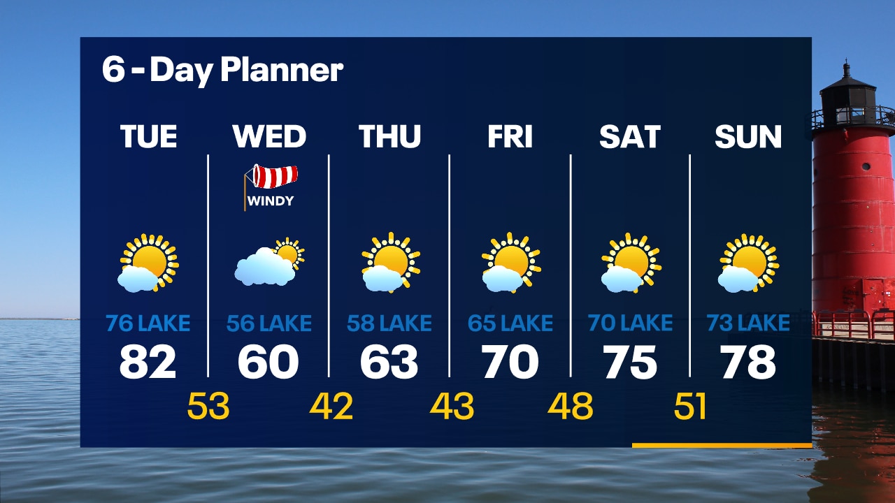
Clear skies overnight with temperatures dropping into the 50s. Mostly sunny and warmer on Tuesday with highs in the low 80s inland, mid-70s near the lake. Much cooler on Wednesday.
Clear skies overnight with temperatures dropping into the 50s. Mostly sunny and warmer on Tuesday with highs in the low 80s inland, mid-70s near the lake. Much cooler on Wednesday.
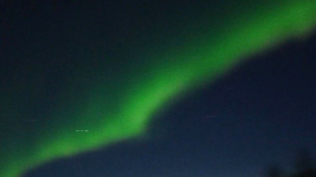

Photographer in Canada captures ‘beautiful northern lights show’ after wildfire smoke clears
The video showcases the vivid green northern lights flowing across the clear Manitoba sky.
The video showcases the vivid green northern lights flowing across the clear Manitoba sky.