

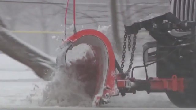

Milwaukee's 1st major snowstorm of season; DPW crews ready
The Milwaukee Department of Public Works (DPW) is geared up and ready for a winter storm set to move into Wisconsin
The Milwaukee Department of Public Works (DPW) is geared up and ready for a winter storm set to move into Wisconsin

Weather webcast with Lisa Michales
Winter Weather Advisory for 9 p.m. tonight through 6 a.m. Tuesday. 1-3" of snow possible. Winter Storm Watch and Warning from 6 a.m. Tuesday through 3 a.m. Wednesday. Total 5-9" inland and 3-7" near the lake. Another small chance of snowfall late Wednesday night. Watching a third system that could bring snow over the weekend with a very cold air mass following it.
Winter Weather Advisory for 9 p.m. tonight through 6 a.m. Tuesday. 1-3" of snow possible. Winter Storm Watch and Warning from 6 a.m. Tuesday through 3 a.m. Wednesday. Total 5-9" inland and 3-7" near the lake. Another small chance of snowfall late Wednesday night. Watching a third system that could bring snow over the weekend with a very cold air mass following it.
Weather Webcast with Tom Wachs
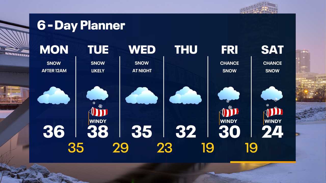
Cloudy on Monday with highs in the 30s. Snow moves in after 11pm Monday. Snowy and windy ALL DAY Tuesday with snow ending around 3am Wednesday. 5-9" inland, a little lower near the lake with a mix possible.
Cloudy on Monday with highs in the 30s. Snow moves in after 11pm Monday. Snowy and windy ALL DAY Tuesday with snow ending around 3am Wednesday. 5-9" inland, a little lower near the lake with a mix possible.

Weather Webcast with Tom Wachs
Winter Storm Watch Tuesday. Dry tonight and Monday. Snow starts after 12am Tuesday with the heaviest snow throughout the day. 5-9" inland, 3-6" near the lake.
Winter Storm Watch Tuesday. Dry tonight and Monday. Snow starts after 12am Tuesday with the heaviest snow throughout the day. 5-9" inland, 3-6" near the lake.
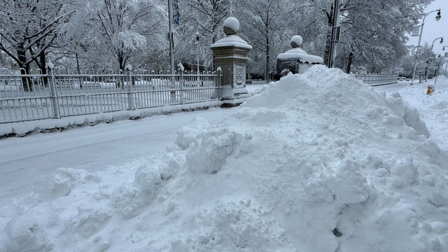

Nor'easter slams Northeast with a foot of snow, flash freeze could lead to dangerous travel in New England
Heavy snow was reported from the Northeast to New England, with several communities reporting more than a foot of snow that slowed travel as millions of Americans were faced with the messy winter weather.
Heavy snow was reported from the Northeast to New England, with several communities reporting more than a foot of snow that slowed travel as millions of Americans were faced with the messy winter weather.
Weather webcast with Lisa Michaels
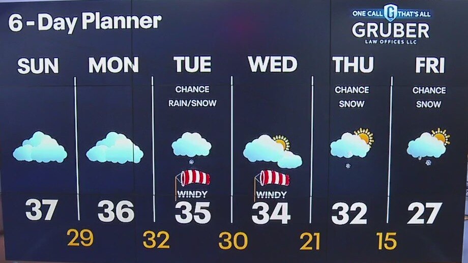
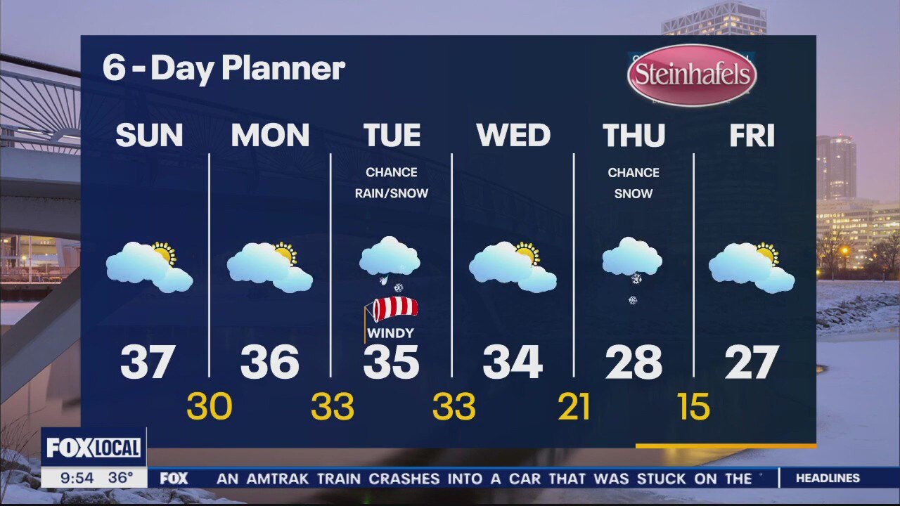
Cloudy and dry Sunday. A few flurries possible. Watching a larger storm system that will bring rain/snow on Monday night through Wednesday morning. Another few systems could bring some snow Thursday into next weekend. A surge of cold air moves in by the middle of the month.
Cloudy and dry Sunday. A few flurries possible. Watching a larger storm system that will bring rain/snow on Monday night through Wednesday morning. Another few systems could bring some snow Thursday into next weekend. A surge of cold air moves in by the middle of the month.
Weather Webcast with Meteorologist Eric Manges
Multiple snow chances moving forward as an active winter weather pattern shifts in
Multiple snow chances moving forward as an active winter weather pattern shifts in

Tornado rips through Fort Lauderdale as storms march across Florida
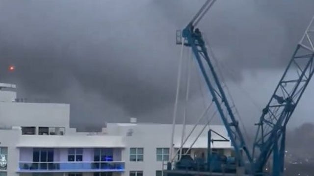
A tornado hit Fort Lauderdale, Florida, on Saturday as a line of storms moved across the Sunshine State.
A tornado hit Fort Lauderdale, Florida, on Saturday as a line of storms moved across the Sunshine State.

Weather Webcast with Meteorologist Eric Manges
Nice little snow to start the weekend with more potential next week
Nice little snow to start the weekend with more potential next week

Winter storm warnings issued, 45 million on alert for East Coast nor'easter
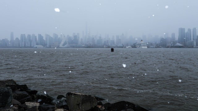
The East Coast's first major winter storm of the year could bring several inches of snow to some areas and disrupt life for 45 million people in the Northeast.
The East Coast's first major winter storm of the year could bring several inches of snow to some areas and disrupt life for 45 million people in the Northeast.
Weather webcast with Lisa Michaels
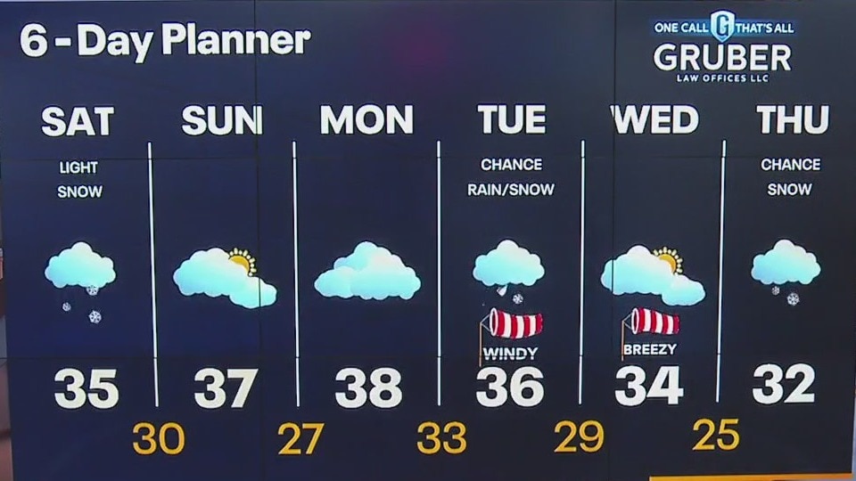
Snow showers Saturday especially in the morning. Most areas will remain under 1" but inland locations could see isolated spots up to 2". Another winter system could bring a mixture of rain/snow Monday night through Wednesday morning. Colder air sets up for the middle and end of next week.
Snow showers Saturday especially in the morning. Most areas will remain under 1" but inland locations could see isolated spots up to 2". Another winter system could bring a mixture of rain/snow Monday night through Wednesday morning. Colder air sets up for the middle and end of next week.

Weather Webcast with Meteorologist Eric Manges
Multiple snow chances heading into next week
Multiple snow chances heading into next week
Weather Webcast with Stephanie Barichello
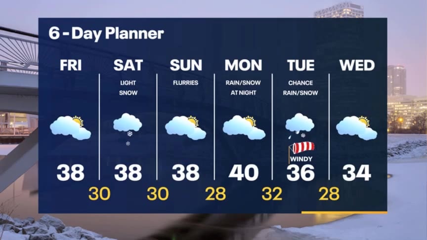
Cloudy today then light snow on Saturday with up to 1" of accumulation. Flurries Sunday and still mild in the upper 30s. More of a rain/snow mix is looking possible Tuesday, so plan on sloppy day.
Cloudy today then light snow on Saturday with up to 1" of accumulation. Flurries Sunday and still mild in the upper 30s. More of a rain/snow mix is looking possible Tuesday, so plan on sloppy day.
Weather webcast with Rob Haswell
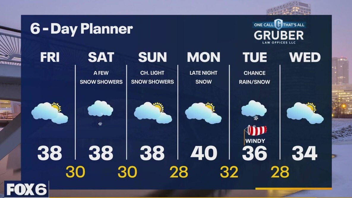
A southwest wind today will bring warmer and slightly more moist air to our region. Highs will warm a bit to the upper 30s and dewpoints will climb. We should stay dry today but a disturbance arrives Saturday with a chance for light snow. A few tenths of an inch are likely. Temperatures remain above average this weekend with highs in the upper 30s to near 40 but cooler air arrives by the mid to late part of next week.
A southwest wind today will bring warmer and slightly more moist air to our region. Highs will warm a bit to the upper 30s and dewpoints will climb. We should stay dry today but a disturbance arrives Saturday with a chance for light snow. A few tenths of an inch are likely. Temperatures remain above average this weekend with highs in the upper 30s to near 40 but cooler air arrives by the mid to late part of next week.
Weather Webcast with Tom Wachs
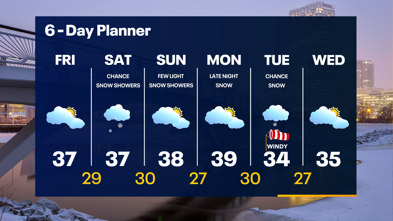
Mostly cloudy overnight with temperatures in the 20s. Mostly cloudy and mild on Friday with highs in the 30s. Snow showers are possible on Saturday with highs in the mid-to-upper 30s.
Mostly cloudy overnight with temperatures in the 20s. Mostly cloudy and mild on Friday with highs in the 30s. Snow showers are possible on Saturday with highs in the mid-to-upper 30s.
Weather Webcast with Tom Wachs
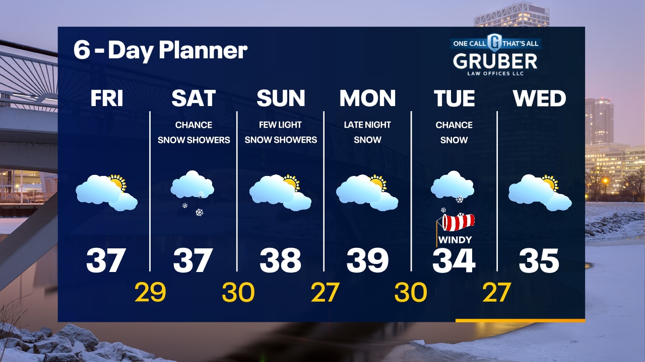
Mostly cloudy tonight with temperatures falling into the 20s. Mostly cloudy and mild on Friday with highs in the 30s. Snow showers are possible on Saturday.
Mostly cloudy tonight with temperatures falling into the 20s. Mostly cloudy and mild on Friday with highs in the 30s. Snow showers are possible on Saturday.
Weather webcast with Rob Haswell
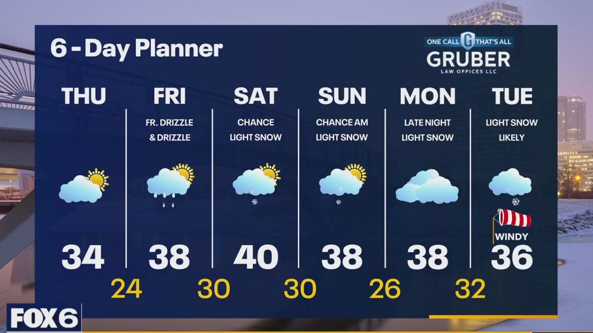
High pressure builds across our area today but with some stratus clouds trapped in a lower level, we remain a bit cloudy with a few sunny breaks. The wind shifts to the southwest by later today and starts a slight warming trend heading into the Friday and Saturday. Highs will be in the low 30s today but reach the upper 30s to near 40 Friday and Saturday. Drizzle is possible Friday and with some of that arriving early, it may be patchy freezing drizzle. Some light snow is possible this weekend
High pressure builds across our area today but with some stratus clouds trapped in a lower level, we remain a bit cloudy with a few sunny breaks. The wind shifts to the southwest by later today and starts a slight warming trend heading into the Friday and Saturday. Highs will be in the low 30s today but reach the upper 30s to near 40 Friday and Saturday. Drizzle is possible Friday and with some of that arriving early, it may be patchy freezing drizzle. Some light snow is possible this weekend
Weather Webcast with Tom Wachs
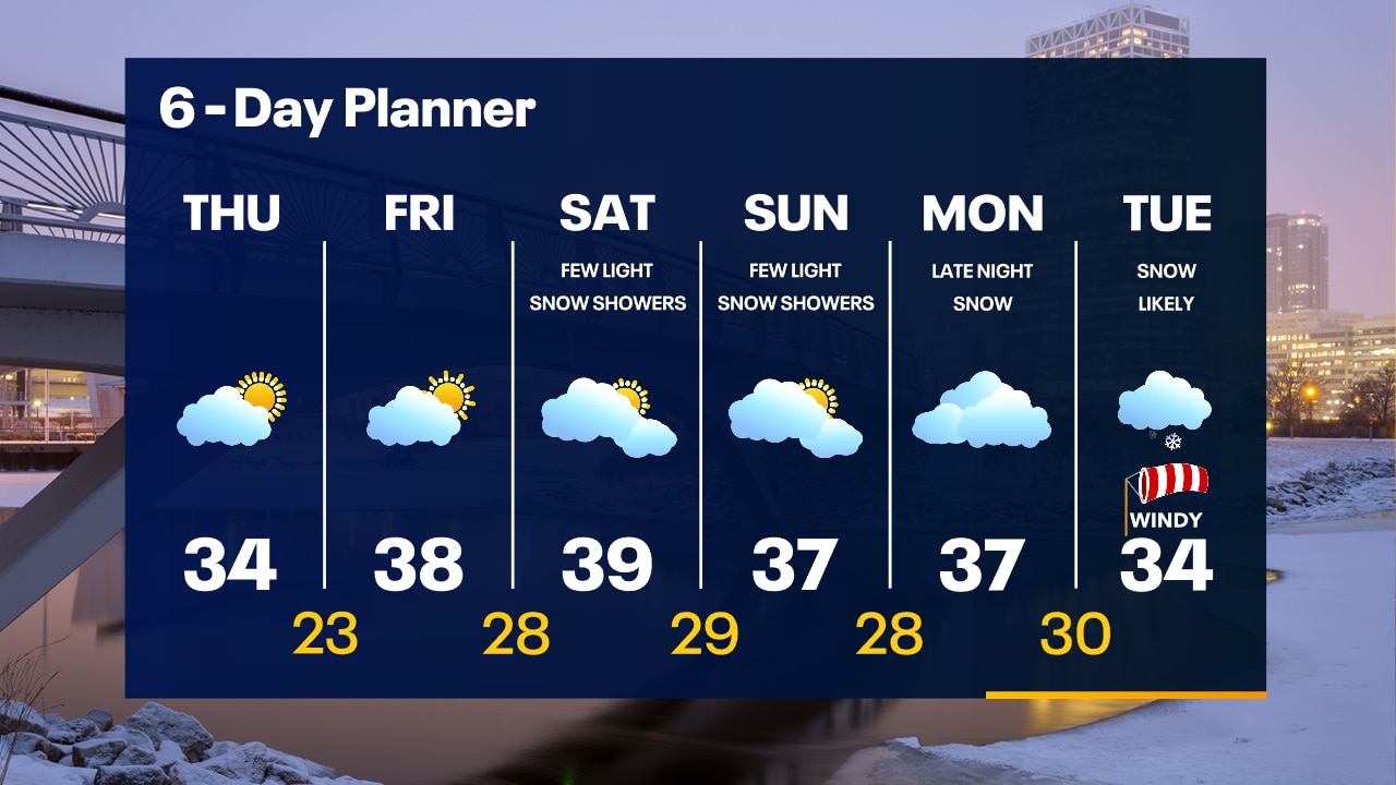
Clouds will gradually clear overnight with temperatures dropping into the 20s. Partly sunny on Thursday with highs in the low-to-mid 30s.
Clouds will gradually clear overnight with temperatures dropping into the 20s. Partly sunny on Thursday with highs in the low-to-mid 30s.
Weather Webcast with Tom Wachs
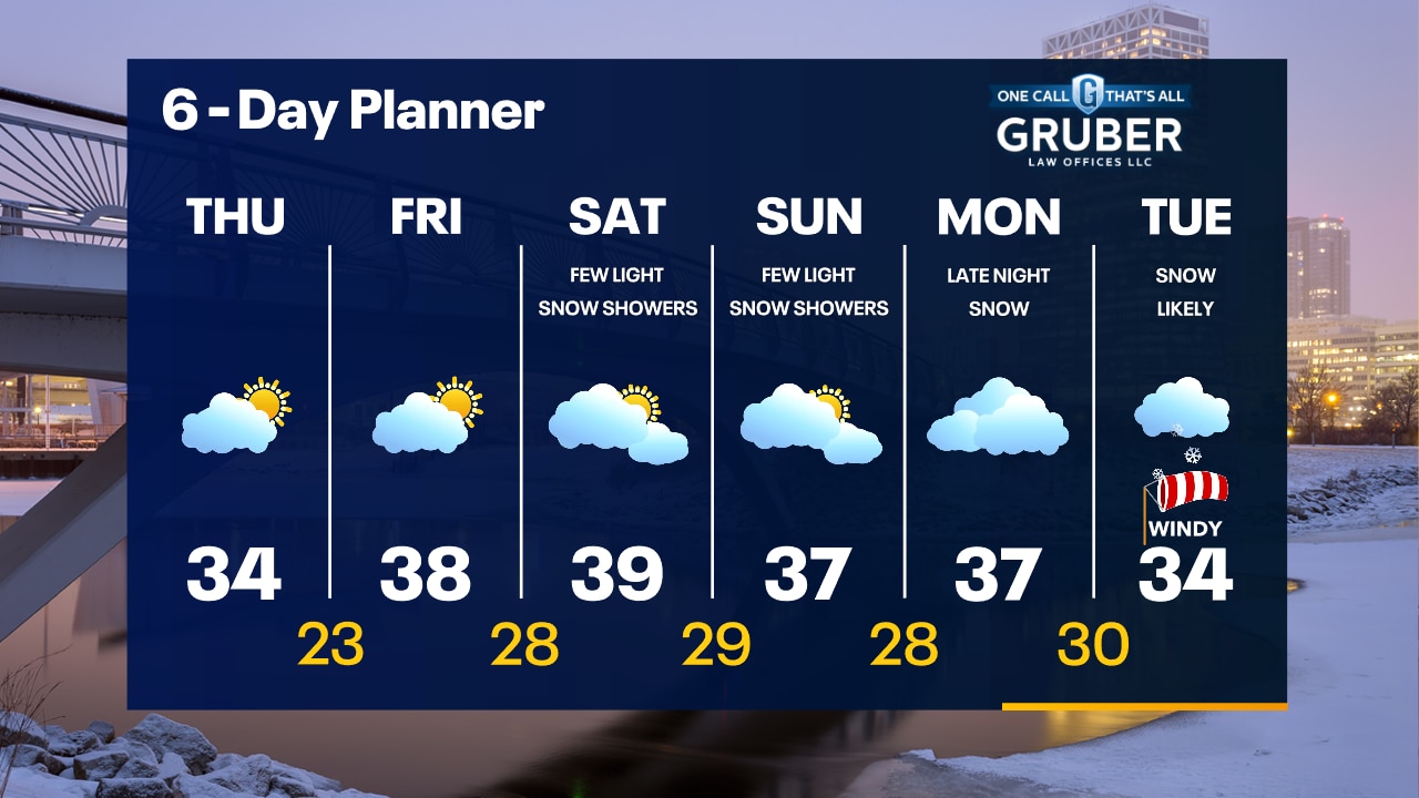
Scattered snow showers and freezing drizzle will end overnight. Gradual clearing overnight as well. Temperatures will drop into the 20s. Some sun returns on Thursday with highs in the low-to-mid 30s.
Scattered snow showers and freezing drizzle will end overnight. Gradual clearing overnight as well. Temperatures will drop into the 20s. Some sun returns on Thursday with highs in the low-to-mid 30s.
Weather webcast with Rob Haswell
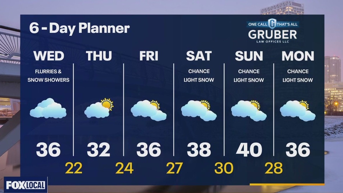
A cold front moves across our area today bringing some of the coolest air of the season. With the passage of the front, we can expect a few flurries or snow showers with light to no measurable accumulations. Behind the front, high pressure returns and clears us up for Thursday and into Friday. Another system arrives for the weekend with light snow possible again Saturday and Sunday.
A cold front moves across our area today bringing some of the coolest air of the season. With the passage of the front, we can expect a few flurries or snow showers with light to no measurable accumulations. Behind the front, high pressure returns and clears us up for Thursday and into Friday. Another system arrives for the weekend with light snow possible again Saturday and Sunday.