

Weather webcast with Rob Haswell
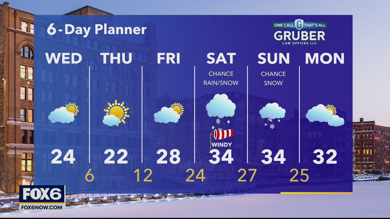
High pressure builds across our area over the next few days bringing sunshine back to the forecast. Much colder air settles in today and tomorrow with highs in the low 20s today and lows in the single digits overnight.
High pressure builds across our area over the next few days bringing sunshine back to the forecast. Much colder air settles in today and tomorrow with highs in the low 20s today and lows in the single digits overnight.
Weather Webcast with Tom Wachs
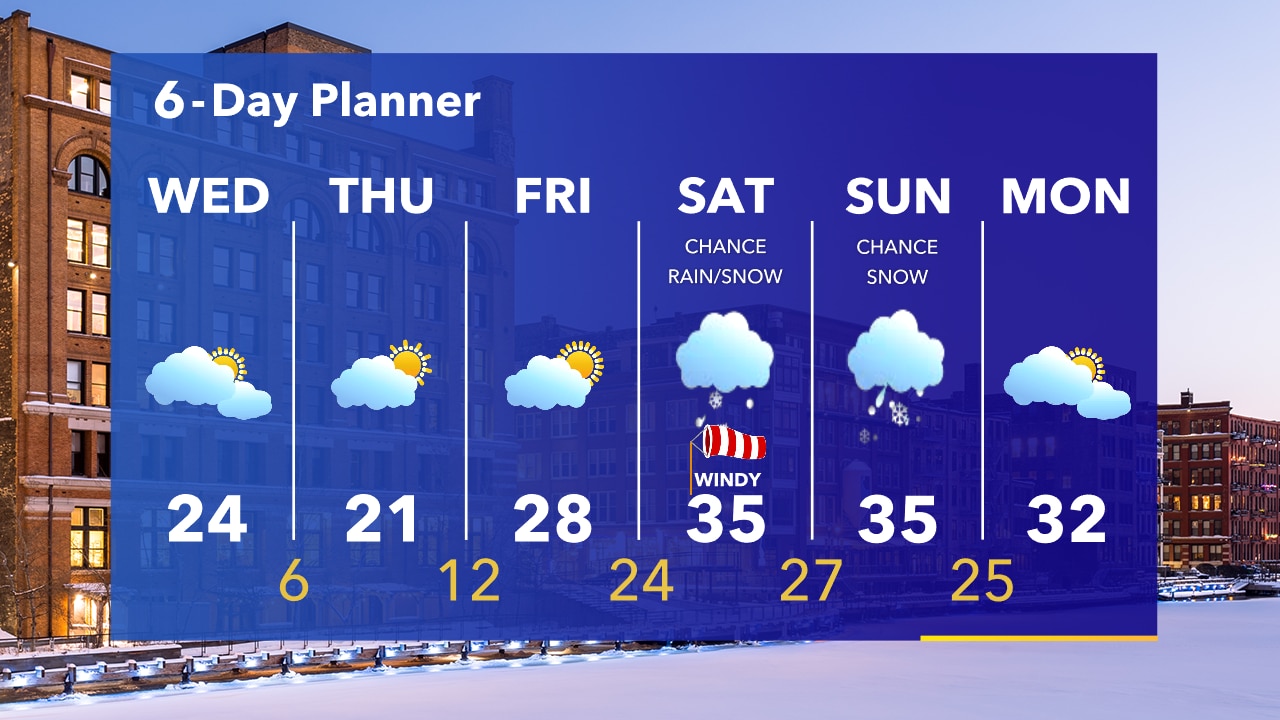
Partly cloudy and cold overnight with temperatures in the single digits and teens. Mostly cloudy on Wednesday with a high in the 20s. Our next system moves in this weekend.
Partly cloudy and cold overnight with temperatures in the single digits and teens. Mostly cloudy on Wednesday with a high in the 20s. Our next system moves in this weekend.
Weather Webcast with Tom Wachs
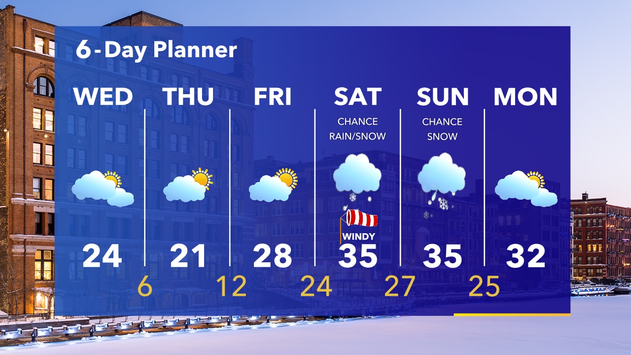
The snow is winding down and the wind will gradually subside. Temperatures dropping into the teens tonight, even single digits away from the lake.
The snow is winding down and the wind will gradually subside. Temperatures dropping into the teens tonight, even single digits away from the lake.
Weather Webcast with Stephanie Barichello
Snow will continue through early evening with an additional 1-2" possible, on top of the 4-7" we've already seen. Blowing/drifting snow and hazardous travel still expected.
Snow will continue through early evening with an additional 1-2" possible, on top of the 4-7" we've already seen. Blowing/drifting snow and hazardous travel still expected.

Weather webcast with Rob Haswell
Snow, heavy at times, today. Improving conditions later this afternoon. However, lake effect snow will linger for areas near Lake Michigan through tonight and possibly into early Wednesday. We clear to partly sunny tomorrow with highs falling from the low 30s today to the low 20s tomorrow.
Snow, heavy at times, today. Improving conditions later this afternoon. However, lake effect snow will linger for areas near Lake Michigan through tonight and possibly into early Wednesday. We clear to partly sunny tomorrow with highs falling from the low 30s today to the low 20s tomorrow.
Weather Webcast with Tom Wachs
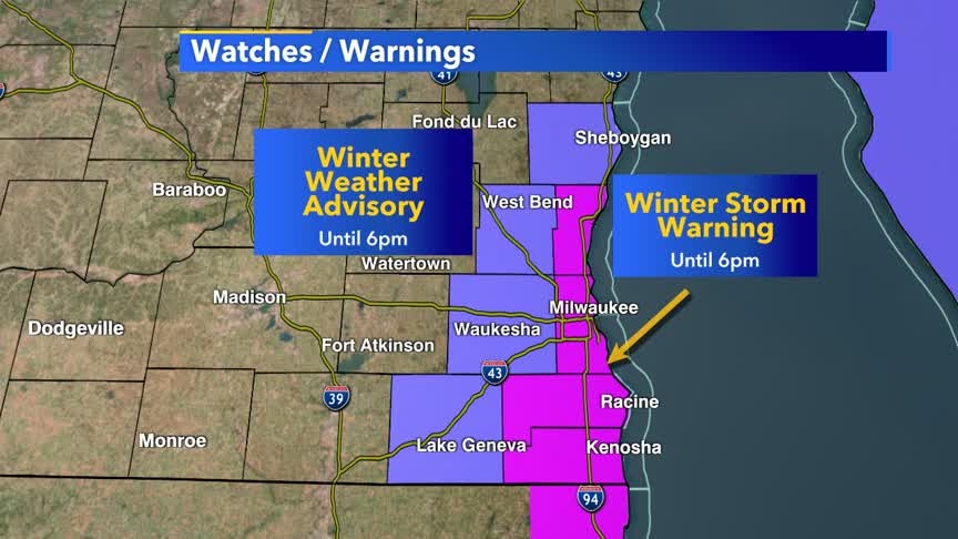
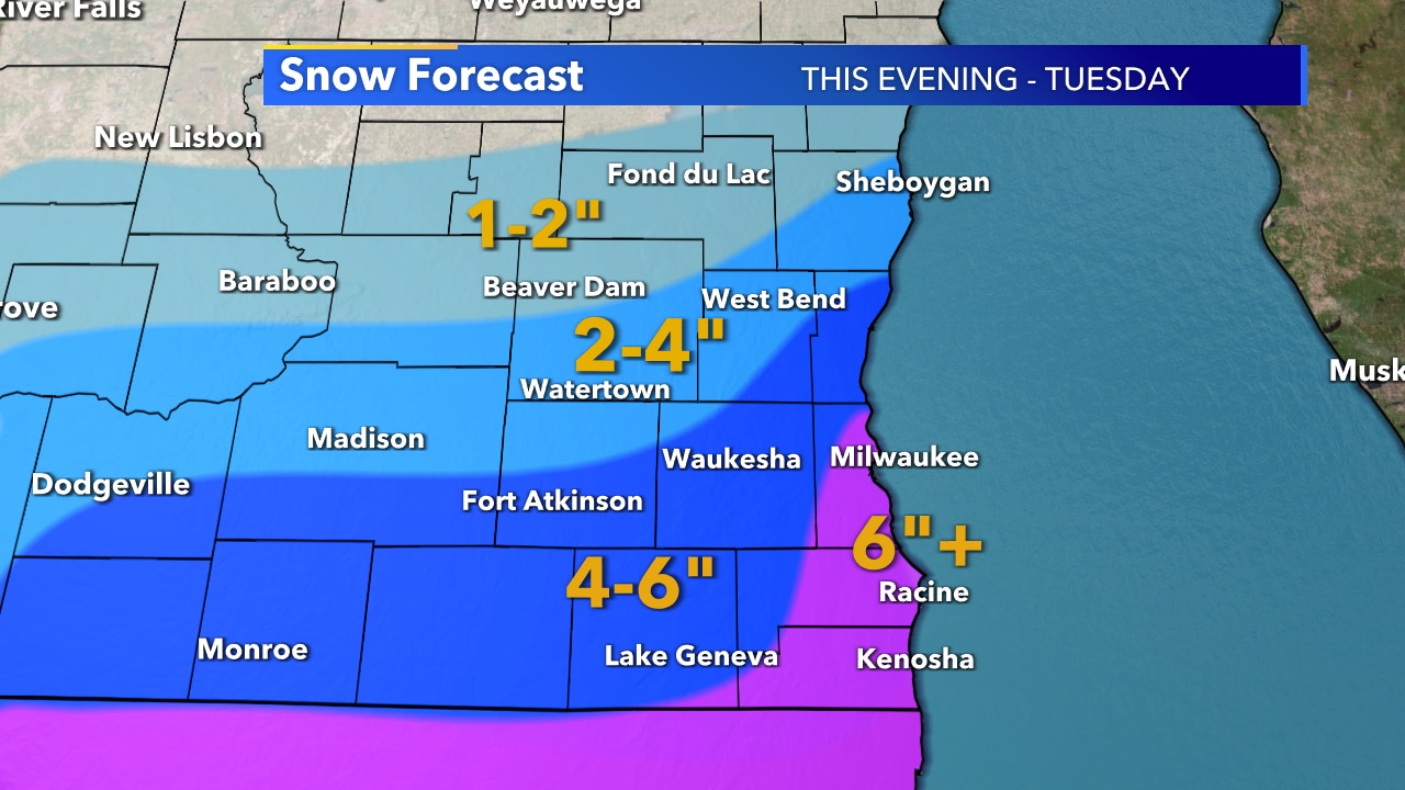
Snow will overspread the area overnight. Snow combined with strong winds will lead to low visibility and slick roads by morning. Winter Storm Warnings and Winter Weather Advisories are in effect.
Snow will overspread the area overnight. Snow combined with strong winds will lead to low visibility and slick roads by morning. Winter Storm Warnings and Winter Weather Advisories are in effect.
Weather Webcast with Tom Wachs
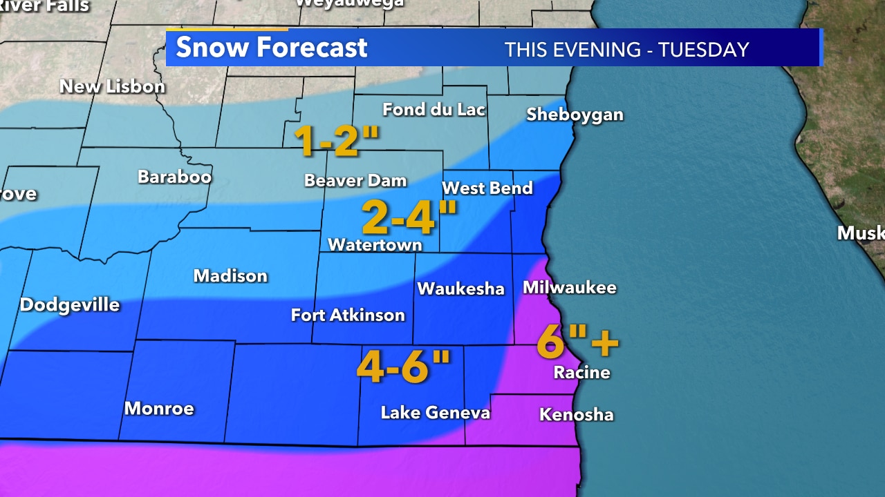
Winter Storm Warnings and Advisories take effect tonight as snow moves in from the south. It will really pick up overnight and into Tuesday morning. Lake enhanced snow will continue into the afternoon. Expect slow going on Tuesday morning.
Winter Storm Warnings and Advisories take effect tonight as snow moves in from the south. It will really pick up overnight and into Tuesday morning. Lake enhanced snow will continue into the afternoon. Expect slow going on Tuesday morning.
Forecast from Meteorologist Stephanie Barichello
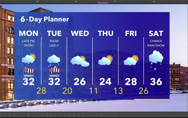
Snow arrives later this evening and tonight - lasting into Tuesday. Several inches possible with highest along the IL border and lakeside due to lake enhancement.
Snow arrives later this evening and tonight - lasting into Tuesday. Several inches possible with highest along the IL border and lakeside due to lake enhancement.
Weather webcast with Rob Haswell
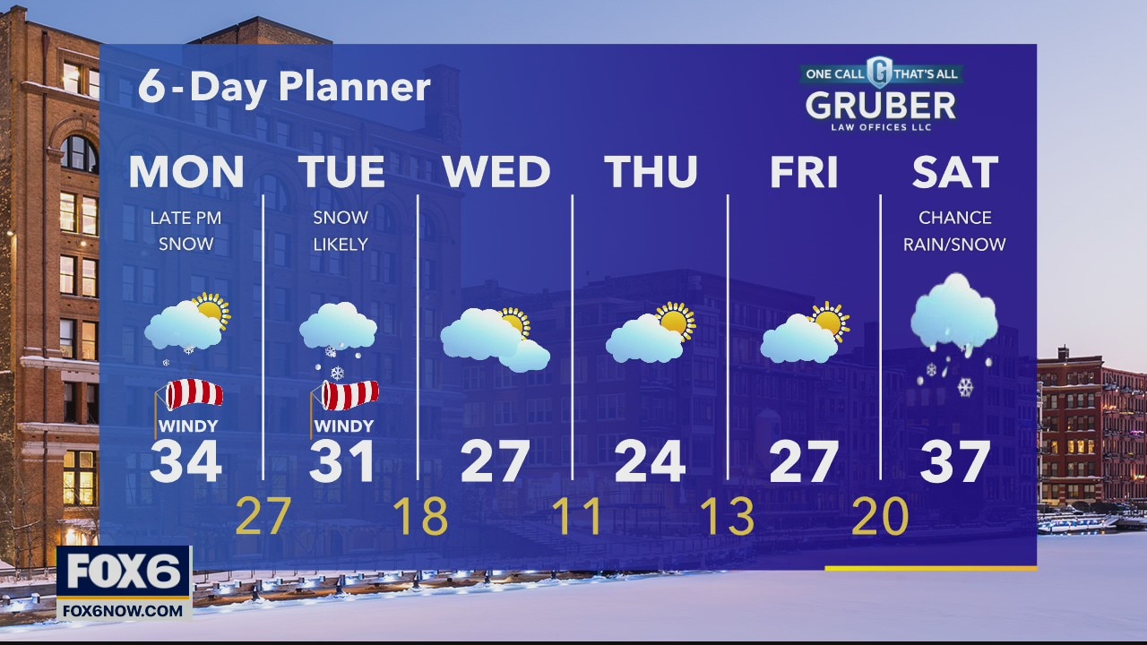
A strong low passes to our south over the next 48 hours bringing a band of snow to souther Wisconsin. A Winter Weather Advisory begins at 6pm and remains in effect until 6pm tomorrow for all but Dodge and Fond du Lac counties.
A strong low passes to our south over the next 48 hours bringing a band of snow to souther Wisconsin. A Winter Weather Advisory begins at 6pm and remains in effect until 6pm tomorrow for all but Dodge and Fond du Lac counties.
Weather Webcast with Tom Wachs
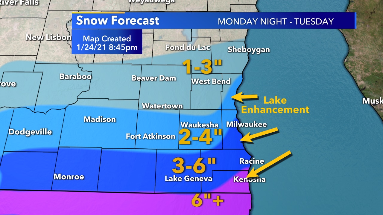
Quiet on Monday before snow moves in Monday night into Tuesday. Heaviest snow near the Illinois border and near the lake.
Quiet on Monday before snow moves in Monday night into Tuesday. Heaviest snow near the Illinois border and near the lake.
Weather Webcast with Tom Wachs
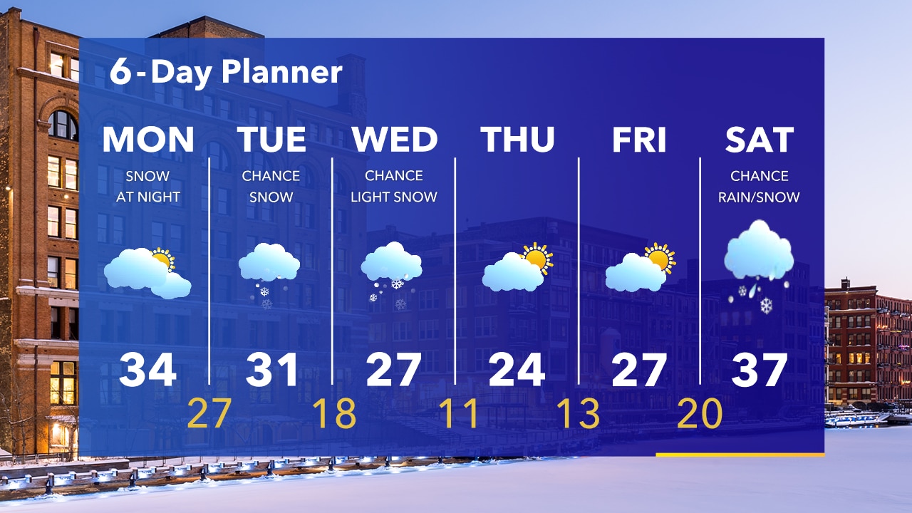
Partly cloudy tonight with temperatures in the upper teens to low 20s by morning. Mostly cloudy and windy on Monday. Snow moves in from the south Monday night and continues Tuesday morning. Heaviest snow/greatest impact near the IL border.
Partly cloudy tonight with temperatures in the upper teens to low 20s by morning. Mostly cloudy and windy on Monday. Snow moves in from the south Monday night and continues Tuesday morning. Heaviest snow/greatest impact near the IL border.
Weather Webcast with Eric Manges
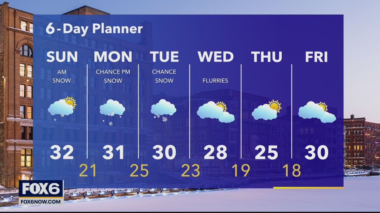
Snow lets up Sunday, but it makes a return Monday night. Eric has what you can expect this week in his 6-day planner.
Snow lets up Sunday, but it makes a return Monday night. Eric has what you can expect this week in his 6-day planner.

Weather Webcast with A.J. Waterman
Winter Weather Advisory for Dodge, Washington, Ozaukee, Fond du Lac, and Sheboygan for snow in the forecast tonight. 1-4" expected across the area, with highest amounts north of Milwaukee.
Winter Weather Advisory for Dodge, Washington, Ozaukee, Fond du Lac, and Sheboygan for snow in the forecast tonight. 1-4" expected across the area, with highest amounts north of Milwaukee.
Weather Webcast with A.J. Waterman
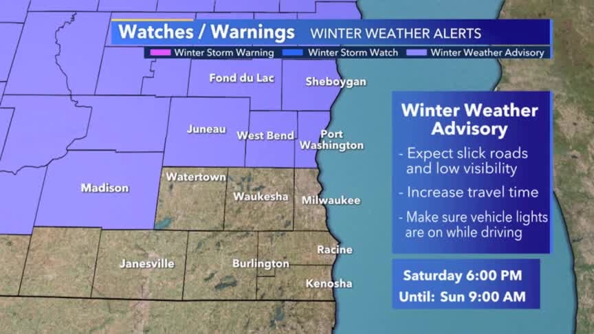
Winter Weather Advisory for Dodge, Washington, Ozaukee, Fond du Lac, and Sheboygan for snow in the forecast tonight. 1-4" expected across the area, with highest amounts north of Milwaukee.
Winter Weather Advisory for Dodge, Washington, Ozaukee, Fond du Lac, and Sheboygan for snow in the forecast tonight. 1-4" expected across the area, with highest amounts north of Milwaukee.
Weather Webcast with Eric Manges
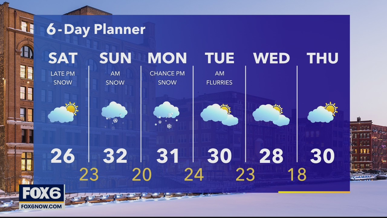
A chilly start to Saturday. Eric times out when the snow shows up this evening in his forecast.
A chilly start to Saturday. Eric times out when the snow shows up this evening in his forecast.
Weather Webcast with A.J. Waterman
Cold tonight! Temps expected in the single digits! Snow is on the way tomorrow night, with Winter Weather Advisories in place Saturday for Ozaukee, Washington, Dodge, Fond du Lac, and Sheboygan.
Cold tonight! Temps expected in the single digits! Snow is on the way tomorrow night, with Winter Weather Advisories in place Saturday for Ozaukee, Washington, Dodge, Fond du Lac, and Sheboygan.
Weather Webcast with A.J. Waterman
Cold tonight! Temps expected in the single digits! Snow is on the way tomorrow night, with Winter Weather Advisories in place Saturday for Ozaukee, Washington, Dodge, Fond du Lac, and Sheboygan.
Cold tonight! Temps expected in the single digits! Snow is on the way tomorrow night, with Winter Weather Advisories in place Saturday for Ozaukee, Washington, Dodge, Fond du Lac, and Sheboygan.
Packers forecast from A.J. Waterman
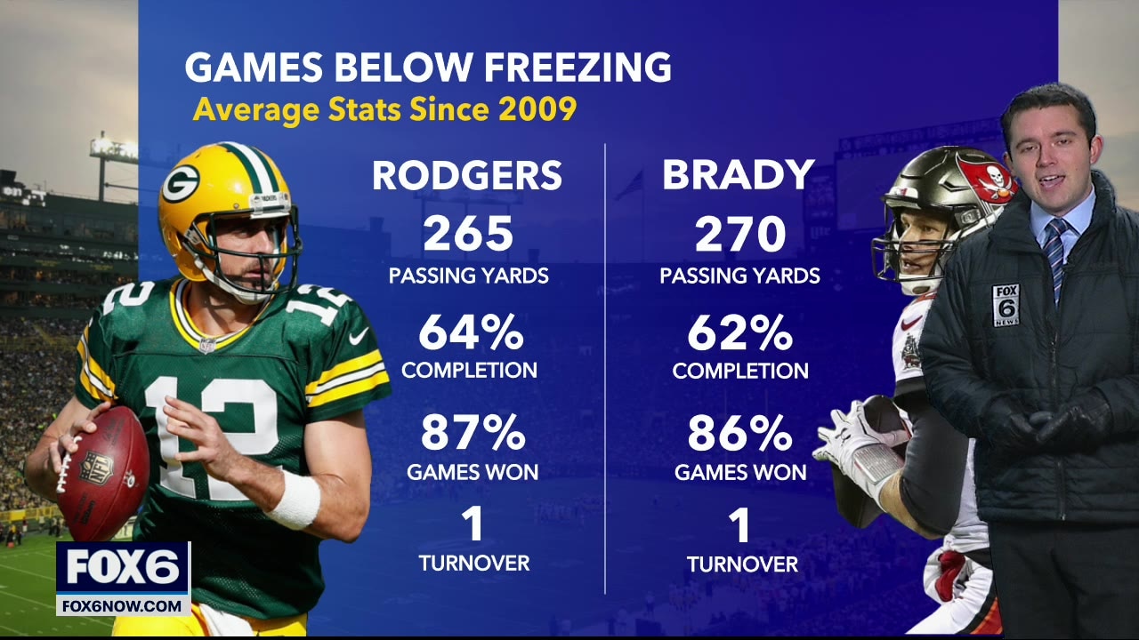
A cold game for the Packers on Sunday! Temps around 28 degrees, but don't expect it to make a huge difference for quarterbacks that play well in the cold!
A cold game for the Packers on Sunday! Temps around 28 degrees, but don't expect it to make a huge difference for quarterbacks that play well in the cold!
Weather webcast with Rob Haswell
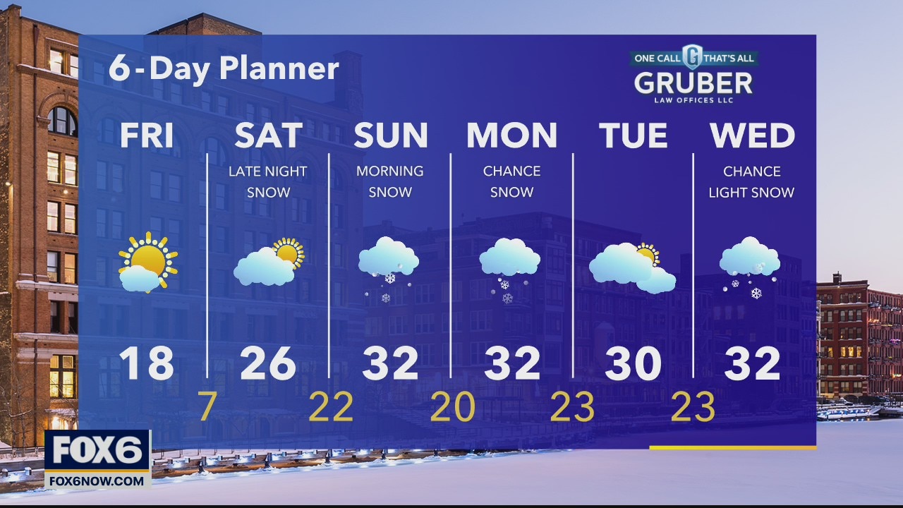
We are now behind yesterday's strong cold front with much colder air taking over. Highs will be in the teens today and feel colder with a breezy NW wind. An area of high pressure moves over us to keep things clear. That means sun today but clear and very cold tonight as we fall into the low single digits overnight.
We are now behind yesterday's strong cold front with much colder air taking over. Highs will be in the teens today and feel colder with a breezy NW wind. An area of high pressure moves over us to keep things clear. That means sun today but clear and very cold tonight as we fall into the low single digits overnight.
Weather Webcast with Tom Wachs
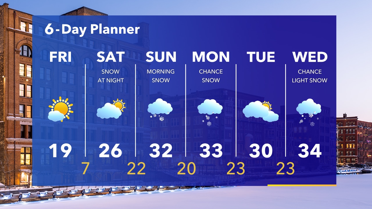
A blast of cold air blows in overnight. Wind chills of 0 to -5 by sunrise. Sunny skies on Friday, but cold with temperatures around 19. Snow is still in the forecast Saturday night into Sunday morning.
A blast of cold air blows in overnight. Wind chills of 0 to -5 by sunrise. Sunny skies on Friday, but cold with temperatures around 19. Snow is still in the forecast Saturday night into Sunday morning.