

Weather webcast with Rob Haswell
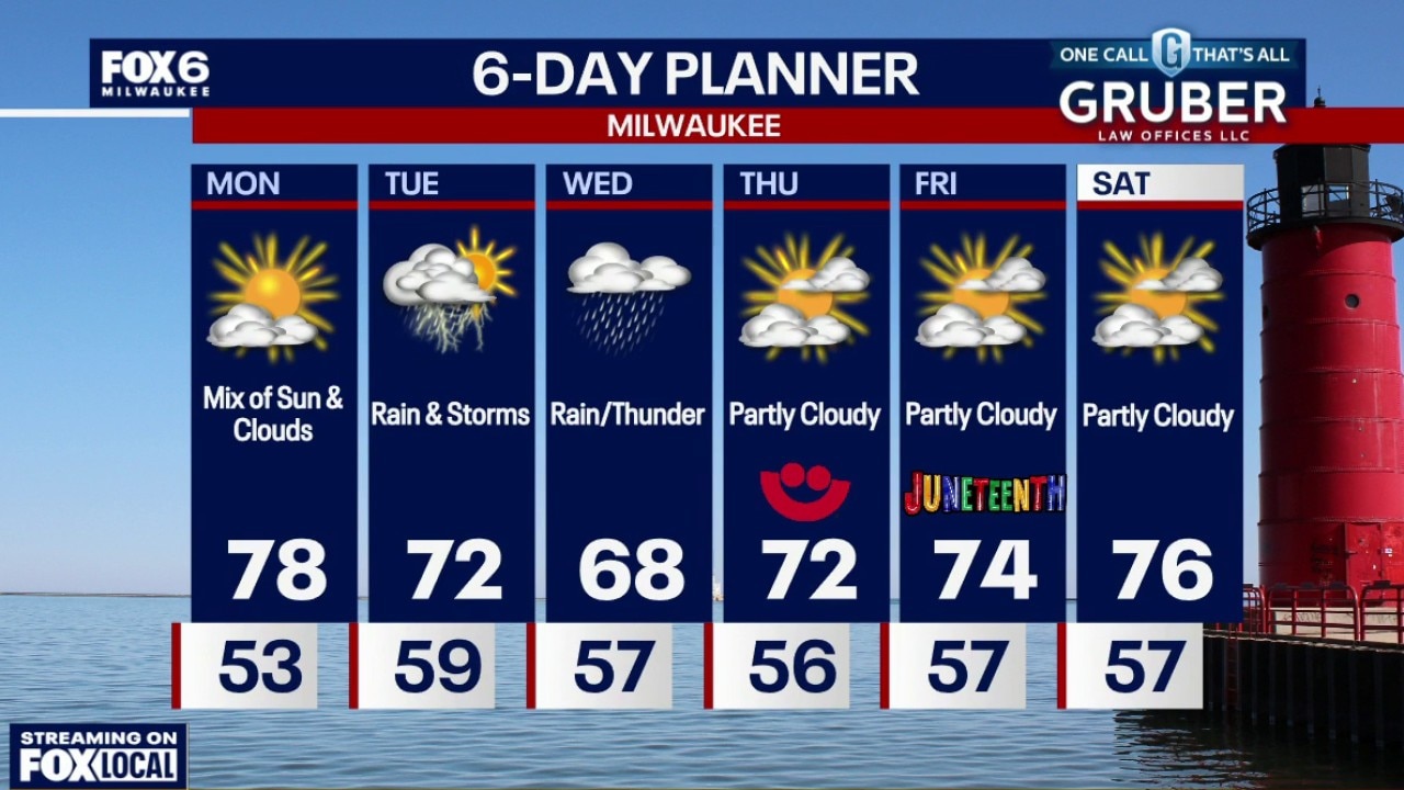
Enjoy the sunshine and comfortable temperatures Monday because the weather pattern turns much more active starting Tuesday. Showers and thunderstorms become likely Tuesday as a strong storm system moves through Wisconsin.
Enjoy the sunshine and comfortable temperatures Monday because the weather pattern turns much more active starting Tuesday. Showers and thunderstorms become likely Tuesday as a strong storm system moves through Wisconsin.
Weather Webcast with Chief Meteorologist Tom Wachs
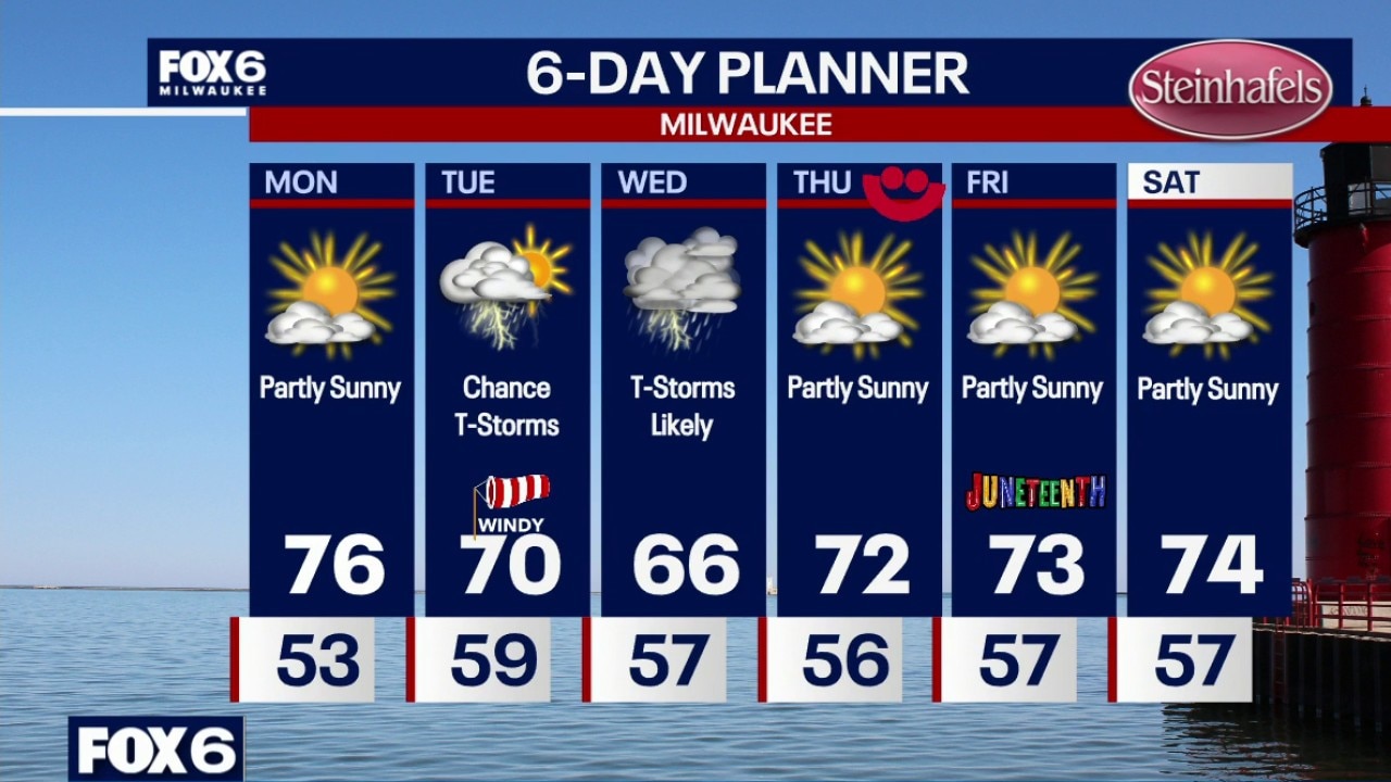
Clear skies overnight with temperatures falling into the 50s by sunrise. Partly sunny and warmer on Monday with a high in the mid-70s. Dew points in the 40s (dry). Windy on Tuesday with a chance for t-storms. High around 70 with gusty westerly winds. Widespread severe weather is not expected.
Clear skies overnight with temperatures falling into the 50s by sunrise. Partly sunny and warmer on Monday with a high in the mid-70s. Dew points in the 40s (dry). Windy on Tuesday with a chance for t-storms. High around 70 with gusty westerly winds. Widespread severe weather is not expected.
Weather Webcast with Chief Meteorologist Tom Wachs
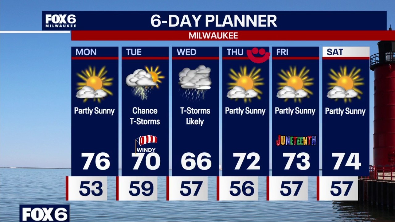
Clearing skies tonight with temperatures falling into the 50s late this evening and overnight. Partly sunny and warmer on Monday with a high in the mid-70s. Dew points in the 40s (dry). Windy on Tuesday with a chance for t-storms. High around 70 with gusty westerly winds. Widespread severe weather is not expected.
Clearing skies tonight with temperatures falling into the 50s late this evening and overnight. Partly sunny and warmer on Monday with a high in the mid-70s. Dew points in the 40s (dry). Windy on Tuesday with a chance for t-storms. High around 70 with gusty westerly winds. Widespread severe weather is not expected.
Weather webcast with Meteorologist Lisa Michaels
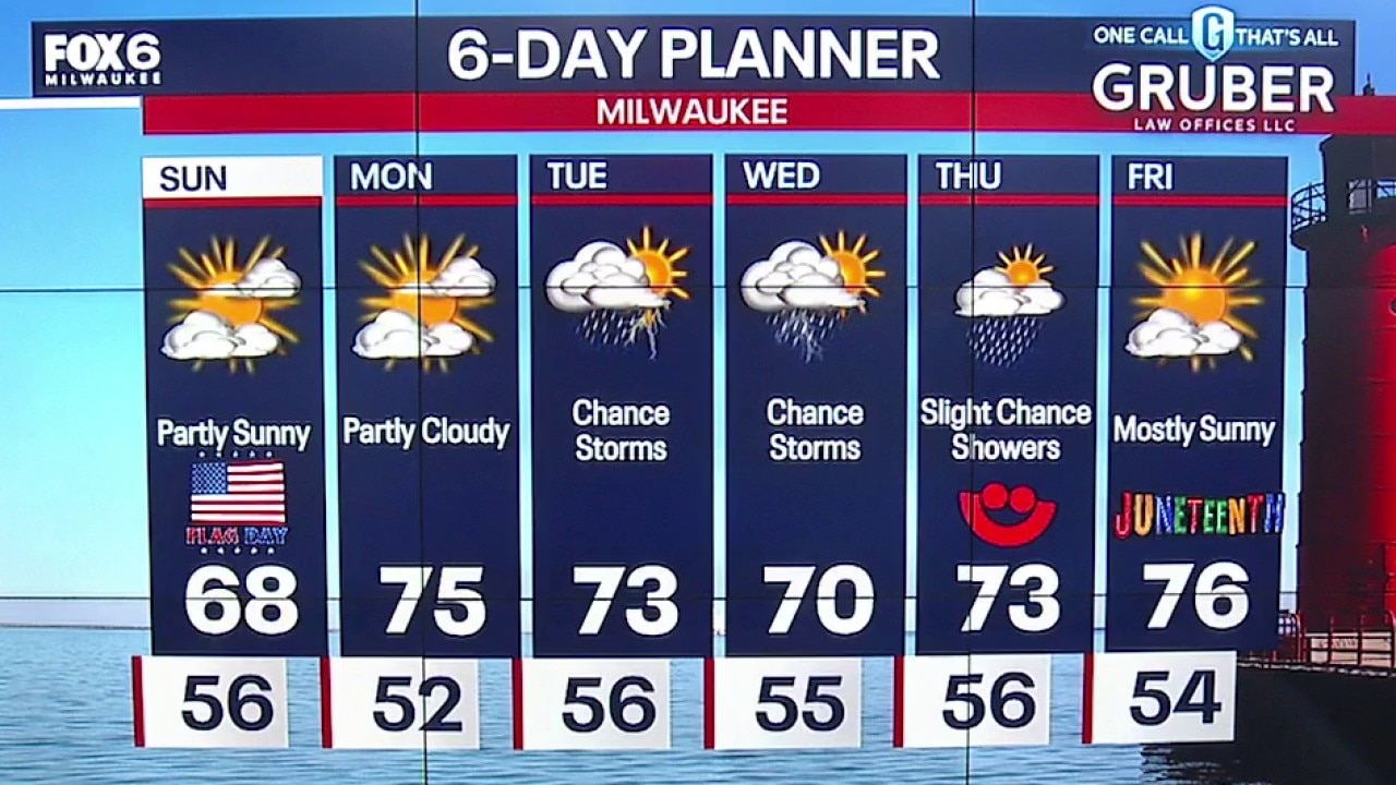
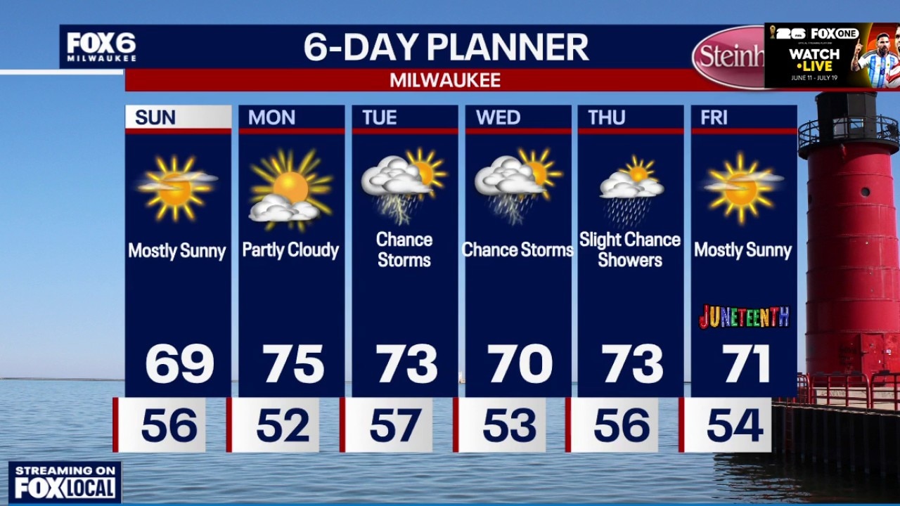
Thicker clouds in the morning will decrease to partly sunny skies Sunday afternoon. Cool and breezy with highs in the upper 60s. More below average to seasonal temperatures over the next six days with the low to middle 70s in store for high temps.
Thicker clouds in the morning will decrease to partly sunny skies Sunday afternoon. Cool and breezy with highs in the upper 60s. More below average to seasonal temperatures over the next six days with the low to middle 70s in store for high temps.
Weather Webcast with Holly Baker
We are tracking a chance for late night storms and cooler temperatures Sunday.
We are tracking a chance for late night storms and cooler temperatures Sunday.
Weather webcast with Meteorologist Lisa Michaels
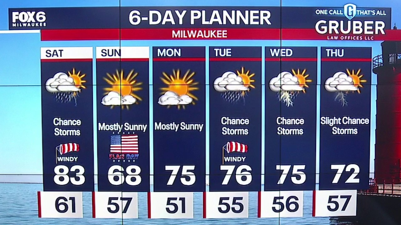
A few isolated showers possible north of I-94 Saturday morning. Drier air may cause virga. Warming into the low 80s with afternoon and evening rain and storms.
A few isolated showers possible north of I-94 Saturday morning. Drier air may cause virga. Warming into the low 80s with afternoon and evening rain and storms.
Weather webcast with Lisa Michaels
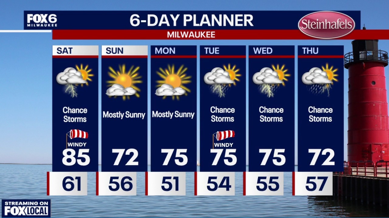
Mostly clear evening with mild temperatures, due to a southwest wind, falling into the low 60s.
Mostly clear evening with mild temperatures, due to a southwest wind, falling into the low 60s.
Weather webcast with Rob Haswell
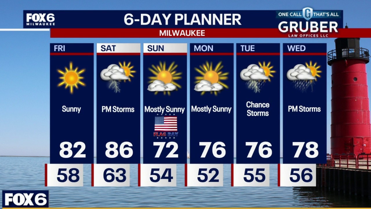
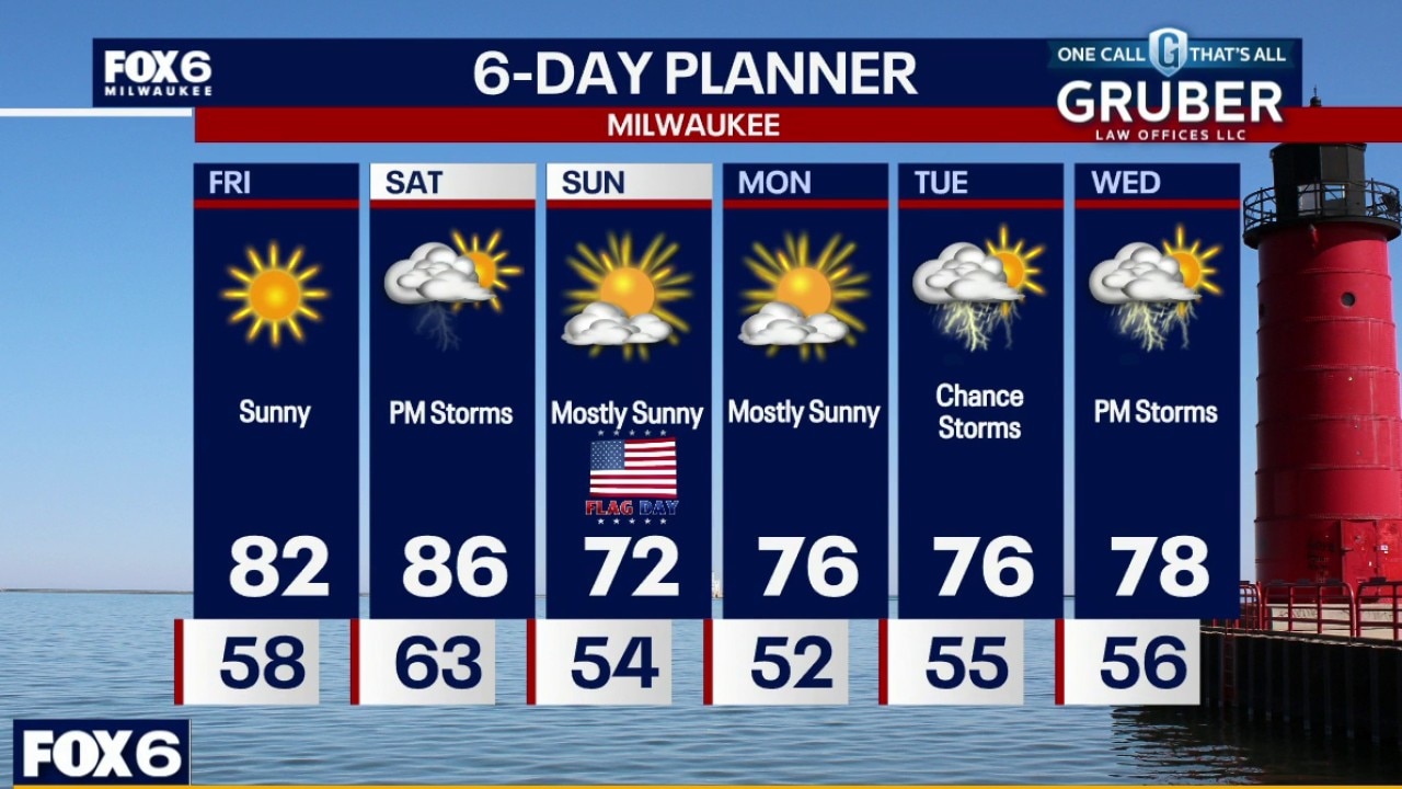
After Thursday's severe weather, southern Wisconsin gets a much-needed break with quiet and dry conditions through Saturday morning. Friday looks like the pick of the forecast with sunshine, lower humidity, and comfortable temperatures.
After Thursday's severe weather, southern Wisconsin gets a much-needed break with quiet and dry conditions through Saturday morning. Friday looks like the pick of the forecast with sunshine, lower humidity, and comfortable temperatures.
Weather webcast with Rob Haswell
After Thursday's severe weather, southern Wisconsin gets a much-needed break with quiet and dry conditions through Saturday morning. Friday looks like the pick of the forecast with sunshine, lower humidity, and comfortable temperatures.
After Thursday's severe weather, southern Wisconsin gets a much-needed break with quiet and dry conditions through Saturday morning. Friday looks like the pick of the forecast with sunshine, lower humidity, and comfortable temperatures.
Weather Webcast with Chief Meteorologist Tom Wachs
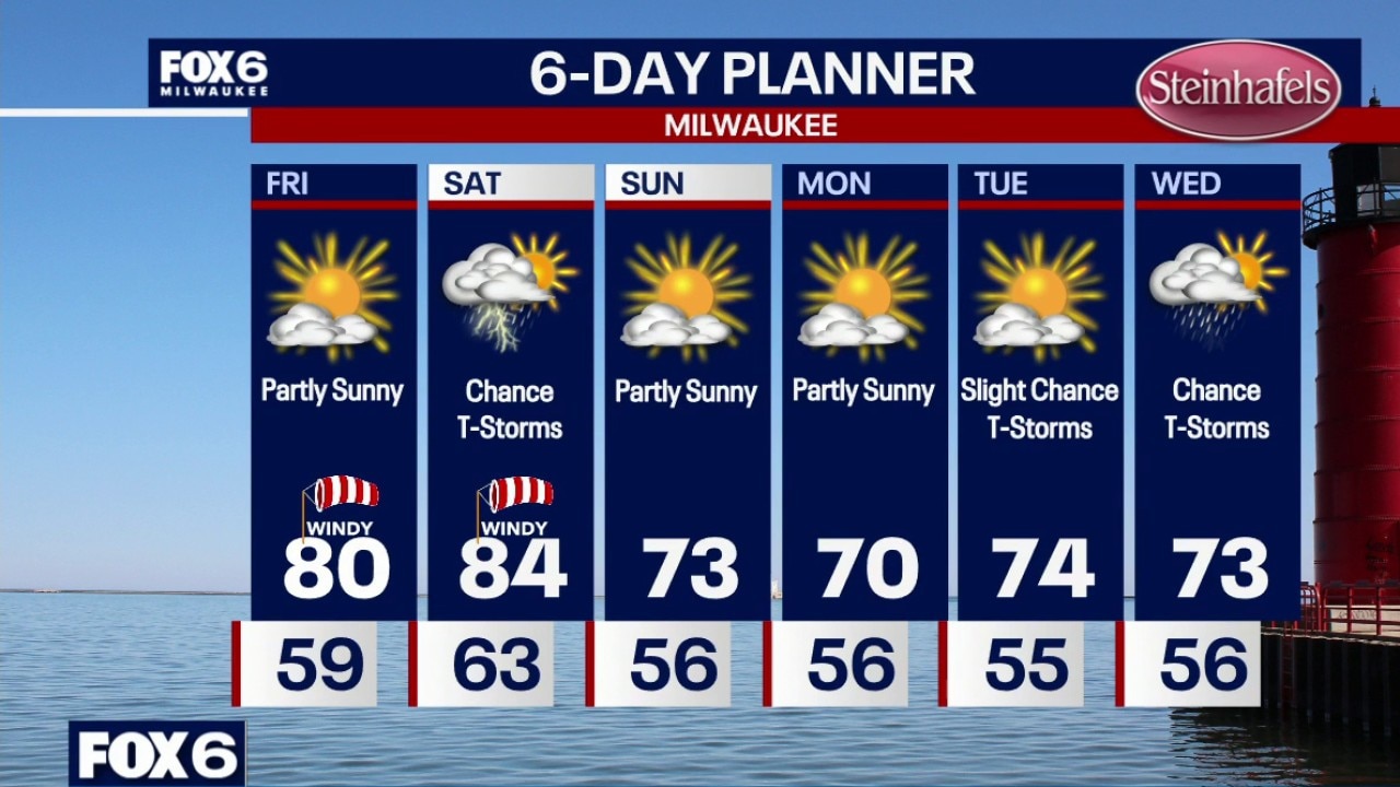
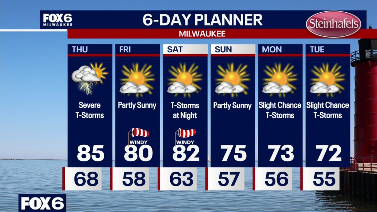
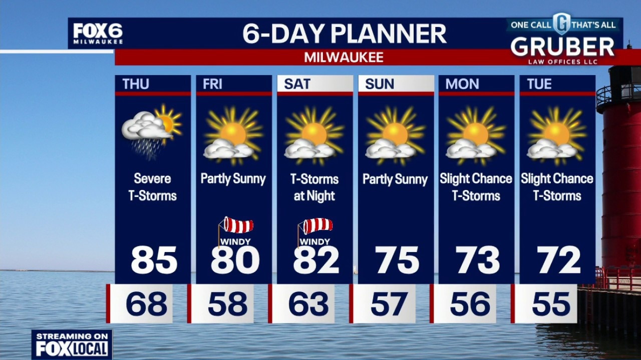
Rain ending and skies clearing out overnight. Temperatures dropping into the 50s by morning. Partly sunny, windy and less humid on Friday with a high around 80. T-Storm chances return on Saturday with gusty winds possible. Highs in the mid-80s. Cooler and dry on Sunday.
Rain ending and skies clearing out overnight. Temperatures dropping into the 50s by morning. Partly sunny, windy and less humid on Friday with a high around 80. T-Storm chances return on Saturday with gusty winds possible. Highs in the mid-80s. Cooler and dry on Sunday.
Weather webcast with Meteorologist Holly Baker
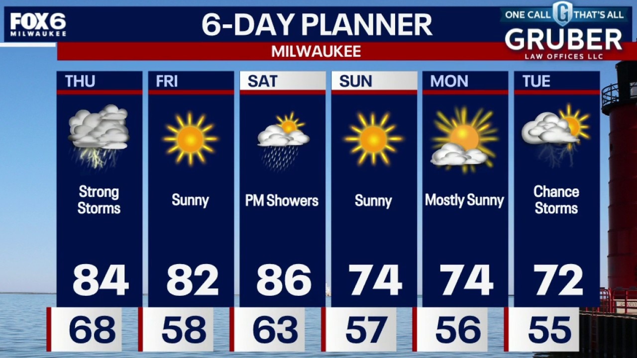
Thursday is shaping up to be another active weather day across southern Wisconsin, with the potential for significant severe storms from mid-afternoon into the early evening.
Thursday is shaping up to be another active weather day across southern Wisconsin, with the potential for significant severe storms from mid-afternoon into the early evening.
Weather webcast with Rob Haswell
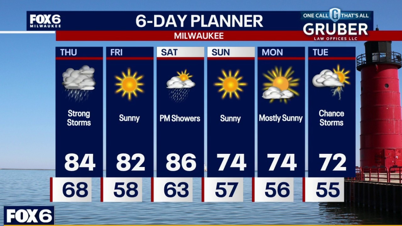
Thursday is shaping up to be another active weather day across southern Wisconsin, with the potential for significant severe storms from mid-afternoon into the early evening.
Thursday is shaping up to be another active weather day across southern Wisconsin, with the potential for significant severe storms from mid-afternoon into the early evening.
Weather Webcast with Chief Meteorologist Tom Wachs
There is a chance we could see more storms through 2am. Temperatures around 70 all night. Partly to mostly cloudy on Thursday. Severe t-storms. Midday severe t-storms are possible, but the worst of the storms will be 4pm-9pm. Tornadoes are expected along with very strong winds and large hail. Flooding is also possible. This is a volatile setup. It is imperative to stay weather aware and have sheltering plans.
There is a chance we could see more storms through 2am. Temperatures around 70 all night. Partly to mostly cloudy on Thursday. Severe t-storms. Midday severe t-storms are possible, but the worst of the storms will be 4pm-9pm. Tornadoes are expected along with very strong winds and large hail. Flooding is also possible. This is a volatile setup. It is imperative to stay weather aware and have sheltering plans.
Weather Webcast with Chief Meteorologist Tom Wachs
There is a chance we could see more storms through 2am. We are watching closely. Temperatures around 70 all night. Partly to mostly cloudy on Thursday. Severe t-storms. Midday severe t-storms are possible, but the worst of the storms will be 4pm-9pm. Tornadoes are expected along with very strong winds and large hail. Flooding is also possible. This is a volatile setup. It is imperative to stay weather aware and have sheltering plans.
There is a chance we could see more storms through 2am. We are watching closely. Temperatures around 70 all night. Partly to mostly cloudy on Thursday. Severe t-storms. Midday severe t-storms are possible, but the worst of the storms will be 4pm-9pm. Tornadoes are expected along with very strong winds and large hail. Flooding is also possible. This is a volatile setup. It is imperative to stay weather aware and have sheltering plans.
Weather webcast with Stephanie Barichello
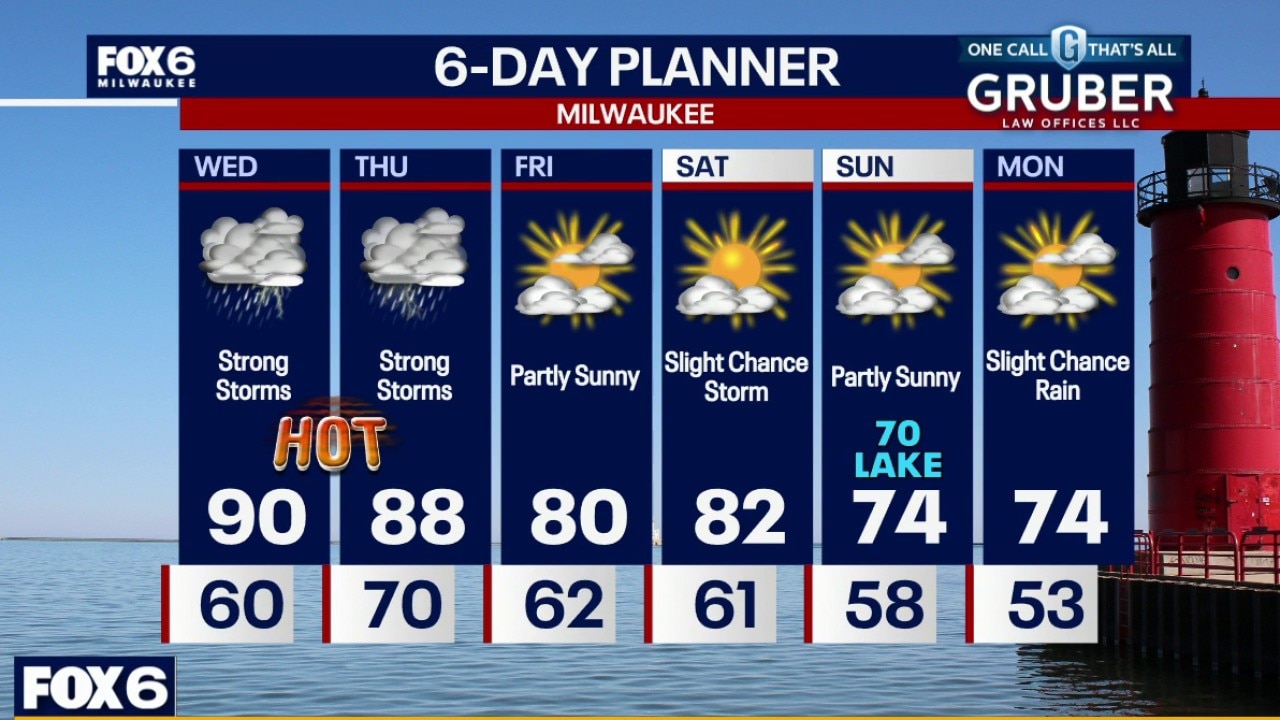
Breezy, hot and humid on Wednesday with highs near 90F and an afternoon heat index around 100. A round of severe t-storms is likely between 1pm-6pm on Wednesday with tornadoes, wind and hail possible.
Breezy, hot and humid on Wednesday with highs near 90F and an afternoon heat index around 100. A round of severe t-storms is likely between 1pm-6pm on Wednesday with tornadoes, wind and hail possible.
Weather webcast with Lisa Michaels
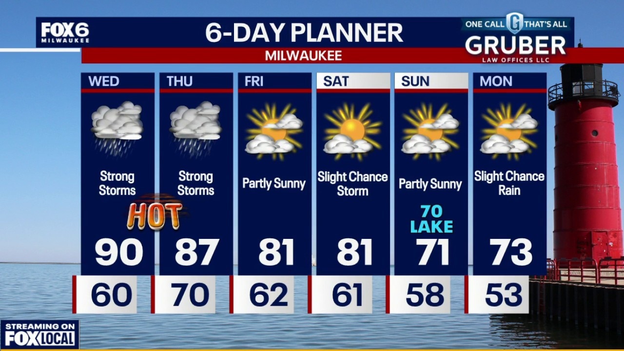
Dense fog advisory until 7am for counties closer to the lake. Windy, hot and humid on Wednesday with highs near 90F and an afternoon heat index around 100.
Dense fog advisory until 7am for counties closer to the lake. Windy, hot and humid on Wednesday with highs near 90F and an afternoon heat index around 100.
Weather Webcast with Chief Meteorologist Tom Wachs
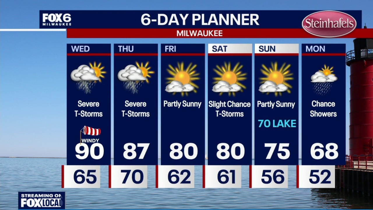
Dense fog overnight with temperatures dropping into the 60s. Slim chance for t-storms on Wednesday morning, but chances are going down. Windy, hot and humid on Wednesday with an afternoon heat index around 100. A round of severe t-storms is likely between 11am-5pm on Wednesday with tornadoes, wind and hail possible. A second round is expected between 7pm-2am with all threats again on the table.
Dense fog overnight with temperatures dropping into the 60s. Slim chance for t-storms on Wednesday morning, but chances are going down. Windy, hot and humid on Wednesday with an afternoon heat index around 100. A round of severe t-storms is likely between 11am-5pm on Wednesday with tornadoes, wind and hail possible. A second round is expected between 7pm-2am with all threats again on the table.
Weather Webcast with Chief Meteorologist Tom Wachs
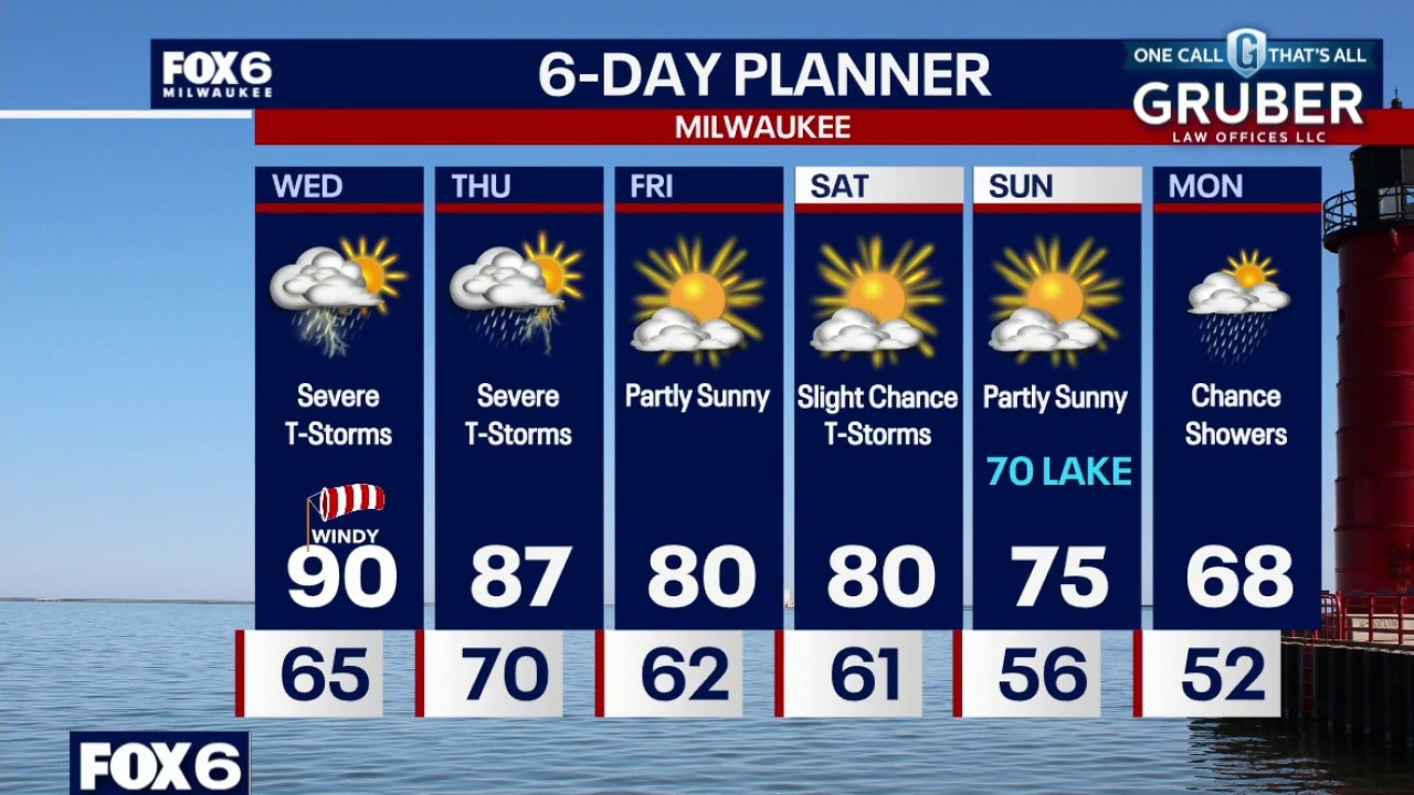
Dense fog developing tonight with temperatures dropping into the 60s. Slim chance for t-storms on Wednesday morning, but chances are going down. Windy, hot and humid on Wednesday with an afternoon heat index around 100.
Dense fog developing tonight with temperatures dropping into the 60s. Slim chance for t-storms on Wednesday morning, but chances are going down. Windy, hot and humid on Wednesday with an afternoon heat index around 100.
Weather Webcast with Stephanie Barichello
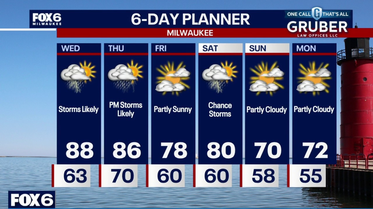
Multiple rounds of severe weather possible Wednesday afternoon and evening, and again Thursday afternoon and evening. All rounds could produce damaging wind over 70mph and tornadoes, along with hail and flash flooding. It's possible parts of SE WI pick up over 2" of rain between the two rounds. It'll also be hot and humid Wednesday with heat indices near 100. Calmer Friday then a chance of storms to start the weekend.
Multiple rounds of severe weather possible Wednesday afternoon and evening, and again Thursday afternoon and evening. All rounds could produce damaging wind over 70mph and tornadoes, along with hail and flash flooding. It's possible parts of SE WI pick up over 2" of rain between the two rounds. It'll also be hot and humid Wednesday with heat indices near 100. Calmer Friday then a chance of storms to start the weekend.
Weather webcast with Stephanie Barichello
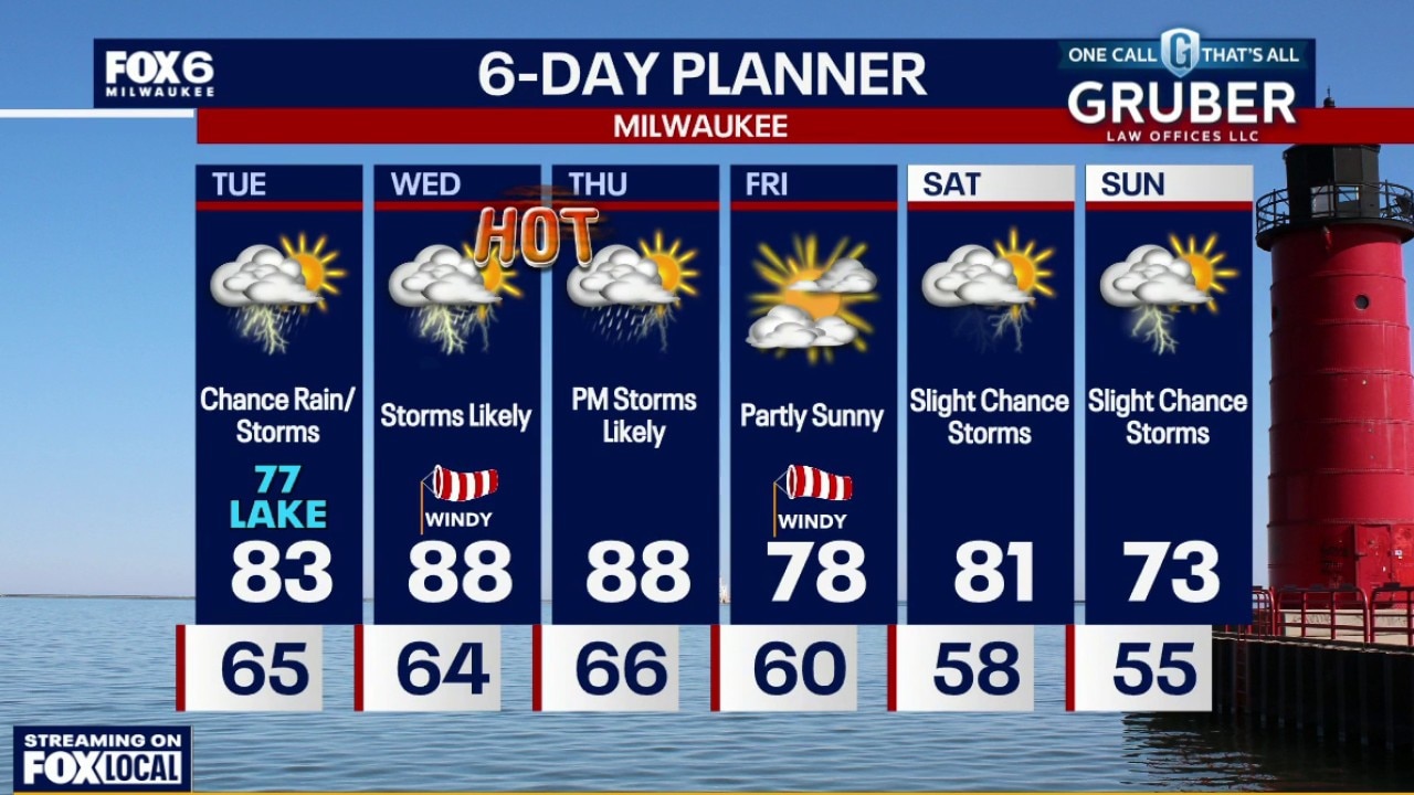
Scattered rain showers and a few storms Tuesday morning. Highs in the low 80s inland and upper 70s lakeside. Muggy. Storm chances increase Wednesday morning with patchy fog possible.
Scattered rain showers and a few storms Tuesday morning. Highs in the low 80s inland and upper 70s lakeside. Muggy. Storm chances increase Wednesday morning with patchy fog possible.