

Weather Webcast with Tom Wachs
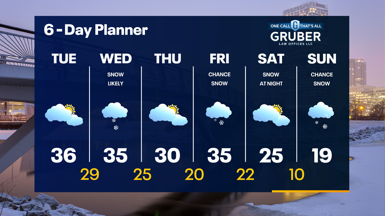
A few light snow showers possible tonight. Breezy with temperatures in the 20s. Dry on Tuesday with a chance for snow on Wednesday.
A few light snow showers possible tonight. Breezy with temperatures in the 20s. Dry on Tuesday with a chance for snow on Wednesday.
Weather Webcast With Lisa Michaels
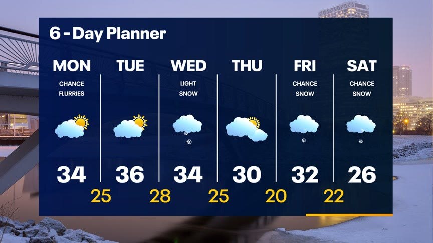
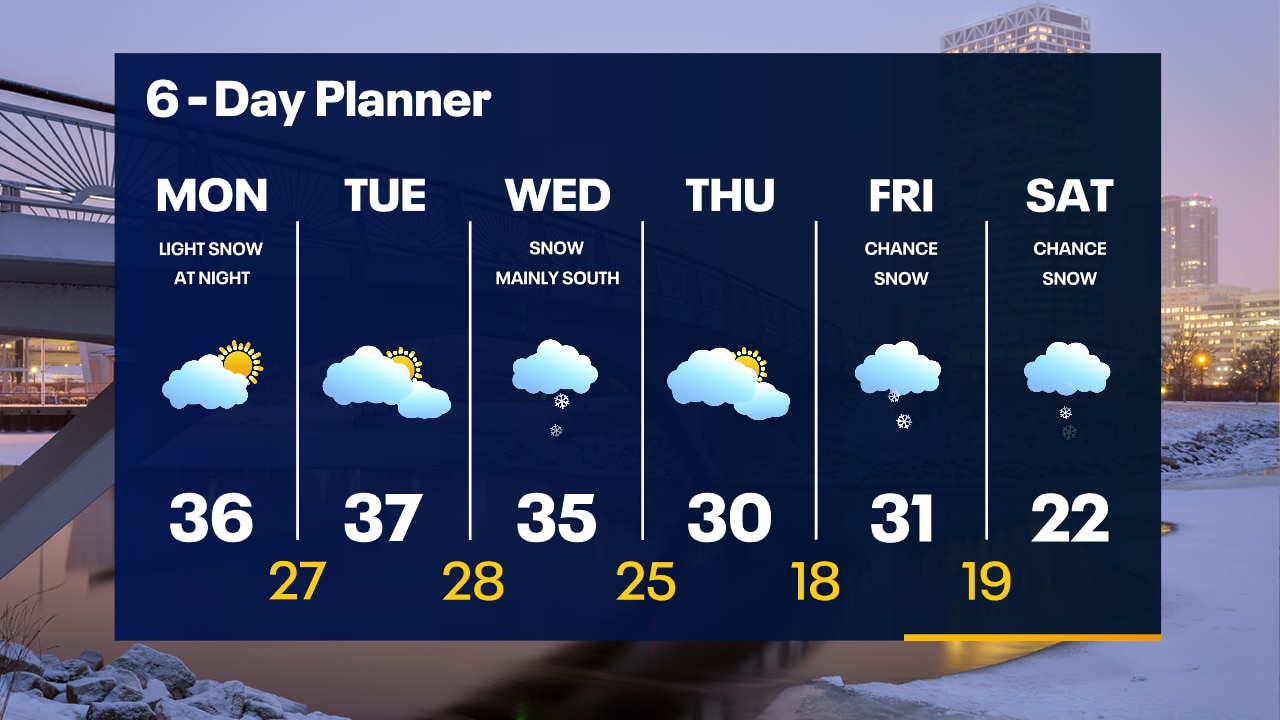
Best chance of sunshine will be this afternoon before clouds return tonight. Strong winds arrive today with gusts up to 30mph at times. Temperatures will remain slightly above average in the low to mid 30s today and tomorrow. Our next round of snow arrives on Wednesday with a chance for a couple of inches - mostly in our south and east counties. We cool the low 30s - near seasonal - Thursday and Friday and drop into the 20s Saturday.
Best chance of sunshine will be this afternoon before clouds return tonight. Strong winds arrive today with gusts up to 30mph at times. Temperatures will remain slightly above average in the low to mid 30s today and tomorrow. Our next round of snow arrives on Wednesday with a chance for a couple of inches - mostly in our south and east counties. We cool the low 30s - near seasonal - Thursday and Friday and drop into the 20s Saturday.
Weather webcast with Rob Haswell
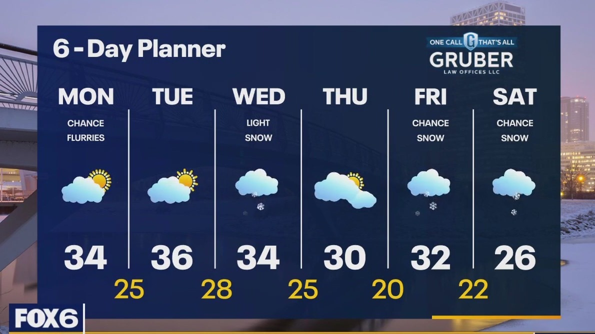
A few flurries are possible today but otherwise mostly cloudy and becoming windy with afternoon wind gusts in the 30mph range at times. Temperatures will remain slightly above average in the low to mid 30s today and warm slightly to the mid to upper 30s Tuesday. Our next round of snow arrives on Wednesday with a chance for a couple of inches - mostly in our south and east counties. We cool the low 30s - near seasonal - Thursday and Friday and drop into the 20s Saturday.
A few flurries are possible today but otherwise mostly cloudy and becoming windy with afternoon wind gusts in the 30mph range at times. Temperatures will remain slightly above average in the low to mid 30s today and warm slightly to the mid to upper 30s Tuesday. Our next round of snow arrives on Wednesday with a chance for a couple of inches - mostly in our south and east counties. We cool the low 30s - near seasonal - Thursday and Friday and drop into the 20s Saturday.
Weather Webcast with Tom Wachs
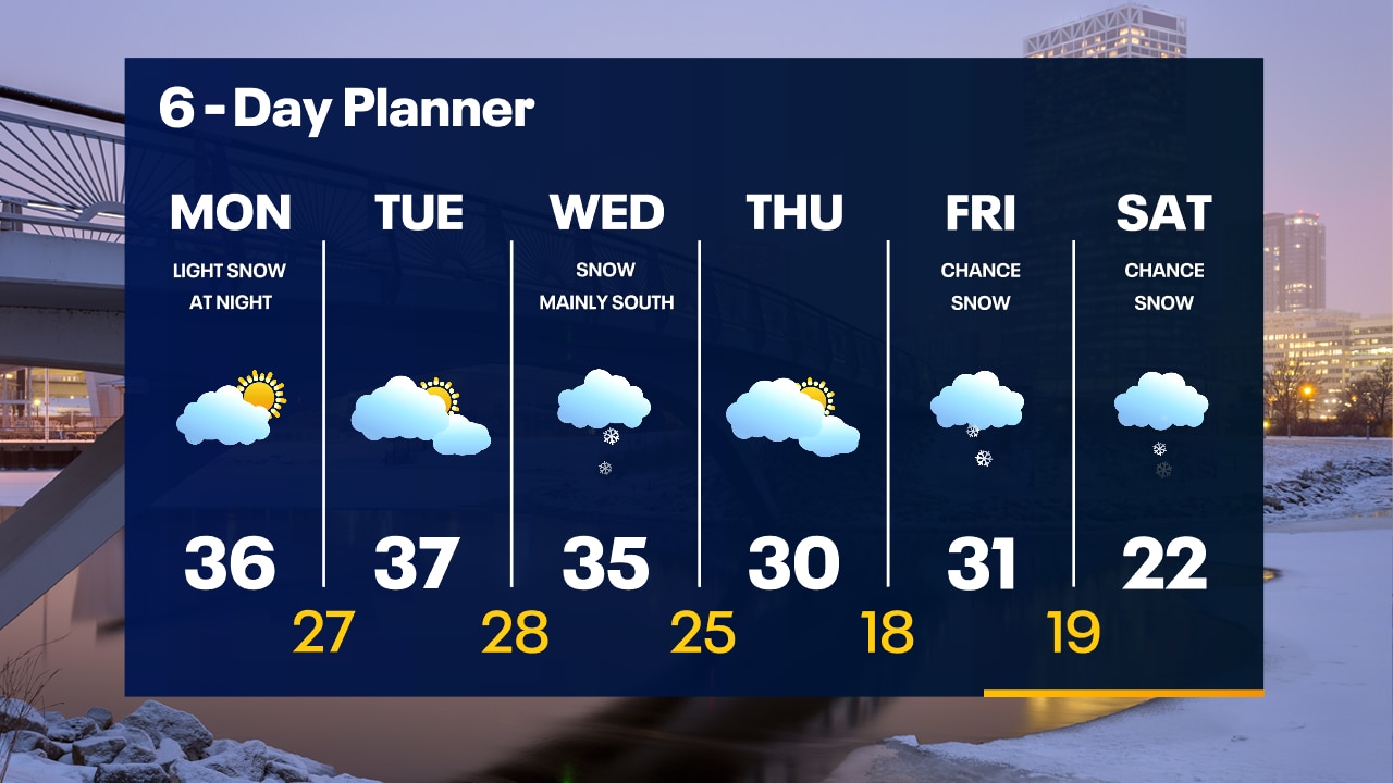
Cold overnight with temperatures in the teens in most areas. Some peeks of the sun (finally) on Monday with highs in the 30s.
Cold overnight with temperatures in the teens in most areas. Some peeks of the sun (finally) on Monday with highs in the 30s.
Weather Webcast with Tom Wachs
Light snow tapering off with temperatures in the teens and 20s tonight. Finally some peeks of sun on Monday with highs in the 30s.
Light snow tapering off with temperatures in the teens and 20s tonight. Finally some peeks of sun on Monday with highs in the 30s.

Weather Webcast with Meteorologist Lisa Michaels
Light snow/flurries early this morning. Snow will gradually exit heading into the late morning. Cloudy skies continue to take over the skies today with highs temperatures in the upper 20s to lower 30s. Sunshine will be limited next week, but the best day to see some will be on Monday. A clipper system could bring a dusting of snow Monday night into Tuesday. Another low-pressure system could bring snow Wednesday.
Light snow/flurries early this morning. Snow will gradually exit heading into the late morning. Cloudy skies continue to take over the skies today with highs temperatures in the upper 20s to lower 30s. Sunshine will be limited next week, but the best day to see some will be on Monday. A clipper system could bring a dusting of snow Monday night into Tuesday. Another low-pressure system could bring snow Wednesday.

Weather Webcast with Meteorologist Eric Manges
FOX6 News at 6 offers the day's news, weather, and sports in southeast Wisconsin, the nation, and the world.
FOX6 News at 6 offers the day's news, weather, and sports in southeast Wisconsin, the nation, and the world.
Weather Webcast with Meteorologist Lisa Michaels
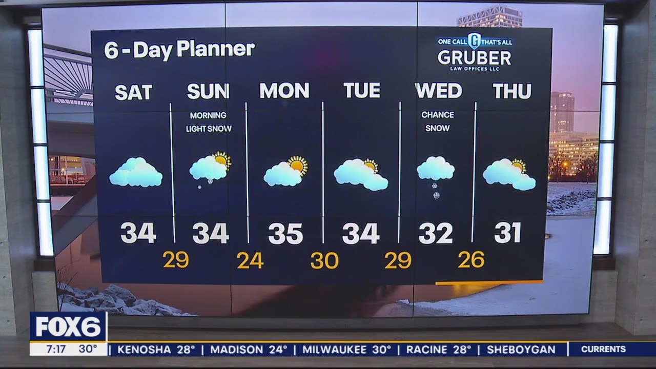
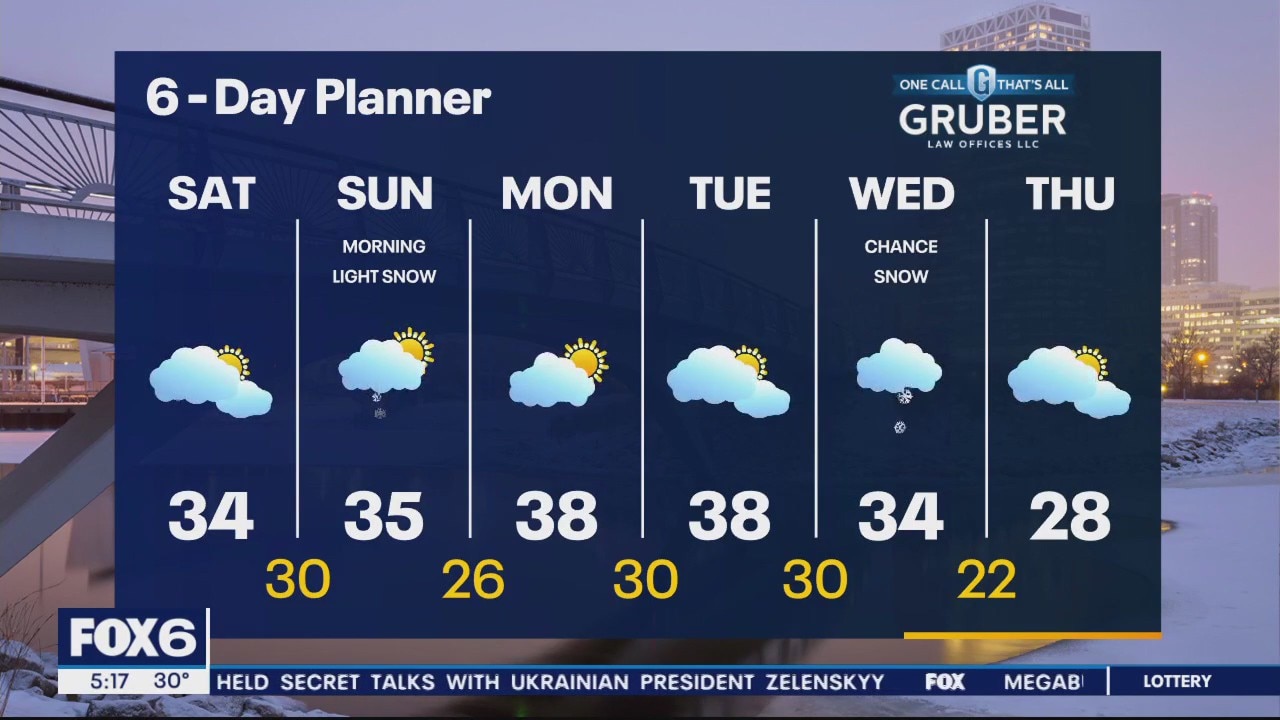
Cloudy but cooler as we head into the weekend but still technically warmer than average. Light snow is possible Saturday night into Sunday mostly a dusting to an inch possible. Cloudy and warmer than average to start the week with our next broader system arriving Wednesday. As of now Wednesday looks like light snow but the main snow is focused in central Illinois but worth keeping an eye on.
Cloudy but cooler as we head into the weekend but still technically warmer than average. Light snow is possible Saturday night into Sunday mostly a dusting to an inch possible. Cloudy and warmer than average to start the week with our next broader system arriving Wednesday. As of now Wednesday looks like light snow but the main snow is focused in central Illinois but worth keeping an eye on.
Weather Webcast with Meteorologist Eric Manges
FOX6 News at 5 offers the day's news, weather, and sports in southeast Wisconsin, the nation, and the world.
FOX6 News at 5 offers the day's news, weather, and sports in southeast Wisconsin, the nation, and the world.
Weather Webcast with Meteorologist Stephanie Barichello
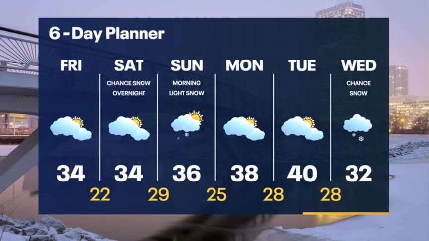
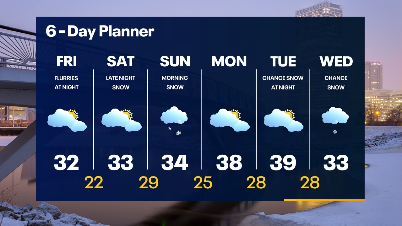
Cloudy and cool this afternoon with a few flurries tonight, then a few peeks of sun possible Saturday. A quick batch of light snow expected Saturday night into Sunday morning , then drying out early next week.
Cloudy and cool this afternoon with a few flurries tonight, then a few peeks of sun possible Saturday. A quick batch of light snow expected Saturday night into Sunday morning , then drying out early next week.

Weather webcast with Rob Haswell
A trough of low pressure is helping to generate some very light snow this morning creating a few slippery patches. High pressure builds in through the day to settle things down and possibly give us a few sunny breaks late today and again tomorrow. A low passes to our southeast Saturday night into Sunday morning and may give us some light snow Sunday morning. Accumulations - if any - will be light. Our next round of snow is possible on Wednesday and there is a better chance of accumulation with this system.
A trough of low pressure is helping to generate some very light snow this morning creating a few slippery patches. High pressure builds in through the day to settle things down and possibly give us a few sunny breaks late today and again tomorrow. A low passes to our southeast Saturday night into Sunday morning and may give us some light snow Sunday morning. Accumulations - if any - will be light. Our next round of snow is possible on Wednesday and there is a better chance of accumulation with this system.
Weather Webcast with Tom Wachs
Black ice is possible in spots overnight as wet roads from earlier freeze up creating patchy slick spots. Watch out on driveways, parking lots and sidewalks.
Black ice is possible in spots overnight as wet roads from earlier freeze up creating patchy slick spots. Watch out on driveways, parking lots and sidewalks.
Weather Webcast with Tom Wachs
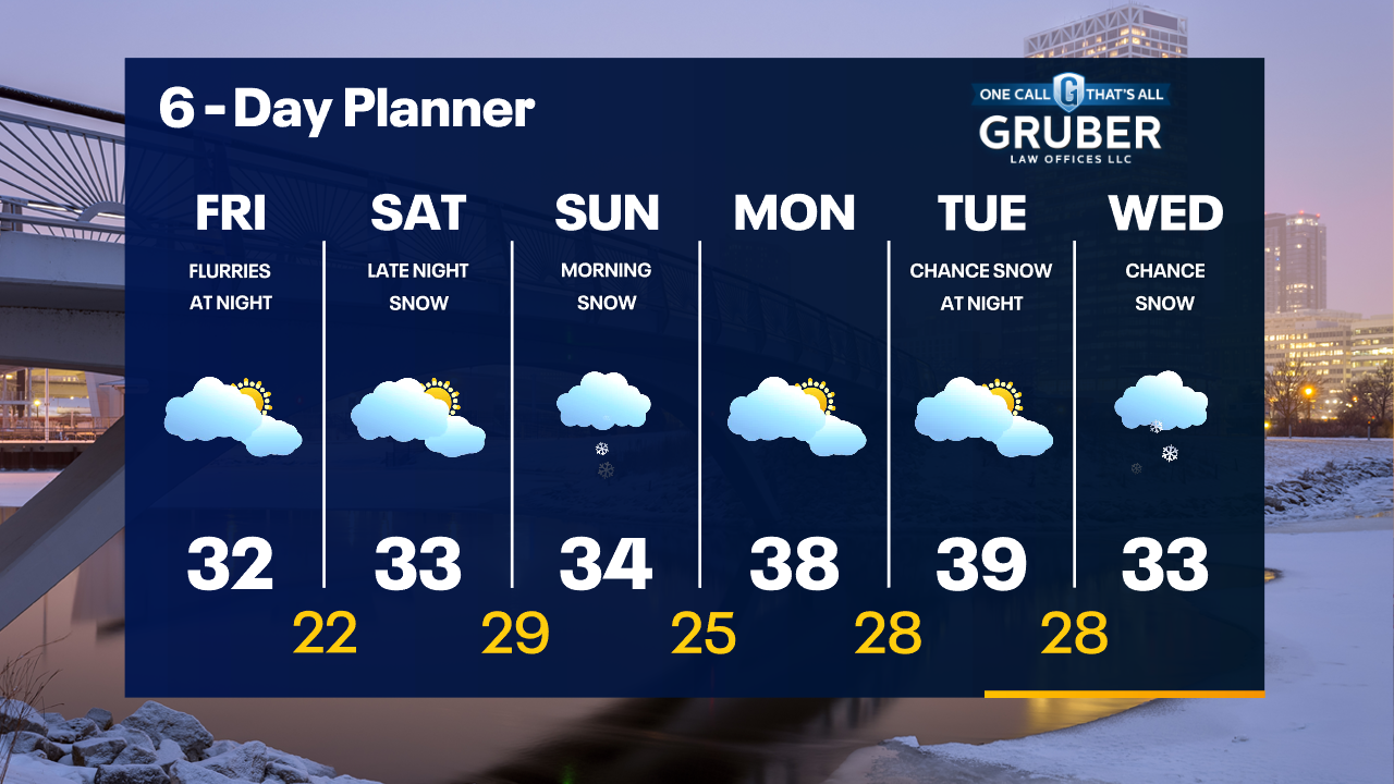
Rain/snow showers ending later this evening. Temperatures will fall into the 20s overnight. Some refreeze is possible overnight. Mostly cloudy & breezy on Friday with highs in the low 30s.
Rain/snow showers ending later this evening. Temperatures will fall into the 20s overnight. Some refreeze is possible overnight. Mostly cloudy & breezy on Friday with highs in the low 30s.

Weather Webcast with Meteorologist Stephanie Barichello
Still some light rain/snow possible this afternoon then drying out tonight and Friday. Cooler and breezy Friday. Some sun Saturday morning then a quick burst of snow Sunday morning.
Still some light rain/snow possible this afternoon then drying out tonight and Friday. Cooler and breezy Friday. Some sun Saturday morning then a quick burst of snow Sunday morning.
Weather webcast with Rob Haswell
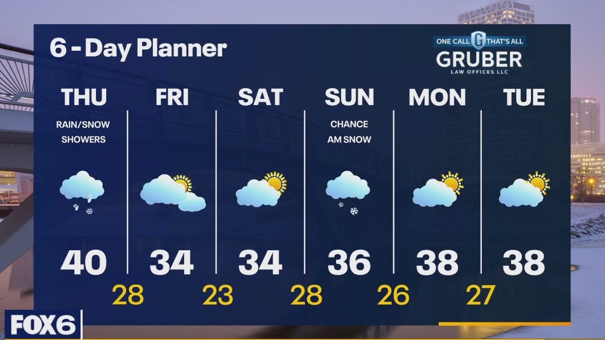
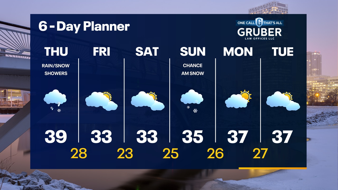
The steady light rain and snow winds down early this morning with scattered rain and snow showers continuing through the later evening hours. Highs today will be near 40 and then we will cool to the 20s overnight and stay in the low 30s for Friday and Saturday with drier conditions. There is a chance for light snow overnight Saturday into Sunday morning with little to no accumulation. We stay above average for the next several days with highs in the mid to upper 30s through late next week.
The steady light rain and snow winds down early this morning with scattered rain and snow showers continuing through the later evening hours. Highs today will be near 40 and then we will cool to the 20s overnight and stay in the low 30s for Friday and Saturday with drier conditions. There is a chance for light snow overnight Saturday into Sunday morning with little to no accumulation. We stay above average for the next several days with highs in the mid to upper 30s through late next week.
Weather Webcast with Tom Wachs
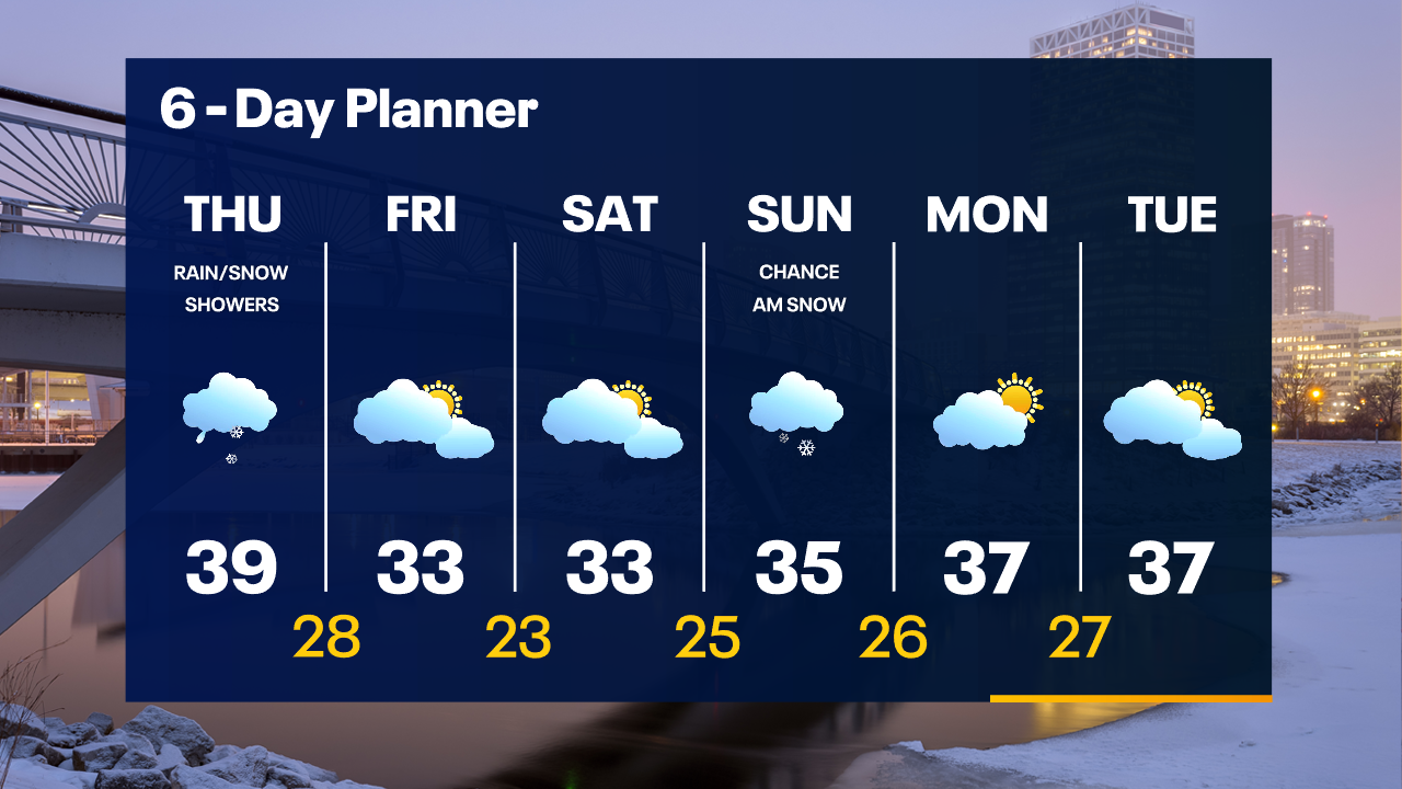
Rain/snow mix Milwaukee and south overnight, all snow north. Slushy accumulation north and northwest of Milwaukee. Precipitation ends south to north throughout the morning.
Rain/snow mix Milwaukee and south overnight, all snow north. Slushy accumulation north and northwest of Milwaukee. Precipitation ends south to north throughout the morning.
Weather Webcast with Tom Wachs
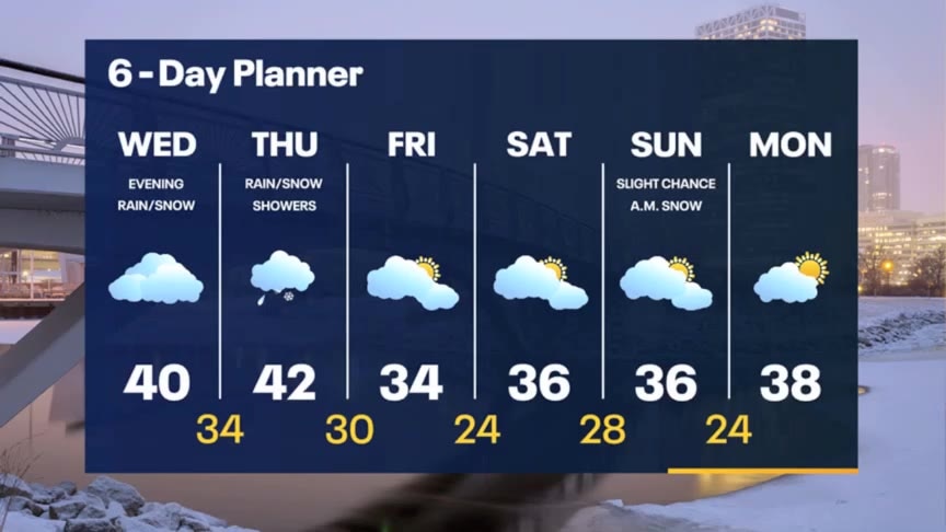
Rain/snow will move in from the southwest this evening and overnight. Greatest snow chance will be west and northwest of Milwaukee. It will stay as a mix or rain Milwaukee and south. Precip. tapers off Thursday morning.
Rain/snow will move in from the southwest this evening and overnight. Greatest snow chance will be west and northwest of Milwaukee. It will stay as a mix or rain Milwaukee and south. Precip. tapers off Thursday morning.
Weather Webcast with Meteorologist Stephanie Barichello
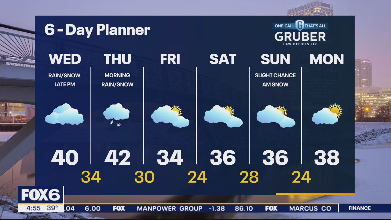
Rain, snow and wintry mix arrive after 8pm and continue into Thursday morning. Expect a few inches of slushy snowfall accumulation from Waukesha northward, and mainly rain/mix from Milwaukee southward. It'll be a sloppy Thursday morning commute.
Rain, snow and wintry mix arrive after 8pm and continue into Thursday morning. Expect a few inches of slushy snowfall accumulation from Waukesha northward, and mainly rain/mix from Milwaukee southward. It'll be a sloppy Thursday morning commute.
Weather webcast with Rob Haswell
Cloudy and mild for most of the day today. Highs will be near 40. A Winter Weather Advisory starts at 9pm for Ozaukee, Washington, Dodge, Sheboygan and Fond du Lac counties.
Cloudy and mild for most of the day today. Highs will be near 40. A Winter Weather Advisory starts at 9pm for Ozaukee, Washington, Dodge, Sheboygan and Fond du Lac counties.

Weather Webcast with Tom Wachs
Cloudy skies on Wednesday with highs in the 30s. Rain/snow moves in from the southwest after 9-10pm. It will really pick up overnight into early Thursday morning.
Cloudy skies on Wednesday with highs in the 30s. Rain/snow moves in from the southwest after 9-10pm. It will really pick up overnight into early Thursday morning.